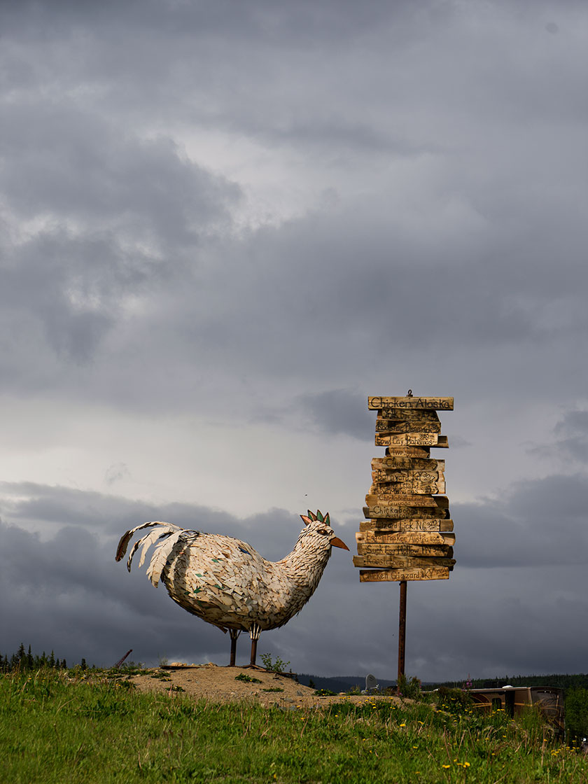
The fourteen foot sculpture of a chicken sits on a hill overlooking the town. Next to it is a signpost designating the mileage to worldwide towns having chicken related names.
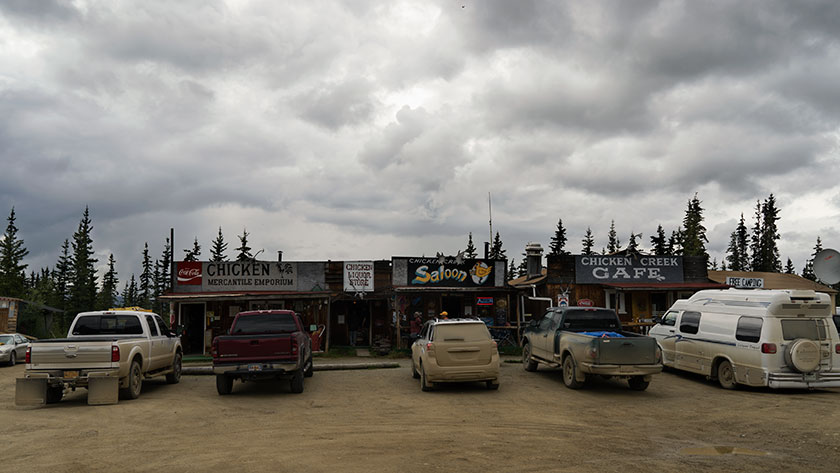
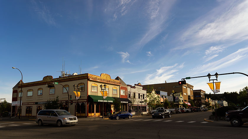
Chicken Alaska is a wide spot in the road, and the road was muddy when we traveled it. There are three parts to the town, two RV Parks and beautiful downtown Chicken, which I photographed in one shot. In spite of all that, the town’s people have a good sense of humor and don’t take themselves seriously.
This panoramic shot captures all the stores in downtown Chicken,
Chicken started out as a gold camp and today there are several active claims being worked. It also is a convenient break on the grueling Top of the World Highway and so the reason for the two RV camps.
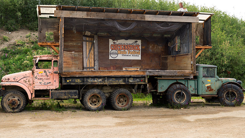
This is the stage used for the annual music festival called Chicken-stock (get it? Woodstock – Chicken-stock).
Chicken was given that name because no one could agree on how to spell ptarmigan (they obviously didn’t have spell check like I do), so they used the plentiful game bird’s nickname instead. Ptarmigan is still the favorite bird to hunt, but you can’t make as many puns.
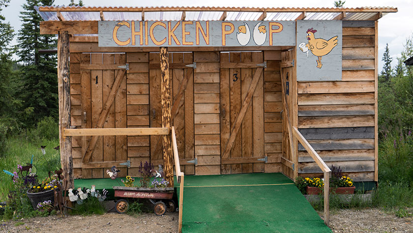
This is a shot of the public restrooms in Chicken. The private ones aren’t better, just smaller. We chose our RV park, because they had the only flush toilets in town.
We just spent one night in Chicken where we had dinner (fried chicken) and breakfast (chicken and waffles). The restaurants do have beef on the menu (chicken fried steak) if you prefer red meat. If you don’t want chicken or beef, there is a variety of omelet and other egg dishes available on the menu.
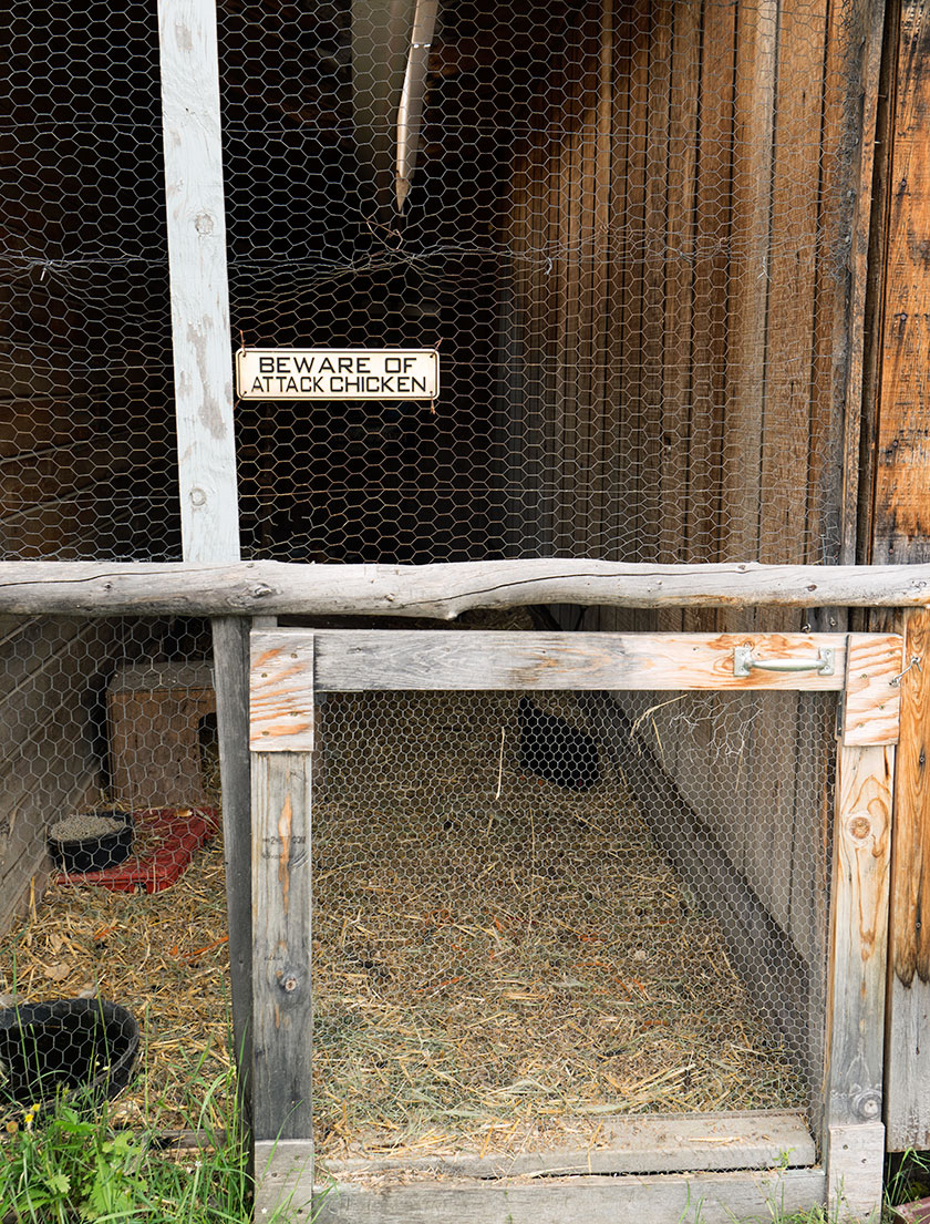
This is the coup that the chicken in Chicken produces all the eggs for the town’s restaurants.
After breakfast and purchasing a souvenir tee-shirt that says, “Quirky drinking town with a gold mining problem,” we continued on the muddy road towards Tok (rhymes with Coke) Alaska. As we left town it started to rain again. However, twelve miles out-of-town the road was paved, and the same forces that splattered mud on The Ritz, now began scrubbing it off. By the time we reached our destination, the front of the trailer was dirty, but not caked with mud. Hallelujah!
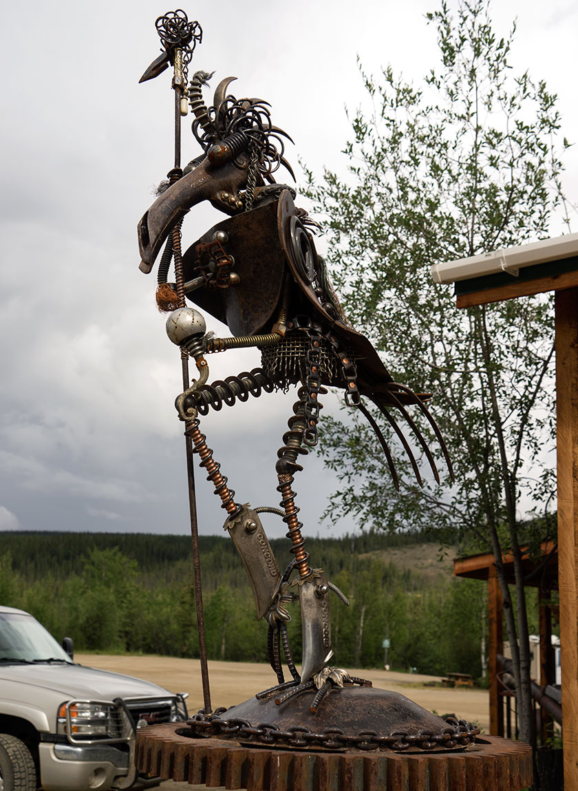
This sculpture was outside one of the restaurants we visited. Besides this one, there are small chicken details fabricated out of scrap metal pieces.
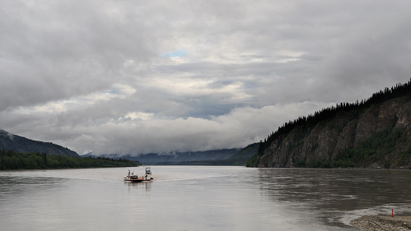
We left Dawson City via the Yukon Ferry. It runs 24 hours and is free, so how could we go wrong? If there are caravans on the road, it could take hours for all of them to cross, but we were fortunate that none were in town. The ride takes less than a half hour, but driving on and off the boat is tricky. There isn’t a permanent dock, so the ramps just let down on the dirt road and there’s a gap that can cause damage to the vehicles. Fred had to re-position his cargo box, Sally got some trim damage and our front trailer foot was slightly bent when we drove off the ferry.
The ferry links Dawson with the Top of the World Highway; and their golf course evidently.
We took some time to fix things and then started up the Top of the World Highway. That’s the name for the road from Dawson to Chicken, Alaska. It got its moniker from the how the trail follows along the three thousand foot mountain ridges.
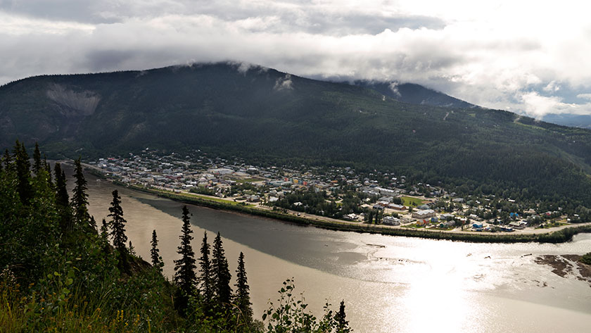
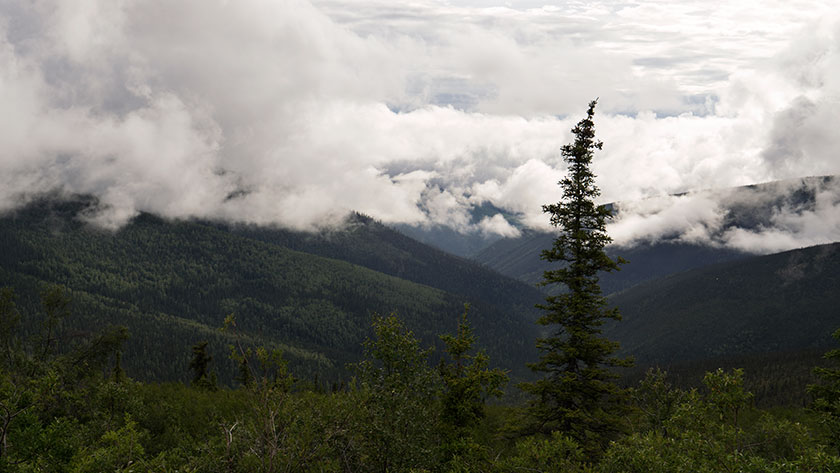
In only a couple of miles, we were high in the mountains and got a last look back at Dawson City.The views from the Top of the World Highway are spectacular on a clear day.
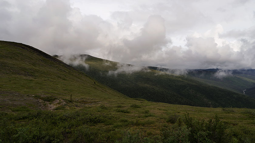
The road climbs steeply from the Yukon bank, past the golf course, and in our case, into the clouds. The views from the road I’m sure are both spectacular and scary at the same time. For us, it was raining, so we drove in and out of the clouds. Every once in a while, the clouds would lift revealing how steeply the mountains dropped into the valleys below us.
As we drove along the road, we would drive in and out of the clouds.
Other people warned us that the road was not the best, but we decided to press on regardless. The rain made the gravel base even worse, filling the pot holes and washboard ruts with mud. We drove like it was a slalom course, trying to find a smoother section.
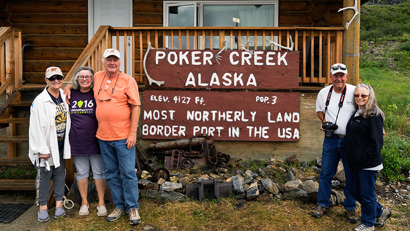
This time it was the US Customs agent that volunteered to take our photo when we crossed into Alaska.
It was slow going, taking almost four hours to make the eighty mile journey to the border. After clearing customs, we started down the US side on brand new, shiny black pavement. It had bright yellow center lines with white lines down the edges. Our walkie-talkies were full of chatter about how much we loved this road, when about five miles later, it turned into . . . mud. Not gravel, just a plain old sloppy muddy road . . . with worse washboards and more pot holes.
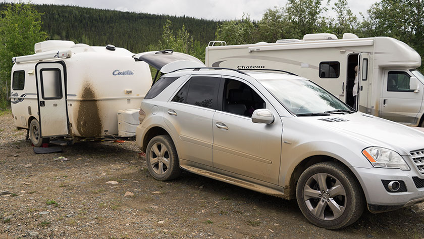
By the time we reached Chicken, the vehicles were caked in mud.
When we pulled into Chicken after another twenty miles, we got out of our vehicles and assessed the mess. The Ritz had two caked on mud stripes down the front that looked like skid marks. I had no idea how I was going to scrape that mess off, but by then, we just wanted to get in out of the rain and get something to eat.
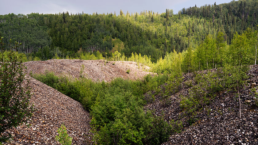
A couple of days ago, my friend Jeff wrote in a post comment that he had noticed strange snake-like formations along each side of the road near Dawson City, and he wondered if I could find out what they were. As you drive into Dawson, it’s obvious what he was talking about, because they’re everywhere. When he asked, I thought I would just reply with an answer, but since these ‘strange’ formation are an interesting part of the Yukon history, I’ll turn it into a full post.
The formations that he noticed are huge piles of river rock and they make ten foot mounds. The tops of the piles have and undulating pattern and they sweep back and forth. Some of them are newer with no vegetation growing, while others are already covered with trees.
The piles of river rocks are the tailing of a placer mining dredge.
The piles are simply river bottom dredged from the creek bottom and piled along the bank. It was one of these contraptions that made these piles:
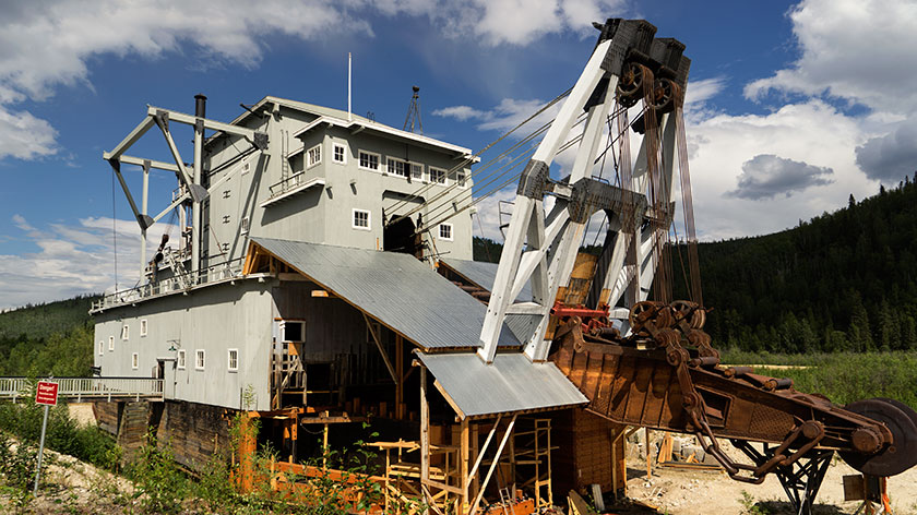
Dredge No. 4 worked the Bonanza Creek until operations stopped. It’s now undergoing full restoration at its last place.
This is the No. 4 Dredge on Bonanza Creek and is under going full restoration. During the short placer mining season a crew of four would run one of these babies twenty-four hours a day. The would dredge up the bottom and sides of rivers, process the load on board, then dump the tailing out the other side. When they ran, they could fill up a normal dump truck every three seconds. At the height of the gold rush, there were twenty-seven of these eight story monsters running at the same time.
Crews positioned them at the mouth of a water-way and they would work their way upstream. Before they could start work, all the vegetation was stripped from the land. If you lived in the way, you were out of luck, because mineral rights trumped property rights. Then the permafrost had to me melted, by pumping steam into the ground. Finally the dredge would crawl its way up the creek at a rate of a foot a day.
Strip mining at it’s best, Ah? The units were 95% efficient, so the area is still crawling with miners working active claims. Fred and I visited the original claim today, which is a park called the Discover Claim, and wondered if any gold was left. We both doubted it, but picked up a shiny rock in the creek anyway.
Our drive to Carmacks today was an easy one. It wasn’t too far, the roads were all in good shape and there weren’t any steep passes. As it happens, we were in our camp and setting up in time for lunch.
There isn’t much of a town, a couple of stores and a gas station along with the RV Park we’re in. There is a bit of history about the town and the person it was named after. George Washington Carmack was a miner who explored the Yukon and found a vein of coal near here. His great fame came later when he discovered the gold nugget that set off the Klondike Gold Rush and the Klondike Gold Field between here and Dawson.
The Yukon River makes a sweeping S curve through the town of Carmacks.
The country is beautiful and the Yukon River flows north until it makes a couple of sweeping bends around the town before heading north again. We had time to stop and read the roadside information signs and they explained that the mountains are formed from conglomerate rock. Like concrete it’s made up of smaller rock glued together with mud (instead of cement). Part of the mountains sloughed off creating a formation called the Whitehorse Trough and the highway runs its length.
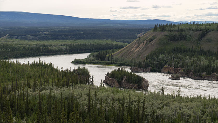
Downstream from here is a rapids called Five Finger Rapids. There are four large formations of these conglomerate rock in the river and since they’re more resistant to erosion, they’ve created a fall in the river. To get the steamboats through the rapids, engineers had to build a cable and wench system to haul the boats up and down.
Four formations made up of conglomerate rock create a rapids below the town of Carmacks.
Since our back door is on the Yukon, Fred and I got in some fishing before dinner. We finally landed something. I caught an Arctic Grayling and a White Fish, while Fred landed two more Grayling. I feel a lot better about all the new fishing equipment now that we’ve actually caught something.
This was our last full day in Whitehorse. Fred and I tried to fish the Yukon River and got skunked again this morning, but we each had a strike, or at least that’s what we told each other. The rest of the day we stocked up with needed staples then did a little sightseeing.
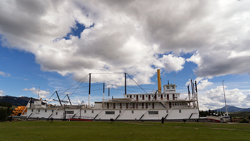
While we played tourist yesterday, we never got to the town’s biggest museum piece, so we made a point to stop at the paddle-wheeler Klondike in the afternoon. It is the riverboat hauled ore and supplies between Dawson City and Whitehorse on the Yukon River. It’s a huge ship with two 450hp steam engines and it took half of a forest to fuel the boiler.
Anne checks out the Klondike paddle wheel riverboat.
Going down stream it took more than a day with one stop for wood, but coming back to Whitehorse against the current the trip was over four days with as many refueling stops. As you would expect the ship is in mint condition with era specific supply boxes and simulated bags of silver stacked neatly in the cargo hold. Since we were second class passengers we didn’t get to see the first class cabins or the wheelhouse. That would have interested me.
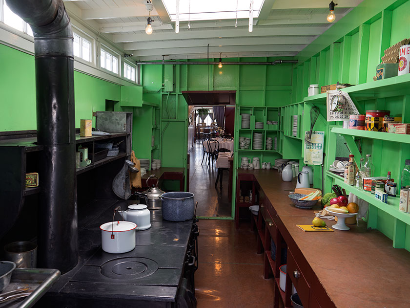
The galley of the Klondike is stocked with plates and cookware from its era.
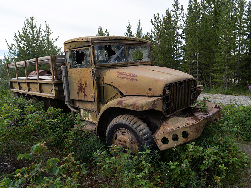
Back at camp, I had to go look at the WWII era military vehicles lined up beside the entrance. I’m not certain if these were used for the construction of the Alaska/Canada Highway or not, but as with Route 66 kitsch at home, any memorabilia that can tie in with the theme is helpful. There are about five on display and although they’re not restored, they really aren’t in bad shape. I’m sure they could be used in a collection somewhere instead of yard art along the road.
Our campgrounds has five different 40s era military vehicles lining the driveway for decoration.
Tomorrow, we’re going to make a side trip off of the Alaska Highway and head north to Dawson City. That’s the other big town in the Yukon and it is highly recommended. It’s also the home of author Jack London, whom I read as a lad. On the same street is the cabin of Robert Service, Yukon’s famous poet.
We’re going to break the trip up by making a stop midway in a town called Carmacks, a small town on the banks of the Yukon River. Then on to Dawson City for a couple of days. After that we will be in . . . (ta-DA!) Alaska after almost a month of traveling.
Finally, we’ve made it to Whitehorse, the capital of the Yukon Territories. I know this is hard to believe but, TV was invented before my formative years and one of the shows my family would watch was Sergeant Preston of the Yukon. “On King! On you huskies!” (That’s all kind of weird now because if he had a horse (Rex), so what did he need a dog sled for? And, how do you pick one of eight dogs as a favorite and not piss off the rest?). The show was transported from the radio shows of the 40’s. At the time, it was high adventure and we didn’t question authority.
Today we explored Whitehorse and hard as I tried, I didn’t see anyone dressed in the iconic Red Mounties uniform. Nary a one was in sight; only men and women dressed in blue, driving RCMP vehicles. Disappointed, we returned to camp to drown our sorrows, then Janet and Tim, another Casita couple we’ve met along our journey, showed us a photo of her posing with . . . yes, Sergeant Preston. It was taken at the gay pride festival held in the downtown park . . . and we missed it. I’m devastated.
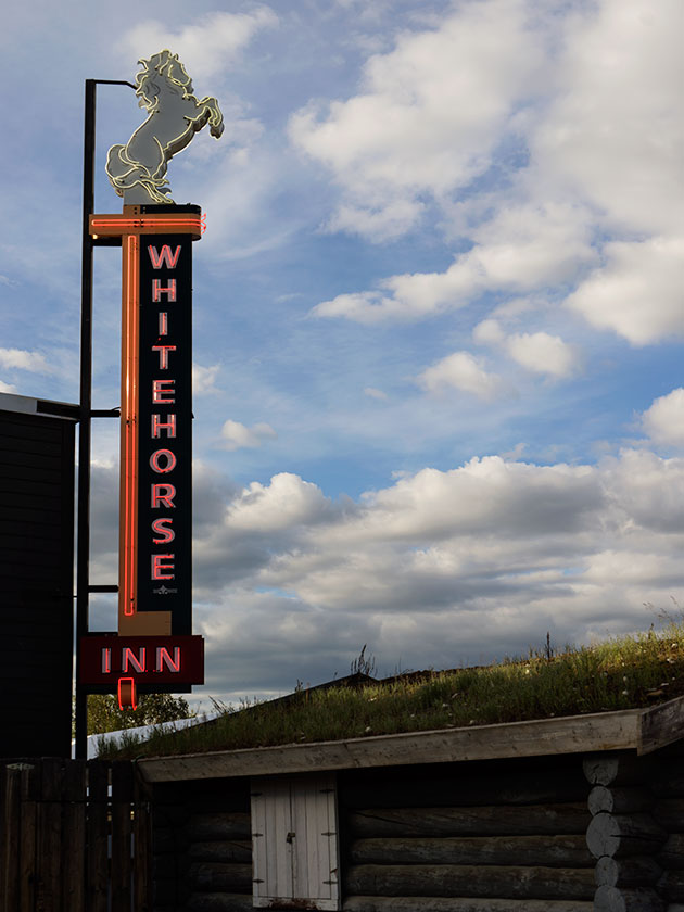
Of all of the iconic signs that would represent this town, the one I found was hanging in the local museum.
Compared to our recent stops, Whitehorse is a big city . . . well, a city big enough to support 22,000 residents. They even have a commercial airport. I can verify this because our camp is at the end of the runway. Fortunately only two 737s come in and leave each day, one in the morning and one in the evening. There aren’t many glamour shops, but you can probably get any thing you need here, except a starter relay for a Mercedes-Benz.
Although small, various merchants to support tourism from summer travailing to winter’s Aurora sightseers’ needs.
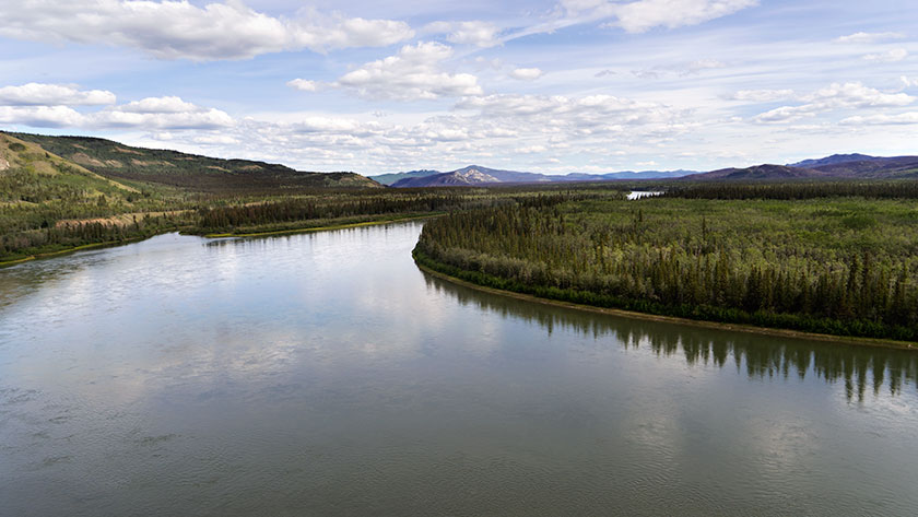
It’s located along the Yukon River which is either the third or fourth largest (depends upon your source) drainage system in North America. Even this far from the sea, the water flows with enough volume that all of Arizona could be turned into a golf course with the amount of water flowing by the old riverboat dock each day.
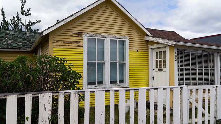
In downtown Whitehorse, there are new buildings next to very old homes, This homes owner hasn’t quite restored the yellow paint.
The architecture is a mix of new functional boxes mixed with rustic homes and shops, so there is are historic and new buildings, something that I’ve missed in the last couple of towns we’ve stayed. There is a real art community shown by murals depicting historic scenes on buildings. My second art clue is that the a lot of the historic sites restored to ‘like new’ or better condition. That takes a lot of resources that, I imagine a town this size couldn’t afford without a strong volunteer organization.
The last thing that I expected to see on a Saturday afternoon was to see a perfect 57 Dodge driving down the street. It’s like being in Cuba.
For a town this size, there are a lot of good restaurants. Last night, we chose the top pick from TripAdvisor.com called Klondike Rib and Salmon BBQ. I don’t really want to do reviews in this blog, but it’s worth a mention. Good ribs yes, but you can get them anywhere. BBQ salmon . . . let’s put it this way; Queen Anne hates fish and her top hate is salmon. We split the ribs and salmon dish (their special) and I made her try a bite. She didn’t finish her ribs and asked to try more of my salmon. That’s strong testimony. Well recommended, but expect a line out the door if you come.
Fred and I are still tied at zip apiece, so tomorrow we’re going to toss lines at the Yukon River. With that flow, I don’t expect to have much luck, but what the heck; it beats doing laundry.
The town of Watson Lake is a little more than a wide spot in the road and for some reason, we’ve spent three days here. It seems more important on the travel brochures than it really is. Oh well, Fred and I got some fishing, or should I say, ‘Casting Practice’ in today. I’d better step up my game, because Fred actually had a fish strike this morning. Just to make things clear, we’re both tied at zip apiece.
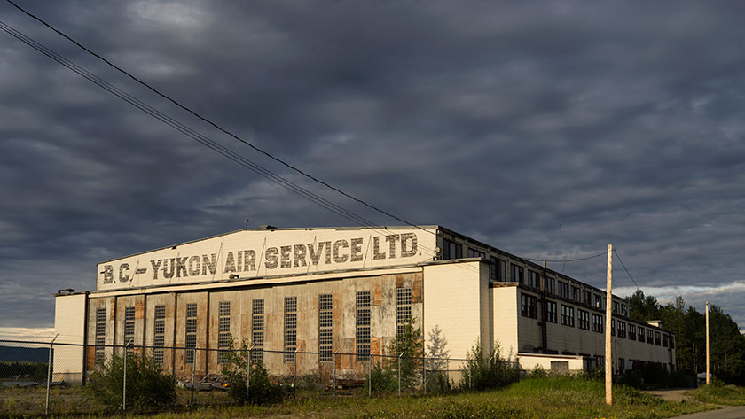
Watson Lake is another town that isn’t in its original place, like Ft. Nelson. When building the Alaska/Canada Highway, it bypassed the Watson Lake by about four miles. The town moved lock, stock and barrel down to the highway. Only the airport remains at the original town site, with a small terminal and a great WWII wooden hangar. The rest of the historic buildings never made the transfer.
One of the few remaining relics of the 40’s is a wooden hanger at the Watson Lake Airport.
Watson Lake and the airport have another historical relic. In the days after the Second World War, the airport was a testing site for cold weather aviation. In 1946 a crew, on a flight from Edmonton, was making the last turn to land, when they lost the starboard engines. To shorten the story, they never recovered and the plane went into the lake. Two crew members died trapped in the frigid waters inside the British Bomber. Rescuers saved the other four. Except for the salvaged parts, the plane’s skeleton still sits in the lake, but you need a boat or plane to view it.
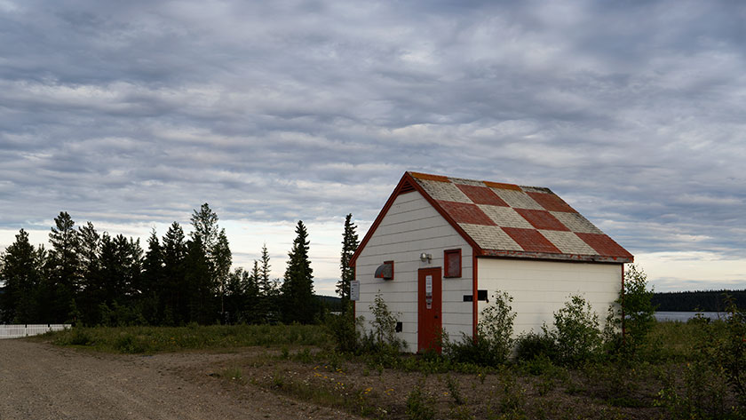
At nine-thirty in the evening, there is still enough light to shoot hand-held this far north.
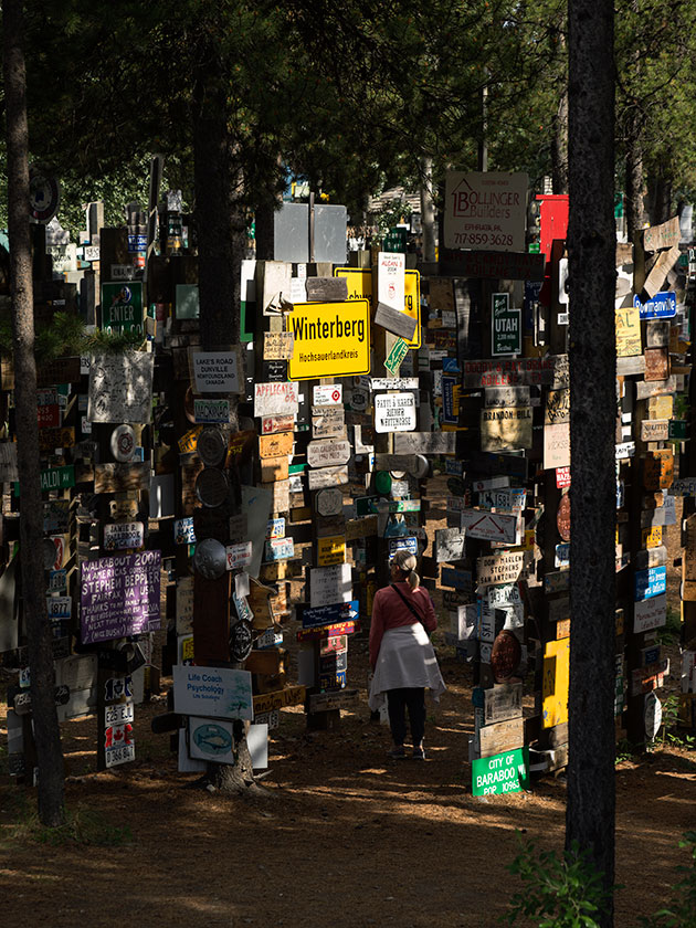
There is another landmark in town and that’s the Sign Post Forest. During the road building, army solder Carl Lindley was so homesick he made up a sign with the mileage to his home town; Danville, Illinois. In the spirit of ‘Kilroy Was Here’, other travelers continued to add to the collection. Today there are more than seventy-five thousand signs in a haphazard maze that takes up a city block. We didn’t bring one from home, but we should have, however we did find one from Congress. In 2003 the Signpost Forest was designated a Yukon Historical Marker. If you come this way, remember to bring your sign.
With over 75,000 signs posted by visitors, and more being added each day, chances are that your hometown is hanging here.
The other town attraction is the Northern Lights Center, a sort of Cinerama movie about the Aurora Borealis. It’s a neat 20 minute movie but Imax, it’s not. The projection resolution is awful, both because of the projector and the overlapping screen panels. They should get rid of the projection system and replace it with a curved LED screen. Then it would be spectacular. The seats all recline so you can take in all the domed screen and the narrator’s voice was so relaxing, I fell asleep twice.
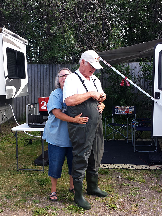
It turns out the Queen Anne is turned on by a man dressed in rubber. Who knew?
I hadn’t mentioned it, but I found some waders in Ft Nelson, so last night I made sure they fit. The gang all did the usual cat calls, so I had to model my new outfit. I’m fighting with them about the idea of posting one of their pictures. When Fred and I went out this morning, to a recommended place, I started to cross the road and two tenths of a mile up, a black bear sow with three cubs was doing the same. For a moment I thought about getting back in the car, but fishing was more important than a bunch of Teddy Bears, so I walked down to the creek.