Walnut Creek Bend Picture of the Week

Walnut Creek Bend - It's perplexing to understand how a normally dry creek could carve a deep gorge into the surrounding limestone.
Walnut Creek Bend – It’s perplexing how a usually dry creek could carve a deep gorge into the surrounding limestone.

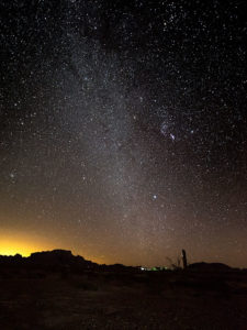
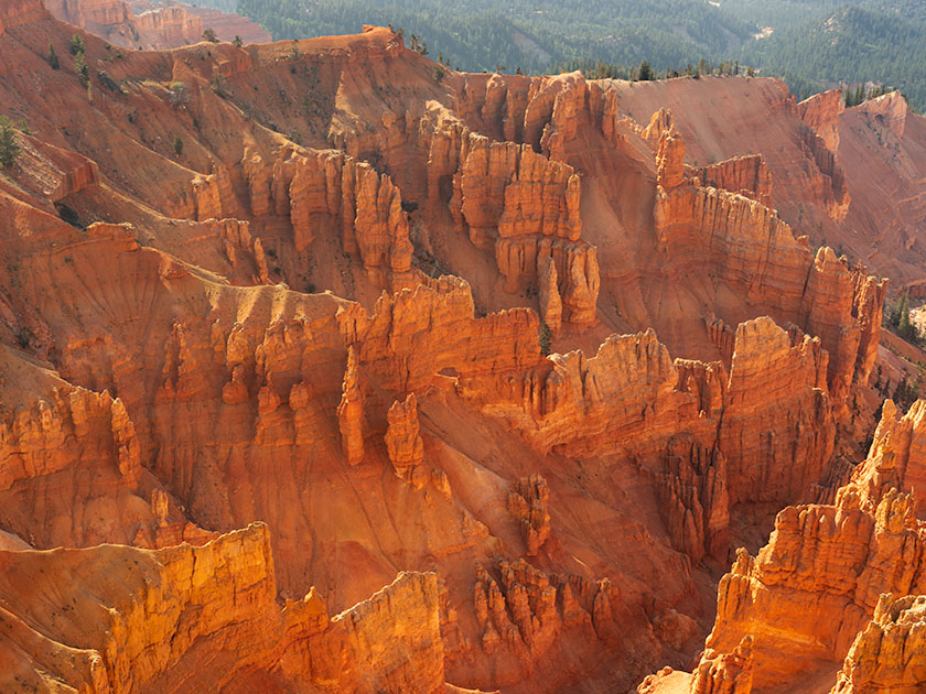
We had to break from the heat last month, so we drug the trailer up to Flagstaff. We didn’t escape the humidity, though. Since it’s the height of the monsoon season, the weather in the high country was the same as at home—only 30°cooler. There’s been a lot of news earlier this summer about the Flagstaff fires, so we found an RV park on the west side of town—right where Old Route 66 merges with Interstate 40. When we got there, the seasonal rains had already quenched the burn. U.S. 89, which both fires crossed, had reopened, but Sunset Crater National Monument is still closed. It suffered extensive damage to the campgrounds and buildings (otherwise, the cinder cone and Bonita Lava Flow were unharmed).

Our trip served a couple of purposes. First, I needed topics to get this publication through the balance of the hot summer months. Second, we wanted to take Ritz (our trailer) on a shakedown cruise to see how well it and the Jeep played together. Finally, we longed to sleep under the covers with open windows in air, not contaminated with that old-person smell—we accomplished all of that. It’s hard to describe how wonderful it felt to enjoy a glass of wine outside and listen to the sound of rain on the awning. Besides, there’s no more fabulous evening entertainment than watching a newbie learn how to do their first black-tank dump (go back and watch the 2006 movie RV again).

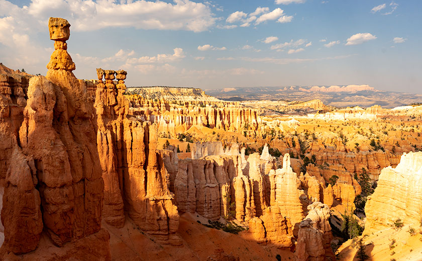
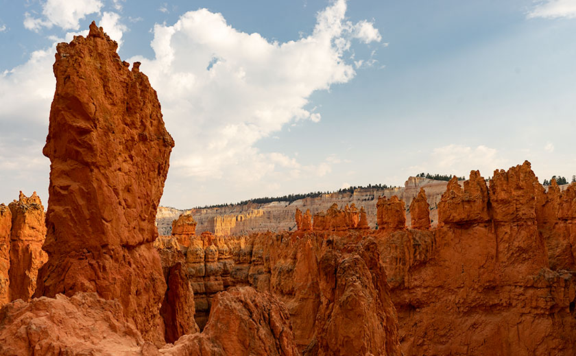
This month’s project is one of the excursions we made to a place that neither Queen Anne nor I have ever been to—Walnut Canyon National Monument. I’m not sure why we missed it. It’s only a couple of miles south of I-40 on Flagstaff’s east side. As you drive the road south, it transitions from Ponderosa Pine to Juniper, so the elevation is lower than the town. The monument is primarily known for the Sinagua cliff dwellings—which I’ll discuss in the upcoming weeks, but it’s the creek we’re interested in today.

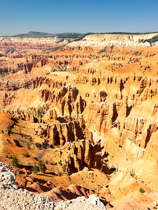
On the Colorado Plateau, water generally flows to the Colorado River. In Flagstaff, however, someone put our state’s tallest mountain in the way, so water has to drain around the San Francisco Peaks. A couple of miles west of town, you cross the Flag Divide, where streams flow west of the mountains. East of the divide is the Rio Flag and Walnut Creek Drainage system. Here the streams flow east of the volcanoes into the Little Colorado River. Walnut Creek drains Mormon Lake, Upper Lake Mary, and Lower Lake Mary. You can count Arizona’s natural lakes with one hand, and this little creek drains three of them. Perhaps that explains how an ordinarily dry creek could carve a deep channel into the limestone. Of course, all of that happened before our 22-year drought. Today, Mormon Lake is a broad, shallow dry lake with a mud puddle marking its deep spot, and both Mary Lakes are similarly low.

In this week’s picture, we’re standing at a spot that overlooks a horseshoe bend in the creek. I took this photo from the north side of the canyon facing south. In the distance is Mormon Mountain, some 16 miles south. The lake is located on the left flank of the mountain. When the creek is wet, water flows from right to left and empties into Rio Flag several miles downstream. Then the river turns north and flows under I-40 until it reaches the Little Colorado River, about a mile east of the Grand Falls (sometimes called Chocolate Falls).

I hope you enjoy discovering Walnut Canyon and seeing this week’s image. You can view the Web version of Walnut Creek Bend on its page by clicking here. Next week, we’ll hike one of the trails and poke around some ruins displayed in the national monument. I hope you’ll join us.

Till next time
jw

Sleeping Under the Stars Picture of the Week

There’s something wonderfully romantic about how cowboys spent evenings eating beans around a fire before laying out their bedrolls and sleeping under the stars. It makes me wonder if I would have been any good riding a fence line. I love the outdoors, campfires, looking at the stars, and dreaming of the ladies back in town (sigh). I can assure you that I could never do that because the last horse I got on said, “oof” and sleeping on the ground has rocks, snakes, spiders, scorpions, skunks, and rabid chipmunks—not to mention the inclement weather.

Queen Anne and I still enjoy getting out in the wilderness; we just bring half of the house with us. For some reason, I sleep very well in our little Casita trailer. She has two layers of foam over the cushions that make into a full-size bed, and when I crawl under our down coverlet, my eyes slam shut faster than a mouse trap. As I lie next to my love and wrestle for more space, I listen to her rhythmic breathing. The hypnotic cadence is a mantra luring me to dreamland—until she misses a gear and sounds like a manual transmission exploding. But, she stops as soon as I nudge her to roll over.

All of this is fresh in my mind because we’re recently back from spending the week in the KofA Wildlife Refuge with The Ritz—our trailer. We succeeded in getting more images to finish up with this month’s topic but concluded that there is a lot more to the KofA range than a couple of blog posts. I think it may need to be a long-term project.

This tip was the first time we used the trailer in winter, and although the days were sunny, the wind blew, and the nights were colder than our Alaska trip. We had to use its heater at night. Even though we set the thermostat to 58º, it still came on often and blared at 85dB. The first time it came on, it made that burning dust smell and I thought we were going to die of carbon monoxide poising, so I opened the windows, which was counterproductive. Like all furnaces, the smell cleared eventually and we stopped jumping every time it started. Even with that racket, I slept until sun up.

We spent two days exploring and shooting photos at the refuge, and on the last day, the wind died, so we were able to use a week’s worth of wood for a fire. We ate brats, drank rich cocoa, and roasted marshmallows for jimmyums over the burning logs. Its warmth kept us outside long enough that the stars came out—all of them. We stared at Mars so hard that it began darting across the sky until we looked through binoculars and proved it wasn’t doing that. Finally, the creamy streak of the Milky Way began to reveal itself and forced me to set up my camera.

KofA Milky Way
KofA Milky Way – Campers enjoy the KofA mountain range-in silhouette against the Phoenix lights-under the Milky Way and Orion early in the January evening.

This week’s featured image is the result of that effort. It’s called KofA Milky Way, and I shot it from our campsite. The bright spots on the ground are from the next camp. The mountain is Signal Peak silhouetted against the lights of Phoenix—150 miles to the east. The constellation Orion is center-right, and Pegasus with the Andromeda galaxy would be overhead, but the fire died, and the cold chased us inside before we could find it.

As usual, you can see a larger version of KofA Milky Way on its Web Page by clicking here. I hope you enjoy viewing this week’s post and next week; we’ll show another featured image from Arizona.

Until next time — jw

Bryce Canyon 2018 Utah Photo Shoot

Thor's Hammer And Sunset Point
Thor’s Hammer And Sunset Point – As the Navajo Trail descends, it passes by Thor’s Hammer, Bryce Canyon’s most iconic hoodoo.

Of all the sights to see along Utah’s State Route 12, Bryce Canyon is the crown jewel. All of the other stops along the way are sideshows. The park draws people worldwide and they have to use SR 12 to get to it. I, however, am a weirdo that stops at Bryce because it’s part of the highway. Interestingly, Route 12 cuts through Bryce’s north-east corner, so you get a taste of the Bryce Canyon without leaving your car.

We’ve been to Bryce a handful of times and it’s one of our favorite national parks. With elevations exceeding 9,000 ft, it’s always cooler than home. It has alpine meadows and forests of spruce, fir, and aspen, which are a definite change from cacti. There are great views from the overlooks dotting its 38-mile road and you get an understanding of the Escalante Grand Staircase when you look down from the top. Finally, there’s wildlife—if you don’t see at least one deer while in the park, well … you’re just asleep at the wheel.

Leaning Tree
Leaning Tree – At the canyon’s bottom are amazingly tall fir trees growing between formations like they were stretching to reach the light.

Like most visitors, Anne and I stopped at the overlooks on our previous visits, but I wanted to do something different this time. While we were in the visitor’s center, I asked the ranger about the trails and she recommended the Navajo Trail to get the photographs that I was looking for. It’s a loop trail that’s less than a mile and a half long. On their chart, it was a moderate hike because of its 500 ft elevation change. I thought to myself, “Piece of cake, sign me up.”

Before tackling the Navajo, Anne and I drove to the road’s end—Rainbow Point. That’s the park’s highest elevation, and in addition to the great view, there’s a flat trail—for Bryce Canyon—that loops through a grove of bristlecone pines. After completing the loop, we concluded that the bristlecone grove at Cedar Breaks was healthier, larger, and a better experience if you like walking among these ancient trees.

Wall Street
Wall Street – The Navajo Trail passes through a section called Wall Street where you’re dwarfed by the cliffs like a ‘Lord of the Rings’ setting.

As we drove back to Sunset Point where the Navajo Trail is, Anne called our insurance agent and demanded that he increase my life insurance policy—she of so little faith. When we arrived, we couldn’t find a parking space and I questioned if anyone was still at home in Europe. All of the spaces were full and a queue of three cars waited for each potential empty spot. We decided that I should go and Anne would circle the parking lot—like you do at the airport—until she found an open parking spot. With a kiss for good luck, I grabbed my camera and backpack—with water—which burst open and emptied before I made it to the rim—and set off on my great adventure.

Let me describe the Navajo Trail. On the map, it’s a 1.3-mile loop with a 500 ft elevation change. I hiked down 500 ft on switchbacks for three-quarters of a mile. At the bottom was a log-bench that felt good to sit on. Then I walked around a column and began the trek up another set of switchbacks climbing 2,000 ft in under three miles. If I went in the other direction, the numbers would have been the same. It was one of the most exhilarating things I have done in my life. I didn’t understand Bryce Canyon until it swallowed me.

Navajo Emerging
Navajo Emerging – As the trail begins to emerge, it feels like breaking the water surface after a dive.

I made my journey in 1½ hours, but I was taking photos as I plodded along the trail. I resented the kids and a young man who ran up the hill wearing flip-flops. George Bernard Shaw was right when he observed, “Youth is wasted on the young.” I’m glad that I made the effort because I got a different perspective of Bryce Canyon in a mental sense and in my work, which I hope you enjoy viewing.

Until next time — jw

Making Lemonade 2018 Utah Photo Shoot

As teenagers growing up in Los Angeles, we were ambivalent about the Santa Ana Winds. They would clear the air in the LA Basin, pushing it offshore where it was somebody else’s problem, and for a week or two, you could see where you lived and enjoy the beautiful mountains surrounding us. But the winds also dried out the scrub. Dry enough, a careless motorist could fire by flipping a cigarette out the window. Fires are a way of life in Southern California. They’re annual, but you don’t get used to it.

As a kid, I saw how smoke can choke the air, but I also saw a phenomenon helpful to photographers, although that didn’t sink in until I was older. When heavy smoke fills the air, it filters the sun—like sunglasses. During sunsets, the sun is an orange globe that you can look directly at. The smoky atmosphere causes beautiful orange sunsets. I don’t know if you’d call that a benefit, but they’re unusual.

After Monday’s shooting, I was processing some photos for yesterday’s blog when I glanced at the setting sun through Ritz’s window and saw an orange sun. Yesterday, as I wrote, I thought about trying to capture a sunset from my teenage memories. I decided to give it a go, and at 7:45, I drove north on US 89, looking for a suitable foreground for my sunset experiment. I settled on a spot where the sun would go down behind a lovely mountain—Sandy Peak. As a bonus, there was a vast field sprinkler spraying streams of water that would glow with the backlighting. I exited the truck and sat by the roadside, camera in hand, and waited.

The smoke in the air must have dissipated because as the sun got lower, it didn’t get duller, although it still had a tint of orange. I knew I would need to wait for the sun to kiss the mountain for the shot to work. That meant shooting when the sun was most colored anyway. Then, at 8:00, four children burst out of the house to my left. One got on a quad and started driving around while three girls—judging from the long dresses they wore—began running toward the sprinkler. When they got there, they turned off my sprinklers. I’m talking about one of those massive machines you see in fields moving on wheels in a circle. I’d be afraid to touch it, and these children turned it off like the hose in the front yard.

I thought about leaving, but the sun was inches away by then, and the girls hung around the fixture, so I adjusted the camera to bring up the foreground and started shooting until the sun slipped halfway behind the mountain.

Sandy Mountain Sunset
Sandy Mountain Sunset- This is my failed attempt to capture an orange sunset, but the story is nice anyway.

Here is my last and best shot. The smoke wasn’t thick enough, the water wasn’t spraying, and I have live humans in my photograph, but I thought I’d share my evening with you—at no extra charge. Can you find the girls? They’re there, I can assure you. Now, I can go back to shooting inanimate objects.

Until next time — jw

Cedar Breaks National Monument Utah Photo Shoot

Cedar Breaks Amphitheater - Cedar Breaks is a five-mile amphitheater that looks like someone took an ice cream scoop to it and left behind the candy toppings. The distant peak is Brian Head at over 11,000', where the ski resort is located.
Cedar Breaks Amphitheater – Cedar Breaks is a five-mile amphitheater that looks like someone took an ice cream scoop to it and left the candy toppings. The distant peak is Brian Head at over 11,000′, where the ski resort is located.

Yesterday could have been the perfect day to visit Cedar Breaks, the mini version of Bryce Canyon high on the eastern edge of the Markagunt Plateau in southern Utah. The muggy weather that had hung around all weekend moved out and it was dry and sunny with a light breeze from the west. As we entered the park the car’s temperature indicator said it was 68° outside. Conditions couldn’t have been better for an afternoon of hiking and picture-taking.

It wasn’t this nice the first time we visited Cedar Breaks. That was Memorial Day weekend in 2004. The Queen and I decided to get out-of-town to escape the 115° weekend. We had tossed the camping gear into the truck and left before dawn dressed in shorts and tee shirts. We drove straight through only stopping at the Flagstaff Mickey D’s for an egg-a-muffin. That truck didn’t have an outside temperature gauge and it barely made it up the 12% grade. We still had the air-conditioning on when we stopped in the parking lot. It was a sunny afternoon, but when we opened the doors, a blast of Arctic air greeted us and chilled us to our bones. We scrambled to find our jackets. At 10,300 feet, Cedar Breaks can be hostile.

Tee shirts and shorts were the perfect uniforms yesterday. That wasn’t a problem. The issue that I had was in the air. Up here, it’s normally clear and pristine, protected by its remoteness, but because somebody’s trying to burn down California, the air was filled with smoke that traveled across Nevada. That smoke-filled air is not conducive for taking detailed landscape panoramas. I had to change my mindset and look for more intimate images.

Bristlecone Pine
Bristlecone Pine – Probably over two thousand years old, bristlecones survive by shutting down damaged parts and only supplying new growth with nutrients.

From the visitor’s center, there’s a short one-mile hike to Spectra Point—an overlook that has a grove of large Bristlecone Pine trees. I’ve always admired these Methuselah trees for how they live for thousands of years in places where nothing else will grow. I had heard about them on my last trip, but it was spring thaw with snow covering parts of the trail and the rest being a muddy bog. That wasn’t an excuse today, so I put on my new camera backpack and balanced the tripod on my shoulder and set off to conquer nature.

Fins, hoodoos, and arches.
Fins, hoodoos, and arches – As the soft sandstone erodes it breaks down into long structures called fins. As the fins erode they leave individual spires called hoodoos. During that process, the bottom of the fin may fail and collapse leaving a window or arch. There are examples of all three in this photo. Can you spot the arch?

The trail actually leads to two overlooks, the second one being Ramparts. As I started skipping along I considered going the extra mile—as they say. It looked doable on the map because the parking lot is 10,300′ and Spectra point is 10,285′. A mere 15-foot drop—posh, child’s work. Ramparts, however, is 9,985′. I decided to see how I felt when I reached Spectra Point—after all, I have ridden a bike five miles every morning, so I’m buff … Right?

My skipping immediately ceased when I turned a corner and reached the base of a 300′ hill that’s not on the map. You can guess what my decision was already. I can walk three miles in an hour at home, but in the thin air, my trip took 45 minutes. I spent an hour shooting trees and views along the rim before heading back to Archie—our truck, where Anne was reading a book. You’d think she’d have carried the camera bag or a picnic basket or something. When I opened the back door in my sweat-soaked shirt and loaded the equipment while panting, all I got was, “How was your little hike dear?”

We spent today recuperating—she broke a nail—and I processed a couple of photos to show you. At dinner, we’ll decide where next to explore. We’ve concluded that the smoke has permeated Utah and we’ll just have to work around it, but we’re going to have fun even if it kills us.

Until next time — jw

Red Toadstool Picture of the Week

There’s a place on US 89 about halfway between Page, Arizona and Kanab, Utah where the road gets lost. As you know, odd-numbered routes run north-south, but this section of 89 goes east-west for 60 miles between the two towns and right in the middle the road hits all the compass points. There’s a perfectly logical reason they built the road this way. This is where US 89 cuts through the southern part of the Grand Staircase Escalante National Monument, and with three cliff tiers in front of you, it’s just easier to go around them.

The explanation for the five-mile section of looping road is the same. This is when the highway crosses a rift valley and climbs around to the north side of Buckskin Mountain. This is also the spot on the map that is a landscape photographer’s Mecca. You have probably seen photos of exotic geological features and wondered where they were taken. Places like The Wave, White Outcrops, Paria Canyon, Buckskin Canyon, Calico Mountain, and The Toadstools are all within fifteen miles from the road. The bad part of that—for us geezers—is that you must hike that distance to get to them.

This week’s featured image only required a jone-mile hike, but it involved a climb to a shelf 300 feet above the road. Once you make it, you’ll find a group of toadstools—columns of sandstone supporting a protective capstone. Although the trail up there isn’t flat, you don’t need to be an élite climber to make it. Queen Anne got far enough that she was able to watch her hero snap this photo, which filled her with so much emotion that she had to return to the car and do her nails.

Red Toadstool
Red Toadstool – A protective capstone is supported by a column of red sandstone near Kanab Utah.

I shot this toadstool from a couple of angles and after viewing the test strips back at camp, I preferred this version even though it’s smaller within the frame. The composition is stronger, and the image is uncluttered, so the formation becomes a stronger subject. The light wasn’t what I envisioned when I planned this trip, but the thunder clouds are kind-of cool. I call this image Red Toadstool and I’m pleased to start a month of Utah photos with it.

You can see a larger version of Red Toadstool on its Web Page by clicking here. I hope you enjoy viewing this week’s post and come back next week when we present another image from a different Utah site.

Until next time — jw

Kanab Overnight 2018 Utah Photo Shoot

We stopped short of our target destination—Panguitch—by a hundred miles because I wanted to shoot along the lower Paria River. I was hoping to shoot a couple of areas that I previously visited bathed in a late afternoon sun. Instead, it rained. I captured some nice images anyway and Queen Anne followed me most of the way up the trail—including a bit of the climb. That was a miracle unto itself.

Dune at the Toadstools
Dune at the Toadstools – This is one of the images taken at the Toadstool stop along US 89. It was the first time I hiked up to them. To her credit, Anne followed me most of the way.

Our temporary site is in Kanab and the RV Park we originally stayed in during our Alaska adventure. New owners bought the place a couple of years ago and have made improvements. I’d have to rate it as one of my favorites—although truck traffic still starts early. Last night we enjoyed a fine meal at the Rocking V Cafe. It’s the fourth time we’ve stopped there without disappointment. Anne was perturbed that they didn’t serve their macaroni and cheese for dinner. She had been going on about it all day and nearly beat up the poor waitress when they wouldn’t make some especially for her. Instead, Anne wound up enjoying the curry dish that she ordered.

We’re packing up this morning and making the pull up to Panguitch. It’s another thousand feet higher and ten degrees cooler so that suits Anne’s prerequisite. It’s also centrally located to the areas that I want to shoot. We will be pulling The Ritz for a couple of hours so we’re not in a rush this morning. As a matter of fact, it just turned 8 am and I rousted her highness from the sack. If she stays in character, she’ll dawdle all morning so that we’ll have to stop at the Rocking V for a lunch of Mac ‘n cheese.

Until next time — jw