Blue Tank Saguaro Picture of the Week

It’s only the third month of 2021, and already I can tell it’s a much better year than the last one. If you remember, this time a year ago, I was comforting my dear wife, who was convalescing from knee surgery, we had growing concerns about a new virus that threatened our existence, and we faced travel restrictions to slow its spread. In contrast, this week, I feel like a kid at the end of a time-out, no longer grounded or released from juvy (of course, I was such an exemplary child that I never experienced any of those feelings—my parents just spanked us).

I have this exhilaration of freedom because we got our second vaccination shot this week—and we have passports to prove it. If you’re debating on getting your shots, you shouldn’t be. Queen Anne and I didn’t experience any abnormal side effects. Like any flu shot, your arm is sore for a couple of days, but other than that, our lives went on normally. And as an extra benefit—like a putty knife—the Microsoft chip they snuck into the vaccine scrapes off any plaque in your arteries (but I do have an incredible desire to buy a new version of Windows).

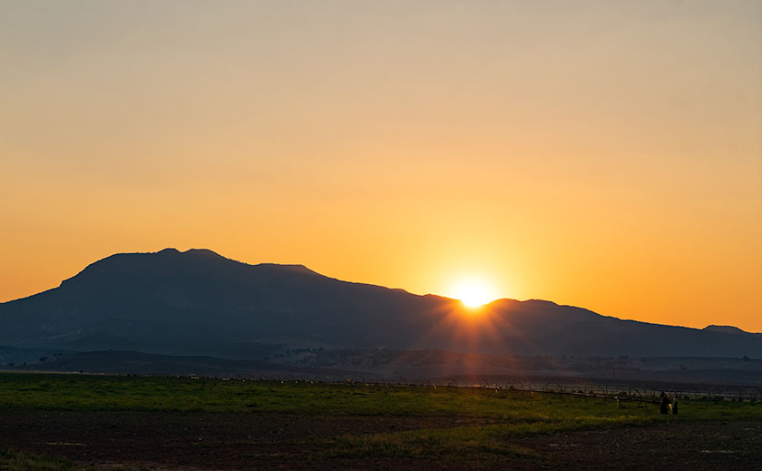
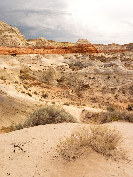
We’re still cautious about our movements—we wear masks and keep our distance, but now we can plan to go on vacation later this summer. In our laundry room, I have a huge wall map of the Colorado Plateau. Whenever Anne gets out of bed this afternoon, I’m going to have her toss a spit-ball at it. Wherever it lands is the place we’ll drag our trailer—The Ritz—this August.

Blue Tank Saguaro - A mature saguaro growing along the bank of the Blue Tank Wash near Wickenburg, Arizona.
Blue Tank Saguaro – A mature saguaro growing along the Blue Tank Wash bank near Wickenburg, Arizona.

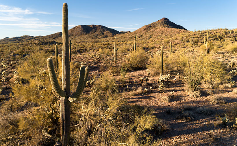
I’m so giddy this morning; I almost forgot this week’s new picture. If it looks familiar, it should. That’s because it’s a variation of last week’s featured image. They both show the mountains on the Hassayampa River’s far side, and they both feature saguaro cactus. The difference is that last week’s photo was of the mountains with cactus in the foreground, and this one is a saguaro with the mountains in the background. Who said you couldn’t get two good variations of the same scene by working-the-shot? I called this shot Blue Tank Saguaro for obvious reasons.

I’m interested in hearing what you think. Both images can be seen on their Web Pages, and you can flip between them using the Previous/Next links. You can get to this week’s image by clicking here. Which of the two do you like better? Let me know by leaving your comment at the bottom of this page. Be sure to come back next week for another of my images from the mountains surrounding Wickenburg.

Until next time — jw

UPDATE 4:30 pm: Anne got up and threw her spit-ball at the map, so I guess in August we’re going to . . . the laundry room.

Stamp Mill Picture of the Week

Everyone has heard the axiom, “All roads lead to Rome.” Well, not in Yavapai County, they don’t. Over the past couple of years of traveling Arizona’s back roads, I’ve found that they lead to mines, and with good reason. We all have a vision of a dusty prospector sneaking off with a couple of burros to a secret gold mine in the mountains—this is before he became the Arizona Lottery huckster. A man like Jacob Waltz may discover a vein of gold, but it takes a corporation to extract it effectively.

To make a ton of money, you have to move a thousand tons of ore. A couple of burlap sacks strapped to a burro’s back just won’t do. You have to move unrefined earth by wagon, truck, or railroad car. So part of The Company’s infrastructure is getting things to and from the mine site. That is the Phelps-Dodge and the Senator Mine story—and this month’s back road adventure.

While bouncing along the Senator Highway in R-Chee (according to his license plate that’s the correct spelling), Anne suddenly blurted, “There’s a large building down there.” Since my side wasn’t overlooking the cliff, I couldn’t see it, so I stopped the truck and walked back to see the steel skeleton of an old structure. “Cool,” I told her as I climbed back into the driver’s seat. “It’s too early, so we’ll stop on the way back when the light is better.”

Stamp Mill - The ruins of the Senator mine stamp mill are perched above the headwaters of the Hassayampa River.
Stamp Mill – The ruins of the Senator mine stamp mill perches above the headwaters of the Hassayampa River. The mill is visible on Google Earth if you zoom in to the Senator Highway where it crosses the Hassayampa River.

After some research, I found out that the building was a 10-unit stamp mill for the Senator mines. As rock came from one of the three parallel shafts, the miners hauled it to the mill, where the hammers pounded big boulders into small ones. As far as ghost towns go, we struck gold (I couldn’t resist the pun, sorry). Concrete foundations usually are all we find in these places, but since this frame was a steel and not timber, the skeleton survives and gives scale to its size. From the road, I could easily walk down the stairs and wander the four floors. Vandals have decorated the remaining vertical walls for Christmas with colorful graffiti everywhere, so I guessed that we weren’t the first people to find this place.

Kennecott Mine - The Kennecott mining town is preserved in the Wrangell-St Elias National Park in Alaska. This should give you an idea of how a mill looked with the clapboard still intact.
Kennecott Mine – The National Park Service has preserved the Kennecott mining in the Wrangell-St Elias National Park in Alaska. This photo should give you an idea of how a mill looked with the clapboard still intact.

In Alaska, I visited a similar mill at the Kennecott Mine in the Wrangell Saint Elias National Park. At this location, the Park Service keeps that building in an arrested state of decay, and it still has the red clapboard siding. I wanted to show you how the Senator stamp mill might have looked while it was running, so I’m including my Alaska photo.

For this week’s featured image—that I call Stamp Mill—I wanted to show the building and its environment, which is hard to do while standing inside of it. So, I took this shot from the far side of the Hassayampa River Canyon as the sun hung low in the western sky. I was lucky in that the remaining silver paint glowed in the afternoon sun, which makes the frame pop from the background.

You can see a larger version of Stamp Mill on its Web Page by clicking here. I hope you like it. Be sure to come back next week when we present the final image from our drive on the Senator Highway.

Until next time — jw

Hidden Springs Ranch Picture of the Week

The cottonwood trees I showcased in this month have told a story of winter in the uplands of Arizona—a part of our state we Zonies keep secret from outsiders. The photos show as much about the chilly morning, crystal clear air, and open spaces as the trees do. After all, there’s nothing special about cottonwood trees—they’re everywhere. Their Latin name is Populas, which means “People’s Tree.” (Wow, did you catch the irony? I have a series of People’s Tree photographs that I shot in Peeples Valley. Yeah, I meant to do that all along).

Although you can find cottonwoods throughout the United States—in one form or another—they’re not widely used in landscaping. In Arizona at least, some homeowners associations explicitly forbid them in their association rules. Although they are fast-growing and provide shade, they’re messy, attack water lines, and are prone to disease, so as they age—just like me—parts fall off. One of their significant irritants is in their name. The mature trees spread seeds to the wind on white cotton-like tufts. When seeds are in the air, it can look like its snowing, and quite a few folks are allergic to them.

If you’re a rancher and you want a fast-growing tree to say, line your driveway, there is an alternative—the Arizona Ash. These trees grow tall quickly, but are less messy, live longer, respond to pruning, and they are more pest resistant. They also have more fall-color than cottonwood, but only slightly. The ash doesn’t get that gnarly old look that interests me.

Hidden Springs Ranch - Well manicured Arizona Ass trees line the drive of the Hidden Springs Ranch in Peeples Valley.
Hidden Springs Ranch – Well manicured Arizona Ash trees line the drive of the Hidden Springs Ranch in Peeples Valley.

When I was shooting my Peeples Valley trees, I first thought that the Hidden Springs Rancher lined his driveway with our friend, the mighty cottonwood. That’s why I photographed the entrance. On second glance, I did a face-slap and thought, “Of course!” Unless you wanted to drive over broken branches all of the time, you would pick a different kind of tree. But, it was winter, and from afar, a bare tree is a bare tree.

I included this week’s photo—called Hidden Springs Ranch—in this series because … well, I needed five pictures instead of the usual four, and my first impressions were wrong. My intentions were good. In case you’re wondering, Hidden Springs is the other ranch in Peeples Valley—they raise horses instead of cattle.

You can see a larger version of Hidden Springs Ranch on its Web Page by clicking here. I hope you like it. Come back next week when we begin a new series from another Arizona back road.

Until next time — jw

Sleeping Under the Stars Picture of the Week

There’s something wonderfully romantic about how cowboys spent evenings eating beans around a fire before laying out their bedrolls and sleeping under the stars. It makes me wonder if I would have been any good riding a fence line. I love the outdoors, campfires, looking at the stars, and dreaming of the ladies back in town (sigh). I can assure you that I could never do that because the last horse I got on said, “oof” and sleeping on the ground has rocks, snakes, spiders, scorpions, skunks, and rabid chipmunks—not to mention the inclement weather.

Queen Anne and I still enjoy getting out in the wilderness; we just bring half of the house with us. For some reason, I sleep very well in our little Casita trailer. She has two layers of foam over the cushions that make into a full-size bed, and when I crawl under our down coverlet, my eyes slam shut faster than a mouse trap. As I lie next to my love and wrestle for more space, I listen to her rhythmic breathing. The hypnotic cadence is a mantra luring me to dreamland—until she misses a gear and sounds like a manual transmission exploding. But, she stops as soon as I nudge her to roll over.

All of this is fresh in my mind because we’re recently back from spending the week in the KofA Wildlife Refuge with The Ritz—our trailer. We succeeded in getting more images to finish up with this month’s topic but concluded that there is a lot more to the KofA range than a couple of blog posts. I think it may need to be a long-term project.

This tip was the first time we used the trailer in winter, and although the days were sunny, the wind blew, and the nights were colder than our Alaska trip. We had to use its heater at night. Even though we set the thermostat to 58º, it still came on often and blared at 85dB. The first time it came on, it made that burning dust smell and I thought we were going to die of carbon monoxide poising, so I opened the windows, which was counterproductive. Like all furnaces, the smell cleared eventually and we stopped jumping every time it started. Even with that racket, I slept until sun up.

We spent two days exploring and shooting photos at the refuge, and on the last day, the wind died, so we were able to use a week’s worth of wood for a fire. We ate brats, drank rich cocoa, and roasted marshmallows for jimmyums over the burning logs. Its warmth kept us outside long enough that the stars came out—all of them. We stared at Mars so hard that it began darting across the sky until we looked through binoculars and proved it wasn’t doing that. Finally, the creamy streak of the Milky Way began to reveal itself and forced me to set up my camera.

KofA Milky Way
KofA Milky Way – Campers enjoy the KofA mountain range-in silhouette against the Phoenix lights-under the Milky Way and Orion early in the January evening.

This week’s featured image is the result of that effort. It’s called KofA Milky Way, and I shot it from our campsite. The bright spots on the ground are from the next camp. The mountain is Signal Peak silhouetted against the lights of Phoenix—150 miles to the east. The constellation Orion is center-right, and Pegasus with the Andromeda galaxy would be overhead, but the fire died, and the cold chased us inside before we could find it.

As usual, you can see a larger version of KofA Milky Way on its Web Page by clicking here. I hope you enjoy viewing this week’s post and next week; we’ll show another featured image from Arizona.

Until next time — jw

Making Lemonade 2018 Utah Photo Shoot

As teenagers growing up in Los Angeles, we were ambivalent about the Santa Ana Winds. They would clear the air in the LA Basin, pushing it offshore where it was somebody else’s problem, and for a week or two, you could see where you lived and enjoy the beautiful mountains surrounding us. But the winds also dried out the scrub. Dry enough, a careless motorist could fire by flipping a cigarette out the window. Fires are a way of life in Southern California. They’re annual, but you don’t get used to it.

As a kid, I saw how smoke can choke the air, but I also saw a phenomenon helpful to photographers, although that didn’t sink in until I was older. When heavy smoke fills the air, it filters the sun—like sunglasses. During sunsets, the sun is an orange globe that you can look directly at. The smoky atmosphere causes beautiful orange sunsets. I don’t know if you’d call that a benefit, but they’re unusual.

After Monday’s shooting, I was processing some photos for yesterday’s blog when I glanced at the setting sun through Ritz’s window and saw an orange sun. Yesterday, as I wrote, I thought about trying to capture a sunset from my teenage memories. I decided to give it a go, and at 7:45, I drove north on US 89, looking for a suitable foreground for my sunset experiment. I settled on a spot where the sun would go down behind a lovely mountain—Sandy Peak. As a bonus, there was a vast field sprinkler spraying streams of water that would glow with the backlighting. I exited the truck and sat by the roadside, camera in hand, and waited.

The smoke in the air must have dissipated because as the sun got lower, it didn’t get duller, although it still had a tint of orange. I knew I would need to wait for the sun to kiss the mountain for the shot to work. That meant shooting when the sun was most colored anyway. Then, at 8:00, four children burst out of the house to my left. One got on a quad and started driving around while three girls—judging from the long dresses they wore—began running toward the sprinkler. When they got there, they turned off my sprinklers. I’m talking about one of those massive machines you see in fields moving on wheels in a circle. I’d be afraid to touch it, and these children turned it off like the hose in the front yard.

I thought about leaving, but the sun was inches away by then, and the girls hung around the fixture, so I adjusted the camera to bring up the foreground and started shooting until the sun slipped halfway behind the mountain.

Sandy Mountain Sunset
Sandy Mountain Sunset- This is my failed attempt to capture an orange sunset, but the story is nice anyway.

Here is my last and best shot. The smoke wasn’t thick enough, the water wasn’t spraying, and I have live humans in my photograph, but I thought I’d share my evening with you—at no extra charge. Can you find the girls? They’re there, I can assure you. Now, I can go back to shooting inanimate objects.

Until next time — jw

Cedar Breaks National Monument Utah Photo Shoot

Cedar Breaks Amphitheater - Cedar Breaks is a five-mile amphitheater that looks like someone took an ice cream scoop to it and left behind the candy toppings. The distant peak is Brian Head at over 11,000', where the ski resort is located.
Cedar Breaks Amphitheater – Cedar Breaks is a five-mile amphitheater that looks like someone took an ice cream scoop to it and left the candy toppings. The distant peak is Brian Head at over 11,000′, where the ski resort is located.

Yesterday could have been the perfect day to visit Cedar Breaks, the mini version of Bryce Canyon high on the eastern edge of the Markagunt Plateau in southern Utah. The muggy weather that had hung around all weekend moved out and it was dry and sunny with a light breeze from the west. As we entered the park the car’s temperature indicator said it was 68° outside. Conditions couldn’t have been better for an afternoon of hiking and picture-taking.

It wasn’t this nice the first time we visited Cedar Breaks. That was Memorial Day weekend in 2004. The Queen and I decided to get out-of-town to escape the 115° weekend. We had tossed the camping gear into the truck and left before dawn dressed in shorts and tee shirts. We drove straight through only stopping at the Flagstaff Mickey D’s for an egg-a-muffin. That truck didn’t have an outside temperature gauge and it barely made it up the 12% grade. We still had the air-conditioning on when we stopped in the parking lot. It was a sunny afternoon, but when we opened the doors, a blast of Arctic air greeted us and chilled us to our bones. We scrambled to find our jackets. At 10,300 feet, Cedar Breaks can be hostile.

Tee shirts and shorts were the perfect uniforms yesterday. That wasn’t a problem. The issue that I had was in the air. Up here, it’s normally clear and pristine, protected by its remoteness, but because somebody’s trying to burn down California, the air was filled with smoke that traveled across Nevada. That smoke-filled air is not conducive for taking detailed landscape panoramas. I had to change my mindset and look for more intimate images.

Bristlecone Pine
Bristlecone Pine – Probably over two thousand years old, bristlecones survive by shutting down damaged parts and only supplying new growth with nutrients.

From the visitor’s center, there’s a short one-mile hike to Spectra Point—an overlook that has a grove of large Bristlecone Pine trees. I’ve always admired these Methuselah trees for how they live for thousands of years in places where nothing else will grow. I had heard about them on my last trip, but it was spring thaw with snow covering parts of the trail and the rest being a muddy bog. That wasn’t an excuse today, so I put on my new camera backpack and balanced the tripod on my shoulder and set off to conquer nature.

Fins, hoodoos, and arches.
Fins, hoodoos, and arches – As the soft sandstone erodes it breaks down into long structures called fins. As the fins erode they leave individual spires called hoodoos. During that process, the bottom of the fin may fail and collapse leaving a window or arch. There are examples of all three in this photo. Can you spot the arch?

The trail actually leads to two overlooks, the second one being Ramparts. As I started skipping along I considered going the extra mile—as they say. It looked doable on the map because the parking lot is 10,300′ and Spectra point is 10,285′. A mere 15-foot drop—posh, child’s work. Ramparts, however, is 9,985′. I decided to see how I felt when I reached Spectra Point—after all, I have ridden a bike five miles every morning, so I’m buff … Right?

My skipping immediately ceased when I turned a corner and reached the base of a 300′ hill that’s not on the map. You can guess what my decision was already. I can walk three miles in an hour at home, but in the thin air, my trip took 45 minutes. I spent an hour shooting trees and views along the rim before heading back to Archie—our truck, where Anne was reading a book. You’d think she’d have carried the camera bag or a picnic basket or something. When I opened the back door in my sweat-soaked shirt and loaded the equipment while panting, all I got was, “How was your little hike dear?”

We spent today recuperating—she broke a nail—and I processed a couple of photos to show you. At dinner, we’ll decide where next to explore. We’ve concluded that the smoke has permeated Utah and we’ll just have to work around it, but we’re going to have fun even if it kills us.

Until next time — jw

Kanab Overnight 2018 Utah Photo Shoot

We stopped short of our target destination—Panguitch—by a hundred miles because I wanted to shoot along the lower Paria River. I was hoping to shoot a couple of areas that I previously visited bathed in a late afternoon sun. Instead, it rained. I captured some nice images anyway and Queen Anne followed me most of the way up the trail—including a bit of the climb. That was a miracle unto itself.

Dune at the Toadstools
Dune at the Toadstools – This is one of the images taken at the Toadstool stop along US 89. It was the first time I hiked up to them. To her credit, Anne followed me most of the way.

Our temporary site is in Kanab and the RV Park we originally stayed in during our Alaska adventure. New owners bought the place a couple of years ago and have made improvements. I’d have to rate it as one of my favorites—although truck traffic still starts early. Last night we enjoyed a fine meal at the Rocking V Cafe. It’s the fourth time we’ve stopped there without disappointment. Anne was perturbed that they didn’t serve their macaroni and cheese for dinner. She had been going on about it all day and nearly beat up the poor waitress when they wouldn’t make some especially for her. Instead, Anne wound up enjoying the curry dish that she ordered.

We’re packing up this morning and making the pull up to Panguitch. It’s another thousand feet higher and ten degrees cooler so that suits Anne’s prerequisite. It’s also centrally located to the areas that I want to shoot. We will be pulling The Ritz for a couple of hours so we’re not in a rush this morning. As a matter of fact, it just turned 8 am and I rousted her highness from the sack. If she stays in character, she’ll dawdle all morning so that we’ll have to stop at the Rocking V for a lunch of Mac ‘n cheese.

Until next time — jw