St Mary, Montana

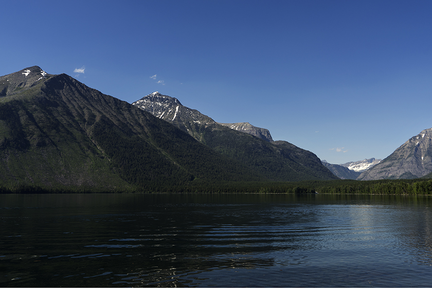
It’s the beginning of our second week of travel and today was the first time we didn’t have clear skies. In Columbia Falls yesterday, the temperature was in the high 90s before afternoon thunderstorms dropped some light rain. Today the storms have been building all day.

We made the drive around the south flank of Glacier Park and got to St Mary in the early afternoon, and that’s even stopping at the goat lick and lunch (it’s not the name of a restaurant, they’re different places). We had to move so we could see Glacier’s east side. As I wrote earlier, the Going to the Sun Road is still covered in snow.

Goats at the salt lick
Mountain goats migrate from the high cliffs down to a salt deposit along the Flathead River.

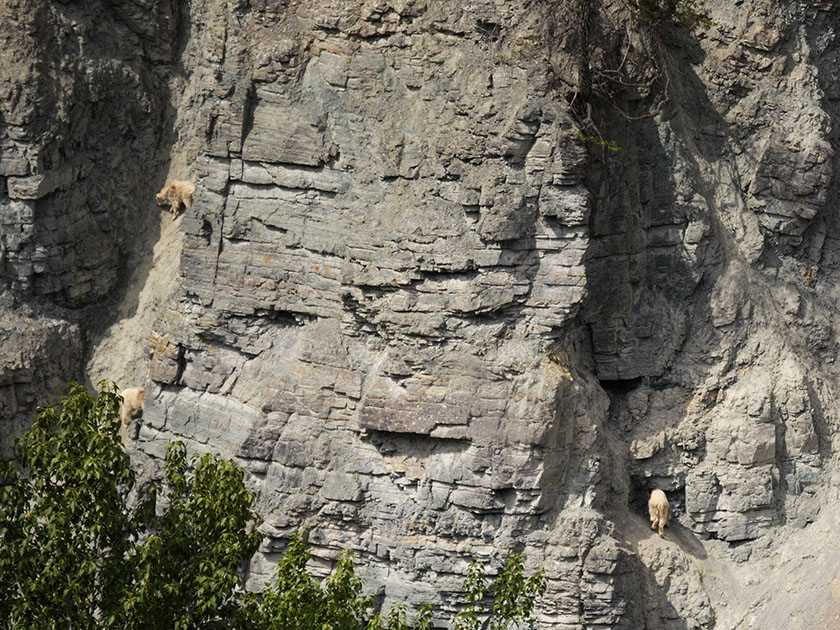
The goat lick is kind of cool. There is a turn out near the south-west corner of the park where you can see mountain goats if you’re lucky. They come down from the high mountains to a spot above a fork of the Flathead River where there are salt deposits. The last time Anne and I stopped, there were about a dozen, but there were only three today. Since they’re on the other side of the river, they’re over a mile away in the shot I made with my telephoto lens.

Storm over St Mary Lake
Afternoon thunderstorms create a dark mood in Glacier National Park.

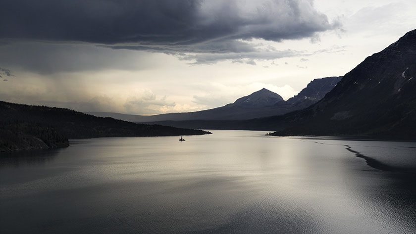
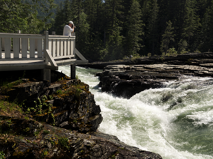
After setting up camp, we piled in the car and drove up the east side of the Going to the Sun Road. That’s when the thunderstorms really developed. As moist air moves in from the west, the Rockies wring a lot of that water out before moving out to the dry prairie. With thunder echoing off of the mountains while rain and hail bounced off of Fritz, the park was showing off a different face.

Two mountain peaks in rain clouds
Behind a grove of burnt evergreens, two Glacier peaks are obscured by rain clouds.

We’re going to stay here for another day then move across the border to Waterton Lakes National Park in Canada. It’s part of the Glacier Eco system and is called the International Peace Park. Besides, Fred and I have to see if we can catch something that moves.

jw

Glacier Fishing

I feel obligated that I should start an official tally here on the blog. I mean, we have to keep score of these things don’t we? Otherwise you would be kept in the dark about such things ant that wouldn’t be transparent would it.

So after our first day of fly fishing, here are the results. Fred caught three trees, a rock, and some grass. I caught four trees and a cabin. I think it’s clear who is a ahead don’t you?

jw

Columbia Falls, Montana

We arrived in Columbia Falls yesterday. Fred needs to get his stitches out (see the earlier post about pending disasters), and after five days of driving we scheduled time for a break. In addition to the medical concerns, we’ll restock some supplies and explore Glacier National Park so we can shoot some pictures and get in some fishing.

McDonald Lake tucked in glacial valley
McDonald Lake fills the glacial valley along the Going to the Sun Road in West Glacier National Park

Glacier is my favorite park (of the ones I’ve visited). It spans the border with Canada and their side is called Waterton Lakes National Park. Glacier is relatively small but has spectacular glacial mountains stacked one after another. I’ve joked before that it’s hard to photograph because to get one mountain completely framed, you back into another mountain.

Fred shooting waterfall
Fred composes a shot at McDonald Creek Falls in Glacier National Park

Going to the Sun road is the only road that traverses the park, and it crosses the Continental Divide at Logan Pass. At 6600 feet elevation, it is the best view of the park. Unfortunately, the road was closed every time we’ve visited and this year the snow won’t be cleared until mid July.

If you visit the park early in the season, you can cheat the snow plows by driving around the park on Highway US 2 to visit the other side, and that’s what we will do on Wednesday. We will spend a couple of days in Saint Mary before we finally cross the Canadian border.

jw

Butte Montana

There’s a pattern developing with our campsites. After driving a couple hundred miles each day, we pull into an RV park to get an evening’s rest. We’ve planned these stops and reserved our spaces before we left. RV Parks have become the motels of our generation. Each of the parks that we’ve stayed at have amenities that make life on the road more pleasant. One of those things is a WiFi connection that makes it possible to communicate with you while on the road.

Of the four places we’ve stayed in, three were really accessible from the highway, while last night’s was . . . well, out-of-the-way. It was in Thornton, Idaho. I know! Where the heck is that? It’s a wide spot in the road north of Idaho Falls and it was a detour from Interstate 15.

The pattern I’m referring to is this. The more convenient a park is to the highway, the more the highway conveniently runs through your bedroom. So far we’ve had semi trucks, trains, freeway noise and industrial sites as our ambient background noise throughout the evening. We dismissed it as part of being on the road, until last night.

Thornton Mercantile
The abandoned Thornton Mercantile and Cafe sits empty along the east side of the street.

When we pulled up to the park in Thornton, we all thought we’d made a big mistake. This wasn’t a big city or quaint little town. It was a spot on a side road with a couple of abandoned grain elevators, a row of closed businesses on the east side of the road and a potato shipping plant across the street. We could easily see the railroad tracks running along the road. It was the train blaring that got us up early in Provo and we thought here we go again. With some apprehension, we turned into the driveway of the Thompson RV Park.

Potato Packing Plant
Potato shipping plants on Thornton’ s west side

When we parked inside of the gate and went to the office to register, we were surprised to find a lovely park with gardens, fish pond, mature trees and lots of space to spread out. After setting up, we had a chance to wander the gardens where Linda Thompson joined us and pointed out all the flower variety growing. “You should have been here when the tulips were growing.” We could imagine what we missed because everything else was still in bloom.

She proudly pointed to a willow tree that she had planted nearly 50 years ago. “It was a twig in one of my mother’s funeral arrangements and when the flowers faded, I stuck it in the ground. I call it the Mom tree.” The house was over a hundred years old and they’ve run the park for about half that time. She explained that she and her husband want to retire and sell the place. They want to move to someplace warmer.

Thompson Gardens
The gardens at the Thompson RV Park have been lovingly cared for by the owners for fifty years.

How was our stay? Dead quiet except for the occasional peacock call in the distance. We could hear that because it was remarkably quiet otherwise. We even talked in hushed tones around our gathering. It will be a shame when the Thompson’s leave. I can’t imagine Corporate America giving the love and care to keep the place the same.

jw

Provo Utah

We put another 250 miles on today, and we arrived at Provo, an hour and a half south of Salt Lake City. Today’s route is one of my all time favorite drives. Head north out of Kanab following US Route 89. It provides access to Zion and Bryce Canyons, and a handful of State Parks too. Traffic was light, so we had time to look at the scenery. Unfortunately, not enough time to get any shots (Besides, the light is never perfect during the day).

When asked tonight, someone said that lunch was the highlight of the day. It was pretty good. We stopped again at Big Daddy’s Deli on a side street in Richfield. Anne, Sally and I ate there on a trip to Yellowstone a few years ago. Food is still good, and I’d recommend it for lunch if you’re in the area.

Tomorrow, we will be in Idaho. However, we will be traveling on I15 and through Salt Lake City. I  don’t consider it a day of oo’s and ah’s. I must admit that the Wasatch Range is a pretty backdrop for the town.

jw

Kanab Utah

It took longer than planned, but we made it to Kanab Utah, our toughest leg of our trip. I think we misjudged the time it would take to go through Prescott. A lot of traffic and a lot of twisty roads. We left Congress a little after seven in the morning and arrived at our camping site just before 5 PM. Since Kanab is on daylight savings time, we lost an hour and the trip took ten hours averaging 45 miles an hour. That’s including potty breaks, emergency stops, and lunch.

The girls stretch their legs
Deb, Sally and Anne stretch their legs in the shade of Sally’s RV.

We only made it to the top of Yarnell hill when Sally called on the walkie-talkie that one of her tire pressures was over 100 pounds. We pulled to the side of the road and sure enough, it was. After letting enough air out to match the others, we were back on the road.

Mickie D’s hosted lunch in Flagstaff. After taking four hours to get there, we were ready for the break. After that we made really good time as the roads and weather were good.

Picture of Kanab's main street.
Located on the southern border of Utah, Kanab hosts tourists visiting the Grand Canyon, Bryce, and Zion National Parks.

Kanab is a little tourist town in southern Utah. It’s only six miles across the border from Arizona situated between the Grand Canyon, Bryce and Zion. It’s loaded with tourists and has a couple of nice restaurants. It’s most striking feature is that it is nestled under the Vermilion Cliffs and the brilliant colors they have at the end of the day.

Tomorrow we strike out for Provo. It will be a better day as the distance isn’t as great and there aren’t as many long pulls we have to climb. And to think, we only have 89 more days like this.

jw