Well Turned Ankle Utah Photo Shoot

The suffering that I must go through to please you people. As I sit here on the couch and looking at my right leg propped up by a pillow, I see that my ankle is thicker than my calf muscle. I had a friend in high school—a girl—who’s legs looked like this. She always lamented that they installed her legs upside-down. That’s how my right leg looks now.

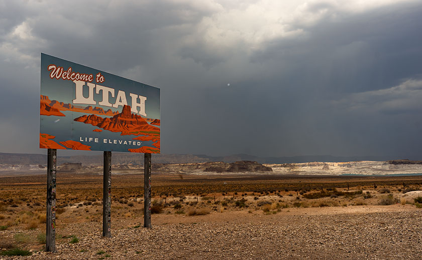
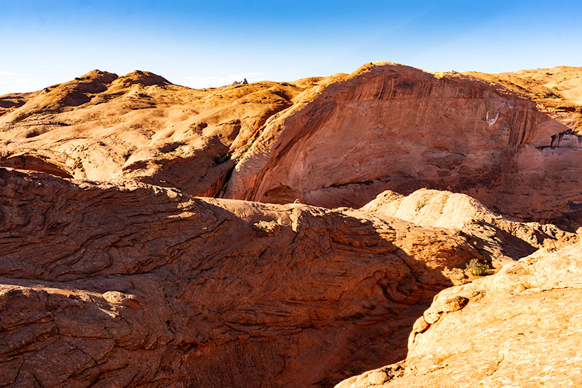
I managed to injure my ankle by twisting it on the hike back from Coyote Gulch in Utah. My pain worse because I didn’t get the shot I wanted. I was this … close. I allowed four hours to trek out, get a shot, and then hike back before the sun went down. The two-mile trail alternated between fine red-powder sand and slick rock which I preferred because I made better time while I walked it. As I neared the canyon, I was concerned because I couldn’t see it. It’s the same as Horseshoe Bend on the Colorado River, so you have to walk to the edge to look into the chasm. The photo shows just how close I got and when I took it, I was not on the trail. What you can’t see in the picture is that beyond the cairn the trail descends like walking down a ball. To get back up, I would have needed to crawl on my hands and knees. Incidentally, that’s a very narrow ridge to be carrying a camera pack and tripod, so yes, I was a-scared. (BTW—here’s a link to what’s down there. It’s copyrighted so I can’t post it, but I can send you for a look.)

The Top of Hamblin Arch
The Top of Hamblin Arch-This is how close I got to my subject. You’re looking at the top of Hamblin Arch, like looking at an elephant’s trunk from its brow. The cairn on the ridge marks the real trail. Behind the cairn, you can make out the arch underside.

I twisted my ankle a third of the way back, and it’s the third time I’ve injured the same ankle. Each time I was carrying a load and my foot rolled-over 90º so that my entire weight was on that pointy ankle bone. Like the other times, I didn’t have a choice but to keep walking and the two-mile trail turned into four miles, then six. I became concerned that I wouldn’t be able to get back to the truck before dark. I began having thoughts about my demise. I wondered if I’d have to eat the dead, except I was alone. I questioned when my camera and tripod would become so much of a burden that I’d discard them along the trail. In case you’re worried, I didn’t die. I got to the truck at sunset and spent the night alone under the stars. I drove back to town the next morning and called my caring wife to tell her I had to come home early—she would need time to get rid of her boyfriends—the Chippendale Dancers.

I think that after the first injury, my ankle is susceptible to re-injury. I wear good hiking boots, and because of their high tops, they have more support. With all the walking, hiking, and biking I’ve done in the past couple of years, I thought my ankle would be stronger. If I want to get back out there and get those out-of-the-way shots, I’m going to have to do strength training exercises and tape my foot up before a hike.

Instead—I’m buying a drone. The one I’ve settled on has a four-kilometer range, and I could fly it out there and get my shots from the parking lot. I’ve pondered how to get more height in my photos anyway, and a drone is a perfect answer. A drone is a medical necessity—no less than an Iron Lung. The challenge I have is that I want a quality camera equal to my current gear. That camera is $21K, and lenses start at $10K. A drone stout enough to fly it is another $7K, and the controller is another couple of grand. Sure, fifty-thousand dollars sounds like a lot of money, but that’s the cost of an emergency room visit and a couple of nights in intensive care. I wonder if my health insurance will cover it if my doctor writes a prescription.

Until next time—jw

Red Toadstool Picture of the Week

There’s a place on US 89 about halfway between Page, Arizona and Kanab, Utah where the road gets lost. As you know, odd-numbered routes run north-south, but this section of 89 goes east-west for 60 miles between the two towns and right in the middle the road hits all the compass points. There’s a perfectly logical reason they built the road this way. This is where US 89 cuts through the southern part of the Grand Staircase Escalante National Monument, and with three cliff tiers in front of you, it’s just easier to go around them.

The explanation for the five-mile section of looping road is the same. This is when the highway crosses a rift valley and climbs around to the north side of Buckskin Mountain. This is also the spot on the map that is a landscape photographer’s Mecca. You have probably seen photos of exotic geological features and wondered where they were taken. Places like The Wave, White Outcrops, Paria Canyon, Buckskin Canyon, Calico Mountain, and The Toadstools are all within fifteen miles from the road. The bad part of that—for us geezers—is that you must hike that distance to get to them.

This week’s featured image only required a jone-mile hike, but it involved a climb to a shelf 300 feet above the road. Once you make it, you’ll find a group of toadstools—columns of sandstone supporting a protective capstone. Although the trail up there isn’t flat, you don’t need to be an élite climber to make it. Queen Anne got far enough that she was able to watch her hero snap this photo, which filled her with so much emotion that she had to return to the car and do her nails.

Red Toadstool
Red Toadstool – A protective capstone is supported by a column of red sandstone near Kanab Utah.

I shot this toadstool from a couple of angles and after viewing the test strips back at camp, I preferred this version even though it’s smaller within the frame. The composition is stronger, and the image is uncluttered, so the formation becomes a stronger subject. The light wasn’t what I envisioned when I planned this trip, but the thunder clouds are kind-of cool. I call this image Red Toadstool and I’m pleased to start a month of Utah photos with it.

You can see a larger version of Red Toadstool on its Web Page by clicking here. I hope you enjoy viewing this week’s post and come back next week when we present another image from a different Utah site.

Until next time — jw

Kanab Overnight 2018 Utah Photo Shoot

We stopped short of our target destination—Panguitch—by a hundred miles because I wanted to shoot along the lower Paria River. I was hoping to shoot a couple of areas that I previously visited bathed in a late afternoon sun. Instead, it rained. I captured some nice images anyway and Queen Anne followed me most of the way up the trail—including a bit of the climb. That was a miracle unto itself.

Dune at the Toadstools
Dune at the Toadstools – This is one of the images taken at the Toadstool stop along US 89. It was the first time I hiked up to them. To her credit, Anne followed me most of the way.

Our temporary site is in Kanab and the RV Park we originally stayed in during our Alaska adventure. New owners bought the place a couple of years ago and have made improvements. I’d have to rate it as one of my favorites—although truck traffic still starts early. Last night we enjoyed a fine meal at the Rocking V Cafe. It’s the fourth time we’ve stopped there without disappointment. Anne was perturbed that they didn’t serve their macaroni and cheese for dinner. She had been going on about it all day and nearly beat up the poor waitress when they wouldn’t make some especially for her. Instead, Anne wound up enjoying the curry dish that she ordered.

We’re packing up this morning and making the pull up to Panguitch. It’s another thousand feet higher and ten degrees cooler so that suits Anne’s prerequisite. It’s also centrally located to the areas that I want to shoot. We will be pulling The Ritz for a couple of hours so we’re not in a rush this morning. As a matter of fact, it just turned 8 am and I rousted her highness from the sack. If she stays in character, she’ll dawdle all morning so that we’ll have to stop at the Rocking V for a lunch of Mac ‘n cheese.

Until next time — jw

Welcome to Utah On Location

Welcome to Utah
Welcome to Utah – With rain cells all around, we stopped to memorialize the state change.

We made it to Utah in spite of getting lost in Williamson Valley because we missed the turn off for Chino. We had to back-track fifteen miles. We finally rolled into Kanab at 5pm and after setting up camp, we relaxed in Ritz’s air-conditioning. The temperature is in the 80’s but it’s really humid.

It’s been a while since we did any shooting in the Beehive State and I’m excited to revisit the National Parks along US 89. It seems like Utah has more National Parks than the other states. We plan on visiting three of them at least. I also want to check out other sites that I’ve heard about. We’re going to be here for a couple of weeks—at least.

It’s been a long day behind the wheel, so we’re making an early evening, but I wanted to get this post out before we crash. I plan on writing more about the things we see and do much like I did during last years Springerville trip, so be ready for more blog posts this month.

Until next time — jw