Gateway to the Past: Valley of Fire’s Petroglyph Canyon Trail Picture of the Week - Valley of Fire State Park, Nevada

A towering red sandstone rock formation standing prominently against a clear blue sky in the Valley of Fire State Park, Nevada.
Gateway to the Past – Standing tall amidst the Valley of Fire’s arid expanse, this sandstone sentinel bears the marks of time, its iron-rich facade a testament to nature’s artistry under the desert sun.

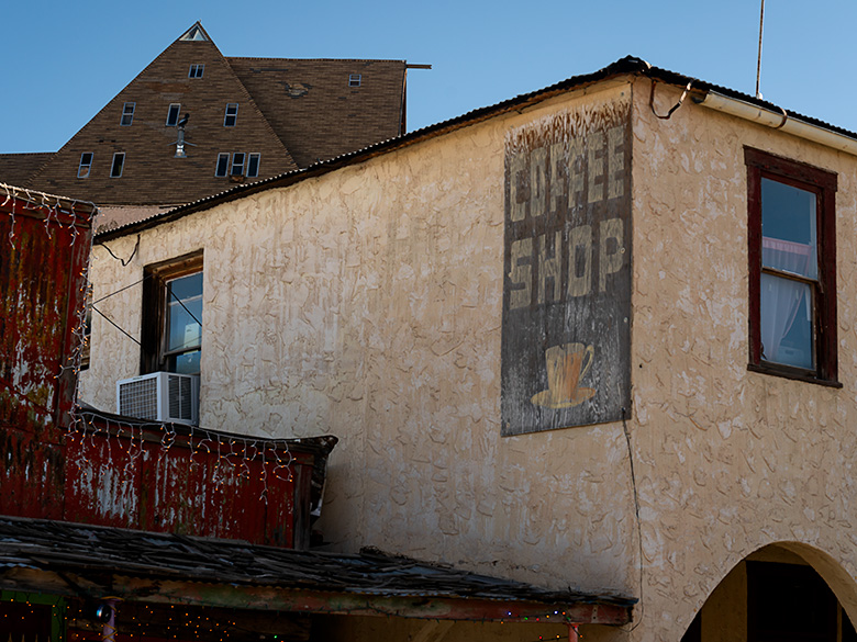
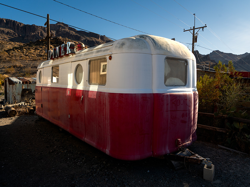
Welcome back to our Valley of Fire saga. After last week’s detour to a reemerged St. Thomas, we’re back on track, diving into the heart of the park’s ancient artistry. Ready for a journey through time? Buckle up; it’s not your average road trip.

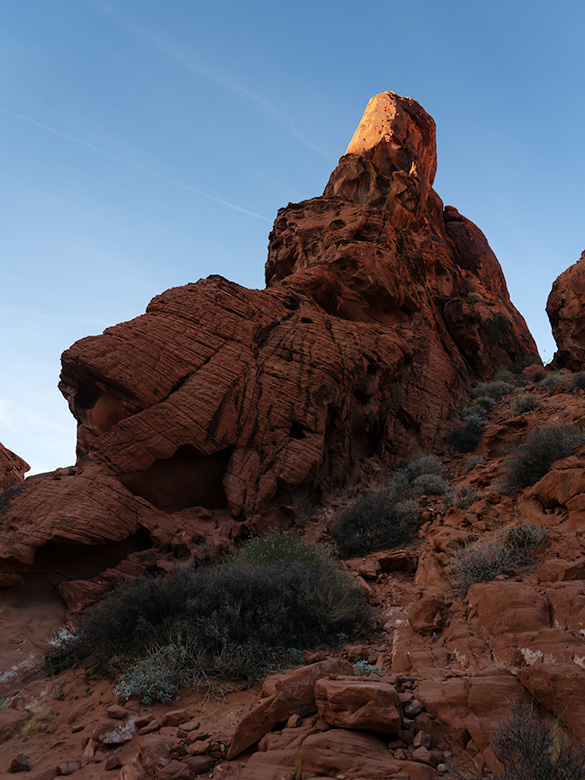
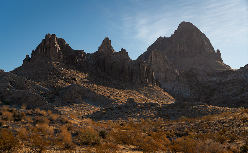
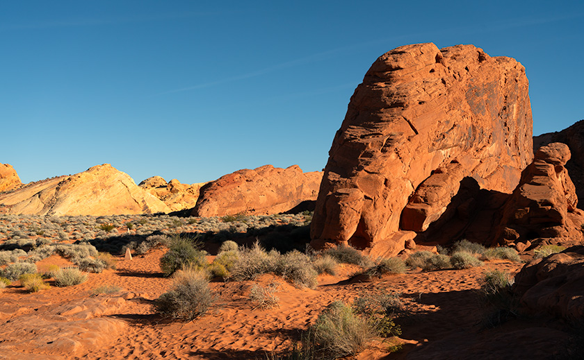
Our Valley of Fire expedition began with a grand tour, taking in the vistas from the comfort of our trusty steed—the Turd. As usual, we took a lap around the park to set our bearings. The main road offered plenty of photo ops, but the real treasure lay off the beaten path—Petroglyph Canyon Trail. Here, amidst the whispers of history, we encountered the park’s silent storytellers: ancient petroglyphs.

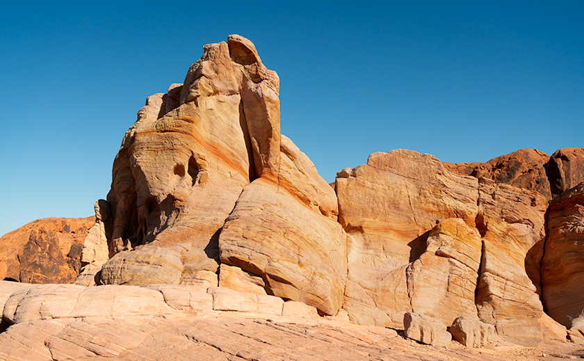
In the middle of Lake Mead’s east-west reach is a lake section that ventures north into the Moapa Valley, where the Muddy and Virgin Rivers flow into the Colorado. This part of the lake is the Overton Arm. Nestled along the Overton Arm lies a canvas of ancient cultures. From the Anasazi to the Paiute, this valley served as a crossroads for tribes, traders, and travelers.

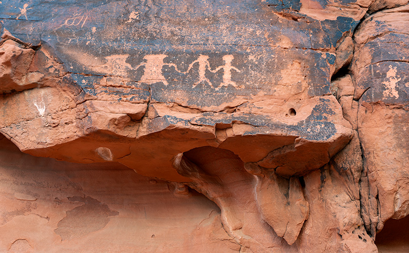
This week’s image is a scene that I shot along the Petroglyph trail. If you look closely, you’ll see the multitude of visitor footprints in the sand, and fortunately, there are several trail markers to guide the way. Without them, I’m sure I would have ‘taken the path less traveled’ and still be trying to find my way back to the parking lot. Several petroglyph panels are along the canyon’s nooks and crannies, including the one in this week’s second photo depicting several individuals dancing around the campfire. Possibly, they’re celebrating breaking par on one of the area’s nearby golf courses.

These petroglyphs, more than mere marks on stone, are the enduring legacy of the valley’s first inhabitants, capturing moments of joy, symbols of identity, and, perhaps, the earliest known complaints about traffic.

A detailed petroglyph panel featuring historical figures and animals, carved into desert varnish on red sandstone at Valley of Fire State Park, Nevada.
Ancient Petroglyphs on Red Sandstone – Valley of Fire – Whispers of the Ancient Winds: This petroglyph panel in Valley of Fire State Park offers a silent narrative of life long ago, etched into the canvas of time by the park’s earliest inhabitants.

As we stood before these ancient murals, it struck us: these were the original social media posts. Without a single hashtag, these images connected communities, shared stories, and even guided travelers. It makes one wonder what tales we would etch into stone for future generations to ponder. How can we guide those who follow if they can’t get reception?

Our trek through Petroglyph Canyon reminded us that some stories transcend time, etched in stone and the heart of the land itself. Have you encountered these timeless tales on your travels? Please share your stories in the comments and join us next week as we conclude our Valley of Fire adventure. If you’re curious, I have larger versions of this week’s photo on my Website < Jim’s Link> and my Fine Art America Page <FAA Link>.

Until next time, keep your spirits high and your humor dry.
jw

Techniques: Bringing out details using local contrast.

Sometimes, you’ve got to do a little tweaking to make your subject stand out. A case in point this week is the petroglyphs carved into the rock face seen in Ancient Petroglyphs on Red Sandstone. The red and black sandstone figures were flat and lifeless when I processed this image. In the old days, I would be stuck because there wasn’t a way to dodge or bun such a tight area without leaving a halo without making a contrast mask—a tedious process at best. In today’s Photoshop, there’s an easy way to lighten tight areas like the dancing figures on the wall.

This process takes a couple of steps. I first made a copy of the background layer and made it active; then, from the top menu, I chose Select>Color Range, which creates a mask from the color selection. Then, make a new Exposure layer and copy the mask to the new layer. The exposure layer’s properties lighten the masked areas from .05 to .25.

The second step is to choose a new Levels layer and copy the mask. Select the properties of your new mask and choose Invert. The mask should swap the black and whites. Next, select the properties icon (the graph) and darken the mid-tones by moving the middle slider until the middle-value box reads 0.95. Voalia, the figures now pop from the wall.

Twilight’s Ember: The Last Rays on Valley of Fire’s Red Rocks Picture of the Week - Valley of Fire State Park, Nevada

A towering red sandstone formation illuminated by the golden light of the sun, set against the clear blue sky in Valley of Fire State Park, Nevada.
Twilight’s Ember – A Natural Sculpture Carved by Time – Witness the interplay of light and shadow on the ancient red sandstone, highlighting the peak as if it were aflame in the heart of Valley of Fire State Park.

Last week, I shared a whimsical thought sparked by our visit to the once-submerged town of St. Thomas along Lake Meade’s shores. The idea? A short video starring our unwitting adventurers in an underwater exploration gone awry. With anything SCUBA, my thoughts invariably turn to the Poteets—Fred being a certified diving instructor. My idea instantly became a classic case of good and bad news. Deb quickly noted the absence of wetsuits in their wardrobe, while Fred, ever the sport, proposed renting them for our aquatic escapade. Thus, I spent the week crafting an epic screenplay for our faux underwater archaeology saga, ready for your enjoyment.


Not Quite a Fathom by Jim Witkowski

EXTERIOR SCENE. ZODIAC DIVING BOAT—DAY

The scene opens with FRED and DEB POTEET, waist up, sitting on the edge of a Zodiac diving boat. Clad in wetsuits, they finalize their snorkeling gear setup. Fred delivers the pre-dive briefing with a hint of solemnity.

FRED
(fiddling with a weight belt)
Remember, St. Thomas has been a memory under Lake Mead’s waters since 1938, untouched by time. The condition of the buildings is unknown, so let’s avoid the timbers.

The camera cuts to a tight shot of Deb; her concern is visible even behind the mask.

DEB
I hope we don’t stumble upon any forgotten skeletons.

Cutting back to Fred, his assurance is firm.

FRED
Fear not. Hugh Lord, the town’s final farewell, waved as the waters embraced his home in ’38. All were safe.

With a final gear check, Fred signals readiness.

FRED (continues)
Ready?

Both poised on the Zodiac’s brink, a countdown commences.

FRED
On three. One… two… three…

On three, Fred leans back and rolls off the Zodiac into the water, followed immediately by Deb.

Cut to a drone camera, tight on Fred’s shocked face.

As Deb turns to Fred, her expression seems to ask, “WTF?” The drone camera slowly pulls up, revealing they are lying face-up on the dry lakebed, their legs still resting on the side of the Zodiac.

The drone camera pulls back further, exposing the dry town site’s barren concrete foundations and pads. As it gets altitude, Fred and Deb stand up, now tiny figures in the vast, dry landscape, including the Muddy River bed.

The camera ascends, eventually dissolving into a Google Earth Studio shot of the Lake Mead Overton arm, zooming out until the entire planet fills the frame.

FADE TO BLACK.


It’s a masterpiece if I do say so myself. Now, about those props—does anyone have a Zodiac lying around? Or perhaps other treasures hidden in your garage that could bring our production to life? Share your ideas in the comments! But let’s pivot from our playful banter to the awe-inspiring beauty captured in this week’s photographs.

This week’s highlight is a breathtaking sandstone formation, its pinnacle bathed in the sunset’s final embrace. The iron oxide-rich layers glow, a fiery testament to Valley of Fire’s geological wonders.

The uplift and erosion revealing such splendor speak to the Basin and Range Province’s dynamic history. Here, the forces of nature sculpt masterpieces: holes carved by chemical reactions with rainwater, alcoves shaped by the relentless wind, and striations etched by the journey of rainwater.

Thank you for joining us on this adventure. As the Superbowl looms, I wish your team luck and, perhaps more importantly, that this year’s commercials bring us joy. Next week promises more marvels from Valley of Fire. Don’t miss it.

Till then, keep your camera at the ready and your humor dry.
jw

A towering formation of layered Navajo sandstone, named 'whiteGibraltar', stands under a clear blue sky in Valley of Fire State Park, Nevada.
White Gibraltar – The Navajo Sandstone Giant of Valley of Fire – A Vision in Sandstone – Rising from the Valley of Fire’s rugged landscape, this pale monolith echoes the grandeur of its namesake, standing as a silent sentinel in the desert sun.

Techniques: Exposing for the Highlight

I spotted the Aztec Sandstone formation while returning to the Turd on a trail hike at the end of the day. My eye was drawn to the very tip of the pinnacle, still glowing in the sun like the flame on the Statue of Liberty or ET’s finger. I knew that if I exposed the shady part of the sandstone, the finger would wash out the nice red color. So, to retain that glow, I pointed my camera at the sky above the finger, half-pressed the shutter to freeze the exposure reading, and slowly lowered the camera to include the rest of the scene.

The raw image looked too dark, and I almost rejected it. However, in post-processing, I could mask off the bright areas and increase the shadows by almost two F-stops. That was enough to bring out the erosion holes and keep the glow on ET’s finger.

Nature’s Palette: Exploring the Red Sandstone Masterpiece at Valley of Fire Picture of the Week - Valley of Fire State Park, Nevada

Red sandstone formations at Valley of Fire State Park, symbolizing the beauty of geologic processes over millennia.
Red Dune Wall in Valley of Fire—A Study in Erosion and Time – The ‘Red Dune Wall’ is a testament to nature’s artistic hand, sculpting the Valley of Fire State Park landscape through the relentless forces of wind and water.

Greetings from the Nevada desert, where Queen Anne (aka Lefty) and I embarked on a wild escapade, armed with nothing but our cameras and a sense of adventure that’s as robust as my morning coffee—deceptively strong and slightly bitter.

It all began in a Mexican restaurant in November, where we had planned to wrestle with the wilds of Gold Butte National Monument. But as we surveyed our gear, we realized we were about as prepared as a fish on a bicycle. With a sigh that echoed off the terracotta walls, we decided to pivot faster than a gambler on a losing streak.

So there we were, poring over maps and munching on nachos when the Valley of Fire State Park flickered onto our radar like a beacon of salvation—or at least a beacon of cell service and paved roads. It was a unanimous decision, fueled by the promise of not getting stuck and the allure of a good story to tell.

After a hearty debate over hash browns and highway maps at Peggy Sue’s Diner the following day, we plotted a less ‘Oregon Trail’ course and more ‘Sunday drive.’ We planned to loop through Overton, graze the shores of Lake Mead, and enter the Valley of Fire from the east, with a sunset deadline to beat the buffet back in Mesquite.

On a whim, we decided to pay our respects to the submerged ghost town of St. Thomas, which was now high and dry thanks to the ever-thirsty sun. The remains were intriguing, but we passed on the hike, preferring to keep our boots dust-free. Instead, I hatched a master plan to lure our friends—the Poteets—into a Jacques Cousteau-style watery charade involving wetsuits and mock-panicked flailing for a film I’d tentatively titled The Great St. Thomas Aquatic Caper.

A towering rock formation known as Silica Dome against the clear blue sky in Valley of Fire State Park.
Silica Dome—The Sentinel of Valley of Fire’s Rocky Landscape – Experience the ‘Silica Dome’ grandeur at Valley of Fire State Park through this captivating image, highlighting the intricate layers and history etched in stone.

As the day wore on, we wandered among the storied stones of the early Jurassic Era. Like Whitney Pocket, these rocks were part of a grander narrative, a to-be-continued tale of petrified dunes stretching from Zion to the Grand Staircase and beyond. The Valley of Fire’s chapters were penned in red Aztec sandstone hues and crowned with white Navajo crests, a chronicle of time written in Earth’s hand.

This week’s photographic heroes are a testament to this fiery anthology. The main photo—a regal formation of red Entrada sandstone—is the park’s namesake, standing proudly amidst the Mojave’s scrappy flora. The supporting act, Silica Dome, wears a coat of Navajo Sandstone, pale and majestic against the desert sky. Together, they tell a story of a sea that once was and dunes that danced in the wind before time turned them to stone.
So, dear readers, come for the photos, stay for the tales, and return next week for another chapter in our desert saga. Will the Poteets make a splash in their wetsuits? Will Queen Anne ever forgive me for the early morning escapades? Find out in the next installment of our arid adventures.

Until then, keep your lenses clean and your humor dry.
jw

Techniques Unveiled: A Tale of Two Sandstones

In the photographer’s toolbox, contrast isn’t just about light and shadow—it’s the story of elements, epochs, and the Earth’s grand design. This week, I set out to capture a tale of two sandstones, a narrative etched into the very landscape of Valley of Fire State Park.

Our lead image, Nature’s Palette, is a canvas painted with iron-rich sandstone, a souvenir from the mid-Jurassic era. Here, the dunes are frozen in an eternal dance, caught mid-twirl by the relentless grip of pressure and heat, akin to the timeless beauty of Canyon de Chelly and the famed arches of Moab. Look closely, and you’ll see the canvas of the ancients—the water-stained varnish that once served as a blackboard for the Fremont and early Pueblo people to etch their indelible art.

The supporting act, Silica Dome, steps onto the stage from a later act in Earth’s drama under the watchful gaze of T-Rex and company. It’s a piece of the past where the climate was as dry as a prohibition-era bar, and vast sandy beaches fringed an ancient inland sea. In this shot, we confront a dune face-to-face, observing its neighbors’ retreat under the onslaught of time, exposing it to the elements that now conspire to return it to its granular beginnings.

I’ve served up larger versions of these geological delicacies online for those hungry for more than just a visual snack. You can feast your eyes on them via the links on my website—< Jim’s Web Page>—and their respective galleries on Fine Art America—<FAA Link>. Or click on the images peppered throughout this article for an instant teleportation to their online abodes.

Your thoughts are the garnish to our digital dish, so please sprinkle liberally in the comments section below. What stories do these ancient stones whisper to you?

BTW:
Last Tuesday, I released another video in my portfolio series on YouTube. This vignette is about the beauty of Arizona’s Farmlands. The five-ish-minute-long video is now online, and you can use this link to see it: <YouTube Link>.

Oatman’s Revival: A Tale of Dams, Dreams, and Daring Do-overs Picture of the Week - Oatman, Arizona

Weathered coffee shop sign on the side of a historic hotel in Oatman, Arizona, with an A-frame house looming in the background and a saloon to the left.
Fading Memories: Oatman’s Historic Hotel Coffee Shop Sign – Remnants of a bygone era, this faded sign on the Oatman Hotel whispers stories of travelers and townsfolk who once gathered over coffee in the heart of a bustling mining town.

Last week, we left Oatman looking more ghostly than a town with a future. But then the mid-20th century rolled around, and everything changed like a plot twist in a spaghetti western. It started with a need for flood control and water conservation, a task as ambitious as teaching a cat to swim. Enter the Bureau of Land Management with its dam-building frenzy. They tamed the Colorado River, creating recreational oases like Lake Mohave and Lake Havasu, inadvertently setting the stage for Oatman’s second act.

Meanwhile, Don Laughlin, a casino mogul with an eye for opportunity sharper than a cactus spine, flew over the Colorado River en route to Kingman. Spotting a riverside motel in 1964, he didn’t just see a run-down building; he saw a neon-lit future. Don transformed the motel into the Riverside Resort, where you could lose your nickels in slot machines and gain a few pounds with 98-cent chicken dinners. This move ushered in a casino boom, turning Laughlin, Nevada, into a gambler’s paradise across the river from Bullhead City.

Not to be outdone, Robert McCulloch, a chainsaw magnate with an affinity for outboard motors and grand gestures, bought a swath of lakeside property. He didn’t just stop at creating Lake Havasu City; he went full theatrical by importing the London Bridge. Yes, that London Bridge—which he rebuilt in the middle of the desert. The Brits scoffed, the Americans gawked, and tourists flocked in droves.

But Oatman’s real comeback hinged on a nostalgia trip kick-started by Angel Delgadillo, a barber from Seligman with more vision than a Route 66 tourist with a pair of binoculars. In the 1980s, as Interstate 40 siphoned off Oatman’s traffic, Angel founded the Historic Route 66 Association of Arizona. He campaigned to get the Mother Road recognized as a Historic Route, sparking a revival that put Oatman back on the map. Suddenly, tourists craved an authentic slice of Americana, and Oatman served it up with a side of staged shootouts.

The final puzzle piece was the cultural shift in San Francisco in the late ’60s. A generation enamored with art, nature, and history began resurrecting Victorian homes with colorful paint jobs that’d make a peacock jealous. This love for the old and quaint spread to Arizona, and towns like Oatman reaped the benefits. The once-desolate streets now buzz with shops, tourists, and the occasional wild burro, all basking in the glory of a Route 66 renaissance.

So there you have it: a cocktail of dams, dreams, and a dash of historical reverence, shaken not stirred, brought Oatman from the brink of becoming a forgotten footnote to a must-visit destination on the map of Americana.

Oatman Hotel

In the heart of Oatman, where the Wild West refuses to be tamed, stands the Oatman Hotel. Its story begins in 1902, opening its doors as the Drulin Hotel, a name as sturdy as the building itself. It was more than just a hotel; it was a beacon for weary gold miners, travelers, and anyone looking to swap tales over a stiff drink. Its walls, if they could talk, would spin yarns of dusty days and golden dreams.

Like a determined prospector, the Drulin Hotel embraced change as time passed. It donned a new name, becoming the Oatman Hotel, as if shedding an old skin to reveal a more refined identity. This wasn’t just a name change, a rite of passage, and a nod to the town’s enduring spirit.
The Oatman Hotel wasn’t just any stopover; it became a slice of history, a living museum with beds. It earned its rightful place as a registered historical building, a title as prestigious as a sheriff’s badge. Its walls, now seasoned by time, became a gallery of memories, each room whispering secrets of the past.

But wait, there’s more glitz to this tale. The Oatman Hotel, with its rustic charm, caught the eye of Hollywood’s finest. None other than Clark Gable and Carole Lombard, after their 1939 Kingman courthouse wedding, chose this very hotel for their honeymoon. Imagine that! Hollywood royalty, nestled in the embrace of the rugged Mojave. Their stay added a sprinkle of stardust to the hotel, making room 15 forever a shrine to their love.

The Oatman Hotel stood tall through booms and busts, a sentinel of history. It watched as Oatman ebbed and flowed yet remained steadfast as ever, a reminder of the golden days and starlit nights.

The Boundary Cone, a significant peak for Mohave tribes, stands tall against the morning sky, viewed from the juncture of old Route 66 and Boundary Cone Road.
Guardian of the Mohave: The Boundary Cone’s Tale – Standing tall against the morning sky, the Boundary Cone serves as a timeless landmark at the crossroads of Route 66, embodying the sacred history and enduring spirit of the Mohave Valley.

We hope you enjoyed our time in Oatman. As usual, larger versions of this week’s image are on my website < Jim’s Web> and Fine Art America <FAA Link> for you to examine. Be sure to return next week when we begin a new project. For February, we’re returning to nature an hour north of here.

Till then, keep your spirits high and your humor dry.
jw

Techniques: Capturing Oatman’s Palette

In this week’s snapshot, the Coffee Shop sign of the Oatman Hotel is a beacon of nostalgia in a sea of architectural chaos. But why this particular sign, you ask? Well, it’s all about perspective and a little artistic rivalry.

On the flip side of the hotel, there’s another sign vying for attention. But there, the Coffee Shop sign gets overshadowed, like an understudy in a Broadway show where the lead refuses to call in sick. The other side also features the Oatman Hotel’s sign, turning the scene into a visual shouting match where the quaint charm of the coffee shop gets drowned out.

Now, let’s talk about setting the stage. The chosen angle for this week’s photo is like a Cubist’s dream from the 1950s, where geometry and color come together in a symphony of shapes. We’ve got the white stucco of the hotel, a daring triangle of an A-frame house peeping from behind, and the bold red facade of the neighboring bar. It’s an ensemble of structures, each playing its part in framing our star sign.

These buildings create a natural frame, like ushers in a theater, guiding your gaze to the center stage where the sign takes its bow. This arrangement keeps the viewer’s eye dancing around the central focus, ensuring the sign isn’t just seen but experienced.

And let’s not forget the grand finale of colors—a patriotic red, white, and blue – tying this month’s photos together like a well-rehearsed chorus line. Each hue plays its part, creating a visual melody that’s distinctly Oatman, distinctly Americana.

So there you have it, a behind-the-scenes peek at how a simple choice of angle and a keen eye for color can turn an everyday scene into a snapshot that captures the essence of a town with as much character as Oatman.

Vintage Red Crown Gas Pumps: Oatman’s Route 66 Treasures Pictrure of the Week - Oatman, Arizona

Vintage Red Crown gas pumps in Oatman, Arizona, along the famed Route 66, evoking the golden era of American road travel.
Time-Standing Still: Vintage Gas Pumps of Oatman – Step back in time with these meticulously preserved ‘Red Crown’ gasoline pumps, a vibrant reminder of Route 66’s golden era, now standing proudly outside Oatman’s antique store — a treasure trove awaiting its next collector.

Let’s talk about a little thing called ROI, or return on investment. In layperson’s terms, it’s like this: if your piggy bank’s diet consists more of withdrawals than deposits, it’s time to put that cash-chewing pastime on a strict no-spend regimen. It’s a handy rule of thumb for deciding whether that avocado toast obsession is a splurge too far and for the bigwigs running the corporate circus. They don’t just steer the company ship; they’re the jugglers, tightrope walkers, and lion tamers tasked with keeping the ROI roaring so the shareholders don’t start looking for a tamer’s head to put in the lion’s mouth.

In the harsh and unforgiving world of mining towns like Oatman, hitting the ROI redline means ‘game over’ for the local economy. The investors pack up their checkbooks, the mines shutter faster than a camera at a ghost sighting, and the workers scatter like tumbleweeds in a dust storm. The town’s pulse slows, and those left behind are like the band on the Titanic—playing on bravely, knowing the finale is nigh.

The tale of Oatman follows a script as predictable as the instructions on a shampoo bottle—minus the rejuvenating wash. It’s a cycle as old as time: boom, bust, and echo. The brightest stars eventually fizzle out, and Oatman’s star, once a beacon of the Gold Rush, was no exception. And just like a one-two punch in a heavyweight bout, Oatman’s knockout came swiftly. First, the mines dried up, and then Route 66 got a face-lift that sidestepped the town altogether. Modern progress, they said, but for Oatman, it was more like a step into obscurity.

The new road followed the railroad’s less adventurous path, leaving Oatman off the beaten path and out of the family vacation route. From the Clampetts to the Griswolds, no one was clamoring to visit an old shanty town at that time—and the Department of Transportation—forgot. Oatman became the town overlooking Mohave Valley with a ‘Do Not Disturb’ sign hung on its door.

As the rest of the world hurtled forward into the mid-20th century, Oatman seemed to hit the pause button. The once frenetic streets, echoing with the din of prosperity, fell silent, leaving only the whispering desert winds to tell their tales. For the few who chose to stay, life became a study of survival and simplicity. Oatman’s dwindling population, a patchwork of tenacious old-timers and resourceful souls, found a way to eke out a living from the sparse offerings of a town that had given its all to the golden days of yore.

The rustic sign of Judy's Saloon and Pool Hall under a wall-mounted American flag on the historic Main Street of Oatman, Arizona.
Judy’s Saloon: Echoes of Oatman’s Vibrant Past – Under Oatman’s azure skies, the worn sign of Judy’s Saloon points the way, juxtaposed with a rustic American flag, to a place where the spirit of the West is not just remembered but still lives on.

The rhythm of life here was no longer dictated by the pulsing promise of gold but by the sun’s arc across the sky. The remaining residents turned to the land, coaxing modest gardens from the arid soil, trading with neighbors, and gathering at Judy’s Saloon for some, reliving the glory days in stories told and retold like cherished family heirlooms. They adapted, repurposing old mining tools for mundane tasks and transforming abandoned structures into homes and makeshift businesses that catered to the occasional traveler, lost or adventurous enough to stray from the new Route 66.

In this era, Oatman’s heartbeat was a subtle one, felt rather than heard, in the stoic persistence of its people and the silent dignity of its weathered buildings. The community’s fabric was tightly knit, each person a thread bound to the other by shared history and collective tenacity. Life in Oatman wasn’t about thriving; it was about enduring, about preserving the essence of a town too proud to fade away.

The gasoline pumps featured in this week’s picture tell a story that’s as much about progress as it is about preservation. Red Crown gas, a blend marketed by Standard Oil (now Chevron), was the fuel of choice during the era these pumps would have served. Picture this: classic cars now wear the badge of ‘vintage’ had a dial for drivers to adjust the timing advance. A tank full of high-octane Red Crown meant more zip without the dreaded engine knock. Nowadays, that’s a job delegated to the computers in our cars.

But take a closer look at these gravity-feed pumps. Their pristine condition raises a question—have they stood the test of time, or are they beautifully restored pieces of history? It’s a bit of a mystery, much like the stories they hold. And for my eagle-eyed followers, yes, you’ve already noticed the white roof of the Diner Car peeking out on the left.

I hope you enjoyed this stroll down the quieter lanes of Oatman’s history, but don’t pack away your walking shoes just yet. Next week, we’re dusting off the fairy tale books for Oatman’s own Cinderella story—a happy ending sure to sparkle. If your curiosity about those Red Crown pumps is ticking like a Geiger counter in a gold mine, here’s your treasure map: links to my web page < Jim’s Site> and the Fine Art America page <FAA Link>. And hey, if you find yourself meandering through Oatman in the next few months, pop into that antique store and snoop around for the price tag on those pumps. Don’t forget to spill the beans in the comments below—I think they’d make a lovely gate for the end of my driveway.

Till our next adventure, keep your spirits high and your humor dry.
jw

Techniques: Mastering the Art of Symmetrical Composition

This week’s photo ventures into symmetrical composition, a method that, admittedly, I usually give a wide berth. Symmetry in photography is all about balance, akin to placing two candles at either end of a mantle for that classic, mirror-image elegance. But who says rules can’t be bent for a bit of creative flair?

Regarding the Red Crown gas pumps, symmetry was the starting point, not the destination. I aimed to capture both pumps in a single frame, spaced evenly from the frame’s edges to create a sense of balance. However, I opted for a slight twist rather than a straight-on, textbook symmetric shot. By shifting my position to the right, the pumps became natural frames for the ‘Antiques’ sign in the background, adding layers and depth to the image. It’s like setting those candles at different heights on the mantle; it catches the eye, creates tension, and makes you look twice.

The result? A photo that adheres to symmetry principles while stepping out of the conventional bounds, making for a more intriguing and dynamic composition. Sometimes, bending the rules just a little can lead to a more compelling story being told through the lens. What’s your take on it? Traditional symmetry or a dash of asymmetrical intrigue?

Hidden Americana: Oatman’s Retro Diner Discovery Picture of the Week - Oatman, Arizona

Vintage red and white diner trailer tucked away in an alley of Oatman, Arizona, along historic Route 66.
Retro Diner Charm in Oatman’s Alley – Discover the charm of a hidden vintage diner trailer in Oatman, AZ, a nostalgic slice of Americana nestled in the heart of historic Route 66.

Let’s embark on a journey back to school for a moment. Picture yourself seated in an Arizona grade-school classroom, pencil in hand and a fresh sheet of paper on your desk. Today’s lesson begins with a pop quiz, a staple of any Arizona curriculum. The question: What are the ‘5 Cs’ of Arizona? If you’re rattling off Copper, Cotton, Cattle, Citrus, and Climate, you’ve hit the nail on the head. But let’s add a twist for the history buffs among us. How about substituting with these: Cactus, Canyons, Crackpots, Computer-Chips, Construction, or Canadians?

The original five Cs were, of course, the most significant revenue producers in the state. But that was so 1950s. Although they still bring substantial money into Arizona, they’re a fraction of their past in the new millennium. For example, when I moved to Phoenix in 1972, the Valley of the Sun was wall-to-wall orange groves. Today, they’ve been replaced by tract homes with a token grapefruit tree in the backyard. The cotton fields stretching from Tolleson to Buckeye have suffered the same fate. The stockyards that fowled the air at the east end of Sky Harbor’s runways are now a parade of gleaming corporate offices.

That leaves climate as the surviving C-word, which brings in the Canadians, and we need to build something to keep them occupied while we crackpots are hard at work making computer chips and constructing new houses. This shift from the agricultural and raw materials of yesteryears to the high-tech and tourist-oriented economy of today mirrors the transformational stories of many Arizona towns. Among these tales of change, one town stands out as a vivid illustration of the state’s rich history and relentless march into the future: Oatman.

This once-thriving gold rush town, nestled in the Black Mountains of Arizona, is a relic of an era that defined the state and the American West. The story of Oatman begins with glittering prospects and dreams of fortune as miners flocked to its hills spurred by the promise of gold. The narrative takes us through the wild roller coaster of economic booms and crushing busts. It paints a picture of the indomitable spirit that characterizes so much of Arizona’s history.

As we dive into the tale of Oatman, we find not just a story of a mining town but a reflection of the more extensive American experience—one marked by hope, struggle, and resilience. So, let’s leave the modern suburbs of Phoenix behind for a moment and journey back to when gold was the C-word that captured everyone’s imagination and set the wheels of destiny in motion for places like Oatman.

In the early 20th century, Oatman was awakened from its sleepy existence by a glint of gold, setting the stage for transforming into one of Arizona’s most prosperous boom towns. It all began with prospector Johnny Moss, who first mined the area in the 1860s, staking claims to two mines, one of which bore his name and the other named after Olive Oatman, a young girl with a dramatic story of survival in the Wild West. However, it wasn’t until the early 1900s that Oatman’s destiny as a gold rush town was firmly sealed. The Vivian Mining Company started operations around 1904, and the discovery of significant gold deposits at the Tom Reed Mine in 1908 led to a frenzy of activity. By 1909, the once modest mining camp officially adopted the name Oatman, and the town was on its way to becoming a symbol of the American dream.

Oatman’s heyday spanned the 1910s and 1920s, marked by bustling streets, saloons filled with hopeful miners, and the constant clatter of activity. The town’s population swelled, and the promise of fortune lured people from all walks of life. The construction of Route 66 through Sitgreaves Pass in 1926 further cemented Oatman’s status. The new highway brought a steady stream of travelers, enhancing the town’s prosperity. During these golden years, Oatman was more than a mere mining town; it was a community brimming with hope and vibrancy, where the American spirit of adventure and pursuit of fortune shone brightest. But as with many boom towns, this period of prosperity would not last, setting the stage for the eventual decline that would transform Oatman into a poignant symbol of the transient nature of boom and bust cycles.

An abandoned house with broken windows, standing desolate along Route 66, symbolizing the unfulfilled dreams of past migrants.
Deserted Dreams: The Abandoned Houses of Route 66 – Amidst the whispers of the desert wind, this abandoned homestead on Route 66 stands as a stark reminder that not all journeys along the famed road lead to a promised land.

Each visit to a town steeped in history like Oatman becomes a treasure hunt for me, a quest for the extraordinary hidden amidst the ordinary. It’s not the overt that catches my eye—the comical store signs and typical tourist fare—but rather the subtle whispers of history that resonate most. This penchant for the historically authentic led me down an unassuming alley in Oatman, where the unexpected sight of a diner trailer captured my curiosity. At first glance, its vintage charm made it resemble a repurposed streetcar, but the presence of a hitch told a different story.

This intriguing relic was shrouded in mystery, nestled quietly away from the main thoroughfare. Questions swirled in my mind: When had this diner seen its heyday? Was it a festive cornerstone during Oatman’s booming past, rolled out for special occasions to serve hungry miners and travelers? Or perhaps it’s a more recent addition, a nostalgic nod to the town’s storied history? And who were the faces behind its service window? I could only hope this article might reach someone holding the keys to its past, someone who could unravel the tales this diner trailer has to tell.

Thanks for stopping by and visiting this week. If your curiosity has the better of you (and you’re not a cat), I have larger versions on my site < Jim’s Web Page> and a page on Fine Art America <FAA Link> for closer examination. We’d love your comments about the dinner or other Oatman experiences in the section below. Come back next week when we discuss what happens at the end of good times.

Till next time, keep your spirits high and your humor dry.
jw

Techniques: The Wide-Angle Lens or How to Save a Marriage

Picture this: there I am in Oatman, trying to frame the perfect shot of the diner, and suddenly, I’m playing a game of sardines with my camera. I’m backed up as far as I can go without turning into a human pretzel, and still, the ‘Diner’ sign is playing hard to get with my lens. At that moment, I realized that my lens wasn’t just wide; it was a regular Houdini, adept at escaping tight spots. However, even Houdini met his match, and so did my lens.

Here’s a secret between us (and please, if you ever meet Anne, mum’s the word): I’ve got my eye on a new-to-me wide-zoom lens. How, you ask? Let’s say I’ve recently saved someone from the clutches of the Maytag Man’s bill. My heroic washing machine repair has earned me some unspoken brownie points, which I intend to cash in for a shiny, used lens. My plan? To casually drop hints about this fantastic eBay find, nudging Anne into believing it’s her brilliant idea for my birthday gift. Genius, right?

With this new addition, my camera bag will boast a triumphant trio of lenses stretching from 16 to 200 millimeters, ready to tackle anything from ant-sized armadillos to gargantuan giraffes. So, stay tuned for my next eBay adventure, where I’ll be the stealthy bidder in the shadows, armed with a pocketful of washing machine savings and a dream.

Cool Springs Route 66: Relics and Flags Picture of the Week - Oatman, Arizona

Vintage cars parked under a waving American flag at Cool Springs Station on Route 66, Oatman, Arizona.
Cool Springs Route 66: Relics and Flags – Echoes of the Past: Vintage cars sit silently under the vibrant hues of the American flag at Cool Springs Station, capturing the enduring spirit of Route 66.

The things you do for love. We don’t often get company, but when we do, Queen Anne transforms into a machine as she attempts to disinfect the house from top to bottom. My best chance of staying out of the trash bin or sucked into one of her vacuums is to lock myself in my office. That’s what happened the first week of December. Anne’s sisters came out for a long weekend visit, meaning that she spent the entire month of November scrubbing the walls. She only put down her Comet can for our traditional Thanksgiving dinner at Denny’s.

Before leaving to pick them up from the airport, imagine my surprise when she handed me a crisp $20.00 bill and told me, “Find someplace to spend the night.” It was predictable because we haven’t had enough beds for multiple guests since we sold our Casita (don’t remind me). I decided to drive over to the river and lose my newfound wealth on the Craps table. Since I was going in that direction, I thought I could get some Route 66 shots. And there, my friend is the story of how Oatman became January’s photo project.

In Arizona, there are two long stretches of the original Mother Road. The first and longest is the Seligman – Peach Springs – Kingman section. The other runs from Kingman, through Sitgraves Pass, to Oatman, and then the old bridge crossing the Colorado River. Since I have very few photos of Oatman, I took this route on my way home from Laughlin. I’m glad I did.

The only other time I drove this section of Old Route 66 was during the pandemic. At the time, we were avoiding people, so we didn’t stop to shoot any roadside attractions. However, the Cool Springs Station burned a hole in my lens, so it was a required stop on this trip.

Cool Springs Station and vintage gas pumps along Route 66 with Thimble Mountain in the background in Oatman, Arizona.
Cool Springs: Route 66’s Desert Jewel – Stepping back in time at Cool Springs Station, an iconic stop along Arizona’s stretch of Route 66, nestled against the majestic backdrop of Thimble Mountain.

You’ve likely seen pictures of this place in books or videos about Route 66. With its classic shiny red Mobil gas pumps (there’s a rusty one, too), it’s a perfect backdrop for motorheads to snap a portrait of their car. It hasn’t always been this gleaming jewel on the Mohave Desert floor. It has a history.

Nestled against the rugged backdrop of the Black Mountains, Cool Springs Station has stood as a silent witness to the ebb and flow of Route 66’s storied past. Established in the mid-1920s, Cool Springs was built to serve the burgeoning car culture of America, providing fuel, refreshments, and a welcome respite to weary travelers making their way through the Sitgreaves Pass. Its distinctive stone façade and gleaming gas pumps quickly became a symbol of the optimism and adventure spirit embodied by the Mother Road.

However, the passage of time and the shifting sands of progress were not always kind to Cool Springs. In the late 1960s, as the new interstate system redirected traffic away from Route 66, the station saw a decline, eventually falling into disrepair and was nearly forgotten. It wasn’t until 2001 that Ned Leuchtner, a Route 66 enthusiast, recognized the cultural and historical importance of Cool Springs. He undertook the painstaking task of reconstructing the station, using vintage photos as his guide to ensure authenticity. Today, the station has been restored to its former glory, complete with those classic red Mobil gas pumps and the original stone masonry, standing as a tribute to the enduring legacy of Route 66.

My picture of the month isn’t of the station but the yard art off to the side. The image is a trio of old car shells clustered under an American flag, with the Black Mountains as a background. Although these vehicles are historic, if they had any value, some collectors would have snatched them long ago.

The thing that made me choose this week’s photo is the flapping flag. I shot this midday with lighting that blends the cars and mountains into a bland porridge. The flag becomes the image’s star. It’s almost like the flags that fly over our national cemeteries. The picture says, “These are the fallen heroes of the long Route 66 history.”

We’re tickled that you started this year by spending time with us. If you want to see a larger version of this month’s photo, they are online on my website < Jim’s Page> and Fine Art America <FAA Link>. If you want to buy the Chevy Truck, you can contact Uncle Jim’s Cherry, One Owner, Used Car Emporium by leaving a comment below.

We look forward to your comments, so don’t be bashful. We’ll return with more Oatman and Route 66 photos next week, so don’t touch that dial.

Till then, keep your spirits high and your humor dry.
jw

Techniques: Waiting for the decisive moment.

You might think snapping a flag is a breeze, but let me tell you, it’s more like herding cats on a windy day. I aimed for a balance—not too limp and not overly taut—to convey a sense of movement and life. This required patience and timing, like capturing the peak moment in sports photography. With the wind’s whims as my conductor, I played a game of red and green light, waiting for Mother Nature’s perfect cue—talk about being at the mercy of the elements. In retrospect, a tripod would have saved me from the armache of holding steady through the breezes.

For the technically curious, this was a dance of light and speed. I shot in Aperture Priority mode with an f-stop of 6.1, relying on the bright midday sun to provide a fast enough shutter speed. My main concern was keeping the truck headlights and the flag’s stars and stripes in sharp focus. Choosing the correct f-stop or waiting for the wind is like deciding on the right spice for a stew or the right socks for sandals—not always obvious, but oh-so-important!