Courthouse Yard The Town Too Tough to Die

Courthouse Yard - The tall brick wall surrounding the Tombstone Courthouse yard conceal the gallows within them
Courthouse Yard – The tall brick wall surrounding the Tombstone Courthouse yard conceals the gallows within them

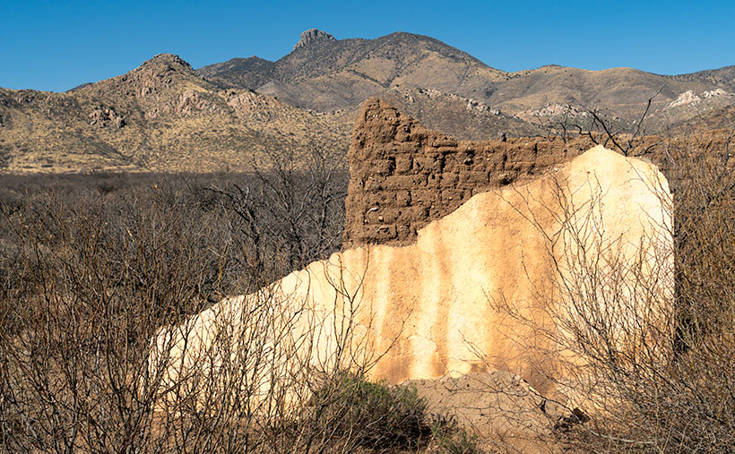
Whenever I visit Tombstone, it takes me a while to get oriented. But when I see a town map, I understand why. Unlike most communities established in the Mormon Territory of Deseret, the streets aren’t aligned to the compass points and aren’t centered on an intersection named Central and Main. Instead, the town is 45° off the compass; there’s no Central Avenue, and Allen Street substitutes for Main Street. Given Tombstone’s distance from Salt Lake City and its rough and tumble history, I don’t suspect its citizens weren’t concerned about religions.

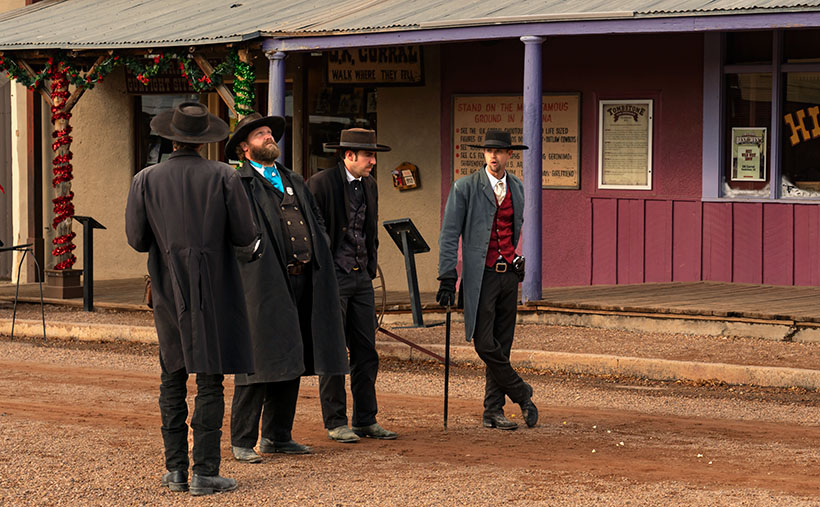
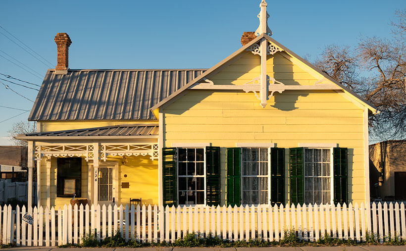
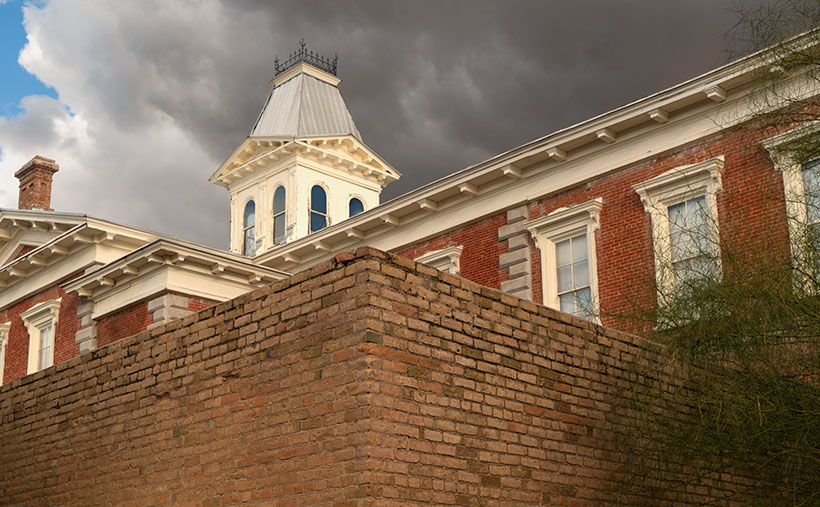
When I visit the “Town Too Tough to Die,” I consider the OK Corral its social and geographical heart. As I stand on the corner of 3rd Street and Allen and look the town over, I see the streets lined with one and two-story old wooden buildings. They’re either painted in bright colors or left in their natural dull brown finish. The only exception is a block southwest on 3rd Street. There you’ll see a large two-story brick building trimmed on each of its angles with white stones. On top is a cupola festooned with a widows-walk. The first time you see this pearl before the swine, you instantly know it must be important. It was—is. It’s the original Cochise County Courthouse.

It only took five years from the silver find to the OK Corral gunfight. In that brief time, the population swelled to 7,000, and robberies and lawlessness ran rampant. Wikipedia notes, “Except for the Earp–Clanton feud, which gave Tombstone an extremely bad press—from which it has no interest in recovering—citizens gladly accepted the proffered alternative.” The townspeople wanted a change. More importantly, miners had to make a two-day journey to Tucson to file a new claim. In 1881 two historical events happened; the shootout and the state legislature carved Cochise County out of Pima and made Tombstone its seat. The irony of those events and building the courthouse a block away from the Corral the next year isn’t lost on me.

By 1929 the silver played out, and Bisbee became the next boom town. The copper strike there required more men to work the mine. With a larger population, Bisbee won the county seat in an election, and the government offices moved 25 miles down the road. The old courthouse sat empty between 1931 and 1955. That’s when the local historical society took an interest in it. They began restoring and lobbying using local contributions until the Arizona legislature declared it an Arizona State Park.

In this week’s featured image, I call Courthouse Yard, I tried to capture the gingerbread and grandeur of the red-brick building, but I wanted to emphasize the wall surrounding the side yard. Inside those enclosures is where convicted murderers met justice at the gallows. The first hangings were the perpetrators of the Bisbee Massacre in 1883, while the last was the two men that killed a sheriff and deputy at the Wilson Ranch Shootout in 1899. The tall brick walls were designed to shield the gentle public from the gruesome hangings, but most of the town went inside and watched through the second-floor windows anyway. Incidentally, I like the foreboding clouds hanging above the courthouse.

You can see a larger version of Courthouse Yard on its Webpage by clicking here. I hope you’ll join us next week when we tell another thrilling tale from yesteryear in Tombstone.

Till next time
jw

BTW:

We’re planning to visit Temecula, California, wine country, in the upcoming weeks. I hope to bring home a bottle or two along with the pictures and stories we gather.

Gunfighters The Town Too Tough To Die

Gunfighters - Actors dressed in Earp costumes try to stay warm on Allen Street while they coax visitors to come see the 3:00 pm show.
Gunfighters – Actors dressed in Earp costumes try to stay warm on Allen Street while coaxing visitors to see the 3:00 pm show.

Ghost towns in Arizona are a dime a dozen. There are enough of them to fill a book. I know because I currently have five of them sitting on my shelves. The morphing of a city into a ghost town follows a familiar pattern. It starts with some loony prospector finding a valuable mineral—gold, silver, copper, diamonds, or another precious stone. News of the bonanza spreads quickly and lures a gaggle of opportunistic people. Half of them want to get rich by picking nuggets from the ground, and the rest want to pick them from someone’s pockets.

A new town springs from the ground like a children’s pop-up book. More people settled in the town and either got jobs at the mine or open shops that every mining community needed, like bars, gambling halls, and whore houses. Eventually—in a year, a decade, or a century—the gold (or whatever) pans out. The excitement of living in a mining town slowly dies, and its residents move on to the next boom town. Mother Nature reclaims the land without caretakers; all that remains is a pile of rotting wood, some foundations, and the eerie spirit of ghosts.

Of course, there are exceptions to my rule. In a handful of cases, when the mine goes bust, its residents look around and say to themselves, “This is a great place to live.” They find other sources of income. I call these places amusement communities. Examples that come to mind include Oatman, Jerome, Bisbee, Bagdad, Clifton, and Tombstone.

Of those locations, Tombstone is the odd duck. There are no gaping open pits to gawk at, historic hotels, or James Beard-worthy restaurants. I suspect that most of its visitors don’t even know about the silver mine. That’s because the silver vein wasn’t gigantic, and that’s how it got the name Goodenough Silver Mine. A gunfight between the Earps and the Clantons secured Tombstone’s historical spot. If it weren’t for that singular gang fight, Tombstone—’The town too tough to die’—would be a pile of splinters by now.

Don’t get me wrong; there is a list of exciting things to see in Tombstone. It was the Cochise County seat for a while, so there’s the old courthouse (with its gallows patio), the Crystal Palace back bar, the world’s largest dead rose bush, and the Birdcage theater should be on everyone’s checklist. Of course, if you have the time and money, you should see the show at the OK Coral, but realize that the actual gunfight was on Highway 80—behind the Coral.

I took this week’s photo on a cold, windy December afternoon. We had checked into our motel and started into town before the light faded. Standing in the middle of Allen Street (dirt, then paved until the street department poured dirt over it again—for authenticity) were four gunfighters dressed in black wearing badges. They tried to stay warm while they hawked visitors to the 3:00 pm show. I don’t know how successful they were because the streets were empty as people sheltered inside the bars. I titled this shot Gunfighters.

You can see a larger version of Gunfighters on its Webpage by clicking here. I hope you’ll join Queen Anne and me throughout January as we show some of the exciting Tombstone scenes we found.

Till next time
jw

BTW:

Queen Anne and I are working on our calendar for the year. We’re putting together a list of places we’d like to visit and this year’s book topics. If you have any requests, let us know in the comments section.

Richardson House Picture of the Week

Richardson House - The remains of the home that John Richardson built on their Union Pass homestead.
Richardson House – The remains of the home that John Richardson built on their Union Pass homestead.

At the beginning of May, I had to make another Algodones run. I broke another tooth and needed our dentist to look at it. Since Queen Anne had company, I traveled alone. These frequent dental visits have gotten old. When we travel to Mexico, it’s not for fun. Being an old codger, I’ve been wondering what advice I have for the following generations, and one thing that comes to mind is this: “Kids if you’re hoping to live past 35, take better care of your teeth.” I could have bought a boat with all my money wasted in my mouth.

My stay in the chair wasn’t extended. The doctor looked in my mouth, chattered in Spanish, ground down the pointy parts, handed me a jar of antibiotics, and said, “Come back in two weeks. We need to dig the old tooth out.” They set me free, and it wasn’t even noon.

I could have driven home, but the house was full of visiting women, and I’d be like a third thumb. Since I wasn’t expected home for another day, I drove north, following the Colorado River to Laughlin, where I could enjoy another boy’s night out. I had my camera to tend to some unfinished business.

My featured project after my last Nevada visit in September was the marvelous rock formations near Union Pass. That’s where Mohave County Route 68 crosses through the Black Mountains and begins its descent to the Colorado River. While researching my articles, I learned about the Richardson family and their Union Pass homestead. I told their story in my pBroken Crown post, so I won’t burden you here by repeating it. At that post’s end, I said I wanted to go back and spend some time shooting the homestead’s ruins, and that’s why I spent the night in Laughlin.

Unfortunately, a law of entropy states that things on their own will decay—they fall apart. There’s a set of humans who enjoy helping the process. That’s why I wanted to return to Union Pass soon, and I’m glad I did. Pictures showed the gas pump island cracked but intact. On my visit, someone utterly destroyed it. However, there were enough ruins left that I spent most of the morning wandering and shooting.

The first picture for this month’s Richardson Homestead project is the two-story house hand-built by John using local stone. It is nestled in the shade of an Arizona Ash. The tree covers the two-story structure with the dappled light that I love. Compared with earlier pictures, someone has torn down the large cross on its right side, and graffiti now decorates the front retaining wall (off-camera and purposefully not included). The house is the most intact building on the homestead. With over forty years of neglect, it hasn’t fallen.

I’m sad that Mohave County or the BLM hasn’t set this property aside as a park or a protected historical site. Without that protection, I expect this place to be gone before future generations learn about the Richardsons and their homestead. Although a complete restoration would be ideal, simply keeping it in a state of arrested decay would be the first step. For example, at the Gillespie Dam and Bridge, Maricopa County’s interpretive center was built to explain its historical significance. Something like that would hopefully deter vandals from running amuck. Hand me a petition; I’ll sign it.

You can see a larger version of Richardson House on its Web Page by clicking here. Next week, we’ll pick through the Richardson ruins to find other artistic shots to show you. Be sure to come back and see them.

Till Next Time
jw

Dos Cabezas Mountains Picture of the Week

Dos Cabezas Mountains - The 'two head' mountain range is a prominent landmark in southeast Arizona.
Dos Cabezas Mountains – The ‘two head’ mountain range is a prominent landmark in southeast Arizona.

Memorial Day has snuck up on us already. The unofficial summer season begins today. Back east, our friends and family have opened swimming pools, drug their Webber grills out of the garage, and finally put on shorts—with white belts and black socks. Meanwhile, here in the desert, we’re beginning to think of clever ways to stay cool for the next three months. This year, Queen Anne and I have come up with some new places to visit, but we have to stop buying food to have gas money.

Before worrying about surviving June and its 110º temperatures, we need to finish May. So, let’s return to our Cochise County Road 186 project, jump into the car, and find one last shot. Then we can drive into Willcox, where I know of a decent Mexican restaurant for dinner.

With the ghost town of Dos Cabezas in the rearview mirror, the county road begins to drop from the foothills into the Sulphur Springs Valley. All of the time, the ‘two-headed’ mountain range looms in the east. The south head blocks its northern twin brother from town, so we will drive several miles until both outcrops are visible. That turned out to be a spot where I could hike past a ranch gate and get this week’s picture.

At first glance, the range resembles a two-headed giant with 15-mile broad shoulders that I’ve seen in cartoons. The twin heads are weathered granite, and the highest one (the south) is 8,354 feet in elevation. That’s not as impressive as it sounds because the valley floor has an average height of 4,000 feet above sea level, but Interstate 10 still detours several miles north of the left shoulder to get around the range. A dirt road on the range’s south side divides the Dos Cabezas and Chiricahua ranges. That road goes to the historic site of Fort Bowie through the ominous Apache Pass. Since that road served as the main trail from New Mexico into Southern Arizona, the Cavalry built the old fort to quell the frequent ambushes by renegade Apaches.

I call this photo Dos Cabezas Mountains because I have a vivid imagination. The sky looked clear and blue, but a few clouds to the south cast shadows over the range. Fortunately, that saved this image from being flat and lifeless. The dark-green patches near the mountain top are tall ponderosa pines. In this picture, the land traverses three climate zones, and that’s an example of why the patches of Coronado National Forest are called Sky Islands. Finally, the San Simon Valley and New Mexico are on the other side of these mountains.

You can see a larger version of Dos Cabezas Mountain on its Web Page by clicking here. Next week, we begin searching for summer refuges, but before we load the Jeep, I will return to a previous location as promised earlier this year. Be sure to come back and see what I’m talking about.

Till Next Time
jw

White House Picture of the Week

White House - An abandoned dwelling of some sort in the ghost town of Dos Cabezas.
White House – An abandoned dwelling of some sort in the ghost town of Dos Cabezas.

Ghost towns are a big business in Arizona. That’s good because we have our fair share, and a few of them attract many tourists. They’re our Disneyland. As soon as your relatives hit the tarmac and demand to see the state, the first suggestion out of your mouth is, “Let’s go to Jerome (Bisbee-Oatman-Tombstone-etc.).” You’d think that, by definition, ghost towns are abandoned places—they had their heyday long ago, but the residents left when things went south. But, that’s not necessarily true. The population count in some of our mining towns rivals the numbers they had in their prime. Our hometown of Congress is an example. People move here to get away from Phoenix’s smog and traffic—or the Minnesota snow—and they’re all on the road and in my way.

I’ve concluded that somebody loves it and wants to live there no matter how remote one of these places is. Take the town I introduced last week—Dos Cabezas. Among the derelict buildings, there are two surviving businesses. One is an art studio/gallery (Dos Cabezas Art Gallery), and the other is a bed and breakfast (Dos Cabezas Retreat Bed and Breakfast). At least those are the two places that advertise their presence. There are several cattle ranches in the area, and there is an emerging wine presence, but not within the town limits.

I don’t know anything about the gallery, but enjoying a glass of local wine while staring at the stars on the B&B patio would be a treat. Since it’s closer to the Chiricahua National Monument, it’s an alternative to the chain hotels or downtown dives in Willcox. The two guest rooms are in an adobe walled casita, and as the name implies, the hosts include breakfast. A drawback for Queen Anne and I would be dinners. The nearest restaurants are 15 miles away in Willcox or Douglas, over an hour’s drive south. If you’re a person that needs bright lights and noise to sleep, the retreat wouldn’t be your cup of tea—the nights in the middle of Sulphur Springs Valley are exceptionally dark and silent.

As you can tell from this week’s picture, the little ghost town is at the foot of the Dos Cabezas Mountains. It’s near the range’s southern reach, so you can only see the south head (Cabeza). There’s a road and trails that will get you to the top, where I imagine the view of the valley and Willcox Playa is spectacular. You need permission to cross a locked gate, and the top is steep, so why bother?

In this image that I call White House, I assume it was a dwelling. It’s a palace compared to some of the miner’s shacks I’ve seen. Unlike the other buildings in Dos Cabezas, this one is a fixer-upper. You have affordable housing with a bit of paint, a few shingles, and a yard clean-up. But there’s probably a community historical committee that needs appeasement, so you can’t paint it purple.

Unlike last week’s photo, the white stucco pops against the brown mountain and clear blue sky, and I like that. There’s plenty of side yard where I visualize Queen Anne hanging laundry on a solar drier. Then, this would be a picture that Norman Rockwell or Andrew Wyeth would envy. Where’s the Saturday Evening Post when you need them?

You can see a larger version of White House on its Web Page by clicking here. Next week, we continue down County Highway 186 in search of an image worthy of another car stop. Please join us.

Till Next Time
jw

Adobe Ruin Picture of the Week

Adobe Ruins - In the ghost town of Dos Cabezas, most of the remaining buildings are severely decayed.
Adobe Ruins – In the ghost town of Dos Cabezas, most of the remaining buildings are in a severe state of decay.

Roughly midway between Willcox and the Chiricahua National Monument, the county highway’s speed limit drops to 45 mph. At first, there’s no clue about the slowdown until a small sign announces that you’re entering the town of Dos Cabezas. Only three of its dozen or so buildings are worthy of occupancy. The rest are in various states of decay. It’s only a city block long, and you soon return to an empty country road, where you can reset the cruise control.

After driving through Dos Cabezas three times, I insisted on stopping on our fourth pass. As regular readers know, I’m a sucker for historic buildings, whether they’re restored or about to be blown down by the wind. I’m glad that I did, and this week’s featured shot is one of several that I captured during that afternoon.

As with most Arizona ghost towns, Dos Cabezas’s history is a flash of glory followed by a long decay period. The town is located at the southeastern reach of the mountain range, which shares the same name. When word came out that prospectors discovered gold and silver on the mountain, miners swooped in like hungry vultures to feed on a carcass. The Feds opened a Post Office in 1878, which served a population of 300 that eventually swelled to over 4000. They found little gold in the Elma mine, but there were some copper deposits. Investment capital dried up when investors discovered that the mine was a scam and part of stock fraud. People left to find work elsewhere. As the town dwindled, the Post Office finally closed its branch in 1960. I guess that you could count today’s Dos Cabezas citizens on one of your hands.

In this picture that I call Adobe Ruin, you see the remains of a large building constructed using adobe bricks and stucco. The town once had a hotel, and these sections may be all that’s left of it. Adobe was a common building material throughout the old southwest because it was simple to make. All you need is to combine mud and straw and let it dry in the sun. The thick bricks provide plenty of protection from the desert heat and cold winters, but they quickly erode once water enters them.

I took several variations of the building, but I favored this one because I liked the mud stains streaking down the wall, and I liked the wall’s placement before the background’s two-headed mountain. The desert willow and hackberry show how soon nature reclaims her own. Ashes to ashes, as it were.

You can see a larger version of Adobe Ruin on its Web Page by clicking here. Next week, we’ll walk down the street to look at another of the Dos Cabezas ruins. Come back then and have a look.

Till Next Time
jw

Schwertner House Picture of the Week

Schwertner House - Built as an overnight barracks for Army officers during the Apache Wars, the Schwertner family bought and lived in the house until 1980.
Schwertner House – Built as an overnight barracks for Army officers during the Apache Wars, the Schwertner family bought and lived in the house until 1980.

In 1880, when Southern Pacific established a whistle-stop in Willcox, there was peace everywhere in the country except in Cochise County. Here the Army was busy battling Cochise and Geronimo in the Chiricahuas. Stupid decisions made by Army officers prolonged the Apache Wars, but that’s another day’s story.

The U.S. Army operated from several forts in the southeast corner of the Arizona Territory, and the newly built railroad was an efficient way to get officers into Arizona. So, the Army immediately paid to have a boarding house built within walking distance of the Willcox train station. The green officers had a place to stay until troops escorted them to Fort Bowie, Fort Grant, or Fort Thomas.

After hostilities ended, Joseph Schwertner bought the barracks for his family’s home. Joe was a well-off Schley saloon owner, one of several that lined Railroad Avenue at the turn of the century. After Joe died in 1929, his heirs continued to live in the house until 1980, when they gifted it to the local historical society. Today, the pretty little yellow house with green shutters is one of several buildings in Willcox on the National Registry list and is open for tours.

In this week’s picture, I shot the historic home at dawn just after I got my first cup of coffee and my eyes finally opened. I called the shot Schwertner House—its proper name. In addition to the lovely morning light on its yellow front and new metal roof, I like the picket fence (I’m a sucker for picket fences because they’re rare in Arizona). The dark green shutters should be next on the TLC list.

What if you’re not into history and old buildings? What else is in Willcox that makes it worth a visit? A mile or so east of the railroad crossing is the town’s golf course. It’s not fancy, and it will never be on the PGA tour, but that’s not important to most golfers. I’ve never been good at stick-and-ball sports, so I’m not keen on golf. However, on the road and just past the course is something that I do find exciting.

Willcox Playa Sandhills - Sandhill Cranes stop at the Wilcox Playa on their way to Canada.
Willcox Playa Sandhills – Sandhill Cranes, stop at the Wilcox Playa to rest and feed on their way to Canada.

We started our Willcox story a couple of weeks ago by explaining why Southern Pacific picked this spot for a stop. The railroad located the town along the northeast part of the Willcox Playa. Usually a dry lakebed, there is enough seasonal water to fill the low spots. Because these shallow pools are dependable year after year, migrating waterfowl stop for food and rest.

The most notable flock of birds is the Sandhill Cranes. The large stilt-legged gray birds are in the ponds late winter until the weather warms enough to continue to Canada. The playa is the best place to watch the red-faced birds this side of New Mexico’s Bosque del Apache preserve.

Since the access road encircles the ponds, you can watch the cranes from your car. In freezing mornings, the birds cluster in tight groups, communicating with trills, clucking, and squawks. Before they take to the air, their cacophony gets louder and the pace quicker. Then a half dozen take a couple of steps and flap their long broad wings rising gracefully above the pond. In winter, the air in Sulfur Springs Valley has temperature inversions, so the birds fly up to where the air is warmer and soar over town. The locals proudly call the phenomena Wings over Willcox, or WOW.

You can see a larger version of Schwertner House on its Web Page by clicking here. Next week, I have a final shot of historical Willcox, so come back and see what we’ve dug up.

Until next time — jw