Gunfighters The Town Too Tough To Die

Gunfighters - Actors dressed in Earp costumes try to stay warm on Allen Street while they coax visitors to come see the 3:00 pm show.
Gunfighters – Actors dressed in Earp costumes try to stay warm on Allen Street while coaxing visitors to see the 3:00 pm show.

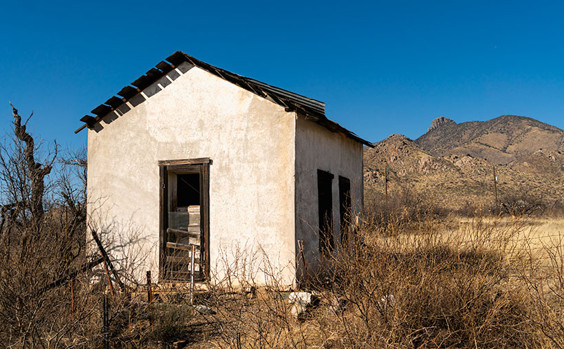
Ghost towns in Arizona are a dime a dozen. There are enough of them to fill a book. I know because I currently have five of them sitting on my shelves. The morphing of a city into a ghost town follows a familiar pattern. It starts with some loony prospector finding a valuable mineral—gold, silver, copper, diamonds, or another precious stone. News of the bonanza spreads quickly and lures a gaggle of opportunistic people. Half of them want to get rich by picking nuggets from the ground, and the rest want to pick them from someone’s pockets.

A new town springs from the ground like a children’s pop-up book. More people settled in the town and either got jobs at the mine or open shops that every mining community needed, like bars, gambling halls, and whore houses. Eventually—in a year, a decade, or a century—the gold (or whatever) pans out. The excitement of living in a mining town slowly dies, and its residents move on to the next boom town. Mother Nature reclaims the land without caretakers; all that remains is a pile of rotting wood, some foundations, and the eerie spirit of ghosts.

Of course, there are exceptions to my rule. In a handful of cases, when the mine goes bust, its residents look around and say to themselves, “This is a great place to live.” They find other sources of income. I call these places amusement communities. Examples that come to mind include Oatman, Jerome, Bisbee, Bagdad, Clifton, and Tombstone.

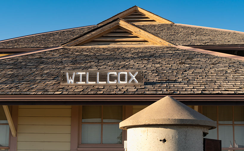
Of those locations, Tombstone is the odd duck. There are no gaping open pits to gawk at, historic hotels, or James Beard-worthy restaurants. I suspect that most of its visitors don’t even know about the silver mine. That’s because the silver vein wasn’t gigantic, and that’s how it got the name Goodenough Silver Mine. A gunfight between the Earps and the Clantons secured Tombstone’s historical spot. If it weren’t for that singular gang fight, Tombstone—’The town too tough to die’—would be a pile of splinters by now.

Don’t get me wrong; there is a list of exciting things to see in Tombstone. It was the Cochise County seat for a while, so there’s the old courthouse (with its gallows patio), the Crystal Palace back bar, the world’s largest dead rose bush, and the Birdcage theater should be on everyone’s checklist. Of course, if you have the time and money, you should see the show at the OK Coral, but realize that the actual gunfight was on Highway 80—behind the Coral.

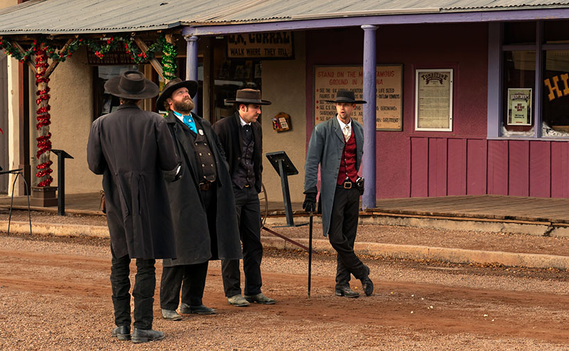
I took this week’s photo on a cold, windy December afternoon. We had checked into our motel and started into town before the light faded. Standing in the middle of Allen Street (dirt, then paved until the street department poured dirt over it again—for authenticity) were four gunfighters dressed in black wearing badges. They tried to stay warm while they hawked visitors to the 3:00 pm show. I don’t know how successful they were because the streets were empty as people sheltered inside the bars. I titled this shot Gunfighters.

You can see a larger version of Gunfighters on its Webpage by clicking here. I hope you’ll join Queen Anne and me throughout January as we show some of the exciting Tombstone scenes we found.

Till next time
jw

BTW:

Queen Anne and I are working on our calendar for the year. We’re putting together a list of places we’d like to visit and this year’s book topics. If you have any requests, let us know in the comments section.

White House Picture of the Week

White House - An abandoned dwelling of some sort in the ghost town of Dos Cabezas.
White House – An abandoned dwelling of some sort in the ghost town of Dos Cabezas.

Ghost towns are a big business in Arizona. That’s good because we have our fair share, and a few of them attract many tourists. They’re our Disneyland. As soon as your relatives hit the tarmac and demand to see the state, the first suggestion out of your mouth is, “Let’s go to Jerome (Bisbee-Oatman-Tombstone-etc.).” You’d think that, by definition, ghost towns are abandoned places—they had their heyday long ago, but the residents left when things went south. But, that’s not necessarily true. The population count in some of our mining towns rivals the numbers they had in their prime. Our hometown of Congress is an example. People move here to get away from Phoenix’s smog and traffic—or the Minnesota snow—and they’re all on the road and in my way.

I’ve concluded that somebody loves it and wants to live there no matter how remote one of these places is. Take the town I introduced last week—Dos Cabezas. Among the derelict buildings, there are two surviving businesses. One is an art studio/gallery (Dos Cabezas Art Gallery), and the other is a bed and breakfast (Dos Cabezas Retreat Bed and Breakfast). At least those are the two places that advertise their presence. There are several cattle ranches in the area, and there is an emerging wine presence, but not within the town limits.

I don’t know anything about the gallery, but enjoying a glass of local wine while staring at the stars on the B&B patio would be a treat. Since it’s closer to the Chiricahua National Monument, it’s an alternative to the chain hotels or downtown dives in Willcox. The two guest rooms are in an adobe walled casita, and as the name implies, the hosts include breakfast. A drawback for Queen Anne and I would be dinners. The nearest restaurants are 15 miles away in Willcox or Douglas, over an hour’s drive south. If you’re a person that needs bright lights and noise to sleep, the retreat wouldn’t be your cup of tea—the nights in the middle of Sulphur Springs Valley are exceptionally dark and silent.

As you can tell from this week’s picture, the little ghost town is at the foot of the Dos Cabezas Mountains. It’s near the range’s southern reach, so you can only see the south head (Cabeza). There’s a road and trails that will get you to the top, where I imagine the view of the valley and Willcox Playa is spectacular. You need permission to cross a locked gate, and the top is steep, so why bother?

In this image that I call White House, I assume it was a dwelling. It’s a palace compared to some of the miner’s shacks I’ve seen. Unlike the other buildings in Dos Cabezas, this one is a fixer-upper. You have affordable housing with a bit of paint, a few shingles, and a yard clean-up. But there’s probably a community historical committee that needs appeasement, so you can’t paint it purple.

Unlike last week’s photo, the white stucco pops against the brown mountain and clear blue sky, and I like that. There’s plenty of side yard where I visualize Queen Anne hanging laundry on a solar drier. Then, this would be a picture that Norman Rockwell or Andrew Wyeth would envy. Where’s the Saturday Evening Post when you need them?

You can see a larger version of White House on its Web Page by clicking here. Next week, we continue down County Highway 186 in search of an image worthy of another car stop. Please join us.

Till Next Time
jw

Cochise Head Picture of the Week

Cochise Head - The 8087' high peak in the Chiricahua Mountains that resembles the great Apache Chief, Cochise.
Cochise Head – The 8087 high peak in the Chiricahua Mountains resembles the great Apache Chief, Cochise.

Living with my editor-in-chief has been particularly stressful. Her sisters are coming for a visit this week. She waltzed her beloved Dyson through the house while singing to the bluebirds, bunnies, and butterflies. She stressed her red vacuum so much that she broke it and had to order parts from Ireland. I don’t think she’s well—I caught her washing a window. I’ve become the red-headed step-child. I have to eat on the back porch, I can’t use either bathroom, and my office desk is the only place I can sit. When I gave her this post to check, I had to check my hand for missing fingers. Cyndi thinks that if she passes this inspection, her sisters will let her accompany them to the palace ball. She’s forgotten that she already hooked her Prince Charming thirty-four years ago. I blame it on this sudden Bridgerton obsession.

Other than that, welcome to May. This month, we will feature images I took as we drove between Willcox and the Chiricahua National Monument. The satin ribbon that ties the collection together is Cochise County Road 186. Otherwise, it’s a collection of odds and ends that didn’t fit inside the park. Over the next five Sundays, we’ll work our way from the monument and back to town. That way, there’s some logic to my presentation.

Right from the beginning, I’m going to cheat. You can’t see the peak in this week’s picture from the highway, and it’s not inside the park, but you can see it best from there. This image is of the 8087′ high Cochise Head in the Chiricahua Mountains’ northern section. For perspective, the eroded granite head is a mile wide. The name is descriptive because it resembles Cochise, the great Apache chief, with his distinctive Mayan nose and a pine tree eyelash. Like Camelback Mountain, no person is credited for the name; everybody just agreed on the resemblance. Imagine having a mountain named for you while you were alive. Arizona has 15 counties, with 12 of them having tribal names. Cochise County is the only one named after a tribe member. I think that shows how much respect our community had for Cochise (of the other two counties, our legislature named one for a mountain (Graham) and the other for a prominent mine owner (Greenly).

When I shot this week’s picture, I tried different compositions that I call Cochise Head naturally. The one that I chose is centered, which is unusual for me. The others seemed unbalanced somehow. As you move up and down the road, the eye and forehead become more or less prominent. I took this shot from my closest position—standing on a rocky ledge overlooking Bonita Creek Canyon.

Click here to see a larger version of Cochise Head on its website. Next week, we’ll make our way back to town for dinner, but there’s a place we have to stop so I can grab another photo. Come back next week and see what I found.

Till Next Time

jw

The Grotto Picture of the Week

Grotto Interior - From the outside, the Grotto looks like a secluded place to hide from the world.
Grotto Interior – The Grotto looks like a secluded place to hide.

Over the past couple of weeks, we’ve been hiking and photographing the Grotto Trail in the Chiricahua National Monument. I know that seems like a long time for a one-mile trail, but I’m old and quickly fall. As you’ve seen in previous photos, massive rock formations that sometimes resemble sculptures line the track. That’s another reason the hike takes me so long—I can’t pass up these shots.

As I walked through the towering erosion formations, I wondered how the grotto would look. By definition, they’re a ‘picturesque cave,’ so I wasn’t sure what I was looking for. I shouldn’t have worried because, as that old proverb goes, “You’ll know it when you see it.” That’s precisely what happened. When I first peeked through a side window, I shouted, “Eureka, I’ve found it.”

It’s a cool room with light filtering in from outside. Four pillars line the room and hold up a slab of stone that fell on top. If you aren’t my size, you can crawl up inside and take a nap or play tea-time should you happen to bring your Barbie set. Because it’s open to the sky, you wouldn’t be able to take shelter from a storm like you’d be able to do in an actual cave.

Grotto From the Trail - When I looked back at the Grotto from the trail, I could see how it was assembled.
Grotto From the Trail – I could see how it is assembled when I looked back at the Grotto from the trail.

After catching my breath for a minute, I started back to the parking area. I was only a few steps down the road when I turned around and shot this second image. It gives you a better idea of how the Grotto is assembled, and quite frankly, it doesn’t seem to be a secret room—just an interesting pile of rocks. You can see a larger version of The Grotto on its Web Page by clicking here.

Since today is the last Sunday of the month, this is the end of April’s Chiricahua project. I took many more pictures, but I couldn’t show you all of them in only four weeks. If only there were another way for you to see them. Oh wait, there is.

Wrote a book about it—wanna see it?—here it is.

Chiricahua National Monument – My new photo essay of our trip to Cochise County will be available on Amazon, but you get a free preview because you’re a subscriber.


I’ve been working on a book while talking with you to prove that I can walk and chew gum. It’s the second in my sampler photo essay series. This one is called Chiricahua National Monument, and it includes the photos I’ve shown this month, plus a couple dozen more. Chapters in the book cover the Faraway Ranch, the hiking trails, and the landscapes surrounding the park.

It isn’t listed yet, but like my last book—Snow Canyon—it will be sold exclusively on Amazon at a ridiculous price of $68.00—unless you want to order a half-dozen or more, I can get a discount for you. Otherwise, no one will pay that price. But because you’re loyal readers, I devised a way for you to read the book and see my other photos—for free. I ordered a PDF version that you can open and download using this link: Chiricahua National Monument. PDF. You’re welcome to download it, print it, and toss it in the garbage when you’re done. I hope you enjoy it.

Next week is a new month, and we’re not entirely done with Cochise County. I found some pretty things to show you outside of the park, so come back next week when we begin May’s project.

Till Next Time

jw

Organ Pipes Picture of the Week

Organ Pipes - One of the first features you see after entering the park is the Organ Pipe Formation.
Organ Pipes – One of the first features you see after entering the park is the Organ Pipe Formation.

Two days have passed since April Fool’s day on Friday. That morning, Queen Anne stopped by my office door and announced, “I’m pregnant.” She’s a one-trick pony because she’s recycled that joke every year that we’ve been married, so I ignored her. However, Friday was an important milestone for me, and since I’ve waited two days, you know I’m not pulling your leg. Friday marks the 50th year since I moved to Arizona. I think that officially makes me overqualified to be a native.

With the month’s change, we’re starting a new project. April Fool’s—we’re not leaving Willcox. I’m just going to show you why we actually traveled to Cochise County and what we did with our afternoons. You’ll recall that I spent mornings in Willcox searching for a decent cup of coffee and shooting the town’s historic buildings. After an hour or so—when the light became too harsh—when I returned to our motel and opened the door, Queen Anne sat on the bed corner bejeweled and makeup finished. “I’m ready for breakfast,” she’d say—who am I kidding? That would never happen. The truth is that I could hear her lyrical voice waft from the bathroom, “I’ll be ready in a minute.” In husband-speak, that phrase meant that I had time for a nap.

The actual purpose of our Willcox visit was to photograph the Chiricahua National Monument. After fifty years of living in Arizona, this was my first visit. It’s usually a half-hour drive southeast of Willcox. Still, we dawdled with a camera and stretched the trip to over an hour. The scenery along County Road 186 reminded me of California’s central valley and the Sierra Nevada foothills. Long butterscotch colored grass filled the broad Sulphur Springs Valley between the Dos Cabezas Mountains (Two Heads in English) on our east to the Dragoons on our west. Arizona ranges don’t tower over its valleys as the Sierra’s do, but at least the air was clear, and we could see all of the mountains.

My After Life - I found out that I can become a rural mail carrier in Cochise County even after I'm dead. That gives me something to do after I'm gone.
My After Life – I learned that I could become a rural mail carrier in Cochise County even after I’m dead. That gives me something to do after I’m gone.

On one of the many photo stops that we made, I was able to chat with the local postal carrier and got some great news. He told me that I don’t have to be useless after my death because I can always get a job delivering mail for eternity. You saw my after-life job delivering mail if you watched Funny Farmthe movie. All I have to do to qualify is pass the Civil Service Exam.

The route coming out of Willcox ends at the Junction of county roads 186 and 181, and you turn east on the latter. You pass from open range into a canyon as you head into the Chiricahuas. Within four miles, there’s a pay station. It’s closed due to the pandemic, so the Rangers collect any fees at the visitor’s center. Immediately on the right is a small family cemetery where the Erickson’s rest under shady oak trees. The Erickson’s are the family that homesteaded here after he retired from the Army at Fort Bowie. They established a ranch along Bonita Creek called Faraway Ranch because it’s far away from anything. Their daughter, Lillian, and her husband, Ed Riggs, welcomed guests to the homestead to promote tourism. They built many of the trails still in use, allowing visitors to wander among the unusual columns of eroded stone.

There’s only a single road in the monument that runs from the entrance, past the visitor’s center, climbs through Bonita Creek Canyon, and winds along the ridge of the park’s eastern boundary. Along its length, there are numerous stops, pull-outs, and parking areas where you can stop and take in the view, like this week’s picture that I call Organ Pipes. However, if you want to immerse yourself in the complete gestalt, you should plan on hiking one of the trails. They range from a half-mile to a couple of miles long. You can also link several trails and make your feet suffer to your heat’s delight.

Chiricahua National Monument only has one small campground, which fills quickly—especially during the season. There are only two towns with hotels, Willcox along Interstate 10 and Douglas at the Mexican border if you’re willing to drive further.

The Organ Pipe Formation captured in this week’s image is one of the first displays after the visitor’s center. The columns rise several hundred feet above Bonita Creek and are mirrored on the other side of the road by similar rocks. There wasn’t a way for me to hike above the trees to get a better shot. This picture does not do justice to their scale.

You can see a larger version of Organ Pipes on its Web Page by clicking here. Next week we will hike one of the short trails to look at the park’s natural sculptures. Come back to see what we found.

Until next time — jw


Past and Future Picture of the Week

Past and Future - Along Willcox's historic Railroad Avenue, there are business that pay homage to the town's past and its future.
Past and Future – Along Willcox’s historic Railroad Avenue, some businesses pay homage to the town’s past and others to its future.

My dad bought our first television the week they hit the stores from stories that my mom told. I don’t remember because I was an infant at the time. The screen was small; you could cover it with your hand. She said that news of our new set spread fast, and the entire neighborhood crowded into our two-room apartment to watch shows on it. The crowd size amazes me because my great-grandmother’s apartment building didn’t have indoor plumbing, but it must have had electricity.

We didn’t need a TV Guide. We memorized the program schedule and could rattle off the shows for any given evening. The best night was Sunday. That was the night that Walt Disney’s Disneyland came on. They called it that between 1954 and 1958, it had various names after that. The gist of the show was always the same. Us kids loved that we could stay up an extra hour to see it—and maybe some of the Ed Sullivan Show if Topo Gigio was a guest.

The Disney show had four rotating themes. My siblings and I liked the cartoon week the best, but my dad enjoyed the westerns. They were either cowboy stories or a smooth-talking narrator explaining the west. He spoke differently from us. He didn’t have an accent as such—he had a drawl. He hung on to words so long they curled at the end—like the top of a Dairy Queen cone. His calm voice was soothing, and even at our young age, we knew that he wasn’t from Pittsburgh.

As I got older, I learned that the narrator’s name was Rex Allen. In addition to the Disney shows, he was an actor, songwriter, and singing cowboy. You may remember seeing his movies on Saturday morning cowboy shows if you’re as old as I am. (I don’t see a lot of hands out there in the peanut gallery, so you’ll have to take my word for it.)

After seeing this week’s picture, many of you have already guessed that he was born and raised in Willcox. I suspect that he’s their most famous native, and that’s why there is a museum for him along Railroad Avenue, across the street from a park with his statue. I can’t imagine anyone loitering in that park because the busy railroad tracks bisect it. It’s no place for a drunken hobo.

The tan building in the photo wasn’t built to house the Rex Allen Museum—it was initially the Schley Saloon. Sound familiar? It was the bar where Joseph Schwertner made his money—go back a read last week’s story. Two doors down, the building with the blue awnings is the Marty Robbins Gift Shop. You’re asking, “What’s he got to do with Willcox?” If you’re a boomer like me, you’ll remember the hit song Streets of Laredo that Robbins sang. Rex Allen wrote it. I think another Allen song that Arthur Godfrey recorded in 1948 is pretty catchy. It’s titled Slap Her Down Again Paw. It’s true; I couldn’t make this one up.

The grand white building between the museum and gift shop was a bank. It’s currently the Keeling Schaefer wine tasting room. One of at least three that Queen Anne and I saw on the avenue, and they may be the future of Willcox tourism. While the memory of Rex Allen and Marty Robbins appeals to my generation, there is no context for those that follow. So, the old cowboys’ draw may be on the wane.

However, wine is another story. A couple of decades ago, some adventurous vintners settled into the high grasslands of southeast Arizona. They saw that the conditions here would be an excellent place to plant vines—especially the well-drained soils of the foothills. The climate and geography are similar to parts of California’s central valley. New wineries are blooming from the little town of Elgin east to New Mexico.

Anne and I spent a couple of hours in Keeling Schaefer sampling and talking with the hostess. We found their offerings to be young and a little rough, but we did like a couple of whites and reds enough to purchase. There is an essence of the local soil in the wine—like the peat in a highland scotch. It’s a characteristic that you like or not. A word of advice if you go; sample at the tasting rooms and note your likes. Then stop at Safeway and buy the bottles at a more reasonable price.

You can see a larger version of Past and Future on its Web Page by clicking here. Next week we move on to a new project. Come back and see our next project.

Until next time — jw

Willcox Depot       Picture of the Week

Willcox Depot - The old train depot in Willcox is now used as the town's city hall.
Willcox Depot – The old train depot in Willcox. The local government now uses it for city hall.

Queen Anne and I traveled to Arizona’s southeast corner this week. One of my future projects is in Cochise County, so we spent a couple of nights in Willcox. The eastern half of the state is unlike where we live. That desert has little cactus. Instead, you see blue mountain ranges rising from the 4000′ elevated broad yellow grass-covered valleys and a couple of dry lakes—or Playas, as the Spanish-speaking people call them. This area shows the geographic diversity of Arizona.

It’s almost over, but it’s still winter, which means it’s still snowbird season, so we skipped seasonal rates at the chain motels near Interstate 10 and opted for a cheaper inn closer to town. The original builders probably built it in the 60-70s, but the current owners work hard to keep it clean and contemporary. Our room had a fresh coat of white paint, new blond fake-wood floors, and a useless bright red sash across the foot of the bed. We could watch long freight trains race past on the Southern Pacific tracks from our window. Three or maybe four of them an hour.

Although the throbbing bass from its five engines was enough to vibrate the bed across the linoleum, the trains didn’t keep us awake. That’s because they never slowed or blasted their horns at the town’s only track-crossing. However, we did have an issue with the new stylish duvet cover. It wasn’t like the plush down-comforter that we have at home. We hit town in-between storms, so the nights were clear and cold—below freezing. We tried to heat the room using the window-air conditioner, but every time it cycled on, it was the equivalent of a DC3 engine starting next to the bed. We finally shut it off and slept closer to one another.

Another amenity missing in little places like these was in-room coffee. I can’t function without my morning java. So, I’d get dressed and venture out to secure my fix at first light. In the golden light, I searched the town for a coffee house. Not only did I find one, but I also discovered a neat little mom-and-pop bakery and the Willcox historic district. Since I had hours to kill while I waited for Her Majesty to prepare herself for public viewing, I wandered the eight blocks with coffee in one hand and camera in the other. After a couple of mornings, I had enough images to decide that March’s project would be about Willcox.

If you drive through Willcox on Interstate 10, you won’t see much—only the usual chain motels and burger joints located at the mid-town exit. Even if you drive through town on the freeway bypass, you’ll pass some old motels, a couple of RV parks, and a gas station or two. There are many closed businesses along the road. The exciting stuff is on Railroad Avenue—next to the tracks because Willcox was built by and for the Southern Pacific Railroad.

Long-time readers may recall that the early steam engines ran on fuel and water. Willcox Playa—a seasonal lakebed—is conveniently located midway between El Paso and Phoenix, so Southern Pacific built a whistle-stop there in 1880. The company dubbed the town Maley. It was a single-purpose town for nine years when a guy, General Orlando B. Willcox, got off to stretch his legs and realized that it would be a fabulous place to raise cattle.

Willcox wasn’t even on a significant highway until the Feds completed Interstate 10 in 1960. Before that, the southern Coast-to-Coast highway was US 80. It went south around the Chiricahuas to Douglas and then Tombstone.

This week’s picture directly relates to the railroad birth of Willcox. It’s a shot of the train depot located at the heart of old-town. It’s a large building for a small town and in pretty good shape, considering the railroad closed the depot years ago. Today the trains race past at full speed and don’t even blow their horn. It’s now the town’s city hall. I liked how the pyramid pattern repeats from the turret to the roof peaks. I called this image Willcox Depot.

You can see a larger version of Willcox Depot on its Web Page by clicking here. Next week, I’ll show you another location I shot during my Willcox wanderings.

Until next time — jw