Summit Monsoon Picture of the Week

My third grade class picture.
A third-grade class picture from my Catholic School days.

Sister Mary Ellie-Font taught us about purgatory in the third grade—and she wasn’t talking about the Colorado ski resort. Heaven and Hell weren’t enough to cover the petty sins not covered by commandments. So, Catholics came up with alternative punishment to keep us in line. One way or another, we were going to pay for the Big Mac we ate on Friday. Purgatory is a holding cell where we would stay until God had enough free time to sort us out—or someone specifically prayed for our soul. At the age of eight, we learned that you could skate from anything if you had connections.

For the last couple of months, it feels like we’ve been living in that purgatory-like state of limbo. We’re waiting for something to happen. When we got our vaccine shots this spring, we all climbed aboard a trolley to the beach. Now it seems like the streetcar is lurching to a halt, and our confidence in the future is waning.

Back in the spring, Queen Anne and I were eager to get back on the road. We were ready to bring back pictures from foreign lands, exotic cities, and far-off islands. We’re not sure the world is ready for that. With the spread of virus variants and rising infection rates, we’ve decided to play it safe a while longer. After all, we’re still in the same high-risk group as when this pandemic began. Besides, that’s what our doctors suggested.

For August, we’re going to hang around our neighborhood, but I wanted to bring you something different. Last week, I wrote about the monsoons and how they brought much-needed rain and spectacular evening light shows. So, this month I’m featuring monsoon clouds—the prettier side of our summer rainy season instead of the floods and muck on the evening news.
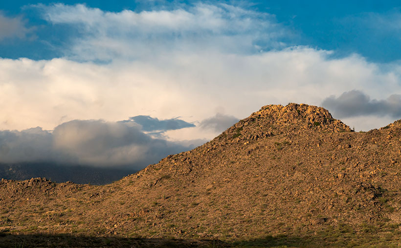
Summit Monsoon - Thunderstorms build over the mountains by day, and then move down to the desert floor in the evenings.
Summit Monsoon – Thunderstorms build over the mountains by day and then move down to the desert floor in the evenings.

I took this week’s picture in our town’s natural amphitheater—where the old mine and pioneer cemetery is. It shows one of the Date Creek Range’s low peaks and thunder clouds building over the distant Weaver Mountains. The storms only happen when enough moisture moves up from Mexico. Then, the billowing thunderheads form high over the Bradshaw Mountains and flow into the desert. The rain cells are not particularly big, so we never know where it will rain—some nights, we get dust and wind, and other evenings we get drenched. However, the winds cool off the air enough to watch the show from the front porch, making the summers bearable.

You can see a larger version of Summit Monsoon on its Web Page by clicking here. Be sure to come back next week to see the next image that I bagged on my cloud hunt.

Until next time — jw

Date Creek and Tres Alamos Picture of the Week

Working during the summer is challenging, whether in house chores or photography. That’s why my favorite pastime during these months is procrastination. Face it; I’m allergic to heat. Thinking about going outside is worse than actually doing so. After all, in today’s southwest, we’ve learned to minimize our heat exposure. We move about in a succession of air-conditioned cocoons.

Heat is why I had difficulty coming up with a theme for  July. The monsoons haven’t kicked in yet, so most pleasant campsites are on fire or closed. I must stay close to home, venturing early or after dinner, find a shot, and then hurry home.

I decided that July’s theme will be U.S. Highway 93. That’s the main thoroughfare near my house that Phoenicians (and Tucsonans) use to commute to Las Vegas. The route goes to Canada, but I’m only concerned about day trips. Because I’ve often traveled the section between here and Kingman, I know a few vistas I wanted to capture on film but never had time to stop. This week’s image is an example.

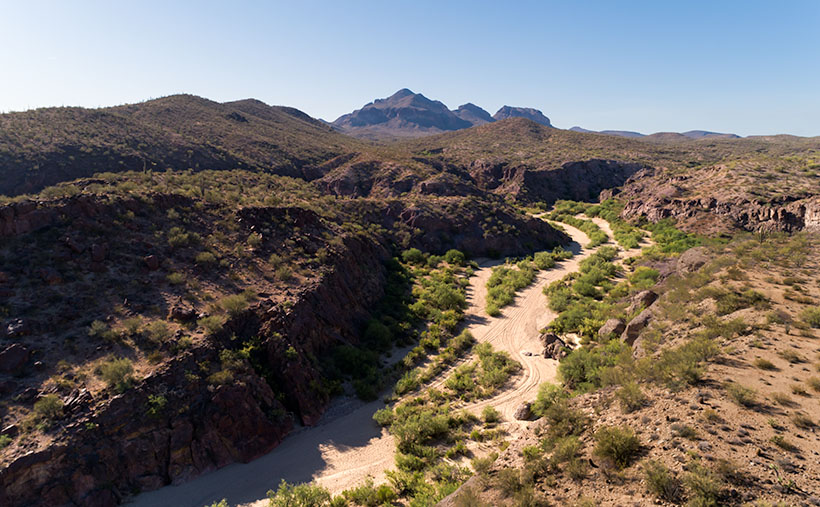
Date Creek and Tres Alamos - Date Creek as it flows by the Tres Alamos Wilderness Area near Congress, Arizona.
Date Creek and Tres Alamos – Date Creek flows by the Tres Alamos Wilderness Area near Congress, Arizona.

North of the SR 71 – 93 junction, the Alamo-Congress Rod is a lousy shortcut to Alamo Lake. It’s a broad dirt road that gets graded annually at best. It passes the Tres Alamos Wilderness Area about 10 miles west of the paved highway. It’s a small nature preserve (83,000 acres) compared to the neighboring Arrastra Mountain Wilderness (129,800 acres). The high point on which Tres Alamos is centered is the 4257-foot Sawyer Peak. To reach the spot where I took this shot, I had to slowly travel a couple of miles on a Jeep trail that left Archie with some Arizona Pinstripes—a badge of honor for a Luxo-SUV.

The wash in this shot is Date Creek, which should be familiar to regular readers because Congress—and the old Congress Gold Mine—are located next to the mountains of the same name. As it were, the creek flows from the Weavers, along the north side of the Date Creeks, to where it merges with the Santa Maria River upstream from Alamo Lake.

An interesting thing in the photo is the tire tracks in the sand. With the rising popularity of those all-terrain buggies, it’s easier for off-roaders to drive through the washes. Most of the time, the ride is smoother than the so-called mine roads. However, in the past, you could see tracks of the animals crossing the river bottoms. It was a visitor guest book. Now that natural history is erased each time they drive over it.

When I first moved to Congress, I coveted owning an ATV. I thought it would help me get into the backcountry and get some unique landscapes. After a couple of rides in Fred’s, I found them uncomfortable because you’re exposed to the elements, and riding in his air-conditioned FJ is more my style of roughing it. Earlier this year, I got hooked on watching Matt’s Off-Road Recovery. He’s a towing company in Hurricane, Utah, and he documents his crew on YouTube as they drag 4-wheelers back to civilization. The best part is that he uses a modified Corvair Lakewood—the station wagon version. Watching him drag ATVs off mountains and dunes convinced me I was better off without one.

Click here to see a larger version of Date Creek and Tres Alamos on its Web Page. Next week, we’ll travel further down the highway and see what’s around the next bend.

Until next time — jw

Bat Ears Picture of the Week

A couple of weeks ago, I drove to a part of Arizona that I hadn’t seen before. I knew about Alamo Lake as a fisherman but never went there because it wasn’t stocked with trout, and the fishing reports always warned about rattlesnakes. That was enough to put me off. But, during our club’s spring classes, one of the students brought in photos from the Alamo area that I found so interesting that I changed my opinion about visiting the La Paz County lake.

She took photos east of the lake, where Date Creek cuts through an ancient mud deposit. Because of how the intermittent water has eroded the soil, the place is known as Mud Cliffs. It’s not shown on any maps I have, but I knew it was the general area, so I left the house with enough time to explore and still have a couple of hours to shoot before sunset.

From Wenden, the paved road to Alamo State Park runs due north. It has little or no traffic, and it only took me an hour to get to the park store. When I asked the friendly staff inside about the cliffs, the host handed me a hand-drawn map. “Head toward Wenden to the Wayside Road, then jog over to Palmerita Road and follow it north.”

“Thanks,” I said as I took the map and paid too much for a Butterfingers candy bar and the park’s day fee—even though I was leaving.

During the classes, my student said her group was out on ATVs, but she believed you could get there by car. She was right. All the roads were wide and well-graded, and when I drove them, they didn’t have a lot of washboards. After I reached the spot on the map, I searched for the canyon shown in her pictures, and when I found it, I spent an hour or so hiking and shooting the photos that I’ll be sharing this month—I guess it’s Alamo Lake Month.

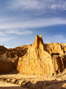
Bat Ears
An erosion formation at the head of the slot canyon glows in the late afternoon sun. The pair of points on top reminded me of a bat or maybe even Batman.

This week’s image is called Bat Ears, and I took it at the slot canyon’s mouth towards the end of the day. I passed it going in, but the sun didn’t have the same warmth as in this image, so it wasn’t interesting enough to shoot. The name comes from the pair of points at the top. This cliff doesn’t have a name—none of them do. Because the soil is so soft, it quickly erodes. A good flood will wipe out the existing landscape and replace it with new formations. The ears may not last another year, so I got to name a geological feature that—maybe—no one else will see. My chest swells with pride.

You can see a larger version of Bat Ears on its Web page by clicking here. I hope you enjoy viewing my new entry, and I hope you’ll tag along as I work my way up the canyon. It’s a pretty exciting hike.

Until next time — jw