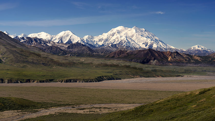
It’s been a long and successful day on the bus. After yesterday’s post I thought I’d share with you a shot from the Eielson Visitor’s Center and relieve the suspense. The shot is of the Denali complex, from The Wedge to Peter’s Dome all surrounding Denali like jewels in a diamond ring.
As I explained in a earlier post, only 30% of the Denali National Park visitors actually see the mountain. What we learned today is that only 10% of those visitors ever see a cloudless mountain. They sell the 30% T-shirts here, but not one for ten per-centers. At the end of our trip, the first thing that the Queen and I did was to march into the gift shop, and buy our tee-shirts. I can die now.
This is the great mountain, Denali and the lesser peaks surrounding it. They are visible and cloudless. A very rare sight for park visitors.
I can’t begin to explain how massive this mountain is. The photo included was not taken with a telephoto lens. It was a normal lens from thirty-two miles away. There are two peaks on Denali, the north, which is pyramid shape, and the south which looks like a scoop of ice cream. The south peak is over twenty thousand feet making it the tallest mountain on the North American Continent. The distance between the two peaks is two miles. Another bit of trivia that sells tee-shirts here is that Denali’s base plateau is under three thousand feet, while Mt. Everest sits on a plateau of sixteen thousand feet. So, with pride, the Alaskan’s boast that Denali is taller from base to peak than Mt. Everest. I’m not going to join that argument, I’ll just say there are windows in the visitor center two stories high, and this mountain fills the center panel. ‘nuf-said.
A high pressure front was supposed to move in today bringing warmer temperatures tomorrow. That means the weather should clear giving us the best chance to photograph The Mountain. So, we extended our stay another day here in Nenana Canyon (the real name of the community the ranger calls Glitter Gulch).
The view from the Eielson Visitor’s Center
We’ve already purchased tickets for tomorrow’s shuttle bus. We’re betting on the conditions being right. It’s been cold, windy and cloudy all day with the temperature never breaking into the sixties. We will be moving to Cantwell on Wednesday regardless, so we all have our fingers and toes crossed.
The Teklanika River has a glacial source so it’s water runs the color of wet cement.
I wanted to get in this short post so that I could give you that update, but it’s also an excuse to show more of the photos from Saturday’s bus ride. Even if we don’t get a good shot, there are some scenes that I didn’t get the first time. We have a 7:00am departure, so the Queen is already preparing for her beauty sleep. Wish us luck.
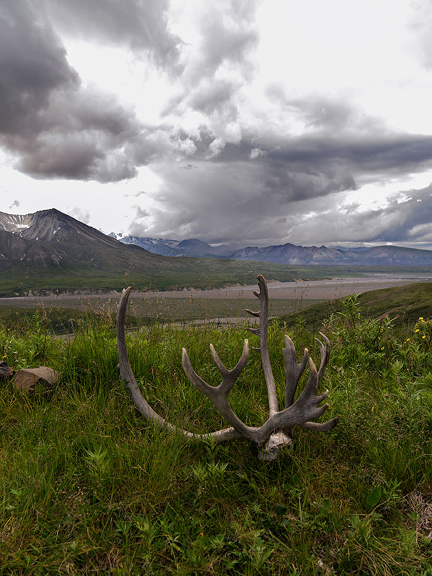
Caribou antlers decorate the grounds of the Eielson Visitor’s Center. If Mt. Denali wasn’t socked in, it would be where the dark cloud is.
When we first talked about this adventure, my destination goal was Denali National Park. Everything up to this point and everything we do on the way home was icing on the cake. We’ve made it, and today is our third of five days camped in the community outside of the park, or as a ranger called it; Glitter Gulch.
I wanted to see the Great Mountain for myself and possibly photograph it. That’s an elusive task because as the Park Service explains, only a third of the visitors get to actually see the mountain. Normally the moist air coming up from the Alaska Gulf rises over the Alaska Range and the mountains squeeze the water vapor out of the air so it condenses into beautiful clouds. But Denali cloaks itself in those clouds most of the time.
On our first attempt the only view of the mountain we got, was from seventy miles away.
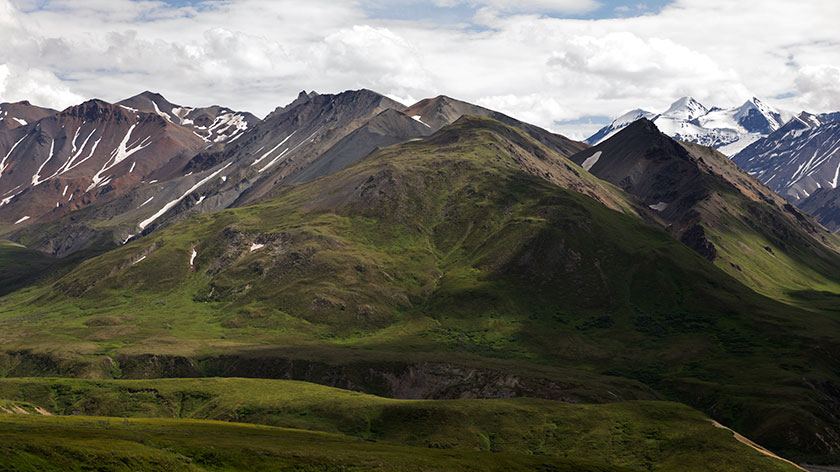
The park is different from any other National Park that I’ve visited. Besides the visitor center on the east side, there are very few concessions within the park boundaries. The intentions for The park was to be more of a wilderness experience. The park service limits traffic to fifteen miles on the single park road. Imagine, the state of Massachusetts having one road and you will get a sense of the space set aside for preservation.
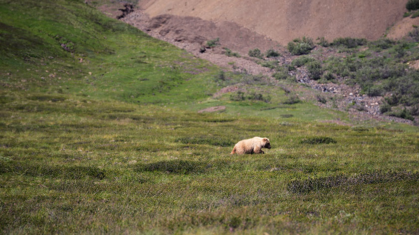
We spotted this female grizzly escorting two cubs across the meadows. Unfortunately, the cubs were shorter than the grass in this photo.
You can’t drive your car into the heart of the park, but you can walk anywhere you like, you can ride a bike along the road, but over three-hundred thousand people use the shuttle or tour buses each year. The tours offer guides and video screens, so you don’t even have to leave your seat to view the wildlife (you can even buy a DVD recording of your tour when you get back).
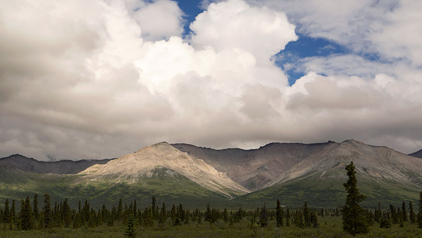
Thunder clouds gather over this white mountain before breaking into afternoon showers.
The shuttle buses take you to various stops along the road and the cost is proportional to the distance. The guide is the driver and there aren’t any video cameras, so you have to spot the animals yourself. Anyone on the bus can yell stop, and the driver will stop, spot the object, move the bus so people can get a better photograph, and explain about what you’ve stopped for. There are only two rules: 1. No body parts can hang out of the windows (lenses are not body parts, so they can protrude). 2. You must stay quiet while the animal is near the bus.
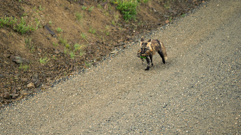
A red fox on his way back to the den with three ground squirrels. This will be food for his hungry kits.
So, that really sucks, right? I want to hang out and try to pet the bears! It’s actually a pretty good system. Because of the rules, the animals don’t associate the buses with humans. They’re just big inedible cows moving back and forth across the landscape. Like being in an observation blind, the passengers get to see the animals act naturally. The ‘Stop!’ thing? Believe me when you have a bus load of people staring intently out the window, you stop more often than if you were by yourself.
Wonder Lake was at the west end of our shuttle bus rid. In all, we spent eleven hours touring the Denali back country.
You may have guessed by now that we took one of the shuttle buses yesterday out to Wonder Lake and back. We did get to see Denali, but only at the first overlook, seventy miles away. That qualifies us for the “I saw the Mountain” tee-shirt. I didn’t get a good shot however. It’s raining today, but Tuesday’s and Wednesday’s forecast is for drier skies, so we’re going to take another bus. I still want my picture.
Last evening Anne and I drove to a river crossing our map said was a good place to fish. It was around six in the evening and we figured there would be another ten hours of daylight left. When we got there, Anne sat in the car reading her Kindle book while I assembled my fly rod.
I had started casting along the shore to the right of the car then, not having any luck, moved upstream to the left of the parking area. I made a couple of casts when I heard a car door close. I glanced back to the car, thinking Anne had gotten bored and wanted to go back to camp.
It wasn’t. Instead it was a young slender woman about medium height with long black hair walking towards me. She wore a smoke blue silk blouse over black skinny jeans tucked into shiny black boots. Then I noticed her dark brown eyes as they looked directly at me and she smiled. She seemed familiar, like Janet Lee; the pool player.
She carried something in her hand and it took me a moment to realize it was a fly rod case, large enough for a two piece rod and reel. When she stood next to me, I’d lost track of my cast and hit the back of my head with my wadded up fly line.
“Do you mind if I fish the bank below you?” she asked with a deep sultry voice. My mind tried to respond with something like “If it pleases you, my dear,” but I swear it came out as <curly> “Why sointley”</curly>. She then gracefully descended the muddy slope to the river’s edge. She remarked how she had caught two graylings the other night. Then she looked puzzled and told me that this wasn’t her spot, because it was closer to the downed log upstream and began to climb back up. I offered my hand in help, but she refused and walked up the bank as if there were stairs. When she stood on the grass, her boots still shined without a trace of mud.
She looked for a path through, and then around the aspens blocking her way. Then she slipped around the end one, and then . . . disappeared; vanishing without a trace. I looked for her for maybe a minute before realizing the Goddess of Fly Fishing visited me. After exhaling and releasing my gut, I began reeling in my limp fly line from the grass, then slowly walked back to Fritz . . . and Anne.
I put away my rod and reel and sat in the driver’s seat letting out a huge sigh as the door closed.
“What was that all about?” Anne asked.
I turned to her and excitedly blurted, “Oh thank God you saw that. I was afraid that I was hallucinating.”
We left Dawson City via the Yukon Ferry. It runs 24 hours and is free, so how could we go wrong? If there are caravans on the road, it could take hours for all of them to cross, but we were fortunate that none were in town. The ride takes less than a half hour, but driving on and off the boat is tricky. There isn’t a permanent dock, so the ramps just let down on the dirt road and there’s a gap that can cause damage to the vehicles. Fred had to re-position his cargo box, Sally got some trim damage and our front trailer foot was slightly bent when we drove off the ferry.
The ferry links Dawson with the Top of the World Highway; and their golf course evidently.
We took some time to fix things and then started up the Top of the World Highway. That’s the name for the road from Dawson to Chicken, Alaska. It got its moniker from the how the trail follows along the three thousand foot mountain ridges.
In only a couple of miles, we were high in the mountains and got a last look back at Dawson City.The views from the Top of the World Highway are spectacular on a clear day.
The road climbs steeply from the Yukon bank, past the golf course, and in our case, into the clouds. The views from the road I’m sure are both spectacular and scary at the same time. For us, it was raining, so we drove in and out of the clouds. Every once in a while, the clouds would lift revealing how steeply the mountains dropped into the valleys below us.
As we drove along the road, we would drive in and out of the clouds.
Other people warned us that the road was not the best, but we decided to press on regardless. The rain made the gravel base even worse, filling the pot holes and washboard ruts with mud. We drove like it was a slalom course, trying to find a smoother section.
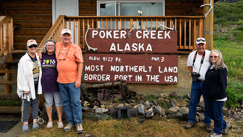
This time it was the US Customs agent that volunteered to take our photo when we crossed into Alaska.
It was slow going, taking almost four hours to make the eighty mile journey to the border. After clearing customs, we started down the US side on brand new, shiny black pavement. It had bright yellow center lines with white lines down the edges. Our walkie-talkies were full of chatter about how much we loved this road, when about five miles later, it turned into . . . mud. Not gravel, just a plain old sloppy muddy road . . . with worse washboards and more pot holes.
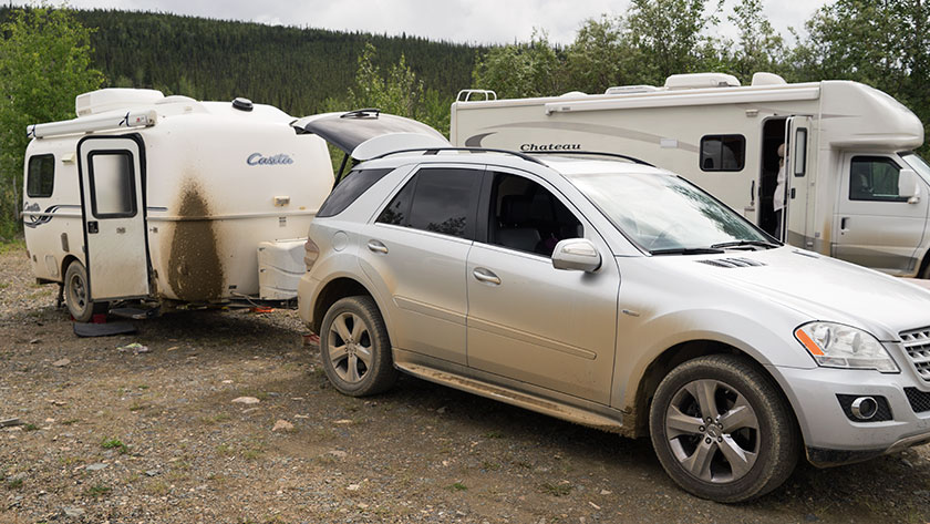
By the time we reached Chicken, the vehicles were caked in mud.
When we pulled into Chicken after another twenty miles, we got out of our vehicles and assessed the mess. The Ritz had two caked on mud stripes down the front that looked like skid marks. I had no idea how I was going to scrape that mess off, but by then, we just wanted to get in out of the rain and get something to eat.
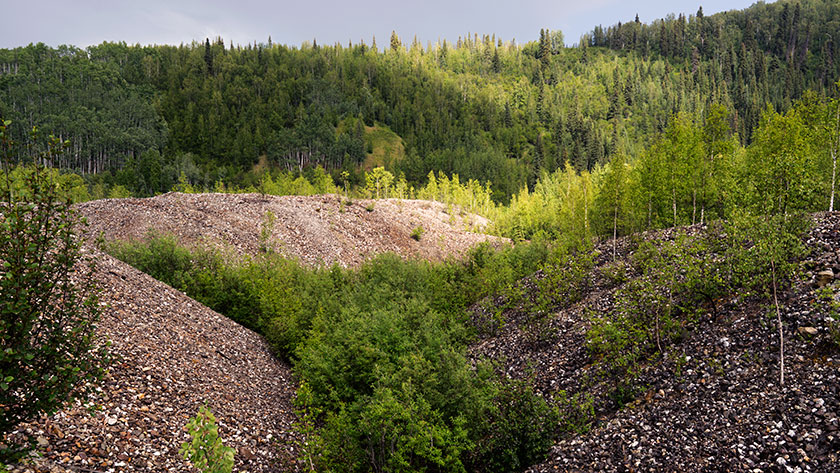
A couple of days ago, my friend Jeff wrote in a post comment that he had noticed strange snake-like formations along each side of the road near Dawson City, and he wondered if I could find out what they were. As you drive into Dawson, it’s obvious what he was talking about, because they’re everywhere. When he asked, I thought I would just reply with an answer, but since these ‘strange’ formation are an interesting part of the Yukon history, I’ll turn it into a full post.
The formations that he noticed are huge piles of river rock and they make ten foot mounds. The tops of the piles have and undulating pattern and they sweep back and forth. Some of them are newer with no vegetation growing, while others are already covered with trees.
The piles of river rocks are the tailing of a placer mining dredge.
The piles are simply river bottom dredged from the creek bottom and piled along the bank. It was one of these contraptions that made these piles:
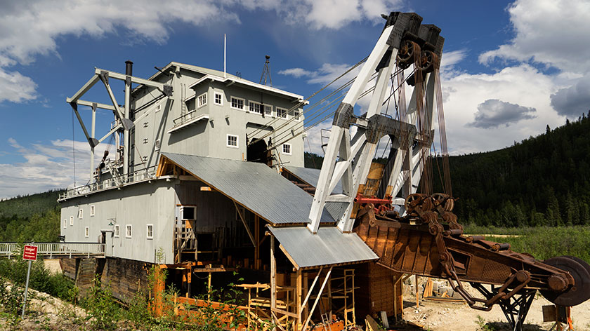
Dredge No. 4 worked the Bonanza Creek until operations stopped. It’s now undergoing full restoration at its last place.
This is the No. 4 Dredge on Bonanza Creek and is under going full restoration. During the short placer mining season a crew of four would run one of these babies twenty-four hours a day. The would dredge up the bottom and sides of rivers, process the load on board, then dump the tailing out the other side. When they ran, they could fill up a normal dump truck every three seconds. At the height of the gold rush, there were twenty-seven of these eight story monsters running at the same time.
Crews positioned them at the mouth of a water-way and they would work their way upstream. Before they could start work, all the vegetation was stripped from the land. If you lived in the way, you were out of luck, because mineral rights trumped property rights. Then the permafrost had to me melted, by pumping steam into the ground. Finally the dredge would crawl its way up the creek at a rate of a foot a day.
Strip mining at it’s best, Ah? The units were 95% efficient, so the area is still crawling with miners working active claims. Fred and I visited the original claim today, which is a park called the Discover Claim, and wondered if any gold was left. We both doubted it, but picked up a shiny rock in the creek anyway.
Our drive to Carmacks today was an easy one. It wasn’t too far, the roads were all in good shape and there weren’t any steep passes. As it happens, we were in our camp and setting up in time for lunch.
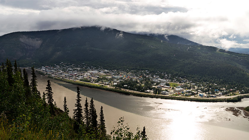
There isn’t much of a town, a couple of stores and a gas station along with the RV Park we’re in. There is a bit of history about the town and the person it was named after. George Washington Carmack was a miner who explored the Yukon and found a vein of coal near here. His great fame came later when he discovered the gold nugget that set off the Klondike Gold Rush and the Klondike Gold Field between here and Dawson.
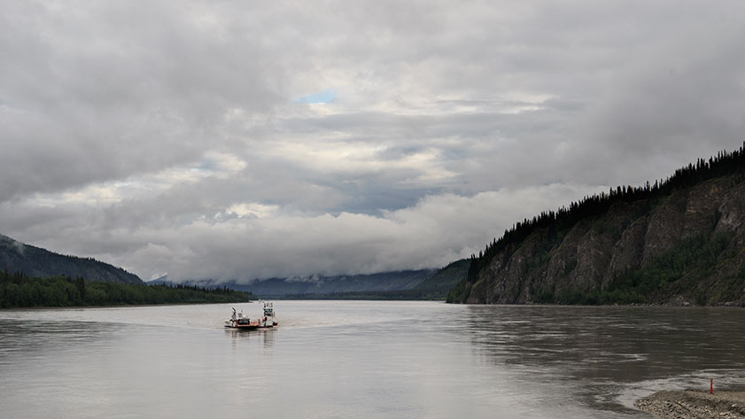
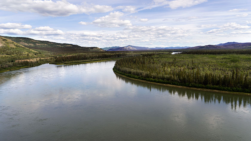
The Yukon River makes a sweeping S curve through the town of Carmacks.
The country is beautiful and the Yukon River flows north until it makes a couple of sweeping bends around the town before heading north again. We had time to stop and read the roadside information signs and they explained that the mountains are formed from conglomerate rock. Like concrete it’s made up of smaller rock glued together with mud (instead of cement). Part of the mountains sloughed off creating a formation called the Whitehorse Trough and the highway runs its length.
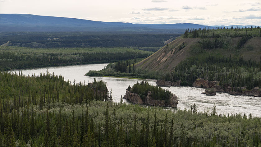
Downstream from here is a rapids called Five Finger Rapids. There are four large formations of these conglomerate rock in the river and since they’re more resistant to erosion, they’ve created a fall in the river. To get the steamboats through the rapids, engineers had to build a cable and wench system to haul the boats up and down.
Four formations made up of conglomerate rock create a rapids below the town of Carmacks.
Since our back door is on the Yukon, Fred and I got in some fishing before dinner. We finally landed something. I caught an Arctic Grayling and a White Fish, while Fred landed two more Grayling. I feel a lot better about all the new fishing equipment now that we’ve actually caught something.