McCarthy/Kennicott/Kennecott – Alaska

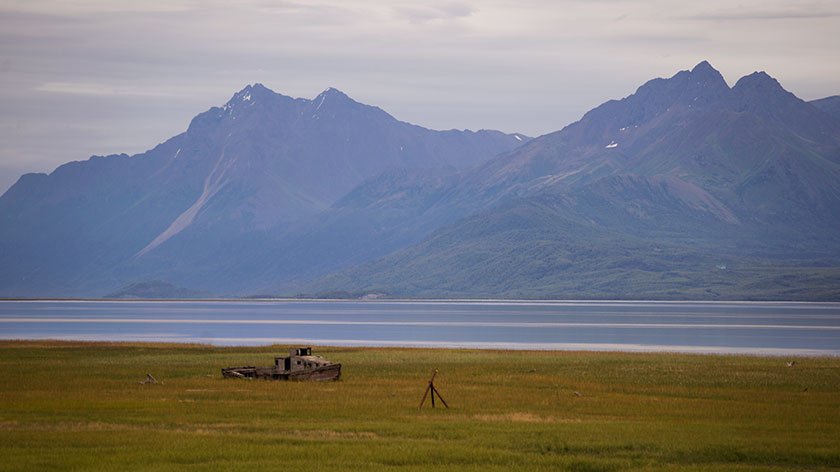
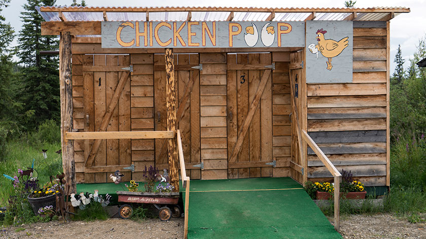
If you ever fly into Alaska and rent a car or motor-home, there will be a clause on your contract that forbids you from driving on certain roads. The first is the Dalton Road to Prudhoe Bay, the second is the road to Chicken, and the most notorious is the McCarthy Road, and it’s infamous for a good reason. The builders never meant it to be a road.

Kennecott Ore Processing
The massive multi-story building processed ore from the mines and loaded it on train cars.

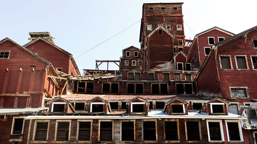
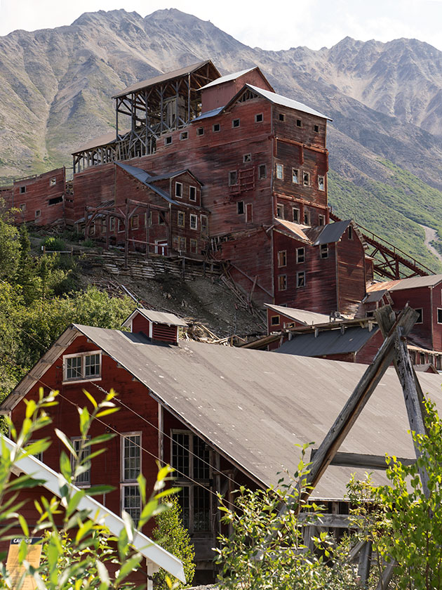
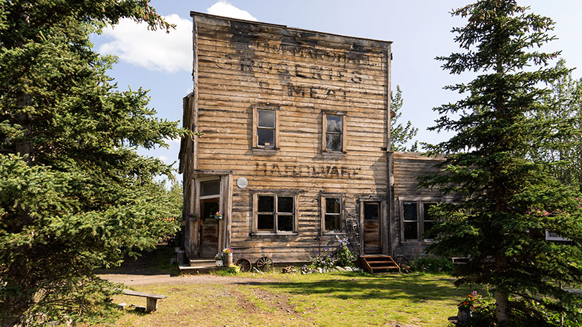
In 1900, two independent prospectors discovered a large copper deposit on the mountain above the Kennicott glacier, later tagged as the Bonanza Hills. Much political wrangling went on over the next ten years, and investors formed a publicly-traded company, except the person filing the papers misspelled the glacier’s name. Today, if you’re talking about the glacier below the mine, it’s spelled, Kennicott. Otherwise, anything to do with the mine is Kennecott. I’m glad to find out that I’m not the only one who flunked spelling classes.

Kennecott Power Plant
This building supplied the power needed to process the ore.

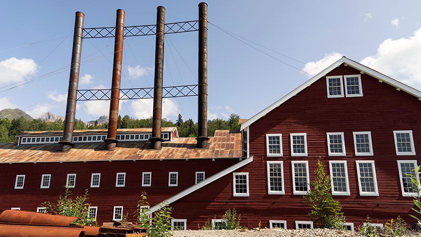
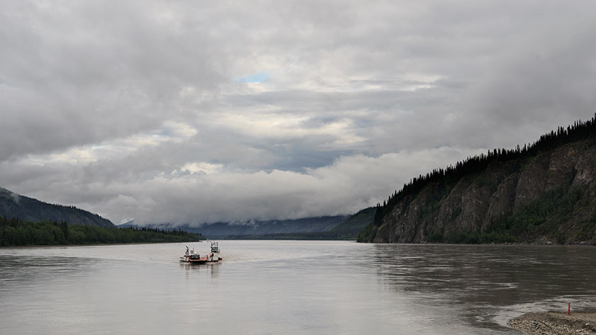
Getting back to the road, the company needed a way to get ore down to the Cordova port. Like any good corporation, they started another corporation to build a railroad and named it the Copper River & Northwest Railroad (CR&NW). Detractors used the initials to call the investment “Can’t Run & Never Will Railroad.” However, the scheme worked and ran successfully for twenty years before copper prices plummeted, and in the thirties, the company closed the mines.

Kennecott Shift Manager's House
Although small, most of the wood detail in the house is exceptional. I wonder how the manager would have reacted to the building leaning in his window.

Years pass, and someone salvaged the rails from the track, but there’s still a historic old mining site upriver from Chitina that could draw tourists. So, some brilliant entrepreneur dumps gravel over the ties, and that becomes the McCarthy Road. During its early years, the discarded spikes tore up a lot of tires. Since those are collector’s items now, they’re not as big of a problem. The road covers sixty miles and, on a good day, takes two to three hours to travel.

Kennecott Processing and Bonanza Hill
The processing plant towers over the town with its complex architecture. The mountain that supported this ingenuity is in the background.

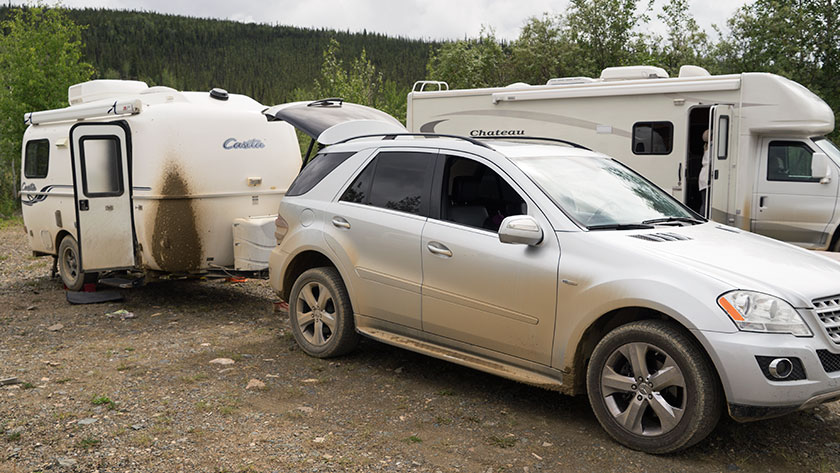
The problem now is that engineers never built the road for automotive traffic. The road is not maintained well, so it is full of ruts and potholes; there is a frequent blockage due to rocks and mudslides, there are no shoulders, and the road runs through bogs. The road is essentially one lane wide, so cars passing need to give way. This year alone, there have been two incidents where a motor-home has pulled over to the ‘should have been a’ shoulder and needed rescue. Last week, one just flopped over on its side, and on my trip, we called a hook for one listing thirty degrees.

McCarthy Hotel
Whereas Kennecott was a company town, McCarthy was the place to let loose. There is still a functioning hotel there—good luck in getting a reservation.

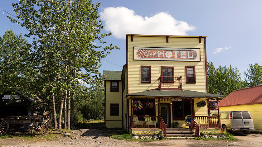
OK, I cheated. I hitched a ride on the scheduled shuttle bus. It cost a lot less than calling a tow truck and the wear and tear on Fritz. Even though I thought the Chicken Road was worse in hindsight, I still felt it was the better choice. I only had enough time to work before the return bus and couldn’t hang around for the perfect light. Unless you want to pay $250.00 for the private bridge across the Kennicott river, you have to walk or take the shuttle up the four and a half miles to Kennecott anyway.

McCarthy Groceries Meats and Hardware
If you couldn’t buy it here, it was probably up on Silk Stocking Road.

If I were to make the trip again, I would consider paying another hundred dollars to McCarthy Air and flying from Glennallen to McCarthy. Then I wouldn’t even need to walk over the footbridge the park service built. To land at the McCarthy’s gravel field, you have to circle a couple of the mountains and come in over the glacier. That would be cool.

jw

Half Empty Glass – Alaska

We’re still in Palmer even though Deb, Fred and Sally have moved on to the Kenai Peninsula. We will meet up with them on Friday. We got Fritz back from the dealer yesterday, after getting the worlds most expensive ignition switch installed. This morning, I took him to the shop for a lube service. I wanted him ready for the long drive home. He’s logged over 5000 miles on the odometer so far; already more than half the scheduled trip, but he’s been on a lot of side trips.

Boat on the Cook Inlet
A wooden boat sits dry in the salt marsh on the Knik River arm of the Cook Inlet.

This is always the time on vacations where I get melancholy. The vacation is already half over. Although there is a lot of traveling left, we’re still on the downhill run. After planning ‘the trip of a lifetime’, I hate to see it come to an end. As I said, there’s more than a month before we get back to the stress and rigor of retirement. We still have so much to see and do.

There’s a line in the Dan Fogelberg song Nether Lands that best explains this confusing feeling I have: “And where do you go when you get to the end of your dream?” I’ve already learned the answer to that question. It’s another quote from the movie Finding Nemo. The line is Dory’s, when she says “Just keep swimming, swimming, swimming.”

My ‘swimming’ technique is like an astronaut coming home from the moon (This is actually how I got through school well before astronauts). I need to focus on getting the landing right, but I stare blankly out the window and let my mind wander. Eventually, another hair-brain scheme pops into my head and (my last quote of the evening is from Tag Team); “Whoomp! There it is.”

jw

Chicken – Alaska

Chicken Overlord
The fourteen foot sculpture of a chicken sits on a hill overlooking the town. Next to it is a signpost designating the mileage to worldwide towns having chicken related names.

Chicken Alaska is a wide spot in the road, and the road was muddy when we traveled it. There are three parts to the town, two RV Parks and beautiful downtown Chicken, which I photographed in one shot. In spite of all that, the town’s people have a good sense of humor and don’t take themselves seriously.

Downtown Chicken
This panoramic shot captures all the stores in downtown Chicken,

Chicken started out as a gold camp and today there are several active claims being worked. It also is a convenient break on the grueling Top of the World Highway and so the reason for the two RV camps.

Chicken Stock Stage
This is the stage used for the annual music festival called Chicken-stock (get it? Woodstock – Chicken-stock).

Chicken was given that name because no one could agree on how to spell ptarmigan (they obviously didn’t have spell check like I do), so they used the plentiful game bird’s nickname instead. Ptarmigan is still the favorite bird to hunt, but you can’t make as many puns.

Chicken Poop
This is a shot of the public restrooms in Chicken. The private ones aren’t better, just smaller. We chose our RV park, because they had the only flush toilets in town.

We just spent one night in Chicken where we had dinner (fried chicken) and breakfast (chicken and waffles). The restaurants do have beef on the menu (chicken fried steak) if you prefer red meat. If you don’t want chicken or beef, there is a variety of omelet and other egg dishes available on the menu.

Attack Chicken
This is the coup that the chicken in Chicken produces all the eggs for the town’s restaurants.

After breakfast and purchasing a souvenir tee-shirt that says, “Quirky drinking town with a gold mining problem,” we continued on the muddy road towards Tok (rhymes with Coke) Alaska. As we left town it started to rain again. However, twelve miles out-of-town the road was paved, and the same forces that splattered mud on The Ritz, now began scrubbing it off. By the time we reached our destination, the front of the trailer was dirty, but not caked with mud. Hallelujah!

Lord of the Chickens
This sculpture was outside one of the restaurants we visited. Besides this one, there are small chicken details fabricated out of scrap metal pieces.

jw

Top of the World Highway – Yukon

We left Dawson City via the Yukon Ferry. It runs 24 hours and is free, so how could we go wrong? If there are caravans on the road, it could take hours for all of them to cross, but we were fortunate that none were in town. The ride takes less than a half hour, but driving on and off the boat is tricky. There isn’t a permanent dock, so the ramps just let down on the dirt road and there’s a gap that can cause damage to the vehicles. Fred had to re-position his cargo box, Sally got some trim damage and our front trailer foot was slightly bent when we drove off the ferry.

Dawson Ferry
The ferry links Dawson with the Top of the World Highway; and their golf course evidently.

We took some time to fix things and then started up the Top of the World Highway. That’s the name for the road from Dawson to Chicken, Alaska. It got its moniker from the how the trail follows along the three thousand foot mountain ridges.

Dawson City from the Top of the World
In only a couple of miles, we were high in the mountains and got a last look back at Dawson City.
Top of the World View
The views from the Top of the World Highway are spectacular on a clear day.

The road climbs steeply from the Yukon bank, past the golf course, and in our case, into the clouds. The views from the road I’m sure are both spectacular and scary at the same time. For us, it was raining, so we drove in and out of the clouds. Every once in a while, the clouds would lift revealing how steeply the mountains dropped into the valleys below us.

Another Highway View
As we drove along the road, we would drive in and out of the clouds.

Other people warned us that the road was not the best, but we decided to press on regardless. The rain made the gravel base even worse, filling the pot holes and washboard ruts with mud. We drove like it was a slalom course, trying to find a smoother section.

The Gang at the Border Crossing
This time it was the US Customs agent that volunteered to take our photo when we crossed into Alaska.

It was slow going, taking almost four hours to make the eighty mile journey to the border. After clearing customs, we started down the US side on brand new, shiny black pavement. It had bright yellow center lines with white lines down the edges. Our walkie-talkies were full of chatter about how much we loved this road, when about five miles later, it turned into . . . mud. Not gravel, just a plain old sloppy muddy road . . . with worse washboards and more pot holes.

Fritz Leaves Skid Marks
By the time we reached Chicken, the vehicles were caked in mud.

When we pulled into Chicken after another twenty miles, we got out of our vehicles and assessed the mess. The Ritz had two caked on mud stripes down the front that looked like skid marks. I had no idea how I was going to scrape that mess off, but by then, we just wanted to get in out of the rain and get something to eat.

jw

Kanab Utah

It took longer than planned, but we made it to Kanab Utah, our toughest leg of our trip. I think we misjudged the time it would take to go through Prescott. A lot of traffic and a lot of twisty roads. We left Congress a little after seven in the morning and arrived at our camping site just before 5 PM. Since Kanab is on daylight savings time, we lost an hour and the trip took ten hours averaging 45 miles an hour. That’s including potty breaks, emergency stops, and lunch.

The girls stretch their legs
Deb, Sally and Anne stretch their legs in the shade of Sally’s RV.

We only made it to the top of Yarnell hill when Sally called on the walkie-talkie that one of her tire pressures was over 100 pounds. We pulled to the side of the road and sure enough, it was. After letting enough air out to match the others, we were back on the road.

Mickie D’s hosted lunch in Flagstaff. After taking four hours to get there, we were ready for the break. After that we made really good time as the roads and weather were good.

Picture of Kanab's main street.
Located on the southern border of Utah, Kanab hosts tourists visiting the Grand Canyon, Bryce, and Zion National Parks.

Kanab is a little tourist town in southern Utah. It’s only six miles across the border from Arizona situated between the Grand Canyon, Bryce and Zion. It’s loaded with tourists and has a couple of nice restaurants. It’s most striking feature is that it is nestled under the Vermilion Cliffs and the brilliant colors they have at the end of the day.

Tomorrow we strike out for Provo. It will be a better day as the distance isn’t as great and there aren’t as many long pulls we have to climb. And to think, we only have 89 more days like this.

jw

And so the adventure begins. The Alaska Journey

The gang poses for a portrait.
The gang takes a pack break to pose in front of the caravan. From left to right: Anne, Jim, Sally, Fred holding Gus and Deb.

Hold on to your hats, folks, because after a year of planning and packing, our road trip to Alaska and back to Arizona is finally kicking off tomorrow morning. We’ll be hitting the road from Congress, driving through Prescott, Verde Valley, and Flagstaff, and then spending the night in Kanab, Utah. I don’t know about you, but I won’t feel like I’m out of town until we’re on the other side of the San Francisco Peaks.

We’ve spent the last month getting our vehicles ready, but there’s always something else to pack. This morning, we had to make an emergency run to get longer chains because, of course, the hitch needed replacing. The pile of stuff in the dining room is smaller now, but I can’t shake this feeling that we’ve forgotten something… something important. But hey, at some point, you just have to get in the car and go. We’ll figure out what we forgot when it’s too late to turn back.

Our route will generally follow the I-15 corridor until we get to Montana, then we’ll cross the Continental Divide and head into Canada on the east side of the Rockies. From there, we’ll drive through the Canadian Rockies up to the Yukon Territory, and eventually reach Fairbanks.

We’ll make a loop through Alaska, hitting up Fairbanks, Denali, Anchorage, and the Kenai Peninsula before making our way back to Tok. And then, we’ll finally start the journey home. We plan to take a more scenic route on the way back, traveling along or near the coast until mid-California. But let’s not get too ahead of ourselves – who knows what kind of trouble we’ll run into along the way.

I’ll be posting updates from our journey, but it would take something pretty catastrophic to stop me from doing so (knock on wood). But hey, if something does happen, at least it’ll make for a good story, right? See you on the road!

jw

Preparation – Tires

I need to get Fritz (our truck) ready for the trip. Although our Casita trailer weighs about half of what Fritz’s capacity is, it’s a long way to Alaska and back; over a third of the way around the planet. I’d like to prevent troubles before they start.

My newsletter readers already know our gang doesn’t have much luck with tires. <Knock wood> . . . we’ve not had any such trouble this year but it’s not wise to thumb your nose at Lady Luck. Last week, when I had my favorite tire store examine mine, they said that there was enough tread to make the trip but it would be better if I got new ones. After a week of pondering, I’ve decided to follow their advice and spring for new tires.

Fritz came with a set of Michelin run-flats and I’ve replaced those with a second set. When you lose air in a run-flat tire, you’re supposed to be able to drive up to fifty miles on the damaged tire. Theoretically, that will get you to a repair shop. Fortunately, I’ve never had to and don’t want to test that theory. Because Fritz came with this type of tire, he doesn’t have a spare.

I’ve always liked Michelins, but these don’t seem to hold a balance well. Sometimes they’ll roll down the road nice and smooth and other times, there’s bouncing at all four corners. So, I did a little research yesterday and I’m considering trying a set of Bridgestones. I have had a chance to have a set of Bridgestones on Betty, our other car, and I liked how they felt on the highway. The price is almost identical, I’m just hoping for a better ride.

I also want to have a spare for this trip even though there’s no place to put it without giving up luggage space. Fritz has one of those buttons that you push if you’re in trouble and someone comes to rescue you. Looking at the map, I wonder if there’s even cell phone coverage on some of those roads. Believe me, I’ve had plenty of experience changing tires and I’d rather have something I could change than wait for tow truck. While I’m at it, I might as well pick up a matching spare for Ritz, the Casita. So today I have to scour eBay to find a couple of wheels for the rigs.

jw