Long before Arizona was a state, it belonged to another country—Mexico. In retaliation to the Alamo massacre, the U.S. declared war on our southern neighbor and took away half of their land. When Mexico surrendered, we tossed fifteen million dollars (the same amount as the Louisiana Purchase) on the bed and said, “The money’s for the room, babe.” Our newest land acquisition was called New Mexico Territory, but—because it was so vast—we split it into several states. Arizona was the last to make the team.
To see what their money got, cigar-chomping Washington politicians handed some change to a young lieutenant—Amiel Weeks Whipple—then told him, “Here, kid. Grab a couple of guys, a tape measure, and measure the backyard.” This expedition was Lt. Whipple’s first across our state. He started in San Diego and headed east, surveying land along the new border. His second journey was in the other direction, and this time, he was to lay out a railroad route along the 35th Parallel—Interstate 40.
I mention Lt. Whipple because, when I research how an Arizona location got its name, it is often cited in Arizona Place Names—that’s the reference I usually use. As he worked his way across the territory, surveying, mapping, and fighting Apaches, Whipple didn’t have the luxury of stopping someone to ask, “Excuse me, but what do you call those mountains?” Not many people lived here, and many who did were cranky. After all, air conditioning hadn’t been invented yet. Instead, if a place needed a name, he’d make something up that seemed to fit.
That’s precisely how the Aquarius Mountains got their name. Whipple, who found abundant water sources in the range, named them after the mythological water bearer. If you’ve driven to Kingman, you’ve passed by the Aquarius Range. They are on the east side of U.S. Highway 93 from Wikiup north to almost Interstate 40. The highest peak is Snow Mountain, with an elevation of 5880′, so it sometimes has snow. Several dirt roads go up into the range, which will be the routes we’ll scout for exciting photographs. We will be spending the month of July photographing along the Aquarius’s back roads.
The first road I’ve always wanted to follow has perplexed me since I drove U.S. 93—Upper Trout Creek Road. I mean, give me a break, this is the Upper Sonoran Desert (the transition zone), how can there be a creek cold enough to support trout? It doesn’t, or at least not this particular Trout Creek. This one is a tributary of the Big Sandy River. As soon as the road crosses the Big Sandy, it’s called something else according to Archie’s navigation system (but not on the Gazetteer). I drove the road to the ridge, where I was treated to a beautiful vista to the east.

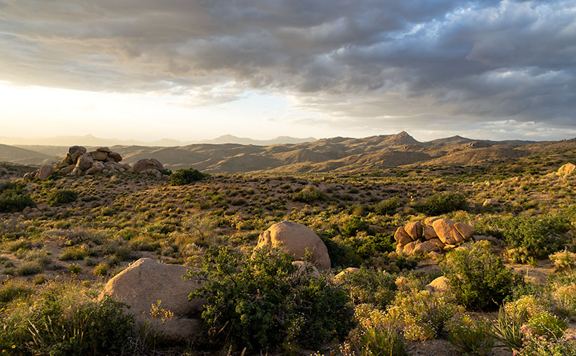
This week’s image is from Granite Flat, halfway up the mountainside. When I stopped, the sun was going down behind the Hualapai Range (on the west side of Highway 93), and its rays cast a warm glow on the rocks, peaks, and low clouds hovering in the sky. I call this shot Aquarius Boulders. It’s a scene looking north with Hwy 93 in the valley to the left and the Aquarius peaks to the right.
You can see a larger version of Aquarius Boulders on its Web Page by clicking here. Be sure to return next week when we set off for another adventure exploring Arizona’s back roads.
Until next time — jw
