Snow-Capped Majesty: Winter Embraces the Weaver Mountains Picture of the Week - Congress, Arizona

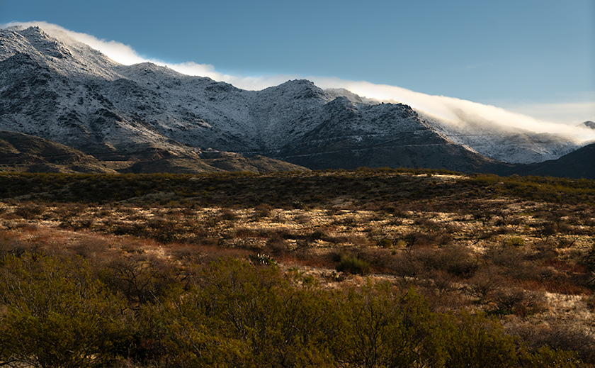
Snow-covered Weaver Mountains with clouds caressing the peaks, viewed from Congress, Arizona
Snow-Capped Majesty: Winter Embraces the Weaver Mountains – A serene morning in Congress, Arizona, as snow blankets the Weaver Mountains, with clouds tenderly skimming the peaks.

I’m often dumbfounded when I encounter snowbirds flocking at the Denny’s cash register complaining about our January rain. Frequently, I’ll interrupt their griping with local folklore. I’ll say, “The natives have a word for this weird weather pattern.”

“Oh ya,” their curiosity peaks, and they’ll ask, “What do they call it?”

“They call it winter,” I respond as I walk past them out the door, but I can always hear their groans behind me.

Yes, Virginia, the Sonoran desert gets rainy in the winter. It’s not our wettest time of the year. That honor comes with the summer monsoons. The dueling wet seasons are why our desert is home to the famous saguaro cactus. The winter months provide enough water for these giants for a spring bloom, and the monsoons provide water for the seeds to germinate. I’m unsure how the behemoth cactus scheduled the weather around their needs.

Understanding Arizona’s Two-Faced Winters

Arizona’s winters showcase a dual personality, much to our visitors’ fascination—and sometimes frustration.

The Gulf of Alaska pens the first act of our winter weather. These storms script our late December and January, bringing a chill that bites through the desert air. They’re the colder of our two patterns, and though the California mountains tend to hoard most of the moisture, they occasionally let enough slip through to grace us with a frosty spectacle.

Then, as if on cue, February presents a delightful intermission with weather so perfect it feels like paradise remembered. Daytime highs coyly flirt with the 70s and 80s, while the nights, crisp in the 40s and 50s, are ideal for a lover’s embrace or a solo serenade under the stars. It’s when we remember why we endure the scorching soliloquies of our summers.

But the final act belongs to the Pineapple Express. These storms spun from the warm waters around Hawaii and debuted around March and April. They bring a wetter, warmer embrace, coaxing the delicate plants from their frosty fear. Yet, this is no guarantee of a tender ending—Easter snow has been known to make a dramatic cameo.

Our rains are brief, a fleeting audience to our desert stage. They come and go, cleansing the air of Phoenix’s smoggy shroud and leaving behind a verdant carpet that transforms the desert floor. It’s a weekly show, though some complain it’s too often on weekends. But we Zonies? We wouldn’t have it any other way.

First Glimpse

When one of these Arctic Blasts cuts through the air, it’s as if the mountains around our house don an exquisite coat of powdered sugar. While the sight is breathtaking, the sun’s warm embrace usually coaxes the snow to leave by noon. However, this January presented an extraordinary spectacle that graced the Weaver’s and Date Creek Ranges with a full, snowy embrace from crest to base. This was not just a fleeting visitation but a rare, all-encompassing transformation that demanded to be captured.

On that magical morning, the urgency of the moment overtook me. Coffee, usually the first crucial step of my day, was forgotten. Dressed against the chill, I grabbed my camera gear and drove up the hill, driven by a compulsion to immortalize the scene before the sun could chase the frost away. March’s theme, the Weaver Winter Wonderland, is thus a tribute to this exceptional event. Through my lens, I hope to share the beauty of snow in the desert and a rare moment that reminds us of nature’s capacity for surprise and wonder.

Photographs

This week’s image is titled Snow-Capped Majesty, and it shows the area where AZ 89 scales the mountainside to the Granite Mountain Hotshots Memorial State Park and Yarnell. I’m happy with the clouds cascading down the slope and the morning light reflecting off the glowing grass. This scene rarely happens, but when it does, I’m glad I moved here to witness it.

Our second image this week was taken later after all but traces of the snow had disappeared. I named it Chilly Dawn, one of the lower hills among the Weavers having a bit of frost in the air. Those of you with sharp eyes know that this was taken at a high elevation in Peeples Valley because of the appearance of the Juniper trees.
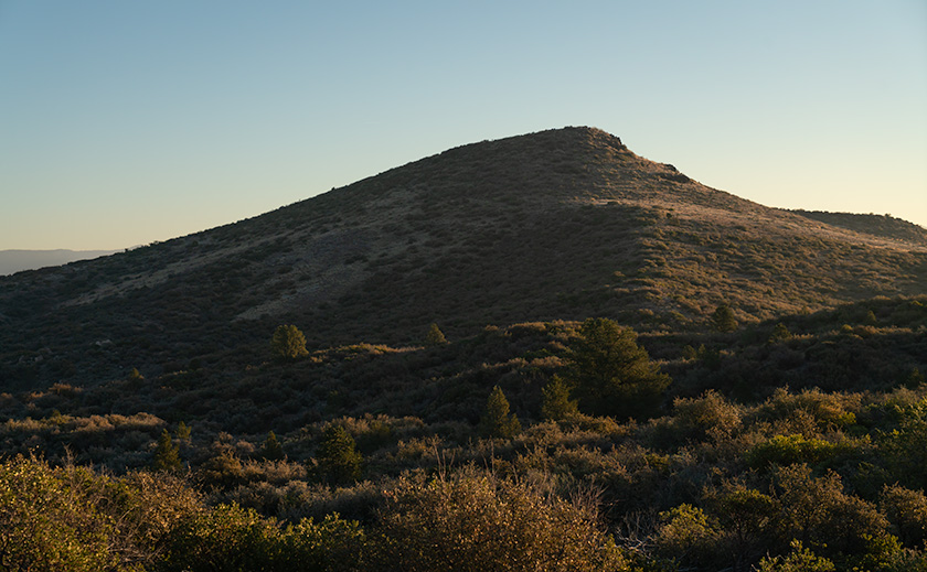
Early morning light casting a chilly haze over the hills above Peeples Valley, Arizona
Chilly Dawn: Hazy Morning Light Over Peeples Valley Hills – The early light of dawn bathes the hills above Peeples Valley in a soft, chilly haze, capturing the tranquil essence of an Arizona morning.

I hope you enjoy viewing my photographs as much as I share them with you. Perhaps we should bookmark and save this series to dig them out in July when it’s 118° outside. Queen Anne and I look forward to your comments about the photos or your winter memories. I have posted larger versions on my website < Jim’s Web> and Fine Art America <FAA Link> should you want to look closer. I’ll have more from Weaver Winter Wonderland next week, so return then.

Until then, keep your socks and humor dry.
jw


March Survey

I need your advice. Since it’s already March, it’s time to consider spring cleaning. To keep my customers happy, I’m asking you to answer some questions about how we’re doing. The survey below will appear for the next four weeks, but I only need your opinion once, so answer the questions once, and you’re done. At the end of the month, I’ll review your input and discuss any decisions we make. I dislike taking these surveys as much as you do, so I’m keeping it short. Mark the first pair of questions with a single answer, but the third is multiple choice. Tick all the boxes that apply to you.

Thanks in advance for helping us.

[formidable id=”4″]

Nature’s Palette: Exploring the Red Sandstone Masterpiece at Valley of Fire Picture of the Week - Valley of Fire State Park, Nevada

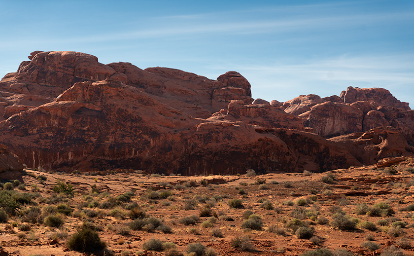
Red sandstone formations at Valley of Fire State Park, symbolizing the beauty of geologic processes over millennia.
Red Dune Wall in Valley of Fire—A Study in Erosion and Time – The ‘Red Dune Wall’ is a testament to nature’s artistic hand, sculpting the Valley of Fire State Park landscape through the relentless forces of wind and water.

Greetings from the Nevada desert, where Queen Anne (aka Lefty) and I embarked on a wild escapade, armed with nothing but our cameras and a sense of adventure that’s as robust as my morning coffee—deceptively strong and slightly bitter.

It all began in a Mexican restaurant in November, where we had planned to wrestle with the wilds of Gold Butte National Monument. But as we surveyed our gear, we realized we were about as prepared as a fish on a bicycle. With a sigh that echoed off the terracotta walls, we decided to pivot faster than a gambler on a losing streak.

So there we were, poring over maps and munching on nachos when the Valley of Fire State Park flickered onto our radar like a beacon of salvation—or at least a beacon of cell service and paved roads. It was a unanimous decision, fueled by the promise of not getting stuck and the allure of a good story to tell.

After a hearty debate over hash browns and highway maps at Peggy Sue’s Diner the following day, we plotted a less ‘Oregon Trail’ course and more ‘Sunday drive.’ We planned to loop through Overton, graze the shores of Lake Mead, and enter the Valley of Fire from the east, with a sunset deadline to beat the buffet back in Mesquite.

On a whim, we decided to pay our respects to the submerged ghost town of St. Thomas, which was now high and dry thanks to the ever-thirsty sun. The remains were intriguing, but we passed on the hike, preferring to keep our boots dust-free. Instead, I hatched a master plan to lure our friends—the Poteets—into a Jacques Cousteau-style watery charade involving wetsuits and mock-panicked flailing for a film I’d tentatively titled The Great St. Thomas Aquatic Caper.

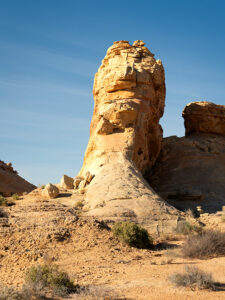
A towering rock formation known as Silica Dome against the clear blue sky in Valley of Fire State Park.
Silica Dome—The Sentinel of Valley of Fire’s Rocky Landscape – Experience the ‘Silica Dome’ grandeur at Valley of Fire State Park through this captivating image, highlighting the intricate layers and history etched in stone.

As the day wore on, we wandered among the storied stones of the early Jurassic Era. Like Whitney Pocket, these rocks were part of a grander narrative, a to-be-continued tale of petrified dunes stretching from Zion to the Grand Staircase and beyond. The Valley of Fire’s chapters were penned in red Aztec sandstone hues and crowned with white Navajo crests, a chronicle of time written in Earth’s hand.

This week’s photographic heroes are a testament to this fiery anthology. The main photo—a regal formation of red Entrada sandstone—is the park’s namesake, standing proudly amidst the Mojave’s scrappy flora. The supporting act, Silica Dome, wears a coat of Navajo Sandstone, pale and majestic against the desert sky. Together, they tell a story of a sea that once was and dunes that danced in the wind before time turned them to stone.
So, dear readers, come for the photos, stay for the tales, and return next week for another chapter in our desert saga. Will the Poteets make a splash in their wetsuits? Will Queen Anne ever forgive me for the early morning escapades? Find out in the next installment of our arid adventures.

Until then, keep your lenses clean and your humor dry.
jw

Techniques Unveiled: A Tale of Two Sandstones

In the photographer’s toolbox, contrast isn’t just about light and shadow—it’s the story of elements, epochs, and the Earth’s grand design. This week, I set out to capture a tale of two sandstones, a narrative etched into the very landscape of Valley of Fire State Park.

Our lead image, Nature’s Palette, is a canvas painted with iron-rich sandstone, a souvenir from the mid-Jurassic era. Here, the dunes are frozen in an eternal dance, caught mid-twirl by the relentless grip of pressure and heat, akin to the timeless beauty of Canyon de Chelly and the famed arches of Moab. Look closely, and you’ll see the canvas of the ancients—the water-stained varnish that once served as a blackboard for the Fremont and early Pueblo people to etch their indelible art.

The supporting act, Silica Dome, steps onto the stage from a later act in Earth’s drama under the watchful gaze of T-Rex and company. It’s a piece of the past where the climate was as dry as a prohibition-era bar, and vast sandy beaches fringed an ancient inland sea. In this shot, we confront a dune face-to-face, observing its neighbors’ retreat under the onslaught of time, exposing it to the elements that now conspire to return it to its granular beginnings.

I’ve served up larger versions of these geological delicacies online for those hungry for more than just a visual snack. You can feast your eyes on them via the links on my website—< Jim’s Web Page>—and their respective galleries on Fine Art America—<FAA Link>. Or click on the images peppered throughout this article for an instant teleportation to their online abodes.

Your thoughts are the garnish to our digital dish, so please sprinkle liberally in the comments section below. What stories do these ancient stones whisper to you?

BTW:
Last Tuesday, I released another video in my portfolio series on YouTube. This vignette is about the beauty of Arizona’s Farmlands. The five-ish-minute-long video is now online, and you can use this link to see it: <YouTube Link>.

Sculpted by Time: Whitney Pocket’s Sandstone Wonders Picture of the Week - Mesquite, Nevada

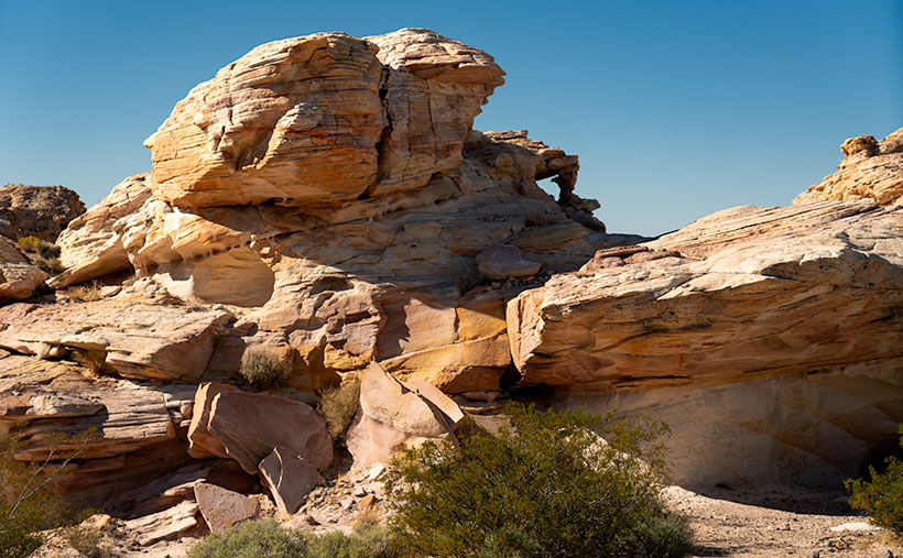
White sandstone rock formation at Whitney Pocket, similar to Zion National Park, in the Gold Butte area of Nevada.
Sculpted by Time: Whitney Pocket’s Sandstone Wonders – Amidst the rugged beauty of Whitney Pocket, this layered sandstone formation stands as a silent witness to the artful touch of natural forces, its contours and colors a desert echo of the famed cliffs of Zion.

Before we even packed the Turd for our Nevada trip, I studied all of the Whitney Pocket YouTube videos I could find like they were a final exam. Packing the Turd for the trip felt a bit like preparing a stubborn mule for a mountain trek—full of hope but expecting surprises. When the morning of our exciting adventure finally came, I had my checklist ready. After a hardy breakfast at Peggy Sue’s Diner, we topped off the gas tank and checked the tires. Part of these exercises was taking precautions and waiting for the visitor’s center to open so that we could buy maps and get free first-hand advice.

The people who answered our questions and the Friends of Gold Butte group volunteers were constructive. With a lack of park rangers, they’ve stepped in to fill that role. After reassurance that my SUV would be capable of the drive, the guide offered one last bit of advice. “Be sure to tell someone where you’re going and when you expect to be back. No cell phone coverage exists, and you could be alone out there.” Anne and I glanced at each other, wondering who we could call—we were alone in Mesquite and didn’t know anyone in town. We decided to call her sister—Jane— in North Carolina and panic her, “If you don’t hear from us by 6:00 pm, call the police.”

After the long drive on the awful road I complained about last week, we made it to the end of the pavement—Whitney Pocket. When I first got out of the truck, I felt disappointed. With our backs to Virgin Peak, we scanned the southern horizon, which went on forever in the clear, dry Mohave Desert air. Except for a few lumps of sandstone close by, there was just a sea of yucca and creosote running endlessly downhill to a thin line of blue, which we identified as Lake Mead. Where were all the majestic sandstone formations in the videos I watched?

We were here, and I would make the best of it. Our map showed a petroglyph site three miles down a side road that we passed, so I drove a quarter mile back and started down what I jokingly call a road. The road was passable, but only if I kept the speed under ten mph. The Turd’s front sub-chassis sounded like it was about to fall off as we dodged the football-sized pavement rocks. In comparison, the entrance road was a freshly paved Interstate.

As promised, there was a parking area with a kiosk and pictures at the three-mile mark. Go to the right and see the Falling Man petroglyph, but there would be a large panel of petroglyphs if I went in the other direction. The guide told us that the Falling Man was a longer hike and tricky to find, so I set off toward the easy shot while Anne and her Kindel kept each other company.

After a half hour of scouring the rocks for rock art, I realized I had missed the trail, was lost, and needed to find my way back to the truck. The trail had been pronounced, so I don’t know how I messed up. I started the hike back using my old tried and true method: ” This looks familiar.” I noticed the rock colors and layers as I searched for the trail. They’re more subtle and muted than you find in Bryce or Zion—almost a pastel quality. Then, I crossed over the surface stone patch and found my trail. I stopped, looked around, and discovered that the trail zigged right while I went left. Ah, the old let’s lose the geezer on the hardscrabble trick.

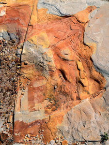
Water or ice erosion exposing red sandstone layers beneath the surface in Whitney Pocket, Gold Butte area.
The Art of Erosion: Exposing Whitney Pocket’s Hidden Hues – Nature’s artistry on display: The intricate dance of erosion carves through time, uncovering the fiery red heart of sandstone beneath the desert’s sunlit canvas.

Now that I was un-lost, I started taking pictures of the stones and capturing the muted colors washed out with the early afternoon sun. My trip back to Anne and the truck was more deliberate as I spent more time shooting and exploring along the way. As we drove away on the rock road, I turned to Anne and said, “I don’t think we should risk running the Turd down these roads until we get new shoes for him.” Anne’s ‘Oh, thank God’ was laced with so much relief that I suspected she might start a Thanksgiving parade there.

While the grand formations played hide and seek with our expectations, the true majesty of Whitney Pocket revealed itself in a serendipitous encounter. This week’s photo—Sculpted by Time—captures a lone formation made from the same limestone that capped Virgin Peak (last week’s shot), one that almost seemed to beckon for attention amidst the vast desert. Its white, streaked face looks unremarkable at first, but if you look closely at the lower-right corner of the image, you’ll see a joint (not that kind, you stoners). This is where a layer of the Navajo Sandstone is popping its head from the ground. These are the same petrified dunes seen in Zion National Park, and we showed you in Utah’s Snow Canyon State Park last year. This shot was a dance of light and texture, a moment where time stood still, and the story of the earth was told in a single frame of layered rock.

Here is evidence of rising ancient seas and covering the dunes up. Over eons, the skeletons of shellfish collected on the seabed and covered the dunes with a layer of their own. I think that’s cool, not to mention that I like the natural window in the upper center, too.

Next week, we’ll return to Whitney Pocket, but our focus will shift to the ‘Dance of Light and Shadow’ this time. We’ll explore how the changing sunlight angles transform the sandstone from mere rocks into a canvas of nature’s art. Expect tales of how the sun brings out different personalities in the stones. If you’d like to examine the rock layering closer, you can stop by my Web Page < Jim’s Page> or my post on Fine Art America <FAA Link>.

Till then, keep your spirits high and your humor dry.
jw