KofA Thunderhead Picture of the Week

KofA Thunderhead - An autumn thunderhead builds over the KofA Mountains in western Arizona.
KofA Thunderhead – An autumn thunderhead builds over the KofA Mountains in western Arizona.

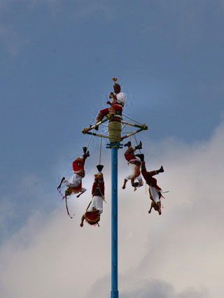
Each time Queen Anne and I jump into the car; I pack a camera in the back seat. I don’t mean on local errands like a trip to the grocery store but on drives longer than an hour. Rarely do I stop to take a picture, but should one of those once-in-a-lifetime moments happens, I’m ready.

If I capture some unique photographs, they don’t fit our usual workflow. We usually pick a location as a month-long project and photograph enough shots for a month of articles (or even a book). My one-of-shots along the highway traditionally become forgotten orphans. No one gets to see them—until now.

For December, I decided to make this month’s project out of the non-project shots I collected this year. With these four pictures, a special moment made me pull over and stop the car. That’s pretty hard to do because once I have a destination set in my mind, I only stop for gas, a candy bar, and bladder relief.

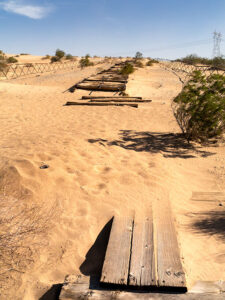
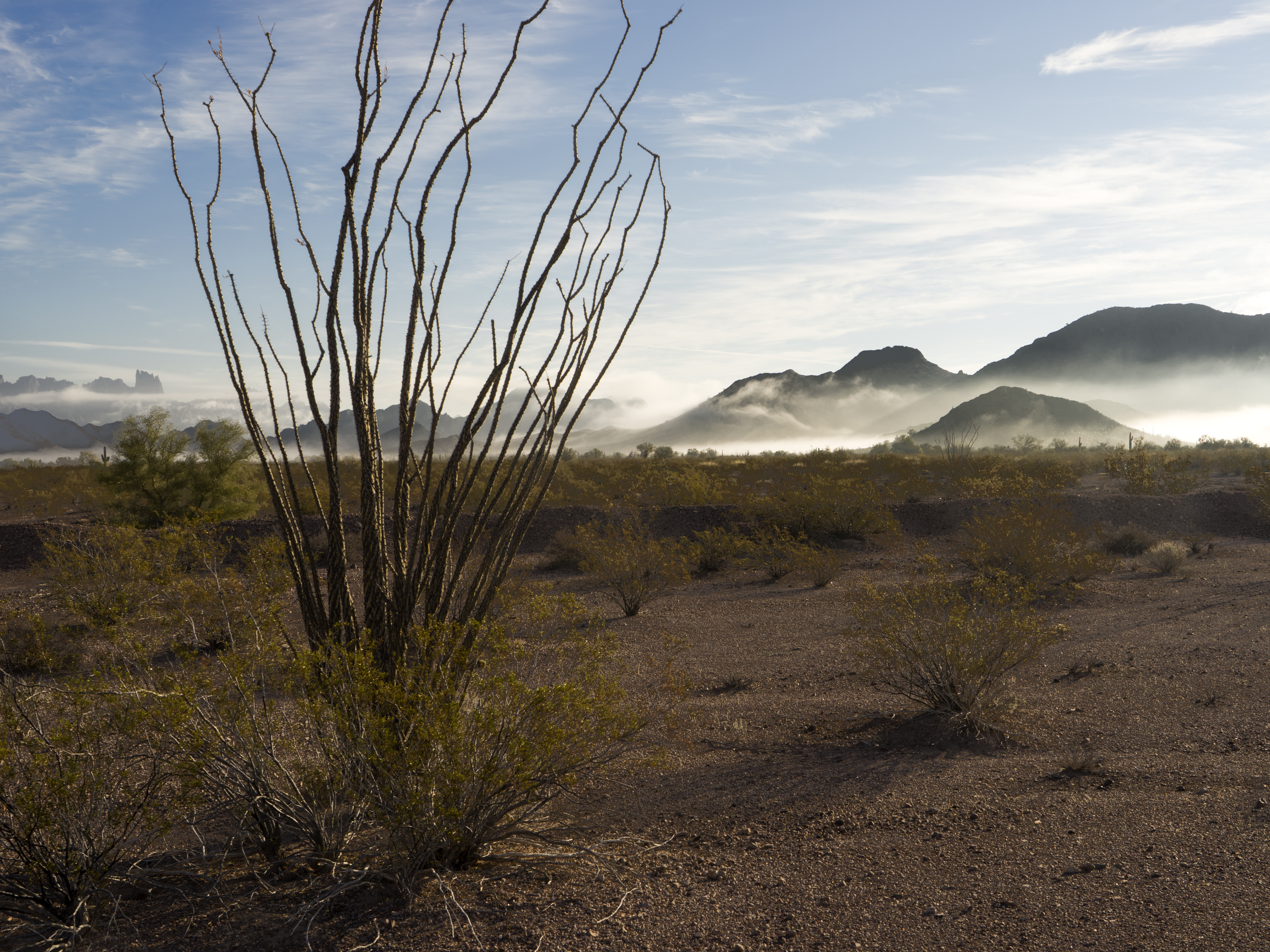
Anne and I run to Mexico about four times a year. We go to Algodones to see our dentist and buy 90 days worth of prescriptions. We’re on Medicare, and we have a gap plan that pays for most of the pills we take, but some of the select drugs (hint: you see them advertised on TV) are so much cheaper in Mexico that it pays for the drive. If we don’t have to wait on the dentist, we can make a drug run in a day. We leave here at 8:00 am, walk two blocks across the border, stop at Mickey D’s for lunch, and get home by 5:00 pm.

That was our itinerary on September 22—the first fall day. As we drove home on Highway US 93, I watched a single thunderhead building thirty miles north over the KofA Mountains. I thought it unusual to have monsoon activity in autumn and a single storm cell develop so far west in Arizona. I spent the next half hour arguing with myself.

“That will be a great shot if the clouds hold together until we get there.”

“If we stop, we’ll get home after dark.”

“It’s an isolated cell, and it’s posing like a runway model.”

“It’s the wrong time of day, and the light is wrong.”

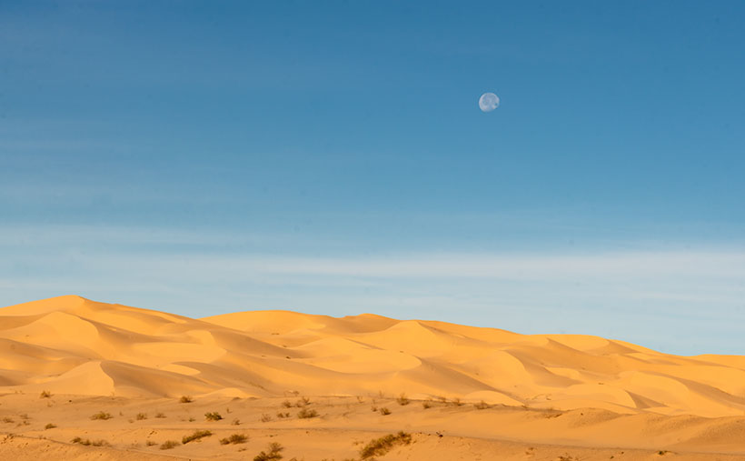
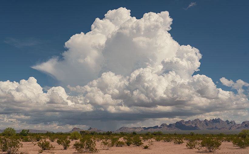
Just after passing the Border Patrol station that marks halfway between Yuma and Quartzsite, I noticed that the cloud was beginning to tear apart (the wispy part on the tower’s left side). It was time to stop the car. I reached back for my camera and hiked a few steps off the highway. I set the zoom-lens as wide as possible before framing and then snapping a couple of shots. I call this week’s featured image KofA Thunderhead.

The spot where I stopped was several miles away, and for perspective, the jagged KofA peaks rise a couple of thousand feet above the 500-foot high basin. That makes the billowing cumulus top nearly 40,000 feet in the air. Unfortunately, I didn’t capture any lightning strikes beneath the storm.

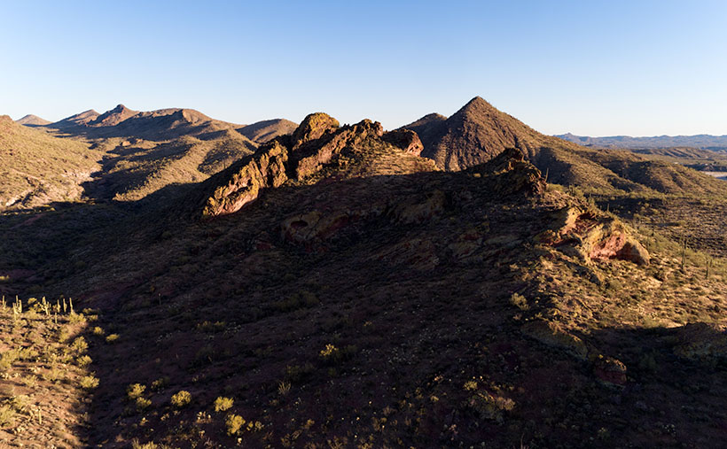
We returned to the road and continued the drive, watching the storm evolve. The upper winds blew the clouds apart by the time we were due east of it. That’s when we saw a funnel cloud drop below the ceiling. The tornado briefly touched the ground near Crystal Hill Road before it disappeared.

We weren’t done with it yet. After stopping for gas in Quartzsite, the storm ambushed us on the pass at Guadalupe Mountain. As it moved north over Interstate 10, it dumped rain so hard that the wipers couldn’t keep up, and traffic slowed to a crawl. We hoped we wouldn’t be surprised by a second tornado, but after a mile or so, we broke into the clear, and the deluge was only an image in the mirror.

You can see a larger version of KofA Thunderhead on its Webpage by clicking here. Next week, I’ll drag out another orphan photo for show and tell. We’ll see you then.

Till next time
jw

BTW:

Anne and I are negotiating next year’s schedule, so there will be a lot of yelling and screaming around here during the holidays. Pay no attention to the man behind the curtains.

Dune Moon Picture of the Week

When Queen Anne and I make our quarterly medical run-to-the-border, the drive is usually three-hours each way. Most of the time, we leave at dawn, see our dentist, buy prescriptions, and then come home. For me, those are long days behind the wheel; for Anne, not so much. She’s usually asleep in the passenger seat until her snoring wakes her up.

Occasionally when we have lab work done, or the customs line is three-hours long because the snow-birds have arrived, we’ll get a room in the elegant east-side Motel 6 and dine at the swanky four-star Denney’s. Our December visit was one of those occasions. Since I needed a topic for January’s posts anyway, we spent an extra night and took a circuitous route home—we’d go up to Blyth to work the Algodones Sand Dunes for this month’s project.

The great swath of sand starts about three miles south of the border outside of Los Algodones, Baja. It continues 45 miles northwest into the Coachella Valley (California’s Imperial Valley). They’re the most extensive contiguous dune system in the U.S. The dunes are also called the Imperial Dunes, Glamis Dunes, and Gordon’s Well. The name varies with location and the leisure activity you’re doing. Still, the entire system is officially named Algodones Dunes (in Spanish, it means cotton plant—the predominant crop grown on both sides of the border along the Colorado River). This week, we’ll start west of Yuma at the Mexican border—at Gordon’s Well.

Imagine it’s 1850, and you’ve traveled by wagon hundreds of miles across the scorching Sonoran Desert, forded a raging Colorado River, and finally crossed into California. You’d think your hardships are behind, but then, you’re greeted with 6 miles of Sahara-like sand to cross. With each step, you sink up to your knees. Even in 1926, when the nation’s first Ocean to Ocean highway was built (U.S. Route 80), the shifting sand was an engineering nightmare. They couldn’t simply scrape the sand away because the prevailing wind constantly covered it up again. Even today, if you’re caught in a windstorm along this section of road, you’ll risk a chance that the sand will blast the paint off your car.

Plank Road - You can see what's left of the old plank road on display at Gordon's Well.
Plank Road – You can see what’s left of the old plank road on display at Gordon’s Well.

The road builder’s solution for getting across was to build a plank road—movable wood sections on railroad-lie ties that floated on the sand’s top. It turned out to be challenging to maintain, but it drastically cut the crossing time when it was clear. Eventually, the planks were replaced with new and expensive asphalt, and eventually, it became Interstate 8. There is a section of the original plank road at Gordon’s Well on display. When you grow tired of looking at the old wood road, you can walk over to the border wall and lean on it.

Dune Moon - A waning gibbons moon setting over the Algodones Dunes west of Winterhaven, California.
Dune Moon – A waning gibbons moon sets over the Algodones Dunes west of Winterhaven, California.

As Anne and I drove west on the freeway, we spotted a waning moon setting on the dunes, so we looked for a place to stop. We’ve got stuck in these sands once before, so we were careful not to drive off the blacktop. I didn’t want to pay for another hook to come to yank us out. As you can see, we found a good spot and took this week’s picture called Dune Moon. The name could have been funnier if I had shot it during a particular summer month. Se la vie.

You can see a larger version of Dune Moon on its Web Page by clicking here. Next week we drive north up the Imperial Valley to visit the northern dune crossing. Be sure to come back and see what we found.

Until next time — jw

Black Hills Picture of the Week

Queen Anne and I spent a couple of days last week visiting our favorite foreign city. That’s right; we went to Algodones, Baja California. I had to see my dentist and have a couple of holes in my head filled. Instead, she worked on my teeth.

Algodones (it means cotton in English) is famous for liquor stores, pharmacies, and dentists. The little town has over 350 dental offices within a 10-minute walk from the crossing. It’s straightforward for visiting Snow-Birds to park in the lot, walk across, hit the liquor store for liquid courage, get a tooth fixed, and buy pain relief on the way out.

During the pandemic, the Mexican border is closed, but there are exceptions for medical, educational, and commerce visits. The big restriction placed for Algodones was closing the crossing at 2:00 pm instead of 10:00 pm. Early on, many people didn’t know that, so the wait times at the customs house were nil. Well, the secret’s out. The line of people going through customs was over a mile long. There’s a break in the gate where our dentist is, and when we can join the crowd there, it’s a half-hour wait. On Tuesday, the end of the line was three times that distance. It was 12:40 pm when we started. At 2:00, when the siren blew, we were only half-way to where our usual starting place.

The way customs close the border is interesting. If you’re in a car, you’re out of luck. You have to drive an hour to San Luis or Mexicali, where the crossings are open 24 hours. But if you’re a pedestrian in line, they stay open until the end of the line. That’s good because I thought we were going to sleep in a cardboard box like homeless people. It was 3:30 by the time we stopped at the Yuma Carl’s Jr. for lunch/dinner.

There was something weird on this trip that has never happened to us before. When we made it to the line’s the halfway point, an American guy jumps out of his car—taps on my shoulder—and asks if we want a ride in his car. “You’ll be in line for another couple of hours, but the cars are crossing in a half-hour.” His car had four people in it already. Anne and I glanced at each other and declined. I’m of the generation that said, “Gas, grass, or ass. Nobody rides for free.” What if we got in the car and he demanded cash that we didn’t have. We’d be back on the street and at the back of the line again. Everyone around us also turned him down. What would you do?

Get to the Picture
Black Hills - As the Hassayampa River flows down from the Bradshaw Mountains, it cut a gorge through the Black Hills, known as the Hassaympa Box Canyon.
Black Hills – As the Hassayampa River flows down from the Bradshaw Mountains, it cut a gorge through the Black Hills, known as the Hassayampa Box Canyon.

Speaking of this week’s picture . . . (I know it’s a lame segue, so I won’t charge you for this issue.) This is another view of the Mountains/Hills that we’ve been photographing in March. I found that they’re called the Black Hills because of the dark crust along their tops, hence the photo’s title. This version was taken on their other side, looking back to Wickenburg.

If you own one of my 2021 calendars, these rocks are the same subject as the March photo. This time I wanted to get a closer look at the interesting fault thrust in the foreground, but when I processed it, I realized I had captured more.

You can see the Hassayampa River as it flows down from the Bradshaw Mountains on the mountain’s left side. But here, it turns right—behind the foreground rocks—and it cut a gorge through these hills. It’s a local attraction called the Hassayampa Box Canyon. Unfortunately, it’s hidden in this shot, but there is a glimpse of the river after it hits the Hassayampa Plain on the right side. Here it turns into a wide, sandy, and the water flows beneath the sand. That’s why the native tribes call it Hassayampa—upside-down river.

I hope my photo brings completeness into your life. You can see a larger version on its Web Page by clicking here. I like reading your comments, so feel free to add your two cents below. Be sure to come back next week for another image from the Wickenburg area.

Until next time — jw

Local News At Its Best

Breakfast at Brownie's
A local Yuma favorite since 1946, Brownie’s is on my list when I’m in town.

We’re back this evening from an overnight Yuma trip where I was reminded of what is essential in local news. We had the TV on while we were getting ready to leave the motel. Like most local stations throughout the country, Yuma’s local broadcast talent was on doling out the news, weather, and traffic. I know, it’s good to know how long it will take to get to work. But in this case, instead of helping the viewers avoid the freeway bottlenecks, Channel 11 reported how long the lines were at the Customs and Immigration inspection stations. And you thought your daily commute was silly.

Till then … jw

Vanilla and Voladores

Buenos Dias, mi nombre es Diane Rockerhousen. My husband, John and I live in Xico (hee’ ko), a town of 30k nestled in the subtropical mountains of the state of Veracruz, Mexico. We retired here from Silverton, Oregon, and I’d like to share that story and a bit about our pueblo.

There are three little words that strike terror in the hearts of strong men, “I was thinking. . .”  Usually, John slaps a pillow over his head to filter out my next sentence. Eleven years ago with retirement looming on the horizon it was time to write next chapter in our lives; a chapter that didn’t include a large home on an acre of land in rural Oregon, but something smaller, while still having a manageable landscape. First step was selling the house, so we put it on the market in 2007 and didn’t see results until five years later.

We had friends in Oregon that were from the state of Veracruz, and I asked if they had family in the capital city of Xalapa. Silly us, of course they had family there, so I got a one way ticket, and made an exploratory visit. I loved the family, the environs, the climate, and the economy (in our favor), which resulted in us renting a house and beginning the process of moving nearly 3,000 miles south.

Why Mexico? Since John and I had traveled the US and Canada to our satisfaction, we decided to complete the North American trifecta, and head south for a new adventure.  Not a day goes by that we aren’t thoroughly confused, entertained or ask ourselves, “Why in hell did we bring that?” After several years of settling in, we’re still happy with our decision. It more than meets our wants and needs

Xico, Veracruz, Mexico
The pueblo of Xico in Veracruz, Mexico

Our pueblo is at the altitude of 4300 feet with an average temperature of 73°F and 66 inches of annual rainfall. It sits nearly midway between Mexico City and the port of Heroica Veracruz on the Gulf Coast.

This area of Veracruz produces a large crop of Arabica coffee that is shipped worldwide. Along with a variety of fruits and vegetables, our pueblo is known for its famous mole sauce (chilies, nuts, fruits and chocolate). If you shop Costco there is a brand named Xiqueno Mole in a jar that our town produces. Allow me to give you a brief tour around the state of Veracruz.

Papantla, Veracruz, Mexico (Latitude: 20.4465500 Longitude: -97.3249500)

Back in the early 1500’s when Moctesuma (A Spanish spelling variation of Montezuma-ed.) invited Hernan Cortez for a chat, the host served up a chocolate drink with a new flavor that the Spaniard had never tasted. Wanting to impress his guest and possibly keep his head, the Chief shared his secret ingredient . . . vanilla. To anyone’s knowledge then, it only grew in one place, Papantla, and was cultivated by the indigenous community of Totonacas. After years of pillaging and conquering, the Spaniards included some beans and vanilla orchid vines (vanilla panifolia) on their return voyage to Spain. The globe-trotting Spaniards were so enamored with the flavor they tried unsuccessfully to grow it in Asia and then Africa. Many expeditions later they discovered that a small indigenous bee (melipona) was the pollinator and only existed in Papantla. There are stories of entrepreneurs (priests) that built green houses with perfect growing conditions so when the orchids bloomed for only one morning per year, young nubile virgins with feather dusters would go from plant to plant pollinating.

Vanilla Guide
Our guide was a native Totonaca and he reveled the vanilla bean process. (Photo by Laura Henchman)

This man is a native Totonaca who was our guide through the natural orchid forest where you feel a part of the process of providing a product that gives pleasure to so many. The long green beans are the vanilla pods that take 9 months to mature. After harvesting they’re placed in the sun to reduce moisture until they are a mahogany brown and aromatic. At the end of the tour he touches your shoulder to give a Totonac blessing; it is truly a magical place to visit.

El Tajin Pyramid Site

El Tajin Pyramid Site
The El Tajin Pyramid has a niche, or cave for each day of the calendar year. (Photo by Laura Henchman)

El Tajin (600 to 1200 C.E.) is a World Heritage site since 1992, due to its cultural importance and its architecture. This architecture includes the use of decorative niches and cement in forms unknown in the rest of Mesoamerica. The pyramid of the niches has 365 “caves” representing the solar year with a direct connection to the underworld. Similar to post office boxes where you drop off your requests, then wait for the results, good or bad. As a side note, above one of the niches is a sculpture of a ceremony with a cacao tree included, leading historians to believe that the Totonacas created the chocolate/vanilla beverage that the Aztecs prized. The pyramids show evidence that many floors were of poured cement, up to a meter thick and perfectly flat.

The Voladores

The Voladores
The Totonacs created a dance team called The Voladores (flyers or bird-men) as a plea for rain during an extended drought. (Photo by Laura Henchman)

The Totonacs created a dance team called The Voladores (flyers or bird-men) as a plea for rain during a particular extended drought. The pole is 150 ft high with a square platform top where a flutist stands tooting while the dancers attach themselves by the ankles to ropes intertwined to the platform. Once the team commits to fall off the platform backwards the slow descent begins, unwinding the ropes while twirling through space with outstretched arms to a successful landing in front of an always appreciative audience that releases a collective sigh of relief that all is back to normal.

In March there is a festival celebrating the Spring Equinox (Cumbre Tajin) that is famous for its spiritual environment, bringing together a broad collection of artists and musicians. It’s the perfect place for finding life-balance for the New Year. Here is a Web Site that tells more about the festival: https://www.cumbretajin.com/

I hope you enjoyed my tour of our little corner of the world as much as I enjoyed writing it. Perhaps I can add to the story as I discover more secrets of Veracruz.

Diane

Los Algodones, Baja California

The Queen and I took time out of our busy schedule to make our quarterly dentist visit this week. Normally you’d think that would take maybe an hour or two at the most. For us, it’s more of a commitment than that. As seniors, our dental insurance is nil to none, so upon recommendation of a couple of friends, we found a good dentist in Algodones . . . Mexico, and that means an overnight journey to Yuma. Both of us got an addatoothtome, so on the first appointment was for a root canal and then an impression to send off to the lab overnight. The next day was for fitting the crown.

It’s been an abnormally wet year for us here in the desert, so when we left Monday at daybreak under a cloudless blue sky, we felt as if we were wasting a good work day. The rains kept us cooped up all weekend while we have outside projects we’ve put off for dry weather. Instead, we were on the road for three hours for an appointment at 11:00 am.

As the sun came up we saw patches of fog, something we rarely get. The evening breeze pushed the ground fog to the base of the low ranges like they were door-stops. The dark hills popped out of the strands of white. South of Quartzsite I couldn’t take it anymore and pulled off the road to snap a shot as we passed through the KOFA (King of Arizona) Wildlife Refuge. Even so, we made it with time for breakfast before our appointments.

Ground Fog and KOFA Range
A rare sight in the desert is ground fog, but after a cold rain it collects at the feet of the low ranges. Here a ocotillo is foreground to the fog at the KOFA Range

Los Algodones is a retirees’ equivalent of Disneyland. The downtown commerce area is an eight block square along the east bank of the Colorado River. It’s an extremely tiny border town when compared to Juarez, Nogales, Tijuana or even Mexicali; sixty miles to the west, yet it’s still a Class A border crossing. That’s because of the large amount of foot traffic. There is some vehicular traffic crossing there, but most people pay the six dollars to the Quechan tribe to park in their huge parking lot and walk across.

The dominant feature is a multi-story steel beam structure like an unfinished building. It’s been unfinished since we first visited some twenty-five years ago and most likely won’t be different in the next twenty-five. Then there are the hustlers. Unlike Tijuana, they’re not trying to get you into one of the girly clubs (of which there are none); they’re working for the dentists, eye doctors, pharmacies or liquor stores. That’s right; the doctors got pimps. After you wander the town a bit, you realize the town is a medical amusement park. Within a block you can get glasses, a tooth implant, new hearing aids, a sombrero, and have a margarita for lunch while you’re waiting for the lab.

As a younger man, I never would have gone to a doctor in Mexico. I had heard the horror stories of shoddy work and surgery disasters, so why the change of heart now? It’s a combination of economics, a referral and desperation. We need dental work, but couldn’t pay what the local dentists where charging . . . even with insurance. So, if I had a problem with a tooth, out it came. After retiring and hanging out with other like-minded geezers, we heard some good stories and then got a couple of strong referrals.

On our summer trip, I broke two crowns, so when we got back, we scheduled an appointment to investigate. As we sat in the tiny waiting room, people our age surrounded us claiming our dentist was the best. The first exam was simple consisting of digital x-rays, tiny cameras, and some poking and prodding. Within fifteen minutes they printed out a chart of my mouth showing the work that I needed including the cost by tooth. Then they went over the x-rays and photos so I could clearly see what they were talking about. After that, they cleaned my teeth and then I was done . . . $25.00. When we left the office, we both had our charts and it was our decision about which teeth to work on and when to do it. All of the prices were less than what our co-pay would be in the States.

As always, the devil must have his due. What you save in money, you pay with time. I already pointed out, the waiting room is crowded with patients that are loyal . . . to a fault. Your 11:00 am appointment only means you’ll be seen sometime after that. If you need to see a specialist, they call an escort to take you there, where you can sit in another waiting room that always has one less chair than people. If you’re lucky, the TV has Discovery Chanel in Spanish, otherwise it will be CNN. If your visit requires replacement parts, the lab will have them ready tomorrow, always tomorrow. If you count on getting back on the road at a decent hour, give it up. You will only have enough time to grab a Big Mac at the Yuma Mickey D’s before the three-hour drive home in the dark.

Western Arizona is one of the weirdest places on earth. It’s all low-lying Sonoran Desert dominated by creosote bushes, Palo Verde trees, and an odd saguaro here and there. It also gently slopes downhill towards Yuma, the lowest place in the state. It’s also the warmest and driest part of the state, both winter and summer. No one lives there.

Yuma Crossing
All of the historical travel routes crossed the Colorado River within 300 yards of this spot. That includes the ferry, railroad, the first Ocean to Ocean Highway (US 80) and the current freeway (Interstate 8).

While driving to Yuma in September, we counted twenty-five empty RV parks along the road. Quartzsite, the halfway point of the trip, was a ghost town with most of the stores closed. On Monday’s trip they were all packed to the brim with people from Montana, Alberta, Idaho, Saskatchewan, Washington and British Columbia. They all come down to the warm desert and camp out under the stars. Except for an occasional Costco run, they never go into Phoenix and the Phoenicians aren’t aware that these people are out there. After all, who goes to Quartzsite? The campers also go to Algodones for doctors, prescriptions and booze.

On the Immigration Service Website, it says that the Algodones Customs Station averages over two thousand pedestrians a day. I’ve been there on days where you could walk right into the custom-house and be on your way two minutes later. This week there were over four thousand people waiting in line to cross the border. The line curled back from the custom-house and several blocks down the street. For over an hour we marched a step or two at a time, while chatting with our neighbors and carrying one bag of prescriptions and another containing one bottle of Kahlua or tequila.

Towards day’s end, the street vendors grab an armload of goods, abandon their stalls and make their way to the line waiting at customs. They form a gauntlet imploring you to buy a poncho, sombrero or a giant carved wooden turtle. On your other side, old women dressed in black hold a swaddled infant and offer Chiclets for spare change. They move on if you smile and softly say, “No. Thank you.” If you dare feel the lace or try on a hat, you’re dead meat until you agree on a price. Being a Baby Boomer, I can tell you that they’d really make a fortune selling street tacos and Margaritas to-go along that exit line.

Till then . . .

jw