Desert Vigil: Creosote and Brittlebush Against Valley of Fire’s Red Backdrop Picture of the Week - Valley of Fire State Park, Nevada

Creosote and Brittlebush dotting the red desert landscape of Valley of Fire State Park under a clear blue sky
Desert Vigil: Creosote and Brittlebush Against Valley of Fire’s Red Backdrop – An array of creosote bushes and brittlebushes spread across the red sandy floor of Nevada’s Valley of Fire State Park, standing resilient under the vast blue sky.

Welcome back to the grand finale of our Valley of Fire State Park extravaganza. This week, we’re taking a stroll through the park’s living tapestry, where life’s tenacity is as clear as the desert sky. If you’re like us, you’ll never see any of the animals on the brochures, except maybe a big-eyed rabid chipmunk with its hand out begging, “M&Ms for my baby.” Usually, the daytime has too much traffic and noise for wild animals, so if you’re hunting for a game, grab a campsite or come early and stay late.

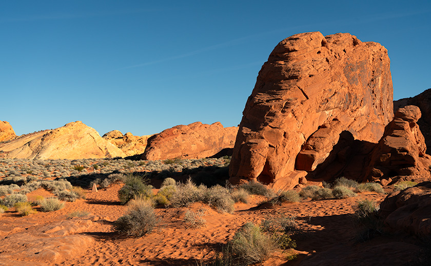
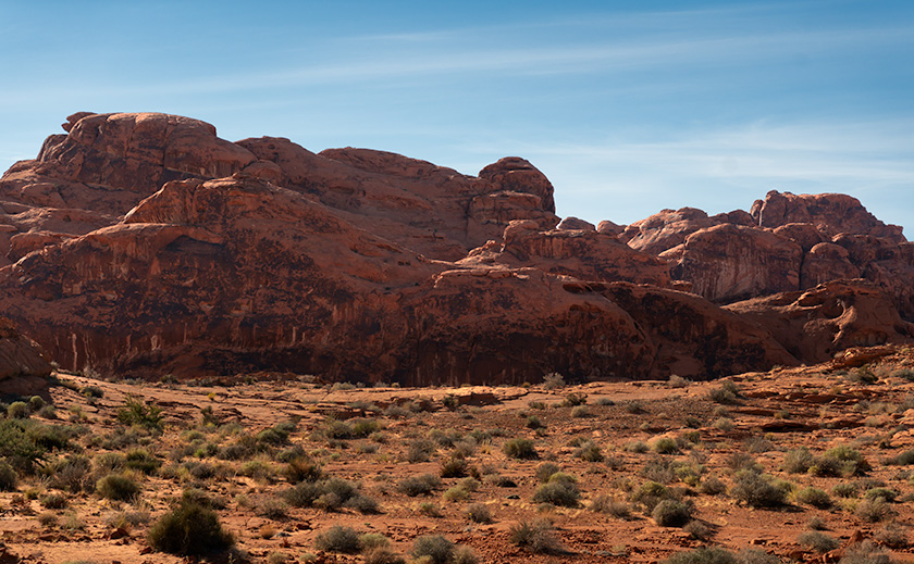
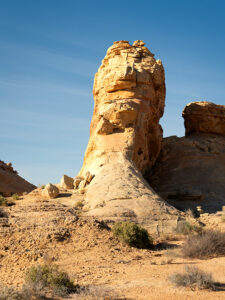
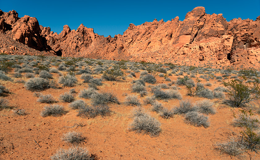
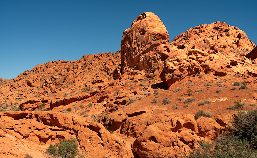
Valley of Fire, renowned for its blazing sandstone formations, is also a sanctuary for various desert flora and fauna. Amidst the rugged terrain, the creosote bush reigns supreme; its waxy leaves a testament to its survival prowess in the harsh climate. Accompanying it is the brittlebush, its silver-gray foliage contrasting starkly with the red sand beneath. These two species flourish in the Nevada desert; they show off with yellow flowers in spring.

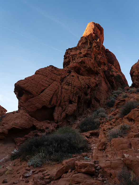
Wildlife enthusiasts might try to glimpse the desert bighorn sheep, masters of rocky terrains and cliffs. They usually hang out on ridgelines and cliff faces but come down for water in the mornings and at day’s end. The park is also home to the clever kit fox, the industrious black-tailed jackrabbit, and the elusive coyote, each playing their part in the desert’s symphony.

Photographic Pursuits Amongst the Desert Blooms

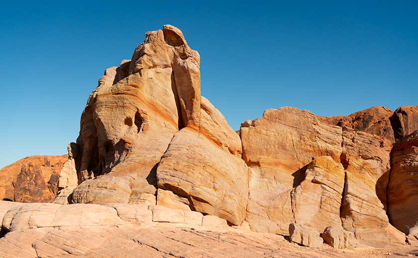
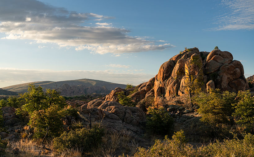
As a photographer, capturing the essence of this diverse ecosystem is both a challenge and a delight. The dance of light and shadow across the landscape breathes life into each image, from the delicate interplay of creosote branches to the fleeting moments of a bighorn sheep in motion if you’re ready with your long lens.

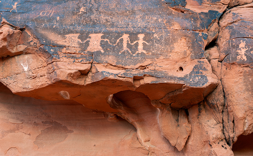
The park’s biodiversity extends beyond the reach of my lens, inviting visitors to look closer and discover the beauty in the details—the pattern of a lizard’s skin, the flight of a raven, or the vibrant hues of wildflowers that defy the desert’s aridity.

Red sandstone rock formation known as Red Turret amid desert shrubs in Valley of Fire State Park
Sentry of the Desert: The Red Turret’s Silent Watch in Valley of Fire – Amidst the sea of creosote and brittlebush, the Red Turret rises as a natural monument within Valley of Fire, echoing eons of geological artistry.

Beyond the Jackpot: Valley of Fire’s Call

So, next time you find yourself in Nevada, yearning to escape the neon lights, remember that just a stone’s throw from the buzz of Vegas lies a world abounding with natural wonders. Valley of Fire State Park offers a chance to reconnect with nature and experience Nevada’s quieter yet equally thrilling side.

Pack your hiking boots, bring your sense of wonder, and don’t forget your camera. The park’s trails await, ready to reveal the secrets of the desert. It’s an experience that promises to be as rewarding as any jackpot—perhaps even more so.

I have uploaded a larger version of this week’s featured image. You can see them on my website using this link < Jim’s Web> and on my Fine Art America Page by clicking here <FAA Page>. I hope you enjoy seeing them.

Next week, we begin a new project, and this time, it’s not a place but an event that motivated me to grab my camera and get out of the house.
Until our next adventure, may your curiosity be as endless as the desert skies and your spirit as resilient as the flora and fauna that grace this fiery valley.

Keep exploring, keep laughing.
jw

Techniques: Capturing the Desert’s Essence

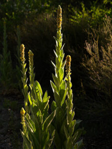
This week, let’s discuss capturing the subtle textures of the desert. I focused on the interplay of textures and colors when photographing the resilient creosote and brittlebush against the sandstone backdrop. The key is to find the right angle where the light enriches the colors without overpowering the delicate details of the plants.

In post-processing, I often use selective adjustments to enhance the flora’s vibrancy without losing the terrain’s natural ruggedness. If you get carried away with the adjustment sliders, you can overwhelm the subtle plant colors with too much contrast and saturation. It’s a delicate balance that, when struck, transforms a photograph into a window into the soul of the desert.

Gateway to the Past: Valley of Fire’s Petroglyph Canyon Trail Picture of the Week - Valley of Fire State Park, Nevada

A towering red sandstone rock formation standing prominently against a clear blue sky in the Valley of Fire State Park, Nevada.
Gateway to the Past – Standing tall amidst the Valley of Fire’s arid expanse, this sandstone sentinel bears the marks of time, its iron-rich facade a testament to nature’s artistry under the desert sun.

Welcome back to our Valley of Fire saga. After last week’s detour to a reemerged St. Thomas, we’re back on track, diving into the heart of the park’s ancient artistry. Ready for a journey through time? Buckle up; it’s not your average road trip.

Our Valley of Fire expedition began with a grand tour, taking in the vistas from the comfort of our trusty steed—the Turd. As usual, we took a lap around the park to set our bearings. The main road offered plenty of photo ops, but the real treasure lay off the beaten path—Petroglyph Canyon Trail. Here, amidst the whispers of history, we encountered the park’s silent storytellers: ancient petroglyphs.

In the middle of Lake Mead’s east-west reach is a lake section that ventures north into the Moapa Valley, where the Muddy and Virgin Rivers flow into the Colorado. This part of the lake is the Overton Arm. Nestled along the Overton Arm lies a canvas of ancient cultures. From the Anasazi to the Paiute, this valley served as a crossroads for tribes, traders, and travelers.

This week’s image is a scene that I shot along the Petroglyph trail. If you look closely, you’ll see the multitude of visitor footprints in the sand, and fortunately, there are several trail markers to guide the way. Without them, I’m sure I would have ‘taken the path less traveled’ and still be trying to find my way back to the parking lot. Several petroglyph panels are along the canyon’s nooks and crannies, including the one in this week’s second photo depicting several individuals dancing around the campfire. Possibly, they’re celebrating breaking par on one of the area’s nearby golf courses.

These petroglyphs, more than mere marks on stone, are the enduring legacy of the valley’s first inhabitants, capturing moments of joy, symbols of identity, and, perhaps, the earliest known complaints about traffic.

A detailed petroglyph panel featuring historical figures and animals, carved into desert varnish on red sandstone at Valley of Fire State Park, Nevada.
Ancient Petroglyphs on Red Sandstone – Valley of Fire – Whispers of the Ancient Winds: This petroglyph panel in Valley of Fire State Park offers a silent narrative of life long ago, etched into the canvas of time by the park’s earliest inhabitants.

As we stood before these ancient murals, it struck us: these were the original social media posts. Without a single hashtag, these images connected communities, shared stories, and even guided travelers. It makes one wonder what tales we would etch into stone for future generations to ponder. How can we guide those who follow if they can’t get reception?

Our trek through Petroglyph Canyon reminded us that some stories transcend time, etched in stone and the heart of the land itself. Have you encountered these timeless tales on your travels? Please share your stories in the comments and join us next week as we conclude our Valley of Fire adventure. If you’re curious, I have larger versions of this week’s photo on my Website < Jim’s Link> and my Fine Art America Page <FAA Link>.

Until next time, keep your spirits high and your humor dry.
jw

Techniques: Bringing out details using local contrast.

Sometimes, you’ve got to do a little tweaking to make your subject stand out. A case in point this week is the petroglyphs carved into the rock face seen in Ancient Petroglyphs on Red Sandstone. The red and black sandstone figures were flat and lifeless when I processed this image. In the old days, I would be stuck because there wasn’t a way to dodge or bun such a tight area without leaving a halo without making a contrast mask—a tedious process at best. In today’s Photoshop, there’s an easy way to lighten tight areas like the dancing figures on the wall.

This process takes a couple of steps. I first made a copy of the background layer and made it active; then, from the top menu, I chose Select>Color Range, which creates a mask from the color selection. Then, make a new Exposure layer and copy the mask to the new layer. The exposure layer’s properties lighten the masked areas from .05 to .25.

The second step is to choose a new Levels layer and copy the mask. Select the properties of your new mask and choose Invert. The mask should swap the black and whites. Next, select the properties icon (the graph) and darken the mid-tones by moving the middle slider until the middle-value box reads 0.95. Voalia, the figures now pop from the wall.

Twilight’s Ember: The Last Rays on Valley of Fire’s Red Rocks Picture of the Week - Valley of Fire State Park, Nevada

A towering red sandstone formation illuminated by the golden light of the sun, set against the clear blue sky in Valley of Fire State Park, Nevada.
Twilight’s Ember – A Natural Sculpture Carved by Time – Witness the interplay of light and shadow on the ancient red sandstone, highlighting the peak as if it were aflame in the heart of Valley of Fire State Park.

Last week, I shared a whimsical thought sparked by our visit to the once-submerged town of St. Thomas along Lake Meade’s shores. The idea? A short video starring our unwitting adventurers in an underwater exploration gone awry. With anything SCUBA, my thoughts invariably turn to the Poteets—Fred being a certified diving instructor. My idea instantly became a classic case of good and bad news. Deb quickly noted the absence of wetsuits in their wardrobe, while Fred, ever the sport, proposed renting them for our aquatic escapade. Thus, I spent the week crafting an epic screenplay for our faux underwater archaeology saga, ready for your enjoyment.


Not Quite a Fathom by Jim Witkowski

EXTERIOR SCENE. ZODIAC DIVING BOAT—DAY

The scene opens with FRED and DEB POTEET, waist up, sitting on the edge of a Zodiac diving boat. Clad in wetsuits, they finalize their snorkeling gear setup. Fred delivers the pre-dive briefing with a hint of solemnity.

FRED
(fiddling with a weight belt)
Remember, St. Thomas has been a memory under Lake Mead’s waters since 1938, untouched by time. The condition of the buildings is unknown, so let’s avoid the timbers.

The camera cuts to a tight shot of Deb; her concern is visible even behind the mask.

DEB
I hope we don’t stumble upon any forgotten skeletons.

Cutting back to Fred, his assurance is firm.

FRED
Fear not. Hugh Lord, the town’s final farewell, waved as the waters embraced his home in ’38. All were safe.

With a final gear check, Fred signals readiness.

FRED (continues)
Ready?

Both poised on the Zodiac’s brink, a countdown commences.

FRED
On three. One… two… three…

On three, Fred leans back and rolls off the Zodiac into the water, followed immediately by Deb.

Cut to a drone camera, tight on Fred’s shocked face.

As Deb turns to Fred, her expression seems to ask, “WTF?” The drone camera slowly pulls up, revealing they are lying face-up on the dry lakebed, their legs still resting on the side of the Zodiac.

The drone camera pulls back further, exposing the dry town site’s barren concrete foundations and pads. As it gets altitude, Fred and Deb stand up, now tiny figures in the vast, dry landscape, including the Muddy River bed.

The camera ascends, eventually dissolving into a Google Earth Studio shot of the Lake Mead Overton arm, zooming out until the entire planet fills the frame.

FADE TO BLACK.


It’s a masterpiece if I do say so myself. Now, about those props—does anyone have a Zodiac lying around? Or perhaps other treasures hidden in your garage that could bring our production to life? Share your ideas in the comments! But let’s pivot from our playful banter to the awe-inspiring beauty captured in this week’s photographs.

This week’s highlight is a breathtaking sandstone formation, its pinnacle bathed in the sunset’s final embrace. The iron oxide-rich layers glow, a fiery testament to Valley of Fire’s geological wonders.

The uplift and erosion revealing such splendor speak to the Basin and Range Province’s dynamic history. Here, the forces of nature sculpt masterpieces: holes carved by chemical reactions with rainwater, alcoves shaped by the relentless wind, and striations etched by the journey of rainwater.

Thank you for joining us on this adventure. As the Superbowl looms, I wish your team luck and, perhaps more importantly, that this year’s commercials bring us joy. Next week promises more marvels from Valley of Fire. Don’t miss it.

Till then, keep your camera at the ready and your humor dry.
jw

A towering formation of layered Navajo sandstone, named 'whiteGibraltar', stands under a clear blue sky in Valley of Fire State Park, Nevada.
White Gibraltar – The Navajo Sandstone Giant of Valley of Fire – A Vision in Sandstone – Rising from the Valley of Fire’s rugged landscape, this pale monolith echoes the grandeur of its namesake, standing as a silent sentinel in the desert sun.

Techniques: Exposing for the Highlight

I spotted the Aztec Sandstone formation while returning to the Turd on a trail hike at the end of the day. My eye was drawn to the very tip of the pinnacle, still glowing in the sun like the flame on the Statue of Liberty or ET’s finger. I knew that if I exposed the shady part of the sandstone, the finger would wash out the nice red color. So, to retain that glow, I pointed my camera at the sky above the finger, half-pressed the shutter to freeze the exposure reading, and slowly lowered the camera to include the rest of the scene.

The raw image looked too dark, and I almost rejected it. However, in post-processing, I could mask off the bright areas and increase the shadows by almost two F-stops. That was enough to bring out the erosion holes and keep the glow on ET’s finger.

Nature’s Palette: Exploring the Red Sandstone Masterpiece at Valley of Fire Picture of the Week - Valley of Fire State Park, Nevada

Red sandstone formations at Valley of Fire State Park, symbolizing the beauty of geologic processes over millennia.
Red Dune Wall in Valley of Fire—A Study in Erosion and Time – The ‘Red Dune Wall’ is a testament to nature’s artistic hand, sculpting the Valley of Fire State Park landscape through the relentless forces of wind and water.

Greetings from the Nevada desert, where Queen Anne (aka Lefty) and I embarked on a wild escapade, armed with nothing but our cameras and a sense of adventure that’s as robust as my morning coffee—deceptively strong and slightly bitter.

It all began in a Mexican restaurant in November, where we had planned to wrestle with the wilds of Gold Butte National Monument. But as we surveyed our gear, we realized we were about as prepared as a fish on a bicycle. With a sigh that echoed off the terracotta walls, we decided to pivot faster than a gambler on a losing streak.

So there we were, poring over maps and munching on nachos when the Valley of Fire State Park flickered onto our radar like a beacon of salvation—or at least a beacon of cell service and paved roads. It was a unanimous decision, fueled by the promise of not getting stuck and the allure of a good story to tell.

After a hearty debate over hash browns and highway maps at Peggy Sue’s Diner the following day, we plotted a less ‘Oregon Trail’ course and more ‘Sunday drive.’ We planned to loop through Overton, graze the shores of Lake Mead, and enter the Valley of Fire from the east, with a sunset deadline to beat the buffet back in Mesquite.

On a whim, we decided to pay our respects to the submerged ghost town of St. Thomas, which was now high and dry thanks to the ever-thirsty sun. The remains were intriguing, but we passed on the hike, preferring to keep our boots dust-free. Instead, I hatched a master plan to lure our friends—the Poteets—into a Jacques Cousteau-style watery charade involving wetsuits and mock-panicked flailing for a film I’d tentatively titled The Great St. Thomas Aquatic Caper.

A towering rock formation known as Silica Dome against the clear blue sky in Valley of Fire State Park.
Silica Dome—The Sentinel of Valley of Fire’s Rocky Landscape – Experience the ‘Silica Dome’ grandeur at Valley of Fire State Park through this captivating image, highlighting the intricate layers and history etched in stone.

As the day wore on, we wandered among the storied stones of the early Jurassic Era. Like Whitney Pocket, these rocks were part of a grander narrative, a to-be-continued tale of petrified dunes stretching from Zion to the Grand Staircase and beyond. The Valley of Fire’s chapters were penned in red Aztec sandstone hues and crowned with white Navajo crests, a chronicle of time written in Earth’s hand.

This week’s photographic heroes are a testament to this fiery anthology. The main photo—a regal formation of red Entrada sandstone—is the park’s namesake, standing proudly amidst the Mojave’s scrappy flora. The supporting act, Silica Dome, wears a coat of Navajo Sandstone, pale and majestic against the desert sky. Together, they tell a story of a sea that once was and dunes that danced in the wind before time turned them to stone.
So, dear readers, come for the photos, stay for the tales, and return next week for another chapter in our desert saga. Will the Poteets make a splash in their wetsuits? Will Queen Anne ever forgive me for the early morning escapades? Find out in the next installment of our arid adventures.

Until then, keep your lenses clean and your humor dry.
jw

Techniques Unveiled: A Tale of Two Sandstones

In the photographer’s toolbox, contrast isn’t just about light and shadow—it’s the story of elements, epochs, and the Earth’s grand design. This week, I set out to capture a tale of two sandstones, a narrative etched into the very landscape of Valley of Fire State Park.

Our lead image, Nature’s Palette, is a canvas painted with iron-rich sandstone, a souvenir from the mid-Jurassic era. Here, the dunes are frozen in an eternal dance, caught mid-twirl by the relentless grip of pressure and heat, akin to the timeless beauty of Canyon de Chelly and the famed arches of Moab. Look closely, and you’ll see the canvas of the ancients—the water-stained varnish that once served as a blackboard for the Fremont and early Pueblo people to etch their indelible art.

The supporting act, Silica Dome, steps onto the stage from a later act in Earth’s drama under the watchful gaze of T-Rex and company. It’s a piece of the past where the climate was as dry as a prohibition-era bar, and vast sandy beaches fringed an ancient inland sea. In this shot, we confront a dune face-to-face, observing its neighbors’ retreat under the onslaught of time, exposing it to the elements that now conspire to return it to its granular beginnings.

I’ve served up larger versions of these geological delicacies online for those hungry for more than just a visual snack. You can feast your eyes on them via the links on my website—< Jim’s Web Page>—and their respective galleries on Fine Art America—<FAA Link>. Or click on the images peppered throughout this article for an instant teleportation to their online abodes.

Your thoughts are the garnish to our digital dish, so please sprinkle liberally in the comments section below. What stories do these ancient stones whisper to you?

BTW:
Last Tuesday, I released another video in my portfolio series on YouTube. This vignette is about the beauty of Arizona’s Farmlands. The five-ish-minute-long video is now online, and you can use this link to see it: <YouTube Link>.

Awakening of the Granite Giants Picture of the Week

Golden morning light illuminating the rugged landscape of Granite Dells, with Glassford Summit in the background.
Awakening of the Granite Giants – A mesmerizing view of the Granite Dells under the soft glow of the morning sun, casting a beautiful light on the weather-worn rocks with Glassford Summit standing majestically in the distance.

My calendar page flipped to August this week, and that means that summer’s half over. In standard years, we would have been inundated with monsoon rains and antsy for the wet season to end. But, in this most unusual year, we’re waiting for the rains to start. We often see afternoon clouds here in Congress, Arizona, but they’ve only been a tease. The new month also means a new photo project, and I decided to stay in the high country—if you consider Prescott the highlands. We will wander the trails in the Granite Dells to capture its natural beauty and fill in my Website portfolio. The exposed cracked and worn boulders are common throughout Arizona, but this patch is the only city park.

The Granite Dells of Prescott, Arizona, is a geological wonder with around 1.4 billion years of history. Their formation began deep beneath the Earth’s surface, where molten magma slowly cooled and crystallized into hard, dense granite. Over hundreds of millions of years, erosion wore away the rock layers above, revealing the granite bedrock. Once exposed to the atmosphere, the granite underwent spheroidal weathering, a process that smoothed its corners and edges into the distinctive, boulder-like shapes we see today. This weathering, coupled with millions of years of further erosion, has sculpted the Granite Dells into their current, stunning form, with the boulders providing unique habitats for diverse flora and fauna.

Close-up study of Common Mullein stalks, brightly lit against a darker, out-of-focus background.
Majesty in the Ordinary – An intimate view of Common Mullein stalks bathed in the golden morning light, their unexpected elegance highlighted against the darker foliage of the Granite Dells.

We will start this month’s photo tour of the Dells with a long shot I took at dawn while hiking the Constellation Trail. At that hour of the morning, I thought I’d have the place to myself, but the parking lot was half full when I arrived, and true to form, I was in everybody’s way as I trudged along with my camera. I was in the middle of the loop when the sun emerged above the cloud layer along the horizon, casting a golden light on the rock formation before me. I can’t begin to tell you how delighted I was to see how it showed off the rounded shape and texture of the granite boulders. The Dells have a sense of anchor in their surroundings with the radio-tower-topped Glassford Summit. I call this week’s image Awakening of the Granite Giants.

We’re so glad that you joined us on the trail this morning. Throughout the rest of the month, we’ll share more images taken on tracks running through Prescott’s most significant city park. And you can count on us to dig up more interesting trivia about the Granite Dells. If you’d like to examine larger versions of Awakening of the Granite Giants, you can visit its page on my Website by following this link (Jim’s Website). You can also pixel peep on my Fine Art America posting by following this link (FAA Post). Be sure to return next week when we present another image of the intriguing Granite Dells.

Till next time
jw

Techniques: Restoring Dark Areas In Back Lit Images

In last week’s session, I showed how I manage shots to prevent blowing out the highlights when shooting in lighting conditions too broad for the camera’s sensor to capture—like the dawn, dusk, or back-lit situations. We concluded that discussion by predicting that the darker areas would be too dark to be pleasing. In this post, I will explain how I balance the exposure in Photoshop so the image looks natural.

Quick Selection Tool - I use this tool in the Tool Palate to select the areas that I want to work. It's the fastest and most accurate selection tool in Photoshop.
Quick Selection Tool – I use this tool in the Tool Palette to select the areas I want to work on. It’s the fastest and most accurate selection tool in Photoshop.

Artificial Intelligence (AI) has recently been in the news, with stories ranging from how it helps doctors find cancer in patients earlier to how it will eventually eat our brains—like Zombies. Well, Adobe has an AI-driven tool in Photoshop that enables you to select complex areas of your images. It’s called the Quick Select Tool. It seems to be mainly used to cut models—and their fly-away hair—from one background so they can be pasted into another. I use it to select the dark areas in my landscapes that need lightening. My process involves three steps: Selecting, Refining, and Correcting.

Refine Selection Workspace - With this tool, you can nudge and perfect which areas you want to be active within your adjustment layer.
Masking Workspace – With this tool, you can nudge and perfect which areas you want to be active within your adjustment layer.

After doing my color corrections and setting my Black and White points in my workflow, I try to balance my image’s exposure. Using the Quick Select (QS) Tool, I roughly select the area I want to work with, and that’s usually everything below the horizon. At this point, I’m not trying to be precise. After I drag the QS brush over the area I want to modify, I click on the Select and Mask button at the top of the workspace, which opens a Masking Workspace showing the selected areas of the image. I use a red mask set to 40% opacity to see which areas of the image will be affected by the following steps. Within the right panel, there’s a bunch of number settings that I’ve fiddled with over the years before settling on these: Radius=0, Smooth=2, Feather=2.5px, Contrast=25%, and Shift Edge=-2% (be sure to check the tiny little box tabled ‘Remember Settings‘ otherwise you’ll constantly have to reset these values). Using these values, I choose the Brush Edge Tool—the second from the top in the brush palate—and run it along the edge of the selected areas. What the AI does for me is pick out all of the little trees and other objects (like the leaves in the second photo this week) and separate them from the sky—an otherwise impossible task. Once I’m happy with the selection, I click ‘OK,’ the screen returns to the original workspace with the selected area now outlined with ‘dancing ants’—a term used to describe the animated dotted line showing the selection.

The next step is to correct for the darkness, and to do that, I choose a new Exposure layer from the list, which opens with the new mask in place. In the new layer, I use the slider to adjust the area to the lightness that looks good to me—usually between ¼ to a complete stop (.25-1.0), but with the sensor on my Sony camera, I’ve been able to lighten the dark areas by 2½ stops without causing a loss of detail in shadows or other unwanted digital artifacts (such as pixelation or banding).

Remember, by working with layers, you can go back and change your adjustments later. Also, remember to save your work frequently, especially after making significant adjustments.

Valencia Peak Vista: Capturing the Essence of Montaña de Oro Picture of the Week - Morro Bay, California

Landscape view of Bluff trail winding through grassy field with majestic mountains in the background at Montaña de Oro State Park in California
Valencia Peak Vista: Capturing the Essence of Montaña de Oro – Immerse yourself in the breathtaking beauty of Montaña de Oro State Park as you follow the beautiful Bluff trail, surrounded by rolling grassy fields and towering mountains. Discover this hidden gem’s serenity and natural wonders on California’s central coast.

Welcome back to our San Luis Obispo County project. As I tried to explain last week, it’s one of our favorite spots on the planet. Usually, the purpose of our trips involves wine tasting, so we spend most of our time traveling the roads that run past the vineyards and traverse the coastal mountains—the Santa Lucia Range. With an extra day set aside for photography, Queen Anne and I made a pact to explore places in San Luis Obispo County that were new to us.

On the morning of our shoot—after I dragged her majesty out of bed while we ate breakfast—I showed her a road I found on our California Gazetteer. It began in Morro Bay and made its way along the coast on the Montaña de Oro headlands to Pismo Beach. I told her my plans to drive down to the resort town and then return via the 101 Freeway. She thought that was a great idea as long as there was a candlelight dinner and a glass of Chardonnay at the road’s end. However, halfway through the drive, we found a locked gate preventing us from going further. It turned out that someone built the Diablo Canyon Nuclear Generating Station in our way and closed the road—how inconsiderate.

Our day wasn’t a total loss because, between Morro Bay and the gate, we drove through three nature preserves: Morro Bay Estuary, El Morro Elfin Forest, and Montana de Oro State Park. Since we had to double back, I’d have to settle with subjects along our route—oh, pity the poor photographer because each place is worthy of an afternoon—if not longer.

Morro Bay Estuary: A coastal wetland teeming with diverse wildlife and stunning vistas. A network of trails to explore that wind through the estuary offers opportunities to spot various bird species, including majestic herons and graceful egrets. If you remember to bring your mukluks, you may even try digging for clams or annoying the critters you’ll find in the tidal pools.

El Morro Elfin Forest: Unique and magical woodland. Marvel at the twisted, dwarfed trees that named the forest, creating an ethereal atmosphere. Stroll along the well-maintained trails, enjoying the tranquil ambiance and the delicate balance between the forest and the surrounding coastal dunes. Keep your eyes peeled for rare plant species and enjoy the peaceful serenity of this hidden gem.

Montana de Oro State Park: A coastal paradise of rugged cliffs, golden beaches, and sweeping vistas. Hike along the stunning bluffs overlooking the Pacific Ocean, witnessing the power of crashing waves and the dramatic coastal scenery. Explore the tide pools, where you can encounter a fascinating array of marine life, and venture further into the park to discover hidden coves and secret beaches.

I took this week’s image at the Bluff trailhead in the State Park. From the parking area, we had a choice of taking the trail down to the ocean or venturing across the street to embark on the course that led us into the majestic mountains. As we made our way along the path, the peaks rising to Valencia Peak stood before us, their commanding presence adding a sense of grandeur to the surrounding landscape. Amidst this natural beauty, my attention was drawn to the display of a bright orange Indian paintbrush. I knew that capturing this scene would encapsulate the essence of Montaña de Oro’s breathtaking vistas.

We invite you to visit the web version of this image, where you can view a larger version of Valencia Peak Vista: Capturing the Essence of Montaña de Oro. Immerse yourself in the stunning scenery, the rich colors, and the sense of serenity captured in this image. It’s a visual testament to the beauty in San Luis Obispo County.

Mark your calendars, and come back next week for another captivating tale and image. Until then, keep exploring, keep capturing moments, and remember that every step you take can lead to new and remarkable discoveries.

Till next time
jw

Techniques: Utilizing Leading Lines in Your Photographs

Leading lines such as the trail, the line of peaks, and the swale in this week’s image are powerful compositional elements that add depth and guide the viewer’s eye through the image. They create a visual pathway, drawing attention and creating a sense of movement. Whether straight, diagonal, or curved lines enhance the overall composition and introduce a three-dimensional quality.

These lines don’t have to be literal; the arrangement of objects or elements can imply them. By utilizing leading lines effectively, you can elevate your images’ impact and storytelling potential, inviting viewers to explore and discover hidden depths within the frame.

You can transform a simple scene into a captivating visual story by incorporating leading lines into your photography. Experiment with different types of lines and their placement to create a dynamic narrative within your image. Consider how leading lines interact with other elements and the mood they evoke.

Courthouse Yard The Town Too Tough to Die

Courthouse Yard - The tall brick wall surrounding the Tombstone Courthouse yard conceal the gallows within them
Courthouse Yard – The tall brick wall surrounding the Tombstone Courthouse yard conceals the gallows within them

Whenever I visit Tombstone, it takes me a while to get oriented. But when I see a town map, I understand why. Unlike most communities established in the Mormon Territory of Deseret, the streets aren’t aligned to the compass points and aren’t centered on an intersection named Central and Main. Instead, the town is 45° off the compass; there’s no Central Avenue, and Allen Street substitutes for Main Street. Given Tombstone’s distance from Salt Lake City and its rough and tumble history, I don’t suspect its citizens weren’t concerned about religions.

When I visit the “Town Too Tough to Die,” I consider the OK Corral its social and geographical heart. As I stand on the corner of 3rd Street and Allen and look the town over, I see the streets lined with one and two-story old wooden buildings. They’re either painted in bright colors or left in their natural dull brown finish. The only exception is a block southwest on 3rd Street. There you’ll see a large two-story brick building trimmed on each of its angles with white stones. On top is a cupola festooned with a widows-walk. The first time you see this pearl before the swine, you instantly know it must be important. It was—is. It’s the original Cochise County Courthouse.

It only took five years from the silver find to the OK Corral gunfight. In that brief time, the population swelled to 7,000, and robberies and lawlessness ran rampant. Wikipedia notes, “Except for the Earp–Clanton feud, which gave Tombstone an extremely bad press—from which it has no interest in recovering—citizens gladly accepted the proffered alternative.” The townspeople wanted a change. More importantly, miners had to make a two-day journey to Tucson to file a new claim. In 1881 two historical events happened; the shootout and the state legislature carved Cochise County out of Pima and made Tombstone its seat. The irony of those events and building the courthouse a block away from the Corral the next year isn’t lost on me.

By 1929 the silver played out, and Bisbee became the next boom town. The copper strike there required more men to work the mine. With a larger population, Bisbee won the county seat in an election, and the government offices moved 25 miles down the road. The old courthouse sat empty between 1931 and 1955. That’s when the local historical society took an interest in it. They began restoring and lobbying using local contributions until the Arizona legislature declared it an Arizona State Park.

In this week’s featured image, I call Courthouse Yard, I tried to capture the gingerbread and grandeur of the red-brick building, but I wanted to emphasize the wall surrounding the side yard. Inside those enclosures is where convicted murderers met justice at the gallows. The first hangings were the perpetrators of the Bisbee Massacre in 1883, while the last was the two men that killed a sheriff and deputy at the Wilson Ranch Shootout in 1899. The tall brick walls were designed to shield the gentle public from the gruesome hangings, but most of the town went inside and watched through the second-floor windows anyway. Incidentally, I like the foreboding clouds hanging above the courthouse.

You can see a larger version of Courthouse Yard on its Webpage by clicking here. I hope you’ll join us next week when we tell another thrilling tale from yesteryear in Tombstone.

Till next time
jw

BTW:

We’re planning to visit Temecula, California, wine country, in the upcoming weeks. I hope to bring home a bottle or two along with the pictures and stories we gather.