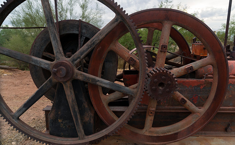
Last week, we left Oatman looking more ghostly than a town with a future. But then the mid-20th century rolled around, and everything changed like a plot twist in a spaghetti western. It started with a need for flood control and water conservation, a task as ambitious as teaching a cat to swim. Enter the Bureau of Land Management with its dam-building frenzy. They tamed the Colorado River, creating recreational oases like Lake Mohave and Lake Havasu, inadvertently setting the stage for Oatman’s second act.
Meanwhile, Don Laughlin, a casino mogul with an eye for opportunity sharper than a cactus spine, flew over the Colorado River en route to Kingman. Spotting a riverside motel in 1964, he didn’t just see a run-down building; he saw a neon-lit future. Don transformed the motel into the Riverside Resort, where you could lose your nickels in slot machines and gain a few pounds with 98-cent chicken dinners. This move ushered in a casino boom, turning Laughlin, Nevada, into a gambler’s paradise across the river from Bullhead City.
Not to be outdone, Robert McCulloch, a chainsaw magnate with an affinity for outboard motors and grand gestures, bought a swath of lakeside property. He didn’t just stop at creating Lake Havasu City; he went full theatrical by importing the London Bridge. Yes, that London Bridge—which he rebuilt in the middle of the desert. The Brits scoffed, the Americans gawked, and tourists flocked in droves.
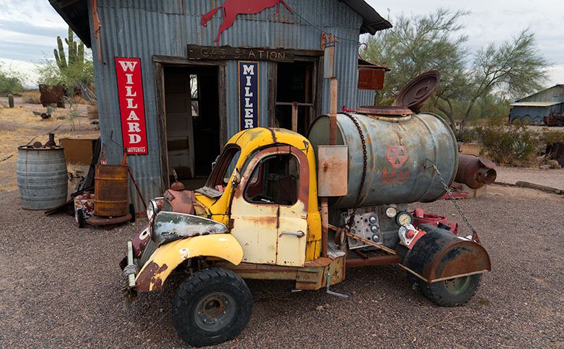
But Oatman’s real comeback hinged on a nostalgia trip kick-started by Angel Delgadillo, a barber from Seligman with more vision than a Route 66 tourist with a pair of binoculars. In the 1980s, as Interstate 40 siphoned off Oatman’s traffic, Angel founded the Historic Route 66 Association of Arizona. He campaigned to get the Mother Road recognized as a Historic Route, sparking a revival that put Oatman back on the map. Suddenly, tourists craved an authentic slice of Americana, and Oatman served it up with a side of staged shootouts.
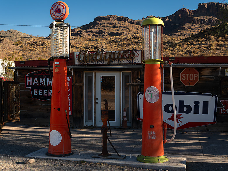
The final puzzle piece was the cultural shift in San Francisco in the late ’60s. A generation enamored with art, nature, and history began resurrecting Victorian homes with colorful paint jobs that’d make a peacock jealous. This love for the old and quaint spread to Arizona, and towns like Oatman reaped the benefits. The once-desolate streets now buzz with shops, tourists, and the occasional wild burro, all basking in the glory of a Route 66 renaissance.
So there you have it: a cocktail of dams, dreams, and a dash of historical reverence, shaken not stirred, brought Oatman from the brink of becoming a forgotten footnote to a must-visit destination on the map of Americana.
Oatman Hotel
In the heart of Oatman, where the Wild West refuses to be tamed, stands the Oatman Hotel. Its story begins in 1902, opening its doors as the Drulin Hotel, a name as sturdy as the building itself. It was more than just a hotel; it was a beacon for weary gold miners, travelers, and anyone looking to swap tales over a stiff drink. Its walls, if they could talk, would spin yarns of dusty days and golden dreams.
Like a determined prospector, the Drulin Hotel embraced change as time passed. It donned a new name, becoming the Oatman Hotel, as if shedding an old skin to reveal a more refined identity. This wasn’t just a name change, a rite of passage, and a nod to the town’s enduring spirit.
The Oatman Hotel wasn’t just any stopover; it became a slice of history, a living museum with beds. It earned its rightful place as a registered historical building, a title as prestigious as a sheriff’s badge. Its walls, now seasoned by time, became a gallery of memories, each room whispering secrets of the past.
But wait, there’s more glitz to this tale. The Oatman Hotel, with its rustic charm, caught the eye of Hollywood’s finest. None other than Clark Gable and Carole Lombard, after their 1939 Kingman courthouse wedding, chose this very hotel for their honeymoon. Imagine that! Hollywood royalty, nestled in the embrace of the rugged Mojave. Their stay added a sprinkle of stardust to the hotel, making room 15 forever a shrine to their love.
The Oatman Hotel stood tall through booms and busts, a sentinel of history. It watched as Oatman ebbed and flowed yet remained steadfast as ever, a reminder of the golden days and starlit nights.
We hope you enjoyed our time in Oatman. As usual, larger versions of this week’s image are on my website < Jim’s Web> and Fine Art America <FAA Link> for you to examine. Be sure to return next week when we begin a new project. For February, we’re returning to nature an hour north of here.
Till then, keep your spirits high and your humor dry.
jw
Techniques: Capturing Oatman’s Palette
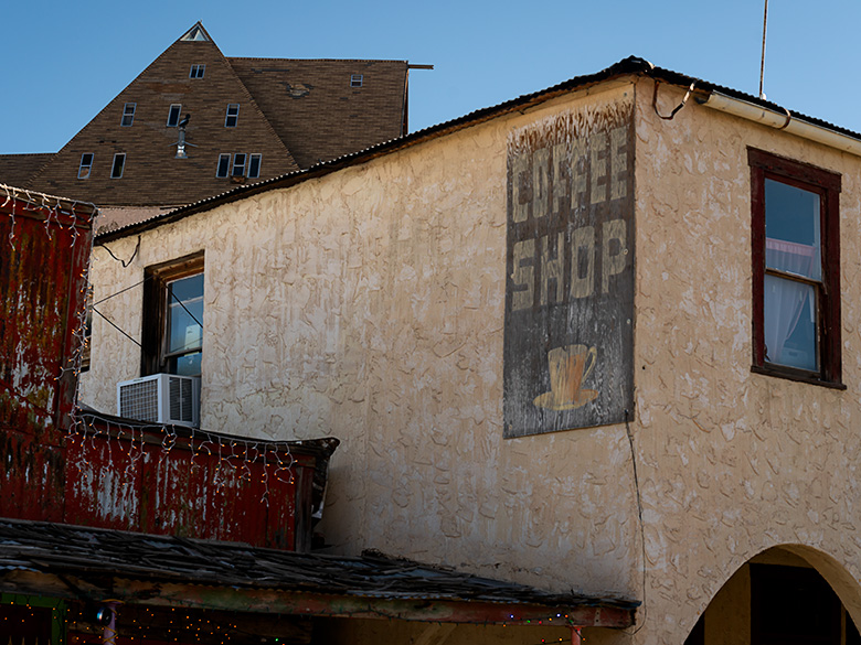
In this week’s snapshot, the Coffee Shop sign of the Oatman Hotel is a beacon of nostalgia in a sea of architectural chaos. But why this particular sign, you ask? Well, it’s all about perspective and a little artistic rivalry.
On the flip side of the hotel, there’s another sign vying for attention. But there, the Coffee Shop sign gets overshadowed, like an understudy in a Broadway show where the lead refuses to call in sick. The other side also features the Oatman Hotel’s sign, turning the scene into a visual shouting match where the quaint charm of the coffee shop gets drowned out.
Now, let’s talk about setting the stage. The chosen angle for this week’s photo is like a Cubist’s dream from the 1950s, where geometry and color come together in a symphony of shapes. We’ve got the white stucco of the hotel, a daring triangle of an A-frame house peeping from behind, and the bold red facade of the neighboring bar. It’s an ensemble of structures, each playing its part in framing our star sign.
These buildings create a natural frame, like ushers in a theater, guiding your gaze to the center stage where the sign takes its bow. This arrangement keeps the viewer’s eye dancing around the central focus, ensuring the sign isn’t just seen but experienced.
And let’s not forget the grand finale of colors—a patriotic red, white, and blue – tying this month’s photos together like a well-rehearsed chorus line. Each hue plays its part, creating a visual melody that’s distinctly Oatman, distinctly Americana.
So there you have it, a behind-the-scenes peek at how a simple choice of angle and a keen eye for color can turn an everyday scene into a snapshot that captures the essence of a town with as much character as Oatman.