I may not be the rugged outdoorsman that I appear to be. Until two years ago, Queen Anne’s and my camping world revolved around our little Casita trailer. We took it everywhere, from the Grand Canyon to Alaska. However, we had to part with it due to unforeseen circumstances and began using motels for our overnight trips.
As much as we enjoy watching The Big Bang Theory reruns in our motel room at night, it’s not the same as sitting around a campfire under the stars and eating Jimmyums. Recently, I decided that I would get back to basics on my next photo shoot—and the perfect opportunity was coming up.
Queen Anne’s Adventure
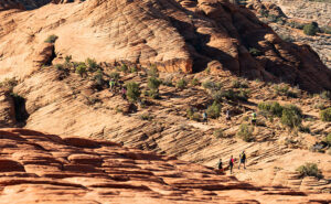
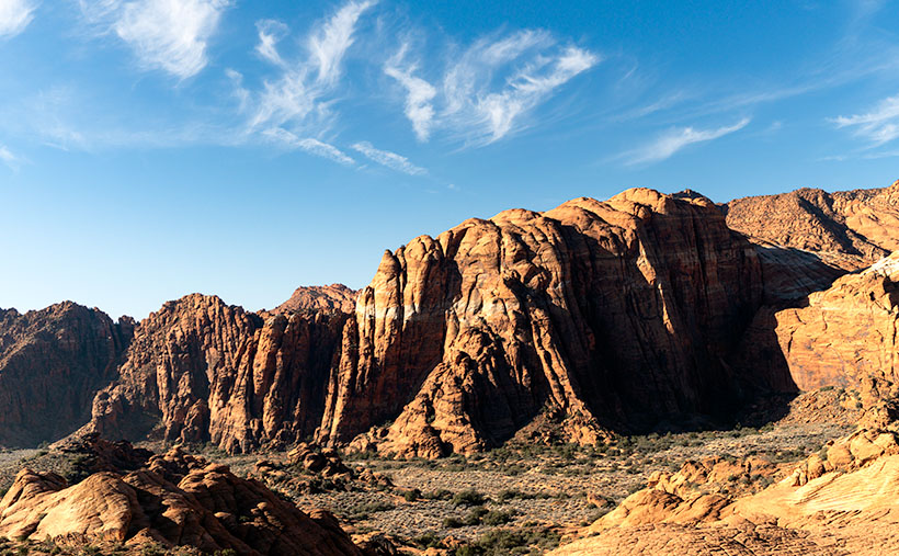
Anne’s sister Jane called about one of her bucket list items: a road trip to Utah’s Mighty-Five National Parks. Anne jumped at the chance to travel with her sister and even offered to drive. Their tour started for two weeks but got whittled down to a week by the time they left. While they were off ‘Thelma and Louise’-ing their way across the Beehive State, I decided to use that time to explore the Bears Ears National Monument near Blanding. After all, when we bought the Turd—my RAV4—I made sure there was room for me to stretch out in the back.
Preparation for the Trip
As I prepared for my adventure, I dug out the remains of our camping gear from the attic and added some kitchen items to augment them. Since I’d be alone, I bought a bunch of canned goods for food, reducing the need for an ice chest. I always heated them on my single-burner propane stove when I camped as a younger man. Besides, Cup-O-Noodles and coffee make for an easy, warm meal on those chilly mornings.
One thing I splurged on was a heavy-duty air mattress. I can no longer tolerate sleeping on a hard surface without a cushion. The one I bought from Amazon was designed to fit in the back of SUVs. It’s T-shaped and broad at the back doors, then narrows between the wheel wells. Another nice feature is that each side inflates independently—so I could pack my camp boxes on the deflated side while day traveling. Did I mention that it was guaranteed not to leak? Yeah, about that…
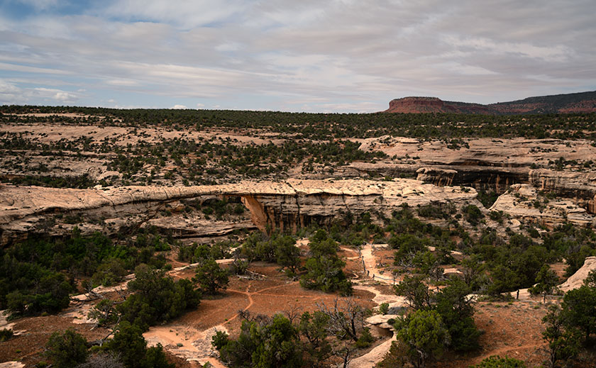
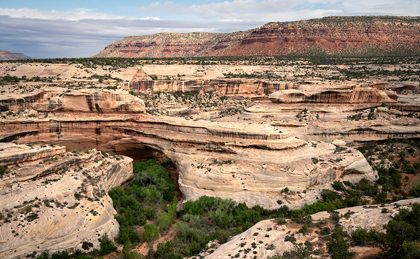
Once the girls got a head start, I carefully packed my new mattress, all of my photo gear, plenty of clean socks and undies, and the rest of my provisions into the Turd and set off on my 9-hour journey to Natural Bridges National Monument in Utah. On the road again—what could go wrong?
The Struggle
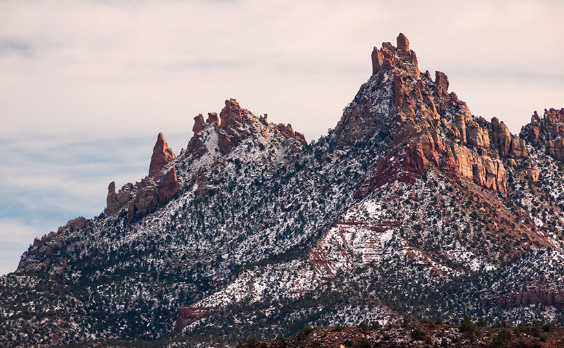
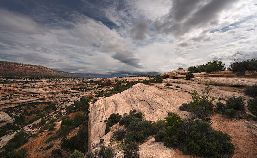
I arrived at the park after 4:00 p.m., so the campground was full. I expected that, but the BLM runs the Mani-La Sal forest, so throw-down camping is permitted, and I had ample time to find a good spot. Before long, I backed into a lovely level spot surrounded by Ponderosa pines beneath the towering red cliffs of Bears Ears.
The air had a damp-cool chill, so I put on the sweater I brought before setting up camp. Since I didn’t have a table, I used my sturdy camp box for one, which doubled as an ottoman after dinner. I stowed the rest of my boxes on the truck roof to keep them out of the dirt.
After emptying the back of the Turd, I unrolled my mattress and started inflating it using the portable pump that it came with. Before I began to inflate the passenger side, I looked closely at the sky and felt it would rain, so I moved the rest of my boxes back inside along the flaccid side of the bed. It cramped my bed space, but I’d be fine since I wasn’t planning on spooning with a bear.
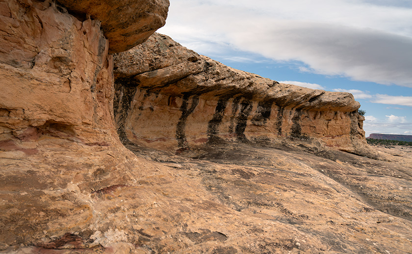
Before dinner, I had time to wander and capture video clips of the red cliffs and trees in the sunset. Upon returning to camp, I prepared an Epicurean meal of warmed-over canned ravioli, a cup of peaches, and a cup of tapioca pudding. As the night grew late, I gathered my things and climbed into the back of the truck. Ah! The life of Reilly.
Outside was silence except for the trees rustling in the gentle breeze—a cowboy’s lullaby. The yellow moonlight was coming in the passenger side windows as I dozed off. I watched it a bit before snuggling into my sleeping bag as sleep crept over me.
The next thing I knew was feeling uncomfortable and opening my eyes to figure out the irritation. The moonlight was now at the back door, so hours must have passed. The mattress still had air, and the sleeping bag was warm. What’s nagging me? Then it hit me: as an old man with a prostate the size of a grapefruit, I had to pee. The one thing that I hadn’t taken into consideration. I needed to get up and out of the truck—NOW.
First, I untangled myself from the twisted sleeping bag and opened the zipper. I began feeling around for my boots, and as I tried to put them on, the laces were tight, so I had to fix that. Once I had them on my feet, I opened the door on my right. While grabbing the handle over it, I tried lifting my legs and pivoting them out the opening, but my right leg got caught in the useless seat belt harness. After freeing myself from the straps, I successfully extracted myself. As I slowly unrolled into a standing position, my back said, “Don’t ever do that again.” But it was not to be. Simone Biles would have been proud to pull off that gymnastics routine once, but I did it three more times that night—and my back seized up in protest.
Where’s My Towel?
I could barely walk when I got out of the truck the final time. Dawn lit the eastern sky, so I hobbled over to my chair and managed to put on a pot of water. As I sat and drank my instant coffee, I pondered my predicament. I had driven a long way and hadn’t snapped a single photo, but I certainly couldn’t spend another night injuring myself in the truck. Not until I can figure out a better method of extracting myself.
I threw in the towel. After my coffee, I started packing the truck, including the camp box that was now too heavy for me to move. I had to remove its contents, then drag the big empty box into the Turd, and finally repack it.
Play Through the Pain
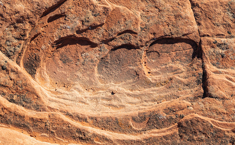
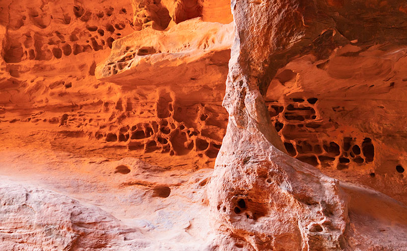
After I had loaded the RAV4, I drove back to the park’s visitor center. It was closed, and I had the entire park to myself. I convinced myself that I could do some shooting even if it meant not hiking down into the canyons. So, as daylight broke, I raced another car from Texas from overlook to overlook, taking pictures. Where the hikes were level and short, I walked like Quasimodo, pulling myself on the handrails where I could.
Notes To Future Self
After I returned home and reviewed my images on the computer, I was happy to find they were publishable—I must have been on auto-pilot. They weren’t the ones I hoped to get, but that encouraged me to return soon. Even hiking in pain may have been beneficial. My back feels much better after a week of rest and light work. The constant low-level pain is there, but that’s how people my age know which of their body parts are still attached. I also conjured some strategery for the next trip—like providing a handy stash for my car keys, opening the tailgate with my remote, and then rolling over on my hands and knees and backing out that door. I’m also going to keep a pair of loafers in the Turd.
Thank you for joining us again this month. I hope you enjoyed my Utah horror story more than I did. As we customarily do, larger versions of my photos are available for you to examine on my website <Jim’s New Work> and on the pages that I created on Fine Art America <FAA Page>. They will be on display for three months before being rotated. Finally, Queen Anne and I can hardly wait to hear the ribbing you’ll give in the comment section. Please share your thoughts about the photos, camping, Utah, or travel horror stories. We love to hear from you.
Until then, keep your spirits high and your Ben Gay handy.
jw.