Erosion and Elevation: Arizona’s Basalt Playground Picture of the Week - Wikieup, Arizona

A sun-kissed Arizona landscape showcasing erosion patterns on basalt rock formations, a tear in the earth, and desert flora like Palo Verde and Saguaro.
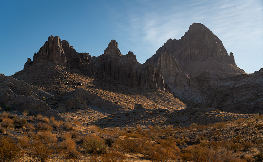
Erosion and Elevation: Arizona’s Basalt Playground – This striking photograph captures the complex topography along Arizona’s US 93. Late afternoon light bathes a basalt outcrop and highlights the intricate erosion patterns, casting dramatic shadows across the earth. A tear-like ravine carves through the landscape, bordered by softly rolling hills and rugged cliffs. The terrain is dotted with native flora, such as Palo Verde trees and Saguaro cacti. Above this awe-inspiring scene, cumulus clouds meander across the sky, echoing the earth’s undulating forms.

Well, folks, it’s week two of our September golden hour stint along good ol’ US 93. Last week, we dabbled in the architectural nuances of silt cliffs—kind of like the Las Vegas Strip but without the neon lights or questionable life choices. Today, we clambered back into the truck, waved hasta la vista to the Big Sandy River, and headed south like snowbirds in reverse. After scaling what can only be described as a geographical hiccup of a hill, we’re greeted by the brooding spectacle of a lava dome. Not the explosive kind, mind you. This one’s been dormant long enough to warrant a picture.

This is one of those places that has escaped my camera for decades because I had been rushing to somewhere else, the light wasn’t right, or the ‘T’ on my typewriter sticks. Pick any excuse; it doesn’t matter. The truth is that I never made myself stop until this afternoon’s trip.

Have you ever driven on US 95 toward Goldfield, Nevada, and thought, “Gee, what this place needs is more cactus”? Well, welcome to Arizona’s answer. Trading Nevada’s coarse, scratchy sagebrush for a verdant army of Palo Verde and Saguaro cacti is far from the barrenness one might expect—like trading in a Ford Pinto for a Mustang.

Don’t be fooled by the lush desert life clinging to these hills. Forget garden-variety potting soil; what you’re laying eyes on is rugged, unyielding basalt—nature’s bedrock. Yep, volcanic rock is hard enough to make diamonds jealous. Another meandering mile down the asphalt ribbon, and we’ll find ourselves hovering on a bridge over a canyon so deep, it could swallow a 30-story building, where Burro Creek has sliced the basalt like it’s a hot knife through…well, rock. Nature’s got its own set of carving tools. It’s such a pretty place that you may want to spend a night in the campground at the bottom, where the song of the semis pounding on the bridge’s expansion joints will lull you into a deep sleep—or give you a headache.

Today’s photography menu featured a main course of Golden Hour light, served up like liquid gold spilling across the jagged landscape, and boy, did it deliver. This week’s photo offers a unique lens into Arizona’s oversized playground. You look at the flora covering these slopes and think, “Ah, a lush, manicured lawn.” But no, that’s not grass. It’s full-sized saguaro and palo verde trees, so don’t go planning a picnic.

What’s more, the distribution of the saguaro says a lot. They’re abundant on this ravine side but scarce on the far side. This is where an imaginary frost line is. That’s Mother Nature’s version of police tape preventing the saguaros from marching north and overrunning Reno. This line in the sand is the boundary between the Sonoran and Great Basin deserts.

Alright, time to hightail it back to the trusty truck; ominous storm clouds are massing in the southern sky, ready to let loose with a downpour. Before you know it, we’ll navigate a basalt slip ‘n slide. Please take a moment to check out larger versions of this week’s photo—Erosion and Elevation—on my website (Jim’s Site) and Fine Art America (FAA Page). Be sure to tune in next week; who knows what wonders—or calamities—we’ll encounter next.

Till next time
jw

Techniques: The Rule of Thirds and the Quest for Visual Balance

The Rule of Thirds is a fundamental principle in photography and art, but its origins are a bit murky. Some trace it back to John Thomas Smith’s 1797 book “Remarks on Rural Scenery,” while others connect it to broader theories of divine proportions. Regardless of its origins, the idea is simple: divide your frame into a 3×3 grid and position the subject or critical elements along those lines or at their intersections. Doing so generally leads to more dynamic, balanced compositions that are more engaging to the viewer.

In this week’s photograph, the basalt butte is a textbook example of the Rule of Thirds in action. It straddles the right vertical line, grounding the image, while its peak touches the lower horizontal line. This positioning does more than “look good”—it directs the viewer’s eyes around the frame in a natural progression, from the butte upward to the cloud lines.

Moreover, using the Rule of Thirds for the butte leaves space for the towering clouds overhead, which adds drama and scale to the photograph. This mirrors the real-life experience of being dwarfed by nature’s grandiosity. It also serves a practical purpose—making room for those clouds allows them to act as another compositional element, filling the frame without crowding it.

The Rule of Thirds isn’t an ironclad law—sometimes breaking it produces strikingly original work—but it’s useful for photographers looking to up their compositional game. Understanding and utilizing the Rule of Thirds can transform a ‘pretty view’ into a compelling visual narrative for a landscape photographer like myself.

Shadows and Spires: An Afternoon on Big Sandy River Picture of the Week - Wikieup, Arizona

Two sedimentary cliff prominence eroded to form preliminary hoodoos, captured during the golden hour near Big Sandy River, Arizona.
Shadows and Spires: An Afternoon on Big Sandy River – Captured during the golden hour, these eroding cliffs along the Big Sandy River reveal nature’s ceaseless artistry. With preliminary hoodoos and soft evening light, it’s a visual spectacle that evokes the grandeur of Bryce Canyon on a smaller scale.

Have you ever heard the saying, “Necessity is the mother of invention?” Let me tweak that: “Frustration is the father of discovery.” A couple of weeks ago, Queen Anne and I were on a quest to pick up her “new-to-us” car from Henderson, Nevada. Ah, the optimism. The plan was simple: drive up, sign paperwork, and zoom back to Congress. We were convinced we’d be home by 3:00. But reality had other plans: car dealerships—the black holes where time and patience vanish. So, our speedy mission morphed into an all-day ordeal, and instead of a quick casino lunch, we settled for an early Mexican dinner in Kingman.

Life’s little curveballs aren’t all bad. The Universe threw us a photographic bone: we were heading back during the golden hour. Of course, I’d left my camera back at the ranch. Insert a string of inventive curses here. Cut to a few days later, and I’m driving that route again, camera in hand and tank full of liquid gold, catching that magical golden hour. Trust me, the encore was worth every cent and expletive.

Situated just a stone’s throw south of Wikieup—Arizona’s self-proclaimed ‘Rattlesnake Capital’—we stumble upon an intriguing spectacle: silt cliffs carved by nature’s endless waltz of wind and water. But the real artist here? The Big Sandy River has been doing its chisel work for millennia, crafting an earthen canvas rich with geological stories. The formations boast early signs of hoodoo development, but erosion’s speedy pace keeps them from becoming full-fledged, free-standing wonders. Think of them as Bryce Canyon’s more humble cousins.

Veteran followers might recall a rookie error I made some years back: driving out here in the dead of night to shoot these west-facing cliffs at sunrise. Yeah, not my brightest moment. But this time, bathed in a warm honeyed glow, these cliffs were showing off for my camera. The low sun cast deep shadows, revealing the intricacies of erosion and the potential of fledgling hoodoos—sort of like teenagers eager to bust out on a Friday night.

Thanks for tagging along on this picturesque journey through Arizona’s road to Sin City—remarkable US 93. This highway, often buzzing with travelers darting between Phoenix and Las Vegas, has hidden gems that’ll soon vanish as Interstate 11 takes over. So catch these scenes while you can! For a high-definition experience, check out the larger version on my website (Jim’s) or peruse it on my Fine Art America page (FAA Page). And join us next week, where we’ll explore another sun-kissed snapshot from the drive on US 93 (boy, wouldn’t ‘drive on 95’ have rhymed so much better?).

Until next time
jw

Techniques: The Art of Capturing the Golden Hour

Ah, the golden hour—nature’s very own Instagram filter. This fleeting window right after dawn or before dusk can magically transform even the most drab scene into a masterpiece. Unlike the harsh glare of the midday sun, the golden hour bathes everything in a soft, ethereal light. It’s like Photoshop, but Mother Nature is at the helm.

Wake up early or set an alarm for the evening. Please make sure you’re in position well before the golden hour begins because, let me tell you, this light waits for no one. I’ve made that mistake before, and it was as frustrating as finding a rattlesnake in my boot.

Personal Note: On our Alaska expedition, I discovered that as you venture away from the equator, the golden hour stretches, much like a cat in a sunbeam. That hour of perfect light can become two during summer, and it’s an all-day thing north of the Canadian border in winter. However, it’s over in the blink of an eye in the arid southwest deserts, as if someone flipped off a celestial switch. Timing and location can throw some delicious curveballs into your golden hour captures, so be prepared.

And remember, while nature’s giving you a fantastic light show, your camera still needs some fine-tuning. Since the light is dimmer than mid-day, tripods can help stabilize long exposures, and a wider aperture can draw focus to your main subject. So, pack wisely, set up carefully, and prepare to create magic.

Water Tank Picture of the Week

Water Tank - The Richardsons added a water tank on their to ensure there was water during dry periods.
Water Tank – The Richardsons added a water tank on their property to ensure there was water during dry periods.

 It’s a miracle! We changed seasons on Tuesday, and Thursday night, we had our first summer rain. Getting rain during summer isn’t unusual, but getting it so soon was. It was nice to break our six-month dry spell finally. It wasn’t a deluge but enough to tamp down the dust.

Our storm cell came through at 1:00 am, and I listened to the thunder approaching in bed. The weather service says that you can tell how far away the strikes are by counting the time between the flash and the thunderclap. “If you count the number of seconds between the flash of lightning and the sound of thunder, and then divide by 5, you’ll get the distance in miles to the lightning: 5 seconds = 1 mile, 15 seconds = 3 miles, 0 seconds = very close.” As I lay in bed, I counted one, two, three …, then there were a couple of strikes where I didn’t get to finish the one. That’s when I got up.

When I did, Queen Anne was already outside—in the dark—dressed in a T-shirt and flip-flops moving flower pots around so the rain could water them. I scolded and reminded her about the 3 S’s (snakes, spiders, and scorpions). She seemed oblivious to the blue-white lightning streaking dozens of miles across the black sky above her head. At first, I was concerned that the strikes would start another wildfire because they struck close around us. When the rain started falling, it eased my mind, and I quickly got bored and went back to bed.

According to forecasters, we’re supposed to have an above-average monsoon this season. That’s good because our drought has lasted nearly 20 years. I’m not optimistic that I’ll see a recovery in my lifetime. Climatologists told us of 100-year droughts in the past, and they conjecture that those dry periods may have caused the Anasazi, Sinagua, and other pueblo tribes to move in search of water.

Water has always been a concern in the desert west. That’s as true today as it was when the Richardsons homesteaded their place in Union Pass. There’s a spring near the pass that supported their cattle and orchard. Can you imagine hauling water up 3000′ from the Colorado River? Even with a spring, they need a healthy water reserve to get through the dry months.
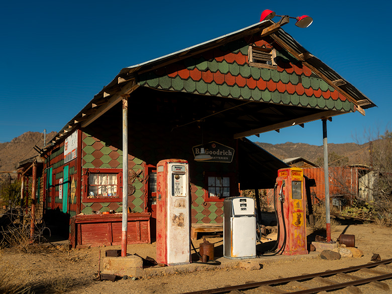
As you can see in this week’s photo that I call Water Tank, they built a good-sized tank on the property for water storage. From this image, I guess the tank dates back to when they made the gas station. The concrete foundation work looks similar to that of the pump island.

I’m sure vandals added the graffiti and bullet holes to the tank’s side after the family moved off the property. They are another example of vandalism that supports my argument that the BLM should set this homestead aside for protection. Otherwise, these ruins won’t be around much longer.

I hope you enjoyed our month at the Richardson Homestead. You can see the larger version of Water Tank on its Web Page by clicking here. Next week we begin a new project in a different location. Hopefully, it will be someplace cool. Please come back then and see what Queen Anne picked for us.

Till Next Time
jw

Sideyard Picture of the Week

Sideyard - The west facing facade of the Richardson home bathed in early morning light.
Sideyard – The west-facing facade of the Richardson home bathed in the early morning light.

This week, we reluctantly leave last week’s Cozy Bed by the Fire and step outside of the historic stone house so that we can explore further. On that May morning, the air was crisp, and the smell of sage-flavored tree pollen filled the air. They were sure signs that spring had come to the 3500′ Union Pass. Since I had spent the night at one of the river casinos, I had on my summer uniform—shorts and a T-shirt. The 60° temperature was perfect for encouraging me to keep moving.

I only took a few steps into the sideyard before seeing the composition that triggered my instinct to take this week’s shot. It’s the west face of the Richardson house covered with a corrugated tin roof. It’s in pretty good shape, so I’m surprised that poachers haven’t already salvaged the metal.

Two weeks ago, Fred commented on the Richardson House post. He said, “…I admire people that can build rock houses. Not easy!” I agree, and as I processed this image, I wondered how John Richardson learned to build a rock house. This morning I searched YouTube and found over a half dozen videos on the task, but John didn’t have that resource in 1897, did he? I understand his use of local volcanic stones—that makes sense. But, I have many other questions: did his dad teach him how to build, or did he take classes at night school?

To further appreciate this century and a quarter-year-old structure, we must remember that the family of five moved to Union Pass from Los Angeles because he had a respiratory disease. Lugging boulders around is fatiguing work for the healthiest of us. If Queen Anne suggested that I build a new home out in the Black Mountains, I’d look around at the rocks, trees, and water supply; then, I’d go hunting for a large cave. It would be faster for me to invent a giant 3D printer than to hand-lay all those rocks.

Maybe people back then were more resourceful than we are. My dad was. Once, in a land far away and a time long ago, my wife and I converted a spare bedroom into a den at our Scottsdale house. We had to pause because we needed shelves for the enormous 24″ TV we wanted in the closet space. In those days, we didn’t have Lowe’s, we had Sears, and lumber yards were closed on Sundays. When my dad came by and we showed off our work, he drove to America’s department store and bought the cheapest skill saw they sold. Then he cut up the bi-fold closet doors and built our shelves out of the garbage we planned to take to the dump. Voila, we watched the football game in our new den on the big screen that evening. I never thought to re-use the scrap wood even though most of my brain cells still functioned then. It’s even worse today. Some mornings I spend minutes staring at the back of the fridge until I remember coming into the kitchen for a coffee spoon.

I don’t think I appreciated how clever my father was until I had to stand alone. So, if you’re fortunate enough, hug your dad for no reason on this Father’s Day. Show your aprication while there’s time.

You can see the larger version of Sideyard on its Web Page by clicking here. Come back next week, and we’ll see what shot I can come up with to finish our month with the Richardsons.

Till Next Time
jw

Cozy Bed by the Fire Picture of the Week

Cozy Bed by the Fire - A discarded box spring left inside the abandoned Richardson House at Union Pass.
Cozy Bed by the Fire – A discarded box spring someone left inside the abandoned Richardson House at Union Pass.

Neither of my grandfathers was around when I grew up, but their wives were more than a kid could handle. I don’t know of two women that were such opposites. They were the prototype for the good-cop/bad-cop routine used by police worldwide. My parents invited each to live with us at one time or another. For us kids, it was like having four bosses—with different agendas.

My dad’s mom was a short stalky woman who spoke with a Polish accent, even though she was born in Pittsburg. That was the primary language in the neighborhood where she lived. When I was in kindergarten, my mom made my dad move to the suburbs after I came home swearing in Polish. Her name was Regina, but we always called her grandma—or Grandma Witt when they were both around. She earned money for cleaning downtown offices at night. It wasn’t a glamorous job, but she owned her home up on Leander Street—the Rodeo Drive of Polack Hill.

After she retired, she joined us in California, and my parents paid her to clean our house—which never needed cleaning. Except for Christmas cookies, she was a terrible cook. She used vinegar in everything, and her favorite vegetable was sauerkraut. On Wednesdays, she’d make pork chops. According to her, they weren’t cooked until they were dry and brittle as their serving plate. It took years to get over my disdain for pork. When we would test her boundaries, the extent of her discipline ended with the phrase, “I’m going to tell your father when he gets home.” She never did, so we got away with murder.

Mom’s mother, on the other hand, was a terrorist. I don’t know how her seven children made it out alive because she detested kids. We called her Grandma Moore even though she took back her maiden name after divorcing my granddad. She was thinner and a couple of inches taller than dad’s mom, and we kids called her Mean Grandma. Whenever my mom would announce that she was coming to stay with us, we tuned up and bawled. My mom told us she was a registered nurse, but her remedy for anything was mercurochrome or Bromo Quinine. If you ever saw a red-splotched child heaving at the curb, that was us.

One time my dad came home on a payday and surprised us with brand new toys. They were those wooden paddles with a red ball attached by a rubber string. The goal was to continuously bounce the ball off the paddle like a horizontal yoyo (Because I lacked coordination, the ball kept smacking me in the face). The day my parents returned to work, she tore the ball and band off and kept the paddles handy to swat us when we got out of line.

I remember her telling us that we were all heathens and should behave more like our cousins. After she died and we all gathered for her funeral, those cousins recounted how my sisters and I were her examples of well-behaved children. That’s when I realized that she acted the same with all her grandkids.

At one point in my photography career, I began shooting trash furniture. I took one picture of a chair, and then I began to see discarded furniture everywhere. It jumped out at me. I have an extensive collection of chairs I found dumped on the street, and you can see some of them in my Have A Seat gallery. When I was shooting at the Richardson Homestead last month and stuck my head inside the house, I came up with the ironic title before I snapped the photo. Even though it’s garbage, Queen Anne and I have stayed in motels that weren’t much better.

I stepped inside, but when I framed the shot, I was too close—even with my widest lens. I had to back up to get everything in the frame. When I stood outside the door, its structure got in the shot, so the perfect place to stand was in the doorway. But, since that was the scene’s primary light source, the stage was too dark. I was blocking the incoming light. That’s when I heard Grandma Moor’s voice in my head reciting one of her favorite phrases, “You make a better door than a window.” She would always say that whenever we stood in front of the TV. Forty years after her death, she haunts the darker corners of my brain.

I finally figured out how to get this week’s photo without the dreaded slow-shutter blur. I call this image Cozy Bed by the Fire, and you can see the larger version on its Web Page by clicking here. Come back next week to see the next shot from my morning at the Richardson Homestead.

Till Next Time
jw

Richardson House Picture of the Week

Richardson House - The remains of the home that John Richardson built on their Union Pass homestead.
Richardson House – The remains of the home that John Richardson built on their Union Pass homestead.

At the beginning of May, I had to make another Algodones run. I broke another tooth and needed our dentist to look at it. Since Queen Anne had company, I traveled alone. These frequent dental visits have gotten old. When we travel to Mexico, it’s not for fun. Being an old codger, I’ve been wondering what advice I have for the following generations, and one thing that comes to mind is this: “Kids, if you’re hoping to live past 35, take better care of your teeth.” I could have bought a boat with all my money wasted in my mouth.

My stay in the chair wasn’t long. The doctor looked in my mouth, chattered in Spanish, ground down the pointy parts, handed me a jar of antibiotics, and said, “Come back in two weeks. We need to dig the old tooth out.” They set me free, and it wasn’t even noon.

I could have driven home, but the house was full of visiting women, and I’d be like a third thumb. Since I wasn’t expected home for another day, I drove north, following the Colorado River to Laughlin, where I could enjoy another boy’s night out. I had my camera to tend to some unfinished business.

After my last Nevada visit in September, my featured project was the marvelous rock formations near Union Pass. That’s where Mohave County Route 68 crosses through the Black Mountains and begins its descent to the Colorado River. While researching my articles, I learned about the Richardson family and their Union Pass homestead. I told their story in my post titled Broken Crown, so I won’t burden you here by repeating it. At that post’s end, I said that I wanted to go back and spend some time shooting the homestead’s ruins, and that’s why I spent the night in Laughlin.

Unfortunately, a law of entropy states that things on their own will decay—they simply fall apart. There’s a set of humans who enjoy helping the process. That’s why I wanted to get back to Union Pass soon, and I’m glad that I did. Pictures showed the gas pump island cracked but intact in recent internet posts. On my visit, someone utterly destroyed it. However, there were enough ruins left that I spent the better part of a morning wandering and shooting them.

The first picture for this month’s Richardson Homestead project is the two-story house hand-built by John using local stone. It is nestled in the shade of an Arizona Ash. The tree covers the two-story structure with the dappled light that I love. Compared with earlier pictures, someone has torn down the large cross on its right side, and graffiti now decorates the front retaining wall (off-camera and purposefully not included). The house is the most intact building on the homestead. With over forty years of neglect, it hasn’t fallen.

I’m sad that Mohave County or the BLM hasn’t set this property aside as a park or a protected historical site. Without that protection, I expect this place to be gone before future generations can learn about the Richardsons and their homestead. Although a complete restoration would be ideal, simply keeping it in a state of arrested decay would be the first step. For example, at the Gillespie Dam and bridge, there is an interpretive center that Maricopa County built to explain their historical significance. Something like that would hopefully deter vandals from running amuck. Hand me a petition; I’ll sign it.

You can see a larger version of Richardson House on its Web Page by clicking here. Next week, we’ll pick through the Richardson ruins to find other artistic shots to show you. Be sure to come back and see them.

Till Next Time
jw

Sunset Wall Picture of the Week

Alright, class, settle down. Get out a sheet of paper and a pen, then put away your backpacks. Today we’re starting with a pop quiz. There is only one question, and you have 15 minutes to answer with 10,000 words—or more. You must cite your sources. Spelling and punctuation will be graded. Are you ready? Your question is, “What do Memphis, Tennessee, and Kingman, Arizona have in common?”

I have talked before about old trading trails morphing into the well-laid-out highway system that we have today. Most of us don’t care how it happened, and we just drive on them. They think that Eisenhower signed a paper in 1956, and the freeways just popped into existence. I think that’s because people younger than me—and that’s pretty much everybody—didn’t experience the change first hand. Our forebearers built most roads over existing paths, and there are reasons someone blazed those original paths. Mark Knopfler describes this phenomenon well in his 1982 song Telegraph Road from the Dire Straits album Love Over Gold.

There have been trading trails across Northern Arizona since the first Pueblo inhabitants. European settlers didn’t use them much because the New Mexico territory was Spanish. Their roads came up from Mexico to towns like Santa Fe and the Old Pueblo at Tucson. Those roads followed the Rio Grande and Santa Cruz Rivers because there was always reliable water. The rest of the desert was a wasteland. What changed that? It was gold.

In 1848, James Marshall discovered gold at Sutter’s Mill in California. In less than two years, California became a state—that’s instantaneous in government time. They needed to move goods and people to the Golden State—and get the gold back to Washington. But, there were no east-west roads, so they put Captain Lorenzo Sitgreaves in charge of a surveying expedition, and he laid out a railroad route around the 35th Parallel.

Then in 1857, the Fed’s paid Edward (Fitzgerald) Beale to build a wagon road from Ft. Smith, Arkansas, to Los Angeles—again along the 35th Parallel (remember, Tucson was still in Mexico). He built his road in a year using camels because they needed less water and food than oxen and horses. By all accounts, it wasn’t much of a road, but Beale bragged that it was the shortest route by 300 miles and “It is the most level: our wagons only double-teaming once in the entire distance, and that at a short hill . . .” His road became the Santa Fe line in 1880, then Route 66 in 1926, and finally Interstate 40 in 1978.

SR 68 through Union Pass - Arizona State Route 68 (on the right) as it enters Union Pass through the Black Mountain Range.
SR 68 through Union Pass – Arizona State Route 68 (on the right) as it enters Union Pass through the Black Mountain Range.

His wagon road wandered a bit from the 35th as it meandered across the desert, but wagon tracks are visible in places on Google Earth. As vehicles became more efficient, each of the subsequent roads shortened its length. Some silly people hike the old road just for giggles. I’m not that ambitious. However, I do know of a place where you’ll be in Ed’s footsteps. Yep, you guessed it. It’s our Union Pass on SR 68. While Sitgreaves went through Oatman, Beale found a more accessible way to Fort Mohave and his river crossing.

Sunset Wall - Layers of volcanic rock upended vertically in the Black Mountain Range.
Sunset Wall – Layers of volcanic rock upended vertically in the Black Mountain Range.

I took this week’s picture on the west side of Union Pass, and it shows layers of lava and ash (tuff) that have been turned horizontal by geological forces. As Don Sprinkle commented in another post; “. . . just like the Grand Tetons.” It was sundown as I took this photo, and that’s why the ordinarily dark rock has a beautiful red glow, and that’s why I called it Sunset Wall.

So, back to your quiz; I’m going to let you grade your papers. What did you answer to: What do Memphis, Tennessee, and Kingman have in common? If you said that they are both along Interstate 40, you get 50%, and if you said that they both have a Beale Street, you get another 50%. I must add that there is a difference too. While Kingman knows who they named their street after, according to the Wikipedia entry for Memphis’ Beale Street, nobody remembers who Edward Beale was, which I find amusing. Maybe it’s forgotten because he was a Union Naval officer.

You can see a larger version of Sunset Wall on its Web Page by clicking here. Please come back next when we begin December’s project and new pictures.

Until next time — jw