Skull Valley Depot Picture of the Week

I’m not considered a sociable person, so you may be surprised that I joined a car club back when I was a younger man—more than half my life ago (oh jeez, where has it all gone). This club’s existence was based on owning a particular brand—which one isn’t important for my story—but the club member’s general attitude was that no one should drive one of these cars because the mileage brought down their value. Insane, I know. Despite that, the club put on well-attended events like parties, tours, meetings, and track days.

The club event that drew the most participation was their annual progressive dinner. If you’ve never heard of that, it’s a three to seven-course dinner served at the volunteers’ houses who prepared each course. So we’d meet at the appetizer house, have a glass of wine, and when the food was all gone, we’d jump in our cars and drive to the next course. The club paid for the food and a couple of jugs of Carlo Rossi wines, and members paid a flat per-head attendance fee. The club made a lot of money. Things were different then. Phoenix had few roads north of Northern Avenue, and traffic was nil on Saturday nights, so by the end of the evening, the drive between houses turned into a Targa Florio race. Half the club would wind up in the slammer on DUI charges these days, and the insurance companies would cancel their policy.

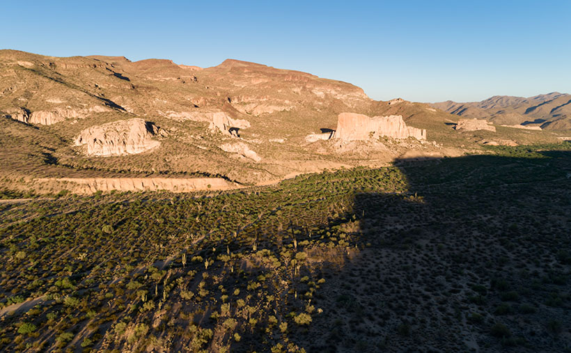
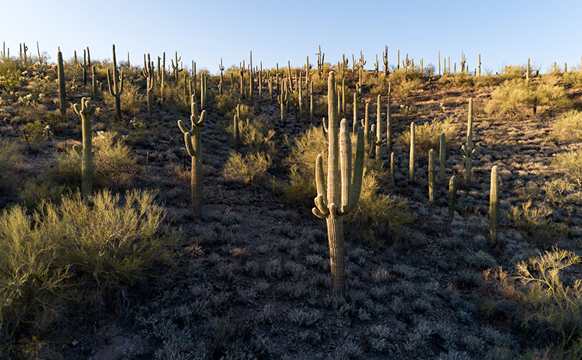
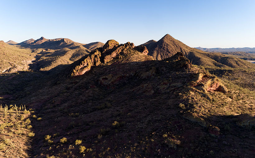
Now hold that thought in the back of your head while I talk about the other part of another one of my grandiose ideas. I’ve written before about the trains that pass our house. They run less than a half-dozen times each day (and night), so the tracks are empty most of the time. The route runs from Phoenix to the northern town of Ash Fork, and it has so many twists and turns that it was dubbed The Peavine Line when it opened a century ago. The tracks run through the heart of Arizona’s historic gold mining country.

Historically our little train used to carry passengers with depots in Phoenix, Wickenburg, Congress, Kirkland, Skull Valley, Prescott (now bypassed), and Ash Fork. Most of the town’s stations are still there in one form or another. And—unlike the routes between Phoenix to Tucson and Phoenix to Yuma—there is some interesting backcountry scenery and at least two climate zones along the journey.

Skull Valley Depot - The townspeople of Skull Valley have put their abandoned depot to good use as a local museum.
Skull Valley Depot – The townspeople of Skull Valley have put their abandoned depot to good use as a local museum.

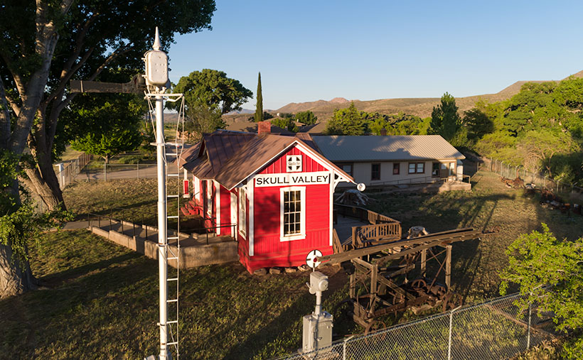
So, after my photo outing where I shot this week’s featured image in Skull Valley, I began to fantasize about having a progressive dinner—on a train. The trip would start in Wickenburg (or maybe Sun City West), then make scheduled stops where the old stations are. At each stop, you could peruse the local museum, enjoy the designated course, spend money on useless trinkets in the gift shop, pee, and get back on the train. Between stations, the guests could taste wine samples (from Arizona vineyards?) and purchase bottles that they would pick up at the evening’s end. At the end of the line, the train would make a leisurely two-hour trip back to the station. The night will have fallen by that time, and guests would enjoy non-alcoholic beverages to sober them up.

I only know of two train excursions in Arizona; the Verde River Line and the trip from Williams to the Grand Canyon. There once was the White Mountain steam train, but that closed a long time ago, and Durango bought the engine (which fell off the trailer along US 89—however that’s another story). I think there’s plenty of market for another train ride in our state, and the dinner would make it a unique experience. Think of it as a dinner cruise on rails.

If this lame-brain idea sounds good to you, then it’s yours. On the other hand, if you feel it’s a stupid idea, I never said anything. My brain hurts too much to work on stuff right now. I’m too old and penniless. Besides, it’s time for my nap.

You can see a larger version of Skull Valley Depot—the picture that set my brain on fire this week—on its Web Page by clicking here. Be sure to come back next week when we continue with another Skull Valley artifact.

Until next time — jw

Shiprock Picture of the Week

Wickenburg’s traffic has worsened over the past couple of months—especially during the weekends. People might feel more comfortable traveling now that Covid restrictions are easing, or maybe folks are just sick of staying home. In either case, going to one of the town’s grocery stores becomes annoying.

There used to be three US highways that ran through our downtown—US 60, US 89, and US 93. That all changed when the feds built the interstates (yes, children, back in my day, there were no freeways). Today, only US 93 remains a significant commerce route—lots of big trucks still pass through town. It starts downtown at the intersection of US 60 and Tegner Street and ends in Jasper, Alberta (the Canadian part isn’t part of the US highway system, but they used the same number on their side of the border).

I have a lot of mixed feelings about US 93. It’s the main link between Phoenix and Las Vegas. It was a narrow two-lane road with twists and turns that made you slow down. There are little white crosses littering the roadside. So many that it was designated the country’s most dangerous road. So, the highway department began inserting four-lane sections over thirty years ago. Even then, they knew it would become a freeway someday (sometime this century, they promise).

When I thought I had extra money to burn, I looked forward to the five-hour trip to Vegas or Bullhead City for an evening in the casinos. Other times, I’d drag my fishing rod to Black Canyon or Lake Meade with dreams of bringing home a whopper. Then, when my folks retired, they’d pull their trailer across the country, alternating between Atlanta—where my sister lives—and Kingman (it was far too hot in Phoenix). As they aged and became unwell, driving north on US 93 became less fun. I can’t begin to count the times that Queen Anne and I made that drive.

One of the landmarks along the road that I always looked forward to was along the Joshua Tree Parkway as the highway descends to the bridge crossing the Santa Maria River. Some large sandstone formations are hidden behind small hills just south of the bridge, and there’s a small gap where you can glimpse Shiprock. For decades, I planned a photography trip out there. The light was never right the couple of times that I tried.

Shiprock - Not the famous one on the Navajo Reservation that is spelled Ship Rock, but the lesser known one in our back yard.
Shiprock – Not the famous one on the Navajo Reservation that is spelled Ship Rock, but the lesser-known one right in our backyard.

The formations are at the eastern toe of the Black Mountains (yet another range with the same name—these are in Yavapai County) and on the other side of Black Canyon Wash, away from the highway. They’re too distant to get a good shot from the road. I found a Jeep trail that got me over the hill, but I needed something like Fred’s Toyota to go down the other side. However, our friends ran out on us for the summer before I could bum a ride.

I took this week’s featured image from the hilltop, and I think it gives a pretty good long view of the sandstone formation and the Black Mountains. You can tell that it’s spring because green chaparral and trees fill the wash. Shiprock is the middle formation (the shadows conveniently point at it). Its name comes from how the left side resembles the stern of an old pirate ship.

This photo also shows the Black Canyon Wash as it flows to the Santa Maria River, just beyond the photo’s right side. That river then flows between the Arrastra Range in the background and the Black Mountains to Alamo Lake. Everything in this picture behind the formations is part of the Arrastra Wilderness Area, so if you want to explore, you’ll do it on foot.

You can see a larger version of Shiprock on its Web Page by clicking here. Come back next week for another shot from around my neighborhood.

Until next time — jw

Saguaro Bouquet Picture of the Week

We’ve spent March exploring the Black Hills—an interesting group of low mountains on Wickenburg’s north side that gets their name from the dark surface crust on their top. I was able to shoot them from different perspectives by driving the old mine roads that my SUV—Archie—could navigate easily. While I’m out jaunting about and looking for different angles of my subject, I try to keep an eye out for other good scenes—and that’s the case with this week’s featured image.

When I drove out Rincon Road a couple of weeks ago, I intended to get the shot Black Hills—last week’s featured image. While I was there, I discovered a hill covered with saguaro. As I’ve written before, saguaro does well on a south-facing well-drained slope, and when I see a stand like this, it makes me happy. This is a healthy forest. Since I’d already invested the time driving out there, I also took this shot.

Saguaro Bouquet-A small but dense grove of saguaro growing on a hillside near Wickenburg, Arizona.
Saguaro Bouquet-A small but a dense grove of saguaro growing on a hillside near Wickenburg, Arizona.

I named this week’s image Saguaro Bouquet jokingly because—although they each weigh a couple of tons—it looks like you could pick them for a Mother’s Day bouquet (hey, no one said I was normal). Although this grove is small, it’s densely packed along the hillside.

There are some other things I see in the photo. It was still winter when I took it, but the scene will change dramatically as the weather warms next month. For example, the little gray bushes covering the ground are brittlebush. In a couple of weeks, they will sprout yellow daisy-like flowers. Shortly after that, the palo verde trees will start flowering, adding more yellow. Finally, in May, the saguaro will be adorned with large white blossoms. That’s an Arizona Highways kind of picture. If you’d like to see it yourself, ask me, and I’ll give you the map coordinates.

I am happy you took the time to view my new photo. You can see a larger version on its Web Page by clicking here. Be sure to come back next week for a complete change of pace. I promise that for April, there won’t be a single saguaro.

Until next time — jw

Black Hills Picture of the Week

Queen Anne and I spent a couple of days last week visiting our favorite foreign city. That’s right; we went to Algodones, Baja California. I had to see my dentist and have a couple of holes in my head filled. Instead, she worked on my teeth.

Algodones (it means cotton in English) is famous for liquor stores, pharmacies, and dentists. The little town has over 350 dental offices within a 10-minute walk from the crossing. It’s straightforward for visiting Snow-Birds to park in the lot, walk across, hit the liquor store for liquid courage, get a tooth fixed, and buy pain relief on the way out.

During the pandemic, the Mexican border is closed, but there are exceptions for medical, educational, and commerce visits. The big restriction placed for Algodones was closing the crossing at 2:00 pm instead of 10:00 pm. Early on, many people didn’t know that, so the wait times at the customs house were nil. Well, the secret’s out. The line of people going through customs was over a mile long. There’s a break in the gate where our dentist is, and when we can join the crowd there, it’s a half-hour wait. On Tuesday, the end of the line was three times that distance. It was 12:40 pm when we started. At 2:00, when the siren blew, we were only half-way to where our usual starting place.

The way customs close the border is interesting. If you’re in a car, you’re out of luck. You have to drive an hour to San Luis or Mexicali, where the crossings are open 24 hours. But if you’re a pedestrian in line, they stay open until the end of the line. That’s good because I thought we were going to sleep in a cardboard box like homeless people. It was 3:30 by the time we stopped at the Yuma Carl’s Jr. for lunch/dinner.

There was something weird on this trip that has never happened to us before. When we made it to the line’s the halfway point, an American guy jumps out of his car—taps on my shoulder—and asks if we want a ride in his car. “You’ll be in line for another couple of hours, but the cars are crossing in a half-hour.” His car had four people in it already. Anne and I glanced at each other and declined. I’m of the generation that said, “Gas, grass, or ass. Nobody rides for free.” What if we got in the car and he demanded cash that we didn’t have. We’d be back on the street and at the back of the line again. Everyone around us also turned him down. What would you do?

Get to the Picture
Black Hills - As the Hassayampa River flows down from the Bradshaw Mountains, it cut a gorge through the Black Hills, known as the Hassaympa Box Canyon.
Black Hills – As the Hassayampa River flows down from the Bradshaw Mountains, it cut a gorge through the Black Hills, known as the Hassayampa Box Canyon.

Speaking of this week’s picture . . . (I know it’s a lame segue, so I won’t charge you for this issue.) This is another view of the Mountains/Hills that we’ve been photographing in March. I found that they’re called the Black Hills because of the dark crust along their tops, hence the photo’s title. This version was taken on their other side, looking back to Wickenburg.

If you own one of my 2021 calendars, these rocks are the same subject as the March photo. This time I wanted to get a closer look at the interesting fault thrust in the foreground, but when I processed it, I realized I had captured more.

You can see the Hassayampa River as it flows down from the Bradshaw Mountains on the mountain’s left side. But here, it turns right—behind the foreground rocks—and it cut a gorge through these hills. It’s a local attraction called the Hassayampa Box Canyon. Unfortunately, it’s hidden in this shot, but there is a glimpse of the river after it hits the Hassayampa Plain on the right side. Here it turns into a wide, sandy, and the water flows beneath the sand. That’s why the native tribes call it Hassayampa—upside-down river.

I hope my photo brings completeness into your life. You can see a larger version on its Web Page by clicking here. I like reading your comments, so feel free to add your two cents below. Be sure to come back next week for another image from the Wickenburg area.

Until next time — jw

Evening in the Hills Picture of the Week

Optimism comes at a price. If you remember, last week’s post was upbeat. The world was peaches and cream. I should have known better because, on Monday, karma smacked me in the face. Life never goes smoothly. It’s one big game of Wack-A-Mole. You have to solve one problem after another.

Here’s what happened. Last Monday, Fred was helping me with some upholstery in the living room. To use my pneumatic staple gun, I dragged my compressor inside and plugged it into the same electrical circuit that my computer is on. We only had a half day’s work, so I went into the office and checked my email when he left. The monitor was black—you know, in sleep mode (or so I thought). But when I touched the keyboard, it never woke up. I spent the next quarter-hour flipping switches, moving wall plugs, and I even moved the monitor to a different room with no luck. It was dead—D-E-D, dead. I’m not sure if the compressor sent a surge into the line or the monitor was already on its deathbed.

It was expensive when I bought it 10-13 years ago. I still have marks on my neck to prove it, where Anne tried to strangle me when she found out how much I paid for it. It was a 30”, it could display 90% of Adobe RGB colors, and it had a native resolution of 2560×1440. Those things are important to me as a photographer and the reason the price was high. I had to find a replacement, so I logged on to Anne’s laptop and started shopping Amazon.

I found two displays that would meet my criteria. They both were 4K models, 32” wide, and had wide color capabilities. They were better than what I had, and they cost less than a quarter of my original unit. I liked the one that wouldn’t be delivered until next week—what, no news this Sunday; I can’t let my loyal fans down. So I settled on the other one, and it arrived Thursday afternoon. It was in a box big enough that we’re going to use it as a guest bedroom for when you visit.

My new monitor works great. I’m using it now to write this post. I’m not too fond of the fact that it’s too low, and there’s no vertical adjustment. I’m probably going to build a box for it to sit on—some exotic wood would be handsome, and a drawer would be nice. Someplace to squirrel away some of the clutter on my desk.

Evening in the Hills - The low evening sun throws long shadows on the desert.
Evening in the Hills – The low evening sun throws long shadows on the desert.

The new monitor also helps my photo editing—like this week’s featured image that I call Evening in the Hills. As with my other March images, this one was taken in the mountains above Wickenburg. This one isn’t about mountains; it’s all about the light. With the sun going down, it began throwing long shadows on the desert, so I turned the camera and captured a group of nearby hills. This was one of those quiet moments when the air was still, and I felt alone in the world.

I hope you like it. You can see a larger version on its Web Page by clicking here. I like reading your comments, so feel free to add your two cents below. Be sure to come back next week for another image from the Wickenburg area.

Until next time — jw

Blue Tank Saguaro Picture of the Week

It’s only the third month of 2021, and already I can tell it’s a much better year than the last one. If you remember, this time a year ago, I was comforting my dear wife, who was convalescing from knee surgery, we had growing concerns about a new virus that threatened our existence, and we faced travel restrictions to slow its spread. In contrast, this week, I feel like a kid at the end of a time-out, no longer grounded or released from juvy (of course, I was such an exemplary child that I never experienced any of those feelings—my parents just spanked us).

I have this exhilaration of freedom because we got our second vaccination shot this week—and we have passports to prove it. If you’re debating on getting your shots, you shouldn’t be. Queen Anne and I didn’t experience any abnormal side effects. Like any flu shot, your arm is sore for a couple of days, but other than that, our lives went on normally. And as an extra benefit—like a putty knife—the Microsoft chip they snuck into the vaccine scrapes off any plaque in your arteries (but I do have an incredible desire to buy a new version of Windows).

We’re still cautious about our movements—we wear masks and keep our distance, but now we can plan to go on vacation later this summer. In our laundry room, I have a huge wall map of the Colorado Plateau. Whenever Anne gets out of bed this afternoon, I’m going to have her toss a spit-ball at it. Wherever it lands is the place we’ll drag our trailer—The Ritz—this August.

Blue Tank Saguaro - A mature saguaro growing along the bank of the Blue Tank Wash near Wickenburg, Arizona.
Blue Tank Saguaro – A mature saguaro growing along the Blue Tank Wash bank near Wickenburg, Arizona.

I’m so giddy this morning; I almost forgot this week’s new picture. If it looks familiar, it should. That’s because it’s a variation of last week’s featured image. They both show the mountains on the Hassayampa River’s far side, and they both feature saguaro cactus. The difference is that last week’s photo was of the mountains with cactus in the foreground, and this one is a saguaro with the mountains in the background. Who said you couldn’t get two good variations of the same scene by working-the-shot? I called this shot Blue Tank Saguaro for obvious reasons.

I’m interested in hearing what you think. Both images can be seen on their Web Pages, and you can flip between them using the Previous/Next links. You can get to this week’s image by clicking here. Which of the two do you like better? Let me know by leaving your comment at the bottom of this page. Be sure to come back next week for another of my images from the mountains surrounding Wickenburg.

Until next time — jw

UPDATE 4:30 pm: Anne got up and threw her spit-ball at the map, so I guess in August we’re going to . . . the laundry room.

Blue Tank Wash Picture of the Week

Along U.S. Highway 93, between Congress and Wickenburg, are a set of peaks that I’ve had my eye on for the last five years. They aren’t named because they’re slightly greater than a line of hills. Their color is the same as the surrounding desert, except they have a basalt mantle along the top. Sometimes the darker capstone looks like a shadow on the hilltops.

They’re generally aligned in an east-west direction, with the Hassayampa River on the west and the Blue Tank Wash on the east side. As they face south, there never seems to be a flattering light on them. The other challenge that I have is getting all four peaks into a frame. Even from the highway (3 ½ miles away), they only fit in with a wide-angle lens. That means that all of the homes, ranches, and construction lining the Hassayampa would be included in the photo. So I decided to get closer and pick them off one-by-one.

Two old mine roads radiate out from Wickenburg (Rincon Road and Constellation Road), and connecting the two is another path called the Blue Tank Wash Road. This dirt trail runs through the valley on our range’s south side. Late afternoon this Tuesday, I drove Archie up there to see what I could do.

Blue Tank Wash - Two of the four mountains that rise above the Blue Tank Wash Road near Wickenburg, Arizona.
Blue Tank Wash – Two of the four mountains that rise above the Blue Tank Wash Road near Wickenburg, Arizona.

This week’s featured image is the first variation that I liked. I wanted shadows to show texture and depth, so I shot this from the third peak looking west at the second. I was fortunate to find some sunlit saguaro growing in reddish soil to place in the foreground for scale. The bright spot gives balance to the dark peak in the background. I call this image Blue Tank Wash.

You can see a larger version of Blue Tank Wash on its Web Page by clicking here. Be sure to come back next week for another of my images from the small mountains above the Harquahala.

Until next time — jw