Four Peaks: The Crown Jewel of the Mazatzal Mountains Picture of the Week - Fountain Hills, Arizona

Four Peaks in the Mazatzal Mountains: Majestic mountain range against a backdrop of lenticular clouds and blue sky.
Four Peaks: The Crown Jewel of the Mazatzal Mountains – A captivating view of Four Peaks and the dramatic play of lenticular clouds in the Arizona sky.

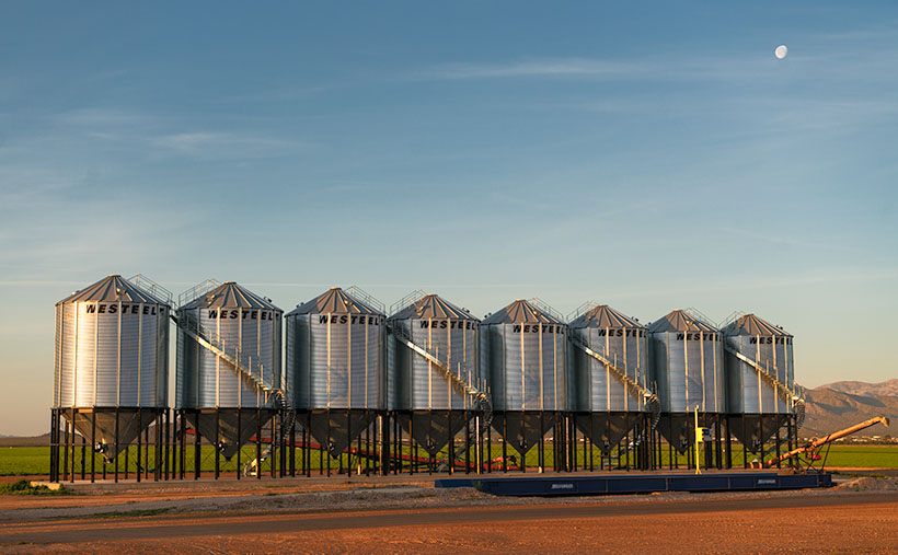
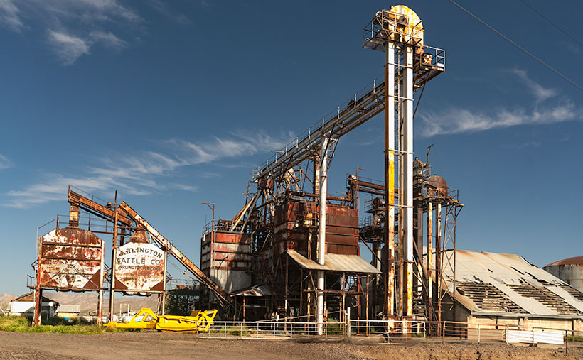
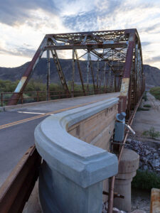
Yea! We’ve made it over the hump. Now we start whittling away the second half of 2023. But first, we must suffer through the insufferable—our monsoon season. As we enter the scorching summer months in Arizona, fleeing from the heat becomes a top priority for Phoenicians. We seek refuge in the pleasant mountain landscapes outside the city to beat the relentless triple-digit temperatures and humidity. But hey! I’m here to help, so July’s photo project involves one of the escape routes Phoenicians by the thousands use each weekend—the Beeline Highway.

It’s been at least a decade since I last drove Arizona State Route 87, but last month, my friend—and regular contributor—Fred asked me to help him fetch some trailer equipment in Heber—a small community on the Mogollon Rim. As he drove through the rugged mountains to Payson, I rode shotgun and thought, ‘I forgot how spectacular this scenery is. I need to come back with my camera.’ That’s when I decided to do July’s Mazatzal Mountains project and use the Beeline Highway for our trail. It sure beats hiking.

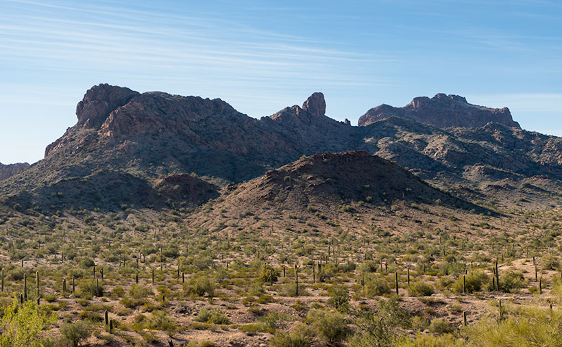
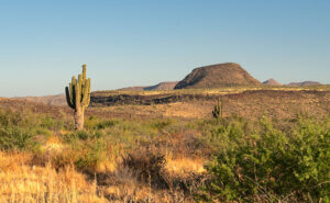
The name—Mazatzal—is a directive of a tribal word the Spanish picked up from the native Indians, Mazatzalli—meaning ankle bone. The Yavapai thought these mountains resembled an ankle when viewed from certain angles. Situated northeast of Phoenix, the Mazatzal Mountains stand as a rugged and formidable barrier, marking the gateway to the Rim Country. These majestic peaks serve as a scenic backdrop for Phoenicians as they embark on their journey to the Mogollon Rim and its surrounding areas. While the Mazatzals offer breathtaking vistas and a sense of natural grandeur, access to their remote backcountry is primarily reserved for avid hikers, horseback riders, and outdoor enthusiasts seeking a more adventurous experience. It’s important to note that due to the rugged nature of the terrain and limited facilities, the Mazatzals may present challenges in terms of accessibility, especially for individuals with mobility restrictions.

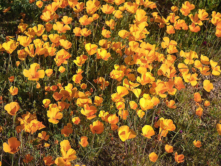
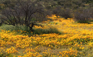
As we travel along the Beeline Highway, we traverse a physical distance and ascend through a tapestry of changing climates and vegetation. From the arid lowlands near Phoenix, we gradually ascend into cooler uplands adorned with diverse flora. We witness transition from cacti-dotted desert landscapes to lush pine forests and high-altitude meadows. This elevation-driven change in vegetation is a constant reminder of the varied ecosystems thriving within the Mazatzal Mountains.

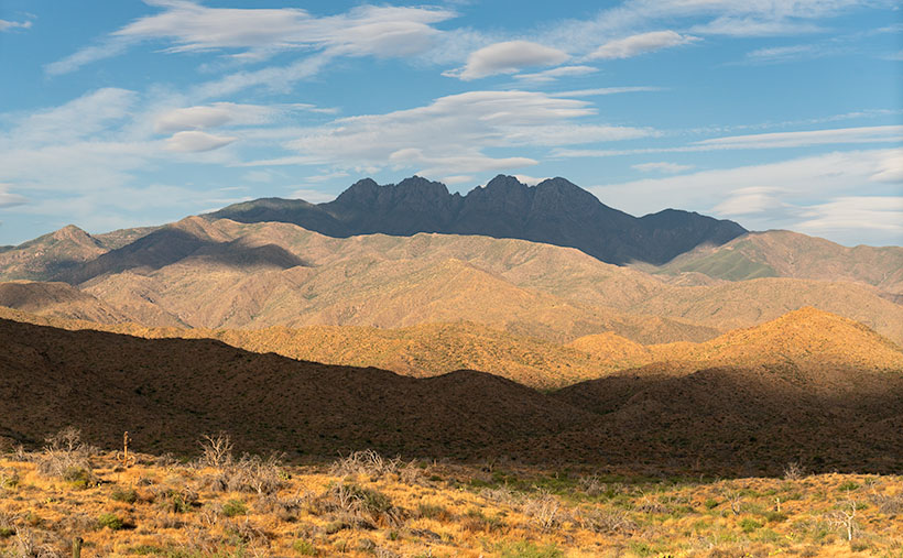
This brings us to this week’s image—Four Peaks: the Crown Jewel of the Mazatzal Mountains. This image is my latest attempt to capture the highest point in Maricopa County. Well, they’re the highest four points in the county. From left to right, they’re named: Brown’s Peak (7657′), Brother Peak (7642′), Sister Peak (7572′), and Amethyst Peak (7524′). On the afternoon that Queen Anne and I stopped to take this image, it was windy, and the sky was filled with lenticular cumulus clouds (cirrocumulus clouds that look like lenses). As they crossed the sky, they cast shadows on the mountain, adding depth and drama to the composition. Without the shadows, the mountain would appear flat and featureless.

Thank you for joining us on this virtual journey through the Mazatzal Mountains. We invite you to share your experiences and memories of these stunning landscapes. Feel free to connect with us and the community as we continue exploring this magnificent region’s natural wonders. Stay tuned for our next installment, where we delve deeper into the heart of the Mazatzals.

Sugarloaf and Sycamore Creek: Impressive rock formation and desert landscape in Arizona's back-country.
Sugarloaf: A Gateway to the Majestic Mazatzal Mountains – When the Beeline Highway passes between Four Peaks and this landmark, you know you’re finally out of town and into the Mazatzals.

If you’d like to see a larger version of Four Peaks, you can do that in several ways. The first is to visit its Webpage using this link (https://www.jimwitkowski.com/newWork/fourPeaks.html). Miss Deb reported last week that the second method works only if you use a desktop computer. Follow this link (https://fineartamerica.com/featured/four-peaks-jim-witkowski.html) to my posting on Fine Art America. Please hover your mouse cursor over the image until a green square appears (they’re magically delicious). Select the area you want to inspect, and then click. A one-to-one preview window of that section will open on the screen.

Till Next Time
jw

Techniques: Embracing the Elements and Finding Drama in Nature’s Surprises

Photography is a dance with elements; sometimes, the most captivating images come from natural surprises. As photographers, we can embrace these elements and find beauty and drama in their presence. The photo of Four Peaks with its lenticular cumulus clouds and their resulting shadows is a prime example of how nature can add a touch of magic to our compositions. When faced with unique cloud formations, we may be tempted to wait for them to clear, fearing they will obscure the peaks. However, there is value in embracing the unexpected and capturing the scene as it unfolds. By incorporating the lenticular cloud shadows, the image takes on a new level of depth and intrigue. The shadows play across the rugged mountain terrain, accentuating its contours and adding drama to the composition.

When you find yourself amid nature’s surprises—a sudden storm, an unexpected play of light, or unusual cloud formations—embrace them. Explore their potential to add depth, drama, and a touch of magic to your photographs. Remember, breaking the rules or deviating from your initial plans can lead to some of your most captivating and memorable images.

Gleaming Stainless Silos: Shining Icons of Agriculture Picture of the Week - Aguila, Arizona

Gleaming stainless steel silos in a cotton field, reflecting the morning light
Gleaming Stainless Silos – Bathed in the soft morning light, the stainless steel silos stand tall amidst the green expanse of a newly planted cotton field. A testament to modern farming and agricultural storage, these gleaming giants symbolize the promise of a bountiful harvest.

Welcome back to the third image in our May orphan photos project. We hope you’ve been enjoying the journey so far. Last week, we took a nostalgic look at some old farm equipment, but we’re shifting gears to bring you something new, and I didn’t have to travel far to find this week’s subject.

During our travels, Queen Anne and I often find ourselves driving through the charming town of Aguila—though calling it a town may be a bit generous. It’s more like where the tumbleweeds stop to stretch their legs, and the cacti gather for a gossip session. It has been the subject of my playful jesting in the past, but today I’ll take a lighter tone. Aguila is situated along route US 60, west of Wickenburg, and as I’ve mentioned before, it serves as the quickest route for Queen Anne and me to reach Interstate 10. On one of our recent journeys through Aguila, a remarkable sight caught my attention—a magnificent set of silos erected on a cotton farm. Their towering presence against the horizon immediately captured my imagination. As a photographer, I’m always searching for unique and captivating subjects. These silos presented the perfect opportunity to catch something unique.

Regarding my photography, I enjoy sharing my work with a broad audience, and one platform that has been instrumental in reaching a larger community is Unsplash. For those who may not be familiar, Unsplash is a platform where photographers can showcase and share their high-resolution images, allowing anyone to download and utilize them freely. I take great pleasure in contributing to this platform, and I currently have around 100 of my photos available there. (You can check out my Unsplash portfolio here :[https://unsplash.com/@jcw].

Among the images, I have posted on Unsplash, two particular silo photos have garnered significant attention. These silo images, which I previously captured and uploaded, have become some of the most popular in my collection. The two silo photos alone have amassed over 1.5 million views and have been downloaded more than 1,100 times. This positive reception motivated me to seek out new and captivating silos to add to my Unsplash portfolio, and that’s where this photo comes into play. Who would have thought that a collection of silos could attract so much attention? Move over cute puppies and stunning landscapes; it’s time for the silos to shine. Maybe they have some secret magnetism, or perhaps it’s just the allure of all that grain storage. Either way, these silos have become the unlikely celebrities of the photography world.

When I laid eyes on these gleaming stainless silos in Aguila, I knew they possessed the potential to enhance my Unsplash portfolio and further boost my numbers. I took this photo with a mixture of artistic vision and a touch of self-interest, fully aware that the unique beauty of these silos would resonate with viewers. It’s fascinating how an ordinary subject like silos can captivate and draw the attention of so many people.

Ultimately, my decision to capture this image was driven by a desire to continue sharing my work with a larger audience and expand my presence on platforms like Unsplash. The allure of these silos and the previous success I’ve experienced with similar images solidified my belief that this photograph would be a valuable addition to my Unsplash portfolio.

When you gaze upon this photo, it’s like sipping a Pousse-Cafe, with each tier offering its delightful flavor (If you have no idea of what I’m referring to, here is a recipe: https://www.epicurious.com/recipes/food/views/the-pousse-cafe-no-1-51167400). At the bottom, we have the earthy essence of the brown dirt road, followed by a refreshing burst of green from the newly planted cotton fields. And finally, the pièce de résistance, the shining stainless steel silos, add a touch of sophistication to this visual libation. And just like a perfectly crafted drink, we have a cherry on top—the waning moon gracing the composition like a delightful garnish. It’s a photographic concoction that will tickle your taste buds and leave you wanting more.

To enhance the curves in the seed containers, I find the light from the sun at a low angle the best. The tanks would look like cardboard cutouts if you shot this scene at noon. Either end of the day works fine, but since I got up early, I got a lovely moon in the bargain. I had to move left to get that moon into the shot, introducing a perspective. In this case, it works better than a static head-on point of view.

I hope you enjoyed this week’s photo and story. These gleaming stainless silos in Aguila serve as a testament to the agricultural essence of this small town. They stand tall, surpassing any yard art or decorative statues, and remind us of the remarkable structures that farmers create as they cultivate the land. The silos embody the local community’s hard work and dedication, showcasing agriculture’s beauty and importance in shaping our surroundings.

To fully appreciate the visual impact of the Gleaming Stainless Silos, I invite you to visit the official webpage, where you can view the photo in all its glory. Follow this link [https://www.jimwitkowski.com/newWork/gleamingSilos.html] to immerse yourself in the fascinating details and explore the nuances captured in this image.

Thank you for joining us this week as we delve into the world of agricultural beauty and the stories behind orphan photos. We appreciate your support and the moments you’ve shared with us. Be sure to mark your calendars for next week’s finale as we unveil a special place in Arizona’s history. It’s an extraordinary journey you won’t want to miss. Thank you for giving us a moment of your time.

Until next time
jw

BTW:

The snake count is two a peace. Ours was a 10′ bullsnake on a mission. He was headed west, and nothing would get in his way. No matter how much I tried, he would not turn around. When I annoyed him enough, he slid under the house. But, the neighbors spotted him later in the evening leaving the park like Horrice Greely personally spoke to him.

Fred and Deb’s story has more drama. Their snake was a baby rattler hiding next to their front hose. When spotted, Fred got a shovel and pitched it into the middle of the street, but the snake had bitten their youngest dachshund. Odie got pretty sick for a while, but he’s feeling better and resting at home. You should run out and buy him a get-well card.

Arlington’s Abandoned Feed Mill: Fading Memories of Cattle Country Picture of the Week - Arlington, Arizona

Abandoned farm equipment at Arlington Cattle Company
Arlington’s Abandoned Feed Mill – The abandoned grain hoppers and silos of the Arlington Cattle Company were left to rust in the Arizona desert.

Last week, I wrote about the exceptional rainfall we had in Arizona and how the wildflowers love it. Well, the same wet winter that showered our land with nature’s colorful confetti also brought heavy mountain snowfall. Since the predicted snowmelt and runoff would overflow our reservoirs, the Salt River Project began releasing water into the river. It’s been quite a while since we have had water in our ordinarily dry riverbeds. While some may scoff at the idea of water in Arizona’s riverbeds, I was thrilled that I might get the chance to shoot some whitewater rapids in the desert.

I convinced Queen Anne to go-for-a-ride(?) a couple of weeks ago. We drove down the west valley to the Gillespie Bridge, excited at the prospect of capturing the raging torrents of water. However, upon arrival, we were met with disappointment. The river was spent and lethargic when the artificial flood passed through Phoenix. The snowmelt’s aftermath left us with sluggish, murky water oozing through the tamarisk. It looked more like effluent than a river. Feeling disheartened, we started to return home when I noticed the stunning light falling on the machinery at the Arlington Cattle Company. When I stopped the car and grabbed my camera, Anne responded, “Hurry up! I’m Starving.”

The Gila River begins its journey in New Mexico’s Gila Mountains. It collects water from its tributaries, including the Salt River, the Verde River, the Santa Cruz River, the New River, the Agua Fria River, and the Hassayampa River. The Gila River embarks on an audacious westward journey, carving its path through untamed landscapes. Just after the confluence of the Gila and Hassayampa rivers, the Gila turns south for thirty miles towards Gila Bend. As the river flows past the Buckeye Hills, it enters a natural pinch point several miles down old US 80. It passes between a formidable silhouette of a volcanic sentinel and the edge of Gillespie Shield Volcano. The black rock lava flow rises two or three stories above the road and river and is known for its impressive pictographs, visible along the cliff of lava rock when examined closely. At this pinch point, pioneers attempted to build three versions of the dam. After they all failed, the highway department erected an all-season bridge to cross the river. Local farmers plant the dam’s old flood plains in summer with deep green cotton, making the little valley a desert oasis.

I’ve been to the Arlington Cattle Company before, so this wasn’t my first time photographing this abandoned equipment. The last time I photographed there was over a decade ago; the massive boom that sent grain over the road to the feed lots there had collapsed into the canal flowing along the roadside. Someone has cleaned that mess up since then. As I stood and framed the shot, I could hear the ghostly sounds of machinery banging, gears meshing, and belts squealing in protest. The equipment stands as a testament to the relentless march of time, bearing the scars of decades past, with the weathered vestiges of industry adorned in hues of faded silver and rust contrasting against the intense blue sky. However, what catches my eye in this photo is the tall silver elevator, which towers above all else, and with the sun’s reflection, it appears as a beacon against the bright blue sky. The wispy white clouds in the background are a bonus and provide a nice contrast to the earthy tones of the equipment.

The Arlington Cattle Company was established in the early 1900s by a group of investors led by William W. Clemens, who also served as the company’s president. The company purchased approximately 55,000 acres of land in the Arlington Valley and constructed a state-of-the-art cattle feeding facility. The company aimed to fatten cattle for the market using a combination of locally grown grains and hay from nearby farms.

The facility stood as a cathedral of innovation, a testament to the audacity of human endeavor, featuring a grain elevator that could lift and store thousands of bushels of grain at a time. The elevator was powered by an extensive motor and conveyor system that could move the grain from the elevator to the various silos and feedlots throughout the property. The company also built a vast network of canals and irrigation ditches to ensure a reliable water supply for the crops (and cattle).

Despite the initial success of the operation, the Arlington Cattle Company struggled to turn a profit. The company faced several challenges, including drought, floods, and fluctuations in the price of beef. In addition, the company’s location in a remote part of the state made transportation difficult and expensive. As a result, the company was forced to declare bankruptcy in the early 1920s. After the default, the land and equipment were sold to various buyers. Today, the rusting equipment seen along the roadside in the Arlington Valley are the only remnants of the Arlington Cattle Company.

Rustic Gillespie Bridge spanning the Gila River with a mountain in the background
Old US 80 Bridge at Gila River – The historic Gillespie Bridge at Gila River, part of Old US 80, features a rusted iron truss structure and spans over the water with a volcanic rock mountain in the background.

I hope you enjoyed this week’s photo and reading about the Arlington Cattle Company and the old farm equipment that still represents Arizona’s ranching history. Don’t forget to check out the larger version of Arlington’s Abandoned Feed Mill Cattle on our website by clicking here. Join us next week for more fascinating stories and photos of farming equipment, from the old to the new. And who knows, maybe we’ll even find something borrowed and blue. Thanks for reading!

Till next time
jw

Dancing Petals: A Burst of Mexican Poppies in Full Bloom Wickenburg, Arizona - Picture of the Week

A captivating view of Mexican Poppies in full bloom, resembling a lively dance of petals.
Dancing Petals: A Burst of Mexican Poppies in Full Bloom – Witness the graceful dance of Mexican Poppies as their vibrant petals create a mesmerizing spectacle of colors.

May has arrived, and so far, it has left the 100° temperatures in a closet at home. To take full advantage of this comfortable weather, we threw open the curtains and windows wide to let in that fresh warm air, allowing the breeze to blow away the stale air that had settled in our home over the long winter months. As I breathed in the cool fresh air, I couldn’t help but notice the unwelcome grime that had accumulated on the windows over the winter. I thought, “Geez, it’s already time for spring cleaning.” Armed with the remains of a five-year-old bottle of Windex, I dove headfirst into restoring our crystal-clear view of the neighbor’s houses. When finished, I still had the energy to waste, so I turned to my recent photography files. You see, not everything I shoot fits neatly within a scheduled project. The subjects sometimes catch my eye purely because they’re pretty, colorful, or bask in the glory of captivating light. These may be image orphans, but I must share them with you. As a man of ridged habit, I occasionally gather and present these gems in their project, Odds and Ends. So, over the next four weeks, I invite you on a journey through a series of unrelated shots I took. They may not fit a specific theme, but they’re worth interrupting our regular schedule to share with you.

Thanks to this winter’s abundant rains—the perfect recipe for a natural phenomenon known as a ‘super bloom’—it was no surprise when the buzz of a colorful and vibrant floral display echoed through the air. I couldn’t help but share my enthusiasm, goading you to grab your camera and join in on the Great Flower Hunt of 2023. I hope you took up the challenge and immersed yourself in the joy of capturing nature’s stunning tapestry or at least romping through fields of wildflowers. Even the weather forecasters can’t resist showcasing fantastic flower shots as their backgrounds.

In this week’s photo—Dancing Petals—I present a patch of Mexican poppies, their bright petals basking in the warm afternoon light. These pretty little flowers, known for their radiant shades of orange and yellow, grace the landscape with their delicate beauty. As I stood above this scene, capturing the poppies from a downward angle, their unique characteristics came into focus. You may wonder how Mexican poppies differ from their close relatives, the California poppies. While both belong to the poppy family, they exhibit distinct but subtle traits. With their bright and fiery colors, Mexican poppies often cluster together in patches. The outer edge of their petals is rounded.

In contrast, California poppies display a softer and more muted palette, with shades of golden yellow and orange. Their petals are more uniformly arranged, creating a charming carpet-like effect across fields and meadows. These subtle variations in color and growth patterns add to the intrigue and diversity of the poppy world, reminding us of nature’s endless ability to surprise and delight.

Living in the Sonoran Desert with its unique diversity, we are accustomed to a world that is harsh and colored in shades of brown and muted green. But when the spring blooms come, they bring a welcome burst of color to our arid landscape. The rich oranges and yellows of Mexican poppies, the electric pink of hedgehog cactus blooms, and the striking white of saguaro flowers create a dazzling and surreal tapestry. However, the ephemeral nature of these blooms reminds us to cherish their beauty while we can, as they wither and dry all too soon. Their transient nature only adds to their preciousness, inviting us to pause and marvel at nature’s fleeting creations. In the desert, where the dry underbrush seems to beckon wildflowers to replenish the soil, these blooms represent a delicate balance of resilience and beauty, a reminder that even in the harshest of environments, life finds a way to thrive.

A mesmerizing tapestry of mesquite trees and Mexican poppies, weaving nature's colors across the Sonoran Desert canvas.
Nature’s Tapestry: Mesquite Trees and Mexican Poppies Painting the Desert Canvas – Witness the masterpiece of nature’s brush as mesquite trees and Mexican poppies paint a vibrant tapestry across the desert canvas.

If you’re eager to see a larger version of these Dancing Petals, you can check out the photo on the web by clicking here. Stay tuned for the next installment of Odds and Ends, where we’ll explore two different eras of farming equipment. Join us as we travel through time, delving into the captivating tale of an abandoned grain hopper that stands as a testament to a bygone era and the shiny new silos that mark the modern age of agriculture. Through these odds and ends, we’ll unravel the mysteries and stories within these two vastly different pieces of farm equipment. Until then, cherish the beauty around you, for it may be as short-lived as the delicate dance of the Mexican poppies.

Till next time
jw

BTW:

Queen Anne must not be feeling well. She didn’t get out of bed at 2 am and watch the coronation of King Charles throughout the night. She settled on watching the reruns—without wearing her usual Tierra. You should offer your wishes if you bump into her along the road.

What’s The Point  Picture of the Week

The Point - Afternoon shadows grow long on a portion of the Eagletail Mountains.
The Point – Afternoon shadows grow long on a portion of the Eagletail Mountains.

After last week’s rant about the failed hike Fred and I attempted in the Eagletail Wilderness Area, some of you have probably concluded that I’ll never do that again. I understand; I had those feelings too. After all, why attempt a 7-mile hike when a) I don’t enjoy hiking, and b) I’m not good at it? Well, it’s because I love being in the wild, and I find it revitalizes my soul.

I didn’t become a nature-lover from my father. He was born and raised in Pittsburgh, Pennsylvania, and grew up in a neighborhood derogatorily called Polack Hill—now Polish Hill. There wasn’t room for nature in the middle of Pittsburgh’s industrial district. I remember seeing the Allegany River between the warehouses from my great-grandmother’s back porch, but no one fished it. The steel mills polluted it so much that the catfish were discolored and had three eyes—like the fish in The Simpsons. Dad didn’t hunt, and the fishing trips he took me on were to fish farms.

It was Ansel Adams that sparked my interest in the natural world. As an impressionable young photographer, I was awed by his works. I wanted to see and shoot all the beautiful places in his pictures. It wasn’t until I moved to Phoenix and joined my brother-in-law on camping trips that ignited my love of the outdoors. He and his friends had the right gear to live well in the wild. That gang taught me that everything tastes better in the dirt. There was something out there that made me feel alive, even if we only swapped Jack Daniels flavored lies in the searing heat of a roaring cowboy fire.

Eagletail Brittlebush - A sure sign that spring is near in the Sonoran Desert, is when the Brittle Bush sprouts new blue-gray leaves.
Eagletail Brittlebush – A sure sign in the Sonoran Desert that spring is near is when the Brittle Bush sprouts new blue-gray leaves. Yellow flowers will soon cover the desert floor.

That feeling of adventure is addictive. I need a regular fix. Although I’m happy to roll down my car window and shoot mountains through it, the thrill is more significant when I know that I’m seeing something most people haven’t. Even though Fred and I failed to find the petroglyphs, we filled our memory basket with petrified wood, rose quartz, and signs of wildlife. I’m not sure if or when I’ll go back to the Eagletails. Other places sing the Sirens song for me.

This year is the beginning of my fourth quarter. Although I can’t see it from here, the end of the road is waiting. With every passing year, I better appreciate nature’s importance. That’s why I’ve joked with Queen Anne to place my ashes on Utah’s Powell Peak—but save my eyes. Like that weird little Microsoft Word assistant—Clippy—put them in a formaldehyde-filled jar so I can still look around. I can hardly wait to see the look on some poor camper’s face when they discover me watching them set up their tents.

This week’s picture is of a mountain ridge inside the Eagletail Mountains. I named it The Point for the granite dome at the center. It’s smaller than Courthouse Rock I showed last week. I shot this image after Fred got back from his reconnoitering trip. While I waited, I watched the afternoon shadows grow into a pleasing composition. You can also see the Ben Avery trail that we meant to hike. The flat Jeep trail near the bottom runs from left to right.

You can see a larger version of The Point on its Web Page by clicking here. Next week, Queen Anne and I begin a new adventure. I’ll give you a hint; it’s someplace in Arizona that I’ve never visited. Come back then and see what we’ve discovered.

Until next time — jw

Courthouse Rock Picture of the Week

Courthouse Rock - The huge granite monolith that attracts climbers and base-jumpers to the Eagletail Wilderness Area.
Courthouse Rock – The massive granite monolith attracts climbers and base-jumpers to the Eagletail Wilderness Area.

When you were in school, did you learn about the Lewis and Clark expedition—the party that explored the Louisiana Purchase and discovered the first Starbucks in what’s now called Seattle? Sadly, when it comes to the outdoors, my buddy Fred and I will never rise to that level of notoriety. We’ll most likely go down in history more akin to Laurel and Hardy.

Fred and Jim's overlapping skill sets - When we get together, things don't always go as we plan.
Fred and Jim’s overlapping skill sets – Things don’t always go as we plan when we get together.

Don’t get me wrong, Fred is a brilliant man. After all, he is an engineer, and I can write complete sentences, so when apart, we can navigate the world and safely return home (to the amazement of our wives). But when we go out together, our skill sets overlap like in a Venn diagram, setting up a thinking interference pattern that causes things to go south.

To finish up this month’s project, the Eagletail Mountains, I needed a couple more photos that are close to the subject. Since it’s a wilderness area, that meant hiking. I spent time researching and found a perfect trail on AllTrails. It’s only 3 1/2  miles each way and goes to Indian Springs. There, we should see a spring and a rock wall of petroglyphs. They described the hike as “the easiest trail in the world. It’s an old mine road with little grade change. A baby can do it.”

I began calculating. I walk at 2.2 miles per hour (I measured it using my hand-held Garmin), so 2 hours in, snap a couple of shots, 2 hours out, and add four hours of drive time down and back. The outing should easily take an afternoon. I asked Fred if he would be interested (somebody needed to carry me out when I fell). He said, “Sure.”

Monday at noon, I tossed on some comfortable jeans, my whitest Tee shirt (so the rescue helicopter could spot me), and a baseball cap. I drove to Fred’s house to pick him up. He opened the front door dressed like an L.L. Bean model, with a freshly pressed ‘cool-shirt,’ safari hat, day pack, and walking sticks. He was gorgeous.

It was a beautiful day, and we spent the two-hour drive talking about the hike and sharing the maps we brought. Fred downloaded the AllTrails map onto his iPhone; I had printed the directions to the trailhead; we were ready.

Mistake #1: The easy part was getting to the Gas-Pipeline road, but we had to count the miles to the turnoff. As Fred read the instructions, I watched the odometer. When the instructions said, “At 1 ½ mile, turn onto an unmarked road,” a road appeared on the left. We turned, but the sign that they promised wasn’t there. We continued anyway and came upon a group of young men camped at its end. This place must be our spot, so we parked.

Mistake #2: The boys/men were friendly and were sitting around packing parachutes. If we were in California, I would have expected them to be waxing surfboards. They had come to Courthouse Rock to climb the monolith and then jump off with a parachute—even though the rock wasn’t in danger of crashing. They asked why we had come. They said we were on the wrong road when we told them about the trail. They said we needed to return to the pipeline road and go another mile. Fred and I looked at one another, the maps, and the app. Since the trail was just over the hill, we ignored their directions—like any person holding a man-card should.

Mistake #3: We started hiking cross-country diagonally toward the trail. “Surely, it must be over that low ridge, and we’ll see it from the top,” I told Fred. We hiked to the ridgeline and saw——another hill. We began the long trudge to its top. What we didn’t realize at the time was that we were climbing Courthouse Rock’s talus slope. The rock must have been significantly larger at one time because sharp granite chips covered the ground. They had flaked off the enormous tower, making the footing lose. Falling on them would hurt—a lot.

Fred the trailblazer - Fred hikes to another ridge to see if it's the last of our hike. It wasn't.
Fred the Trailblazer – Fred hikes to another ridge to see if it’s the last of our hike. It wasn’t.

After an hour of hiking uphills and over gullies, we reached a point where we could see the trail. It was on the other side of a deep wash. That meant we could get to it if we could cross the dry creek, but it was still a half-mile away. We only managed to cover less than a mile during the past hour. I was ready to quit but could see yet another ridge on the horizon. I hoped it was the last. Fred volunteered to continue seeing if it was our summit while I sat, drank water, and caught my breath. He confirmed that it wasn’t, so we started back when he returned.

Instead of retracing our steps, we went down into the wash, where we could walk the sandy bottom back to the Jeep in half the time. We had to explain our failure to the base-jumping dudes when we reached the camp. “Yeah, I thought you should drive to the other road,” one of them graciously taunted. Since we were in the area, we did. We found the second road with signs, parking, and an informational kiosk. At least we’ll know should we ever go back, but the two-hour drive home was nearly silent for now.

I shot this week’s picture that I call Courthouse Rock at the beginning of our hike. It’s of the enormous granite monolith from its west side. The 20-foot palo verde tree gives scale, so I’m glad the tree photo-bombed my shot.

Click here to see a larger version of Courthouse Rock on its Web Page. Next week, we’ll finish our Eagletail Mountain visit and move on to another project. Hopefully, somewhere I can drive.

Until next time — jw

Eagletail Peak  Picture of the Week

In last week’s article, I mentioned that the Eagletail Wilderness encompassed two desert mountain ranges and the Sonoran Desert basin that lies between them. The Eagletail Range was one, while the other is a chain known as Cemetery Ridge. After I gave you their name, I made an offhand remark about how they got that name. Well, I accepted that question as this week’s homework assignment, boys and girls. Here’s what I found—nothing.

Cemetery Ridge - A 16 mile-long chain of mountains that make up the southwest flank of the Eagletail Mountain Wilderness Area.
Cemetery Ridge – This is a 16 mile-long chain of mountains that make up the southwest flank of the Eagletail Mountain Wilderness Area.

Well, that’s not wholly true because, in my handy Arizona Place Names book, there is this entry:

“This sixteen-mile-long and two-mile-wide, low range was the scene of the killing of several prospectors in the 1870s, according to local stories. Their bodies are said to be buried on the ridge (sic), which is also known as Cemetery Hills.”

When I read that, I thought, “Alright, there’s an interesting historical story to tell my loyal readers.” So I, as the unofficial Marshall Trimble understudy, started a week of research that would have made Jimmy Olson proud. I wanted to find out what miners, who killed them, why, and where are they buried. I asked Alexa, Siri, Cortana, and Google’s unnamed assistant. None of them knew nothin’.

I did find out that I’m not the only person searching for those answers. Google referred me to the Desert Mountaineer blog. There I found the anonymous author had written a three-part journal covering Cemetery Ridge. The writer is a pretty good storyteller and photographer, but his passion is climbing mountains, and the photographs are incidental, kind of the opposite of what I do.

His three-part saga covers four days of driving the same roads I did, looking for graves. He travels with his dog, sleeps in his truck, and often stops to climb the mountains he passes—sometimes two or three in a day. I’m impressed! Anyway, after exploring the entire length of Cemetery Ridge, he didn’t find our legendary graves. He does mention the place where Deadman Wash crosses Cemetery Ridge on the west side. If ever there were a place to look, that would be where I’d start. It has all the intrigue of a pirate’s treasure map.

Framed between two of the Cemetery Ridge Mountains, Eagletail Peak's feathers lit by the sunrise.
Framed between two of the Cemetery Ridge Mountains, Eagletail Peak’s feathers lit by the sunrise.

I shot this week’s image along the Arlington-Clanton Well Road on the south side of Cemetery Ridge. The Ridge’s mountains (like hills really) appear and disappear in a straight line for 16 miles. At one of those places where they slip below the surface like a giant sea-serpent, I saw Eagletail Peak framed and lit by the sunrise. You can make out the ‘tail feathers’ sticking up at the top in the picture. I want to explain that the Eagletail Wilderness is directly under the Los Angeles-Phoenix flyway, so contrails are part of the natural landscape, but they won’t let me fly my drone there.

You can see a larger version of Eagletail Peak on its Web Page by clicking here. Next week we go hunting for more treasure in the Eagletail Range. Come back then and see if we were successful.

Until next time — jw