If you thought Arizona’s summer heat this year was terrible, you should have been here a couple of epochs ago. In the Miocene epoch, around 20 million years ago, molten lava wasn’t just rolling—it was stampeding across this landscape like spilled coffee on a countertop, much hotter and far less forgiving. Why? Because this corner of the Earth sat atop one of the most geologically active regions on the planet. Tectonic plates jitterbugged and collided, cracking the Earth’s crust like a fragile eggshell. Faults yawned open, releasing fiery rivers of lava, and the Earth wasn’t just warm—it was downright boiling.
Arizona’s Volcanic Past
Volcanoes were breaking out all over Arizona like pimples on a teenager’s face—a geological puberty that stretched for millions of years. It all started in the Miocene Epoch, about 20 million years ago, when the Earth’s crust stretched like an old pair of jeans across the Basin and Range Province. Magma bubbled through the cracks, spilling to form shield volcanoes and sprawling lava fields. One of the grandest results was the White Mountains, whose towering peaks and vast basalt flows gave the landscape a bold, volcanic makeover.
Arizona’s volcanic party got going by the Pleistocene Epoch around 2.8 million years ago. In the San Francisco Volcanic Field, stratovolcanoes like Humphreys Peak erupted with flair, spewing ash and lava while smaller cinder cones popped up like freckles across the northern plains. Bill Williams Mountain joined the festivities later, its viscous dome adding another dramatic feature to the state’s volcanic portfolio.
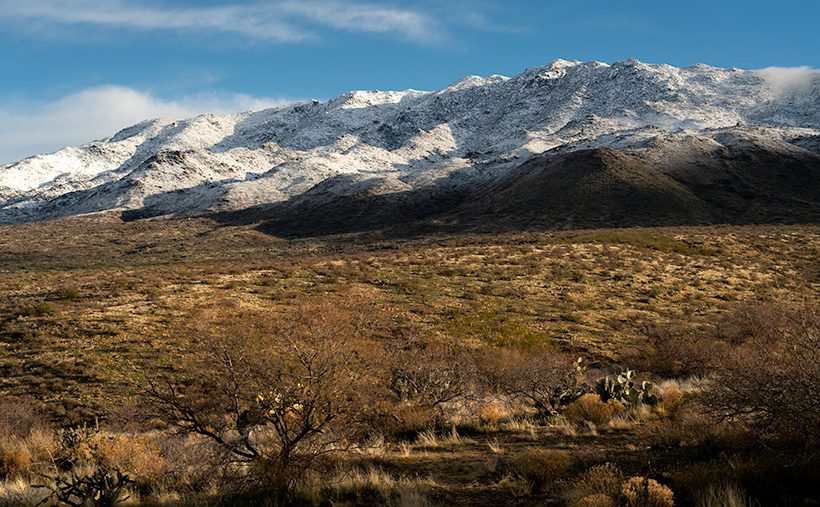
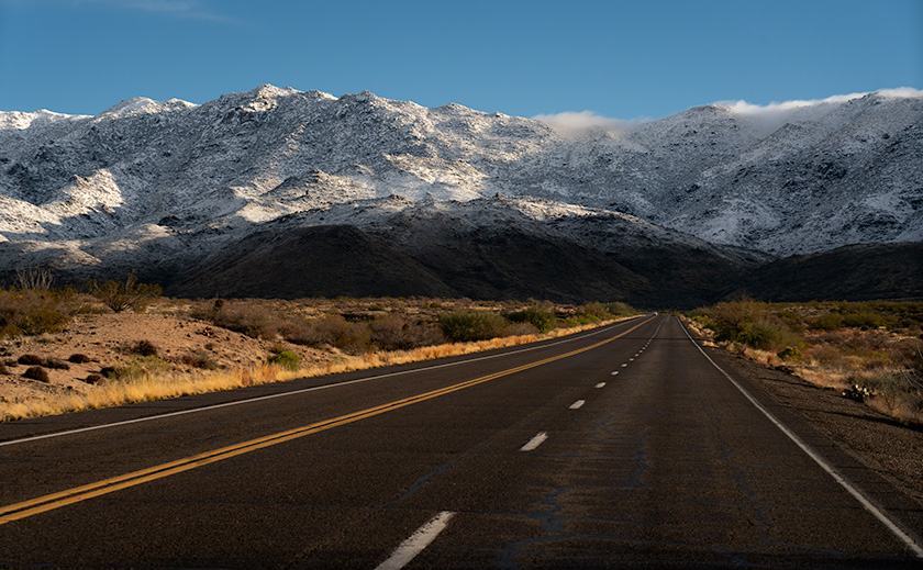
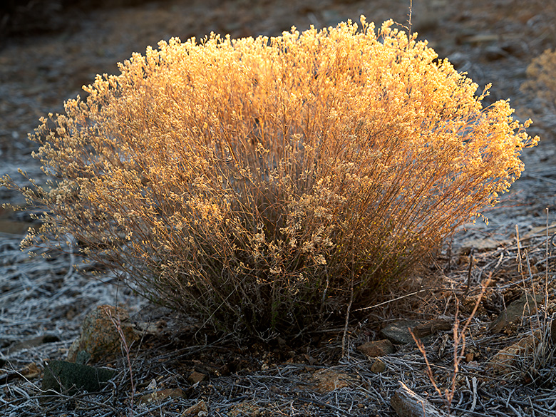
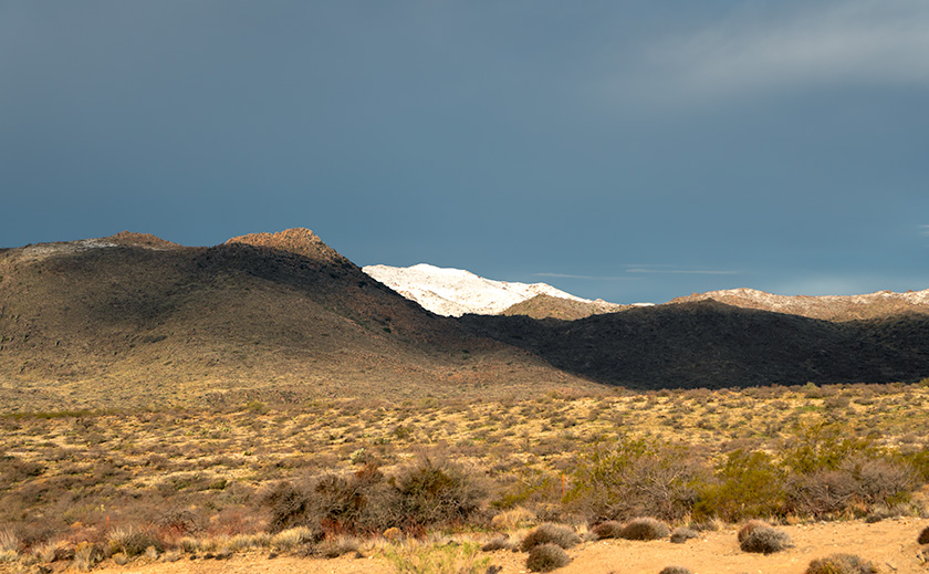
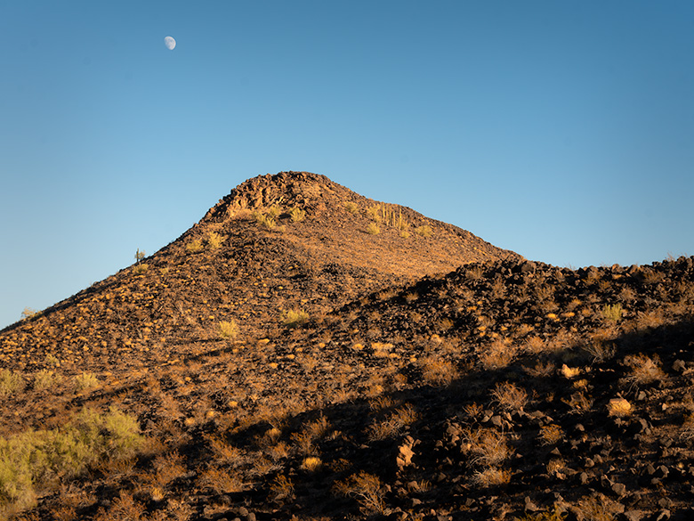
The evidence of all this geological chaos is still visible today. Any hill, mountain, or plain covered in black basalt is a telltale sign of volcanic activity. You can spot these dark, rocky remnants from your car as you cruise Arizona’s desert highways, head toward California, or explore the state’s backroads. These basaltic leftovers aren’t just eye-catching—like a giant road map to the state’s fiery past.
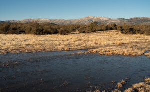
All this volcanic activity didn’t just leave behind rugged peaks and lava fields; it also created geothermal hotspots. When groundwater seeps deep into the Earth, it brushes against rocks still warm from ancient magma chambers and rises to the surface as hot springs. While Arizona isn’t as famous for these thermal features as neighboring Nevada, it still boasts a few noteworthy examples. Tonopah and Castle Hot Springs offer glimpses of this natural phenomenon. Still, one of the most intriguing is the spring at Agua Caliente—a warm oasis that once lured travelers seeking rest and rejuvenation in the heart of the desert.
Indigenous and Early History
Long before stagecoaches rattled across Arizona’s rugged terrain or settlers carved dusty trails, the hot springs at Agua Caliente were a haven for Indigenous peoples. Tribes such as the Hohokam and later the Tohono O’odham and Apache revered the springs as sacred ground. Their mineral-rich waters weren’t just warm—they were believed to heal both body and spirit, offering relief from ailments and a deeper connection to the land. The springs were more than just a practical resource for these early inhabitants—they were a spiritual touchstone, humming with the Earth’s energy.
When Spanish explorers ventured into the region in the 16th and 17th centuries, they encountered these springs and called them Agua Caliente—”hot water.” To the Indigenous peoples, however, the springs were simply part of a greater whole called Tonopah, meaning “hot water place.” Though the Spanish expeditions were brief, their naming left a lasting imprint on the area’s history.
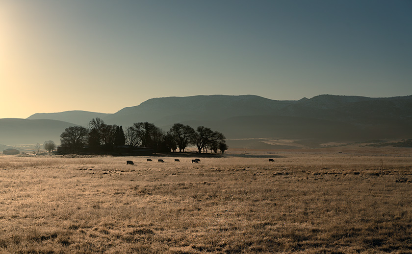
By the mid-19th century, Agua Caliente was at the crossroads of history as westward expansion swept through the region. The Butterfield Overland Mail stage line, operating from 1858 to 1861, threaded its way across the Arizona desert, linking the eastern United States with the golden promises of California. While Agua Caliente may not have been an official stop, its reputation as a reliable water source made it a lifeline for travelers braving the relentless sun and parched soil. To a stagecoach driver, spotting those steaming springs must have been like finding an oasis in a sea of dust.
Later, the Oatman Route brought settlers, traders, and wagons rolling through the area, further cementing Agua Caliente’s importance. Named after the harrowing story of the Oatman family’s capture by the Yavapai, the trail became a crucial passage for pioneers navigating Arizona’s unforgiving wilderness. Even the Yavapai and Apache, who knew this land better than anyone, often stopped at the springs during their movements. Agua Caliente stood where cultures intersected—a desert crossroads where survival trumped divisions.
Before the railroads ironed their way through Arizona’s vast deserts, Agua Caliente was a beacon for anyone bold enough to journey through southern Arizona. From Indigenous healers seeking spiritual renewal to stagecoach passengers desperate for a drink, its waters sustained weary travelers across centuries. Every ripple in its springs carried a story, each as rich as the minerals bubbling up from the depths.
Agua Caliente’s Heyday
By the late 19th and early 20th centuries, Agua Caliente had transformed from a dusty desert waypoint into a sought-after retreat. The adobe guest quarters, built in the 1870s and expanded over the following decades, were simple yet inviting, nestled among the desert plains. Their charm matched the bubbling pools of mineral-rich water, which promised relief from aching joints to mysterious ailments doctors couldn’t quite name. Agua Caliente was Arizona’s answer to high society’s spas for a taste of rustic charm with the allure of healing waters.
The Southern Pacific Railroad played a crucial role in the resort’s rise, mainly after Arizona achieved statehood in 1912. Railcars carried passengers from the soot-stained cities of the East, eager to trade Wall Street stress for desert serenity. Lured by tales of magical waters, visitors—many dismissive of Indigenous traditions—were quick to embrace the springs’ purported healing powers. After all, if hot water could fix a stiff back, gout, or “nerves,” it was worth a shot.
Agua Caliente thrived in a world that was rapidly modernizing. As Arizona became the nation’s youngest state, the resort became a beacon for weary travelers and health seekers. The adobe lodges buzzed with activity. Guests soaked in the steaming pools daily, claiming the mineral waters melted away ailments and sour moods. By evening, laughter spilled from the adobe walls as card games and tall tales of desert adventures echoed into the night. It was a perfect mix of elegance and frontier spirit—where boots met parasols, and everyone left with a story.
Agricultural Development and Water Table Decline
As the 20th century progressed, the once-thriving oasis of Agua Caliente began to wither—fade from neglect but from the insatiable demands of agriculture. For much of the early 1900s, Arizona’s deserts were seen as vast, useless expanses. But farmers soon discovered a transformative truth: add water, and the barren soil could burst into life. With the promise of productivity on the horizon, the surrounding plains transformed into a patchwork of cotton fields and other thirsty crops stretching to the horizon. Wells were drilled, pumps roared, and groundwater flowed like there was no tomorrow—all to sustain an agricultural empire that would help feed the growing demands of a nation.
The boom wasn’t just about local ambition. As the country mobilized for two World Wars, cotton and other desert crops became vital resources for military use, from clothing to tents and more. The fields didn’t just symbolize progress—they represented patriotism and the belief that even the desert could serve a higher purpose. But with this progress came a cost.
Farmers likely dismissed the first murmurs of trouble. After all, how could a few wells harm a spring bubbling faithfully for centuries? To them, the water table was like the change jar on the kitchen counter—always there when you needed it. But the Earth, it turned out, had a different balance sheet. As the water table sank lower and lower, the hot springs that had sustained Agua Caliente faltered. Once-vibrant pools turned to muddy trickles, and the resort’s lifeblood evaporated into the desert air.
The decline of the springs was more than just a geological shift—it marked the end of an era. Without the water, the allure of Agua Caliente faded, leaving the adobe walls to stand as silent witnesses to what was lost. The same farmers who benefited from the booming fields likely drove past the resort ruins, perhaps scratching their heads and wondering what went wrong. Few, if any, ever connected the dots between their pumps and the death of the springs, a quiet casualty of human ambition.
Decay and Urgency to Visit
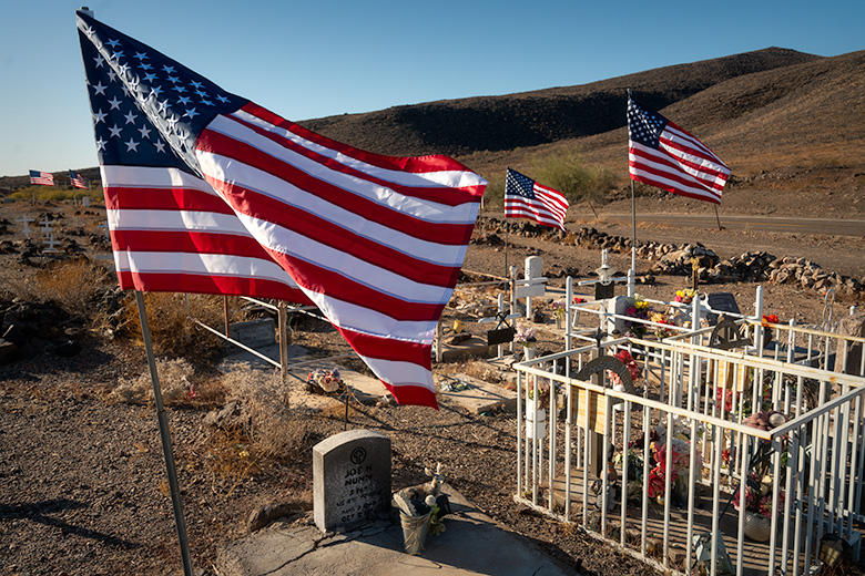
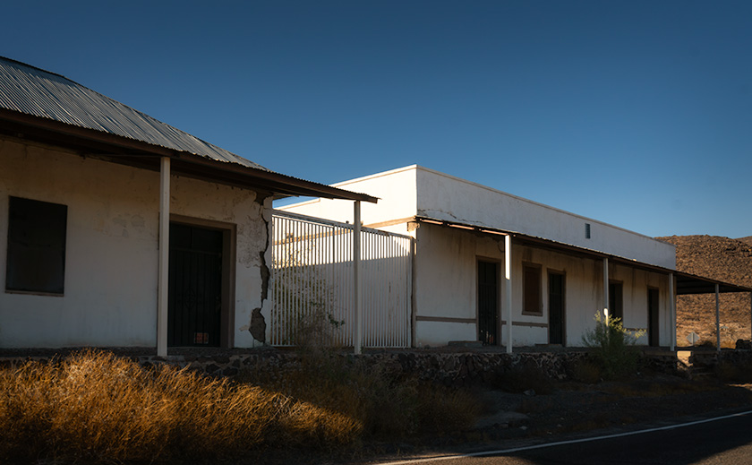
Once a bustling oasis, the Agua Caliente resort now teeters on the edge of oblivion. The adobe structures, including the reception area and guest quarters, slowly succumb to time, their plaster peeling like sunburnt skin and walls crumbling into dusty heaps. Surrounding buildings, some made from rugged black basalt, are in various states of disrepair—especially those farther from the leading club central, where collapse seems not just likely but inevitable.
Ownership of the site remains a mystery, shrouded as much in obscurity as the ruins themselves. Nearby, a covered structure housing hay and equipment hints at a private owner, though specifics are hard to come by. What is clear, however, is the lack of preservation efforts. With no markers, informational signs, or protective measures, Agua Caliente’s historical significance seems to hang by a thread, leaving the remaining structures at the mercy of the relentless desert sun.
For those intrigued by its haunting beauty, visiting Agua Caliente sooner rather than later is not just a suggestion—it’s a ticking clock. The adobe walls and basalt stones are steadily losing their battle against gravity and heat, while the surrounding grounds are a minefield of rusted roof timbers, ancient nails, and the odd relic of its former life. Add to that the possibility of encountering a rattlesnake seeking shade during summer, and it becomes clear: caution is your best companion.
But tread lightly, both literally and figuratively. These ruins are more than just crumbling buildings; they are fragile echoes of Arizona’s past. The desert reclaims a little more sand each year, and time erases what remains. If you’re tempted to take a souvenir or leave your marks, resist the urge. Respecting the past means preserving it for others to experience its quiet, crumbling beauty—just as you have.
Agua Caliente is a place where history whispers, not shouts. Visit while you still can. Move carefully, look closely, and honor the stories etched into the adobe and basalt. They won’t linger forever.
Final Thoughts
Thank you for joining me on this journey through time to the once-thriving resort of Agua Caliente. From its fiery volcanic beginnings to its heyday as a desert retreat and, finally, to its quiet decline, this place stands as a testament to the resilience of nature and history. It’s a story of survival, ambition, and the delicate balance between progress and preservation. I hope you’ve enjoyed exploring its layers as much as I’ve enjoyed sharing them.
Be sure to visit the gallery on my website for larger photos of the ruins and the surrounding desert landscape. These images, featured in the New Work portfolio for the next three months, capture this unforgettable place’s haunting beauty, quiet mystery, and inevitable decay—and they might inspire your own adventures.
Next month, we’ll hit the road again to uncover another abandoned spot steeped in history and intrigue. Where will the road take us? That’s a story for another time—you must stay tuned to find out!
Until then, keep exploring, respect the places you visit, and remember to bring water—especially if your journey takes you to Agua Caliente.
jw