Blue Tank Wash Picture of the Week

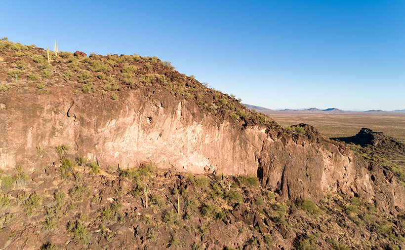
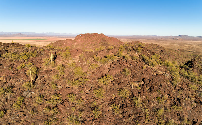
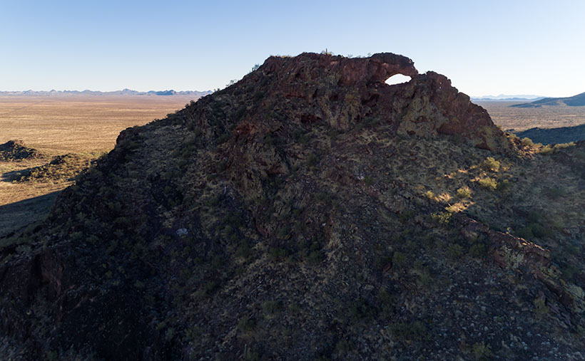
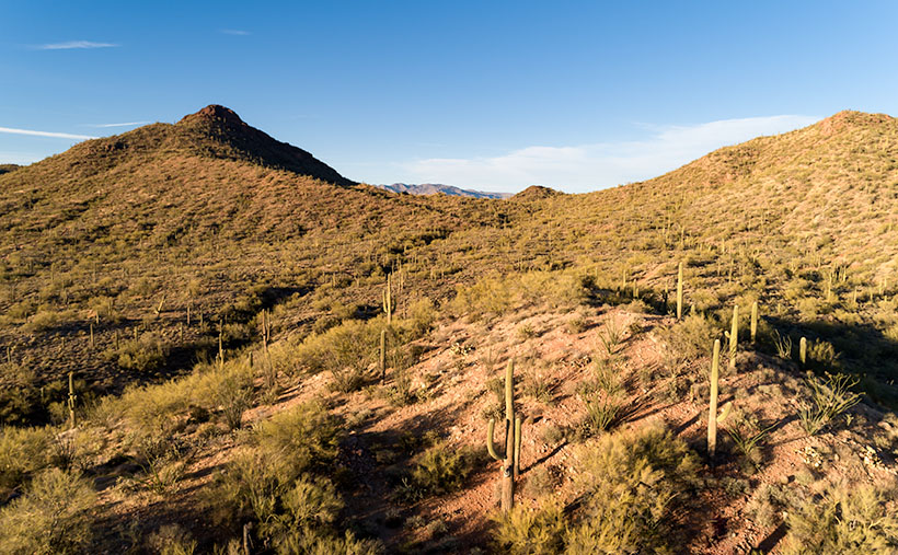
Along U.S. Highway 93, between Congress and Wickenburg, are a set of peaks that I’ve had my eye on for the last five years. They aren’t named because they’re slightly greater than a line of hills. Their color is the same as the surrounding desert, except they have a basalt mantle along the top. Sometimes the darker capstone looks like a shadow on the hilltops.

They’re generally aligned in an east-west direction, with the Hassayampa River on the west and the Blue Tank Wash on the east side. As they face south, there never seems to be a flattering light on them. The other challenge that I have is getting all four peaks into a frame. Even from the highway (3 ½ miles away), they only fit in with a wide-angle lens. That means that all of the homes, ranches, and construction lining the Hassayampa would be included in the photo. So I decided to get closer and pick them off one-by-one.

Two old mine roads radiate out from Wickenburg (Rincon Road and Constellation Road), and connecting the two is another path called the Blue Tank Wash Road. This dirt trail runs through the valley on our range’s south side. Late afternoon this Tuesday, I drove Archie up there to see what I could do.

Blue Tank Wash - Two of the four mountains that rise above the Blue Tank Wash Road near Wickenburg, Arizona.
Blue Tank Wash – Two of the four mountains that rise above the Blue Tank Wash Road near Wickenburg, Arizona.

This week’s featured image is the first variation that I liked. I wanted shadows to show texture and depth, so I shot this from the third peak looking west at the second. I was fortunate to find some sunlit saguaro growing in reddish soil to place in the foreground for scale. The bright spot gives balance to the dark peak in the background. I call this image Blue Tank Wash.

You can see a larger version of Blue Tank Wash on its Web Page by clicking here. Be sure to come back next week for another of my images from the small mountains above the Harquahala.

Until next time — jw

Eagle Eye Cliff Picture of the Week

There’s trouble brewing for me. In this case, it’s a good problem—it’s mischief, really. My conflict is a clash between my annual wanderlust and self-preservation. Sitting on each of my shoulders is an angel and a devil (they’re a metaphor, I don’t really see them, so don’t send a paddy wagon after me). The good one tells me to take the long-term view, while its counterpart tempts me with immediate gratification.

Arizona’s winters come in two parts; cold and wet. They’re relative, of course, nothing like what you see in other parts of the country, but hey, it’s what we’re used to. During the cold period, our weather drops in from the Gulf of Alaska. The second half of our winter is wet because the incoming storms originate over the Pacific. In between these mini-seasons, high pressure settles over the State, and we have warm, sunny days and cool evenings. This period of ideal weather can last from one to six weeks. Last year, we skipped the wet part and went straight to summer.

Last week we had a cold front move through our state with high winds and cloudy skies. It left us and went to Texas, and you can see what happened there. But the second half of the week was sunny and clear. The air was so clean; you could make out boulders on distant mountains. I immediately knew that this is our mid-winter lull. I say we should close the Arizona border so outsiders don’t find out why we live here.

Thursday morning, I took my cup of coffee out onto the back of the deck, and I got that familiar feeling in the pit of my stomach. I need to be on a boat somewhere with a fishing line tied to my big toe while I nap in the sun. This is my annual spring wanderlust, and I want to go somewhere—anywhere. I’ve had enough of winter; I’m ready for adventure.

But, we still have this global plague to deal with. Queen Anne and I have received our first vaccine dose, and next week, we get the second. However, that isn’t a Get out of jail free card. We still have to constrain ourselves. I don’t know how much more willpower I have. I’m really ready to flick the angel off my shoulder and drive to the coast to taste the new wines, visit some Santa Fe galleries, or explore Utah’s Henry Mountains, anyplace but Aguila.

Eagle Eye Cliff - The cliffs on the south side of the Eagle Eye Mountains shows that there is limestone foundations under the lava.
Eagle Eye Cliff – The cliffs on the south side of the Eagle Eye Mountains show limestone foundations under the lava.

But since we’re still stuck in Aguila, let me show you this week’s featured image. I call this one Eagle Eye Cliff. It’s from the same pair of mountains as we’ve explored for the last couple of weeks. The two peaks are the eastern end of the Harquahala Range and are dwarfed by their big brother next door.

I’ve already talked about how the Eagle Eyes are covered in lava, but you can see a limestone foundation underneath in this shot. I don’t know if the white cliff is the remnant of an old reef or the volcanic stone shielded it from erosion. To me, it looks like sloppily done chocolate icing on a white cake. That’s barbaric. Everybody knows that white cake should have caramelized pineapple on it.

You can see a larger version of Eagle Eye Cliff on its Web Page by clicking here. Be sure to come back next week, and I’ll show you the final shot that I liked from my outing in Aguila.

Until next time — jw

Eagle Eye East Picture of the Week

My sweetie loves me! Incredible, I know. After living together for over 32 years, this morning, on Valentine’s Day, she asked me what I would like for a romantic dinner. The question took me by surprise. I had to think about it. I puzzled about which meals nurtured the minds and souls of great artists. What’s the most romantic place I can think of? Then it hit me—Giverny, France of course—home of Claude Monet. So I looked up the restaurant menu from Hotel Baudy—a scene in several of his paintings and where he gathered with many of his Impressionist cronies.

I Google translated each menu item looking for something manly and not cheesy. Halfway down the list, the obvious choice jumped off the page. It has three of the world’s best things you can put in your mouth in one dish: Magret de canard poêlé aux cerises et sauce au porto—seared duck breast in a cherry-port sauce. Ah—I slobbered all over my keyboard, thinking about it.

I rushed into the living room where Queen Anne was reading the Sunday paper dressed in her threadbare robe, fuzzy slippers, and rollers. I blurted out my dinner choice. I guessed wrong. She explained that what she meant was, “Which of the packages in the freezer do you want me to microwave for you—and you can’t have the one that I picked.” <Sigh> So, I picked the other TV dinner. Ain’t love grand?

Eagle Eye East - The view from the top of Eagle Eye Mountain looking east towards the arch on Eagle Eye Peak in Aguila, Arizona.
Eagle Eye East – The view from the top of Eagle Eye Mountain looking east towards the arch on Eagle Eye Peak in Aguila, Arizona.

Letting my romance wilt on the vine, let’s talk about this week’s featured image. As I promised last week, I wanted to show you the Eagle Eye Arch from another angle. In this image—that I call Eagle Eye East—we’re looking at the arch from the south side of the mountains in Aguila. I shot this picture from the top of Eagle Eye Mountain facing Eagle Eye Peak, and that’s why the arch seems more distant than last week’s photo. Since this was the sunny side of the mountains, it better shows how rough the lava surface is. I like how the bright green saguaro and palo verde contrast with the reddish-brown rocks.

Another interesting thing in this image—to me—is the background mountains. The Forepaugh Range is on the right and beyond them is the town of Wickenburg. Beyond the Aguila Valley, the tall mountains on the left horizon are the Weavers, and that’s where we call home.

You can see a larger version of Eagle Eye East on its Web Page by clicking here. Be sure to come back next week, and I’ll show you the final shot that I liked from my outing in Aguila.

Until next time — jw

Eagle Eye Peak Picture of the Week

The last time I wrote about Aquila’s Eagle Eye was in 2018, and I didn’t have much to say about it—other than it was there. That post included a photo that I shot with a telephoto lens from miles away. I had to do that because a lot of the land around the peak is posted as private. There were two comments on that column. The first was from Fred, who thanked me for pointing out the bridge to him, and the second was from my old friend Gary who chastised me for not getting closer.

This month—since I’ve been hanging around Aguila anyway—I thought I’d try to make Gary happy. About three miles south of Aguila are mountains on the east flank of the Harquahala range. They almost have the same name; Eagle Eye Mountain is on the west while Eagle Eye Peak is the lump of lava to the east (they actually touch one another). The latter peak is the one with the window on top.

Eagle Eye Peak - A natural arch on top of a peak several miles south of Aguila, Arizona
Eagle Eye Peak – A natural arch on top of a peak several miles south of Aguila, Arizona. Behind Eagle Eye is the Harquahala Plain, which stretches south to the Big Horn Range on the horizon.

You can get very close to the arch if you drive to the old cemetery where Eagle Eye Road bends around the mountains. The bad news is that you can’t see the arch from there because it faces east, and all you see are the rocks from the edge on. There’s a better view if you scramble up an 800’ cactus-infested lava hill like an insane person, but I did the lazy thing. I brought my drone, and I flew it to the mountain top. Once it got up there, I rotated it to the right and composed this shot.

The Eagle Eyes, like a lot of low desert mountains, were formed from volcanic activity. This particular pair of mountains are basalt covered limestone. The rocks are much darker than the rest of the Harquahala Range. They appear as shadows on the horizon. Their surface is rough and pockmarked like they had a bad case of acne. They are riddled with caves formed by air-pockets in the lava.

I didn’t find an article that explains how this arch was formed. I don’t think it was formed from wind erosion. The rocks aren’t polished. It could be from one of those air-voids in the thin-walled lava collapsing. My favorite guess is this: If this is Rhyolite—slow-moving lava common to peak formation—then maybe a cone of lava formed vertically, and as it cooled, it slumped over and froze in place. At least that’s what it looks like to me. What do you think?

Well, Gary, I hope you’re happy. You can see a larger version of Eagle Eye Peak on its Web Page by clicking here. Be sure to come back next week when I’ll show you the arch from a different perspective.

Until next time — jw