Arlington’s Abandoned Feed Mill: Fading Memories of Cattle Country Picture of the Week - Arlington, Arizona

Abandoned farm equipment at Arlington Cattle Company
Arlington’s Abandoned Feed Mill – The abandoned grain hoppers and silos of the Arlington Cattle Company were left to rust in the Arizona desert.

Last week, I wrote about the exceptional rainfall we had in Arizona and how the wildflowers love it. Well, the same wet winter that showered our land with nature’s colorful confetti also brought heavy mountain snowfall. Since the predicted snowmelt and runoff would overflow our reservoirs, the Salt River Project began releasing water into the river. It’s been quite a while since we have had water in our ordinarily dry riverbeds. While some may scoff at the idea of water in Arizona’s riverbeds, I was thrilled that I might get the chance to shoot some whitewater rapids in the desert.

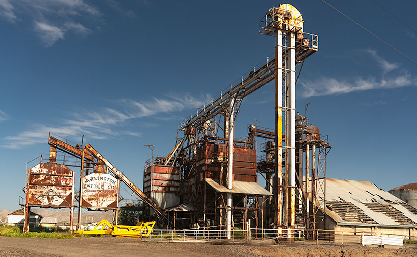
I convinced Queen Anne to go-for-a-ride(?) a couple of weeks ago. We drove down the west valley to the Gillespie Bridge, excited at the prospect of capturing the raging torrents of water. However, upon arrival, we were met with disappointment. The river was spent and lethargic when the artificial flood passed through Phoenix. The snowmelt’s aftermath left us with sluggish, murky water oozing through the tamarisk. It looked more like effluent than a river. Feeling disheartened, we started to return home when I noticed the stunning light falling on the machinery at the Arlington Cattle Company. When I stopped the car and grabbed my camera, Anne responded, “Hurry up! I’m Starving.”

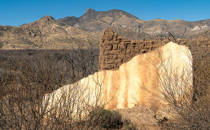
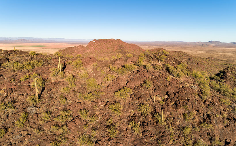
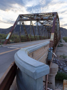
The Gila River begins its journey in New Mexico’s Gila Mountains. It collects water from its tributaries, including the Salt River, the Verde River, the Santa Cruz River, the New River, the Agua Fria River, and the Hassayampa River. The Gila River embarks on an audacious westward journey, carving its path through untamed landscapes. Just after the confluence of the Gila and Hassayampa rivers, the Gila turns south for thirty miles towards Gila Bend. As the river flows past the Buckeye Hills, it enters a natural pinch point several miles down old US 80. It passes between a formidable silhouette of a volcanic sentinel and the edge of Gillespie Shield Volcano. The black rock lava flow rises two or three stories above the road and river and is known for its impressive pictographs, visible along the cliff of lava rock when examined closely. At this pinch point, pioneers attempted to build three versions of the dam. After they all failed, the highway department erected an all-season bridge to cross the river. Local farmers plant the dam’s old flood plains in summer with deep green cotton, making the little valley a desert oasis.

I’ve been to the Arlington Cattle Company before, so this wasn’t my first time photographing this abandoned equipment. The last time I photographed there was over a decade ago; the massive boom that sent grain over the road to the feed lots there had collapsed into the canal flowing along the roadside. Someone has cleaned that mess up since then. As I stood and framed the shot, I could hear the ghostly sounds of machinery banging, gears meshing, and belts squealing in protest. The equipment stands as a testament to the relentless march of time, bearing the scars of decades past, with the weathered vestiges of industry adorned in hues of faded silver and rust contrasting against the intense blue sky. However, what catches my eye in this photo is the tall silver elevator, which towers above all else, and with the sun’s reflection, it appears as a beacon against the bright blue sky. The wispy white clouds in the background are a bonus and provide a nice contrast to the earthy tones of the equipment.

The Arlington Cattle Company was established in the early 1900s by a group of investors led by William W. Clemens, who also served as the company’s president. The company purchased approximately 55,000 acres of land in the Arlington Valley and constructed a state-of-the-art cattle feeding facility. The company aimed to fatten cattle for the market using a combination of locally grown grains and hay from nearby farms.

The facility stood as a cathedral of innovation, a testament to the audacity of human endeavor, featuring a grain elevator that could lift and store thousands of bushels of grain at a time. The elevator was powered by an extensive motor and conveyor system that could move the grain from the elevator to the various silos and feedlots throughout the property. The company also built a vast network of canals and irrigation ditches to ensure a reliable water supply for the crops (and cattle).

Despite the initial success of the operation, the Arlington Cattle Company struggled to turn a profit. The company faced several challenges, including drought, floods, and fluctuations in the price of beef. In addition, the company’s location in a remote part of the state made transportation difficult and expensive. As a result, the company was forced to declare bankruptcy in the early 1920s. After the default, the land and equipment were sold to various buyers. Today, the rusting equipment seen along the roadside in the Arlington Valley are the only remnants of the Arlington Cattle Company.

Rustic Gillespie Bridge spanning the Gila River with a mountain in the background
Old US 80 Bridge at Gila River – The historic Gillespie Bridge at Gila River, part of Old US 80, features a rusted iron truss structure and spans over the water with a volcanic rock mountain in the background.

I hope you enjoyed this week’s photo and reading about the Arlington Cattle Company and the old farm equipment that still represents Arizona’s ranching history. Don’t forget to check out the larger version of Arlington’s Abandoned Feed Mill Cattle on our website by clicking here. Join us next week for more fascinating stories and photos of farming equipment, from the old to the new. And who knows, maybe we’ll even find something borrowed and blue. Thanks for reading!

Till next time
jw

Adobe Ruin Picture of the Week

Adobe Ruins - In the ghost town of Dos Cabezas, most of the remaining buildings are severely decayed.
Adobe Ruins – In the ghost town of Dos Cabezas, most of the remaining buildings are in a severe state of decay.

Roughly midway between Willcox and the Chiricahua National Monument, the county highway’s speed limit drops to 45 mph. At first, there’s no clue about the slowdown until a small sign announces that you’re entering the town of Dos Cabezas. Only three of its dozen or so buildings are worthy of occupancy. The rest are in various states of decay. It’s only a city block long, and you soon return to an empty country road, where you can reset the cruise control.

After driving through Dos Cabezas three times, I insisted on stopping on our fourth pass. As regular readers know, I’m a sucker for historic buildings, whether they’re restored or about to be blown down by the wind. I’m glad that I did, and this week’s featured shot is one of several that I captured during that afternoon.

As with most Arizona ghost towns, Dos Cabezas’s history is a flash of glory followed by a long decay period. The town is located at the southeastern reach of the mountain range, which shares the same name. When word came out that prospectors discovered gold and silver on the mountain, miners swooped in like hungry vultures to feed on a carcass. The Feds opened a Post Office in 1878, which served a population of 300 that eventually swelled to over 4000. They found little gold in the Elma mine, but there were some copper deposits. Investment capital dried up when investors discovered that the mine was a scam and part of stock fraud. People left to find work elsewhere. As the town dwindled, the Post Office finally closed its branch in 1960. I guess that you could count today’s Dos Cabezas citizens on one of your hands.

In this picture that I call Adobe Ruin, you see the remains of a large building constructed using adobe bricks and stucco. The town once had a hotel, and these sections may be all that’s left of it. Adobe was a common building material throughout the old southwest because it was simple to make. All you need is to combine mud and straw and let it dry in the sun. The thick bricks provide plenty of protection from the desert heat and cold winters, but they quickly erode once water enters them.

I took several variations of the building, but I favored this one because I liked the mud stains streaking down the wall, and I liked the wall’s placement before the background’s two-headed mountain. The desert willow and hackberry show how soon nature reclaims her own. Ashes to ashes, as it were.

You can see a larger version of Adobe Ruin on its Web Page by clicking here. Next week, we’ll walk down the street to look at another of the Dos Cabezas ruins. Come back then and have a look.

Till Next Time
jw

Thumb Flat   Picture of the Week

With a basic knowledge of native Arizona plants and observational skills, it’s easy to tell what elevation you’re at in our state. Maybe only Florida is easier because the entire state is below 350′. I’ve written before about how State 48 has all but two of the world’s climate zones; sub-tropic and tundra permafrost. So all you have to do is look at the bush you’re standing next to you for a clue.

For example, compare last week’s picture to the one that I posted today. The tall ponderosa pines you see in Yellow Field thrive at altitudes over 6,500 feet. While the pinion pine in this week’s image—Thumb Flat—is the dominant plant between 5,000 and the appearance of tall pines. My rule is only a rough generalization because there are microclimate pockets all across the state. I can name two places off the top of my head as examples; Palm Canyon in the KOFA Range south of Quartzite and the east slope of the Poachie Range south of Wikiup. The state’s only native palms grow in a mountainside crevice at the first location, and the latter has saguaro and pinion pine intermingling on its slopes.

When Queen Anne and I visited Williams, it was only natural as we drove down the south slope of the dormant volcano to see ponderosa pine replaced with stands of juniper. As the White Horse Lake Road descended even lower, the juniper became sparser. By the time we reached Thumb Flat—as it’s called on the map—individual trees had stood alone in the wildflower-covered fields.

Thumb Flat - A beautiful alligator juniper stands in a wildflower covered field.
Thumb Flat – A beautiful alligator juniper stands in a wildflower-covered field.

Here I spotted this beautiful alligator juniper, which made me stop Archie and get its portrait. I think this specimen would be a prized possession in anyone’s garden. Probably the only reason this tree isn’t already in somebody’s front yard is that it’s in the middle of the Kaibab National Forest.

In this week’s featured image that I call Thumb Flat, I like how the foreground is darker in color from being in the shade of a cloud. It contrasts nicely against the bright white background cumulus clouds. The wildflowers are the same as in last week’s image, but you can see how much more dull they are when they’re not in direct sunlight. In this case that’s OK because they’re not the subject here—this week, they’re only playing a ‘walk-on’ part.

You can see a larger version of Thumb Flat on its Web Page by clicking here. Next week, we turn onto another side road, so come back and see where that road ends.

Until next time — jw

P.S. If the picture is not showing up in your email version of this post, you can click on the article title (Thumb Flat) to open the Web version of this post.

Yellow Field Picture of the Week

The four roads out of Williams, Arizona, point to the four compass directions. To the east and west is Interstate 40—the modern-day version of Route 66 and even older trails that the First Nation People used. To the north is Arizona Route 64—the busiest route to the Grand Canyon. The least traveled road goes south and is Coconino County Route 73, or Perkinsville Road. This is the back road that we’re using for this month’s project.

If you’ve never heard of the town of Perkinsville, it’s understandable. It’s been a ghost town ever since its lime quarry shut down in the 1950s. Several families still live in the Perkinsville area, but its biggest claim to fame is the Verde Canyon Railroad stop, where they turn the train around. Also, if you’ve ever bought Arizona red flagstone, it comes from neighboring quarries between Drake and here.

To get to our road, you take 4th Street south from downtown Williams, to where it changes name at the town’s edge. The paved two-lane road winds through Cataract Canyon past a handsome masonry dam and reservoir. The railroad built it to supply water for the steam trains, and the name, Santa Fe Reservoir, has stuck. Shortly after, the road climbs up and over the east shoulder of Bill Williams Mountain, and you’re quickly in a ponderosa pine forest.

Within minutes you reach the road’s crest, and open pastures appear. Here you’ll see hiking trail signs that direct you to a trail that climbs to the mountain’s 9253-foot summit—should that be something on your bucket list. Further along, there’s another side road that goes to the Williams Ski Area. I didn’t even know that Williams had a ski area.

As Anne and I drove along the downhill slope, juniper replaced the tall pines, and large fields of yellow wildflowers were all around us. The good rains that we’ve had this summer have been beneficial for the flowers. We continued south on CR 73 until we turned east onto White Horse Lake Road. We were out after a weekend of rain, and although its surface is packed gravel, it’s navigable even for a 2wd sedan.

Yellow Field - The abundant monsoon rains that we've had have been especially good for the wildflowers.
Yellow Field – The abundant monsoon rains that we’ve had have been perfect for the wildflowers.

Since the flowers were so profuse, I wanted to take their picture with the sunlight beaming down on them, but a cumulus cloud got in the way every time I stopped Archie. I played this cat-and-mouse game several times before I captured this week’s featured image. I call it Yellow Field. I don’t know the flower’s actual name, but it’s the same weed we’ve been spraying for the past month in our yard. Wildflowers is weeds—who’d have thunk?

You can see a larger version of Yellow Field on its Web Page by clicking here. Next week, we’ll show more of the scenery we found on White Horse Lake Road. Come back then.

Until next time — jw

Eagle Eye East Picture of the Week

My sweetie loves me! Incredible, I know. After living together for over 32 years, this morning, on Valentine’s Day, she asked me what I would like for a romantic dinner. The question took me by surprise. I had to think about it. I puzzled about which meals nurtured the minds and souls of great artists. What’s the most romantic place I can think of? Then it hit me—Giverny, France of course—home of Claude Monet. So I looked up the restaurant menu from Hotel Baudy—a scene in several of his paintings and where he gathered with many of his Impressionist cronies.

I Google translated each menu item looking for something manly and not cheesy. Halfway down the list, the obvious choice jumped off the page. It has three of the world’s best things you can put in your mouth in one dish: Magret de canard poêlé aux cerises et sauce au porto—seared duck breast in a cherry-port sauce. Ah—I slobbered all over my keyboard, thinking about it.

I rushed into the living room where Queen Anne was reading the Sunday paper dressed in her threadbare robe, fuzzy slippers, and rollers. I blurted out my dinner choice. I guessed wrong. She explained that what she meant was, “Which of the packages in the freezer do you want me to microwave for you—and you can’t have the one that I picked.” <Sigh> So, I picked the other TV dinner. Ain’t love grand?

Eagle Eye East - The view from the top of Eagle Eye Mountain looking east towards the arch on Eagle Eye Peak in Aguila, Arizona.
Eagle Eye East – The view from the top of Eagle Eye Mountain looking east towards the arch on Eagle Eye Peak in Aguila, Arizona.

Letting my romance wilt on the vine, let’s talk about this week’s featured image. As I promised last week, I wanted to show you the Eagle Eye Arch from another angle. In this image—that I call Eagle Eye East—we’re looking at the arch from the south side of the mountains in Aguila. I shot this picture from the top of Eagle Eye Mountain facing Eagle Eye Peak, and that’s why the arch seems more distant than last week’s photo. Since this was the sunny side of the mountains, it better shows how rough the lava surface is. I like how the bright green saguaro and palo verde contrast with the reddish-brown rocks.

Another interesting thing in this image—to me—is the background mountains. The Forepaugh Range is on the right and beyond them is the town of Wickenburg. Beyond the Aguila Valley, the tall mountains on the left horizon are the Weavers, and that’s where we call home.

You can see a larger version of Eagle Eye East on its Web Page by clicking here. Be sure to come back next week, and I’ll show you the final shot that I liked from my outing in Aguila.

Until next time — jw

Dean Peak Picture of the Week

Dean Peak
Dean Peak – One of several points in the Hualapais over 7,000′. I captured this as the sun was setting and the rest of the mountain was in shade.

There’s a Prime Video series Queen Anne, and I watched this month called Good Omens. We enjoyed it so much that we watched it a second time, and caught a lot of the subtler jokes that we missed the first time. The main characters—an angel and his demon buddy—aren’t very good at their jobs, and consequently, they screw up Armageddon. This riddle was in an episode, “How many angels can dance on the head of a pin?” It’s a trick question because as God—the voice of Frances McDormand—explains; Angels don’t dance, that’s something the devil conjured, and there’s not a substantial enough number to count them all, because demons can line-dance in the spaces between the pin’s atoms—funny stuff. When I visited this month’s photo location, I thought about the show’s riddle.

For my August pictures, I only had to walk across the street—as such. My new subject is the mountain range on the west side of the Big Sandy River and U.S. Highway 93—the Hualapai Range. They’re part of the parallel mountain ranges making the Basin and Range Domain which runs from Utah to the California Sierras. From space, these formations look like a pack of caterpillars stampeding across a sidewalk.

The Hualapai’s are a twin to last month’s Aquarius Mountains, except they are high enough—7,000 to 8,400—for pinion and ponderosa pine to grow. That means they are often snow-covered in winter. They fill the area between Wikiup and Kingman.

When my folks lived in Kingman, I heard of a park up on the mountain, but never visited, so last week I loaded Archie and drove up Sawmill Canyon Road (alas, if there was a sawmill, it’s gone now). The DW Ranch Road exit on Interstate 40 is a handy shortcut to use if you’re coming from the valley. It’s less than 10 miles from the Interstate to the County Park which is situated in a tiny valley at the top, and where Kingman residents have packed summer cabins into every available space. As I drove along the deeply rutted streets, I wondered, “How many Ford executives can camp on the top of Hualapai Peak?” In the village’s center, there is a concrete catch basin that’s called Pine Lake, but I couldn’t find public access to it, and—from its color—I’m not sure you would want access anyway. I got frustrated at having to back out of each street I tried and decided to check out the Hualapai Mountain Park and campgrounds.

After paying a day fee, I parked in the trailhead parking lot and checked out the maps. It was already after five when I started on the path to Stair Step Overlook, about a half-mile hike. I was never athletic, and I don’t claim to be in great shape today. I grew up uncoordinated, and when I was a kid, I was always the last pick for team sports. But, I regularly walk now, and my average speed is over two miles an hour. I figured a 15-minute walk at the most, so I grabbed my camera and left my water in the truck. I was wrong. It took 10 minutes—coming back down the mountain. The trail climbed four-hundred feet in that half-mile. As I hiked, I followed a group of two men and a woman who were in their early thirties and equipped with day-packs. I followed them inch-worm style; they walked out of my sight and then they’d be resting when I caught up.

When I finally got to the overlook, my new hiking friends were lounging on large granite slabs and taking in the view. As I climbed up the stairs, I looked up to see six of them before my eyes could focus again. The woman looked concerned and asked, “Do you need water?”

“No,” I replied. “I only wanted to get here and take some pictures. I’m going back down right after that.”

Then the guy with the beard drove a stake through my heart, “Man! I hope that I can be hiking up and down some mountainside when I get as old as you are.”

I did get a shot from the overlook, but I took this week’s featured image on the drive home. I call it Dean Peak because that’s what this point’s name is. When I took this shot, the sun was almost down, and the lower part of the mountain was already in the shade. I hope you enjoy viewing it.

You can see a larger version of Dean Peak on its Web Page by clicking here. Be sure to come back next week when we’ll be showing more from the Hualapai Mountains.

Until next time — jw