Burro Creek Bridge Picture of the Week

I had been asleep for an hour when Queen Anne finally came to bed last night. She nudged me until I almost woke and snapped, “What?”

“It’s raining,” she gleefully said.

I rolled over, pulled the covers up, and tried to go back to sleep while grunting, “Harrumph.”

“It’s pouring,” she persisted.

“Why are you waking me?”

“You’re snoring,”

I was too sleepy to recall accurately what happened next, but I think she bumped her head because she went to bed and didn’t get up till morning. I swear that’s the actual conversation we had last night.

This year’s monsoon season is unlike the drought that we had last year. We’ve been enjoying a week of cloudy skies, isolated showers, and last night’s low was under 70°. It wasn’t that pleasant autumn-like 68° where you can throw open the doors and windows. It was 68° with 95% humidity—which is cool only if you have gobs of air blowing at you—aka swamp cooler. But still, we have a decent river flowing down the street out front and the Red Sea in our backyard. The two trellis vines out front that have spent last year imitating Paul Rubin’s death scene in Buffy the Vampire Slayer—are already sprouting fresh green shoots.

All in all, it’s been a good monsoon so far, and they say there’s more to come. I lament the wasted rainwater flowing down the streets. There should be a way to capture some of it and store it for a (forgive me) non-rainy day. The runoff flows down the washes and eventually into the Gila River, where the Gila Bend and Yuma farmers use it for their crops.

I’ll bet if I revisited Burro Creek—last week’s featured image—it would look like a proper creek instead of a string of puddles. I’m not going to risk a possibility of getting caught in a flash flood. Arizona has a Stupid Driver law now, and with my luck, I’d be the first person to get billed for my rescue. Instead—as I promised last week—I’ll turn the camera around so that you can see what’s downstream.
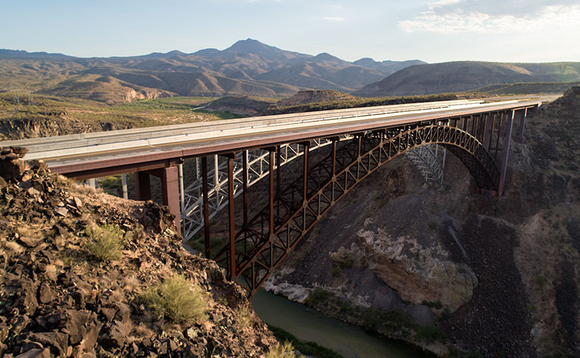
Burro Creek Bridges - A pair of future freeway bridges cross Burro Creek before Greenwood Peak.
Burro Creek Bridges – A pair of future freeway bridges cross Burro Creek before Greenwood Peak.

The subject of this week’s image is a pair of freeway bridges over Burro Creek, waiting for Interstate 11. Don’t be fooled into believing that this is an empty highway. U.S. 93 is normally a bustling traffic corridor. It’s just that my image was taken just after dinner when the freight drivers are still belching in truck stops.

You can see a couple of other things in the photo and another hidden by the bridge. First—under the bridge—are the deep pools in the creek. They’re wet all year round, so they have small fish in them. The minnows are useless to anglers, but they support a colony of Great Blue Herron that nest along the canyon walls.

Along the horizon is the 4,339 foot high Greenwood Peak. I have another shot of this mountain that was featured in a January 2020 post. During that month, Anne and I drove over the pass to the mountain’s left and, at the bottom, we found the road blocked by water flowing in the Big Sandy River. In that article, we remarked how the slopes of the Poachie Range were covered with saguaro and pinion pines growing next to one another.

Finally, what’s hidden behind the bridges is the Burro Creek Campground. It’s smallish with quiet camping spots until a loaded semi drives over the bridge’s expansion strips—the noise echoes along the canyon walls like Gilbert Godfrey with a megaphone. However, if you’re into history, the campground’s access road is the original two-lane highway that winds its way down the canyon, crosses the creek on a  low bridge, and then ascends the north face.

You can see a larger version of Burro Creek Bridge on its Web Page by clicking here. I have to come up with a creative idea for August, so please come back and see what I’ve come up with. For now, I’m going to don my galoshes and go stomp in some puddles.

Until next time — jw

Burro Creek Canyon Picture of the Week

There is the phrase Grand Canyon State on every Arizona license plate—it’s our state slogan. I find it ironic that the biggest thing we brag about is something that eroded millions of years ago. Sure, we have the World’s biggest hole in the ground, but there are many other sights in Arizona that we can be proud of.

I think that the slogan can have two meanings. First is obvious; the Grand Canyon State—we’re the state where the Grand Canyon is. The other interpretation that I see is; the grand canyon state—meaning that we’re a big state with lots of canyons within it. It’s true. We have pretty canyons all over the state. There’s the big ditch, of course, but there is also Canyon de Chelly, Salt River Canyon, Oak Creek, Madera Canyon, Sabino Canyon, and too many others to list here. Actually, I looked for a comprehensive list like the one I found for our mountains, but it alluded me.

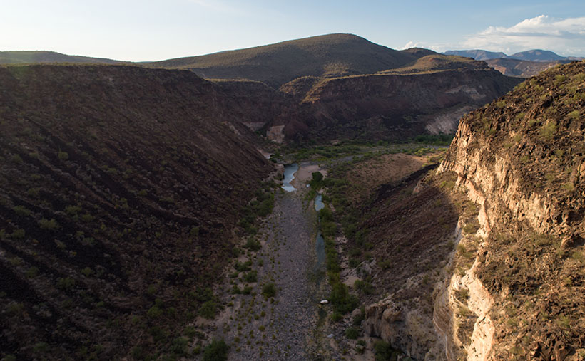
Burro Creek Canyon - An awesome view that most people miss because they're in a hurry to get to Vegas, or back home.
Burro Creek Canyon – An awesome view that most people miss because they’re in a hurry to get to Vegas or back home.

Our stop this week along Highway US 93 is Burro Creek Canyon. The view of the canyon is spectacular, but it’s hard to see from the road. The bridges over the chasm are short, and the walls are high, so unless they’re in a semi-truck, most people don’t get to see over them—a gripe I share with the new bridge at Hoover Dam. The highway department didn’t build a scenic overlook, and you’re not supposed to walk across the bridge. You can take in the vista in my shot by parking in an unmarked lot accessible from the northbound lanes. Then, a short hike up a trail will get you to the south wall.

Canyons have always been important to Arizona travelers because you usually find water in them. After all, that’s how they were carved. Burro Creek is one of those exotic desert waterways that always has water (in normal years). As you can see in my shot, a couple of surface pools reflect the blue sky even during our extended drought. That makes the creek a reliable water source for wildlife, cattle, and even the wild burros that are pervasive in western Arizona.

I’ve considered adding canyons to my projects list. There’s enough subject matter to fill another of my book fantasies. However, my to-do list already has mountains, old towns, historic hotels, deserts, farms, Colorado Plateau, and the Grand Canyon on it. How do I prioritize them? Where would I ever find the time to photograph them all? I’d have to clone myself because my time is getting short, and the list keeps growing.

You can see a larger version of Burro Creek Canyon on its Web Page by clicking here. Next week, I’ll turn the camera around for a nice look in the other direction.

Until next time — jw

Summer Joshua Picture of the Week

Nature diligently gives us clues about seasonal changes. When it comes to summer’s onset, I tolerate most of them. There’s a specific one that I’d be happy to skip. It’s the seasonal appearance of our first rattlesnake. When we moved into our little shack in Congress, our neighbors said that they rarely see one—maybe one shows up in the subdivision. However, we personally are averaging close to one a year. Since we spent our first summer in Alaska, there’s no telling how many slithered through the yard while we were gone, so we don’t know how many we missed in 2016.

This one—Sid, as Anne called it for some reason—showed up Thursday morning—our dump day. We always look forward to Thursdays because it’s our day out on the town. We gather our weekly trash and recycle and take it up to the dump. After that, we’ll swing by Nichol’s West for our usual eggs Benedict breakfast.

This week—while Anne prepared herself for the public—I emptied all the bins and boxes then loaded them into Archie. When she was finally ready, we opened the back door, and there Sid greeted us like a Jehovah’s Witness with a sack full of Watchtower magazines. Mind you; I had already been through that door a half dozen times. I have no idea the direction from which he came, but he seemed to enjoy sunbathing on the back-door mat.

I won’t bore you with an account of the ensuing battle because it went down pretty much like last year’s encounter, but I learned a couple of lessons that morning. The first is that there’s still a gap in the decking that I need to plug. The other thing I learned from our stare-down was more important. That little varmint struck at me a couple of times, and I had time to pay attention to his rattles. They’re softer than I expected, and they’re the same pitch as my tinnitus. That means that when I’m out stomping around the desert, I have to be vigilant about spotting them first because I’m deaf to their warning sound. Of course, the only time I’ve ever spotted a rattler; it’s been in our backyard.

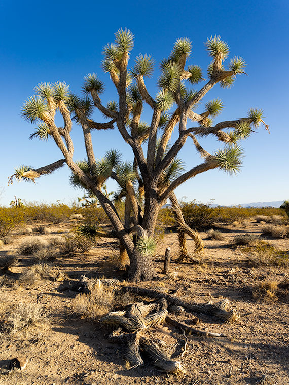
Summer Joshua - Joshua trees shed unnecessary leaves to help get through the hot summers in the desert.
Summer Joshua – Joshua trees shed unnecessary leaves to help get through the hot summers in the desert.

There were no snakes around when I shot this week’s featured image called Summer Joshua. On our journey north on U.S. 93, the next landmark that I wanted to show you was the large area of Joshua Trees. Because so many grow along this section, it’s called Joshua Tree Parkway. It’s a north-facing 13 mile downhill slope on which the giant lilies thrive.

The Joshua is dense along this part of the road, so when I found this isolated specimen, I stopped and asked if it would sit for a portrait. Even with the fallen limbs in the foreground, this is a healthy plant, and you can see one of its heat survival secrets. Actually, you can’t because the secret is the sparse foliage. Like most Sonoran Desert plants, the tree only has the minimum amount of leaves to keep it alive. That strategy cuts down on water evaporation, a scarce commodity around these parts. The old dry foliage folds and covers the branches, which helps cool the plant the same way people use parasols for shade. Cool being relative, because when I shot this image, the air temperature was 105° even though the time was after 5:00 pm.

You can see a larger version of Summer Joshua on its Web Page by clicking here. Next week, we’ll continue north and find another landmark along US 93, so ya’ll come back now—eh?

Until next time — jw

Date Creek and Tres Alamos Picture of the Week

Working during the summer is challenging, whether in house chores or photography. That’s why my favorite pastime during these months is procrastination. Face it; I’m allergic to heat. Thinking about going outside is worse than actually doing so. After all, in today’s southwest, we’ve learned to minimize our heat exposure. We move about in a succession of air-conditioned cocoons.

Heat is why I had difficulty coming up with a theme for  July. The monsoons haven’t kicked in yet, so most pleasant campsites are on fire or closed. I must stay close to home, venturing early or after dinner, find a shot, and then hurry home.

I decided that July’s theme will be U.S. Highway 93. That’s the main thoroughfare near my house that Phoenicians (and Tucsonans) use to commute to Las Vegas. The route goes to Canada, but I’m only concerned about day trips. Because I’ve often traveled the section between here and Kingman, I know a few vistas I wanted to capture on film but never had time to stop. This week’s image is an example.

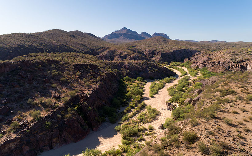
Date Creek and Tres Alamos - Date Creek as it flows by the Tres Alamos Wilderness Area near Congress, Arizona.
Date Creek and Tres Alamos – Date Creek flows by the Tres Alamos Wilderness Area near Congress, Arizona.

North of the SR 71 – 93 junction, the Alamo-Congress Rod is a lousy shortcut to Alamo Lake. It’s a broad dirt road that gets graded annually at best. It passes the Tres Alamos Wilderness Area about 10 miles west of the paved highway. It’s a small nature preserve (83,000 acres) compared to the neighboring Arrastra Mountain Wilderness (129,800 acres). The high point on which Tres Alamos is centered is the 4257-foot Sawyer Peak. To reach the spot where I took this shot, I had to slowly travel a couple of miles on a Jeep trail that left Archie with some Arizona Pinstripes—a badge of honor for a Luxo-SUV.

The wash in this shot is Date Creek, which should be familiar to regular readers because Congress—and the old Congress Gold Mine—are located next to the mountains of the same name. As it were, the creek flows from the Weavers, along the north side of the Date Creeks, to where it merges with the Santa Maria River upstream from Alamo Lake.

An interesting thing in the photo is the tire tracks in the sand. With the rising popularity of those all-terrain buggies, it’s easier for off-roaders to drive through the washes. Most of the time, the ride is smoother than the so-called mine roads. However, in the past, you could see tracks of the animals crossing the river bottoms. It was a visitor guest book. Now that natural history is erased each time they drive over it.

When I first moved to Congress, I coveted owning an ATV. I thought it would help me get into the backcountry and get some unique landscapes. After a couple of rides in Fred’s, I found them uncomfortable because you’re exposed to the elements, and riding in his air-conditioned FJ is more my style of roughing it. Earlier this year, I got hooked on watching Matt’s Off-Road Recovery. He’s a towing company in Hurricane, Utah, and he documents his crew on YouTube as they drag 4-wheelers back to civilization. The best part is that he uses a modified Corvair Lakewood—the station wagon version. Watching him drag ATVs off mountains and dunes convinced me I was better off without one.

Click here to see a larger version of Date Creek and Tres Alamos on its Web Page. Next week, we’ll travel further down the highway and see what’s around the next bend.

Until next time — jw