Reach for the Sky Picture of the Week

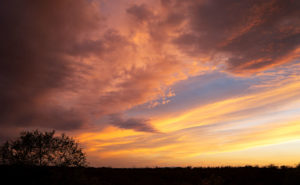
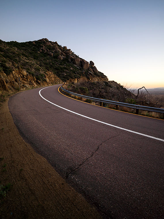
I drove down past the Safeway into the Vulture Mountains last evening to do some photography. My intent was to capture an image of Vulture Peak shining in the sunset, so I drove around until I found an angle where I could get the image that I visualized and set up my camera. It didn’t work. From the spot I was shooting, it would work better as a sunrise shot. While at that scene, I saw this funny little saguaro on my right and decided to shoot it instead. I call it little, but even with its center trunk lopped off, it’s taller than I am.

Reach for the Sky
Reach for the Sky – A near-full moon rises behind a decapitated saguaro in the Vulture Mountains.

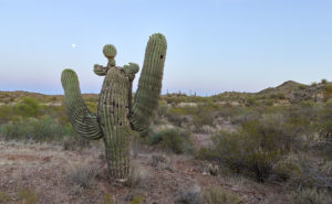
By the time I got set up for this image, the sun was down and it was already into the blue hour—the period after the sun has set but still light enough to see colors. It wasn’t until I began to concentrate on the saguaro that I noticed the near-full moon rising, so I’m going to toss it in for no extra charge. The cactus is interesting for a couple of reasons. Somehow it lost the top of its main trunk and it has sprouted new arms, of which one looks like a melon … or even a head if you have a vivid imagination. The second notable thing is that it’s still plump with water even though we haven’t had rain for months—which may be the reason it was able to generate the new growth. In any case, it has cool apartments for woodpeckers, cactus wrens, and maybe an owl family this summer.

I called this shot Reach for the Sky and you can see a larger version of it on its Web page here. I hope you enjoy viewing my new pico’-week and that you’ll tell me what you think. Maybe next week, I may get out of bed early enough to get a better version of my first idea.

Until next time — jw

Adventures in Traveling With a Canoe Sailing along America's Interstates

Being on the road isn’t always predictable. When everything is right, you’re filled with a sense of adventure and invincibility when you begin your journey. That’s the way Magellan must have felt when he sailed around the world for the first time. Then there are the other times when you wonder why you ever left the house. The item you forgot to pack, the door you forgot to lock, or the thing you just had to bring and is now driving you nuts are examples of times that make you want to stop and turn the car around.

This article is about one of those times and it comes from our friends—the Poteets—who set off last week for a summer in Minnesota. Deb unwittingly wrote this summer’s first guest post when she sent me emails about their trip. Her comments made me smile, so I thought I’d share them with you.

Wayward Canoe
Wayward Canoe – “Eight times tied down and it isn’t going anywhere now!
Adventures in Traveling With a Canoe

Thought you would find this interesting. So we left North Ranch and were barely 500 feet when the wind moved the canoe. Yikes!!!

We slowly drove to a place to pull over and Fred readjusted the straps and off we went again. This was to reoccur three times! Do you think we could have picked a windier day to leave?

Got to Meteor Crater RV Park and one more time Fred redid the straps on the canoe. Let’s see, that’s 4 times.

 Monday we went to see the crater. On our way, it felt like we crawled to stay on the road with the canoe still on the truck. Once there Fred decided to check straps again and his hat—his favorite hat—flew off his head and over a fence.

 Well … to get his hat, he has to get over the fence somehow. Hum … his Good Wife reminded him that he had a step-ladder in the back of the truck.  He managed to get his hat and we continued to the crater. (Editor’s Note: Fred has already injured himself three times via ladders.)

 We watched the film inside the discovery center which was interesting. Tour was canceled due to the wind. I might add that I could barely stay on my feet. Hold my hat, hold the rail, and try to see the crater … big hole!

 Gourmet lunch at Subway and we purchased a tee-shirt before we headed back to the RV Park.

 OK, adjustment number 6—adding more straps.

 Windy, windy, windy!!!

 We are off to Santa Fé today. Ugh! It’s still very windy. Fred says it will be a tailwind. Fingers crossed that we don’t have a canoe sail!

Share this with Anne as I am not typing this again.

Hugs Deb”

I think it would be a great Christmas gift idea if everybody went to Harbor Freight and got Fred another ladder or more sets of tie-down straps.

Until next time—jw

April Sunset Picture of the Week


April Sunset
April Sunset – After a flat and dreary day, a weather front breaks up at sunset.

Life is full of ironies. After writing last week about sunsets, I spent most of Monday working in my wood shop. A weather front had moved in overnight and most of the day was flat and overcast. The disturbance brought snow to the high country but nary a drop of rain to the desert. It was a good day for working indoors. However, late in the afternoon, I noticed that Chuck and Kay’s house—our neighbors from across the street—was bathed in sunlight, which made me walk to our deck out back so I could see the western sky. I watched the clouds beginning to break up and leaving a clear sky behind them. From experience, I knew that meant that there would be a colorful sky once the sun dipped below the horizon. After writing a week ago that I have been too lazy to chase sunsets, I decided to make a lie of that comment, so I gathered my gear and when the time was right, I drove to a place where I had a clear view of the horizon. I took my time and recorded the psychedelic scene until it faded. Of the fifty images that I captured, I liked this one best and I call it April Sunset.

As opposed to the simple streaks of colors in last week’s photo, this one is about textures; all kinds of different textures. The streaks of yellow, the wisps of the pink cotton candy stand out against the single patch of blue. As I shot, there was color all around me, but there was only one area having a dark pile of cotton balls seen in the upper right and this was the shot best showing those lumpy edges as they grabbed the sun’s rays.

You can see a larger version of April Sunset on its Web page here. I hope you enjoy my new work. Tell me how you think it compares to Harcuvar Sunset, its predecessor?

Until next time — jw

It’s Too Beautiful; Run For Your Lives Warning: Summer is comming to the desert.

Blooming Palo Verde
Blooming Palo Verde – When the Palo Verde Trees bloom in the desert it means that spring is at a crescendo and summer will be soon.

The Palo Verde are in bloom. Spring in the Sonoran Desert is at its pinnacle. It’s sort of like the finale at a fireworks show and when the desert is the best. In wet years—like last year—the wildflowers carpet the floor with cacti sprouting surreal and almost garish flowers soon after. Then, starting in the lowlands, the native Palo Verde turn yellow in a succession that works its way to higher elevations, like a Technicolor wave. Finally, the giant saguaro put out dinner-plate sized white flowers at their arm tops.

There are, of course, other signs of spring around us. Male doves try to attract a mate by cooing from perches then furiously flapping into the sky as high possible before they stall and glide back to their starting place. I suppose it’s their equivalent of doing push-ups to impress the girls. Queen Anne and I spot more quail while on our morning bike ride. Soon the adults will be shepherding multi dozen covey of chicks from one shrub to the next. Other birds like the Cardinals, Cooper Hawks, and Turkey Buzzards have returned from their winter retreats. Sex is in the air and I might as well break out my copy of Stravinsky’s Rite of Spring as a soundtrack.

Here at Uncle Ernie’s Holiday Camp another spring ritual has begun. Each day, another fifth-wheel or motorhome pulls out of the park and begins a journey north. Our friends and neighbors are leaving for their seasonal excursions or summer homes which are beginning to emerge from snow banks. Pretty soon our neighborhood will be empty again with only a few of us hearty souls standing guard.

Although Anne and I don’t have a Montana home, even we’ve put pennies aside to escape the heat that comes after all of this desert beauty dries and shrivels up. This is a travel photography blog after all and—like last year—I want to report of some exotic far-off land. This year, our Shangri-La is … Utah (I know, I know. You don’t have to rub it in).

We’re going to make camp in a valley somewhere between the high plateaus that flank U.S. Highway 89. It’s been a while since I’ve photographed Utah and with several National Parks located within a day’s drive, I’ll be building on my projects. Equally important is that I will be able to blog about our adventures just like we did on past trips. We haven’t settled on where, when or exactly how long we will be on the road, but we have a couple of months to work that all out. Until then, we need to scrape the dust off the Ritz, buy fresh linens, and maybe even fix the microwave.

Since it’s travel season again, and we will only be on the road part-time, I’m going to open the blog for guest posts as I did last year. We had a positive response from those articles and they provided interesting content. So, if you’re out on the road, here’s your chance to share your stories and photos with our readers. Let me know if you’re interested and I’ll send off some guidance.

Until next time — jw

Harcuvar Sunset Picture of the Week

There are good days and there are bad days. I have been out on photo shoots where nothing went right, and then there have been days when everything was perfect. This week’s photo is from one of my better days. Last week, I went on an expedition to Alamo Lake—a place I hadn’t visited before—because I saw a place in a student’s assignment that I wanted to photograph. I spent several hours driving to La Paz County and an hour searching for the right place. I spent another hour or two walking and shooting before I felt like I had what I wanted and packed up for the long drive home. As I got closer to home, the sun was setting and when I turned onto State Route 71, this was the view out of my door window so I pulled over to capture it.

Harcuvar Sunset
Harcuvar Sunset – After a day of shooting in the desert, I stopped on the drive home to take one last photograph.

I’m pretty ambivalent about sunset photos. They’re beautiful and all, but they’re everywhere. When I was younger I shot a lot of them, then I went through a period where I ignored them. Maybe I’ve mellowed in my old age because I feel like I’ve passed up some spectacular shots because I was too lazy to drive to an open field and I promised myself to rectify that.

This shot—called Harcuvar Sunset—is interesting to me because of the cloud layers. The sun’s last rays color the low clouds while the higher upper streaks are still white. The contrail—usually something that meddles in a photo—seems to be caught in the space between them. I captured this scene at the edge of an alfalfa field in Aguila and the mountains are the Harcuvar Range—I was shooting on the north side of them for most of the day.

You can see a larger version of Harcuvar Sunset on its Web page here. I hope you enjoy my new work and that you’ll tell me what you think. Do you think sunsets are beautiful or are they trite and overdone?

Until next time — jw

The Legends of Elephant Curve Under Yavapai Skies

Elephant Rock

While testing new photo equipment last weekend, I stopped at a spot on the road that I’ve meant to stop at since we moved to Congress over two years ago. Before this weekend, I was either in a hurry, or there was too much traffic, and there was no room to get off the road. This spot is part of the famous Yarnell grade, a stretch of Arizona State Route 89 that winds through the scenic landscape. The Yarnell grade is known for its steep descent and tight curves, making it a challenging drive for many motorists. However, it also has a unique and intriguing landmark—the legendary Elephant Curve.

Elephant Curve
Elephant Curve – As shown on the USGS Topo map, Elephant Curve has earned its spot on the map, but what happened there?

It’s a real place, and the USGS Topographic map shows its name, and at that curve, there is always an elephant painted on the rocks. Once or twice a year, the Arizona Department of Transportation, or a disgruntled Democrat, will cover over the pachyderm. Someone else takes it upon themselves to draw a new version within a week. This is the fourth iteration that I’ve witnessed since we moved here.

Elephant Rock – This is the latest version of our elephant-on-the-rock. The rock art gets painted over annually but quickly reappears within a week. The version before this was in pink paint and traces of the pink area on the pachyderm’s back.Why is this elephant so important? My favorite legend is about a circus caravan traveling to Phoenix in the late 1930s. As the group descended the newly paved but steep grade, one of the trucks lost its brakes and crashed into the rock, killing Scooby—their prized elephant—and as is the tradition in Arizona, the circus troop memorialized Scooby with a painting at the crash site.

Isn’t that sad? That would explain why the elephant painting should remain a lasting memorial marker. Unfortunately, when I researched the story online and visited the Congress Library, I discovered it’s all a myth. When I asked a long-time resident, she gave me a wry smile and muttered, “That’s just a made-up story. It never happened.”

A second local legend involves a miner returning home from a night on Prescott’s Whisky Row. Reportedly, he had to swerve at that spot to avoid a giant pink elephant in the road and crashed his car head-on into the boulder. This story explains why new versions are sometimes pink instead of white.

Elephant Curve
Elephant Curve – As you descend Yarnell Hill, Elephant Curve is the tightest and slowest you’ll meet. Five days after I took this shot, another accident ripped apart this section of the Armco barrier.

Neither story is true—so I’ve been told. The true story is that some unknown local with a strong sense of humor likes to perpetuate the elephant myths. I think there must be more than one artist because each version I’ve seen has distinctive brush strokes. Now that I’m in on the joke, I can picture myself out at night painting my take on Scooby.

Until next time — jw

Yarnell Overlook Picture of the Week

For each picture of the week in this series, I normally select the best shots from the locations that I’ve written about. This week is a little different. I had to push back the scheduled image that I was going to use so I could insert a shot that I took yesterday. I intended to just shoot some test shots, but because this image fits into the current theme and because it came out better than expected, I decided to insert it into this week’s rotation. It’s called Yarnell Overlook named so because that’s where I shot it.

Yarnell Overlook  – The vista from the Yarnell Overlook takes in Fools Gulch in the foreground to Harquahala Mountain—fifty miles to the west.


I ordered a tripod part from Amazon that arrived Friday and I was anxious to put it to work, so I decided that I would ‘run up the hill’ at sunset and test it at the overlook. It was an easy place to get to and there’s little traffic there. During the day, I was concerned because of a boring cloudless sky and the winds kicked up a layer of dust making the atmosphere hazy. I resigned myself that the results would technically be OK,  so I didn’t expect more than that. As sunset approached, however, a few puffy clouds began forming near the Weavers which picked up my spirits. After dinner, I packed my gear into the car and set off for the pull-out located half-way up Yarnell Hill to conduct my test. The view from the overlook is most often hazy and the back-light from a setting sun is even worse for shooting a high detail photo.

After I processing the test, however, I think the results exceeded my expectations. Although the dust obscures the fine detail and acts, well … like fog adding some drama. I like it because of the afternoon clouds above the layer of dust. The viewpoint overlooks Fools Gulch with its working gold mine. The Stanton road that I wrote about for the last couple of weeks is just beyond the very large Parker Diary Farm that you can see in the middle-right. The last thing that is pleasing to my eye is the repeating round shapes of the boulder-covered foreground hill and Harquahala Mountain—some fifty miles away on the horizon. In case you’re curious, our house is located in a lighter patch of homes near photo’s center.

You can see a larger version of Yarnell Overlook on its Web page here. In last week’s post, I mentioned using a Like button. Fred correctly pointed out that when you follow the post links, there isn’t such a button. There are Like and Share buttons, but they are only on the blog’s homepage. To access that version, you need to first open my Webpage and click on the Blog link in the menu. That sounds like too much trouble, so I won’t bother mentioning them again. No matter which version you see, I hope you enjoy viewing my newest work.

Until next time — jw