Thumb Flat   Picture of the Week

With a basic knowledge of native Arizona plants and observational skills, it’s easy to tell what elevation you’re at in our state. Maybe only Florida is easier because the entire state is below 350′. I’ve written before about how State 48 has all but two of the world’s climate zones; sub-tropic and tundra permafrost. So all you have to do is look at the bush you’re standing next to you for a clue.

For example, compare last week’s picture to the one that I posted today. The tall ponderosa pines you see in Yellow Field thrive at altitudes over 6,500 feet. While the pinion pine in this week’s image—Thumb Flat—is the dominant plant between 5,000 and the appearance of tall pines. My rule is only a rough generalization because there are microclimate pockets all across the state. I can name two places off the top of my head as examples; Palm Canyon in the KOFA Range south of Quartzite and the east slope of the Poachie Range south of Wikiup. The state’s only native palms grow in a mountainside crevice at the first location, and the latter has saguaro and pinion pine intermingling on its slopes.

When Queen Anne and I visited Williams, it was only natural as we drove down the south slope of the dormant volcano to see ponderosa pine replaced with stands of juniper. As the White Horse Lake Road descended even lower, the juniper became sparser. By the time we reached Thumb Flat—as it’s called on the map—individual trees had stood alone in the wildflower-covered fields.
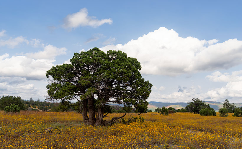
Thumb Flat - A beautiful alligator juniper stands in a wildflower covered field.
Thumb Flat – A beautiful alligator juniper stands in a wildflower-covered field.

Here I spotted this beautiful alligator juniper, which made me stop Archie and get its portrait. I think this specimen would be a prized possession in anyone’s garden. Probably the only reason this tree isn’t already in somebody’s front yard is that it’s in the middle of the Kaibab National Forest.

In this week’s featured image that I call Thumb Flat, I like how the foreground is darker in color from being in the shade of a cloud. It contrasts nicely against the bright white background cumulus clouds. The wildflowers are the same as in last week’s image, but you can see how much more dull they are when they’re not in direct sunlight. In this case that’s OK because they’re not the subject here—this week, they’re only playing a ‘walk-on’ part.

You can see a larger version of Thumb Flat on its Web Page by clicking here. Next week, we turn onto another side road, so come back and see where that road ends.

Until next time — jw

P.S. If the picture is not showing up in your email version of this post, you can click on the article title (Thumb Flat) to open the Web version of this post.

Yellow Field Picture of the Week

The four roads out of Williams, Arizona, point to the four compass directions. To the east and west is Interstate 40—the modern-day version of Route 66 and even older trails that the First Nation People used. To the north is Arizona Route 64—the busiest route to the Grand Canyon. The least traveled road goes south and is Coconino County Route 73, or Perkinsville Road. This is the back road that we’re using for this month’s project.

If you’ve never heard of the town of Perkinsville, it’s understandable. It’s been a ghost town ever since its lime quarry shut down in the 1950s. Several families still live in the Perkinsville area, but its biggest claim to fame is the Verde Canyon Railroad stop, where they turn the train around. Also, if you’ve ever bought Arizona red flagstone, it comes from neighboring quarries between Drake and here.

To get to our road, you take 4th Street south from downtown Williams, to where it changes name at the town’s edge. The paved two-lane road winds through Cataract Canyon past a handsome masonry dam and reservoir. The railroad built it to supply water for the steam trains, and the name, Santa Fe Reservoir, has stuck. Shortly after, the road climbs up and over the east shoulder of Bill Williams Mountain, and you’re quickly in a ponderosa pine forest.

Within minutes you reach the road’s crest, and open pastures appear. Here you’ll see hiking trail signs that direct you to a trail that climbs to the mountain’s 9253-foot summit—should that be something on your bucket list. Further along, there’s another side road that goes to the Williams Ski Area. I didn’t even know that Williams had a ski area.

As Anne and I drove along the downhill slope, juniper replaced the tall pines, and large fields of yellow wildflowers were all around us. The good rains that we’ve had this summer have been beneficial for the flowers. We continued south on CR 73 until we turned east onto White Horse Lake Road. We were out after a weekend of rain, and although its surface is packed gravel, it’s navigable even for a 2wd sedan.

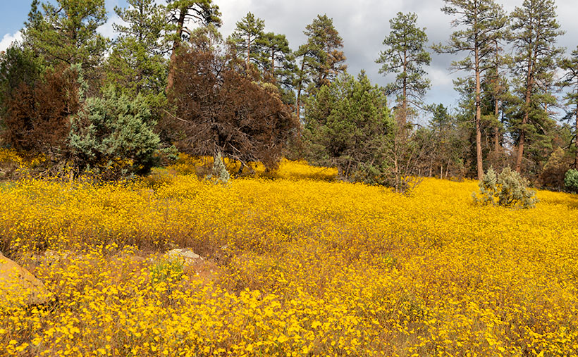
Yellow Field - The abundant monsoon rains that we've had have been especially good for the wildflowers.
Yellow Field – The abundant monsoon rains that we’ve had have been perfect for the wildflowers.

Since the flowers were so profuse, I wanted to take their picture with the sunlight beaming down on them, but a cumulus cloud got in the way every time I stopped Archie. I played this cat-and-mouse game several times before I captured this week’s featured image. I call it Yellow Field. I don’t know the flower’s actual name, but it’s the same weed we’ve been spraying for the past month in our yard. Wildflowers is weeds—who’d have thunk?

You can see a larger version of Yellow Field on its Web Page by clicking here. Next week, we’ll show more of the scenery we found on White Horse Lake Road. Come back then.

Until next time — jw