Cool Springs Route 66: Relics and Flags Picture of the Week - Oatman, Arizona

Vintage cars parked under a waving American flag at Cool Springs Station on Route 66, Oatman, Arizona.
Cool Springs Route 66: Relics and Flags – Echoes of the Past: Vintage cars sit silently under the vibrant hues of the American flag at Cool Springs Station, capturing the enduring spirit of Route 66.

The things you do for love. We don’t often get company, but when we do, Queen Anne transforms into a machine as she attempts to disinfect the house from top to bottom. My best chance of staying out of the trash bin or sucked into one of her vacuums is to lock myself in my office. That’s what happened the first week of December. Anne’s sisters came out for a long weekend visit, meaning that she spent the entire month of November scrubbing the walls. She only put down her Comet can for our traditional Thanksgiving dinner at Denny’s.

Before leaving to pick them up from the airport, imagine my surprise when she handed me a crisp $20.00 bill and told me, “Find someplace to spend the night.” It was predictable because we haven’t had enough beds for multiple guests since we sold our Casita (don’t remind me). I decided to drive over to the river and lose my newfound wealth on the Craps table. Since I was going in that direction, I thought I could get some Route 66 shots. And there, my friend is the story of how Oatman became January’s photo project.

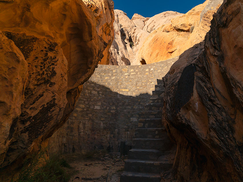
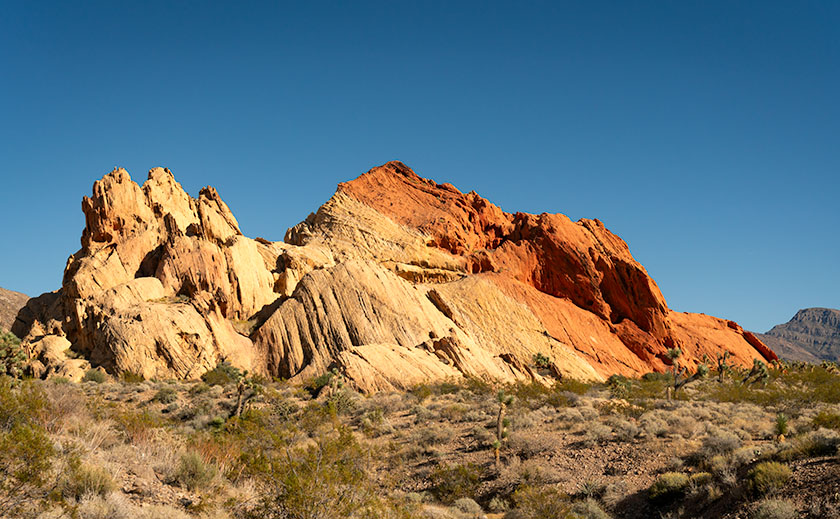
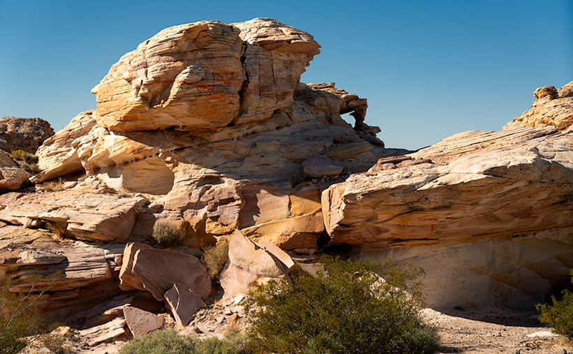
In Arizona, there are two long stretches of the original Mother Road. The first and longest is the Seligman – Peach Springs – Kingman section. The other runs from Kingman, through Sitgraves Pass, to Oatman, and then the old bridge crossing the Colorado River. Since I have very few photos of Oatman, I took this route on my way home from Laughlin. I’m glad I did.

The only other time I drove this section of Old Route 66 was during the pandemic. At the time, we were avoiding people, so we didn’t stop to shoot any roadside attractions. However, the Cool Springs Station burned a hole in my lens, so it was a required stop on this trip.

Cool Springs Station and vintage gas pumps along Route 66 with Thimble Mountain in the background in Oatman, Arizona.
Cool Springs: Route 66’s Desert Jewel—Step back in time at Cool Springs Station, an iconic stop along Arizona’s stretch of Route 66, nestled against the majestic backdrop of Thimble Mountain.

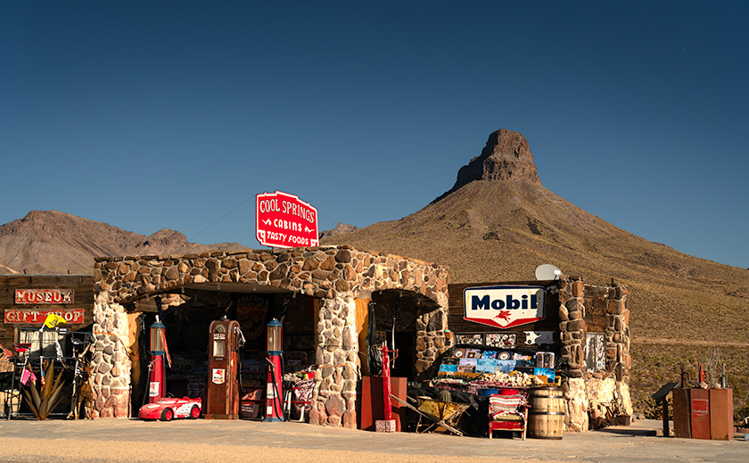
You’ve likely seen pictures of this place in books or videos about Route 66. With its classic shiny red Mobil gas pumps (there’s a rusty one, too), it’s a perfect backdrop for motorheads to snap a portrait of their car. It hasn’t always been this gleaming jewel on the Mohave Desert floor. It has a history.

Nestled against the rugged backdrop of the Black Mountains, Cool Springs Station has stood as a silent witness to the ebb and flow of Route 66’s storied past. Established in the mid-1920s, Cool Springs was built to serve the burgeoning car culture of America, providing fuel, refreshments, and a welcome respite to weary travelers making their way through the Sitgreaves Pass. Its distinctive stone façade and gleaming gas pumps quickly became a symbol of the optimism and adventure spirit embodied by the Mother Road.

However, the passage of time and the shifting sands of progress were not always kind to Cool Springs. In the late 1960s, as the new interstate system redirected traffic away from Route 66, the station saw a decline, eventually falling into disrepair and was nearly forgotten. It wasn’t until 2001 that Ned Leuchtner, a Route 66 enthusiast, recognized the cultural and historical importance of Cool Springs. He undertook the painstaking task of reconstructing the station, using vintage photos as his guide to ensure authenticity. Today, the station has been restored to its former glory, complete with those classic red Mobil gas pumps and the original stone masonry, standing as a tribute to the enduring legacy of Route 66.

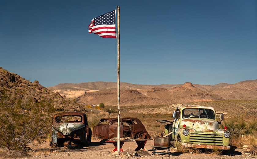
My picture of the month isn’t of the station but the yard art off to the side. The image features a trio of old car shells clustered under an American flag, set against the backdrop of the Black Mountains. Although these vehicles are historic, if they had any value, some collectors would have snatched them long ago.

The flapping flag is what made me choose this week’s photo. I shot this midday with lighting that blends the cars and mountains into a bland, uniform backdrop. The flag becomes the image’s star. It’s almost like the flags that fly over our national cemeteries. The picture says, “These are the fallen heroes of the long Route 66 history.”

We’re tickled that you started this year by spending time with us. If you want to see a larger version of this month’s photo, they are online on my website < Jim’s Page> and Fine Art America <FAA Link>. If you want to buy the Chevy Truck, you can contact Uncle Jim’s Cherry, One Owner, Used Car Emporium by leaving a comment below.

We look forward to your comments, so don’t be bashful. We’ll return with more Oatman and Route 66 photos next week, so don’t touch that dial.

Till then, keep your spirits high and your humor dry.
jw

Techniques: Waiting for the decisive moment.

You might think snapping a flag is a breeze, but let me tell you, it’s more like herding cats on a windy day. I aimed for a balance—not too limp and not overly taut—to convey a sense of movement and life. This required patience and timing, like capturing the peak moment in sports photography. With the wind’s whims as my conductor, I played a game of red and green light, waiting for Mother Nature’s perfect cue—talk about being at the mercy of the elements. In retrospect, a tripod would have saved me from the arm ache of holding steady through the breezes.

For the technically curious, this was a dance of light and speed. I shot in Aperture Priority mode with an f-stop of 6.1, relying on the bright midday sun to provide a fast enough shutter speed. My main concern was keeping the truck headlights and the flag’s stars and stripes in sharp focus. Choosing the correct f-stop or waiting for the wind is like deciding on the right spice for a stew or the right socks for sandals—not always obvious, but oh-so-important!

WPA Legacy: The Historic Cattle Dam of Gold Butte Picture of the Week - Mesquite, Nevada

WPA-built stone dam between rock formations in Gold Butte National Monument, captured by Jim Witkowski.
WPA Legacy: The Historic Cattle Dam of Gold Butte – Stepping Through Time: This WPA-constructed dam at Gold Butte stands as a rugged monument to past endeavors, harmonizing with the arid beauty that surrounds it. A silent witness to history, its stones speak of a bygone era of hope and hard work.

Victorious in my quest to capture the ancient whispers etched into stone, I returned to our trusty steed, the Turd. There, amidst the dust and echoes of bygone civilizations, sat Queen Anne; her latest book–escape, concluded. Her gaze met mine, an unspoken dialogue of adventure’s end, punctuated by a brief, ‘Can we go now?’ Her tone carried the weight of a royal decree, yet I knew the kingdom’s treasury of wonders still had one gem left to unveil.

At the end of the infamous paved road, you can turn south towards the abandoned town of Gold Butte or go straight towards the Arizona border and the Grand Canyon—Parashant National Monument. Both roads are equally evil to drive on, but I wanted to find another relic of history—a WPA-era dam, so I started east. We didn’t travel far because I spotted a cistern on the left as soon as we drove through the first dry wash. I pulled the truck over and grabbed my camera.

The cistern looked like a dry concrete bathtub, and a rusty pipe beckoned from the cistern to a narrow canyon on the right. A couple of creosote bushes blocked the view (and the path), so I brushed them back with my arm and saw the dam. It looked like a scale model of the Hoover Dam 50 miles downstream. Although it was built in the 30s and no longer maintained, it looked like it would still hold water if you closed the gate and valves. It is another testament to those folks’ work during the Great Depression.

After getting some shots, I wanted to see how deep the backside was, which meant climbing the stairs. In my younger days, I would have said, “Nothing to it,” and jogged up the stairs. But there’s no handrail, and my balance isn’t the same, so I did it the hard way—backing up one step at a time while sitting on my butt. I got my dose of vertigo and started back down the stairs when three outdoorsmen walked through the slot. My face turned red, and I apologized, “Sorry guys, this is how we geezers climb stairs these days.” One of them quipped, “We understand—Mister Girly-Boy.”

An erosion-formed window in a sandstone canyon wall, illuminated by sunlight at Gold Butte, photographed by Jim Witkowski.
Nature’s Art Frame: The Erosion Window of Gold Butte -Carved by the patient hands of time and elements, this erosion window in Gold Butte’s canyon wall frames a story millions of years in the making—each layer a verse in earth’s grand narrative.

This week’s other photo is of a natural erosion window along the canyon’s narrow. Unless you’re the stature of our friend and frequent commenter, Deb Poteet, you can frame your face with it by standing on your toes. As usual, Anne wouldn’t get out of the car, so I had to settle for shooting the opening without her pretty face. Still, it’s pretty cool.

In the mirror

Queen Anne and I covered a lot of ground this year. We visited two California Wine regions without being tossed out on our ears. We followed some of our favorite trails and got reacquainted with the charming cities of Bisbee, Tombstone, and Douglas. We explored the Beeline Highway and the Mazatzal Mountains, shot wildflowers in the spring, got caught in a monsoon storm at sunset, and discovered some fantasy shapes in Prescott’s Granite Dells City Park. With pandemic restrictions lifted, we did a decent job of broadening our range and bringing you more diversity with this year’s photos and stories.

This has been a year of growth for us. I’ve tried to improve my writing skills. I completed a couple of online creative writing courses. You’d think it would make my work more manageable, but it didn’t. What I used to knock out on a Sunday morning now takes me three days of writing, editing, and revising before I’m ready to publish. I also invested in a grammar checker that—hopefully—gets most of the commas in the right places.

I’ve been tinkering with my photo processes by watching online photographers. I picked up some new tips and tricks, which I’ve tried to pass along to you in the Techniques section. I think you found them helpful because I’ve received positive feedback from you. Finally, to attract new subscribers, we started producing monthly YouTube videos. In each of the last few months, I converted one of my static portfolios into a five-ish-minute video with music and voice-overs. With these new videos, we’re blending the old-world charm of static images with the zippy excitement of moving pictures—without the smell of darkroom chemicals. It seems to be working because my web traffic is on the rise.

Through the windshield

I have an Arizona wall map on our laundry room wall with colored dots indicating the places we’ve visited in the last couple of years. Instead of being evenly distributed, two empty spots glare at me from the map. The first is along the southern border between Nogales and Yuma. Since that’s restricted chiefly to military ranges, there’s not a lot I can photograph without starring in my impromptu sequel to North by Northwest. The other section is the northeast corner of Arizona—the Navajo and Hopi reservations. I intend to paste a dot or two in that corner next year. Maybe you could suggest some locations.

There’s more to discover at Gold Butte National Monument. I plan to return this spring if the Turd’s crummy tires ever wear out. Getting stuck out there without communication is a genuine concern for us. Some sights we missed this year include Devil’s Throat, the remains of Gold Butte’s ghost town, and Little Finland.

Finally, next year’s wine region adventure will be in Northern California. Will it be Napa, Sonoma, or the Russian River? Let us know where your favorite California wine comes from. We haven’t picked a winner yet, but the trip will be in August. As Samuel Clements once said, “The coldest winter I ever spent was a summer in San Francisco.” Some dispute that the quote is genuine, but for us desert dwellers, it’s a challenge.

Queen Anne and I wish you a very happy and prosperous New Year. We hope you’ll continue joining us on our escapades and maybe invite some friends. We’re always delighted to see you in the back seat. Feel free to share your New Year’s adventure plans in the comments below. They give us ideas for which roads we take.

Till next time, keep your spirits high and your humor dry.
jw

BTW:

Last week, I released my latest YouTube video based on my portfolio of pictures of California. It’s five minutes of eye candy, and I invite you to see it by using this link: [https://youtu.be/cgXAHPyzQ5Y]

Geologic Puzzle: Unearthing Whitney Pocket’s Sandstone Secrets Picture of the Week - Mesquite, Nevada

Brown layered Navajo Sandstone uplifted and eroded by fault activity in Whitney Pocket, with unusual rounded edges and color variation.
Geologic Puzzle: Unearthing Whitney Pocket’s Sandstone Secrets – Nature’s Tilt: Witnessing the Story of Uplift and Erosion in Whitney Pocket’s Sandstone Layers.

Arriving at a new location like Gold Butte ignites a whirlwind of excitement in me, and my initial instinct is to capture everything in sight. This flurry of photography is more about immersion than precision, leading to a digital pile-up that I inevitably sift through, discarding the excess like chaff. Unlike the costly days of film, where each shot was a precious commodity, the digital age allows me to indulge in this initial creative outburst, knowing it’s part of reaching the true gems.

Once the initial rush subsides, I transition from capturing to contemplating, delving into the ‘why’ and ‘how’ of the landscape before me. It’s here that Shawn Willsey’s geology videos come into play. As a professor at the College of Southern Idaho, Shawn has a gift for demystifying the complexities of earth science, guiding even the uninitiated through geological wonders. His explanations, particularly his Random Roadcuts segments, clarify unusual layering and erosion and bring a new depth to my photographs, transforming them from mere images to stories set in stone.

From a distance, the formation in the picture above looked like the blades of a turbine engine embedded in the Navajo Sandstone. For all I know, there is a 747 out there with the guts missing from one of its engine cowlings. The brown color, multi-layers, with rounded edges, stood out like the red marks on one of my term papers. How can I tell you about it when I haven’t a clue? So, I emailed Professor Willsey and asked if he’d look at my photo—and he accepted. He answered, “The feature in question is not a vein but appears to be an upturned section of Aztec (Navajo) sandstone. The near vertical layering is the cross beds deposited on the dune field’s backside (downwind) side. Some faults and other structures in this region of NV are likely the culprits that have tilted the rock layers. Very cool.” Then, he returned to hosting his live coverage of this week’s Iceland eruptions. Now, don’t you feel smarter?

A butte in Whitney Pocket with layered Navajo and Entrada sandstone, with the red end facing south, creating a 'Neapolitan ice cream' effect in the desert.
Neapolitan Earth: Unraveling Whitney Pocket’s Colorful Geology – Stratified Delight: The Neapolitan Butte of Whitney Pocket, where Geology Meets Gastronomy.

There’s a question in this week’s other picture as well. It’s an image of a sandstone formation that looks like a bowl of Neapolitan ice cream after Queen Anne was done with it. I say that because Queen Anne always eats the chocolate and turns her nose up at the rest. The issue is that the red section appears on the white layer. From all I’ve read, the Entrada era—with its rust-colored sandstones—came before the white dunes. My best guess is that the forces that lifted the Virgin Mountain Range over a mile in the air also jumbled the natural order in this basin. What are your thoughts?

I have posted larger versions of Geologic Puzzle on my website < Jim’s Web> and my Fine Art America page <FAA Link> should you want to examine the layers closer. Next week, we wrap our foray into Gold Butte National Monument with one of the rare evidentiary remnants that anyone preceded us. It’s like unearthing the Spinx. Join us then, won’t you?

Until next time, keep your spirits high and your humor dry.
jw

BTW:

As we gather to celebrate the holiday season, Queen Anne and I would like to extend a hearty Seasons Greetings to all of you. Whether you’re out there chasing the perfect light or cozening up at home with loved ones, may your days be merry, bright, and filled with the joy of discovery. Here’s to capturing more beauty, sharing more stories, and creating unforgettable memories in the year ahead.

Sculpted by Time: Whitney Pocket’s Sandstone Wonders Picture of the Week - Mesquite, Nevada

White sandstone rock formation at Whitney Pocket, similar to Zion National Park, in the Gold Butte area of Nevada.
Sculpted by Time: Whitney Pocket’s Sandstone Wonders – Amidst the rugged beauty of Whitney Pocket, this layered sandstone formation stands as a silent witness to the artful touch of natural forces, its contours and colors a desert echo of the famed cliffs of Zion.

Before we even packed the Turd for our Nevada trip, I studied all of the Whitney Pocket YouTube videos I could find like they were a final exam. Packing the Turd for the trip felt a bit like preparing a stubborn mule for a mountain trek—full of hope but expecting surprises. When the morning of our exciting adventure finally came, I had my checklist ready. After a hardy breakfast at Peggy Sue’s Diner, we topped off the gas tank and checked the tires. Part of these exercises was taking precautions and waiting for the visitor’s center to open so that we could buy maps and get free first-hand advice.

The people who answered our questions and the Friends of Gold Butte group volunteers were constructive. With a lack of park rangers, they’ve stepped in to fill that role. After reassurance that my SUV would be capable of the drive, the guide offered one last bit of advice. “Be sure to tell someone where you’re going and when you expect to be back. No cell phone coverage exists, and you could be alone out there.” Anne and I glanced at each other, wondering who we could call—we were alone in Mesquite and didn’t know anyone in town. We decided to call her sister—Jane— in North Carolina and panic her, “If you don’t hear from us by 6:00 pm, call the police.”

After the long drive on the awful road I complained about last week, we made it to the end of the pavement—Whitney Pocket. When I first got out of the truck, I felt disappointed. With our backs to Virgin Peak, we scanned the southern horizon, which went on forever in the clear, dry Mohave Desert air. Except for a few lumps of sandstone close by, there was just a sea of yucca and creosote running endlessly downhill to a thin line of blue, which we identified as Lake Mead. Where were all the majestic sandstone formations in the videos I watched?

We were here, and I would make the best of it. Our map showed a petroglyph site three miles down a side road that we passed, so I drove a quarter mile back and started down what I jokingly call a road. The road was passable, but only if I kept the speed under ten mph. The Turd’s front sub-chassis sounded like it was about to fall off as we dodged the football-sized pavement rocks. In comparison, the entrance road was a freshly paved Interstate.

As promised, there was a parking area with a kiosk and pictures at the three-mile mark. Go to the right and see the Falling Man petroglyph, but there would be a large panel of petroglyphs if I went in the other direction. The guide told us that the Falling Man was a longer hike and tricky to find, so I set off toward the easy shot while Anne and her Kindel kept each other company.

After a half hour of scouring the rocks for rock art, I realized I had missed the trail, was lost, and needed to find my way back to the truck. The trail had been pronounced, so I don’t know how I messed up. I started the hike back using my old tried and true method: ” This looks familiar.” I noticed the rock colors and layers as I searched for the trail. They’re more subtle and muted than you find in Bryce or Zion—almost a pastel quality. Then, I crossed over the surface stone patch and found my trail. I stopped, looked around, and discovered that the trail zigged right while I went left. Ah, the old let’s lose the geezer on the hardscrabble trick.

Water or ice erosion exposing red sandstone layers beneath the surface in Whitney Pocket, Gold Butte area.
The Art of Erosion: Exposing Whitney Pocket’s Hidden Hues – Nature’s artistry on display: The intricate dance of erosion carves through time, uncovering the fiery red heart of sandstone beneath the desert’s sunlit canvas.

Now that I was un-lost, I started taking pictures of the stones and capturing the muted colors washed out with the early afternoon sun. My trip back to Anne and the truck was more deliberate as I spent more time shooting and exploring along the way. As we drove away on the rock road, I turned to Anne and said, “I don’t think we should risk running the Turd down these roads until we get new shoes for him.” Anne’s ‘Oh, thank God’ was laced with so much relief that I suspected she might start a Thanksgiving parade there.

While the grand formations played hide and seek with our expectations, the true majesty of Whitney Pocket revealed itself in a serendipitous encounter. This week’s photo—Sculpted by Time—captures a lone formation made from the same limestone that capped Virgin Peak (last week’s shot), one that almost seemed to beckon for attention amidst the vast desert. Its white, streaked face looks unremarkable at first, but if you look closely at the lower-right corner of the image, you’ll see a joint (not that kind, you stoners). This is where a layer of the Navajo Sandstone is popping its head from the ground. These are the same petrified dunes seen in Zion National Park, and we showed you in Utah’s Snow Canyon State Park last year. This shot was a dance of light and texture, a moment where time stood still, and the story of the earth was told in a single frame of layered rock.

Here is evidence of rising ancient seas and covering the dunes up. Over eons, the skeletons of shellfish collected on the seabed and covered the dunes with a layer of their own. I think that’s cool, not to mention that I like the natural window in the upper center, too.

Next week, we’ll return to Whitney Pocket, but our focus will shift to the ‘Dance of Light and Shadow’ this time. We’ll explore how the changing sunlight angles transform the sandstone from mere rocks into a canvas of nature’s art. Expect tales of how the sun brings out different personalities in the stones. If you’d like to examine the rock layering closer, you can stop by my Web Page < Jim’s Page> .

Till then, keep your spirits high and your humor dry.
jw

Sipping with a View: The Panorama at DAOU Vineyards Picture of the Week - Paso Robles, California

A panoramic view of rolling vineyard hills under a clear sky from the DAOU Vineyards tasting room in Paso Robles, photographed by Jim Witkowski.
Sipping with a View: The Panorama at DAOU Vineyards – Gaze over the lush expanses of DAOU Vineyards, where every turn offers a view more stunning than the last, inviting you to a tasting experience graced with natural splendor.

I bought our first bottle of DAOU wine by accident. While choosing from the Safeway shelf selection, I looked a row above the cheap stuff and spotted a bottle of their Chardonnay. I immediately noticed that it came from Paso Robles—our favorite wine region. It was more pricey than our house brand but not by much, and since it had been a rough week, I thought, “What the heck?” I grabbed it by the neck and placed it in the cart.

That was a couple of years ago, and since—when we wanted something a little nicer—we splurge on a bottle of DAOU. That’s why we were so tickled that a stop at DAOU was on our wine-tasting recommendation list this spring. Indeed, I thought we wouldn’t come home without buying the place out.

Driving up to the tasting room reminded me of the Clifton Hillclimbs of days past. A castle-like building sits at the summit of the family-owned mountain. Instead of orange pylon cones, the narrow, twisting road is lined with lavender, making the mountain look like it’s wearing a purple crown. The finish line is under an ornate wrought-iron arch at the top—just after a sharp right turn. After I parked the truck, I let the engine idle for a few minutes to let it cool, which gave Queen Anne time to stop screaming and hyperventilating. Our breaths were removed again when we stepped out of the truck—this time from the view.

Stepping out onto the hilltop patio of DAOU Vineyards, one can’t help but feel as if they’ve entered an exclusive retreat, a day spa designed not just for relaxation but for the epicurean at heart. With panoramic views that command the senses and an ambiance that whispers of indulgence, it’s a place where time seems to stand still, encouraging you to savor every moment. With their attentive grace, the staff are like sommeliers of comfort, offering tastings and a complete escape from the ordinary.

The distinguished sign marking the tasting room at DAOU Vineyards & Winery, inviting visitors to indulge in the art of wine, as photographed by Jim Witkowski.
Begin Your Journey: The Tasting Room at DAOU – The sign at DAOU Vineyards & Winery is not just a marker but an invitation to a world of exquisite tastes and shared stories.

For Queen Anne and me, this wasn’t just another stop on our wine trail; it was a moment of serendipity that had us seriously contemplating a permanent residence. The fusion of luxury and viticulture was intoxicating in its own right. And as the hot and cold running hostesses pampered us, each sip of DAOU’s exquisite wine seemed to erase any thought of a world beyond the vineyard’s embrace. It was here, amidst the laughter and clinking glasses, that we made our selections—wines that would forever remind us of the sun-drenched patio, the gentle breeze, and the feeling of absolute contentment.

A visit to DAOU Vineyards is essential to any wine lover’s journey through Paso Robles. It’s an experience that transcends the act of tasting into an art form, set against a canvas of sweeping hills and skies that stretch into infinity. DAOU is renowned not just for its wines but for its ability to transport you to a state of awe with its mountaintop location, offering a view that could rival any famed landscape painting. Here, each glass is complemented by the vast vistas of the valley below, the verdant rows of vines narrating the terroir’s tale. The tasting room, an epitome of elegance, invites guests to savor each note of their carefully crafted wines wrapped in Paso Robles’ natural grandeur. This harmonious blend of sensory pleasures positions DAOU as a destination of choice for those seeking to indulge in the grand symphony of winemaking.

At the heart of DAOU Vineyards stand the founders, brothers Georges and Daniel DAOU, whose journey in winemaking is as rich and compelling as the wines they create. Their foray into grape cultivation was born from a shared vision to produce Bordeaux-style wines that would rival the world’s best. With roots stretching back to the mountains of Lebanon, the DAOU brothers bring a unique fusion of old-world charm and new-world innovation to their craft. They are known for their exacting standards, from fastidious vineyard management to the precision of their cellar practices, constantly pushing the boundaries of what’s possible in Paso Robles. At DAOU, it’s not just about maintaining quality but elevating it, ensuring that every bottle tells a story of excellence and ambition, a narrative that honors their heritage and the land they’ve come to cherish.

DAOU Vineyards has etched its name in the annals of fine winemaking with a portfolio of wines that speaks to the discerning connoisseur’s heart and intellect. Their flagship offering, “Soul of a Lion,” is a testament to the DAOU brothers’ father and embodies the winery’s pursuit of uncompromised excellence—a Cabernet Sauvignon that commands attention with depth and complexity. The “Reserve Chardonnay” marries the richness of Paso Robles fruit with the finesse of French oak, creating a harmonious profile beloved by those who favor a fuller-bodied white. Not to be overlooked, their “Estate Cabernet Sauvignon” stands as a pillar of their red wine collection, showcasing the perfect balance of power and grace that the region’s unique climate and soils can instill. These wines, among others, have propelled DAOU to the forefront of Paso Robles wineries, each vintage crafted not only to impress but to leave a lasting impression of the terroir’s potential.

I would love to tell you what bottles we bought during our DAOU visit, but as you can see from the prices below, we were well out of our league. But throughout our discussion of whether we could get adopted by the DAOU family, we enjoyed each of the five samples our hostess selected for us. Unlike our introduction to wine tasting—when the Carlo Rossi Burgundy came from the very jug you bought—these days, the samples served at the vineyards are the creme de la creme—If the wine you buy in a retail store were an AC Bristol, they tempt you with a Shelby Cobra here at the ranch. Had we the budget, here are the bottles we would have brought home.

    • 2021 Estate Chardonnay–$100.00. We liked this chardonnay. It had the same characteristics as our Safeway version but more of everything. Unfortunately, it was clearly out of our price range, so we passed and bought four bottles of the normal chard from Total Wine instead.
    • 2020 Reserve Eye of the Falcon—$75.00. This Cabernet Sauvignon is made from a blend of Cabernet Sauvignon and Verdot grapes grown on the valley floor. It has excellent color and a great taste of black fruits and aromatics.
    • 2021 Cuvee Lizzy—$89.00. This was another Bordeaux-style wine using estate-grown grapes. It’s a blend that starts with Malbec grapes and is then blended with Petite Verdot, Cabernet Franc, and Cabernet Sauvignon stock. This was our favorite of the flight. We’d buy a bottle if possible, but we haven’t found one in our local stores. If we want to enjoy a bottle, we must win the lottery and return to Paso Robles.

Beyond enjoying DAOU’s wines, the experience at the vineyards was breathtaking. Sitting in those red patio chairs with attendants passing frequently with another offering was the definition of indulgence. We would have stayed the night if we’d brought our sleeping bags. At the end of our visit, our wine guide noticed that I was using my USAA credit card to pay the tab. She asked, “Oh, you’re a vet?” When I confirmed that I was, she waived the tasting fees. If I had known that was possible, we might have sprung for one of their Eye of the Falcons.

We hope you enjoyed our month of wine offerings as much as we did. If you’d like to pixel-peep this week’s Image, you can visit the larger version on my website < Jim’s Web> or its FAA page <FAA Link>. Be sure to put us on your holiday calendar next month because we’re going to a place where no man has gone before—well, not many have been there. Join us next week when we take you off the beaten path—it’ll be an adventure, I promise.

Till next time, keep your spirits high and your humor dry
jw

Techniques: Leveling the Horizon on Sweeping Vistas

A common pitfall I’ve noticed in many online landscape photos is a slightly tilted horizon, which can unintentionally give the impression that the scene is off-balance. Remember, even the Pilgrims relied on the horizon to align their buildings at Plymouth Rock. Getting this right in-camera is critical, as it preserves the natural balance of your shot.

For those looking to ensure a perfectly level horizon, modern technology offers a helping hand. My camera, for instance, comes equipped with an in-built level in the viewfinder. As you adjust the angle, the level’s indicators align, turning green at the perfect balance point. It’s a small step in the setup but makes a difference, especially for scenes like the one in this week’s photo where the horizon plays a starring role.

If you capture a slightly askew horizon, don’t fret—software like Photoshop can come to the rescue. Use the ruler tool to draw a line along the horizon, then select Image> Image Rotation > Arbitrary. Photoshop cleverly calculates the necessary adjustment, automatically realigning your Image. A quick crop to tidy up any resulting white edges, and your photo is ready to impress with a horizon that’s true to reality.

BTW:

I released the fourth video in my On the road with Jim on YouTube on Friday. This one covers the images in my Sonoran Desert portfolio. As a subscriber to this newsletter, you get a sneak preview before I add any links. If you want to view my latest effort, you can use this link to get to the video: https://youtu.be/QDc9fXnccy8