Have you ever looked at an Arizona road map and noticed the big empty swaths—entire regions with no towns, no intersections, no welcome signs? A third of the state looks uninhabited. That’s not cartographic laziness—it’s the truth. Some places were never meant for people. Look at a land-ownership map and you’ll understand why. Much of the terrain south of I-8 is military proving ground (because what better use is there for a desert than dropping bombs?). To the north, you’ve got the Grand Canyon and vast stretches of tribal land. And over in the west—well, welcome to the Bermuda Triangle of Arizona.
Three roads trace its edges: U.S. 93 on the west, I-40 to the north, and Arizona 89 on the east. Unlike the Sahara-style sandscapes you might expect, this isn’t a wasteland. The land rolls between 3,000 and 10,000 feet in elevation, a mix of grasslands and mountains. It gets summer monsoons—thunderheads stack up there most afternoons. It looks like it should be dotted with towns.
But it’s not.
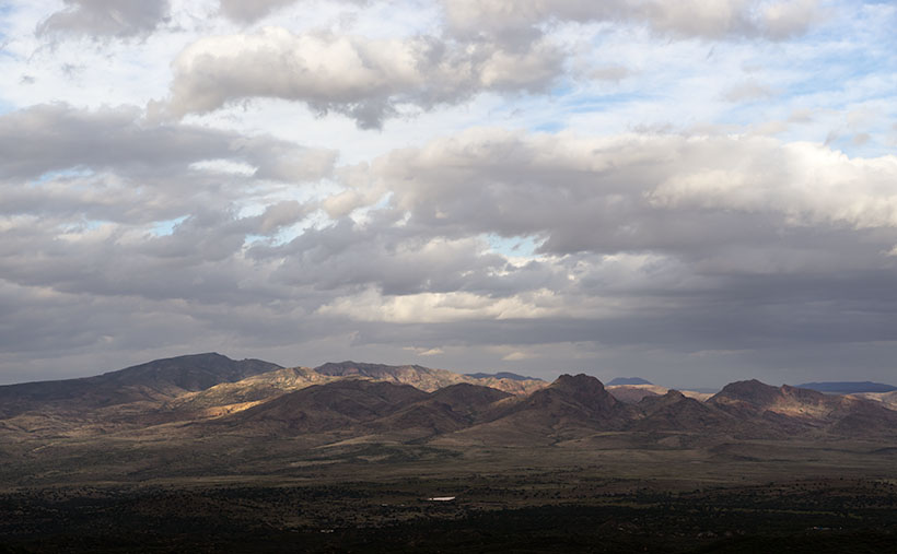
This month, I decided to poke around this odd no-man’s-land. I set my sights on the Aquarius Mountains, taking Upper Trout Creek Road—a little loop that climbs over a saddle and drops down the far side before ending at a quiet religious retreat. There’s a parking area where I stopped, took in the view, and turned around. That’s where I captured this month’s image: Mohan Range.

The Mountains You’ve Never Heard Of
I hadn’t either. You don’t see the Mohan Range from U.S. 93—it’s tucked behind the Aquarius Mountains. But it’s real. Mohan Peak stands at a respectable 7,500 feet, putting it in Arizona’s top 100 summits. From Interstate 40 or some spots in Prescott, it’s visible—if you know where to look.
Naturally, I came home and Googled it. I expected to find a line or two. Instead, I struck gold.
One of the first search hits was from the Peakbaggers website. These folks climb the top 100 mountains in each state—for fun. (No, I don’t understand them either.) But their post was solid: detailed, well-written, and packed with photos. That page led me to something even better—a beautifully photographed article by Kathy McCraine about the O RO Ranch.
A Quarter Million Acres of Off-Limits
So why aren’t there any towns in this triangle? Because nearly all of it—over 250,000 acres—is the O RO Ranch. It’s private, and it’s vast. This is cowboy country, in the old sense of the word. The eastern part of the ranch stems from an original Spanish land grant—the Baca Grant, which the U.S. government actually honored. Later, the Mohan Ranch to the west was folded in, and the two became one: Arizona’s oldest and largest cattle operation.
According to McCraine, life here hasn’t changed much. Cowboys still ride the range on horseback and sleep in teepees. There’s no town, no road system, and definitely no Starbucks. And they don’t want company.
I loved one line she wrote:
“Cowboy wannabes need not apply.”
Take the hint. If you’re driving through, heed the signs. This is not a place for sightseeing unless you’ve got an invite, a saddle, and some serious grit.
The Road Less Photographed
You can see a larger version of Mohan Range on its web page here. And as always, we hope you’ll come back next month for another installment of Arizona’s overlooked corners and dusty crossroads. There’s something special about these places—where history lingers, maps go blank, and the silence stretches for miles.
Until then, keep your spirits high and your humor dry.
—jw
