
I’m down to the last page on my calendar this morning. It’s already time to get a new one. Einstein may have been right about time being relative, but I think he got it backward. Instead of the clock slowing down as you travel faster, time speeds up as you age. Don’t you remember how a week dragged when you had a date on Saturday night? Now it seems like Queen Anne, and I make our weekly run to the garbage dump every other day. What upsets me is that there’s little time for my daily naps anymore.
With a new month comes a new road to explore. We’ve had an extended summer, and it has been a very dry fall, so I initially thought that her majesty and I could go into the mountains. But that all changed recently and we’ve had wave after wave of Pacific storms roll through. Being less daring than I was, I changed my mind and looked for a closer route. One that wouldn’t have snow or mud, or maybe wasn’t even dirt. I mean, we’ve all watched the local heroes on the evening news as rescuers drag them from flooded washes. I’ll only go so far for free-press.
So, I packed the camera, some snacks, and my wife for a lap around Harquahala Mountain using three roads, a triangle of sorts. I’ve driven these roads several times, but not for a photography outing. We started in our neighboring town of Aguila, an agricultural community at the east end of the McMullen Valley. From downtown—the Family Dollar store—we headed south on Eagle Eye Road to the Salome Highway and back to Aguila on U.S. 60. If we weren’t stopping for pictures, we could cover the entire loop in three hours, and the Harquahala Range was out the passenger window the whole time (In the Mohave language, Harquahala translates into: “running water high up“).
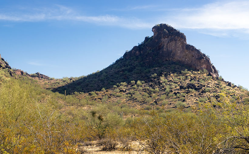
We didn’t even get out of town before our first photo stop. Just past the gated airpark—where wealthy Anguillans live—is the town cemetery at the foot of Eagle Eye Mountain. There are two piles of volcanic rock sitting side by side along the highway. The east one is called Eagle Eye Peak, and it has a big hole in it. I’ve written about it before. The shorter western one is called a mountain, which is a generous description at best. It’s hardly a couple of hundred feet high. Compared to the massive Harquahala Range west of the highway, they’re hills. They rise from the surrounding plains, and I’m unclear if they’re part of the Vulture Mountains—15 miles due east, or they are foothills of the western more significant mountain range. Still, they were cute enough to stop and compose a picture.
From the spot where I shot this week’s featured image, I thought that it looked like a punctuation mark, because of the overhang at the top. After further thought, I came up with Apostrophe Butte, which I think is more fitting. All I have to do now is to petition the Department of Names—or whatever you call it—to correct Arizona maps.
You can see a larger version of Apostrophe Butte on its Web Page by clicking here. I hope you enjoy viewing it. Join us next week as we continue our trip around the Harquahala Range.
Until next time — jw