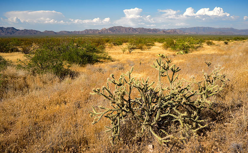
As I wrote earlier this week, we’ve had a pretty good Monsoon Season. The afternoon storms have brought rain every other day. A couple of the storms were short but intense causing a lot of run-offs. The amount of rain is too much for the soil to absorb and so, most of it runs into the street. If the flow is great enough, it will drag sand off the lots on to the street.
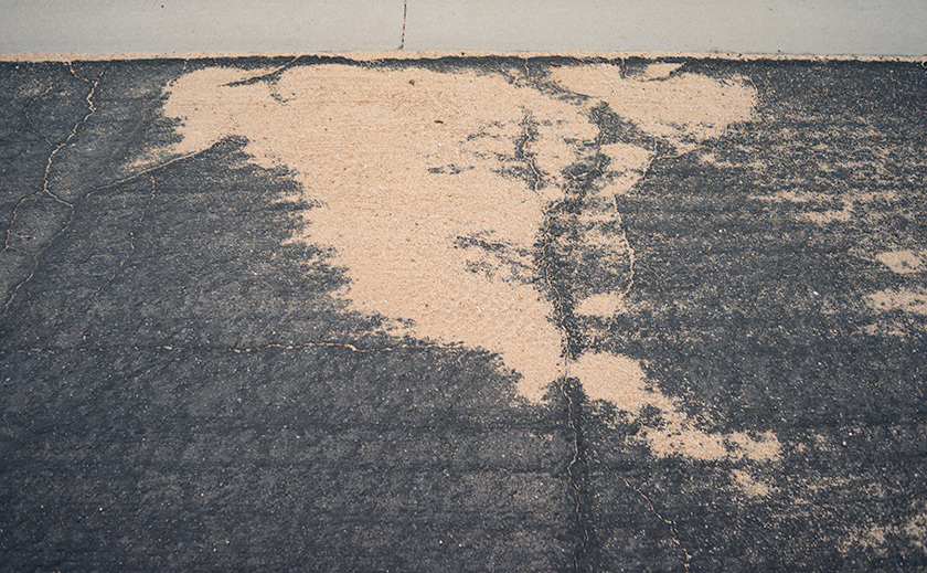
On our morning walks around the trailer park, Queen Anne and I come across these sand trails all the time. One of them, however, stopped me in my tracks. I saw something that I recognized and as we examined it, we realized it was a pretty good map of the North American Continent. Alaska, Canada, Greenland, Cuba, and Mexico were all in their places. Missing in the map was Florida, some of the Aleutian Islands and parts of the east coast. With climate change and all, maybe it’s a sign of things to come.
A pretty good map of North America that we found in sand run-off while on our morning walk.
What do you think?
Till then … jw
ps: After three storm cells move through the area last evening, it washed more, sand onto the street. On this morning’s walk, the shape was completely different. Only the Alaska part remained recognizable.
It’s raining this morning, a steady gentle shower that’s driven the outside temperature down to 73°. That’s the lowest reading I’ve seen on our outside thermometer all month. The rain postponed our morning walk until it let up. We made it through most of our route before Queen Anne felt a couple of drops and began screeching, “I’m melting.” By the time we made it back to the house, the point on her black hat flopped over into her face. I’m afraid that she looked like a bit of a cartoon.
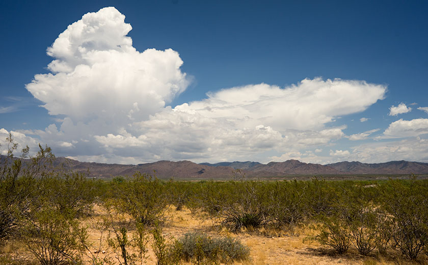
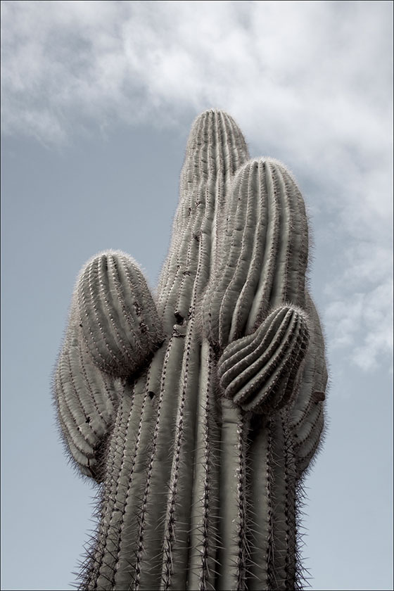
It’s been a decent monsoon season so far. We’re getting rain every other day. There’s enough to fill Lake What-A-Muck-A until the waters lap onto the pavers out back. The ground is damp, the saguaros have plumped again and some of the cacti have begun to bloom for the second time.
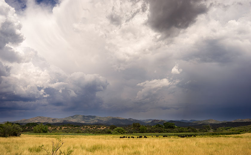
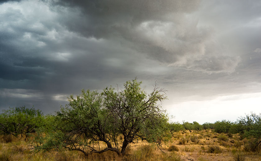
There’s enough moisture coming up from Mexico that the thunderheads form over the plateau behind the Weaver Range each afternoon. We watch them as they boil in slow motion until they anvil out and spread in their direction of travel. As the hot air rises down here on the desert basin, it acts like a vacuum, sucking the thunderstorms off of the mountain. Here at the house, with our views to the horizon, we watch as the lightning and rain cells pass to the north and south of us. But sometimes, we’re in the path. It’s like playing dodgeball while standing still.
Each afternoon, thunderheads form above the plateau behind the Weaver Range.
First, come the outflow winds which can gust over 60 mph. That’s why we keep the tree out front trimmed up, so the wind can blow through the top canopy instead of breaking off limbs or blowing the tree over. In the neighborhood, we’ve had nearly a half-dozen century agaves bloom, with a 20-30 foot phallic center shoot. The Christmas tree like stalk gives the wind enough leverage to rip the roots of the four-foot blue agaves right out of the ground.
Monsoon clouds move down from the Bradshaw Range in Skull Valley.
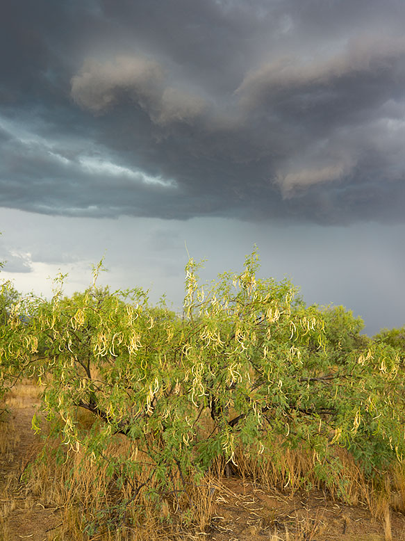
Following the wind is rain. Sometimes it’s only a drop or two that leave spots on your dust-covered car. Other times it’s a gully washer and the streets fill like rivers. Out on the desert floor, the washes run with fast-flowing muddy red water; those are the flash floods that are dangerous even if your miles downstream. Every once in a great while, Mexico sends up enough moisture that you get a long-lasting gentle rain, like today. It’s slow enough that the ground has time to absorb it.
Ripe pods on a mesquite tree will be dispersed in the winds of a monsoon storm.
Conveniently, the rains usually arrive in time for sunset cocktails, and we sit out on one of the covered porches while enjoying a glass of wine. It’s a popular summer past time in Arizona. The temperature drops 10 to 20 degrees below the century mark. The lightning show is always spectacular and can last for hours. With a stiff breeze and the moisture; it’s pleasant outside, besides you have to hold down the furniture somehow.
A mesquite grove is about to get drenched in an afternoon thunderstorm.
It ends abruptly. Shortly after the rain stops, the sweltering black top evaporates the last of the street’s water like hot sauna rocks. The wind dies and the humidity closes in. When it becomes intolerable, you retreat back into the air conditioning, if the power’s still on. There’s time for a TV show before watching the weather. It’s important to find out how the rest of the valley fared before calling it a night.
Hi, I’m Jeff, another one of Jim’s long-time friends. Jim recently invited me, along with his other friends to write a guest post for his blog. I presume he thought his friends would jump at the chance to give to his blog and like Tom Sawyer, his friends would paint his fence. I was onto him though and intended to politely decline, because I find writing too much work and I have done quite enough of that for now, thank you. But as I was drafting my response to his email, my fingers somehow typed the words “Sure … it sounds like fun” and now I’m stuck. I hate when that happens. There is no pain worse than self-inflicted pain!
Because I didn’t have any ideas what I might write about, I subsequently asked Jim if he had any particular topics in mind. Unfortunately, he wasn’t very helpful, suggesting only that I should write about something that’s related to travel or photography, even if only minimally. Oh, and if possible, I should try to make it humorous, too.
Well … okay then.
Unfortunately, my past and present family circumstances have been/are such that I’m not able to travel very often nor very far these days. Instead I wind up photographing my dog, Miss Abby, while we’re out walking. I have a photoblog where I post the resulting photos: https://abby.aminus3.com/. The only photography I do nowadays is typically done late at night while I’m walking around well-to-do Scottsdale neighborhoods with Miss Abby in tow or in the seedy, grimy downtown Phoenix warehouse district.
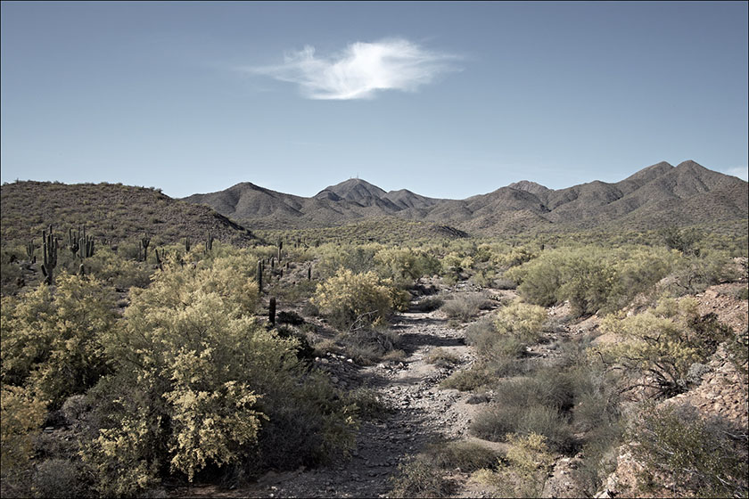
While I’m not able to travel as often or as far as I would prefer, I do still enjoy getting away from it all when I can, even if only to a small and very temporary degree, and the very best way I’ve found to do that is to take a hike … literally. Fortunately, I live in the geographic center of Scottsdale, which means there are two hiking areas within a 10-minute drive from my house and three more within 20-minutes, all of which are part of the McDowell Sonoran Conservancy project (https://www.mcdowellsonoran.org/).
The broadcast towers visible on top of Thompson Peak are the only clue that one isn’t in a pristine wilderness.
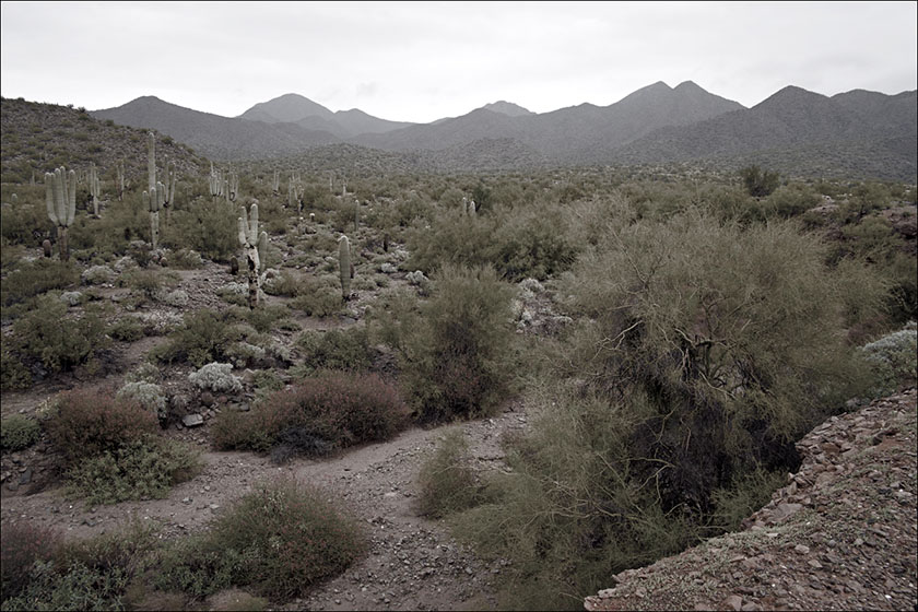
At each of these hiking areas, I can hike for several miles without backtracking over the same trail and better still, once I’ve hiked 15 minutes or so away from the trail head, it’s surprisingly difficult to tell that I’m on the outskirts of the fifth largest metropolitan area in the U.S. instead of way out in the remote desert, miles from anywhere (The only thing that occasionally ruins the illusion is the broadcast towers visible on top of some of the nearby mountains). The time commitment is small; two to three hours, max, round-trip from my front door. These trips require minimal planning, so I can usually be out the door and on my way within 10 minutes of when the urge to get away hits me.
Within 10 minutes drive from my home, I can immerse myself into nature.
While I’m not much of a landscape photographer these days, I always bring a camera with me and practice what I have come to call “hikography,” which means taking photos while I’m hiking, sometimes even one-handed and without breaking my stride. It’s roughly similar to “street photography” (walking around with a camera and recording scenes of everyday life), except that in the desert, there are no streets, only trails … and a lot fewer people.
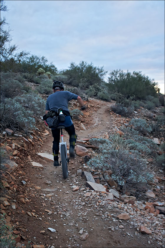
Like Street Photography, you can capture shots of other travelers along the trail.
To my way of thinking, hikography is different from other genres of photography, because hiking is the primary activity and photography is strictly secondary. This means that I leave my tripod home, as well as the extra lenses and filters and other accouterments that are part and parcel of the landscape photography experience, and instead carry a simple, point-and-shoot-type camera in my right hand, secured by a wrist-strap and always powered-on, so it’s immediately ready for use.
There is always time along the trail to stop and take shots of the giant icons of the Sonoran Desert.
For me, the key to hikography is that it’s not purely photography nor purely hiking, but a complementary combination of the two. Without taking photos along the way, I find hiking pointless and boring; and without hiking, I find landscape photography ho-hum (which is almost, but not quite boring) and largely a waste of time due to the all the standing around and waiting on the ‘magic’ light.
But combine the two and something magical happens, just as when peanut butter and chocolate combine to make Reese’s Peanut Butter Cups. When done together, the two activities, hiking and photography, create a greater, more enjoyable experience than either of them one does when practiced individually. Hiking now has a purpose, a raison d’être, if you will, and photography becomes a tangible experience, not just an intellectual search for pretty scenes to put in front of a camera when there’s good light available. The two activities build upon each other, the way that fine wine complements fine food and a cigarette after sex used to hit the spot. Just ask the Queen … er, never mind.
So now I have a reason to hike regularly, as well as a reason to take photos while I’m doing so. By engaging in both activities simultaneously, I am now actually engaging in both activities, instead of just thinking about doing them … tomorrow … maybe. Did I mention the fitness benefits of hiking? They are real and if it’s done often and energetically enough, hiking can replace a significant amount of time spent in the gym (Unless your gym is amply stocked with attractive, toned women wearing Lycra and Spandex and doing pole aerobics [or, I suppose, depending upon one’s orientation, hunky men pumping iron], this is a good thing. Alas, my gym is not one of those, because it recently closed and I now use the free gym at the nearby Scottsdale Senior Center, which is very aptly named. Needless to say, given my options, I would much rather spend my time hiking in the desert than working out at the gym.)
By now, you’re no doubt thinking, Well, … this is all well and good for him, but I don’t live in the desert with many hiking areas nearby and I’m not very good at using a camera, either, so what good does any of this do me? To my way of thinking, the answer to that question is crystal clear: Just as New York is said to be a state of mind, so is landscape photography. Landscape photography — literally, photographing the land, doesn’t mean just photographing grand vistas at a National Park or the Grand Canyon. It can also be done (in fact, it should be done!) close to home as well and not just during the two weeks of the year when you are vacationing somewhere scenic.
No matter where you live, there are many places nearby where you can hike and photograph the land. It may not be the pristine, natural land untouched by man that you want to experience, but just as with sex and pizza, even the worst you’ve ever had is still pretty damned good! While there’s nothing wrong with appreciating the work of others (or buying many large prints to hang on your walls … hint, hint), there’s also nothing like creating art of your own. Even if the only camera you own doubles as a telephone and video arcade, it can still be used to take (nay, to make) great photos, so long as you point it at an interesting scene instead of at yourself (Just say No to selfies … puh-leeze!).
No matter where you live, there is somewhere nearby that you can explore, both on foot and with a camera. Now you have two reasons instead of just one to push your chair back from your computer, lace up your comfy shoes, and head out the door with your camera in hand. You may well come home empty-handed. Hey, it happens. At least you will have gotten outdoors for a while and had yourself an experience, and possibly even a bit of an adventure.
There are a lot of things we’re thankful for when we moved to Congress last year, but shopping isn’t one of them. Sure we have a couple of local grocery stores and merchants nearby that we make do for basics, and there’s always Amazon for the occasional weird stuff we need, but making a Costco run takes days of planning. The stores are far enough away that we plan our trip into town with multiple stops along the route. Shopping at the big box store is an all-day trip.
Our house is conveniently (if you can call it that) located midway between the two nearest stores. We exclude the one in Sun City because it’s impossible to maneuver around the golf carts and inattentive drivers. Our choice is between the Deer Valley store on I-17 and the one in Prescott. The drive time difference is literally five minutes, so the choice comes down to what other errands we need to run. If I need to pick up some hardwood, we go to Deer Valley. If I need something at Harbor Freight, we head to Prescott (for our friends out-of-state, the townspeople pronounce it ‘Press-kit’ and they’re not shy about correcting you). During the summer though, Prescott wins hands down because it’s in the pines and cooler.
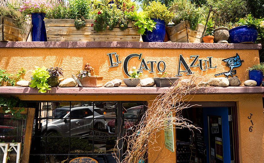
When we make the Prescott run, Queen Anne and I try hard to build in time for lunch, and our favorite place there has become El Gato Azul a tapas place at 316 West Goodwin Street. Goodwin is the street that runs along the south side of the courthouse; the restaurant is two blocks east of Whiskey Row.
Two blocks east of Whisky Row is the tapas bar, El Gato Azul.
The restaurant building is a small one story box on the east side of the Willow Creek trail. It’s smaller than most fast food chains, and the Dijon mustard colored façade has lavender ledges covered with potted plants and lights. The clutter almost obscures the sign.
To enter, you step down from the sidewalk (an access ramp is a few steps to the right) and walk through the bright blue door. Inside the dining room are two . . . maybe three tables and behind the hostess station, an ‘L’ shaped bar fills the rest of the room. The décor is a mix of upscale Goodwill and early garage sale interspersed with canvases from local artists. If you’ve come to eat, (why else would you be there) the host/hostess will escort you back outside through a door on the right. Here is a large covered main dining area that is open in summer, but enclosed with clear vinyl curtains in winter; portable heaters provide warmth.
The food that we expect at El Gato is not what you’d call rib sticking comfort food, but small dishes as you would find in a Spanish tapas bar, but with a southwest influence. It’s more of a tasting menu where you get an interesting burst of flavor combinations in one bite. As with a Chinese restaurant, it’s fun to pick out several items and share. One dish is not enough for a full meal, but the Queen and I fill up by sharing three items. It’s sort of like making a dinner out of a couple of appetizers. Plates range in price from $10-$13 each, so it’s not cheap. They offer a list of soft drinks along with the stocked bar.
One of the meals we enjoyed was their Cajun Corn Dogs. This consists of bacon wrapped tiger prawn fried in corn batter and a glaze of honey.
The next time you travel up Prescott way and you want to try something different, the Queen and I recommend you give El Gato Azul a try. We recommend it, even though Anne is now annoyed with me for letting The Blue Cat out of the bag.
Monsoon clouds form over the Weaver Range behind a staghorn cactus. Near Congress, Arizona.
It’s mid-summer in the Sonoran Desert and the winds have begun to shift bringing moist air up from Mexico and monsoon season. All of the smart people have escaped the desert floor, while we and a handful of other trailer park residents try to cope with the stifling humidity (25%). With most of the neighbors gone for the summer, it’s really boring in the neighborhood. So boring in fact, that last week a service showed up to remove a dying saguaro, and the neighborhood lined up lawn chairs to watch the show.
Since the themes of this blog are photography and travel, I feel that I need to add some posts about the latter. Unfortunately, the queen and I are stuck at home this year, so I need to come up with content somehow, and I got an idea. I reached out to our circle of friends that are or have been on the road and asked them to write about their trips. I’m pleased that they agreed to contribute.
It’s been a couple of weeks now and some material has started to come in and in the next few days I’ll be able to post our first guest article. I’m looking forward to traveling vicariously with our friends; seeing new places, tasting new foods from beyond the horizon. And, let me add this. If you’ve been on the road lately and like to share your story and photos, let me know and there may be room on the stage for you.
It’s the eve of the national celebration of Queen Anne’s birthday and I’d like to interrupt your celebrations preparations for an announcement. Two out of a half-dozen submissions were accepted to be part of the West of Center art show at the town museum this summer. This is Wickenburg’s big summer art show at the Desert Caballeros Western Museum’s Cultural Crossroads Learning Center in downtown Wickenburg.
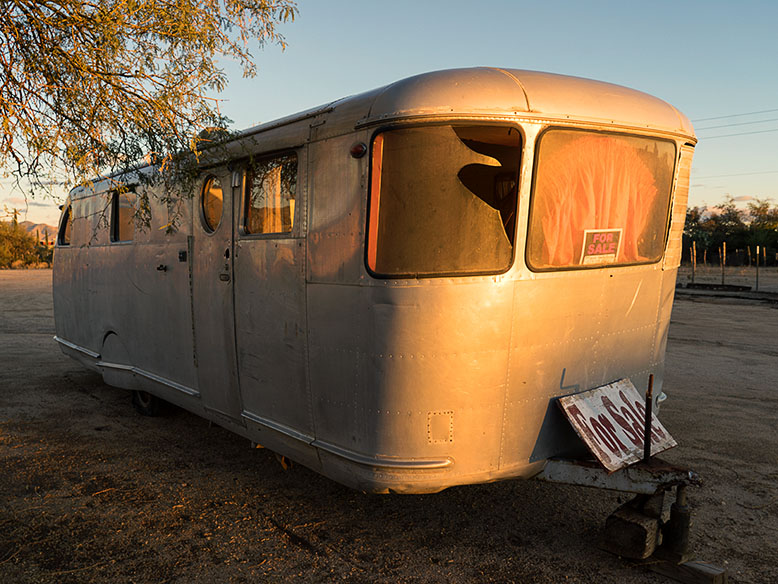
One of my images selected for the show is an early model of an Airstream Trailer sits on a lot in Congress, Arizona.
The show runs from Saturday July 29th thru Sunday October 29th. There will be an opening reception at the Learning Center on Friday the 28th from 5:00 – 7:00 pm, which the Queen and I will attend. I am also hosting the show at least once each month on Fridays/Saturdays (depending when I’m scheduled) during the duration.
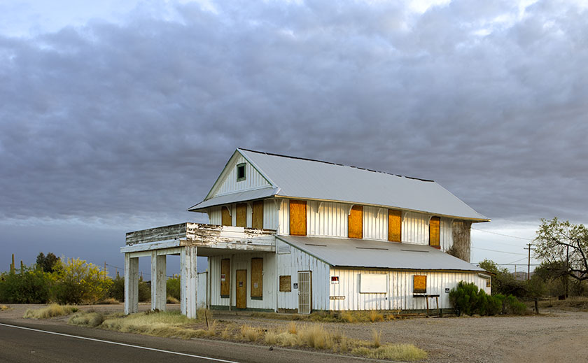
The second image selected for the show is of the old Whitman Store that I shot along US 60.
The art show features the works of Wickenburg’s local artists. There will be a variety of paintings, water colors, sculptures, weaving, and photography from the town’s local artists.
I hope you get a chance to visit our little hamlet and enjoy the art. The Learning Center is located at the Northwest corner of Tegner and US 60 (if you go under the railroad tracks, you’ve gone too far). Here’s hoping to see you at the reception or on one of my working days.
Today is summer solstice at 9:24 PM (MST); summer’s official start. Temperatures in Phoenix are forecast to reach near 120°, making it the hottest day of the year (so far). The Queen and I are celebrating the end of spring like a couple of mushrooms hiding in the dark while hoping the air conditioner doesn’t fail.
To cope with the increased temperature, we’ve changed our daily routines. We go on our morning walk at 6:30 to take advantage of the cooler morning temperature; although this morning’s low was still 83°. With 20% humidity, eighty degrees should be comfortable and it is in the shade, but this being desert, there’s little shade. There’s something about an oppressive high barometric pressure that intensifies the Sun’s radiant heat, so along our route, we divert to every patch of shade we find like lizards darting between rocks.
I limit my time out in the shop now. Instead of waiting most of the morning for the garage to warm up, I only work the hour before breakfast and I break my chores into chunks to fit the time. At least with that schedule, I get more computer work done in the afternoons.
There are other clues that our exceptional spring is being pushed aside. The roadside flowers I featured in earlier posts, have withered into dried grasses. The stately saguaro, one gluttonously plump with winter rain are undergoing transition to their impression of TheThin Man with their accordion folds compressing together. I wonder if the birds living in the giant cactus’ apartments notice their shrinking floor space.
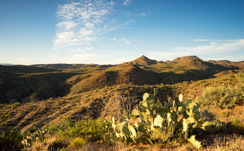
The setting sun shines on a prickly pear cactus and hills near Bagdad, Arizona.
Even the creosote is changing. A month ago they were full of yellow buds and the open spaces between washes were fields of light green resembling dense crops. Their flowers have turned into tiny gray fuzz-balls and the bush begins shedding leaves. They’re conserving water so they can survive out in the summer sun.
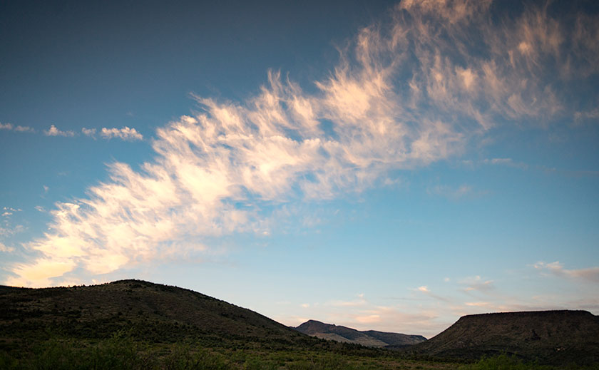
The setting sun lights up a line of clouds over Kirkland Valley.
I see out of my window that clouds are gathering above the Weaver Mountain Range. There will be no welcome rain from them today. There isn’t enough moisture in the air for them to swell into magnificent thunderheads. That will come in a couple of weeks when the winds change and bring humid air from the south, and that will be the real monsoon season start. Today’s clouds are just a promise of things to come.