Nearly three years after limping the Turd home from a Las Vegas dealer, it finally earned a new set of shoes. The Turd—our trusty but unglamorous RAV4—had been rolling around on a mismatched set of tires so cheap they probably doubled as floaties in their previous life. The dealer, ever the bargain artist, slapped two new tires on the front and waved off the rears, claiming they were “good enough.” Good enough for what? Ice skating?
Now, I’ll admit, I’m a cheapskate. No, wait—cheapskate is too generous. I’m a cheap-sketeer, proudly waving my coupon flag while riding into battle on a discounted steed. Queen Anne was already less than thrilled about buying an SUV in the first place, so I figured, why spend a penny more than necessary? Besides, I was sure those dealer-installed tires would wear out faster than flip-flops at the Grand Canyon. But to my surprise—and annoyance—they wouldn’t die. One year went by, then another, and finally, this fall, I noticed the wear bars creeping up between the treads like a slow elevator. “Yes!” I cheered. It was finally time.
I took the Turd straight to Tony’s Tire-O-Rama, where Tony recommended a set of beefier tires tough enough for Arizona’s backroads. I didn’t want anything flashy—no oversized doughnuts that scream, “Look at me, I’m compensating!” They’re a smidge wider and taller for an extra half-inch of clearance. The result? It’s subtle but satisfying. The Turd now stands a bit prouder, like a French maître d’ with a slight bow, murmuring, “Ho ho, monsieur, you mistake my purpose.” With these new shoes, I finally have the confidence to tackle sandy washes, rocky trails, and all the Arizona backroads where secret treasures are hidden.
Shakedown Cruise to Arizona’s Secret Lake
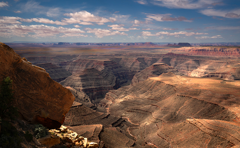
When I first heard about Palmerita Ranch, a historic homestead nestled in the Alamo Lake area, I knew it was the perfect destination for the Turd’s inaugural off-road adventure on its new tires. Alamo Lake, often called Arizona’s “secret lake” (or perhaps “secret park,” depending on who you ask), sits so far off the beaten path that it feels more like a treasure hunt than a road trip.
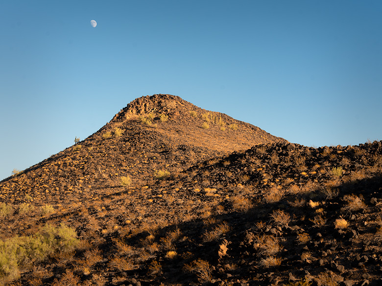
The journey began with a drive halfway to Quartzsite, where we turned right at a wide spot in the road named Wenden. From there, we headed north on Alamo Road, threading the Harcuvar Mountains through Cunningham Pass and descending into Butler Valley. I’d only been out this way once before—to photograph a hike in the Mud Cliffs—and I remembered the dirt roads being manageable enough that I didn’t need a tank to navigate them. My main concern this time was the deep sand in the dry washes.
Sure enough, the Date Creek Wash gave us our first test. As the Turd climbed the sandy bank on the far side, I felt a surge of confidence—no need for 4WD here. The extra width and chunky tread on the new tires made light work of the loose sand, even if Queen Anne didn’t quite share my enthusiasm. She grumbled through every bump and rut, reminding me why we call this a “shakedown cruise.”
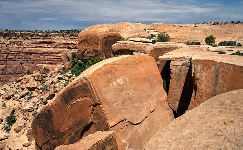
The real challenge came when we reached the Santa Maria River. The ranch was on the same side of the River as us, but the high bank demanded an entry road that plunged sharply down a rocky, narrow cow path carved into the hillside. The grade was so steep that we couldn’t see the abandoned buildings until we were two-thirds down. Gravel and loose rocks made the descent feel like riding a controlled avalanche. By the time we reached the bottom and prepared for the climb back up, the sun was setting, Anne’s stomach was growling in duet with her commentary, and I decided it was time to engage 4WD to assist. Was it overkill? Maybe. But it got us up the hill faster, and sometimes, survival means knowing when to appease your passengers.
Of course, the entire trip from our house in Congress to the ranch measured precisely 100 miles. Had I been feeling adventurous (read: foolish), I could’ve driven up US 93 for 33 miles and hiked 14 miles down the Santa Maria Riverbed through the Arrastra Mountain Wilderness. But let’s be honest—you know how I feel about hiking.
The Hidden Legacy of Palmerita Ranch
The Valenzuela family, who founded Palmerita Ranch in the 1860s, were a remarkable lineage with roots stretching back to Spanish settlers who arrived in California in the late 1500s. Their eastward migration brought them to the Arizona wilderness, where they built a life of resilience and resourcefulness. As ranchers and homesteaders, the Valenzuelas thrived despite the isolation and arid conditions, raising livestock and cultivating the land with ingenuity and determination. Their story is one of courage, perseverance, and a deep connection to the land that still echoes through the ruins of Palmerita Ranch.
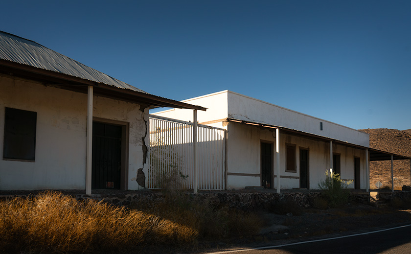
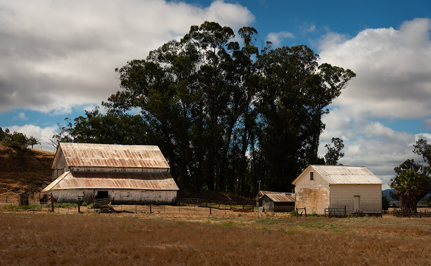
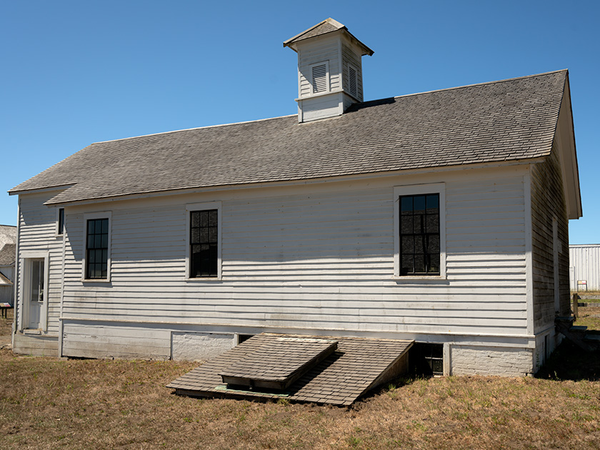
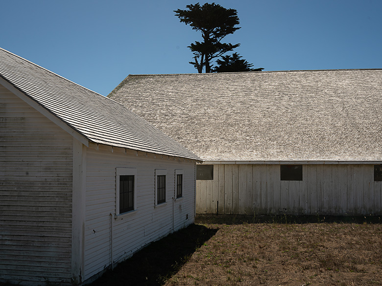
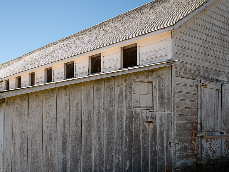
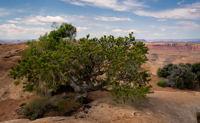
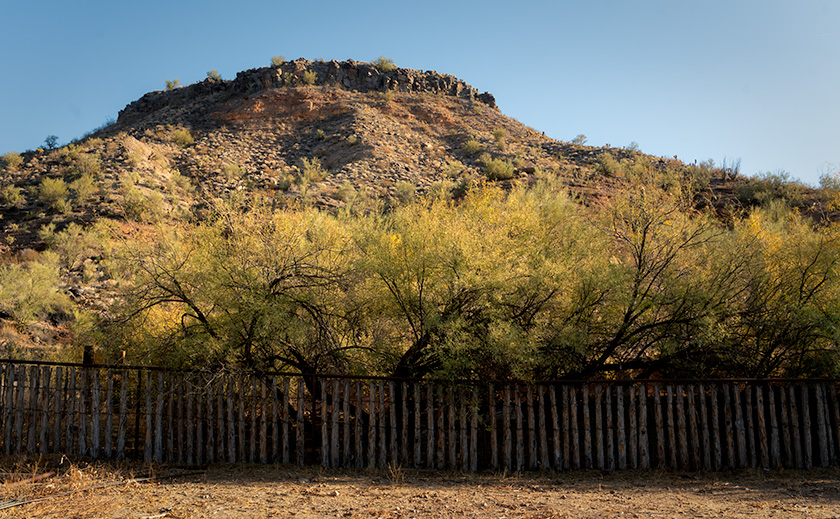
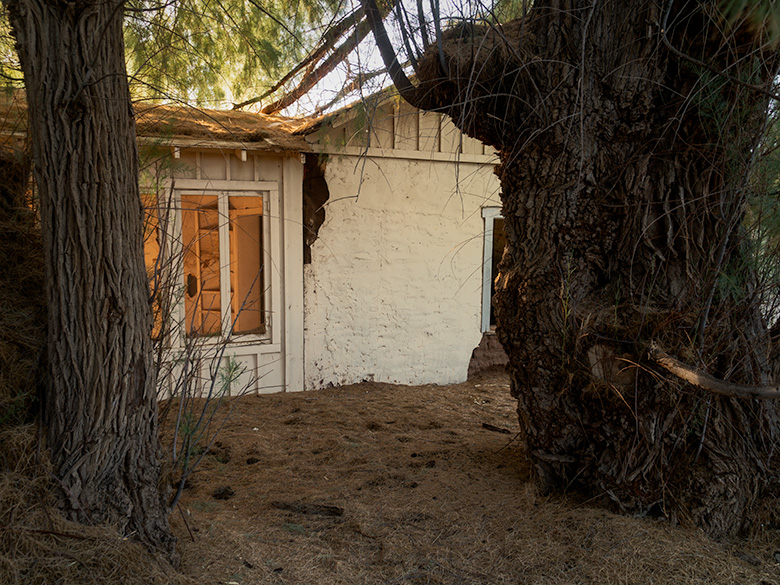
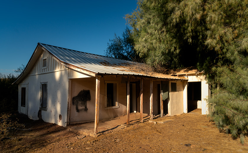
Palmerita Ranch sits quietly along the ordinarily dry Santa Maria River, where the water table isn’t far below the surface—a fact betrayed by the towering trees that shade the property. We discovered two homes nestled within a forest of giants during our visit. To the west, Red Gum and White Bark Eucalyptus trees soared over 100 feet, their stature a testament to the River’s hidden life. On the east side, the second house stood under the watchful guard of two colossal tamarisk trees, the largest I’ve ever seen.
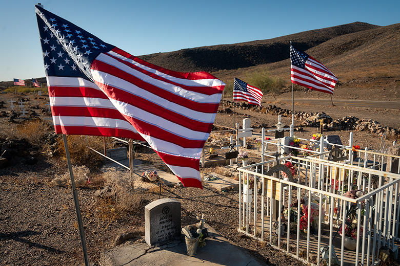
A short walk along the riverbank brought us to a small cemetery, now overgrown and untended. Whatever names and dates once adorned the graves have been erased by time and the elements. Still, the site evoked a quiet reverence, hinting at the lives and stories that played out here. A visitor from the 1920s once described fields of alfalfa thriving in the riverbed, used to sustain livestock—hogs, cattle, and goats—that kept the ranch alive.
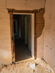
Though stripped of its comforts, the large adobe house revealed hints of its former grandeur. Its south wall featured large windows framed in flagstone, centered around a fireplace stained with years of smoke, and through the windows stretched a stunning view of the Santa Maria River and the Arrastra Mountains in the distance—a panorama that must have provided solace during the ranch’s more isolated days. Standing within those walls, I could almost imagine living there—if only it had electricity, city water, Wi-Fi, and a grocery store that wasn’t 100 miles away.
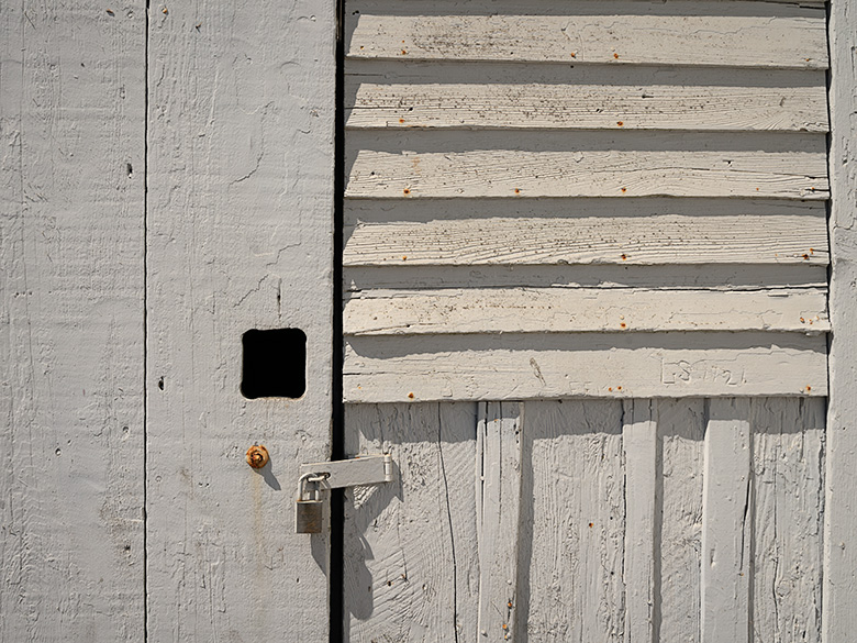
Palmerita Ranch may no longer be a working homestead, but its history and place in the Arizona wilderness endure. The soaring trees and sturdy adobe structures stand as monuments to the resilience of the people who once built a life here despite the challenges of isolation and harsh desert conditions. Walking its grounds, it was easy to feel connected to the past and to the enduring spirit of the land itself.
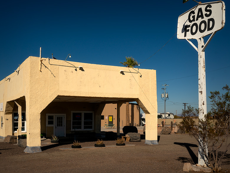
A Pit Stop for Burgers and Brew
The sun sank low as we started back up the embankment from Palmerita Ranch. By the time we reached the top—after listening to Queen Anne grumble about the constant need to adjust her tiara—I knew we wouldn’t make it home before evening. I stopped the Turd so she could use the mirror to perfect her royal accessories.
“How long’s the drive back?” she asked, still fussing with her reflection.
“Well,” I said, calculating the distance, “long enough to work up an appetite. How about we stop at that bar on the way back and grab a burger for dinner?”
She huffed something indistinct, which I took as an enthusiastic “yes,” so we began the dusty trek toward civilization. Oddly enough, the drive back always feels shorter than the trip out, and before we knew it, we pulled into the Wayside Bar.
Holding the door for Anne to make her grand entrance, I followed her inside and let my eyes adjust to the dim light. The decor was exactly what you’d expect: rusted road trash nailed to the walls, a few highway signs, animated beer lights flickering halfheartedly, and dollar bills covering the ceiling like a green constellation. It reminded me of the Pinnacle Peak Patio at Riata Pass, the first place I’d ever seen that particular motif.
At the far end of the room sat a row of cowboys, their white hats lined up brim to brim along the bar. It felt like a scene straight out of Charlie Daniels’ Uneasy Rider. We grabbed a couple of stools at the other end, strategically positioned with a clear view of the door—just in case.
The barkeep came over and asked what we’d like. Anne ordered a Chardonnay, and I went for the only beer on the list that didn’t have “lite” tacked on it. When it arrived, Anne’s wine was served in a Welch’s grape-jelly glass. She was just about to object when I quickly clamped my hand over her mouth, sparing us both a lecture about proper stemware. My beer followed in—what else?—a frosty mason jar. High-class all the way.
We ordered a burger to split, piled high with jalapeños and enough sauce to make it slide apart at first bite. And fries. Lots of fries. Out there in the dirt, even a roadside burger tastes gourmet. We devoured it like we hadn’t eaten in days, which was a slight exaggeration but not by much. Naturally, I ended up with all of Anne’s peppers, so my half of the burger packed more punch.
When the barkeep returned to ask about dessert, I opened my mouth to remind Anne of the fresh-baked goodies at home. But before I could say anything, she politely declined, asked for the check, and whipped out her credit card to settle up. You could practically hear a record scratch. All along the bar, cowboy hats tilted slightly as they saw Anne paying. I was too busy mentally rehearsing my next line to notice the collective eyebrow lift.
As the bartender returned the card, I leaned over, channeling my manliest voice. “Are you ready to go…cupcake?”
The reaction was immediate. At the far end of the bar, the cowboys snapped their heads around so fast their hats created a breeze. Silence followed, then synchronized laughter erupted like a perfectly timed punchline. The catcalls started as we slinked toward the door, Anne’s tiara slightly askew. The long, quiet ride home was all the sweeter for the fresh-baked dessert waiting for us—though the real treat might have been the memory of that moment.
Final Thoughts
Thanks for coming along on our journey to Palmerita Ranch! We’d love to hear your thoughts—whether it’s about the ranch’s history, your own funny bar story, or anything else you’d like to share. Your comments always make these adventures more fun and meaningful.
If you’d like to see larger versions of the images from this trip, please stop by the New Work section of our website. They’ll be there for the next three months until fresh troops take their place. And don’t forget to join us next month as we set off on another dusty trail, chasing adventure, stories, and, of course, more unforgettable moments.
Until then, may your roads be smooth, your tires chunky, and your humor as dry as the Santa Maria River.
jw