I find some places where it is difficult to photograph properly. Most of those are wilderness areas. Because they’re not accessible by road, you have to hike to get to the good stuff; that’s exciting visually. You know by now how I feel about hiking—I’m vehemently against it. However, sometimes you have to do things that make you uncomfortable.
The Eagletail Mountains are one of those places. Plenty of old jeep trails are running through the area, but since it was declared a wilderness and set aside in 1990, you can’t drive on them. Instead, you have to hike anywhere within its boundaries.
I last visited the Eagletails in 2003—when I first created my Website. Since I routinely update the site with newer and better photos, I discarded those shots long ago. I needed a new project, so I decided to revisit the Eagletail Wilderness and try my luck again.
There are two mountain ranges in the Eagletail Wilderness. Foremost is the Eagletail Range that runs north-south. If it were a hand on a clock, they would be in the 11:00 position. The other range is Cemetery Ridge (hmm, there’s got to be a story behind that name), a line of mountains that run northwest-southeast, or 9:30-10:00. Most of this wilderness fits within this triangle between the two ranges. That’s the justification that Congress used to preserve it. It is a complete example of two mountain ranges separated by a flat Sonoran Desert basin.
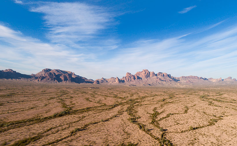
This week’s picture is of the western slope of the Eagletails. It’s an aerial shot taken with my drone. Since I can’t fly into a wilderness, it’s as close as I could get from the east side. It shows the jagged ridgeline with Eagletail Peak—the high point—at center-right. If you got closer, you’d see its top has several granite spires resembling feathers—so its name is descriptive.
The trouble is that the interesting geologic formations and petroglyphs are on the other side. For February, my challenge is to see how far I can walk in and show you what’s there. It’s been several years since I last twisted my ankle, so I’m about due.
You can see a larger version of Eagletail Mountains on its Web Page by clicking here. Next week, we move south and get a shot, including Cemetery Ridge. I promise to see how it got that name. Come back then and see what we found.
Until next time — jw
