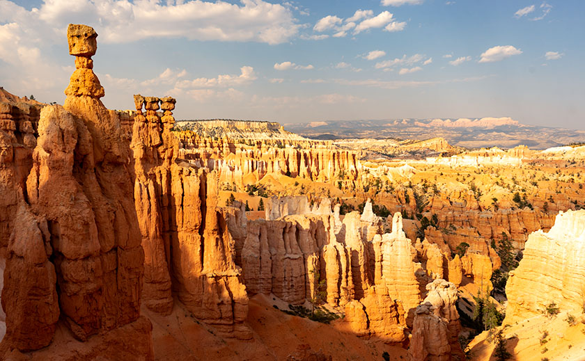
When exploring Utah’s State Route 12, you really must take time for a side trip to Utah’s Kodachrome Basin State Park—20 miles east of the Bryce Canyon entrance road. Kodachrome Road runs among the cattle pastures from Cannonville to where the pavement ends and the park entrance. There is a small entry fee which you pay at the visitor’s center. If you’re camping, the park’s sites are coveted and the restrooms have flush toilets, hot and cold water, and they’re heated in winter.
I’ve written about Kodachrome Basin in my newsletters before because it’s a favorite destination of ours. Located on the valley floor below Bryce Canyon, the elevation is three-thousand feet lower, so in winter it doesn’t have a bitter cold you’ll find back up on the hill. But it also means that summers are warmer and the temperature can crack the century mark.
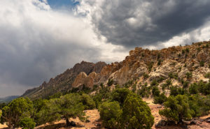
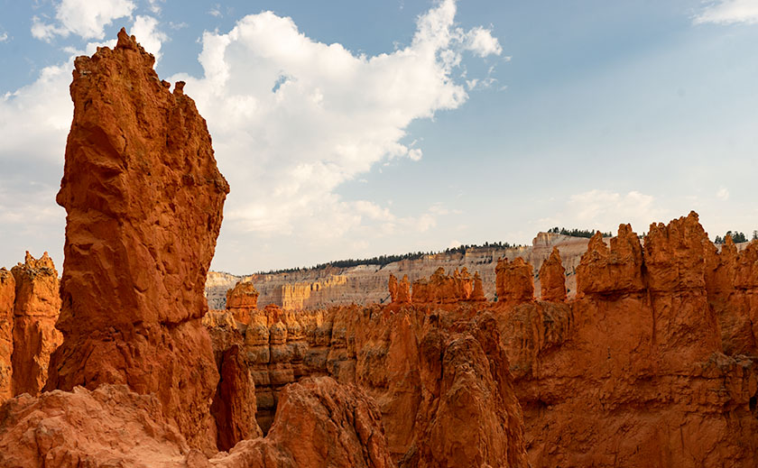
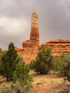
Surrounding the park are tri-colored cliffs—red, white, and gray—the same colors that make up the middle three stairs of the Escalante Grand Staircase. Unique to Kodachrome Basin is its sand pipes. It’s thought that millions of years ago, this area was like Yellowstone with geysers and hot springs and as the basin sank into a shallow sea it was covered with layers of sand. The geyser’s immense pressure forced fractures in the hardening sandstone and drilled vents. Then, as the plateau rose, rivers cut into the soft sandstone leaving the hard stone pipes behind. There are over sixty pipes in the park for you to find and photograph (hmm, sounds like a book idea). The one in this month’s featured image is on a shelf overlooking the campground like a trophy on display.
Our Kodachrome visit on this trip was by accident. Each day, afternoon thunderstorms kept us off the dirt roads we’d planned to explore. Because the park roads are paved, we changed plans and wasted some electrons photographing Kodachrome Basin in the rain. My first observation is that the colors are duller when they’re wet. My second was that the trails were muddy and the washes were running so we stayed near the roads. I’ve photographed this pipe before but wasn’t happy with the result. This time, I think I have an interesting shot for you. I call this image Kodachrome Pipe, but I may have to begin numbering them in the future. Because it was so overcast, I wasn’t aware that I was shooting directly at the sun—the bright area in the photograph’s sky. While I processed the image, I tried forcing the clouds to be darker, and when I did, the sun’s disk began to show including a rainbow ring around it. The results didn’t look natural, so I dialed it back to this version.
You can see a larger version of Kodachrome Pipe on its Web Page by clicking here. I hope you enjoy viewing this week’s post and come back next week—a new month—when we’ll start a new series from a different place.
Until next time — jw