Hyder – Alaska

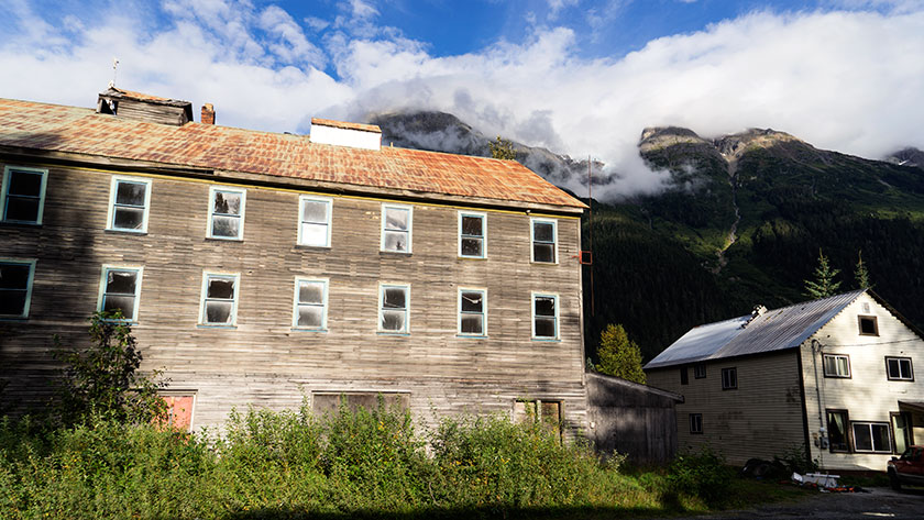
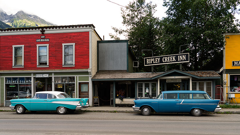
And you thought we left Alaska. Well, we did. Except, we made a side trip to Stewart, which is in British Columbia and Hyder, an Alaska town. They could conceivably be the same town, but there’s an international border in the middle of main street. There is only one way in to Hyder and it’s also the only way out. The US Customs doesn’t even man the border here, only the Canadians do. They really asked us if we bought anything in Hyder, which is funny, because it’s essentially a ghost town with one closed general store.

The tourist attraction of Hyder is the bear observation platform built and maintained by the Forest Service. You’re probably thinking what I had. It’s that place where they filmed the brown bears catching salmon in mid-air. It’s not.

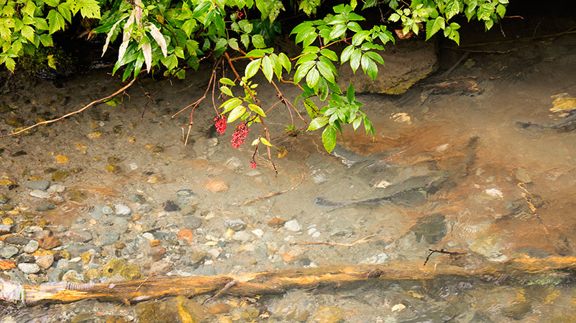
Here, the service has a deck along Fish Creek, where you can watch the salmon make their journey upstream, spawn and die. All of this is very interesting . . . to a fisherman or biologist. Today we saw pink and chum salmon nesting while steel-head kept pestering their courtship.

Salmon Spawning in Fish Creek
A female pink salmon has dug a nest while a couple of courting males wait with anticipation.

Occasionally, a bear will wander on the set, and grab a meal. That’s what gets the tourists excited . . . including us. I admit, I paid five bucks to watch a bear grab a salmon out of the creek. It would have been worth it . . . had one showed up, but we didn’t get the schedule.

Each day, at the ticket window, there is a list of the most recent bear sightings. They start at around 6am and the last one shows up around 10am. Six is when the ticket window opens, so nothing happens before then. Our camp host told us that late in the afternoon was good too, but for the last week, sightings we of bears in the morning. So, when you get here, come early.

V
An otter scratches his head while resting on a downed pond log.

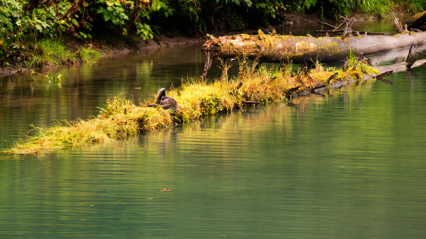
Disappointed about not seeing bears, we took solace in watching two otters playing in the water. They were tricky to shoot, because every time I got the camera ready, they submerged. I’m glad I’m not shooting film, because I would have wasted two rolls shooting water ripples.

Glacier Detail
Detail of an unknown glacier near Stewart.

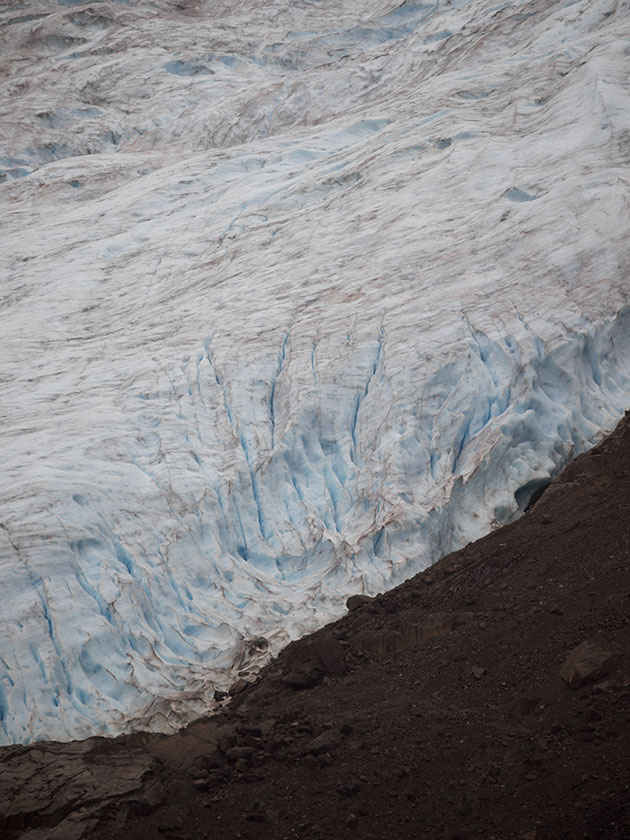
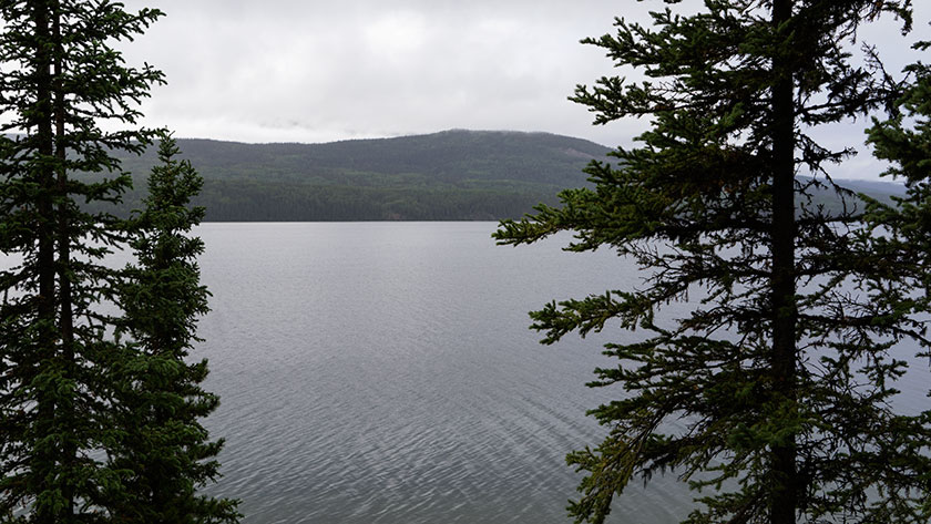
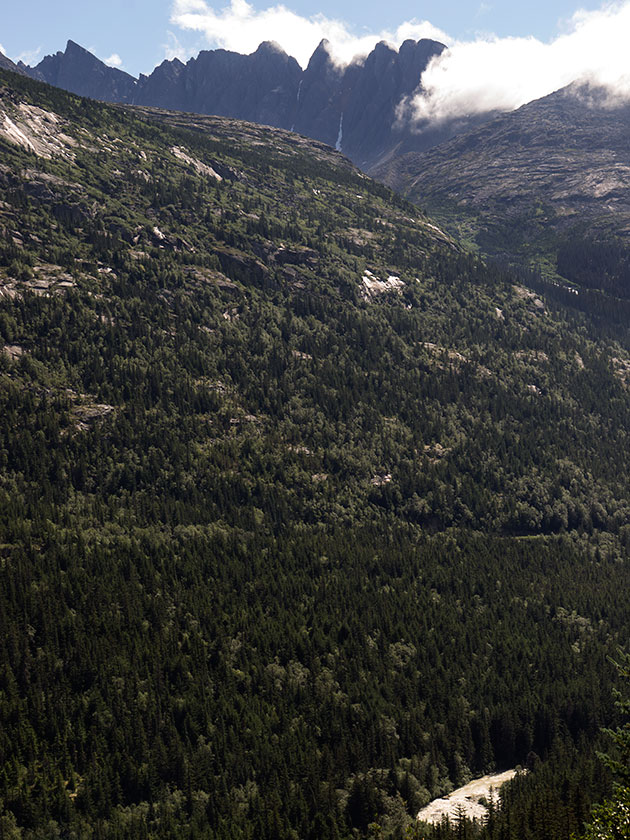
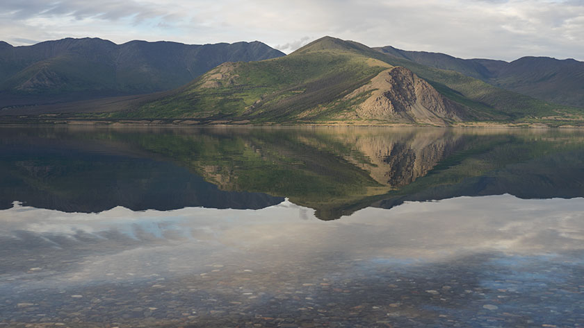
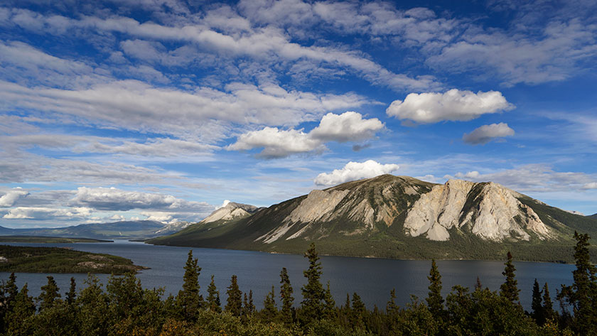
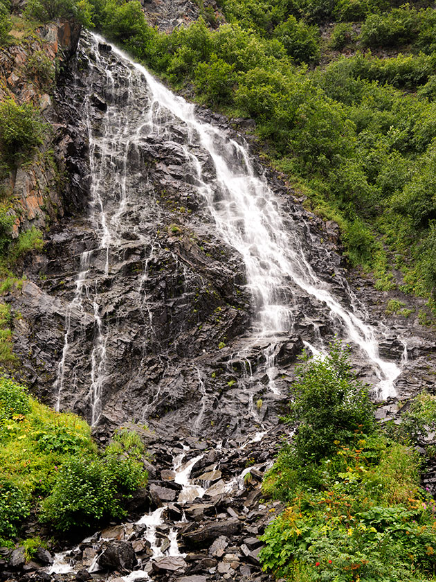
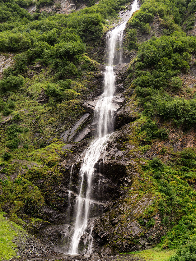
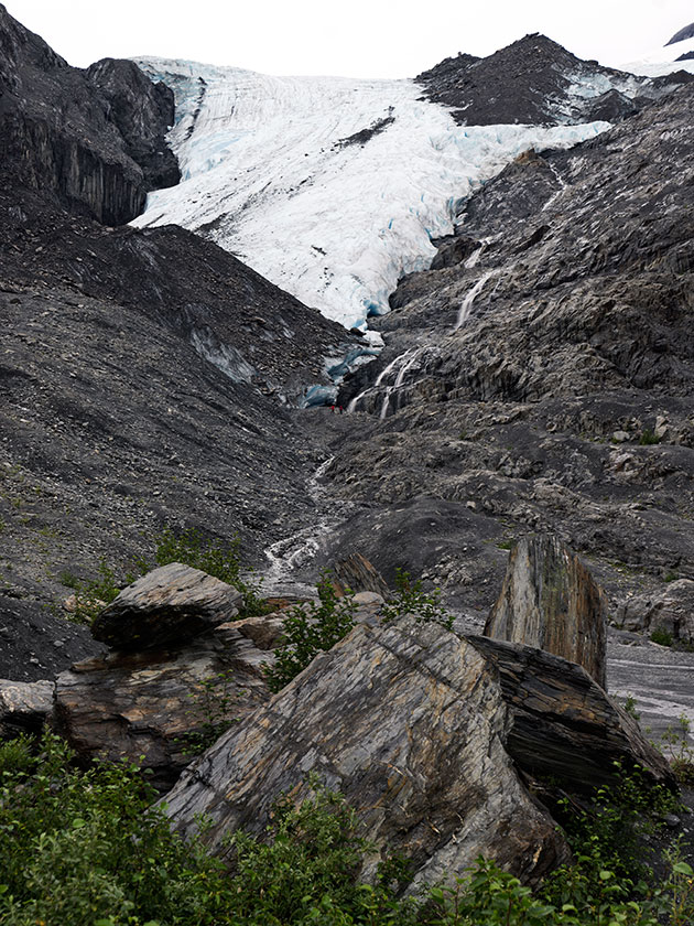
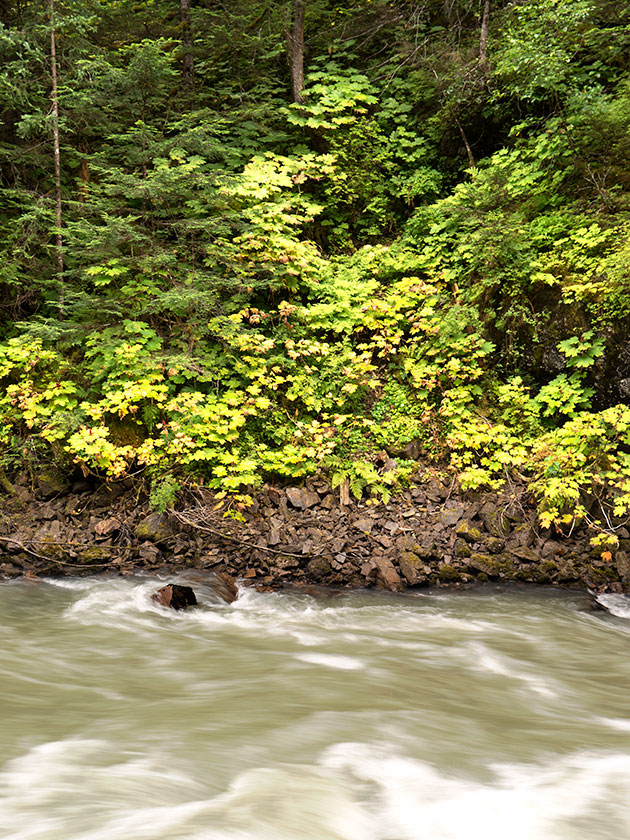
The scenery is nice in Misty Fjord, home for this community. A couple of nice glaciers and several waterfalls decorate the mountainsides. The broad leaf trees are at the first stage of turning color and the fireweed seed pods have begun to open, releasing white feathery seeds to the wind. In another week or two, this place will be ablaze in color.

Bear River
The Bear River runs from the above glacier to the sea, a length of twenty miles, with more water than Phoenix uses annually.

Tomorrow morning we head further south towards Prince George and civilization. It has a Wall-Mart and (be still my heart) a Costco. It’s funny how your priorities change when you’ve been on the road for a couple of months.

jw

Stewart – British Columbia

While we were still in Carcross Sunday, I needed to get up during the night. It seemed pretty dark, but I didn’t really pay much attention, because Queen Anne made some black-out curtains for the windows. As I got back in bed, I peeked through the curtains, and I saw stars in the night sky. I’ll let that soak in for a minute. It was finally dark enough that stars were visible. I don’t know if we were enough south, or that much time has passed since summer solstice, but we’re beginning to have real nights. That does wonders for my sleep.

We hit the road early yesterday and made our way along the Alaska Highway towards Watson Lake. That section of road is in good shape and we made good time. The Canadians are good about putting orange markers along the road sides, indicating the bad sections. Either you slow down or drive on the left side around the road hazard. Since we were the only ones on the road, we could easily maneuver in any lane we chose.

Since I didn’t have to drive a slalom course of potholes, I drove relaxed, and that gave me a chance to look around. I noticed the willow leaves were turning yellow already. This is the beginning of August and fall colors are starting above the 60th parallel. The second thing I noticed was how beautiful the Yukon is. Sparsely dominated by black spruce and willow, where even with a modest grade, we rose above tree line. The mountains, separated by lakes, are not craggy, snow-capped and grandiose, like we’ve seen in Alaska, but they stand tall above the tundra. They also go on forever, range after range for hundreds of miles.

Unless we wanted to go back the way we came, we needed to take another road south, and that was Highway 37, about fifteen miles west of Watson Lake. We originally had planned to stay in the RV camp at that junction, but we had made such good time that we decided to press on. After driving south five miles we crossed the sixtieth parallel into British Columbia.

Have you ever had the feeling that you were sure you’ve made a mistake even though all the signs say you haven’t? That’s Highway 37. On the map it looks like a major road cutting south through upper BC, but through the windshield, it looked like a Kentucky back road. Barely two lanes wide, it cut between the bogs twisting every which way. The speed limit was 48 mph (80km), but only a lunatic would have driven that fast pulling a trailer. It had no center lines and no shoulders. As we drove further, the road began to widen and became what we consider normal. We had almost worked up the nerve to go the speed limit when we had to stop to let a black bear cross in front of us.

Dease Lake
The view from our campsite was so pretty that we had to clean the trailer’s back window.

We stopped in a dry camp for the night about a hundred miles into BC. A place called Dease Lake. Our camp site was on a bluff overlooking the lake, and the view was so pretty that we broke out the window cleaner and scrubbed the back window so we could enjoy it. We slept the night with the curtains pulled back.

As with every road we’ve been on during this trip, there was the usual construction sites and the dirty mess on the vehicles. This road was full of such projects and by day’s end, The Ritz was carrying ten pounds of mud on the front.

Old Stewart Boarding House
An old building in Stewart Alaska below the glacier towering in the mountains above.

Towards the end of day two and four construction zones later, route 37 finally turned into a real highway with center lines and shoulders. We have another day before we’re done with this road, but tonight we’ve made camp in the town of Stewart. I’ll show you why tomorrow.

Chevy's in Stewart
When was the last time you saw two of these parked on your street?

jw

Skagway – Alaska

We had lunch in Skagway today. It was an international meal. We had to leave the Yukon Territories  for British Columbia, and then go through customs at the Alaska border. The trip took about an hour from our Carcross camp. With this little jaunt, we have covered every mile of the Klondike Highway, from mile zero in Skagway to the Dawson City ferry.

The Klondike Highway between Carcross and Skagway is pure eye-candy. It climbs beside a series of lakes up to the three thousand foot White Pass, and the border. There the road descends back to sea level in thirteen miles, with grades up to 15% (my guess, they’re not marked). I would compare it to Arthur’s Pass in New Zealand. If you lost your brakes on either hill, I’m sure you’d hit the ocean and skip across the water.

Tree Line
The tree line at White Pass is below 3000 ft. Glacial ponds dot the bedrock landscape.

The vegetation along the road ranges from dense spruce to above tree line, then back to broad leaf forests. The top of the pass is glacially scraped bedrock with thousands of little alpine ponds. If you keep watch on the high slopes, you may see a mountain goat or two. After passing the summit, it’s easy to see how a glacier cut the fjord that Skagway is in.

White Pass
The west side of White Pass has a steep grade. In this photo, you can see the train tracks climbing along the fjord wall above the Skagway River.

As for Skagway . . . there were two cruise ships in port, so the town was packed. There were shuttle vans taking people up to the pass, there were trains taking people up to the pass, and there were airplanes taking people up to the pass. You can rent bicycles, mopeds or just walk thirteen miles up the hill.

If you don’t know the history of the pass, here’s the thirty-second version.

Part A: During the 1890’s Klondike gold rush, prospectors throughout the world converged in this area trying to get to the Yukon gold fields. The original preferred route was the Chilkoot Trail. Historic photos show men shoulder to shoulder, climbing this pass in the snow. To cross into Canada, you had to prove that you could sustain for a year, so you had to have a ton of provisions with you. You, or someone you paid had to carry all that junk up to the border and pile it on a scale. Only then could you enter the Yukon.

Part B: In 1900 an US/Canadian company completed a narrow gauge railroad that runs between Skagway and Whitehorse (it still does) through White Pass. After that prospectors abandoned the Chilkoot route. Twenty years later, all the easy gold was gone anyway.

Yellow Street Cars on City Tours
Old building line the historic part of town, where merchants offer the typical items that tourists crave.

Back to Skagway. A lot of today’s tourists didn’t care about the pass. They’d prefer to shop for jewelry, furs, tee shirts or fudge. While they’re at it, maybe they’d like a beer, a meal, or visit a brothel. That’s what Skagway does very well. The historic buildings are well-kept and neat to see. There are several museums to visit and learn about its history. But the things you need to live there are hard to find, like a gas station, grocery store or even a working bank. They are in a different part of the town.

Skagway Post Office
Every American Town has one.

I’m glad we visited, we had fun visiting the brothel (it’s on the haunted building registry), but we didn’t pay ten bucks for the twenty-minute tour (same price as in 1899). Continuing a tradition that started on my fiftieth birthday, Anne bellied up to the bar and bought me a beer, but not a the tee-shirt.

Tomorrow, we break camp and move south into British Columbia where we will be dry camping lakeside at a Provincial Park. We won’t have an internet connection, so my next post will have to wait till we return to civilization.

jw

Carcross – Yukon Territories

Queen Anne and I left the gang behind in Tok two days ago. Since we have different priorities for the trip home, the group figured it would be best for each of us to follow our own routes and time-table. Fred and Deb promised that they would send updates and photos via email so we can follow their adventures too. For example, they made it to Beaver Creek today and by chance, stopped at the same store we had visited yesterday . . . Only they ran into Dudley Do Right.

Dudly Do-Right With Sally and Deb
Sally and Deb run into Dudley Do-right at the local convenience market/Laundromat. Who knew stars hang out in Beaver Creek, YT?

Yesterday’s road was enough to tear the rest of my hair out. After leaving Tok the Alaska Highway gets a bit rough, and I began to hear clunking coming from the trailer hitch. We pulled into a wayside to make sure nothing was wrong. I have a device that clamps the hitch to the receiver and I wanted to make sure it was tight. Since the parking area was on a slant, the first thing I did was to chock the trailer tires. After fiddling with the receiver and hitch, we tightened everything up and connected the Ritz to Fritz. A few miles down the road confirmed that we had fixed the clunk. It wasn’t until we left this morning that I realized that I had driven away from the chocks. Now we have to get a new set.

We were trying to make a campground in Destruction Bay (ominous name, isn’t it). Remember when I bragged about my clean and shiny truck and trailer. Well, between Beaver Creek and Destruction Bay, the Canadians have three construction zones. They never really fix the roads, they just scrape off the surface, pile more dirt in the wallows, then put more gravel and oil on it. That takes all summer. Just to summarize it, there was fifteen miles of wet mud, in the rain where they were fixing the road. By the time we made camp, I didn’t want to touch the car or trailer.

Kluane Lake and Ruby Range
The mirror like waters of Kluane Lake reflect the Ruby Range east of the lake.

We did camp last night in a Provincial Park campgrounds at Kluane Lake. Our campsite was on the water so we enjoyed the marvelous view and the pair of loons that came by for a visit. Before a breeze picked up, the water was glass smooth. We sat around a campfire for dinner before turning in. As we were leaving a pair of white swans called us down to the shore to show off their signet.

We made Whitehorse by lunch. That’s an important milestone as we now have traveled every mile of the Alaskan Highway. If you remember, we left the highway because we wanted to go through Dawson City, and only God knows why, the town of Chicken. (See previous dirty car rant.)

CarCross Railroad Depot
The town of Carcross has a working train depot.

After lunch in Whitehorse, we headed south on the Klondike Trail and we’re camped in an RV park in Carcross. I know, the first thing that went through my mind was it was some car ferry or something, but this is the site where great herds of caribou forged the Yukon River. It sort of changes the way you pronounce the town’s name. It’s a small native village on Bennett Lake, which is one of a series of lakes at the headwaters of the Yukon.

Tagish Lake
Tagish Lake is one of several lakes that deliver water to the Yukon River.

We chose to stay here, because tomorrow we’re going to run into Skagway for a visit. It’s only sixty miles and we can make it down for lunch and back for dinner. I should have a report for you tomorrow.

jw

Tok – Alaska

Tok (rhymes with Coke) is a small town along the Alaska Highway, not a hundred miles west of the Canadian border. Sometimes, on the road signs, it’s called Tok, and other times, Tok Junction since it’s where Alaska Highway (AK 2) and the Richardson Highway (AK 1) intersect. Because of its site, the primary industry here is to service highway travelers. The unique thing about Tok is that if you drive into Alaska, it’s the only community you have to go through twice.

Queen Anne and I returned to Tok yesterday, and the rest of the gang will arrive this afternoon. (The S.S. Minnow did return to port late yesterday, and everyone had a great time; see Deb’s comment in the Valdez post for details) This means we’ve completed our circular tour of the state. We will bid Alaska farewell tomorrow and begin our trip home via the Yukon Territories, British Colombia, and along the U.S. West Coast.

We’re staying at the Sourdough Campgrounds RV Park and Cafe, run by Tim and Tracy Hulett. They both share responsibilities in running the park and café. Tim cooks, Tracy handles the tables, Tracy checks in guests, and Tim does maintenance in the park.

The park has two shticks going for it. The first is that they have a quarter car wash on the premises. I can’t begin to tell you how important that was to us after driving down the muddy Chicken Road. The second unique thing they do here is they hold their world-famous pancake toss on the stage behind the office every evening. OK, so someone in England knows about it, and that makes it world-famous.

Every night, Tim has about a dozen pancakes on a platter, and every attendant gets a turn at tossing two pancakes into a bucket. The first is practice, but you win a free pancake breakfast in the morning if you get the second one in. Of course, during the show, everyone gets to introduce themselves, tell where they are from, and what they hope to see on their trip. Each person tells their own story, and a lot of ribbing goes on. For example, when our gang all stood up and said that we were from Congress, no one believed anyone was left in town.

When someone is ready to toss a pancake (the secret is to toss and not try to fling them Frisbee style), they say ready, and the rest of the audience has to chant encouragement. If Tim catches someone not chanting, they have to go in front of the audience and get chanting lessons.

I know that I should have written about this last month, but I didn’t. We had WiFi problems, and I had to catch up on several posts. I also knew that we would be back . . . for another reason.

Rub on the Roibs
Last night, I made a rub from some of our ingredients and a bottle of spice that Fred had borrowed.

After the show we attended, we all sat around the campfire that Tim builds each evening and just chatted. We enjoyed our wine and asked to hear Tim’s story . . . which eventually led to cooking. As we compared favorite foods, he boasted about his ribs. I turned to Anne and said, “Here, hold my beer; watch this.” And that’s how the first-ever Great Tok Rib Smack-Down was born.

Borrowed Smoker
This is the electric smoker that Tim let me use. I’ve never used one like this before. The way I figure, If I lose, I can blame the smoker. If I win, I have to get me one of these.

It took a month looking for ingredients to make my sauce, and Tim graciously supplied a couple of rib racks and an electric smoker for me to use. The ribs have been on for three hours now, and there are two more to go before the judging. My ribs look great, but I haven’t even put sauce on them yet. Tracy has enlisted two or three people checking in to serve as judges. They won’t know who the cooks were.

Chef at Work
The ribs are half done now and looking great. I didn’t want them to dry out at this point, so I turned the heat down.

I honestly don’t care who wins. I see the event as a going-away party, a celebration of our time in Alaska. The best thing is that we’ll drive a sparkly, clean truck and trailer behind us when we hit the road.

jw

Also, although it doesn’t matter, the judges marginally voted for my ribs. I don’t believe there’s a loser here because we both enjoyed cooking. Thanks again for the hospitality, Tim.

 Tim Offer Congratulations
Jim and café owner Tim Hulett shake hands in congratulations.

P.S.S. At this evening’s pancake toss, yours truly won a free breakfast.

Valdez – Alaska

Ho hum, another waterfall, another glacier. You can quickly get jaded after a month in Alaska. On today’s drive we, crossed over the Alaska Range. The same one that parallels the Alaska Highway, and impressed us so much the first week we arrived. Today, Anne’s comment was, “Those are pretty, but they don’t have snow on them so they’re not very high.”

Horsetail Falls
As the Richardson Highway descends into Valdez, several waterfalls decorate the cliffs.

Yesterday’s adventure was driving down to Valdez to have lunch with Sally, Fred and Deb. They chartered a boat to do a three-hour cruise to some island. The charter company delayed their cruise for two days, because the boat was in repair. The last we heard this morning was that boat left the harbor, but we haven’t heard back from them . . . yet.

Glacial Bogs
Tidal bogs provide wetlands along the road to Valdez.

We wanted to visit Valdez to see what it was like. It was raining and foggy, so we didn’t get to see much of anything. It’s another fjord port along the southern coast and the terminus for the Alaska Pipeline. What little of the mountain tops we could see from town, towered above the water, just like in Seward. And as I said, there was only a hint of them appearing now and then through the fog.

Bridal Veil Falls
Another water fall and in my opinion, the most photogenic along the Richardson Highway, is Bridal Veil Falls.

The most interesting thing that the Queen and I saw, was the massive school of pink salmon in the bay in front of the fish hatchery. I’ve seen Jacques Cousteau films of schools like this, but I was awe-struck when I saw it with my own eyes. There were so many fish in the bay that they had to bump into one another as they swam. Seals were coming up from beneath the school and charging them. We could see the fish boil to the surface as they tried to evade the hidden predators.

Behind us on the other side of the road, a small water fall came from the cliff, making a short creek that ran through a road culvert and into the sea. The creek too was salmon packed. Above the first small riffle awaited a gauntlet of sea gulls that attacked every fish that tried to make its way upstream. One after another, the salmon tried and failed. The fish still kept coming.

Deb, Fred and Sally told us how they saw other animals join in on the harvest. There were bald eagles, sea otters, and they saw a grizzly that appeared out of the dense woods. He strolled to the water’s edge and plunged his muzzle into the water and then retreated back to the forest with dinner wiggling in his mouth.

Worthington Glacier
Although we did see a Cal Worthington Dodge dealership in Fairbanks, I doubt that they named this glacier after Cal (and his dog spot).

The fish were so dense that fishing meant casting a hook into the water dragging it back intending to snag a fish. I was tempted to try my hand, but it was raining and my heart just wasn’t into fishing in that way. I watched a couple of guys haul in three or four fish in five minutes that way before we left for the drive back to camp. Unlike the waterfalls and glacier, we stopped to shoot along the way home, I doubt I will ever get to see another run of salmon like that again in my life.

jw

McCarthy/Kennicott/Kennecott – Alaska

If you ever fly into Alaska and rent a car or motor-home, there will be a clause on your contract that forbids you from driving on certain roads. The first is the Dalton Road to Prudhoe Bay, the second is the road to Chicken, and the most notorious is the McCarthy Road, and it’s infamous for a good reason. The builders never meant it to be a road.

Kennecott Ore Processing
The massive multi-story building processed ore from the mines and loaded it on train cars.

In 1900, two independent prospectors discovered a large copper deposit on the mountain above the Kennicott glacier, later tagged as the Bonanza Hills. Much political wrangling went on over the next ten years, and investors formed a publicly-traded company, except the person filing the papers misspelled the glacier’s name. Today, if you’re talking about the glacier below the mine, it’s spelled, Kennicott. Otherwise, anything to do with the mine is Kennecott. I’m glad to find out that I’m not the only one who flunked spelling classes.

Kennecott Power Plant
This building supplied the power needed to process the ore.

Getting back to the road, the company needed a way to get ore down to the Cordova port. Like any good corporation, they started another corporation to build a railroad and named it the Copper River & Northwest Railroad (CR&NW). Detractors used the initials to call the investment “Can’t Run & Never Will Railroad.” However, the scheme worked and ran successfully for twenty years before copper prices plummeted, and in the thirties, the company closed the mines.

Kennecott Shift Manager's House
Although small, most of the wood detail in the house is exceptional. I wonder how the manager would have reacted to the building leaning in his window.

Years pass, and someone salvaged the rails from the track, but there’s still a historic old mining site upriver from Chitina that could draw tourists. So, some brilliant entrepreneur dumps gravel over the ties, and that becomes the McCarthy Road. During its early years, the discarded spikes tore up a lot of tires. Since those are collector’s items now, they’re not as big of a problem. The road covers sixty miles and, on a good day, takes two to three hours to travel.

Kennecott Processing and Bonanza Hill
The processing plant towers over the town with its complex architecture. The mountain that supported this ingenuity is in the background.

The problem now is that engineers never built the road for automotive traffic. The road is not maintained well, so it is full of ruts and potholes; there is a frequent blockage due to rocks and mudslides, there are no shoulders, and the road runs through bogs. The road is essentially one lane wide, so cars passing need to give way. This year alone, there have been two incidents where a motor-home has pulled over to the ‘should have been a’ shoulder and needed rescue. Last week, one just flopped over on its side, and on my trip, we called a hook for one listing thirty degrees.

McCarthy Hotel
Whereas Kennecott was a company town, McCarthy was the place to let loose. There is still a functioning hotel there—good luck in getting a reservation.

OK, I cheated. I hitched a ride on the scheduled shuttle bus. It cost a lot less than calling a tow truck and the wear and tear on Fritz. Even though I thought the Chicken Road was worse in hindsight, I still felt it was the better choice. I only had enough time to work before the return bus and couldn’t hang around for the perfect light. Unless you want to pay $250.00 for the private bridge across the Kennicott river, you have to walk or take the shuttle up the four and a half miles to Kennecott anyway.

McCarthy Groceries Meats and Hardware
If you couldn’t buy it here, it was probably up on Silk Stocking Road.

If I were to make the trip again, I would consider paying another hundred dollars to McCarthy Air and flying from Glennallen to McCarthy. Then I wouldn’t even need to walk over the footbridge the park service built. To land at the McCarthy’s gravel field, you have to circle a couple of the mountains and come in over the glacier. That would be cool.

jw