This was our last full day in Whitehorse. Fred and I tried to fish the Yukon River and got skunked again this morning, but we each had a strike, or at least that’s what we told each other. The rest of the day we stocked up with needed staples then did a little sightseeing.
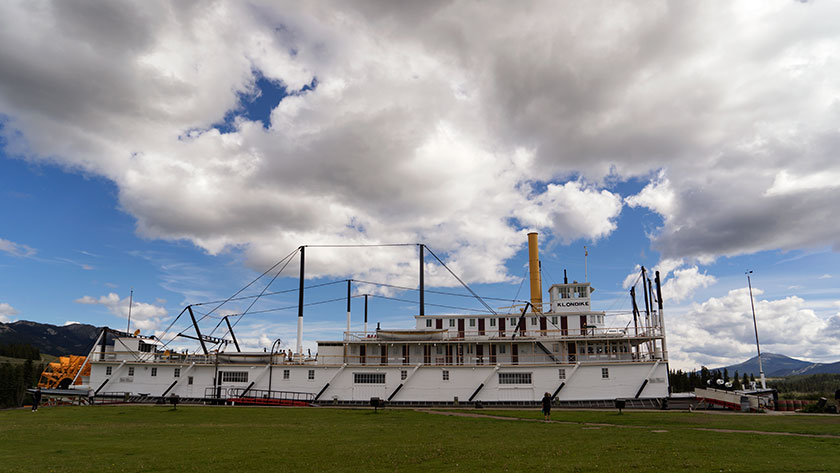
While we played tourist yesterday, we never got to the town’s biggest museum piece, so we made a point to stop at the paddle-wheeler Klondike in the afternoon. It is the riverboat hauled ore and supplies between Dawson City and Whitehorse on the Yukon River. It’s a huge ship with two 450hp steam engines and it took half of a forest to fuel the boiler.
Anne checks out the Klondike paddle wheel riverboat.
Going down stream it took more than a day with one stop for wood, but coming back to Whitehorse against the current the trip was over four days with as many refueling stops. As you would expect the ship is in mint condition with era specific supply boxes and simulated bags of silver stacked neatly in the cargo hold. Since we were second class passengers we didn’t get to see the first class cabins or the wheelhouse. That would have interested me.
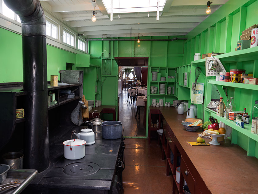
The galley of the Klondike is stocked with plates and cookware from its era.
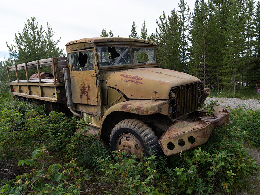
Back at camp, I had to go look at the WWII era military vehicles lined up beside the entrance. I’m not certain if these were used for the construction of the Alaska/Canada Highway or not, but as with Route 66 kitsch at home, any memorabilia that can tie in with the theme is helpful. There are about five on display and although they’re not restored, they really aren’t in bad shape. I’m sure they could be used in a collection somewhere instead of yard art along the road.
Our campgrounds has five different 40s era military vehicles lining the driveway for decoration.
Tomorrow, we’re going to make a side trip off of the Alaska Highway and head north to Dawson City. That’s the other big town in the Yukon and it is highly recommended. It’s also the home of author Jack London, whom I read as a lad. On the same street is the cabin of Robert Service, Yukon’s famous poet.
We’re going to break the trip up by making a stop midway in a town called Carmacks, a small town on the banks of the Yukon River. Then on to Dawson City for a couple of days. After that we will be in . . . (ta-DA!) Alaska after almost a month of traveling.
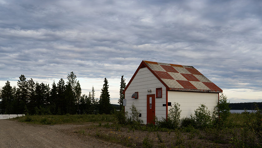
The town of Watson Lake is a little more than a wide spot in the road and for some reason, we’ve spent three days here. It seems more important on the travel brochures than it really is. Oh well, Fred and I got some fishing, or should I say, ‘Casting Practice’ in today. I’d better step up my game, because Fred actually had a fish strike this morning. Just to make things clear, we’re both tied at zip apiece.
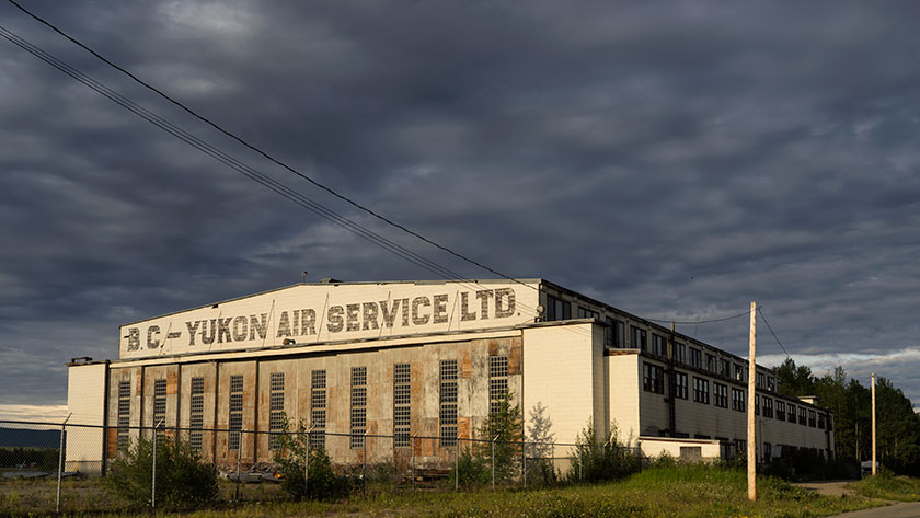
Watson Lake is another town that isn’t in its original place, like Ft. Nelson. When building the Alaska/Canada Highway, it bypassed the Watson Lake by about four miles. The town moved lock, stock and barrel down to the highway. Only the airport remains at the original town site, with a small terminal and a great WWII wooden hangar. The rest of the historic buildings never made the transfer.
One of the few remaining relics of the 40’s is a wooden hanger at the Watson Lake Airport.
Watson Lake and the airport have another historical relic. In the days after the Second World War, the airport was a testing site for cold weather aviation. In 1946 a crew, on a flight from Edmonton, was making the last turn to land, when they lost the starboard engines. To shorten the story, they never recovered and the plane went into the lake. Two crew members died trapped in the frigid waters inside the British Bomber. Rescuers saved the other four. Except for the salvaged parts, the plane’s skeleton still sits in the lake, but you need a boat or plane to view it.
At nine-thirty in the evening, there is still enough light to shoot hand-held this far north.
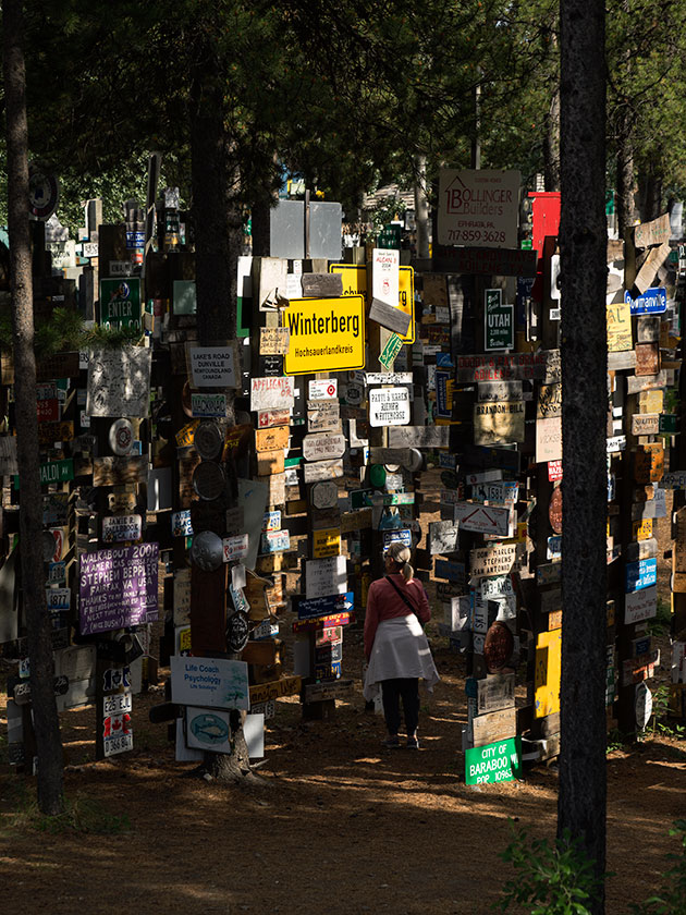
There is another landmark in town and that’s the Sign Post Forest. During the road building, army solder Carl Lindley was so homesick he made up a sign with the mileage to his home town; Danville, Illinois. In the spirit of ‘Kilroy Was Here’, other travelers continued to add to the collection. Today there are more than seventy-five thousand signs in a haphazard maze that takes up a city block. We didn’t bring one from home, but we should have, however we did find one from Congress. In 2003 the Signpost Forest was designated a Yukon Historical Marker. If you come this way, remember to bring your sign.
With over 75,000 signs posted by visitors, and more being added each day, chances are that your hometown is hanging here.
The other town attraction is the Northern Lights Center, a sort of Cinerama movie about the Aurora Borealis. It’s a neat 20 minute movie but Imax, it’s not. The projection resolution is awful, both because of the projector and the overlapping screen panels. They should get rid of the projection system and replace it with a curved LED screen. Then it would be spectacular. The seats all recline so you can take in all the domed screen and the narrator’s voice was so relaxing, I fell asleep twice.
It turns out the Queen Anne is turned on by a man dressed in rubber. Who knew?
I hadn’t mentioned it, but I found some waders in Ft Nelson, so last night I made sure they fit. The gang all did the usual cat calls, so I had to model my new outfit. I’m fighting with them about the idea of posting one of their pictures. When Fred and I went out this morning, to a recommended place, I started to cross the road and two tenths of a mile up, a black bear sow with three cubs was doing the same. For a moment I thought about getting back in the car, but fishing was more important than a bunch of Teddy Bears, so I walked down to the creek.
We’ve arrived in the Yukon and <best pirate voice> least ye be warned mates, pirates in these waters be </pirate voice>. More about that later, but first I want to talk about the trip.
For those of you interested in maps, here’s a fun fact for you. The British Columbia/Yukon border is the 60th parallel. We made the 320 mile trip from Fort Nelson to Watson Lake and we are now in the Yukon Territories. That means we’re less than seven degrees from the Arctic Circle; land of the midnight sun.
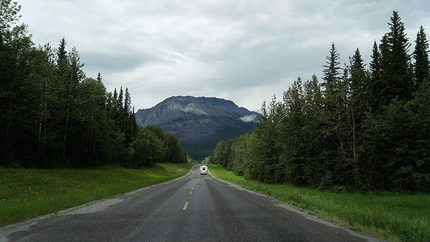
The Alaska – Canada Highway as it passes through the northern Rockies.
Today’s drive was long and complicated by several road construction crews along the way. The worst held us up for over forty-five minutes. I know that the roads have to be repaired, but why couldn’t you have done all of this work last year. Didn’t you know that Queen Anne was touring?
The highway led in a northwest direction and the snow capped peaks of the northern Rockies looming on our distant left, became a maze that the road traversed. It rained, the temperature dropped and that was were the worst construction was. Once we made it through the passes all was well again and the temperature on arrival was in the low 80s.
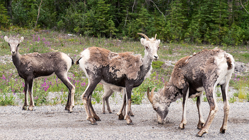
Stone sheep, a type of Big Horn, find salt and minerals along the roadside.
We saw a lot of game along the road. There were two or three small groups of Stone Sheep (a subset of Big Horns), two black bear, a small brown bear and numerous bison. The bison are so numerous that we don’t even count them anymore. We do slow down when they’re on the road like today.
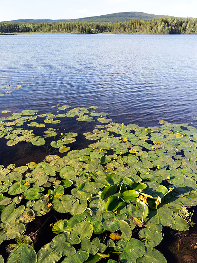
Wye Lake is across the street from our campsite.
Because the construction put us behind, we got into Watson Lake late, so we haven’t checked the town out yet. We’re going to spend three days here so I’m sure there will be updates.
Oh! The Pirates? That was the news we got at our campgrounds, which I consider the least attractive of our trip so far. It seems that up here, the Internet is considered a novel frill. All RV parks provide free service as part of your stay. In the Yukon, you also get free WiFi . . . for an hour. After that it’s $10.00 (CDN) for each additional half hour. We also get another hour on each day we stay, but have to go to the office to pick up a new user name and password.
I was upset enough that I fruitlessly protested to the inn keeper and for a brief moment thought of moving on. We’re tired however and need the rest. Besides, I have to catch a fish before Fred does.
Summer Solstice; the longest day of the year and we celebrated it here in Fort Nelson, or mile 300 on the Alaskan/Canadian highway. At 58.81 degrees north, we’re only five degrees south of the Arctic Circle and night is a constantly dusk. It’s not getting dark and the queen’s eye masks aren’t enough to let her sleep comfortably. She had to make a set of dark curtains to make it through the night lack of night.
The road yesterday turned westerly again towards the Canadian Rockies. We haven’t gotten to the big craggy mountains yet. The geography is more like the Appalachians, low-lying mountains with an occasional cliff and river canyon. The oil industry is very much present in this area of British Columbia and most of the trades support either that or tourists like us.
Fort Nelson is a smaller community than Dawson Creek. Our official and highly accurate census is taken from whether there’s a Wall-Mart, Safeway or Costco. None of them are here. There are several liquor stores here however, for which we’re grateful.
Since there is so much daylight, I got up early to explore the town and try to find something interesting to shoot. After an hour and a half I gave up and came back to the trailer and crawled back in bed. Most of the architecture is metal buildings that are so practical for a place like this, but so boring when they’re all you can find.
Except for a new Ramada Hotel, most of the commercial buildings are prefabricated.
Later in the morning Fred and I went out to a local fishing store that I found, to see about a set of waders for me (No, I am not going to walk the catwalk like Fred did. How could I possibly top that act?). But we also had to pick up a battery for my car remote, a swivel for his trailer sink and a new jar of trailer hitch grease (and while we were at it, we hit one of the liquor stores). The women, wanted to visit a quilt shop at the edge of town but it’s closed on Monday’s.
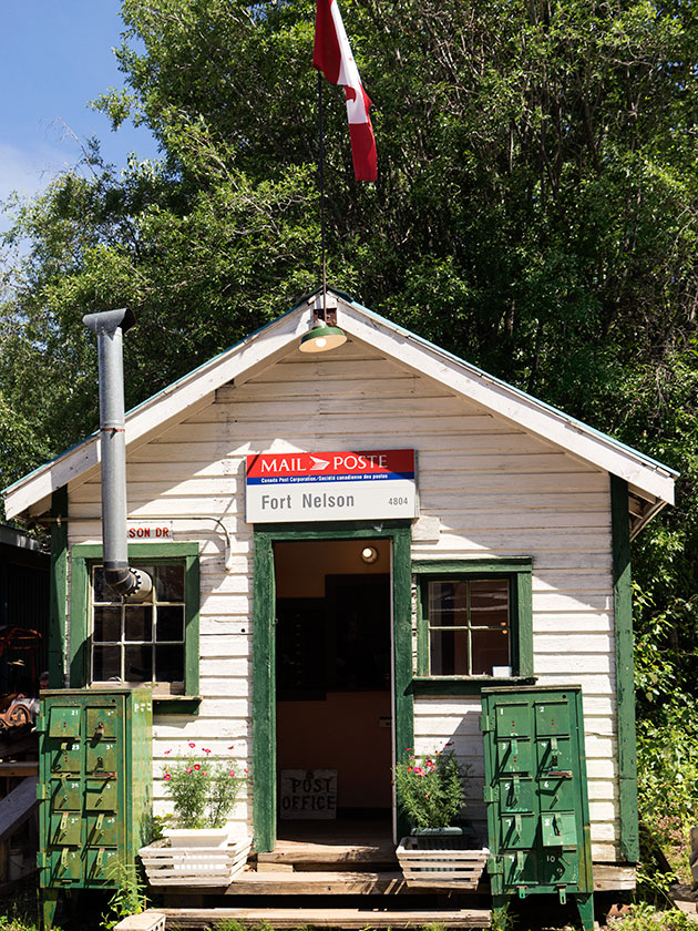
Fred and I ran into them at the Ft. Nelson Museum, one of the recommendations in the guide books. That changed my view of the town. That’s because, this isn’t the first Ft. Nelson site. I don’t know if fires, floods or some other disaster was the reason to move the town, but all of that interesting stuff is in this museum; even some of the original buildings.
The post office from the original site of Ft. Nelson is located in the Historical Ft. Nelson Museum.
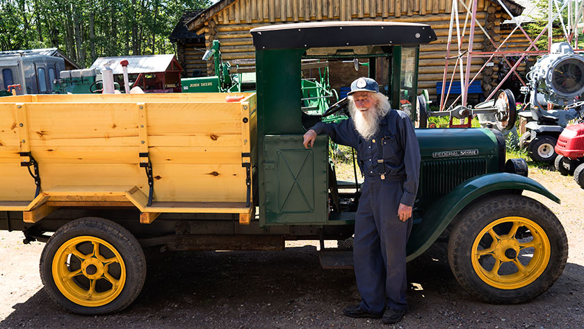
We met the owner/curator, a wonderful codger named Marl Brown in the auto building. At 87 years, he loves to show off his toy’s if you ask the right questions. He keeps about a dozen automobiles of different vintages in the building and none of them were restored, but they all run! One of them is a century old Buick that Marl told us that he drove round trip to Watson Lake and back on its birthday. That is just over 600 miles. He parades them on Canada’s National Day. They’re not mint, but he keeps them running.
Curator, Marl Brown, in front of a running Federal truck.
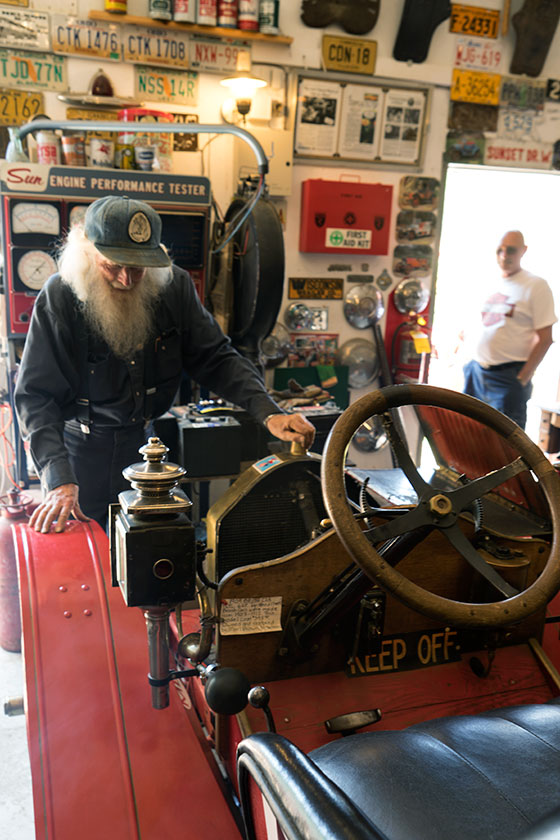
I have a friend, Paul Speer, that collects ‘Hit and Miss’ engines (a motor with a flywheel used to pump irrigation water), so I asked Marl if he had one. Yes he did and proceeded to put a thimble of gasoline in it, then started it for us. Marl jury-rigged a Coke and Pepsi can on the exhaust ports and they randomly popped up when the alternating cylinders fired.
As a visitor watches, Marl Brown prepares to start one of his antique cars; an open one cylinder roadster that I’ve never heard of before.
We spent a bit of time perusing the treasures that were in Marl’s collection. Surveying equipment, bulldozers used in for building the road, assay scales, rotary airplane motors (and an Alison engine from a Spitfire), and daily stuff that people used during the road construction.
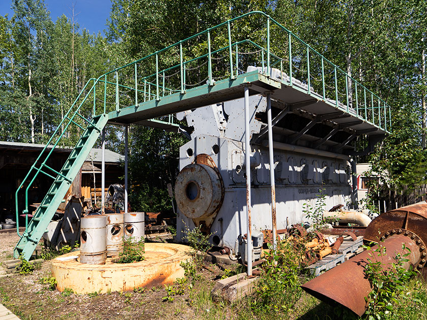
There was even something that was close to home for Fred and I. In the early years of the town, electricity was provided by five generators driven by large diesel engines. They’ve been replaced by gas-powered turbines. The diesel engines are the same that we had at the power plant that we worked at. Marl had one of these two-story monsters sitting in the yard.
A sixteen cylinder engine, similar to those used at the power plant used to supply the power for Fort Nelson.
A day that started off as a bust turned into a highlight on the trip. Even though, I appreciate looking at historical artifacts, what made this special was that I got a chance to meet Marl Brown and watch the sparkle in his eye as he showed off something in his collection.
We’ve been on the road seventeen days with 2600 miles on the odometer when we arrived at Dawson Creek yesterday (Friday; it’s scotch night). Dawson Creek is an important stop on our trip.
It’s our first stop in British Columbia.
The weather is warmer than we’ve had the last few days.
This completes the first section of Fred’s itinerary.
The most important reason though, is that Dawson Creek is where we pick up the famous Alaska Highway. As Fred said this afternoon, “We’ve come all this way just to get to the start.” If you want to drive to Alaska, this is the road that will get you there. Fairbanks is at the other end of this road, only 1500 miles away.
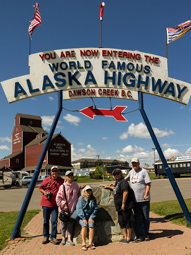
Fred, Sally, Deb, Anne and Jim take a moment to pose for photos under the highway banner.
The Army Corps of Engineers built the road in 1942 in eight months for military purposes during the second world war. The public didn’t have access to the road until 1948 and it wasn’t paved until the Alaska pipeline was built. Now the road’s covered with RVs. There’s a thriving cottage industry shepherding caravans of RVs on the same route that we’re taking.
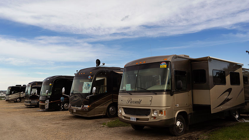
A small part of a RV Caravan sharing the same campsite with us. Our paths cross often as we move from park to park.
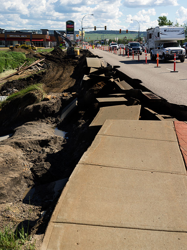
A couple of days ago, I was afraid that we wouldn’t get into Dawson Creek. Last week they had torrential rains that dumped over four inches of rain in the area. The creek that runs through the middle of town (surprise, it’s also called Dawson Creek) cut the town in half by washing out the main road. Within three days, crews patched the roads enough to get traffic flowing again.
Only a couple of days before we arrived in Dawson Creek, over four inches of rain caused flooding on Dawson Creek and closed the major road through town.
We’ve now cleared the Canadian Rockies and the countryside is flatter, with farms and lots of timber. The towns are further apart, but they have all the franchises you’d expect at home. We even passed a Costco yesterday in Grand Prairie, which is something that we rarely do.
The geography of our route has changed from mountains to prairie as we pick up the ALCAN Highway.
Tomorrow morning we strike out for Fort Nelson. A leg that’s close to three hundred miles or 450km. Although the road is famous, it gets bad reviews for its condition. We’ll batten down the hatches and suffer through it, because now we’ve made a turn and are on our way to Alaska.