Sheridan Manzanita Picture of the Week

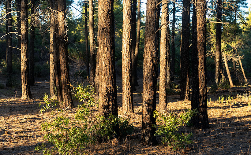
Camp Wood Ponderosa - The late afternoon light adds a glow to a ponderosa pine grove at Camp Wood.
Camp Wood Ponderosa – The late afternoon light adds a glow to a ponderosa pine grove at Camp Wood.

East of Camp Wood, the road is wide and smooth as it rolls through the Santa Maria Mountain foothills. There are a few isolated places with washboards, but it’s quiet enough you might think that they paved it, although the plume of dust you see in the rearview mirror proves otherwise.

Queen Anne and I visited here the week after a heavy rain, so it packed down the dust, but the roadside troughs were full of debris. As we drove further, it looked like road crews had hosed the gutters with oil, because they were so black. We questioned if that was to keep the dust down, or were they preparing to pave the east end of Camp Wood Road. As soon as I got those questions out of my mouth, we rounded a bend and found a scene of utter destruction. On the north side of the trail, everything was normal, with pinions, chaparral, and gamble oak covering the landscape, but the south side was black and barren. Only charcoal-colored tree skeletons dotted the hills and valleys.

This road section was the location of the lightning-caused Sheridan Fire—one of those forest fires you watch on the evening news as they bomb the countryside with a fire retardant. The reporters tell you it’s near Prescott—but they’re always near Prescott—and it’s so remote that you don’t pay much attention. The fire started on August 5th, and it burnt through 22 thousand acres until early September rains finally put it out. I’ve never visited such a fresh burn site. Unbroken black ash covered the ground, and the rains washed some of it into the road gutters. The Forest Service blocked all of the side-roads, and hiking trails leading south with signs warning of fire danger.

Because Camp Wood Road is so wide here, it worked as an effectual fire break. The stark contrast between the left and right sides of the road drove home the destructive power of a forest fire. Although it looks like a barren wasteland now, within a few weeks, grasses will begin to sprout, and the fire area will renew itself. That’s how nature works.
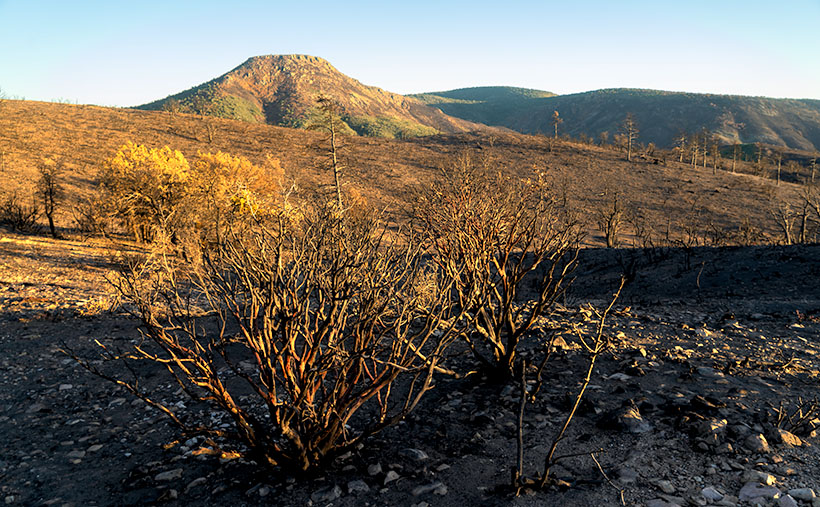
Sheridan Manzanita - Red bark manzanita burnt in the 2019 Sheridan Fire near Camp Wood, Arizona
Sheridan Manzanita – Red bark manzanita burnt in the 2019 Sheridan Fire near Camp Wood, Arizona

When we got to a place where I could see Cottonwood Mountain as a backdrop, I stopped to take a few images. My favorite of the group is this week’s featured image. It shows burnt Manzanita skeletons in front of the flat-top mountain. Manzanita is one of my favorite plants because of its mahogany-colored bark, as you see in the photo. It only grows at higher altitudes in Arizona, and it’s hard to photograph because its dense round green leaves always hide the brightly colored branches. I called this image Sheridan Manzanita, and I hope you enjoy viewing it.

You can see a larger version of Sheridan Manzanita on its Web Page by clicking here. I hope you enjoy viewing it. Next week, we’ll make another stop along the Camp Wood road for yet another change of scenery. I hope you’ll join us.

Until next time — jw

Clay Hills Picture of the Week

July is soon ending, and I’ll be writing about a different mountain range and its backroads next month. In a way, I’m not ready to move on. The Aquarius Range has more that I’d like to explore, and it may be a while before I get a chance to come back. I could use an extra Sunday to squeeze in another story. Oh well—a promise is a promise.

So, this week, we’ll finish up at the beginning or end—depending on your direction of travel—of the Aquarius Range, its south end. Here, there’s no sharp boundary that identifies that we’ve arrived. The mountains just taper into low hills then gently deliver you into the Burro Creek Valley at Six-Mile Crossing.

Depending on the source the Clay Hills or Hell's Half Acre
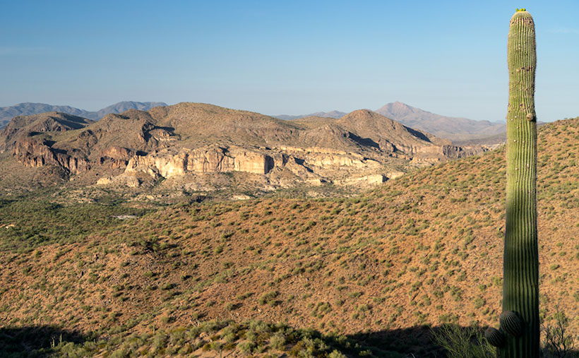
Depending on your reference these are the Clay Hills or Hell’s Half Acre as viewed from the south end of the Aquarius Range near Burro Creek Crossing.

As you descend from the higher mountains into the valley, you’ll notice a cluster of small hills with buckskin-colored cliffs for which I found two names. On the valley floor, there are Bureau of Land Management (BLM) signs saying these Clay Hills were restoration protection. On my TOPO Maps, however, they’re called Hell’s Half Acre. It amuses me that when pioneers found land that wasn’t flat and plowable, they called it Hell’s This or Devil’s That. I once had a friend who was an Ohio farm boy who told me, “… the Grand Canyon is a wasteland. You can’t grow crops there.”

I took this week’s image after I poked around the Six-Mile crossing for a while. I looked for a pretty shot of the creek running under the Cottonwood trees. The water was slow, stagnant, and choked with algae. It resembled a cesspool, so I gave it a pass, although the shade was pleasant.

As I began driving up into the mountains, I stopped to capture the scene that I call Clay Hills. It was already late morning, and the pretty light was quickly disappearing. The glare of the harsh desert sun would soon replace the warm colors. The camera is pointed west in this perspective and highway US 93 crosses Burro Creek Canyon on the far side of the cliffs. The pointy mountain eight miles in the distance is Burro Peak, so the air was pretty clear considering the recent fires near Prescott. For a cherry topping, I threw in a young saguaro with fresh buds sprouting from its top like the hairdo kids wear these days.

Click here to see a larger version of Clay Hills on its Web Page. Be sure to come back next week when we set off for another adventure exploring more Arizona back roads.

Until next time — jw

Bitter Creek Saguaros Picture of the Week

Queen Anne and I spent yesterday changing the house calendars, and with a new month, it’s time for a new photo project. I’ve been struggling to come up with an ongoing long-term theme—something similar to last years where we took you from town to town within Yavapai County. I considered several options—all of which I crossed off because they involved exercise and the possibility of having my mug broadcast on a Silver Alert.

To find inspiration, as I frequently do, I grabbed my Arizona Gazetteer Map, went into the library, and scoured through it until my legs fell asleep. In the maps, I saw something that would be interesting as a basis for a long term project. I noticed that there are roads—secondary unpaved roads—all over the state. They’re like the ones around my neighborhood that are well graded and can be traveled in ordinary sedans (in dry weather). For Archie—my four-wheel SUV—they’re freeways. These back-roads go to places I’ve never seen, and because they’re not meant for speed, almost all of you haven’t been on them either. Some of them are dead ends, some lead up into the mountains, and some head off across the desert. Haven’t you ever drive past some side road and think, “I wonder where that goes?”

So, that’s what I plan to take on for a while. I’ll pick a back road and see if it leads to something pretty or novel. Maybe I’ll eventually collect enough material and produce a catalog or magazine of sorts, but I’ll worry about that later. I can always suspend this project when I come across something fresh or different. You might say that this blog, newsletter, or whatever you want to call it, is going from On the Road to Off the Beaten Path.

Conveniently, I had a head start, because a couple of weeks ago, I took my camera and headed up Castle Hot Springs Road. It’s the long way between Lake Pleasant and Morristown, and the only way you can get to the newly reopened Castle Hot Springs Resort where Clark Gable stayed (we’ll talk more about that in another post). The road winds its way through the Wickenburg Range, Buckhorn Range, around the Hell’s Gate Wilderness, and past several working ranches, so there’s lots of eye-candy along the way.

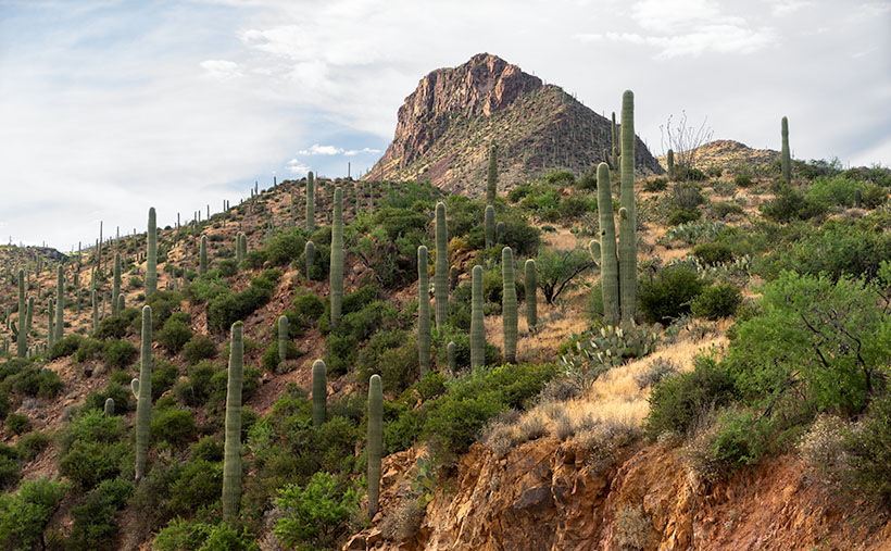
Large saguaros march up the side of an unnamed mountain.
Bitter Creek Saguaros–Large saguaros march up the side of an unnamed mountain.

This week’s featured image comes from the area where the road runs through Bitter Creek. The 3700’ mountain is unnamed, and I was struck at how the saguaros grew thick along its flank to the top. At the base of the mountain’s north side, there is a ranch labeled 11 L on my topo map and a water hole named Layton Tank. I like how the vertical cacti resemble the crowds climbing Mt. Everest we’ve seen in the news lately. I’m also pleased that the clouds parted enough to add texture to the sky. I called this image Bitter Creek Saguaros.

You can see a larger version of Bitter Creek Saguaros on its Web Page by clicking here. Be sure to come back next week when we’ll see another beautiful scene I shot on my Castle Hot Spring Road outing.

Until next time — jw