One day, I’m going to stand on top of Mount Everest—or Chomolungma (Mother Goddess of the World) as the Tibetans call it. I’ll to need some help, so I’m waiting until they finish the escalator, and a Starbucks is open at each of the decompression stations. It’s bound to happen. The mountain is already overcrowded, so we may as well wholly ruin the highest spot on our planet. Everybody should get a chance to experience that majestic view once in their life.
I love standing on mountains, canyon edges, and tall buildings. Standing there and taking in the vista enhances my map of the world. We all carry one deep in our hippocampus. It’s our sense of direction, and we probably developed it long before we fell out of the trees. It’s natural for us to want to know what’s over there and where the lions are. It’s a tool that we have located in the most primitive area of our brain. Like all of our other muscles, our spatial map works better when it’s exercised.
When I travel to the mountains like the Bradshaws, I make it a point to stop at the viewpoints and take a look around. Being the nerd that I am, I love it when the Highway Department has those displays that tell you what you’re seeing. I spend so much time studying them that Anne finally wakes up mad in the car. She thinks that I’ve abandoned her at the curb, which is silly because I would never leave the car behind.
The Bradshaw Mountains—or Wi:kañacha, in the Yavapai language (rough, black range of rocks)—have six peaks over 7000 feet. The two highest peaks, named during the Civil War, are Mount Union (7979) and Mount Davis (7897)—yes, Jefferson Davis. They’re located on the same ridgeline less than a mile apart. On the Senator Highway that Queen Anne and I explored this month, there’s a side road that goes to Mount Union and a lookout tower. On the other hand, to reach Mount Davis, there aren’t any trails—you have to hike cross country from the Mount Union picnic area.

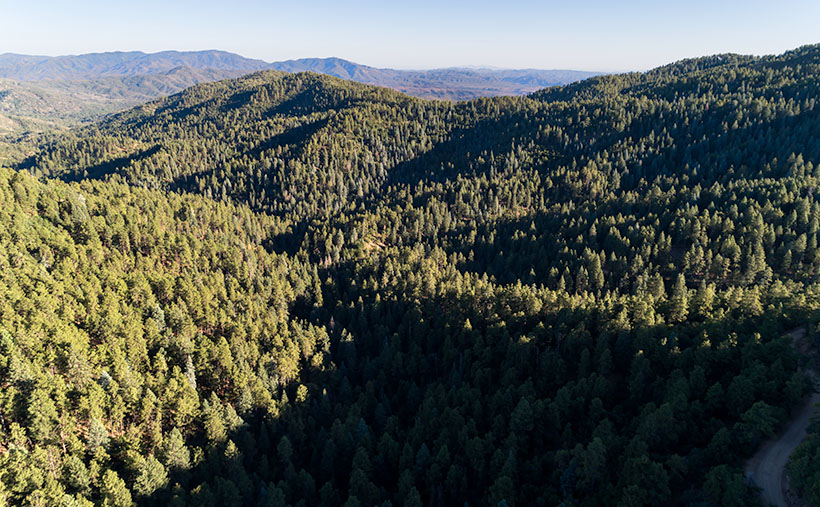
This week’s featured image has a name different than how I usually name my work. It’s called Mount Union, and I called it that because of where I stood rather than the image’s subject. This time, I found a place for the camera where trees weren’t in the way and of the several angles that I captured; I liked this version the best. This photo is of the view looking east, and it not only shows the dense pine forest on the mountain’s top, but it also includes the Black Hills that are east of Cordes Junction and on the horizon is the Mazatzal Range. Somewhere in the valley between the mountains is Interstate 17—Arizona’s primary north-south corridor.
You can see a larger version of Mount Union on its Web Page by clicking here. I hope you enjoy seeing it. Be sure to come back next week when we begin a new adventure traveling more of Arizona’s back roads.
Until next time — jw

