“I know a shortcut.”
How many of you have heard those words and broken into a cold sweat? The road that Queen Anne and I decided to explore this month didn’t start as a shortcut. It was supposed to be a much longer trip, but it got cut short.
I had intended to drive to the north shore of Alamo Lake. There are a couple of exciting mountains I’ve seen from across the water when I last visited. The best road to get there starts in Wikieup. On my maps (including Google), there are two ways to get there. One is twenty miles south of Wikieup, and the other is about five miles south. Both roads go to the little town of Signal. I’m sure you spotted the signs on a drive to Las Vegas.
We decide to take 17 Mile Drive road. It’s the first left after the Nothing Gas Station. It’s a wide well-graded dirt road that climbs over a pass in the Poachie Mountains, then down into a valley where Signal is. The scenery at the pass is amazing—something we’ll get to later—and you can drive the route with your family station wagon. There’s one hitch along the way, and that’s crossing the Big Sandy River at Greenwood. Usually, crossing the river here could be tricky because—well, it’s deep sand, and you might get stuck without four-wheel drive.

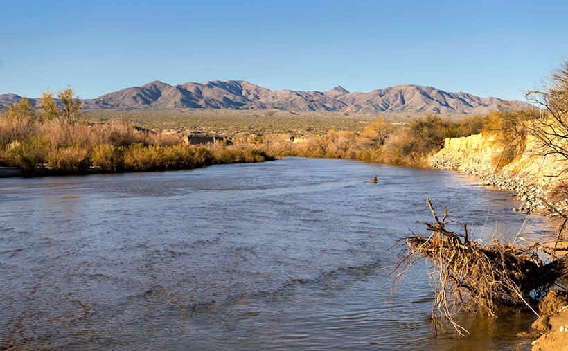
That wasn’t the case today. The Big Sandy was a real river and not in an ugly flash flood kind of way. Its waters flowed like it was an old river; clear and quiet. If I didn’t know better, I might have been tempted to pull out my waders and fly rod and make a few casts. It wouldn’t have been my worst day fishing, being the great angler that I am. There was no way to tell how deep the water was. It could have been two feet or a dozen, but it was not tempting enough for the police to cite me under the Stupid Motorist Law.
So, we’ll begin this month’s journey at the end and go backward. As I said, there was enough material to shoot in the mountains to fill a month, so we’ll save Alamo for another month, and we’ll start at the water’s edge.
I took this week’s featured image standing on the river’s bank. If I didn’t know, I would venture a guess that it was a photo of the Colorado River south of Bullhead City, and the mountains were in Nevada. Nope, it’s all Arizona. We’re looking north-east, and the peaks are actually on our side of the Big Sandy. The high point is Burro Peak. Although everything appears calm on this warm winter afternoon, the banks on each side of the water show erosion from raging water at some time. There are more cliff-banks like this—some higher—along the riverside past Wikieup that you can see from Highway 93. I wonder if I’ll ever again see a sight like this.
You can see a larger version of Big Wet Sandy on its Web Page by clicking here. I hope you enjoy viewing it. Join us next week as we start our return over the Poachie Mountains.
Until next time — jw
