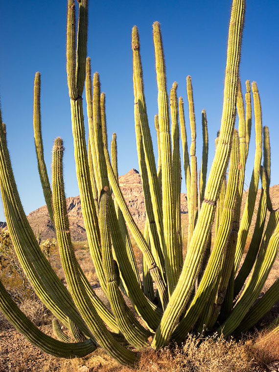
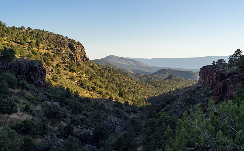
Organ Pipe Cactus National Monument has two vehicle loops that allow visitors to explore the park beyond the visitor center. On the west side of Highway 85 is the Puerto Blanco Drive, which is over 40 miles long and has stretches that require four-wheel drive. East of the highway is the Ajo Mountain Loop Drive, which is half the length and can be navigated in your family sedan (in good weather). Since I was only there for an afternoon, I opted to take the latter route.
I suppose if you didn’t stop to look at anything, you could follow this route through the Ajo Mountain Foothills in less than an hour traveling at the posted speed, but I spent more than three hours on the 19-mile loop because I was constantly hopping out of the truck taking pictures and gawking. In all that time, not once did I see another person—not even a ranger.
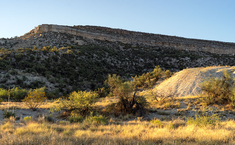
The road heads north-ish along the foothills’ west flank from the visitor’s center until it climbs over a pass at Arch Canyon. Then the road returns south through a valley between Ajo Mountain and its foothills. This week’s featured image was taken at the trail’s high point at Arch Canyon. There I was surprised to discover—an arch! Who knew? And it’s a good-sized one. I don’t recall seeing it in any of the park’s brochures, which I find odd.
The arch doesn’t have a name on my topo maps. They only note the location of the natural arch. Maybe I could petition them to call it Queen Anne Arch. If the park service did that, maybe I could get her butt in the truck to see it. There is also a picnic area and campgrounds in Arch Canyon, but only tents are allowed. I guess that’s good because the camp would be packed with motor homes and fifth-wheels all year long.
This would have been a perfect opportunity to fly my drone so that I could get a shot that was closer and from a higher perspective. Alas—there’s a double drone prohibition in place here. Drones are not permitted to fly in National Park or National Monument airspace (although winged RC airplanes are permitted). Also, most of the Organ Pipe Cactus National Monument is designated as a wilderness area. Only a dozen yards on either side of the roads are the exception. All motorized vehicles are banned from wilderness areas.
While I was in the picnic area, I took some time to read the wonderful signs that the Park Service puts up to explain the views. I learned something that I’ve wondered about for years. The Ajo Mountain Range is part of the much larger ancient Pinacate volcanic field covering more than 1,900 square miles. The Pinacate Mountains are south of the border, about halfway to the Sea of Cortez. Over eons, this field had violent eruptions that spewed tons of magma, and alternately it had periods where the volcanoes spit out tons of ash and relatively little lava.
You can see a streak of light-colored rock near the ridge’s top in this week’s image. The darker rock is our old friend Rhyolite, the slow-moving magma found in the KOFA Range. The lighter streaks are from the ash falling from the sky and covering the ground. The ash layer is called Tuff, and I’ve seen it throughout Arizona—(and that’s the rest of the story, g’day – as Paul Harvey used to say).
You can see a larger version of Arch Canyon on its Web Page by clicking here. Come back next week to see the down hillside of the Ajo Mountain Loop.
Until next time — jw