Making Lemonade 2018 Utah Photo Shoot

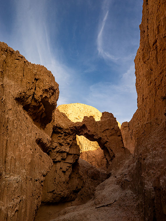
As teenagers growing up in Los Angeles, we were ambivalent about the Santa Ana Winds. They would clear the air in the LA Basin, pushing it offshore where it was somebody else’s problem, and for a week or two, you could see where you lived and enjoy the beautiful mountains surrounding us. But the winds also dried out the scrub. Dry enough, a careless motorist could fire by flipping a cigarette out the window. Fires are a way of life in Southern California. They’re annual, but you don’t get used to it.

As a kid, I saw how smoke can choke the air, but I also saw a phenomenon helpful to photographers, although that didn’t sink in until I was older. When heavy smoke fills the air, it filters the sun—like sunglasses. During sunsets, the sun is an orange globe that you can look directly at. The smoky atmosphere causes beautiful orange sunsets. I don’t know if you’d call that a benefit, but they’re unusual.

After Monday’s shooting, I was processing some photos for yesterday’s blog when I glanced at the setting sun through Ritz’s window and saw an orange sun. Yesterday, as I wrote, I thought about trying to capture a sunset from my teenage memories. I decided to give it a go, and at 7:45, I drove north on US 89, looking for a suitable foreground for my sunset experiment. I settled on a spot where the sun would go down behind a lovely mountain—Sandy Peak. As a bonus, there was a vast field sprinkler spraying streams of water that would glow with the backlighting. I exited the truck and sat by the roadside, camera in hand, and waited.

The smoke in the air must have dissipated because as the sun got lower, it didn’t get duller, although it still had a tint of orange. I knew I would need to wait for the sun to kiss the mountain for the shot to work. That meant shooting when the sun was most colored anyway. Then, at 8:00, four children burst out of the house to my left. One got on a quad and started driving around while three girls—judging from the long dresses they wore—began running toward the sprinkler. When they got there, they turned off my sprinklers. I’m talking about one of those massive machines you see in fields moving on wheels in a circle. I’d be afraid to touch it, and these children turned it off like the hose in the front yard.

I thought about leaving, but the sun was inches away by then, and the girls hung around the fixture, so I adjusted the camera to bring up the foreground and started shooting until the sun slipped halfway behind the mountain.

Sandy Mountain Sunset
Sandy Mountain Sunset- This is my failed attempt to capture an orange sunset, but the story is nice anyway.

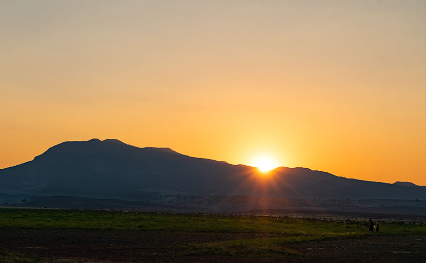
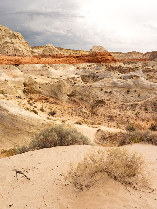
Here is my last and best shot. The smoke wasn’t thick enough, the water wasn’t spraying, and I have live humans in my photograph, but I thought I’d share my evening with you—at no extra charge. Can you find the girls? They’re there, I can assure you. Now, I can go back to shooting inanimate objects.

Until next time — jw

Cedar Breaks National Monument Utah Photo Shoot

Cedar Breaks Amphitheater - Cedar Breaks is a five-mile amphitheater that looks like someone took an ice cream scoop to it and left behind the candy toppings. The distant peak is Brian Head at over 11,000', where the ski resort is located.
Cedar Breaks Amphitheater – Cedar Breaks is a five-mile amphitheater that looks like someone took an ice cream scoop to it and left the candy toppings. The distant peak is Brian Head at over 11,000′, where the ski resort is located.

Yesterday could have been the perfect day to visit Cedar Breaks, the mini version of Bryce Canyon high on the eastern edge of the Markagunt Plateau in southern Utah. The muggy weather that had hung around all weekend moved out and it was dry and sunny with a light breeze from the west. As we entered the park the car’s temperature indicator said it was 68° outside. Conditions couldn’t have been better for an afternoon of hiking and picture-taking.

It wasn’t this nice the first time we visited Cedar Breaks. That was Memorial Day weekend in 2004. The Queen and I decided to get out-of-town to escape the 115° weekend. We had tossed the camping gear into the truck and left before dawn dressed in shorts and tee shirts. We drove straight through only stopping at the Flagstaff Mickey D’s for an egg-a-muffin. That truck didn’t have an outside temperature gauge and it barely made it up the 12% grade. We still had the air-conditioning on when we stopped in the parking lot. It was a sunny afternoon, but when we opened the doors, a blast of Arctic air greeted us and chilled us to our bones. We scrambled to find our jackets. At 10,300 feet, Cedar Breaks can be hostile.

Tee shirts and shorts were the perfect uniforms yesterday. That wasn’t a problem. The issue that I had was in the air. Up here, it’s normally clear and pristine, protected by its remoteness, but because somebody’s trying to burn down California, the air was filled with smoke that traveled across Nevada. That smoke-filled air is not conducive for taking detailed landscape panoramas. I had to change my mindset and look for more intimate images.

Bristlecone Pine
Bristlecone Pine – Probably over two thousand years old, bristlecones survive by shutting down damaged parts and only supplying new growth with nutrients.

From the visitor’s center, there’s a short one-mile hike to Spectra Point—an overlook that has a grove of large Bristlecone Pine trees. I’ve always admired these Methuselah trees for how they live for thousands of years in places where nothing else will grow. I had heard about them on my last trip, but it was spring thaw with snow covering parts of the trail and the rest being a muddy bog. That wasn’t an excuse today, so I put on my new camera backpack and balanced the tripod on my shoulder and set off to conquer nature.

Fins, hoodoos, and arches.
Fins, hoodoos, and arches – As the soft sandstone erodes it breaks down into long structures called fins. As the fins erode they leave individual spires called hoodoos. During that process, the bottom of the fin may fail and collapse leaving a window or arch. There are examples of all three in this photo. Can you spot the arch?

The trail actually leads to two overlooks, the second one being Ramparts. As I started skipping along I considered going the extra mile—as they say. It looked doable on the map because the parking lot is 10,300′ and Spectra point is 10,285′. A mere 15-foot drop—posh, child’s work. Ramparts, however, is 9,985′. I decided to see how I felt when I reached Spectra Point—after all, I have ridden a bike five miles every morning, so I’m buff … Right?

My skipping immediately ceased when I turned a corner and reached the base of a 300′ hill that’s not on the map. You can guess what my decision was already. I can walk three miles in an hour at home, but in the thin air, my trip took 45 minutes. I spent an hour shooting trees and views along the rim before heading back to Archie—our truck, where Anne was reading a book. You’d think she’d have carried the camera bag or a picnic basket or something. When I opened the back door in my sweat-soaked shirt and loaded the equipment while panting, all I got was, “How was your little hike dear?”

We spent today recuperating—she broke a nail—and I processed a couple of photos to show you. At dinner, we’ll decide where next to explore. We’ve concluded that the smoke has permeated Utah and we’ll just have to work around it, but we’re going to have fun even if it kills us.

Until next time — jw

Red Toadstool Picture of the Week

There’s a place on US 89 about halfway between Page, Arizona and Kanab, Utah where the road gets lost. As you know, odd-numbered routes run north-south, but this section of 89 goes east-west for 60 miles between the two towns and right in the middle the road hits all the compass points. There’s a perfectly logical reason they built the road this way. This is where US 89 cuts through the southern part of the Grand Staircase Escalante National Monument, and with three cliff tiers in front of you, it’s just easier to go around them.

The explanation for the five-mile section of looping road is the same. This is when the highway crosses a rift valley and climbs around to the north side of Buckskin Mountain. This is also the spot on the map that is a landscape photographer’s Mecca. You have probably seen photos of exotic geological features and wondered where they were taken. Places like The Wave, White Outcrops, Paria Canyon, Buckskin Canyon, Calico Mountain, and The Toadstools are all within fifteen miles from the road. The bad part of that—for us geezers—is that you must hike that distance to get to them.

This week’s featured image only required a jone-mile hike, but it involved a climb to a shelf 300 feet above the road. Once you make it, you’ll find a group of toadstools—columns of sandstone supporting a protective capstone. Although the trail up there isn’t flat, you don’t need to be an élite climber to make it. Queen Anne got far enough that she was able to watch her hero snap this photo, which filled her with so much emotion that she had to return to the car and do her nails.

Red Toadstool
Red Toadstool – A protective capstone is supported by a column of red sandstone near Kanab Utah.

I shot this toadstool from a couple of angles and after viewing the test strips back at camp, I preferred this version even though it’s smaller within the frame. The composition is stronger, and the image is uncluttered, so the formation becomes a stronger subject. The light wasn’t what I envisioned when I planned this trip, but the thunder clouds are kind-of cool. I call this image Red Toadstool and I’m pleased to start a month of Utah photos with it.

You can see a larger version of Red Toadstool on its Web Page by clicking here. I hope you enjoy viewing this week’s post and come back next week when we present another image from a different Utah site.

Until next time — jw

Kanab Overnight 2018 Utah Photo Shoot

We stopped short of our target destination—Panguitch—by a hundred miles because I wanted to shoot along the lower Paria River. I was hoping to shoot a couple of areas that I previously visited bathed in a late afternoon sun. Instead, it rained. I captured some nice images anyway and Queen Anne followed me most of the way up the trail—including a bit of the climb. That was a miracle unto itself.

Dune at the Toadstools
Dune at the Toadstools – This is one of the images taken at the Toadstool stop along US 89. It was the first time I hiked up to them. To her credit, Anne followed me most of the way.

Our temporary site is in Kanab and the RV Park we originally stayed in during our Alaska adventure. New owners bought the place a couple of years ago and have made improvements. I’d have to rate it as one of my favorites—although truck traffic still starts early. Last night we enjoyed a fine meal at the Rocking V Cafe. It’s the fourth time we’ve stopped there without disappointment. Anne was perturbed that they didn’t serve their macaroni and cheese for dinner. She had been going on about it all day and nearly beat up the poor waitress when they wouldn’t make some especially for her. Instead, Anne wound up enjoying the curry dish that she ordered.

We’re packing up this morning and making the pull up to Panguitch. It’s another thousand feet higher and ten degrees cooler so that suits Anne’s prerequisite. It’s also centrally located to the areas that I want to shoot. We will be pulling The Ritz for a couple of hours so we’re not in a rush this morning. As a matter of fact, it just turned 8 am and I rousted her highness from the sack. If she stays in character, she’ll dawdle all morning so that we’ll have to stop at the Rocking V for a lunch of Mac ‘n cheese.

Until next time — jw

Welcome to Utah On Location

Welcome to Utah
Welcome to Utah – With rain cells all around, we stopped to memorialize the state change.

We made it to Utah in spite of getting lost in Williamson Valley because we missed the turn off for Chino. We had to back-track fifteen miles. We finally rolled into Kanab at 5pm and after setting up camp, we relaxed in Ritz’s air-conditioning. The temperature is in the 80’s but it’s really humid.

It’s been a while since we did any shooting in the Beehive State and I’m excited to revisit the National Parks along US 89. It seems like Utah has more National Parks than the other states. We plan on visiting three of them at least. I also want to check out other sites that I’ve heard about. We’re going to be here for a couple of weeks—at least.

It’s been a long day behind the wheel, so we’re making an early evening, but I wanted to get this post out before we crash. I plan on writing more about the things we see and do much like I did during last years Springerville trip, so be ready for more blog posts this month.

Until next time — jw

Timberline Picture of the Week

Timberline
Timberline – The subjects of this image suggest that it is on a scale larger than it really is.

The wind was warmer than I expected at this altitude. Blowing on my back, it seemed to help push me along the John Muir Trail in California’s High Sierra’s. The Mt. Whitney Trail was only a half mile further when I stopped to snap this photo of massive granite formations along the tree line.

I just made all of that up. My chances of hiking those famous trails have long vanished, but this week’s photo has a sense of scale that could work with a fictitious story like that. I took this photo I call Timberline at the Granite Dells along with the others featured this month. It’s the angle that fools the eye so that you think you’re looking at a craggy mountaintop. The trees also play tricks with your sense of scale. They’re actually shrub-size like they were scale models of ones that are much taller—bonsai versions if you will, and the sheer drop in the lower left isn’t the hundreds of feet that it seems. It’s only a dozen feet over your head as you hike the Flume Trail to the park’s northern boundary.

The reason I included Timberline in this month’s set is that it distills the Granite Dells into three simple elements; massive rocks, trees eking a living in hostile conditions, and the changing sky over them. The photo speaks of weight—or mass—and it shows a time contrast of a changing sky and momentary life against the permanence of the weathered granite. The sky changes hourly while the trees will be different in a century, but the granite will survive the next millennia unaltered.

You can see a larger version of Timberline on its Web Page by clicking here. I hope you enjoy viewing this week’s post and come back next week when we start a new set of images from a new location.

Until next time — jw

West of Center Art Show New Show Announcement

The inmates are taking over the asylum again. Each year at this time, the folks at the Desert Caballeros Western Museum take a vacation and before they leave town, they toss the keys to the Wickenburg Art Club. Like a bunch of teenagers hyped on hormones, we throw a wild party … well, we actually host an exhibition of local artists for three months. Nobody’s in town anyway, so why not?

This is the seventh year that the Art Club has put on the West of Center Art Exhibition and Sale and it’s really a big deal around these parts. The members each submit up to five pieces for consideration and a jury selects the best for the show. Year after year it’s a good show because there’s a lot of good talent in the Wickenburg area. The show runs from July 28th through October 28th at the Desert Caballeros Museum’s Learning Center at the northwest corner of Highway 60 and Tegner Street. The hours are 10 a.m. – 5 p.m. Tuesday through Saturday and noon to 4 p.m. on Sundays. The store is closed Mondays. There are also art demonstrations on Saturdays from 1 – 3 p.m. If you can stop by then, we’ll learn ya somthin’.

Blue Mesa
Blue Mesa was my favorite shot from the Petrified Forest last summer. It was selected to be part of the West of Center Art Show this year.

The jury selected two of my submissions for the show this year and I’m excited to see them hanging. My first piece is a shot I took from the Petrified Forest last year called Blue Mesa. It’s a 17 x 10½ print in one of my standard black frames. You may remember a couple of weeks ago when I wrote about how I was having trouble printing it because of ink problems. Well, I solved them and I’m happy with the results.

Mud Arch
Mud Arch – I had this printed on a piece of aluminum and floated it a walnut frame for the show.

For my second entry, I did something exotic (for me). I sent my image of Mud Arch off to be printed on a sheet of aluminum 15 inches wide by 20 inches high and when it came back it looked stunning. The colors and detail came out exceptionally well. Because the print’s surface is cleanable with a mild window cleaner, I didn’t have to cover it with glass. Instead, I float-mounted it in a rustic-finished walnut frame. Despite the extra costs for this process, I plan to keep this process in my repertoire.

I hope you get a chance to stop by and take in the show. I think you’ll be surprised by the quality of art on display. The Saturday demonstrations are interesting and informative. Last year, for example, Stan Strange’s talk on Cell Phone Photography turned into the basis for the photo classes the club put on this spring. After the show, put the top down on your hot-rod and stop by Screamer’s drive-in for a cheeseburger and shake.

Until next time — jw