The Shrine Under Yavapai Skies

Ask any Arizonan about Yarnell and they’ll most likely tell you about the horrible 2013 fire that swept through the town and the 19 hotshot firefighters that lost their lives when the fire trapped them, in an open field. It’s a big deal for us and to honor those men, Arizona built the Granite Mountain Hotshots Memorial Park. Someday I hope to show that park to you, but I must first build up my stamina to be able to complete the seven-mile round trip trail over a 1200’ elevation rise. For now, I want to talk about another Yarnell attraction that’s celebrating its 79th anniversary this year; The Shrine of Saint Joseph of the Mountains. I’m guessing it’s a place that even most Arizonans haven’t heard about.

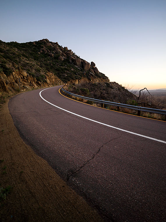
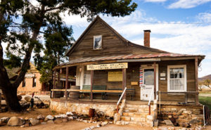
As you travel north on Yarnell’s main street lined with antique shops, it’s very easy to miss Shrine Drive, a paved road on the east side barely wide enough for passing cars. The road winds through dappled shade of scrub oaks lining Harper Canyon. The pavement only lasts a half mile, and when it turns to dirt, it’s at the Shrine parking area. As you get out of the car, the first thing you notice is how quiet it is. Even the birds whisper. You don’t see much at first, but through the trees in front of you, seated at a table is a welcoming statue of Jesus.

Praying Jesus
Praying Jesus – A statue depicting Jesus Praying is an example of Felix Lucero’s artwork at the shrine and makes a stop worthwhile.

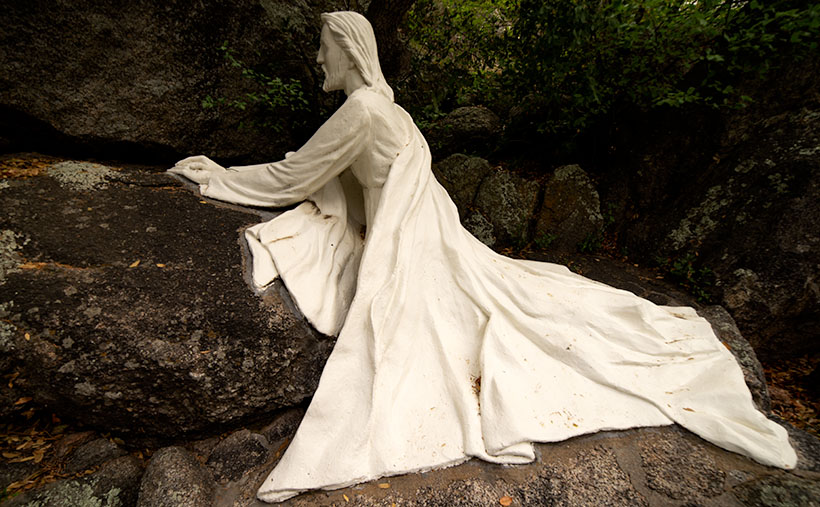
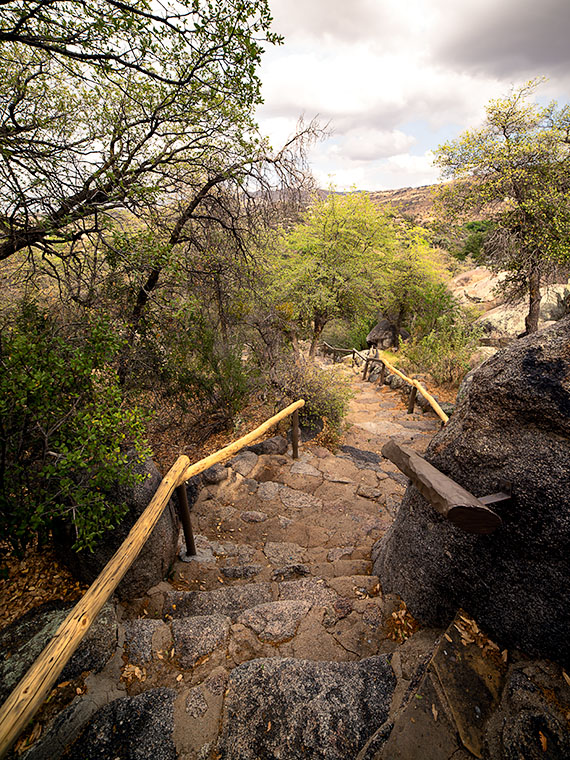
The retreat (park, pilgrimage, or however you may interpret its purpose) was the concept of the Catholic Action League of Arizona in 1934. They worked on the plan for four years and contracted self-taught sculptor and unemployed dishwasher Felix Lucero who was living under the Congress Street Bridge in Tucson. Felix’s life is a story of its own and his other collection of work is in Tucson’s Garden of Gethsemane; now know as Felix Lucero Park. The shrine is a representation of the 14 Stations of the Cross—a ritual where Christians symbolically stop and pray at significant events that happened on Jesus’ crucifixion path. The stations at the shrine are along a stair pathway that climbs the mountainside culminating with a sculpture of Jesus on the Cross. Then you continue down the stairs past the last stations until you reach a sculpture representing the resurrection—a slab in an empty grotto draped with a shroud cloth.

Stair Path
Stair Path – The stairs leading to the Stations of the Cross are often Steep. Considering that they already start at a moderate elevation, it’s not an easy journey.

The 2013 fire swept through the shrine site. It destroyed several of the support buildings, charred the trees, and completely burned some of the wooden station crosses. The fire burned away the crucifix on the hilltop completely leaving the sculpture of Jesus floating in the air suspended by bolts welded to a metal frame. Remarkably, the ivory colored statue was not damaged or discolored.

Shrine View – There are places along the path where the canopy opens revealing beautiful views of the surrounding countryside.

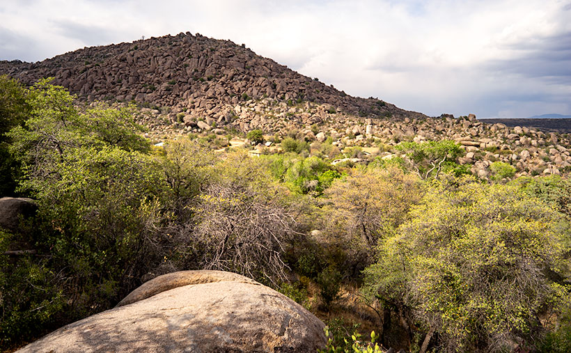
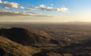
I went to Catholic school for four years and that was enough to cure me of organized religion, but as an artist, I enjoy the architecture of churches and the paintings, sculptures, and stained glass within them. I think that’s why I enjoy places like this shrine. I can see the thoughtful planning, hard work, and attention to detail found here. Besides, as you near the top, the tree canopy opens, and you have wonderful views of Yarnell and the Weaver, Bradshaw, and Granite mountains.

The next time you’re traveling the back road to Prescott, I recommend you spend some time visiting The Shrine of St. Joseph in Yarnell. If nothing else, walking the stations is good exercise. Let me warn you that your starting elevation is 4700’ and the stairs are steep. It’s almost a rock scramble; bring water. You’ll enjoy the art, the views, and the serenity. There’s no charge but there is a donation box that you’re welcome to use.

Until next time — jw

Adventures in Traveling With a Canoe Sailing along America's Interstates

Being on the road isn’t always predictable. When everything is right, you’re filled with a sense of adventure and invincibility when you begin your journey. That’s the way Magellan must have felt when he sailed around the world for the first time. Then there are the other times when you wonder why you ever left the house. The item you forgot to pack, the door you forgot to lock, or the thing you just had to bring and is now driving you nuts are examples of times that make you want to stop and turn the car around.

This article is about one of those times and it comes from our friends—the Poteets—who set off last week for a summer in Minnesota. Deb unwittingly wrote this summer’s first guest post when she sent me emails about their trip. Her comments made me smile, so I thought I’d share them with you.

Wayward Canoe
Wayward Canoe – “Eight times tied down and it isn’t going anywhere now!
Adventures in Traveling With a Canoe

Thought you would find this interesting. So we left North Ranch and were barely 500 feet when the wind moved the canoe. Yikes!!!

We slowly drove to a place to pull over and Fred readjusted the straps and off we went again. This was to reoccur three times! Do you think we could have picked a windier day to leave?

Got to Meteor Crater RV Park and one more time Fred redid the straps on the canoe. Let’s see, that’s 4 times.

 Monday we went to see the crater. On our way, it felt like we crawled to stay on the road with the canoe still on the truck. Once there Fred decided to check straps again and his hat—his favorite hat—flew off his head and over a fence.

 Well … to get his hat, he has to get over the fence somehow. Hum … his Good Wife reminded him that he had a step-ladder in the back of the truck.  He managed to get his hat and we continued to the crater. (Editor’s Note: Fred has already injured himself three times via ladders.)

 We watched the film inside the discovery center which was interesting. Tour was canceled due to the wind. I might add that I could barely stay on my feet. Hold my hat, hold the rail, and try to see the crater … big hole!

 Gourmet lunch at Subway and we purchased a tee-shirt before we headed back to the RV Park.

 OK, adjustment number 6—adding more straps.

 Windy, windy, windy!!!

 We are off to Santa Fé today. Ugh! It’s still very windy. Fred says it will be a tailwind. Fingers crossed that we don’t have a canoe sail!

Share this with Anne as I am not typing this again.

Hugs Deb”

I think it would be a great Christmas gift idea if everybody went to Harbor Freight and got Fred another ladder or more sets of tie-down straps.

Until next time—jw

It’s Too Beautiful; Run For Your Lives Warning: Summer is comming to the desert.

Blooming Palo Verde
Blooming Palo Verde – When the Palo Verde Trees bloom in the desert it means that spring is at a crescendo and summer will be soon.

The Palo Verde are in bloom. Spring in the Sonoran Desert is at its pinnacle. It’s sort of like the finale at a fireworks show and when the desert is the best. In wet years—like last year—the wildflowers carpet the floor with cacti sprouting surreal and almost garish flowers soon after. Then, starting in the lowlands, the native Palo Verde turn yellow in a succession that works its way to higher elevations, like a Technicolor wave. Finally, the giant saguaro put out dinner-plate sized white flowers at their arm tops.

There are, of course, other signs of spring around us. Male doves try to attract a mate by cooing from perches then furiously flapping into the sky as high possible before they stall and glide back to their starting place. I suppose it’s their equivalent of doing push-ups to impress the girls. Queen Anne and I spot more quail while on our morning bike ride. Soon the adults will be shepherding multi dozen covey of chicks from one shrub to the next. Other birds like the Cardinals, Cooper Hawks, and Turkey Buzzards have returned from their winter retreats. Sex is in the air and I might as well break out my copy of Stravinsky’s Rite of Spring as a soundtrack.

Here at Uncle Ernie’s Holiday Camp another spring ritual has begun. Each day, another fifth-wheel or motorhome pulls out of the park and begins a journey north. Our friends and neighbors are leaving for their seasonal excursions or summer homes which are beginning to emerge from snow banks. Pretty soon our neighborhood will be empty again with only a few of us hearty souls standing guard.

Although Anne and I don’t have a Montana home, even we’ve put pennies aside to escape the heat that comes after all of this desert beauty dries and shrivels up. This is a travel photography blog after all and—like last year—I want to report of some exotic far-off land. This year, our Shangri-La is … Utah (I know, I know. You don’t have to rub it in).

We’re going to make camp in a valley somewhere between the high plateaus that flank U.S. Highway 89. It’s been a while since I’ve photographed Utah and with several National Parks located within a day’s drive, I’ll be building on my projects. Equally important is that I will be able to blog about our adventures just like we did on past trips. We haven’t settled on where, when or exactly how long we will be on the road, but we have a couple of months to work that all out. Until then, we need to scrape the dust off the Ritz, buy fresh linens, and maybe even fix the microwave.

Since it’s travel season again, and we will only be on the road part-time, I’m going to open the blog for guest posts as I did last year. We had a positive response from those articles and they provided interesting content. So, if you’re out on the road, here’s your chance to share your stories and photos with our readers. Let me know if you’re interested and I’ll send off some guidance.

Until next time — jw

The Legends of Elephant Curve Under Yavapai Skies

Elephant Rock

While testing new photo equipment last weekend, I stopped at a spot on the road that I’ve meant to stop at since we moved to Congress over two years ago. Before this weekend, I was either in a hurry, or there was too much traffic, and there was no room to get off the road. This spot is part of the famous Yarnell grade, a stretch of Arizona State Route 89 that winds through the scenic landscape. The Yarnell grade is known for its steep descent and tight curves, making it a challenging drive for many motorists. However, it also has a unique and intriguing landmark—the legendary Elephant Curve.

Elephant Curve
Elephant Curve – As shown on the USGS Topo map, Elephant Curve has earned its spot on the map, but what happened there?

It’s a real place, and the USGS Topographic map shows its name, and at that curve, there is always an elephant painted on the rocks. Once or twice a year, the Arizona Department of Transportation, or a disgruntled Democrat, will cover over the pachyderm. Someone else takes it upon themselves to draw a new version within a week. This is the fourth iteration that I’ve witnessed since we moved here.

Elephant Rock – This is the latest version of our elephant-on-the-rock. The rock art gets painted over annually but quickly reappears within a week. The version before this was in pink paint and traces of the pink area on the pachyderm’s back.Why is this elephant so important? My favorite legend is about a circus caravan traveling to Phoenix in the late 1930s. As the group descended the newly paved but steep grade, one of the trucks lost its brakes and crashed into the rock, killing Scooby—their prized elephant—and as is the tradition in Arizona, the circus troop memorialized Scooby with a painting at the crash site.

Isn’t that sad? That would explain why the elephant painting should remain a lasting memorial marker. Unfortunately, when I researched the story online and visited the Congress Library, I discovered it’s all a myth. When I asked a long-time resident, she gave me a wry smile and muttered, “That’s just a made-up story. It never happened.”

A second local legend involves a miner returning home from a night on Prescott’s Whisky Row. Reportedly, he had to swerve at that spot to avoid a giant pink elephant in the road and crashed his car head-on into the boulder. This story explains why new versions are sometimes pink instead of white.

Elephant Curve
Elephant Curve – As you descend Yarnell Hill, Elephant Curve is the tightest and slowest you’ll meet. Five days after I took this shot, another accident ripped apart this section of the Armco barrier.

Neither story is true—so I’ve been told. The true story is that some unknown local with a strong sense of humor likes to perpetuate the elephant myths. I think there must be more than one artist because each version I’ve seen has distinctive brush strokes. Now that I’m in on the joke, I can picture myself out at night painting my take on Scooby.

Until next time — jw

Yarnell Overlook Picture of the Week

For each picture of the week in this series, I normally select the best shots from the locations that I’ve written about. This week is a little different. I had to push back the scheduled image that I was going to use so I could insert a shot that I took yesterday. I intended to just shoot some test shots, but because this image fits into the current theme and because it came out better than expected, I decided to insert it into this week’s rotation. It’s called Yarnell Overlook named so because that’s where I shot it.

Yarnell Overlook  – The vista from the Yarnell Overlook takes in Fools Gulch in the foreground to Harquahala Mountain—fifty miles to the west.


I ordered a tripod part from Amazon that arrived Friday and I was anxious to put it to work, so I decided that I would ‘run up the hill’ at sunset and test it at the overlook. It was an easy place to get to and there’s little traffic there. During the day, I was concerned because of a boring cloudless sky and the winds kicked up a layer of dust making the atmosphere hazy. I resigned myself that the results would technically be OK,  so I didn’t expect more than that. As sunset approached, however, a few puffy clouds began forming near the Weavers which picked up my spirits. After dinner, I packed my gear into the car and set off for the pull-out located half-way up Yarnell Hill to conduct my test. The view from the overlook is most often hazy and the back-light from a setting sun is even worse for shooting a high detail photo.

After I processing the test, however, I think the results exceeded my expectations. Although the dust obscures the fine detail and acts, well … like fog adding some drama. I like it because of the afternoon clouds above the layer of dust. The viewpoint overlooks Fools Gulch with its working gold mine. The Stanton road that I wrote about for the last couple of weeks is just beyond the very large Parker Diary Farm that you can see in the middle-right. The last thing that is pleasing to my eye is the repeating round shapes of the boulder-covered foreground hill and Harquahala Mountain—some fifty miles away on the horizon. In case you’re curious, our house is located in a lighter patch of homes near photo’s center.

You can see a larger version of Yarnell Overlook on its Web page here. In last week’s post, I mentioned using a Like button. Fred correctly pointed out that when you follow the post links, there isn’t such a button. There are Like and Share buttons, but they are only on the blog’s homepage. To access that version, you need to first open my Webpage and click on the Blog link in the menu. That sounds like too much trouble, so I won’t bother mentioning them again. No matter which version you see, I hope you enjoy viewing my newest work.

Until next time — jw

Stanton Dusk Picture of the Week

On my last outing, I spent an afternoon exploring the Stanton Road searching for suitable photography subjects. The dirt road runs along the base of the Weaver range between Arizona Highway 89 and the Stanton ghost town. There, you can either continue up the hill on the back road to Yarnell—something that I’ll do in the future—or take the Octave road to the old Octave Mine site. I drove down the road until it became too rough for my wimpy truck and I turned around. The light was failing anyway, so I decided to call it a day. I was almost back to Stanton, and as I rounded a corner, I saw this scene and stopped the truck so I could take a photo. I call this shot Stanton Dusk and it’s my new photo of the week.

Stanton Dusk
Stanton Dusk – The sun at the western horizon lights the ridges along the Weaver Range behind the ghost town of Stanton.

The low sun lighting the mountain ridges is what first caught my attention. The ridgelines highlighted like that keeps Weaver Mountain from being a flat silhouette and adds texture and perspective to the large dark shape. I think the sky and clouds contribute to a sense of open space. Finally, the light-colored structures atop the lower ridge anchor the frame. This shot has many of the elements that Ansel Adams captured in his masterpiece: Moonrise over Hernandez (I must mention that the image in this link is a poor representation of one of his original prints). I’m not saying that my shot has the stature of his, but Moonrise has long been a personal inspiration and I can see some of the influences in my shot. Of course, my shot doesn’t have a moon and—as some photographers do—I could add one in post-processing, but I won’t.

You can see a larger version of Stanton Dusk on my Website here. Examine both pieces and see if you agree with me. Can you see the similarity in the dark sky, the light structures, background mountain, and clouds, or am I fantasizing? Please feel free to share your thoughts in the comment section below and don’t be bashful about clicking on the Like button if you enjoyed this post.

Until next time — jw

Stanton—The Outlaw Ghost Town Under Yavapai Skies

My lovely bride abandoned me for a couple of days to get her annual check-up at a beauty spa on the Arizona Rivera—Lake Havasu City. Before she climbed into her friend—Yasmeen’s—car, she turned to me and with a pointed finger and sternly said, “I have two words for you. Be – have!” Well … that sounded like a challenge to me, so I began thinking about what kind of trouble I could get into. I was in the mood for a photography outing and I hadn’t been to Stanton since Fred and I got lost, so I tossed my gear into the truck and set off to get some new photos.

Hotel Stanton
Hotel Stanton – During the Summer of Love, hippies moved in and set up a commune. Unfortunately, they tore down many of the old buildings for firewood. LDMA has slowly repaired the remaining structures since acquiring the town in 1976.

Stanton is one of the many towns in mountainous Yavapai County (rhymes with have-a-pie) where, because someone discovered gold, a town sprung up overnight and disappeared just as quickly when the ore played out. It was little more than a stagecoach stop on the Wickenburg-Prescott road at  Antelope Creek until a tracker named Alvaro chased an errant burro to the top of what is now Rich Hill. When he got back to camp and told the expedition leader—Pauline Weaver—about finding gold nuggets “the size of potatoes” on the summit, you can surely guess what happened next.

Opera House
Opera House – The Opera House is an adobe building with a brick façade. It’s now used as a meeting hall for the RV Park.

The town—known at the time as Antelope Station—got its name from an unscrupulous character named Chuck Stanton who moved to the thriving community several years later. Stanton opened a store and, with the help of his hired banditos, killed off his competition. His reign didn’t last very long as he was shot and killed that same year (living with swords, I guess). The town thrived afterward for several decades but it had a bad reputation. “In 1892, for example, a Prescott newspaper reported that the residents of Stanton liked to ‘drink blood, eat fried rattlesnakes and fight mountain lions’” (Wikipedia). By 1905 the gold ran out and Stanton was abandoned.

Stanton Homes
Stanton Homes – Only three houses have survived the years of abandonment. They line a street surrounded by campers.

Ownership has changed several times since then and now it belongs to Lost Dutchman’s Mining Association (LMDA) and they have turned it into a member’s only RV Park. Membership is kind of pricey but LDMA has methodically bought up mining claims in the area and its members can work those old claims without charge. It’s surprising how many people will pay good money to play in the dirt—I don’t even like to plant flowers. Guests are allowed to visit but they first have to stop by the office and sign a release.

After my visit this week, I drove further down the road to the old Octave and Weaver mine sites and saw people on either side of the road prospecting. Late in the day, I stopped to take a photo along the roadside at quitting time when several trucks pulled out of a side road. They all slowed and waved and one of the men stopped to ask if I was getting some good shots. I asked him how his day went.

“What do you mean?” he asked.

“Did you make a fortune today,” I explained.

He laughed and replied, “Only the boss makes any money.”

“I see.”

Then he started telling an old joke, “Do you know how to make a small fortune in placer mining?”

“Yeah, you start with a big fortune,” I responded.

With that, he laughed and drove off in a big trail of dust.

Until next time — jw