Skull Valley Station Picture of the Week

It’s been a while since I pointed my camera at an old building. The last time I did was before we all got locked up last year. I did publish that shot of Oatman’s empty streets last year, but that image spoke about desertion rather than historic buildings. I guess I missed this genre because after I shot the train depot in last week’s photo, I hung around and worked on other Skull Valley buildings.

Shooting architecture is a different discipline than nature photography. That’s because lens distortion is more obvious when you’re shooting boxes. That’s why view cameras have movements that allow the artist to correct for perspective distortions. These days, you can correct that in Photoshop—to a degree. A photographer can use a couple of other secrets to minimize camera distortion that I could reveal to you, but then I’d have to kill you.

As I grow old, history becomes increasingly important to me, so I wish I could tell you the story behind each of the buildings I shoot. However, most of my subjects are ordinary, and they’re only historic because they survived the wrecking ball. If I were a better researcher, I could visit the local museums and city halls to uncover records. Unfortunately, I’m not going to because I’m lazy. If it doesn’t exist on Google, then it never happened.
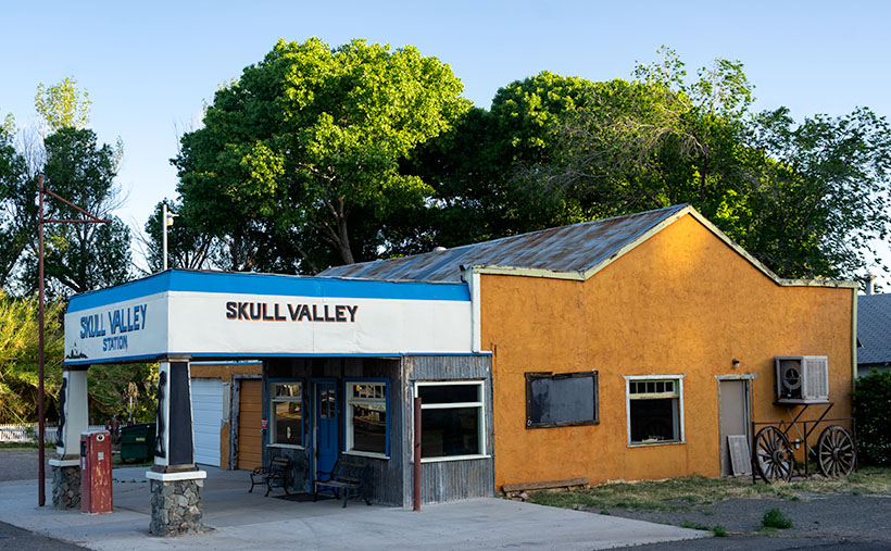
Skull Valley Station - Located on Iron Springs Road in Skull Valley on the north side of the Peavine tracks.
Skull Valley Station – Located on Iron Springs Road as it winds through Skull Valley just north of the Peavine railroad tracks.

Take this week’s featured image, for example. Up until this year, tenants used this building as a feed store. I guess that the pandemic was bad for their business, and they closed shop early this spring. I don’t know when someone last sold gas here, but the pump is set to 33 cents per gallon. I did find this article from The Daily Courier that suggests that a previous owner—Bob Colbert—didn’t know he owned a service station until he uncovered the original sign under layers of paint. Now someone has slapped more paint over the sign again (I wonder what happened to the other two pumps).

We drive by this building each month on our way to the Prescott Costco. It’s on the right immediately after Iron Springs Road crosses the Peavine tracks I talked about last week. I never stopped to take a picture because of the feed signs, and there were always newer vehicles parked outside. They kinda ruined the old-gas-state motif. This time with the early-morning light in the cottonwoods and dappled on the orange façade, I took time to shoot the station from several angles. This week’s featured image is the version I liked best. I called it Skull Valley Station. What else could I call it?

You can see a larger version of Skull Valley Station on its Web Page by clicking here. We’re going to hang around Skull valley for another couple of weeks, so come back and see what else caught my attention.

Until next time — jw

The Boulders Picture of the Week

As we continue our journey east along the Florence-Kelvin Highway, we leave behind the dry washes and haunted valleys of the Tortilla Mountains. We reach a crest where the land becomes a flat plain of sorts. There are small mountain peaks—big hills really—dotting the countryside here and there, but the view is more open, and it seems less appealing now.

Without the mountains and gulleys, the road has long straight sections, and although it appears to be flat, it’s a long downhill slope into Florence. The elevation drops almost a thousand feet over the next ten miles. Just after passing the Tea Cup cattle ranch on the road’s north side, we spot a field of granite boulders that Google Maps identifies—oddly enough—as The Boulders.

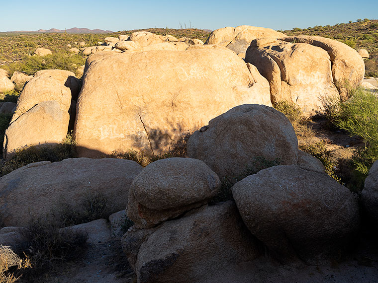
The Boulders-Another outcrop of granite deposit found throughout the state of Arizona.

The boulders that you find at The Boulders are the same pile of granite rocks found in Prescott, up the hill from here in Yarnell, Kingman, or any other place throughout Arizona. They’re everywhere. Instead of turquoise, the state legislature should have designated these granite deposits as the state gemstone, but, like Ben Franklin’s idea of making the turkey the national bird, granite just lacks pizzazz—except on your kitchen countertops.

Because the rocks stand out like a sore thumb along the road, I had to stop to take some more rock pictures. There are a couple of good campsites here. In fact, on our visit, a motor-house and fifth-wheel were doing just that nearby, so The Boulders is a popular place. As I clambered in, on, and among the rocks, I looked for a composition that distinguished this outcrop. The image that I chose to present this week was one that was covered with graffiti. I’m always flabbergasted how some people love to get out in the wild and are then compelled to mark it up with spray paint.

I call this week’s featured image The Boulders, and I like it for a couple of reasons. One is the contrast of small against the big; the other is the shadow against the light. I’ll throw in the wall-art at no additional charge. Another thing in this image that I find interesting is the Tortilla Mountains barely visible on the horizon. It shows the amount of distance Queen Anne and I have traveled.

You can see a larger version of The Boulders on its Web Page by clicking here. I hope you enjoy viewing it. Next week, we’ll finish up our trip along the Florence-Kelvin Highway and I have a surprise to show you—something I’ve seen in pictures, but never in person.

Until next time — jw

Granite Mountain Picture of the Week

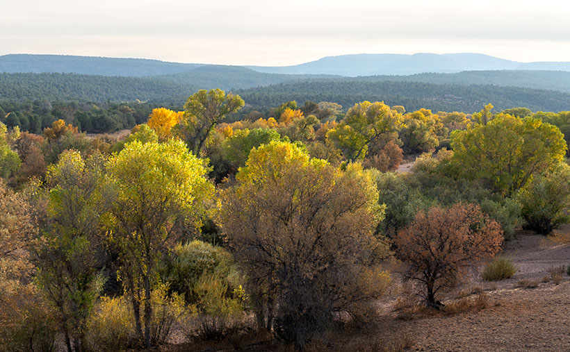
Fall on the Humphrey Wash- Usually the high-country aspen trees get all of the attention for their fall colors, but every so often, you can find some subtle color along the road.
Fall on the Humphrey Wash- Usually, the high-country aspen trees get all the attention for their fall colors, but occasionally, you can find some subtle colors along low-land roads.

This week’s featured image (below) is the last from our Camp Wood Road excursion. It was taken a few miles from the route’s junction with Williamson Valley Road—also known as Yavapai County Route 5. You’re still in the middle of nowhere when you arrive at that intersection. Iron Springs is 22 miles south, Seligman is 30 miles north, and all dirt roads. I’ve already made a note of it for a possible future trip.

From the Sheridan Fire area, I talked about last week, Camp Wood Road descends from the pine-covered hills and mountains into Prescott’s flat grasslands. It’s a natural location for the sprawling cattle ranches of the past, and now it’s the target of developers selling one-acre McMansions. When I traveled to this area as a younger man, I could frequently spot grazing antelope. They’re a rare sight these days, and that makes me sad.

When Queen Anne and I set off on this photoshoot, we spent more time getting to Camp Wood than I estimated. It was already after sunset by the time we reached the road’s end. As we drove in the dim light, I knew I wanted to include the open grassland in the Camp Wood story, so we made a second trip. This time, we drove counter-clockwise—which is more accessible and a much faster way to get there. However, on the second drive, the sky was overcast, and someone had set the Bradshaw Mountains ablaze, which filled the air with smoke. I wasn’t optimistic about getting good shots. As it turns out, the fire was only a controlled burn, and the fire crews had it out by the afternoon.

We found another change when we reached an area called Humphrey Wash on my maps. The broadleaf trees started turning color in the intervening weeks between our visits. Of course, this is Arizona, so they weren’t the bright colors you’d see in New England, but they were still worth getting out of the truck and getting them on film.

Granite Mountain
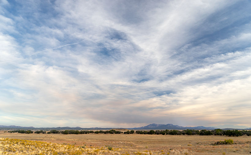
Granite Mountain – Under a vast sky filled with broken clouds with lingering smoke, Granite Mountain dominates the southern horizon from the Las Vegas Ranch in Williamson Valley.

Further east on Camp Wood Road is a large ranch with two driveways. It’s the Las Vegas Ranch, and one of the entrances is along Camp Wood Road, while the other connects to the Williamson Valley Road—a dozen miles away. When we arrived, the sun was low, the overcast began breaking, and Granite Mountain was predominant on the southern horizon. I took two versions of that scene, but I think the second was better because of the cottonwood trees lining an unnamed wash. I called it Granite Mountain, and I wanted to show the Prescott grassland’s open space. Just as it is in real life, the sky dominates everything. In this photograph are all of the elements of that visit: the broken clouds, lingering fire smoke, Granite Mountain, and the vast open plain. I hope you enjoy it.

Click here to see a larger version of Granite Mountain on its Web Page. I hope you enjoy viewing it. It’s the start of a new month next week, so we’re off to explore a different Arizona back road, so be sure to come back and see what we’ve discovered.

Until next time — jw

AD Wash Gap Picture of the Week

This month’s photo topic is Castle Hot Springs Road—part of my long-term project of getting off the highways to explore Arizona’s back roads. My only restriction is that the roads are accessible by regular passenger cars. That’s because I don’t want to buy some dune buggy for the project (Actual Read: Queen Anne won’t let me buy one).

Since I live on its west, Castle Hot Springs Road starts in Morristown at its junction with U.S. Highway 60—Grand Avenue. It loops northeast from Arizona State Route 74—which we always called Carefree Highway, but I see that it’s officially listed as Morristown-New River Highway—past the Wickenburg Mountains into the Buckhorn Range before it returns to SR 74 via the bed of Castle Creek through the Hieroglyphic Mountains. Its length is less than thirty-five miles, and you can use a pick-up truck because most of it is well-graded and broad. Its roughest section is on the east side, the several miles between Lake Pleasant and the resort, because it travels in the creek bottom. So, if you want to drive your Lamborghini to the Castle Hot Springs resort, take the clockwise direction from Morristown.

As I’ve said through the years,  people build highways from roads, roads on trails, and trails from paths, so you shouldn’t be surprised that some of the Castle Hot Springs Road originated from the Wickenburg stagecoach route. “Why travel through the mountains when there’s a straight shot across the desert floor?” you may ask. Remember, stages needed water for both passengers and horses. The trip took all day at best. On the west side, some parts of the original stagecoach road remain, and you can drive them, but you need an ATV or Jeep for that.

AD Wash Gap
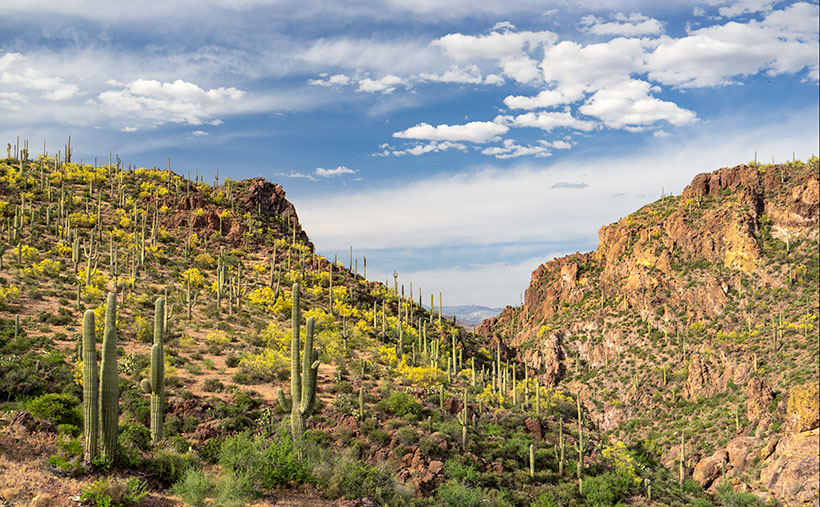
AD Wash Gap–The AD Wash drains the local mountain and runs by the road before turning into a narrow canyon and eventually becoming part of Castle Springs. You get a peek of the Bradshaw Mountains in the distance in the gap.

This week’s image comes from the road’s west section, a mile up the road from last week’s photo. On the north side of the mountain seen in that photo, Rincon Spring feeds a runoff called AD Wash—there’s no reference to what the name means, even in my trusty Arizona Place Names. The wash drains the local mountain and feeds the Layton tank before it turns and flows through a canyon between the hills. On the other side, AD Wash drops a couple hundred feet into Castle Creek.

When I shot this photo, I wanted to capture the saguaro grove against the canyon’s jagged edges in the late afternoon light. When I saw it on my computer, I was pleased with the paloverde in bloom and the blue streak running through the cloudy sky. For those unfamiliar with our Sonoran Desert, the saguaros in this photo range from 40 to 60 feet tall, and that should help set a sense of scale to what you’re viewing.

You can see a larger version of AD Wash Gap on its Web Page by clicking here. Be sure to return next week when we see another beautiful stop I made on my Castle Hot Spring Road outing.

Until next time — jw