Mack’s Bar Picture of the Week

Mack's Bar - Something that its patrons may never see is the early morning sun shining on Mack's Bar in Willcox, Arizona.
Mack’s Bar – Something that its patrons may never see is the early morning sun shining on Mack’s Bar in Willcox, Arizona.

“Gee, had I only known …” I don’t know about you, but I’ve uttered that phrase a lot. I shouldn’t be surprised because my mom always told me that I “was a day late and a dollar short.” And, I always thought she called me sun because I was so bright.

This time I whispered the idiom to myself after getting back from our Cochise County trip. As I always do, I began looking for stories that complement my pictures. I found a great story about another Earp shooting. Not Wyatt. That would have been too good. This incident involved the shooting death of Warren Earp—Wyatt’s youngest brother—at 1:30 am July 6th, 1900, in the Headquarters Saloon.

If you’re not familiar with the controversial Earp brothers (where have you been), they were supposedly the good guys at the OK Corral shootout in 1881—even though they wore the black hats and black dusters. I don’t want to dwell on the Tombstone incident, but the short version is that Wyatt, two of his brothers Virgil and Morgan, and their friend—Doc Holiday went to the corral to disarm four Clanton Gang cowboys. The confrontation erupted in a 30-second gunfight where the Earp’s killed Tom and Frank McLaury and Billy Clanton while Ike Clanton managed to run away. (In this video, Bob Boze Bell—former DJ, artist, and publisher of True West magazine—explains the shootout’s story better. It’s longish but interesting.)

Warren wasn’t in Tombstone at that time because he was too young and lived with his parents in California, but he later got entangled in the subsequent vendetta that lasted another year. By 1900, Warren had settled in Willcox, a mountain range east of Tombstone. He worked as a stage driver for the mail and a Sierra Bonita Ranch hand. It was at the ranch where he and Johnny Boyett became close.

On the fateful night, Warren and Johnny got into a shouting match in the saloon on the northeast corner of Maley Street and Railroad Avenue (diagonally across the street from last week’s train station). As their argument heated, they threatened to kill one another, although neither was armed. Short-tempered Warren and Boyett left the bar separately. Earp wanted to cool off, and Johnny went to get a gun. When Warren returned through the back door, Boyett shot at him four times. He seemingly missed on purpose. Earp taunted the ranch foreman and opened his duster to prove he didn’t have a gun. “Don’t come an inch closer,” Johnny shouted, but Warren continued. Johnny fired another round sending a bullet through Earp’s heart. Warren fell foreword, dead onto the floor. Then things got weird.

Between the 1:00 am shooting, and sunrise, Earp’s body was dragged to the cemetery and buried in an unmarked grave. Meanwhile, the Sheriff arrested Johnny. Then he got the local judge out of bed. They held a trial, where the witnesses testified. Finally, the judge determined the shooting was justified and freed Johnny Boyett. The incident was closed and sealed forever.

There is a tantalizing clue, however. In the 1930s, a reporter interviewed a woman living in Prescott’s Pioneer Home. Her name was Mary Cummings—she was also called Kate Elder, but she was best known as Big Nose Kate. She worked as a prostitute in Tombstone and was Doc Holiday’s common-law wife. During that interview, she recounted her memories of the Earp brothers and said Warren’s death “… was the result of an altercation between two individuals involved in an unnatural male relationship.”

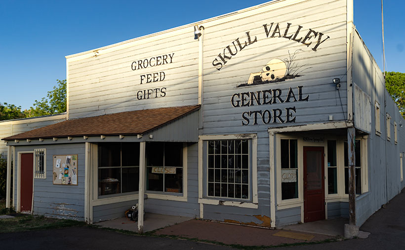
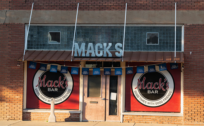
How does this week’s picture fit into this story? It doesn’t. The Headquarter Saloon burned to the ground sometime after the shooting, but the builders used the foundations to rebuild an identical structure. It’s repurposed now—ironically as a wine-tasting room. While I was shooting in Willcox, I didn’t feel it worthy because it has a tacky sign painted on the white stucco. This week’s photo—Mack’s Bar—is also on Maley Street, a block west of where our story took place. So, it’s a bar, it’s on the same street, and that’s as close as I got.

You can see a larger version of Mack’s Bar on its Web Page by clicking here. Next week, I have another picture from Willcox, and maybe I can find a story that goes with it.

Until next time — jw

Skull Valley General Store Picture of the Week

Skull Valley (the town, not the people) is an odd community. You will think it’s another Arizona ghost town when you drive north on Yavapai County Road 10—Iron Springs Road. With its empty buildings, you’d be right to believe that. However, it wasn’t always that way. There’s a lot of history associated with this town.

Before the white man came here, it was home to the Yavapai Apaches, who were noted for marauding neighboring tribes. Undocumented stories tell of one particular raid they made on the Maricopas. In the skirmish, the Apaches stole crops, livestock, and women while killing the village men.

The Maricopa didn’t much like that, so the normally peaceful valley farmers gathered warriors to exact revenge. The gathering set off to hunt down the Apaches, and to keep this story short, they kicked ass and then left the raiders to lie where they fell. Years later, when Captain Hargraves was leading a squad of The First California Volunteers—the first white people that traveled through this area—they found a pile of bleached skulls in a dry wash. This was the only evidence of the great battle.

Then in 1866, a band of 100 Apaches challenged four freight wagons escorted by four foot-soldiers. One of the infantrymen ran three miles back to Camp McPherson for help (that’s what Skull Valley Station was long before it ever sold gas—see last week’s post). When the Calvary showed up, things quickly heated up, ending in a gun battle with another 35 Apache warriors added to the bone pile. At least, that’s what it says in my copy of Arizona Place Names.

Skull Valley General Store - After a century of serving the community and highway travelers, the General Store in Skull Valley closed in 2015.
Skull Valley General Store – After a century of serving the community and highway travelers, the General Store in Skull Valley closed in 2015.

The general store in this week’s featured image was opened in 1915 and served Skull Valley for over a hundred years. Half of that era was before freeways when the main highway between the Valley and Prescott was US 89 and/or the Iron Springs Road, and travelers needed to buy gas more frequently then. I suppose that—while you’re stopped—running across the street to buy a basket of food was handy. Locals both shopped and got their mail at the store.

Today, the passenger train doesn’t run anymore, and most of the Prescott traffic is on Interstate 17—on the other side of the Bradshaw Mountains. Little traffic flows through Skull Valley, and that’s probably the main reason two of the three buildings I’ve recently photographed have been shuttered. It would be easy for you to conclude that this little town is dead. You’d be wrong.

Oddly enough, our little town is Arizona’s mecca for Polo. The field is on the Van Dickson Ranch, and you’re welcome to come to watch a match—or worse, take lessons. On the dirt roads north of town, you can visit the Painted Lady Vineyard, smell the flowers at the Skull Valley Lavender Farm, and have a beer at the Barnstar Brewing Company. It’s a small craft brewery that’s open on the weekends. You would never know that these places were there because you can’t see them from the highway. I only found out about them from an Arizona Highways TV episode.

In this week’s picture, I really like how the morning light creates a two-tone effect on the building. I was there before 6 am so I timed the light pretty well. Incidentally, the cottonwood trees behind this building—and last week’s station—are growing in Skull Valley Wash—three miles upstream from where the bleached bones were discovered.

When I win the Power Ball, I’m going to buy this place and convert it into the perfect breakfast and lunch café/gallery—as I wrote about when we were still living in Goodyear. I will hire a Michelin Chef to run the place and have a Danish baker sell pastries in the front next to the cash register. All of the walls will be covered with my photographs for the patrons to enjoy and buy. Since there won’t be much traffic, I’ll purposefully run it at a loss until the money runs out or I do. Since I don’t care to work anymore, my responsibilities will be to stop in occasionally and sample the Danish Waffles for breakfast or the world’s best Reubens at lunch. Watch this space; I’ll let you know how it’s going.

You can see a larger version of Skull Valley General Store on its Web Page by clicking here. We have one more image to share from Skull Valley, so make sure to come back next week.

Until next time — jw

Skull Valley Depot Picture of the Week

I’m not considered a sociable person, so you may be surprised that I joined a car club back when I was a younger man—more than half my life ago (oh jeez, where has it all gone). This club’s existence was based on owning a particular brand—which one isn’t important for my story—but the club member’s general attitude was that no one should drive one of these cars because the mileage brought down their value. Insane, I know. Despite that, the club put on well-attended events like parties, tours, meetings, and track days.

The club event that drew the most participation was their annual progressive dinner. If you’ve never heard of that, it’s a three to seven-course dinner served at the volunteers’ houses who prepared each course. So we’d meet at the appetizer house, have a glass of wine, and when the food was all gone, we’d jump in our cars and drive to the next course. The club paid for the food and a couple of jugs of Carlo Rossi wines, and members paid a flat per-head attendance fee. The club made a lot of money. Things were different then. Phoenix had few roads north of Northern Avenue, and traffic was nil on Saturday nights, so by the end of the evening, the drive between houses turned into a Targa Florio race. Half the club would wind up in the slammer on DUI charges these days, and the insurance companies would cancel their policy.

Now hold that thought in the back of your head while I talk about the other part of another one of my grandiose ideas. I’ve written before about the trains that pass our house. They run less than a half-dozen times each day (and night), so the tracks are empty most of the time. The route runs from Phoenix to the northern town of Ash Fork, and it has so many twists and turns that it was dubbed The Peavine Line when it opened a century ago. The tracks run through the heart of Arizona’s historic gold mining country.

Historically our little train used to carry passengers with depots in Phoenix, Wickenburg, Congress, Kirkland, Skull Valley, Prescott (now bypassed), and Ash Fork. Most of the town’s stations are still there in one form or another. And—unlike the routes between Phoenix to Tucson and Phoenix to Yuma—there is some interesting backcountry scenery and at least two climate zones along the journey.

Skull Valley Depot - The townspeople of Skull Valley have put their abandoned depot to good use as a local museum.
Skull Valley Depot – The townspeople of Skull Valley have put their abandoned depot to good use as a local museum.

So, after my photo outing where I shot this week’s featured image in Skull Valley, I began to fantasize about having a progressive dinner—on a train. The trip would start in Wickenburg (or maybe Sun City West), then make scheduled stops where the old stations are. At each stop, you could peruse the local museum, enjoy the designated course, spend money on useless trinkets in the gift shop, pee, and get back on the train. Between stations, the guests could taste wine samples (from Arizona vineyards?) and purchase bottles that they would pick up at the evening’s end. At the end of the line, the train would make a leisurely two-hour trip back to the station. The night will have fallen by that time, and guests would enjoy non-alcoholic beverages to sober them up.

I only know of two train excursions in Arizona; the Verde River Line and the trip from Williams to the Grand Canyon. There once was the White Mountain steam train, but that closed a long time ago, and Durango bought the engine (which fell off the trailer along US 89—however that’s another story). I think there’s plenty of market for another train ride in our state, and the dinner would make it a unique experience. Think of it as a dinner cruise on rails.

If this lame-brain idea sounds good to you, then it’s yours. On the other hand, if you feel it’s a stupid idea, I never said anything. My brain hurts too much to work on stuff right now. I’m too old and penniless. Besides, it’s time for my nap.

You can see a larger version of Skull Valley Depot—the picture that set my brain on fire this week—on its Web Page by clicking here. Be sure to come back next week when we continue with another Skull Valley artifact.

Until next time — jw

Stamp Mill Picture of the Week

Everyone has heard the axiom, “All roads lead to Rome.” Well, not in Yavapai County, they don’t. Over the past couple of years of traveling Arizona’s back roads, I’ve found that they lead to mines, and with good reason. We all have a vision of a dusty prospector sneaking off with a couple of burros to a secret gold mine in the mountains—this is before he became the Arizona Lottery huckster. A man like Jacob Waltz may discover a vein of gold, but it takes a corporation to extract it effectively.

To make a ton of money, you have to move a thousand tons of ore. A couple of burlap sacks strapped to a burro’s back just won’t do. You have to move unrefined earth by wagon, truck, or railroad car. So part of The Company’s infrastructure is getting things to and from the mine site. That is the Phelps-Dodge and the Senator Mine story—and this month’s back road adventure.

While bouncing along the Senator Highway in R-Chee (according to his license plate that’s the correct spelling), Anne suddenly blurted, “There’s a large building down there.” Since my side wasn’t overlooking the cliff, I couldn’t see it, so I stopped the truck and walked back to see the steel skeleton of an old structure. “Cool,” I told her as I climbed back into the driver’s seat. “It’s too early, so we’ll stop on the way back when the light is better.”

Stamp Mill - The ruins of the Senator mine stamp mill are perched above the headwaters of the Hassayampa River.
Stamp Mill – The ruins of the Senator mine stamp mill perches above the headwaters of the Hassayampa River. The mill is visible on Google Earth if you zoom in to the Senator Highway where it crosses the Hassayampa River.

After some research, I found out that the building was a 10-unit stamp mill for the Senator mines. As rock came from one of the three parallel shafts, the miners hauled it to the mill, where the hammers pounded big boulders into small ones. As far as ghost towns go, we struck gold (I couldn’t resist the pun, sorry). Concrete foundations usually are all we find in these places, but since this frame was a steel and not timber, the skeleton survives and gives scale to its size. From the road, I could easily walk down the stairs and wander the four floors. Vandals have decorated the remaining vertical walls for Christmas with colorful graffiti everywhere, so I guessed that we weren’t the first people to find this place.

Kennecott Mine - The Kennecott mining town is preserved in the Wrangell-St Elias National Park in Alaska. This should give you an idea of how a mill looked with the clapboard still intact.
Kennecott Mine – The National Park Service has preserved the Kennecott mining in the Wrangell-St Elias National Park in Alaska. This photo should give you an idea of how a mill looked with the clapboard still intact.

In Alaska, I visited a similar mill at the Kennecott Mine in the Wrangell Saint Elias National Park. At this location, the Park Service keeps that building in an arrested state of decay, and it still has the red clapboard siding. I wanted to show you how the Senator stamp mill might have looked while it was running, so I’m including my Alaska photo.

For this week’s featured image—that I call Stamp Mill—I wanted to show the building and its environment, which is hard to do while standing inside of it. So, I took this shot from the far side of the Hassayampa River Canyon as the sun hung low in the western sky. I was lucky in that the remaining silver paint glowed in the afternoon sun, which makes the frame pop from the background.

You can see a larger version of Stamp Mill on its Web Page by clicking here. I hope you like it. Be sure to come back next week when we present the final image from our drive on the Senator Highway.

Until next time — jw

Shadows, Boulders, and Cracks Picture of the Week

Queen Anne and I had only ventured into the Bradshaw’s once before this month’s Senator Highway adventure. We borrowed a friend’s 4wd tow truck and wanted to see how well it performed on dirt roads. We decided to drive to Crown King for Sunday brunch. It was a horrible experience—lunch was nice, but the track was one long washboard. The truck bounced so much that it took a week for our eyes to stop vibrating. That was before Google Maps—actually, it was before computers—so we added another unnecessary 50 miles to the trip. Anne swore off dirt roads forever.

That’s too bad because the Bradshaws (named for trailblazer William D. Bradshaw) fascinated me since I moved to Phoenix. From the valley, they’re the high range to the north. When you head Flagstaff, they’re the first pine-covered mountains that you pass. The Sunset Point rest stop, which is at the range’s eastern flank, is where I feel that we’ve at last got past the city limits. Finally, during the summer monsoons, they create the storms that bring rain to the valley (as I look out my window today, I see what could be our first seasonal storm—and it’s moving south from the Bradshaws—if it gets here at all).

Whenever we’ve stopped at Sunset Point, and I had to wait for you-know-who to finish up in the bathroom, I always looked up at the mountains and mistakenly thought that they were dry and deserted. I’d think to myself, “It’s too bad there aren’t any fishing lakes up there.” On our recent trip, I found out that I was wrong because back roads lace through the range leading to former mining towns filled with summer cabins. There are even a couple of small lakes—but they’re so close to Prescott, I’d classify them as town lakes. Perhaps it’s just as well that there’s no destination up there, because if there were a big lake up there, then there’d be freeways and planned communities around it.

Shadows, Boulders, and Cracks - This is the simplest essence of what I found interesting about a pair of granite boulders south of Groom Creek, Arizona.
Shadows, Boulders, and Cracks – This is the purest essence of what I found interesting about a pair of granite boulders south of Groom Creek, Arizona.

As Anne and I continued exploring Senator Highway, we came across a boulder field south of Groom Creek. I find these large lumps of granite interesting, but they’re all over the state, and my rock collection is vast. I hear people say, “Meh. It’s another rock picture.” So, for this week’s featured image, I tried to show just the part that made me raise the camera to my eye. In the case of this week’s featured image, that I call Shadows, Boulders, and Cracks, it was the texture of the massive rocks, the delicate shadows of the deciduous trees, and the fracture that splits the right sphere in half. Even without seeing the entire boulder, you instinctively know that you couldn’t skip one of these pebbles across Goldwater Lake.

You can see a larger version of Shadows, Boulders, and Cracks on its Web Page by clicking here. I hope you like it. Be sure to come back next week when we present another image from the Senator Highway going south from Prescott.

Until next time — jw

Placerita Hills Picture of the Week

While having this morning’s coffee, I sat on the front porch and watched the sunrise over the Weaver Mountains. That’s the best view from my house, but there are still homes and trees in the way, so I can only see their tops unless I walk down to the end of the street. Since the elevation here is 1500’ higher than the Phoenix basin, the mornings are still cool—even in June. Because my porch faces east, all of that pleasantness comes to an abrupt halt the second the sun clears the horizon. Then I’m forced to retreat to the back where I have a spectacular view of my neighbor’s shed.

When we moved here almost five years ago, I knew nothing about the Weaver Range other than their name. With time, I learned more about their secrets as I researched the subjects I photographed. I fear that by the time I run out of film, I’ll become a sort of grizzled old Gabby Hayes wandering the Wickenburg streets, wearing a torn cowboy hat, a mouth full of chaw, and spinning yarns about mountain ghosts, so the tourists will give me loose change.

The Weaver’s have been at the center of my attention for a couple of months now because they’re the subject of my third drone video that I’ll finish in a couple of weeks. For the video, I made a list of points to film, and I’ve grappled how to describe the range best. On the way to the Prescott Costco last week, I blurted to Anne, “They’re like a horseshoe wrapped around Peeples Valley.” She said, “Huh?” I probably should have started with some context. Then I came up with a better metaphor. They’re more like the palm of your left hand—not the Michigan one.

The Weaver Range - The geography of the Weaver Range can be summed up on one hand, but you have to use the correct one.
The Weaver Range – The geography of the Weaver Range can be summed up on the one hand, but you have to use the correct one.

Use your imagination. Peeples Valley is the depression in the center, and State Route 89 is your life-line ascending from your wrist up Yarnell Hill to the little town at the pass. The Weaver’s tallest peaks are along with the thumb, and where gated communities of summer homes are. The desert wall (the northern boundary of the Sonoran Desert) is along your wrist. The area under your little finger represents the lower eastern peaks—more like rolling hills. The Hassayampa River separates the Weavers from the Bradshaws. The area that we’re exploring this month is at the base of your little finger.

Placerita Hills - The east flank of the Weaver Range are hills than tall peaks.
Placerita Hills – The east flank of the Weaver Range are hills than tall peaks. On the distant horizon is Weaver Peak which is on the other side of Peeples Valley, and is the range’s tallest peak.

The east flank of the mountain range doesn’t have any soaring peaks, at least not when you drive in from Peeples Valley. The mountains are more like rolling hills, as seen in this week’s featured image that I call Placerita Hills. To get there, you have to drive up a long gradual incline. The hilltops have granite outcrops that are like miniature versions of eastern and southern peaks. In the photo, the dense vegetation is very evident and is a mixture of Manzanita, Scrub Oak, and some others that I’m not able to name. Unlike the desert floor, there’s no space to walk, and it’s easy to understand why cowboys wear chaps. The mule deer that we saw bounced over the brush instead of running through it. It’s incredible to me that the area’s ranchers can raise cattle here.

You can see a larger version of Placerita Hills on its Web Page by clicking here. I hope you enjoy it. Come back next week to see what else we found along the road to Placerita.

Until next time — jw

Placerita Post Office Picture of the Week

It was lust for gold that lured men to the Weaver Mountains in southern Yavapai County. They heard stories of miners plucking nuggets from the ground and, in just a day, returning to camp a wealthy man. The fever for gold outweighed the risks of hostile Indians, treacherous mountains, poisonous snakes, and oppressing heat from the relentless sun.

Prospectors discovered several veins of the precious mineral with Rich Hill at their center. Pauline Weaver’s party started the rush when they accidentally found placer gold on the hill’s top. Boomtowns sprung up surrounding Rich Hill. The camps in Stanton, Octave, and Yarnell all had ore-bearing mines. There were so many claims on the hill; it’s a wonder that prospectors didn’t dig into each other’s tunnels. But it only took 20 years for the gold to dry up; as a result, when Anson Wilbur Callen arrived in the 1880s, he decided to prospect somewhere else.

If you flew a small airplane due east of Yarnell, you’d see a geographic anomaly. Instead of the regular distribution of peaks and hills in the Weaver Range, there’s a 2-3 mile gash between Antelope Peak and Rich Hill. From Yarnell, it runs northeast, and it looks like a score on the top of a loaf of bread. It’s very evident on a topo map or Google Maps.

There’s a natural divide in the gap’s center, and Antelope Creek drains south along the east flank of Rich Hill. Arrastre Creek flows in the divide’s north side (Arrastre is the Spanish word for a drag, as used for mining). Anson set up his camp where Arrastre Creek flows out of the canyon.

By accounts, Anson Callen was a big man and weathered beyond his age. Locals called him Old Grizzly at the age of 40. When he set up camp, his initial task was to create a reliable water source, so he dammed up the creek. As he dug a five-mile water ditch to his base, he uncovered two pieces of gold that earned him $550. There are more stories of finding large gold nuggets in the area—one of which was four pounds that the assay office valued at $900 ($107,792 in today’s market). Before Anson knew what had happened, the town of Placerita sprung up around his claim.

On Tuesday morning, I dragged my friend—Fred—out of bed, and at 5 a.m., we drove his Toyota FJ into the sunrise to find the ghost town of Placerita. As I’ve written, real ghost towns rarely have any remaining artifacts. Maybe there’s a pile of timber or a concrete slab, but never an intact building. My research showed that Placerita had a standing stone cabin, and I needed to photograph it.

Ruins in the Woods - From the roadside, we could see the remains of one of the town buildings, but we couldn't see an easy way to get to it.
Ruins in the Woods – From the roadside, we could see the remains of one of the town buildings, but we couldn’t see an easy way to get to it.

When we got to the area, we drove by a shed with a collapsed roof, but the brush was so thick that we couldn’t find a path to it. Instead, Fred drove down to the creek crossing and parked in an apparent campsite. We intended to hike up the creek, find the buildings, and photograph the ruins. Indeed, they were built along the banks. We soon discovered that walking in a dry creek bed wasn’t the best thing a couple of septuagenarians should do—especially a pair that has a hard time walking on carpets. We struggled for what seemed like a couple of miles, occasionally falling on the rocks and swatting at attacking insects.

Placerita Post Office - The 30 townspeople were served by this Post Office from 1896 to 1910, when the gold ran out.
Placerita Post Office – The 30 townspeople were served by this Post Office from 1896 to 1910 when the gold ran out.

Finally, we gave up and started back to the truck, but instead of the creek, we found a cattle track that had boot prints. We followed it to a clearing where—you guessed it—we found the collapsed building. We spent some time shooting photographs from different angles, including this week’s featured image called Placerita Post Office. About half the walls were standing, but the timbers were full of termites, and that finally caused the roof to collapse.

We never found the stone cabin—or at least we thought we hadn’t—but after I got home and did some further research, I found a photo caption that said, “It has been reported that the roof has collapsed since this picture was taken.” We did reach our goal; it’s just ten years too late. I also found out that the stone building that we shot was the town’s Post Office—built in 1896 and closed in 1910. As a federal building, it was built more durable than the rickety shacks that the miners cobbled together. It makes sense that it outlasted the rest of the town.

You can see a larger version of the Placerita Post Office on its Web Page by clicking here. I hope you enjoy it. Come back next week to see the work I’ve shot along the road to Placerita.

Until next time — jw