Get Bent Picture of the Week

Not all saguaros are super-models. Like people, they come with all sorts of warts and scars. The Gila woodpeckers carve nests in them because inside the flesh, the summer daytime temperatures can be over thirty degrees cooler than outside. The cavities don’t cause harm to the saguaro, and squatters like hawks, owls, and other birds move in after the woodpeckers leave. The substantial threats to a saguaro’s life are from lightning, strong winds, stupid people, but the real culprit is frost.

On our imaginary day-trip around Saguaro National Park, we’ve left behind the visitor center, and we’re exploring the Bajada Wash Loop, which leads from the west side up toward the Tucson Mountains—the park’s backbone. In fact, these are the only roads into the interior. Countless trails crisscross the park, and they appear to be the preferred method of exploring the backcountry. I’ll leave that mode of transportation to people younger and more agile than me.
Get Bent - A frost damaged saguaro rises above a thicket of palo verde before the Tucson Mountains.
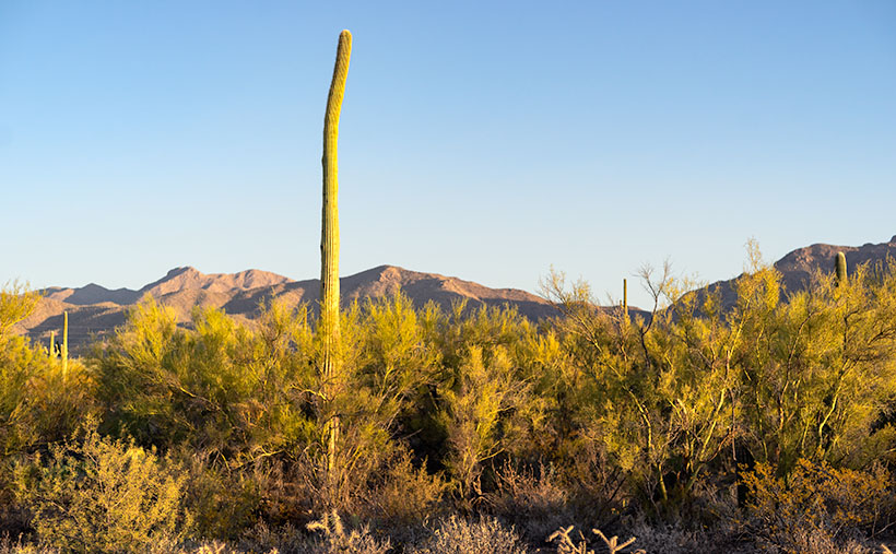
Get Bent – A frost-damaged saguaro rises above a thicket of palo verde before the Tucson Mountains.

The afternoon was getting late when we reach the top of the loop. The shadows were already long as I looked for a shot of the range’s high peaks. I stopped the truck when I spotted an interesting cactus. It rose maybe thirty-feet above the top of a palo verde thicket, and it had a bent trunk. I guessed the deformity was the result of a freeze. It’s a young specimen—if you can consider thirty-years young—to have damage like this, but the Tucson Basin is a thousand-feet higher than Phoenix, and we were near the top of the loop, which is 500-600 feet above the city. That’s near the limits of the saguaro’s range because winter nights often get below freezing up here.

After I processed this shot and began pouring over area maps,  I realized that I also captured another landmark in it—actually two of them. To the saguaro’s left are two peaks on the horizon. The taller of them is Wasson Peak (4639′), and the other is Amole Peak (4386′). They are the two highest points within the park’s boundaries. So, this week you get a BOGO.

You can see a larger version of Get Bent on its Web Page by clicking here. Next week, our day in Saguaro National Park comes to an end, so be sure to come back and see what we found.

BTW: Queen Anne and I wish you a very safe and happy Thanksgiving. We’ll be spending the day at home enjoying store-bought leftovers. You know, the usual turkey, stuffing, mashed potatoes swimming in gravy, cranberry sauce molded in the shape of a can, and buttermilk pie topped with fruit and whipped cream. I’ll see you next week if I can get up from the couch.

Until next time — jw

Tucson Mountains Sunrise Picture of the Week

I woke up in a very chipper mood this morning. When I put on my jeans, they were so loose that I had to tighten my belt a notch to make things better. My morning routine is to check my vitals before making coffee, and my blood pressure was perfect today. There’s been a great weight lifted off my shoulders, and let me tell you what I think it is. First of all, I finally finished the wood project that’s kept me busy all summer—I’ll show you on Wednesday—and secondly, summer’s finally over—well I hope it is.

Over the past couple of days, clouds have filled the Congress skies, and it sprinkled Friday evening. That’s the first precipitation in months. This morning, our new wall thermometer got below 40º for the first time, and I got to put on one of my bulky sweaters. It keeps getting better—today’s forecast is for snow in the mountains. Yep, straight from summer to winter. Today, the world is better.

My mood is so good; I don’t have any snarky stories about Queen Anne, so let’s go back down to Tucson and see where we stopped for our second November image. Last week, we visited the overlook at the top of Gates Pass before dawn. Believe it or not, I wasn’t the only photographer there. A handful of guys were hanging out with their tripods set up for a sunrise shot when I got there. I’m not usually late to one of these parties, and when I saw what they were getting ready to shoot, I wasn’t impressed—it was more of a sundown kind of shot. After snapping a few other scenes, I hopped in the truck and headed down the road stopping again at the bottom of the pass.

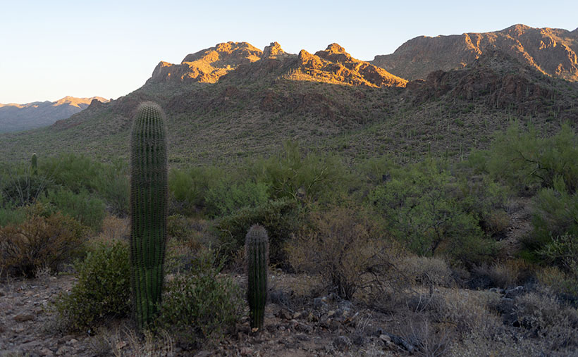
Tucson Mountain Sunrise - The morning sun shines on top of the Tucson Mountains.
Tucson Mountain Sunrise – The morning sun shines on top of the Tucson Mountains.

In this week’s featured image—that I call Tucson Mountain Sunrise—we’re looking back at the overlook. It’s the flat area between the two forward peaks at the bottom of the sunlight. Behind that, you might recognize Bushmaster Peak from last week’s image. Actually, all of it is Bushmaster Peak, but I really liked the western side’s gnarly part. It has the most character. For scale, I found a couple of young saguaros and placed them in the foreground—that means that I was wandering around in the dark, rocky, snake-infested desert to get this shot just for you.

How could you ruin a beautifully quiet moment like this? Well, let me tell you how. Just as I finished my shot and began walking back to R-chee, a guy who was parked nearby in a black late-model Chevy pick-up fired it up, and the distinct sound of a V8 with open headers reverberated throughout the canyon. Now, I enjoy loud race cars as much as anybody, but it has to be in the right context. As this gentleman drove east through the pass, it was obvious that he wasn’t racing—he was making noise just for the sake of noise. Fortunately, after the summit, he rode the brakes downhill, and the bird songs once again filled the morning air.

You can see a larger version of Tucson Mountain Sunrise on its Web Page by clicking here. Next week, we’ll make a morning stop in Saguaro National Park for another photograph in our story.

Until next time — jw

Gates Pass Dawn Picture of the Week

According to Google Maps, a Phoenican’s drive to Tucson takes an hour and thirty-eight minutes. That’s city hall to city hall, so the time you spend on Interstate 10 is less. It’s probably the most excruciating drive in Arizona. It used to be worse. Back during the oil embargo, when the Feds mandated a 55mph speed limit, it almost took two hours. It was a dangerous trip. The commute was so boring and depressing that people pulled to the side of the road and killed themselves rather than going on. Needless to say, I try to avoid that stretch of highway, and that’s why I haven’t been to Tucson in a decade.

After photographing in Organ Pipe Cactus National Monument last month, I became curious about Tucson’s National Park. Yes, that’s right—a National Park within the Tucson city limits (kind of). As you drive into the old pueblo from the north, there are mountains west of the freeway between Cortaro Road and Speedway Boulevard. Those mountains are the backbone of Saguaro National Park—another prime example of the Sonoran Desert diversity. I have never really visited before, so Queen Anne and I packed up the truck and headed east (or south—whichever direction I-10 goes between Arizona’s capital and its second-largest city).

Organ Pipe Cactus NM and Saguaro NP are quite different even though they share the same desert. Except for a swath of land along the roadsides, almost all of Organ Pipe is Wilderness Area, while Saguaro NP is in the middle of town. There are homes west of the park, so the bordering roads along the north and south side are heavily used by commuters. Saguaro National Park’s wilderness experience is like parking a trailer on the summit of Camelback Mountain. It’s hard to enjoy nature with all that traffic whizzing by.

We spent time exploring the roads surrounding Saguaro NP and the single dirt loop that’s still open from dawn to dusk inside the park. Like Organ Pipe, it’s lovely and very photogenic. The Tucson Mountains are at the park’s core, with Wasson Peak the tallest followed closely by Amole Peak on its western flank. As I said, there’s only one drivable loop road—with a great view from its summit—but there are beaucoups hiking trails throughout the park (if you’re into that sort of thing).

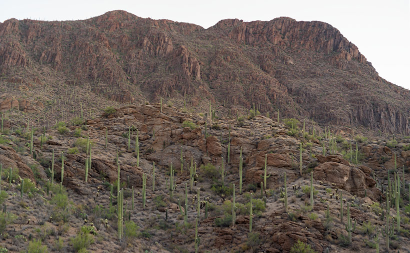
Gates Pass Dawn - Saguaro cacti grow up the side of Bushmaster Peak in dawn's early morning light.
Gates Pass Dawn – Saguaro cacti grow up the side of Bushmaster Peak in dawn’s early morning light.

I shot enough material to tell a story this month in chronological order—a day in Saguaro National Park as it were. I took this week’s featured image in the soft light of pre-dawn—the blue hour. It’s technically not from within the park but was taken from the road along the south side. Speedway Boulevard becomes Gates Pass Road as it heads west toward the Old Tucson movie set. I took this photo at the lookout from the top of Gates Pass. In the image, you can see the copious cacti growing up the slope of Bushmaster Peak—part of the Tucson Mountain Range. I named this image Gates Pass Dawn, and I hope you agree that it’s a great way to start our day of exploring Saguaro National Park.

You can see a larger version of Gates Pass Dawn on its Web Page by clicking here. Come back next week when the sun rises on another image further along the road.

Until next time — jw