Lomaki Picuter of the Week

Lomaki - The crooked walls look as if the fierce Northern Arizona winds will blow them over.
Lomaki – The crooked walls look like the fierce Northern Arizona winds will blow them over.

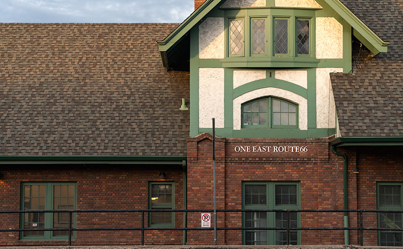
In the half-century that I’ve called Arizona home, I can’t count the times that I’ve traveled thru Flagstaff and then north on Highway U.S. 89. I travel that route to get to the Grand Canyon, Lee’s Ferry, Lake Powell, Monument Valley, Utah, or Colorado. My best guess would be once a year on average. Sometimes I even stop to take pictures along the way.

With that many trips, you’d think I’d pay no mind to the scenery, but that’s not true. There’s always something new. There’s one location that makes my jaw drop, no matter how many times I see it. I’m talking about the view at Sunset Crater Pass I wrote about last month. It’s an in-your-face example of something I learned in a college geography course: mountains affect climate.

The climate on the south side of the San Francisco Peaks is the polar opposite of that on the north. As you travel to Flagstaff from Phoenix, you climb into the pines, and the temperature can drop as much as 30° along the way. As fronts move north from the Gulf in the summer or west from the coast in winter, the mountains wring moisture from the air as it climbs the slopes. After passing over the mountains, the air is dry and picks up pressure on the way down. Dry air heats faster than humid air. The phenomenon creates a rain shadow on the mountain’s leeward side. The next time you travel north of Flagstaff, stop your car at the pass and take a look back—trees. Then turn to the north again—trees kept away.

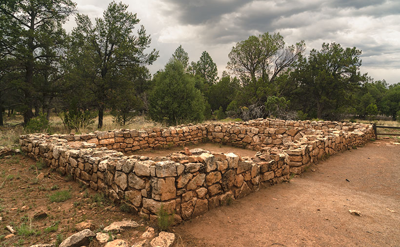
Now that you know how mountains work, it’s easy to understand why the early Pueblo Tribes living at Wupatki lived in rock dwellings instead of log cabins. Amazingly, the Indians still used timbers to span the walls and hold up a roof. That means they had to drag lumber off the mountains by hand. They built their structures before the Spanish arrived, so they didn’t have horses.

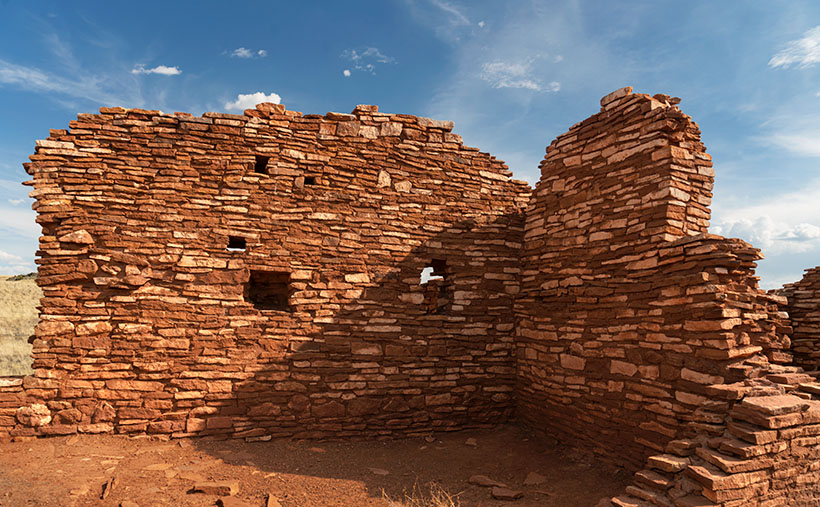
This week we’re looking at one of the bigger pueblos in the National Monument—Lomaki. That’s a Hopi word that translates into English as “Beautiful House.” Anthropologists have partially restored its two-story walls. As you walk through the ruins, you begin to appreciate the ancient people’s masonry skills and tenacity. They must have had to rent scaffolding for walls that size at A-Z Rentals in town. It was either that or standing on one another’s shoulders. You’d do the same thing.

In this week’s picture, titled Lomaki, you get a good idea of the wall height. The windows are at eye level. A peculiar thing you notice in this shot is the walls are leaning. I’m not sure if the scientist put that feature in on purpose or if they weren’t as skilled as the original Pueblo builders. As a photographer, I have a thing about lines that aren’t level or square. Oceans don’t run downhill, so I wince whenever I see a seascape with a crooked horizon. On my first visit to Lomaki decades ago, its tilted walls jumped out at me. They look like a good wind will blow them over—and this area of Arizona is exceptionally windy. However, on this year’s visit, the walls were still standing and didn’t seem any worse, so maybe they’ll remain long after I’ve gone.

You can see a larger version of Lomaki on its Webpage by clicking here. Next week, we’ll walk around Lomaki and see its details. Come back then and see what we find.

Till next time
Jw

BTW:

The calendar cut-off day is Tuesday, so if you are interested, place your order.

Beer Can Picture of the Week

Beer Can - An uncouth visitor left an empty beer can near a cattle tank on the Babbitt Ranch.
Beer Can – An uncouth visitor left an empty beer can near a cattle tank on the Babbitt Ranch in Northern Arizona.

If you drive north on US Route 89 from Flagstaff, you get to see one of the best scenic views in the country. To get there, we need to get around the San Francisco Peaks—the remains of an ancient volcano, and they rise over 12,000 feet—Arizona’s high point. Route 89 is on the east flank of the peaks and winds through Flagstaff suburbs that suffered fire and flood damage this spring. As the road climbs a gentle grade, the scenery changes from open meadows full of new homes to a ponderosa forest. There was substantial fire scaring, but many tall, red-barked trees survived.

At the top of the hill, the four-lane highway briefly flattens before you reach the Sunset Crater National Monument entrance road and the 7288-foot elevation marker. A mile further, the road suddenly drops from its mountain elevation to the Little Colorado River Bridge, 3100 feet below and 35 miles away. On an exceptionally clear day, you can see into Utah—I swear.

This vista encompasses every rainbow color. On the left, the dark green pine trees grow down the mountain slope until they make way for lighter green junipers and then the yellow grass-covered cinder cones on the Babbitt Cattle Ranch. The twenty-one miles of perfectly straight blacktop divides the east side from the west. On the east side, patches of black lava flow give way to the distant Painted Desert colored in hues of reds, whites, greys, and purples. Above everything, the deepest blue skies—a color they don’t make anymore—tie the canvas together.

Every time I see this scene through my windshield, I have a smile on my face. My joy is probably because I’m on my way to someplace fun, like Lake Powell, Lee’s Ferry, the Grand Canyon, or (shudder) Utah. As I drive down the mountainside, I habitually switch my dash view to see if I can recover my gas mileage before I hit the bridge. It keeps my mind occupied for the next half hour. As you all know, I’m easily amused.

Except for a few visits to Sunset Crater and Wupatki National Monuments, I’m usually passing through this wonderland. But, during our July visit to Flagstaff, Queen Anne and I came to the mountain’s north side to photograph the cinder cones in the San Francisco Lava Field. They’re technically on the private ranch owned by the Babbitt family. The Arizona pioneers that have been successful ranchers, merchants, and politicians.

Before we drove out to the ranch, I checked in at their store in town to see if we needed a hall pass. “No, if the gate is open, you can enter as long as you’re respectful and drive on the roads.” Taking the caution to heart, I was surprised when we reached the old trading post that there wasn’t even a gate to open. The dirt road was so smooth that we didn’t tax our Jeep’s capabilities—not even its four-wheel drive. It’s only a couple of miles to the lava field, but before we got there, we drove by a cattle tank where some uncouth slob left an old beer can. I was so upset that I stopped to document what the thoughtless cretin had done. The picture came out so well that I made it this week’s featured image. I call it Beer Can.

As you might have figured out already, it’s not actually a beer can but graffiti that some vandal painted on the side of one of the ranch’s metal water tanks. They’re used to hold water for the cattle during the dry season. Indeed, the lettering is still vandalism, but one that appeals to my perverted sense of humor. Besides the tank, I don’t know what the trash can lid is. Perhaps it’s a cache to store surplus hay for when a herd is in the area.

An unnamed volcanic cone appears in the background, and it doesn’t seem very high until you try climbing it. Neither Anne nor I tried scaling anything on this trip because there weren’t any stairs for me to bitch about, so as usual, Anne stayed in the Jeep reading her Kindle while I ran around taking pictures.

You can view my Web version of Beer Can on its page by clicking here. We have a month’s worth of photos from the lava field, so we’ll be spending October here. I hope you enjoy this week’s pictures and come back next week when we present more. Be sure to join us then.

Till next time
Jw

BTW:

We recently discussed making a Route 66 photo trip and producing a large coffee-table book from the new photos. After burning down my calculator, we’ve put off any such trip until later. We’ll wait and see what happens next year.

Hotel Monte Vista Picture of the Week

Hotel Monte Vista - Built in the 1920s as an upscale hotel by Flagstaff investors. It was named the Community Hotel until a private corporation purchased it in 1960.
Hotel Monte Vista – Built in the 1920s as an upscale hotel by Flagstaff investors. It was named the Community Hotel until a private corporation purchased it in 1960.

The proverbial railroad tracks split Flagstaff’s downtown, but in this case, I don’t think there’s a wrong side. The north side is a historic district; on the other side, old warehouses fill the limited space between the tracks and Northern Arizona University. Each has a distinct vibe.

Older masonry structures make up the historic district and crowd the sidewalks. As a result, the streets are narrow, and parking is limited. If you find a parking spot, walking about the 24 blocks downtown is easy. When the founders laid out the town, they included alleys so deliveries and utilities would be off the street. That may have worked in the mid-twentieth century, but retail space is at a premium, so landlords split the buildings, and now shops occupy the building’s front and back. That means there’s always a beer delivery truck clogging the street somewhere.

I get the feeling that since the city is Arizona’s “premier” ski area, the city planners are using other resort towns as models. There is the usual mix of restaurants, bars, souvenir shops, and galleries for you to spend money in. The building owners maintain the facades well and have decorated them with low-voltage lights—for that Disney Main Street look. However, something’s missing. The Snow Bowl doesn’t draw the same skiers as Aspen, Telluride, or Park City (the airport couldn’t hold that many private jets). So, although I enjoy walking around and seeing the architecture of the old town, it needs more polish.

Nope - I spotted this sign in a tavern window and it confused me for days. Then I realized that it has a different meaning if you move the 'N' from the top, to the bottom.
Nope – I spotted this sign in a tavern window, which confused me for days. Then I realized it has a different meaning if you move the ‘N’ from the top to the bottom.

If the area north of the tracks is all façade, the south side is another story. As you’d expect from a college town, it’s more bohemian, rustic, and organic. The merchants may slap paint on their industrial buildings and hang an open sign on this side of town. They depend on the product and repeat clientele to survive. You’ll get the same bar food but without the pretentiousness. For example, this is where the youth hostel is. Over the past two weeks, I’ve shown motel signs from here, where you’ll find a café called the Tourist Home. This eating establishment has good food, but they’ve replaced the wait staff and cashier with your cell phone—petulant geezers like me, beware (they dare to expect tips).

For this week’s picture, we will cross the tracks north to the Aspen and San Francisco Streets intersection. Here, we’ll see Flagstaff’s third oversized sign on scaffolding. This one is on the roof of the Hotel Monte Vista, one of the oldest hotels in Northern Arizona.

Monte Vista has an interesting backstory. It was built in the 1920s with money raised by local citizens. Including a big chunk from Zane Grey, they raised $200,000 to fund an upscale hotel the town desperately needed. It opened on New Year’s Day 1927 as the Community Hotel. It was a publicly held business until private investors bought it in 1960. Besides the hotel, the building was home to the Post Office, newspaper, and radio station, and its lounge was a speak-easy during prohibition. The hotel’s Website has a page with other histories, famous guests, and ghost stories. You can read it here.

I shot this week’s image, Hotel Monte Vista, early morning before the sun and the empty streets. The lack of light muted the building’s colors. It looks like I was trying for a sepia-toned effect, but I wasn’t. It’s an unusual look, and I’m not sure it works. What do you think? I also noticed that the signs on all three of this month’s photos have the sign on the right. I would have changed that had I thought about a grouping layout.Teal 356 - I stumbled on this Porsche while on my morning shoot on the south side of the tracks. It proves that even the bourgeoisie appreciate classy cars.

Teal 356 – I stumbled on this Porsche while on my morning shoot on the south side of the tracks. It proves that even the bourgeoisie appreciate classy cars. You can view my Hotel Monte Vista web version on its page by clicking here. I hope you enjoy seeing this month’s trio of hotel signs. Next week, we start a new adventure from Northern Arizona, so be sure to join us.


Till next time
jw

BTW: A couple of weeks ago, I wrote about coffee cups, contests, and calendars. I asked for your advice, and the response I got was: <crickets> – – Silence – – </crickets>. You’re not interested, so to paraphrase Seinfeld’s soup-Nazi character, “NO CUPS FOR YOU—ONE YEAR.” Now, I must shave my head before meeting with Larry and Mo.

Motel Du Beau Picture of the Week

Motel Du Beau - This 1929 establishment was one of the first to cater to tourists driving those new-fangled motor carriages.
Motel Du Beau – This 1929 establishment was one of the first to cater to tourists driving those new-fangled motor carriages.

When Queen Anne and I spent a week in Flagstaff last month, our primary goal was heat relief, but I was confident that I could snap a few shots of historic buildings and signs to add to my Route 66 collection. In this journal, I’ve written several times about my experiences traveling the Mother Road as a kid, so I’ll spare you from repeating them. Instead, I must say that I was disappointed at how hard it was to find kitschy motel and dinner signs along the main street. More profitable strip malls and professional offices are rapidly replacing them. Interstate 40 travelers prefer the newer hotels on Butler Street, where the Little America Hotel is. Nobody drives 66 anymore—too many lights and too much traffic.

John Steinbeck’s novel The Grapes of Wrath, the depressing story of dust bowl migrants, searching for survival, didn’t make Route 66 famous. Nor did that fame come from my father’s generation, who—like the Joad family—moved en masse to California after World War II. It came when Angel Delgadillo—the Seligman barber—pitched a historic highway idea to the State of Arizona. When that designation came through, tons of beer-guts had a play-pen to gather and drive their car toys. We’re dying off now, and like the coals in your Webber Grill, that passion is dying with us.

Master photographers Ansel Adam and Minor White influenced how I photograph the world. Still, in 1975, the George Eastman House showed a photo exhibition called The New Topographics: Photographs of a Man-Altered Landscape. The show still floats between museums today. It was a collection of ten photographs made by ten photographers that were opposite the landscapes I embraced. It was heresy. The photos are stark images of industrial buildings and houses devoid of people. I didn’t even think some of the artists printed very well. But I did kind of like the ones John Schott did. His pictures were of Route 66 motels. You can see where this led.

Flagstaff Train Depot - Either this is new or I've been blind, but the coolest Route 66 sign that I saw was the train station's address.
Flagstaff Train Depot – Either this is new, or I’ve been blind, but the coolest Route 66 sign I saw was the train station’s address.

I’ve considered compiling a book of my Route 66 photos. I have several, but most are from Arizona, with a couple from California and New Mexico, but nothing east of Texas. If this horse hadn’t been flogged to death, I still could work on my own Mother Road project. Now that I’m retired, I have time. I figure a month on the road should do it. To do it properly, I’d have to drive a classic car—something from the ’50s or ’60s. However, it needs air-conditioning, cruise control, and a good stereo (I won’t put up with AM radio stations dropping out under bridges). My ultimate ride would be a red ’62 Corvette—like the one Buzz and Todd drove—but hold the whitewalls. I could haul my camera equipment behind it in a small aluminum trailer like the autocross guys lug their race tires. October is a perfect month for a road trip, so if anyone out there wants to be my Angel investor, let me know. You’d get all the bills, half of the proceed, and a free book out of the deal.

This week’s featured image is of a prominent Flagstaff landmark. It’s called Motel du Beau, and the subject is the sign. It’s one of three hotel signs towering above the city (can you guess what this month’s project is). With the Lowell Observatory on top of the hill, Flagstaff has adopted a dark-sky policy, so the zoning people would never allow these enormous signs in town. If they weren’t historical landmarks, the city would tear them down.

In the late 1920s, Albert Eugene Du Beau vacationed in northern Arizona and envisioned a new way to make money. Instead of building a multi-story building for railroad and train travelers to stay, why not create a place for people traveling in these new-fangled motor cars? So, he designed and built a single-story motor-hotel (later shortened to motel) to be convenient to unload and load their vehicles in 1929. His design featured a U-shaped layout with steam-heated garages (they burned down in a 1970s fire) and indoor toilets. He built his motor court adjacent to downtown’s main street, which was brilliant because, in time, the busy highway became Route 66. The Motel Du Beau was one of the pioneering businesses to use neon signs and elevate them on towers.

In today’s modern world, the Motel Du Beau still looks like a nice place to stay, with rooms starting at $75—a far cry from the original price of $2.50 per night. Their website shows various room types, and they have a lovely little wine lounge called Nomads. I’d certainly be willing to try it after they reopen the bar.

I hope you enjoy seeing a part of Flagstaff’s history. You can view my Motel Du Beau web version on its page by clicking here. Next week, we’ll look at another historic Flagstaff motel sign, so be sure to join us then.

Till next time
jw

Sinagua Pueblo Picture of the Week

Sinagua Pueblo - A two room stacked-stone ruin that the Sinagua people used for ceremonial purposes.
Sinagua Pueblo – A two-room stacked-stone ruin that the Sinagua people used for ceremonial purposes.

When Queen Anne and I married, we lived most of a decade in a second-floor condo. Besides living in cramped quarters, the thing we most disdained was lugging groceries from the parking lot and up those stairs. My right knee cracked with each step. We swore then that we’d never live in a two-story house.

The Sinagua people would’ve considered us Snowflakes. Imagine your family living in a small cave with a plastered rock façade built on the side of Walnut Canyon. They scaled the canyon walls (without stairs) to get to work. Once on top, the men tended small patches of fertile soil along the edge. They grew drought-resistant crops because their name means Without Water. At least, the Spanish called them that when they first visited the canyon. For protein, they hunted deer, elk, and big horn sheep. After butchering the game, they stuffed the meat into Safeway plastic bags and lowered it on ropes.

Given my extreme age, my most significant anxiety would be getting up in the middle of the night for a glass of Water. As it is, I struggle to find our kitchen in the dark, much less climb down to the creek and back. Of course, their local wise man was in his thirties, and he knew when to stand up and declare, “Today is a good day to die.” Then as he tossed his blanket over his shoulder, he’d tromp out of the camp to the nearest mountaintop, where he’d sit for weeks until dying of starvation. Once again, I’ve proved that exercise is unsuitable for you.

There are many disadvantages to living on a cliff-side cubby hole, but for me, it’s the TV reception. It’s lousy down there. You’d need to get cable or a satellite dish. Then you’d waste time waiting for the cable guy to show up.

There are two trails for you to explore when you visit Walnut Canyon National Monument. Both are under a mile long. The Island Trail is a loop that drops into the canyon, past several dwellings, and then climbs back to the rim. We’ll explore it next week. The Rim Trail stays on top of the mesa and is easier to hike. It goes past some old crop fields and a couple of ruins. I took this week’s picture on the Rim Trail.

The image that I call Sinagua Pueblo shows a two-room stone building of generous size. This structure was probably a communal building for ceremonies and grain storage, like your condo’s community center. Here is where the Sinagua unloaded their trucks after a Costco run. Surely you realize that I’m joking. Flagstaff doesn’t have a Costco. Recovered artifacts show that the Sinagua traded with the villages at Eldon Mountain, Wupatki, and Homolovi—after a short train ride to Winslow.

As you quietly stand and admire the pueblo’s stonework, you can hear Sinagua ghosts laughing, smoking peyote, and chanting with the rhythm of deerskin drums late into the night—until the neighbors come by and yell, “turn down those damn drums.” More cowbell.

I hope you enjoy seeing the pueblo at Walnut Canyon. You can view the Web version of Sinagua Pueblo on its page by clicking here. Next week, we’ll explore the Island Trail and show those photos—if I can only make it up this last flight of stairs.

Till next time
jw

Walnut Creek Bend Picture of the Week

Walnut Creek Bend - It's perplexing to understand how a normally dry creek could carve a deep gorge into the surrounding limestone.
Walnut Creek Bend – It’s perplexing how a usually dry creek could carve a deep gorge into the surrounding limestone.

We had to break from the heat last month, so we drug the trailer up to Flagstaff. We didn’t escape the humidity, though. Since it’s the height of the monsoon season, the weather in the high country was the same as at home—only 30°cooler. There’s been a lot of news earlier this summer about the Flagstaff fires, so we found an RV park on the west side of town—right where Old Route 66 merges with Interstate 40. When we got there, the seasonal rains had already quenched the burn. U.S. 89, which both fires crossed, had reopened, but Sunset Crater National Monument is still closed. It suffered extensive damage to the campgrounds and buildings (otherwise, the cinder cone and Bonita Lava Flow were unharmed).

Our trip served a couple of purposes. First, I needed topics to get this publication through the balance of the hot summer months. Second, we wanted to take Ritz (our trailer) on a shakedown cruise to see how well it and the Jeep played together. Finally, we longed to sleep under the covers with open windows in air, not contaminated with that old-person smell—we accomplished all of that. It’s hard to describe how wonderful it felt to enjoy a glass of wine outside and listen to the sound of rain on the awning. Besides, there’s no more fabulous evening entertainment than watching a newbie learn how to do their first black-tank dump (go back and watch the 2006 movie RV again).

This month’s project is one of the excursions we made to a place that neither Queen Anne nor I have ever been to—Walnut Canyon National Monument. I’m not sure why we missed it. It’s only a couple of miles south of I-40 on Flagstaff’s east side. As you drive the road south, it transitions from Ponderosa Pine to Juniper, so the elevation is lower than the town. The monument is primarily known for the Sinagua cliff dwellings—which I’ll discuss in the upcoming weeks, but it’s the creek we’re interested in today.

On the Colorado Plateau, water generally flows to the Colorado River. In Flagstaff, however, someone put our state’s tallest mountain in the way, so water has to drain around the San Francisco Peaks. A couple of miles west of town, you cross the Flag Divide, where streams flow west of the mountains. East of the divide is the Rio Flag and Walnut Creek Drainage system. Here the streams flow east of the volcanoes into the Little Colorado River. Walnut Creek drains Mormon Lake, Upper Lake Mary, and Lower Lake Mary. You can count Arizona’s natural lakes with one hand, and this little creek drains three of them. Perhaps that explains how an ordinarily dry creek could carve a deep channel into the limestone. Of course, all of that happened before our 22-year drought. Today, Mormon Lake is a broad, shallow dry lake with a mud puddle marking its deep spot, and both Mary Lakes are similarly low.

In this week’s picture, we’re standing at a spot that overlooks a horseshoe bend in the creek. I took this photo from the north side of the canyon facing south. In the distance is Mormon Mountain, some 16 miles south. The lake is located on the left flank of the mountain. When the creek is wet, water flows from right to left and empties into Rio Flag several miles downstream. Then the river turns north and flows under I-40 until it reaches the Little Colorado River, about a mile east of the Grand Falls (sometimes called Chocolate Falls).

I hope you enjoy discovering Walnut Canyon and seeing this week’s image. You can view the Web version of Walnut Creek Bend on its page by clicking here. Next week, we’ll hike one of the trails and poke around some ruins displayed in the national monument. I hope you’ll join us.

Till next time
jw