Yarnell Daze New Art Show

There’s a thing about living in a rural Arizona town that is lacking in big cities. It’s the small town block parties.  It’s where the town celebrates an obscure but important community event. Wickenburg has Gold Rush Days that coincide with the Senior Pro Rodeo each winter. Our town celebrates Congress Day. I don’t know who sponsors our event since we don’t have a city hall, but in the dirt lot in front of the library, our firemen line up their shiny truck beside a half-dozen citizens sitting at card tables hawking arts and crafts or shiny boxes of rocks. This year, organizers omitted the bouncy castle because last year, none of my fellow septuagenarians were able to get out of it.

Cinderhills and Clouds
On the high plains of Western New Mexico, puffy clouds cast a shadow on one of the cinder hills.

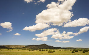
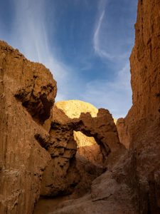
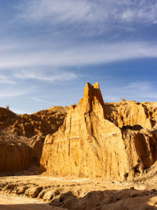
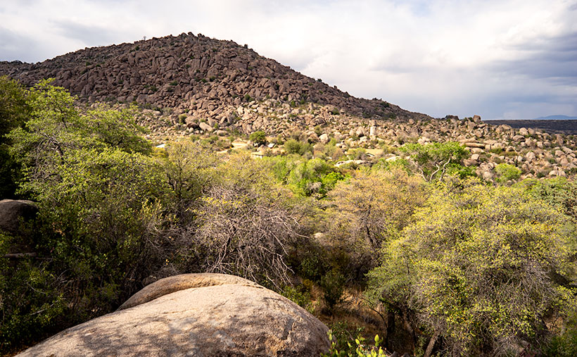
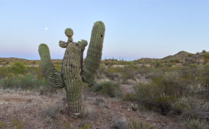
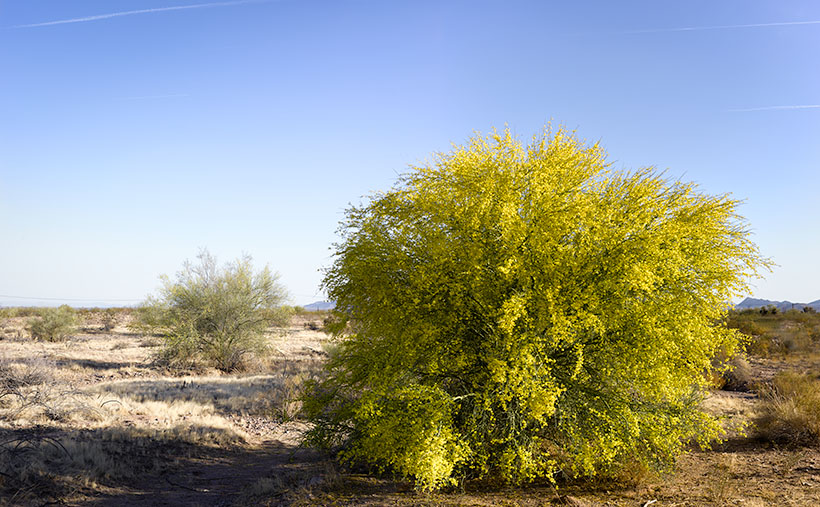
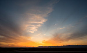
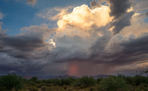
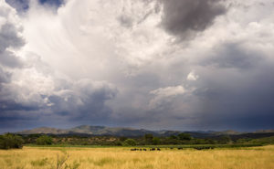
This Saturday, ten miles up the highway, the town of Yarnell will be having a block party that they call Yarnell Daze Mountaintop Festival. The celebration on the hilltop is bigger than ours because they have a chamber of commerce. There is a parade, live music, and different activities scheduled all day, but the one thing that warrants me writing about the festival is the art show. The organizers have invited artists from Wilhoit to Wickenburg to show samples of their work and I have submitted these three pictures from my cloud series for the show.

Sunset Thunderhead
As the sun began to drop below the horizon, this beautiful thunderhead moved southward over the Weaver Range.

The festival starts off with a pancake breakfast at 7:00 am, hosted by the Yarnell Fire Department. The parade begins at 10:00 am (remind me to tell you the story about the parade in Kanab sometime). The art show is inside the Big Blue Barn on AZ-89—it’s the only two-story blue building in town and it’s on the east side of the street. If you go, there are also a couple of good cafes to eat at if you don’t want pancakes and besides the art show, there are a myriad of antique stores to peruse.

Skull Valley Monsoon
Monsoon clouds move down from the Bradshaw Range in Skull Valley.

Unfortunately, Queen Anne extends her regrets. It seems that her posse is gathering at Yaz’s house for The Wedding. If you can believe this, they will be getting up at 2:00 am to watch TV while wearing tiaras and consuming high tea. Right now she’s busy in the kitchen making cucumber and egg salad sandwiches. She’s already cursing about the nail she broke while trimming the bread crust. Knowing that group, I bet they oversleep and miss it.

Until next time — jw

Mud Arch Picture of the Week

Continuing last week’s adventure to the mud cliffs at Alamo Lake, I took this week’s picture at the other end of the slot canyon. It’s not a very long hike—maybe fifteen minutes if you don’t dawdle—but I was exploring with a camera and stopped to take pictures often along the route. The reward waiting for you at the canyon’s head is this mudstone arch carved by rushing water draining from the surrounding mesa. If you hike a few yards beyond the arc, the canyon ends, and you’re on the mud flats between Date Creek and the Santa Maria River. The water is runoff from the Black Mountains in the north that has carved the canyon from the flats.

Mud Arch
Mud Arch – At the end of a short hike up the slot canyon is a mud arch as a reward for your effort.

Since I’m not a geologist, I can’t tell you how old the arch is, but because the surrounding soil quickly erodes and because I slept in a Holiday Inn Express once, I assume that it hasn’t been there for very long—geologically speaking—and it may soon crumble. You’ll notice that the arch’s shape isn’t smooth and rounded like the sandstone arches in Utah, which tells me it hasn’t been polished by blowing wind. That’s another clue to its relatively young age. I won’t be surprised if it disappears in less than a decade.

When I arrived on this scene, the sun was low enough that it didn’t shine onto the canyon walls, but it did add that late afternoon glow to the mound behind it and separated the arch from the background—sort of a spotlight, as it were. With streaky clouds in the sky … what more could a photographer ask for?

You can see a larger version of Mud Arch on its Web page by clicking here. I hope you enjoy viewing my newest entry and tagging along for the other canyon shots I’m revealing this month.

Until next time — jw

Bat Ears Picture of the Week

A couple of weeks ago, I drove to a part of Arizona that I hadn’t seen before. I knew about Alamo Lake as a fisherman but never went there because it wasn’t stocked with trout, and the fishing reports always warned about rattlesnakes. That was enough to put me off. But, during our club’s spring classes, one of the students brought in photos from the Alamo area that I found so interesting that I changed my opinion about visiting the La Paz County lake.

She took photos east of the lake, where Date Creek cuts through an ancient mud deposit. Because of how the intermittent water has eroded the soil, the place is known as Mud Cliffs. It’s not shown on any maps I have, but I knew it was the general area, so I left the house with enough time to explore and still have a couple of hours to shoot before sunset.

From Wenden, the paved road to Alamo State Park runs due north. It has little or no traffic, and it only took me an hour to get to the park store. When I asked the friendly staff inside about the cliffs, the host handed me a hand-drawn map. “Head toward Wenden to the Wayside Road, then jog over to Palmerita Road and follow it north.”

“Thanks,” I said as I took the map and paid too much for a Butterfingers candy bar and the park’s day fee—even though I was leaving.

During the classes, my student said her group was out on ATVs, but she believed you could get there by car. She was right. All the roads were wide and well-graded, and when I drove them, they didn’t have a lot of washboards. After I reached the spot on the map, I searched for the canyon shown in her pictures, and when I found it, I spent an hour or so hiking and shooting the photos that I’ll be sharing this month—I guess it’s Alamo Lake Month.

Bat Ears
An erosion formation at the head of the slot canyon glows in the late afternoon sun. The pair of points on top reminded me of a bat or maybe even Batman.

This week’s image is called Bat Ears, and I took it at the slot canyon’s mouth towards the end of the day. I passed it going in, but the sun didn’t have the same warmth as in this image, so it wasn’t interesting enough to shoot. The name comes from the pair of points at the top. This cliff doesn’t have a name—none of them do. Because the soil is so soft, it quickly erodes. A good flood will wipe out the existing landscape and replace it with new formations. The ears may not last another year, so I got to name a geological feature that—maybe—no one else will see. My chest swells with pride.

You can see a larger version of Bat Ears on its Web page by clicking here. I hope you enjoy viewing my new entry, and I hope you’ll tag along as I work my way up the canyon. It’s a pretty exciting hike.

Until next time — jw

The Shrine Under Yavapai Skies

Ask any Arizonan about Yarnell and they’ll most likely tell you about the horrible 2013 fire that swept through the town and the 19 hotshot firefighters that lost their lives when the fire trapped them, in an open field. It’s a big deal for us and to honor those men, Arizona built the Granite Mountain Hotshots Memorial Park. Someday I hope to show that park to you, but I must first build up my stamina to be able to complete the seven-mile round trip trail over a 1200’ elevation rise. For now, I want to talk about another Yarnell attraction that’s celebrating its 79th anniversary this year; The Shrine of Saint Joseph of the Mountains. I’m guessing it’s a place that even most Arizonans haven’t heard about.

As you travel north on Yarnell’s main street lined with antique shops, it’s very easy to miss Shrine Drive, a paved road on the east side barely wide enough for passing cars. The road winds through dappled shade of scrub oaks lining Harper Canyon. The pavement only lasts a half mile, and when it turns to dirt, it’s at the Shrine parking area. As you get out of the car, the first thing you notice is how quiet it is. Even the birds whisper. You don’t see much at first, but through the trees in front of you, seated at a table is a welcoming statue of Jesus.

Praying Jesus
Praying Jesus – A statue depicting Jesus Praying is an example of Felix Lucero’s artwork at the shrine and makes a stop worthwhile.

The retreat (park, pilgrimage, or however you may interpret its purpose) was the concept of the Catholic Action League of Arizona in 1934. They worked on the plan for four years and contracted self-taught sculptor and unemployed dishwasher Felix Lucero who was living under the Congress Street Bridge in Tucson. Felix’s life is a story of its own and his other collection of work is in Tucson’s Garden of Gethsemane; now know as Felix Lucero Park. The shrine is a representation of the 14 Stations of the Cross—a ritual where Christians symbolically stop and pray at significant events that happened on Jesus’ crucifixion path. The stations at the shrine are along a stair pathway that climbs the mountainside culminating with a sculpture of Jesus on the Cross. Then you continue down the stairs past the last stations until you reach a sculpture representing the resurrection—a slab in an empty grotto draped with a shroud cloth.

Stair Path
Stair Path – The stairs leading to the Stations of the Cross are often Steep. Considering that they already start at a moderate elevation, it’s not an easy journey.

The 2013 fire swept through the shrine site. It destroyed several of the support buildings, charred the trees, and completely burned some of the wooden station crosses. The fire burned away the crucifix on the hilltop completely leaving the sculpture of Jesus floating in the air suspended by bolts welded to a metal frame. Remarkably, the ivory colored statue was not damaged or discolored.

Shrine View – There are places along the path where the canopy opens revealing beautiful views of the surrounding countryside.

I went to Catholic school for four years and that was enough to cure me of organized religion, but as an artist, I enjoy the architecture of churches and the paintings, sculptures, and stained glass within them. I think that’s why I enjoy places like this shrine. I can see the thoughtful planning, hard work, and attention to detail found here. Besides, as you near the top, the tree canopy opens, and you have wonderful views of Yarnell and the Weaver, Bradshaw, and Granite mountains.

The next time you’re traveling the back road to Prescott, I recommend you spend some time visiting The Shrine of St. Joseph in Yarnell. If nothing else, walking the stations is good exercise. Let me warn you that your starting elevation is 4700’ and the stairs are steep. It’s almost a rock scramble; bring water. You’ll enjoy the art, the views, and the serenity. There’s no charge but there is a donation box that you’re welcome to use.

Until next time — jw

Reach for the Sky Picture of the Week

I drove down past the Safeway into the Vulture Mountains last evening to do some photography. My intent was to capture an image of Vulture Peak shining in the sunset, so I drove around until I found an angle where I could get the image that I visualized and set up my camera. It didn’t work. From the spot I was shooting, it would work better as a sunrise shot. While at that scene, I saw this funny little saguaro on my right and decided to shoot it instead. I call it little, but even with its center trunk lopped off, it’s taller than I am.

Reach for the Sky
Reach for the Sky – A near-full moon rises behind a decapitated saguaro in the Vulture Mountains.

By the time I got set up for this image, the sun was down and it was already into the blue hour—the period after the sun has set but still light enough to see colors. It wasn’t until I began to concentrate on the saguaro that I noticed the near-full moon rising, so I’m going to toss it in for no extra charge. The cactus is interesting for a couple of reasons. Somehow it lost the top of its main trunk and it has sprouted new arms, of which one looks like a melon … or even a head if you have a vivid imagination. The second notable thing is that it’s still plump with water even though we haven’t had rain for months—which may be the reason it was able to generate the new growth. In any case, it has cool apartments for woodpeckers, cactus wrens, and maybe an owl family this summer.

I called this shot Reach for the Sky and you can see a larger version of it on its Web page here. I hope you enjoy viewing my new pico’-week and that you’ll tell me what you think. Maybe next week, I may get out of bed early enough to get a better version of my first idea.

Until next time — jw

It’s Too Beautiful; Run For Your Lives Warning: Summer is comming to the desert.

Blooming Palo Verde
Blooming Palo Verde – When the Palo Verde Trees bloom in the desert it means that spring is at a crescendo and summer will be soon.

The Palo Verde are in bloom. Spring in the Sonoran Desert is at its pinnacle. It’s sort of like the finale at a fireworks show and when the desert is the best. In wet years—like last year—the wildflowers carpet the floor with cacti sprouting surreal and almost garish flowers soon after. Then, starting in the lowlands, the native Palo Verde turn yellow in a succession that works its way to higher elevations, like a Technicolor wave. Finally, the giant saguaro put out dinner-plate sized white flowers at their arm tops.

There are, of course, other signs of spring around us. Male doves try to attract a mate by cooing from perches then furiously flapping into the sky as high possible before they stall and glide back to their starting place. I suppose it’s their equivalent of doing push-ups to impress the girls. Queen Anne and I spot more quail while on our morning bike ride. Soon the adults will be shepherding multi dozen covey of chicks from one shrub to the next. Other birds like the Cardinals, Cooper Hawks, and Turkey Buzzards have returned from their winter retreats. Sex is in the air and I might as well break out my copy of Stravinsky’s Rite of Spring as a soundtrack.

Here at Uncle Ernie’s Holiday Camp another spring ritual has begun. Each day, another fifth-wheel or motorhome pulls out of the park and begins a journey north. Our friends and neighbors are leaving for their seasonal excursions or summer homes which are beginning to emerge from snow banks. Pretty soon our neighborhood will be empty again with only a few of us hearty souls standing guard.

Although Anne and I don’t have a Montana home, even we’ve put pennies aside to escape the heat that comes after all of this desert beauty dries and shrivels up. This is a travel photography blog after all and—like last year—I want to report of some exotic far-off land. This year, our Shangri-La is … Utah (I know, I know. You don’t have to rub it in).

We’re going to make camp in a valley somewhere between the high plateaus that flank U.S. Highway 89. It’s been a while since I’ve photographed Utah and with several National Parks located within a day’s drive, I’ll be building on my projects. Equally important is that I will be able to blog about our adventures just like we did on past trips. We haven’t settled on where, when or exactly how long we will be on the road, but we have a couple of months to work that all out. Until then, we need to scrape the dust off the Ritz, buy fresh linens, and maybe even fix the microwave.

Since it’s travel season again, and we will only be on the road part-time, I’m going to open the blog for guest posts as I did last year. We had a positive response from those articles and they provided interesting content. So, if you’re out on the road, here’s your chance to share your stories and photos with our readers. Let me know if you’re interested and I’ll send off some guidance.

Until next time — jw

Harcuvar Sunset Picture of the Week

There are good days and there are bad days. I have been out on photo shoots where nothing went right, and then there have been days when everything was perfect. This week’s photo is from one of my better days. Last week, I went on an expedition to Alamo Lake—a place I hadn’t visited before—because I saw a place in a student’s assignment that I wanted to photograph. I spent several hours driving to La Paz County and an hour searching for the right place. I spent another hour or two walking and shooting before I felt like I had what I wanted and packed up for the long drive home. As I got closer to home, the sun was setting and when I turned onto State Route 71, this was the view out of my door window so I pulled over to capture it.

Harcuvar Sunset
Harcuvar Sunset – After a day of shooting in the desert, I stopped on the drive home to take one last photograph.

I’m pretty ambivalent about sunset photos. They’re beautiful and all, but they’re everywhere. When I was younger I shot a lot of them, then I went through a period where I ignored them. Maybe I’ve mellowed in my old age because I feel like I’ve passed up some spectacular shots because I was too lazy to drive to an open field and I promised myself to rectify that.

This shot—called Harcuvar Sunset—is interesting to me because of the cloud layers. The sun’s last rays color the low clouds while the higher upper streaks are still white. The contrail—usually something that meddles in a photo—seems to be caught in the space between them. I captured this scene at the edge of an alfalfa field in Aguila and the mountains are the Harcuvar Range—I was shooting on the north side of them for most of the day.

You can see a larger version of Harcuvar Sunset on its Web page here. I hope you enjoy my new work and that you’ll tell me what you think. Do you think sunsets are beautiful or are they trite and overdone?

Until next time — jw