Stoned Bunny Picture of the Week

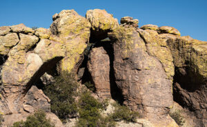
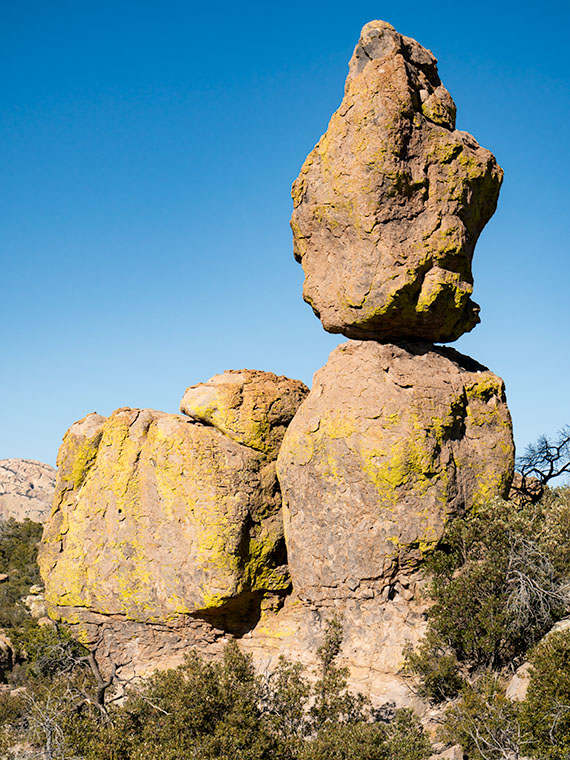
Stoned Bunny - I admit that it's a stretch to see this rock as a rabbit, but Camelback Mountain's Praying Monk is obscure too.
Stoned Bunny – I admit that it’s a stretch to see this rock as a rabbit, but Camelback Mountain’s Praying Monk is obscure.

I love the park service’s pamphlets at the entrance gates. I collect them. In addition to a map, they show all the things to see and do inside the park. When I opened the one for Chiricahua National Monument and looked at all the trails, I thought it looked like a drunken pirate’s treasure map. There are trails on the straight and narrow; trials that go in circles, ones that climb mountains, while others descend into canyons.

Visitors don’t need to hike any of the trails. There are several parking areas where they can take in spectacular vistas. Heck, you don’t even need to get out of the car. However, if you want a genuine Chiricahua experience, you should venture out and walk among the formations. In the World of Rocks, features are hiding from the parking area. Even after all of my recent bellyaching about hiking, I found a short enough trail for me. It’s called the Grotto Trail, and it was pretty level and less than a mile round trip. I completed my tramp in less than 90 minutes, including my photography stops. Over the balance of this month, I will show you the trail’s highlights.

Do you remember several months ago when I wrote how the pixies build trail markers out of stacked rocks—called cairns? Well, there are no cairns in this monument. Using rock stacks to find your way through a park full of stacked rocks is useless. Cairns would be camouflaged. Instead, the WPA installed signposts at junctions and points along the way. How novel.

I found the balanced rock featured in this week’s post not far from the trailhead, so I shot it twice, once on the way out and again on my return. Calling the image Balanced Rock seemed dull because there are so many beside the trails. Then I’d have a series of photos named: balanced rock 1, balanced rock 2, etc. So, as I processed them, I tried to imagine what they resembled. If I close my left eye and stare at this image, it looks like a rabbit with his ears up and the face of Mr. Magoo. If I close my right eye, the image resembles a poorly crafted Easter Island statue.

Trying to decide, I stared at my computer and alternating eyelids when Queen Anne walked into the room, slapped me upside the head, and yelled, “Stop doing that. You’ll put your eye out, kid.” I was on the rabbit at the time, so that’s how it got its name—plus, I ate Stoned Rabbit at a fancy Italian restaurant once; it tasted like chicken.

You can see a larger version of Stoned Bunny on its Web Page by clicking here. Next week I’ll show you another shot that I took on the way to the Grotto. Be sure to come back and take part in the fun.

Till Next Time

jw


Organ Pipes Picture of the Week

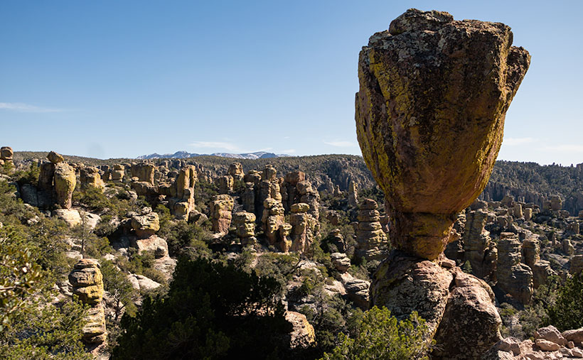
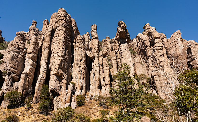
Organ Pipes - One of the first features you see after entering the park is the Organ Pipe Formation.
Organ Pipes – One of the first features you see after entering the park is the Organ Pipe Formation.

Two days have passed since April Fool’s day on Friday. That morning, Queen Anne stopped by my office door and announced, “I’m pregnant.” She’s a one-trick pony because she’s recycled that joke every year that we’ve been married, so I ignored her. However, Friday was an important milestone for me, and since I’ve waited two days, you know I’m not pulling your leg. Friday marks the 50th year since I moved to Arizona. I think that officially makes me overqualified to be a native.

With the month’s change, we’re starting a new project. April Fool’s—we’re not leaving Willcox. I’m just going to show you why we actually traveled to Cochise County and what we did with our afternoons. You’ll recall that I spent mornings in Willcox searching for a decent cup of coffee and shooting the town’s historic buildings. After an hour or so—when the light became too harsh—when I returned to our motel and opened the door, Queen Anne sat on the bed corner bejeweled and makeup finished. “I’m ready for breakfast,” she’d say—who am I kidding? That would never happen. The truth is that I could hear her lyrical voice waft from the bathroom, “I’ll be ready in a minute.” In husband-speak, that phrase meant that I had time for a nap.

The actual purpose of our Willcox visit was to photograph the Chiricahua National Monument. After fifty years of living in Arizona, this was my first visit. It’s usually a half-hour drive southeast of Willcox. Still, we dawdled with a camera and stretched the trip to over an hour. The scenery along County Road 186 reminded me of California’s central valley and the Sierra Nevada foothills. Long butterscotch colored grass filled the broad Sulphur Springs Valley between the Dos Cabezas Mountains (Two Heads in English) on our east to the Dragoons on our west. Arizona ranges don’t tower over its valleys as the Sierra’s do, but at least the air was clear, and we could see all of the mountains.

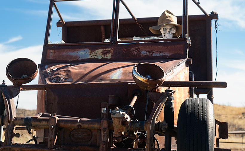
My After Life - I found out that I can become a rural mail carrier in Cochise County even after I'm dead. That gives me something to do after I'm gone.
My After Life – I learned that I could become a rural mail carrier in Cochise County even after I’m dead. That gives me something to do after I’m gone.

On one of the many photo stops that we made, I was able to chat with the local postal carrier and got some great news. He told me that I don’t have to be useless after my death because I can always get a job delivering mail for eternity. You saw my after-life job delivering mail if you watched Funny Farmthe movie. All I have to do to qualify is pass the Civil Service Exam.

The route coming out of Willcox ends at the Junction of county roads 186 and 181, and you turn east on the latter. You pass from open range into a canyon as you head into the Chiricahuas. Within four miles, there’s a pay station. It’s closed due to the pandemic, so the Rangers collect any fees at the visitor’s center. Immediately on the right is a small family cemetery where the Erickson’s rest under shady oak trees. The Erickson’s are the family that homesteaded here after he retired from the Army at Fort Bowie. They established a ranch along Bonita Creek called Faraway Ranch because it’s far away from anything. Their daughter, Lillian, and her husband, Ed Riggs, welcomed guests to the homestead to promote tourism. They built many of the trails still in use, allowing visitors to wander among the unusual columns of eroded stone.

There’s only a single road in the monument that runs from the entrance, past the visitor’s center, climbs through Bonita Creek Canyon, and winds along the ridge of the park’s eastern boundary. Along its length, there are numerous stops, pull-outs, and parking areas where you can stop and take in the view, like this week’s picture that I call Organ Pipes. However, if you want to immerse yourself in the complete gestalt, you should plan on hiking one of the trails. They range from a half-mile to a couple of miles long. You can also link several trails and make your feet suffer to your heat’s delight.

Chiricahua National Monument only has one small campground, which fills quickly—especially during the season. There are only two towns with hotels, Willcox along Interstate 10 and Douglas at the Mexican border if you’re willing to drive further.

The Organ Pipe Formation captured in this week’s image is one of the first displays after the visitor’s center. The columns rise several hundred feet above Bonita Creek and are mirrored on the other side of the road by similar rocks. There wasn’t a way for me to hike above the trees to get a better shot. This picture does not do justice to their scale.

You can see a larger version of Organ Pipes on its Web Page by clicking here. Next week we will hike one of the short trails to look at the park’s natural sculptures. Come back to see what we found.

Until next time — jw


Ajo Mountain Foothills Picture of the Week

In my post a couple of weeks ago, I tossed out the fact that Organ Pipe Cactus National Monument was established in 1937—Franklin Roosevelt proclaimed it on April 13th, to be exact. In the subsequent weeks, we’ve explored the east side loop, which shows off the beautiful and rugged Sonoran Desert. So we accept that the monument is worth traveling a half-hour south of Ajo to visit—in fact, 22 million people did that last year—but in 1937, who knew?

If you look at a 1935 Arizona road map, you’ll notice that there isn’t anything south of Ajo except for the Papago Indian Reservation (They now call themselves Tohono O’odham, which means “Desert People” in their language—Papago is a derogatory derivative of a Spanish word for “Bean Eaters”). The only settlers in the Monument area were the Grays—a ranching family who bought up several local homesteads. So, how did word get back to the president about this unique area?

I came across one story that I liked, and I hope it’s true. In the Wikipedia listing for Organ Pipe Cactus National Monument, I found a line that says, “Land for the Monument was donated by the Arizona state legislature to the federal government during Prohibition knowing that the north-south road would be improved and make contraband alcohol easier to import from Mexico.” Of course, the very next words are “Citation needed.” It sounds too good to be true, but it also sounds like something the Arizona Legislature would do. A fact that makes me skeptical is that Prohibition was repealed in 1933, four years before Roosevelt’s proclamation. If the story is true, the smuggler’s highway has become the main thorofare to the Arizona Riviera—Puerto Peñasco—or as we Zonies call it, Rocky Point.

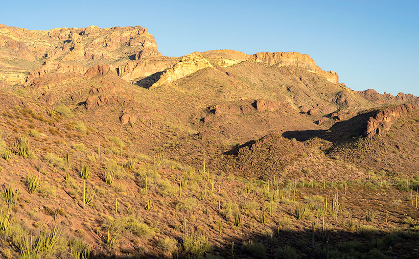
Ajo Foothills - Organ Pipe and Saguaro grow on a hillside below rugged cliffs in the Ajo Mountain Range.
Ajo Foothills – Organ Pipe and Saguaro grow on a hillside below rugged cliffs in the Ajo Mountain Range.

This week’s featured image was taken on the Ajo Mountain Loop’s downside as the road descends into a valley among the foothills. The shadows were getting long when I took the shot, and you can see Organ Pipe and Saguaro growing on the hillside below the rugged cliffs of Rhyolite and Tuff. I call this image Ajo Foothills.

I really enjoyed my afternoon at the monument. I want to return and drive the western loop. I want to take the Ritz and spend a night under the stars. Maybe we can do that next year when we’re able to move about the country again freely. Besides, there are other beautiful places in Arizona that we can show you in the coming months.

You can see a larger version of Ajo Foothills on its Web Page by clicking here. Come back next week when we begin another adventure traveling Arizona’s back roads.

Until next time — jw

Arch Canyon Picture of the Week

Organ Pipe Cactus National Monument has two vehicle loops that allow visitors to explore the park beyond the visitor center. On the west side of Highway 85 is the Puerto Blanco Drive, which is over 40 miles long and has stretches that require four-wheel drive. East of the highway is the Ajo Mountain Loop Drive, which is half the length and can be navigated in your family sedan (in good weather). Since I was only there for an afternoon, I opted to take the latter route.

I suppose if you didn’t stop to look at anything, you could follow this route through the Ajo Mountain Foothills in less than an hour traveling at the posted speed, but I spent more than three hours on the 19-mile loop because I was constantly hopping out of the truck taking pictures and gawking. In all that time, not once did I see another person—not even a ranger.

The road heads north-ish along the foothills’ west flank from the visitor’s center until it climbs over a pass at Arch Canyon. Then the road returns south through a valley between Ajo Mountain and its foothills. This week’s featured image was taken at the trail’s high point at Arch Canyon. There I was surprised to discover—an arch! Who knew? And it’s a good-sized one. I don’t recall seeing it in any of the park’s brochures, which I find odd.

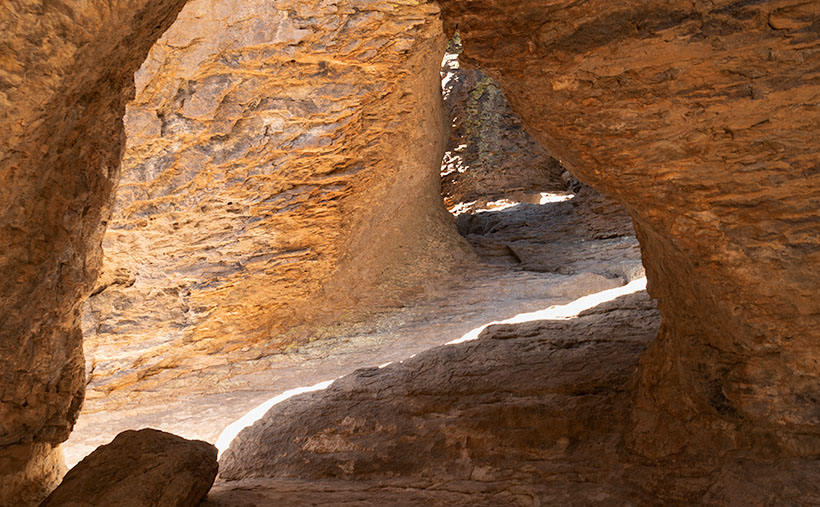
Arch Canyon - At the north end of the Ajo Mountain Loop, you'll find the picnic grounds at Arch Canyon with an unnamed arch overlooking the area.
Arch Canyon – At the north end of the Ajo Mountain Loop, you’ll find the picnic grounds at Arch Canyon with an unnamed arch overlooking the area.

The arch doesn’t have a name on my topo maps. They only note the location of the natural arch. Maybe I could petition them to call it Queen Anne Arch. If the park service did that, maybe I could get her butt in the truck to see it. There is also a picnic area and campgrounds in Arch Canyon, but only tents are allowed. I guess that’s good because the camp would be packed with motor homes and fifth-wheels all year long.

This would have been a perfect opportunity to fly my drone so that I could get a shot that was closer and from a higher perspective. Alas—there’s a double drone prohibition in place here. Drones are not permitted to fly in National Park or National Monument airspace (although winged RC airplanes are permitted). Also, most of the Organ Pipe Cactus National Monument is designated as a wilderness area. Only a dozen yards on either side of the roads are the exception. All motorized vehicles are banned from wilderness areas.

While I was in the picnic area, I took some time to read the wonderful signs that the Park Service puts up to explain the views. I learned something that I’ve wondered about for years. The Ajo Mountain Range is part of the much larger ancient Pinacate volcanic field covering more than 1,900 square miles. The Pinacate Mountains are south of the border, about halfway to the Sea of Cortez. Over eons, this field had violent eruptions that spewed tons of magma, and alternately it had periods where the volcanoes spit out tons of ash and relatively little lava.

You can see a streak of light-colored rock near the ridge’s top in this week’s image. The darker rock is our old friend Rhyolite, the slow-moving magma found in the KOFA Range. The lighter streaks are from the ash falling from the sky and covering the ground. The ash layer is called Tuff, and I’ve seen it throughout Arizona—(and that’s the rest of the story, g’day – as Paul Harvey used to say).

You can see a larger version of Arch Canyon on its Web Page by clicking here. Come back next week to see the down hillside of the Ajo Mountain Loop.

Until next time — jw

Organ Pipe Cactus Picture of the Week

There’s nothing rare or unusual about the organ pipe cactus. They’re a common sight in the Mexican states of Sonora and Baja. I’m sure that the local folks view them the way Zonies do the saguaro; they’re just another part of the local landscape. But, the saguaro’s smaller cousin only reaches into the United States in the national monument that’s a half-hour south of Ajo, and that’s what makes them special to us.

Like the saguaro, the organ pipe grows best on south-facing rocky slopes of the Sonoran Desert. So why don’t they grow further north? Well, that’s because they’re less tolerant of frost and won’t survive a hard freeze. The specimens that we have in our cactus garden have to wear styrofoam cup hats to get through even our mild winter nights.

Another difference between the columnar cacti is obvious by looking at them. The giant saguaro grows with a single trunk and sprouts arms after it reaches 50 years—like a tree. On the other hand, the organ pipe’s arms sprout from a stem close to the ground resembling a bush. Internally, their structures are similar to porous skeletons that allow the flesh to expand and store water.

While the saguaro and organ pipe’s flower looks the same, the latter’s are only open at night and are pollinated by bats. The saguaro keeps its flowers open in the day, which lets bees and doves help the pollination. Like the saguaro, the organ pipes produce fruit during the rainy season about a tennis ball’s size. The flesh is bright red and supposedly tastes better than watermelon. After eating the sticky fruit, birds disperse the seeds by defecating from the branches of palo verde trees.

Organ Pipe Cactus - This cactus specimen commonly grows in the Mexican states of Sonora and Baja, but only crosses the border within the boundaries the Organ Pipe Cactus National Monument.
Organ Pipe Cactus – This cactus specimen commonly grows in the Mexican states of Sonora and Baja, but only crosses the border within the boundaries of the Organ Pipe Cactus National Monument.

I drove a good distance on the Ajo Mountain Loop looking for a really nice organ pipe to photograph for this week’s featured image. The specimen in my image—called Organ Pipe Cactus—is a beaut, resembling an upside-down octopus on steroids. I’m a little upset that Ajo Mountain snuck in and photo-bombed my picture. At least you can see how far I traveled by how the mountain’s angel changed from last week’s photo. My references say that an organ pipe’s normal height is 10 to 16 feet, but this baby towered over my head and may have reached 20.

You can see a larger version of Organ Pipe Cactus on its Web Page by clicking here. Next week’s stop resulted in a surprise photo op. Be sure you come back and see what I found.

Until next time — jw

Ajo Mountain Picture of the Week

I turned my calendar over this week, and that means a couple of things to me; the best is that it’s the final quarter of 2020. In an average year, the hot weather finally breaks in a couple of weeks, because there’s an Arizona law that prohibits kids from Trick-or-Treating on a hot night. Of course, nothing about this year has been normal, so I’m not holding my breath. The Queen and I are looking forward to opening the house soon, and I’m anxious to take my drone out again and resume filming.

For October’s project, I drove south into the heart of the Sonoran Desert. As I said, we live along the northern edge of the saguaro country. We have a good population here in Congress and Wickenburg, but in other parts of the state, the giant cactus thrives. To show you, I traveled south of Ajo last week and drove the Ajo Mountain Drive loop in the Organ Pipe Cactus National Monument. The road is unpaved, but a sedan will make it as long as it’s not raining.

A couple of years ago, Anne and I visited the monument for the first time. I wanted to take this loop, but we didn’t bring an off-road truck. Plus, when she saw a sign warning of smugglers and illegal aliens, she said no. The park is 10 miles from the Mexican border, and 30 miles south of the old copper mining town of Ajo (evidently the Spanish found wild garlic growing in the area, so that’s how it got the name). The road passes through the middle of the Goldwater Bombing Range, so I’d recommend not stopping along the way to pick wildflowers.

The Monument is the only place where you can see large stands of Organ Pipe Cactus. They’re more common south of the border, but on this side—not so much. The two columnar cacti (saguaro and organ pipe) grow side-by-side throughout the park. With the dry summer that we’ve had this year, I was pleased to see that the specimens in the monument looked healthy and watered. The rain patterns in lower Pima County are different from home, and they had a better monsoon than we did. The cacti are packed in down there—if you could ever call a desert lush, Organ Pipe would be an example.

Ajo Mountain - The volcanic peak rises above its foothills in the Organ Pipe Cactus National Monument.
Ajo Mountain – The volcanic peak rises above its foothills in the Organ Pipe Cactus National Monument.

Ajo Mountain is the name of this week’s featured image, and in it, I was trying to show two things. They are the volcanic mountain—rising above its surrounding foothills—and how many saguaros are growing per square mile. These giants also seem significantly taller than our home-boys.

You can see a larger version of Ajo Mountain on its Web Page by clicking here. Next week we’ll stop further along the drive and show you the organ pipe cactus from which the monument gets its name.

Until next time — jw

Cedar Breaks National Monument Utah Photo Shoot

Cedar Breaks Amphitheater - Cedar Breaks is a five-mile amphitheater that looks like someone took an ice cream scoop to it and left behind the candy toppings. The distant peak is Brian Head at over 11,000', where the ski resort is located.
Cedar Breaks Amphitheater – Cedar Breaks is a five-mile amphitheater that looks like someone took an ice cream scoop to it and left the candy toppings. The distant peak is Brian Head at over 11,000′, where the ski resort is located.

Yesterday could have been the perfect day to visit Cedar Breaks, the mini version of Bryce Canyon high on the eastern edge of the Markagunt Plateau in southern Utah. The muggy weather that had hung around all weekend moved out and it was dry and sunny with a light breeze from the west. As we entered the park the car’s temperature indicator said it was 68° outside. Conditions couldn’t have been better for an afternoon of hiking and picture-taking.

It wasn’t this nice the first time we visited Cedar Breaks. That was Memorial Day weekend in 2004. The Queen and I decided to get out-of-town to escape the 115° weekend. We had tossed the camping gear into the truck and left before dawn dressed in shorts and tee shirts. We drove straight through only stopping at the Flagstaff Mickey D’s for an egg-a-muffin. That truck didn’t have an outside temperature gauge and it barely made it up the 12% grade. We still had the air-conditioning on when we stopped in the parking lot. It was a sunny afternoon, but when we opened the doors, a blast of Arctic air greeted us and chilled us to our bones. We scrambled to find our jackets. At 10,300 feet, Cedar Breaks can be hostile.

Tee shirts and shorts were the perfect uniforms yesterday. That wasn’t a problem. The issue that I had was in the air. Up here, it’s normally clear and pristine, protected by its remoteness, but because somebody’s trying to burn down California, the air was filled with smoke that traveled across Nevada. That smoke-filled air is not conducive for taking detailed landscape panoramas. I had to change my mindset and look for more intimate images.

Bristlecone Pine
Bristlecone Pine – Probably over two thousand years old, bristlecones survive by shutting down damaged parts and only supplying new growth with nutrients.

From the visitor’s center, there’s a short one-mile hike to Spectra Point—an overlook that has a grove of large Bristlecone Pine trees. I’ve always admired these Methuselah trees for how they live for thousands of years in places where nothing else will grow. I had heard about them on my last trip, but it was spring thaw with snow covering parts of the trail and the rest being a muddy bog. That wasn’t an excuse today, so I put on my new camera backpack and balanced the tripod on my shoulder and set off to conquer nature.

Fins, hoodoos, and arches.
Fins, hoodoos, and arches – As the soft sandstone erodes it breaks down into long structures called fins. As the fins erode they leave individual spires called hoodoos. During that process, the bottom of the fin may fail and collapse leaving a window or arch. There are examples of all three in this photo. Can you spot the arch?

The trail actually leads to two overlooks, the second one being Ramparts. As I started skipping along I considered going the extra mile—as they say. It looked doable on the map because the parking lot is 10,300′ and Spectra point is 10,285′. A mere 15-foot drop—posh, child’s work. Ramparts, however, is 9,985′. I decided to see how I felt when I reached Spectra Point—after all, I have ridden a bike five miles every morning, so I’m buff … Right?

My skipping immediately ceased when I turned a corner and reached the base of a 300′ hill that’s not on the map. You can guess what my decision was already. I can walk three miles in an hour at home, but in the thin air, my trip took 45 minutes. I spent an hour shooting trees and views along the rim before heading back to Archie—our truck, where Anne was reading a book. You’d think she’d have carried the camera bag or a picnic basket or something. When I opened the back door in my sweat-soaked shirt and loaded the equipment while panting, all I got was, “How was your little hike dear?”

We spent today recuperating—she broke a nail—and I processed a couple of photos to show you. At dinner, we’ll decide where next to explore. We’ve concluded that the smoke has permeated Utah and we’ll just have to work around it, but we’re going to have fun even if it kills us.

Until next time — jw