KofA Thunderhead Picture of the Week

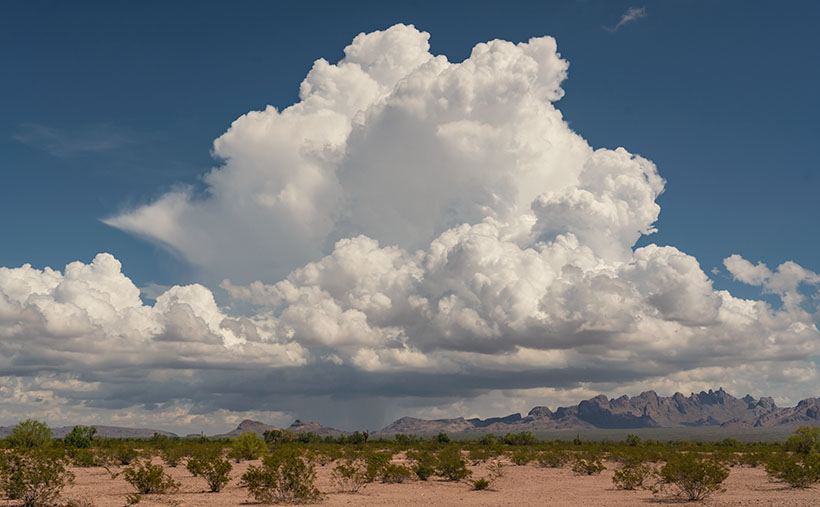
KofA Thunderhead - An autumn thunderhead builds over the KofA Mountains in western Arizona.
KofA Thunderhead – An autumn thunderhead builds over the KofA Mountains in western Arizona.

Each time Queen Anne and I jump into the car; I pack a camera in the back seat. I don’t mean on local errands like a trip to the grocery store but on drives longer than an hour. Rarely do I stop to take a picture, but should one of those once-in-a-lifetime moments happens, I’m ready.

If I capture some unique photographs, they don’t fit our usual workflow. We usually pick a location as a month-long project and photograph enough shots for a month of articles (or even a book). My one-of-shots along the highway traditionally become forgotten orphans. No one gets to see them—until now.

For December, I decided to make this month’s project out of the non-project shots I collected this year. With these four pictures, a special moment made me pull over and stop the car. That’s pretty hard to do because once I have a destination set in my mind, I only stop for gas, a candy bar, and bladder relief.

Anne and I run to Mexico about four times a year. We go to Algodones to see our dentist and buy 90 days worth of prescriptions. We’re on Medicare, and we have a gap plan that pays for most of the pills we take, but some of the select drugs (hint: you see them advertised on TV) are so much cheaper in Mexico that it pays for the drive. If we don’t have to wait on the dentist, we can make a drug run in a day. We leave here at 8:00 am, walk two blocks across the border, stop at Mickey D’s for lunch, and get home by 5:00 pm.

That was our itinerary on September 22—the first fall day. As we drove home on Highway US 93, I watched a single thunderhead building thirty miles north over the KofA Mountains. I thought it unusual to have monsoon activity in autumn and a single storm cell develop so far west in Arizona. I spent the next half hour arguing with myself.

“That will be a great shot if the clouds hold together until we get there.”

“If we stop, we’ll get home after dark.”

“It’s an isolated cell, and it’s posing like a runway model.”

“It’s the wrong time of day, and the light is wrong.”

Just after passing the Border Patrol station that marks halfway between Yuma and Quartzsite, I noticed that the cloud was beginning to tear apart (the wispy part on the tower’s left side). It was time to stop the car. I reached back for my camera and hiked a few steps off the highway. I set the zoom-lens as wide as possible before framing and then snapping a couple of shots. I call this week’s featured image KofA Thunderhead.

The spot where I stopped was several miles away, and for perspective, the jagged KofA peaks rise a couple of thousand feet above the 500-foot high basin. That makes the billowing cumulus top nearly 40,000 feet in the air. Unfortunately, I didn’t capture any lightning strikes beneath the storm.

We returned to the road and continued the drive, watching the storm evolve. The upper winds blew the clouds apart by the time we were due east of it. That’s when we saw a funnel cloud drop below the ceiling. The tornado briefly touched the ground near Crystal Hill Road before it disappeared.

We weren’t done with it yet. After stopping for gas in Quartzsite, the storm ambushed us on the pass at Guadalupe Mountain. As it moved north over Interstate 10, it dumped rain so hard that the wipers couldn’t keep up, and traffic slowed to a crawl. We hoped we wouldn’t be surprised by a second tornado, but after a mile or so, we broke into the clear, and the deluge was only an image in the mirror.

You can see a larger version of KofA Thunderhead on its Webpage by clicking here. Next week, I’ll drag out another orphan photo for show and tell. We’ll see you then.

Till next time
jw

BTW:

Anne and I are negotiating next year’s schedule, so there will be a lot of yelling and screaming around here during the holidays. Pay no attention to the man behind the curtains.

Dune Moon Picture of the Week

When Queen Anne and I make our quarterly medical run-to-the-border, the drive is usually three-hours each way. Most of the time, we leave at dawn, see our dentist, buy prescriptions, and then come home. For me, those are long days behind the wheel; for Anne, not so much. She’s usually asleep in the passenger seat until her snoring wakes her up.

Occasionally when we have lab work done, or the customs line is three-hours long because the snow-birds have arrived, we’ll get a room in the elegant east-side Motel 6 and dine at the swanky four-star Denney’s. Our December visit was one of those occasions. Since I needed a topic for January’s posts anyway, we spent an extra night and took a circuitous route home—we’d go up to Blyth to work the Algodones Sand Dunes for this month’s project.

The great swath of sand starts about three miles south of the border outside of Los Algodones, Baja. It continues 45 miles northwest into the Coachella Valley (California’s Imperial Valley). They’re the most extensive contiguous dune system in the U.S. The dunes are also called the Imperial Dunes, Glamis Dunes, and Gordon’s Well. The name varies with location and the leisure activity you’re doing. Still, the entire system is officially named Algodones Dunes (in Spanish, it means cotton plant—the predominant crop grown on both sides of the border along the Colorado River). This week, we’ll start west of Yuma at the Mexican border—at Gordon’s Well.

Imagine it’s 1850, and you’ve traveled by wagon hundreds of miles across the scorching Sonoran Desert, forded a raging Colorado River, and finally crossed into California. You’d think your hardships are behind, but then, you’re greeted with 6 miles of Sahara-like sand to cross. With each step, you sink up to your knees. Even in 1926, when the nation’s first Ocean to Ocean highway was built (U.S. Route 80), the shifting sand was an engineering nightmare. They couldn’t simply scrape the sand away because the prevailing wind constantly covered it up again. Even today, if you’re caught in a windstorm along this section of road, you’ll risk a chance that the sand will blast the paint off your car.

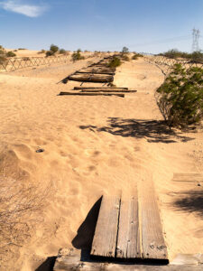
Plank Road - You can see what's left of the old plank road on display at Gordon's Well.
Plank Road – You can see what’s left of the old plank road on display at Gordon’s Well.

The road builder’s solution for getting across was to build a plank road—movable wood sections on railroad-lie ties that floated on the sand’s top. It turned out to be challenging to maintain, but it drastically cut the crossing time when it was clear. Eventually, the planks were replaced with new and expensive asphalt, and eventually, it became Interstate 8. There is a section of the original plank road at Gordon’s Well on display. When you grow tired of looking at the old wood road, you can walk over to the border wall and lean on it.

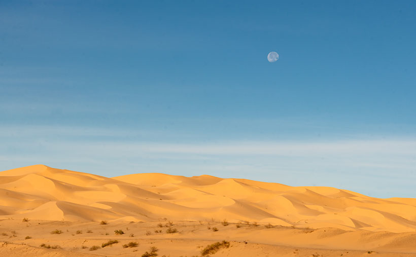
Dune Moon - A waning gibbons moon setting over the Algodones Dunes west of Winterhaven, California.
Dune Moon – A waning gibbons moon sets over the Algodones Dunes west of Winterhaven, California.

As Anne and I drove west on the freeway, we spotted a waning moon setting on the dunes, so we looked for a place to stop. We’ve got stuck in these sands once before, so we were careful not to drive off the blacktop. I didn’t want to pay for another hook to come to yank us out. As you can see, we found a good spot and took this week’s picture called Dune Moon. The name could have been funnier if I had shot it during a particular summer month. Se la vie.

You can see a larger version of Dune Moon on its Web Page by clicking here. Next week we drive north up the Imperial Valley to visit the northern dune crossing. Be sure to come back and see what we found.

Until next time — jw

Sleeping Under the Stars Picture of the Week

There’s something wonderfully romantic about how cowboys spent evenings eating beans around a fire before laying out their bedrolls and sleeping under the stars. It makes me wonder if I would have been any good riding a fence line. I love the outdoors, campfires, looking at the stars, and dreaming of the ladies back in town (sigh). I can assure you that I could never do that because the last horse I got on said, “oof” and sleeping on the ground has rocks, snakes, spiders, scorpions, skunks, and rabid chipmunks—not to mention the inclement weather.

Queen Anne and I still enjoy getting out in the wilderness; we just bring half of the house with us. For some reason, I sleep very well in our little Casita trailer. She has two layers of foam over the cushions that make into a full-size bed, and when I crawl under our down coverlet, my eyes slam shut faster than a mouse trap. As I lie next to my love and wrestle for more space, I listen to her rhythmic breathing. The hypnotic cadence is a mantra luring me to dreamland—until she misses a gear and sounds like a manual transmission exploding. But, she stops as soon as I nudge her to roll over.

All of this is fresh in my mind because we’re recently back from spending the week in the KofA Wildlife Refuge with The Ritz—our trailer. We succeeded in getting more images to finish up with this month’s topic but concluded that there is a lot more to the KofA range than a couple of blog posts. I think it may need to be a long-term project.

This tip was the first time we used the trailer in winter, and although the days were sunny, the wind blew, and the nights were colder than our Alaska trip. We had to use its heater at night. Even though we set the thermostat to 58º, it still came on often and blared at 85dB. The first time it came on, it made that burning dust smell and I thought we were going to die of carbon monoxide poising, so I opened the windows, which was counterproductive. Like all furnaces, the smell cleared eventually and we stopped jumping every time it started. Even with that racket, I slept until sun up.

We spent two days exploring and shooting photos at the refuge, and on the last day, the wind died, so we were able to use a week’s worth of wood for a fire. We ate brats, drank rich cocoa, and roasted marshmallows for jimmyums over the burning logs. Its warmth kept us outside long enough that the stars came out—all of them. We stared at Mars so hard that it began darting across the sky until we looked through binoculars and proved it wasn’t doing that. Finally, the creamy streak of the Milky Way began to reveal itself and forced me to set up my camera.

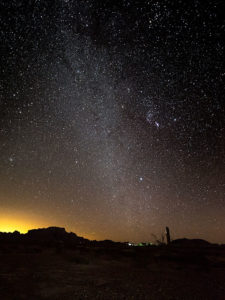
KofA Milky Way
KofA Milky Way – Campers enjoy the KofA mountain range-in silhouette against the Phoenix lights-under the Milky Way and Orion early in the January evening.

This week’s featured image is the result of that effort. It’s called KofA Milky Way, and I shot it from our campsite. The bright spots on the ground are from the next camp. The mountain is Signal Peak silhouetted against the lights of Phoenix—150 miles to the east. The constellation Orion is center-right, and Pegasus with the Andromeda galaxy would be overhead, but the fire died, and the cold chased us inside before we could find it.

As usual, you can see a larger version of KofA Milky Way on its Web Page by clicking here. I hope you enjoy viewing this week’s post and next week; we’ll show another featured image from Arizona.

Until next time — jw

Saguaro Climbers Picture of the Week

You can tell a story in several ways. You can start with details and pull back to reveal the whole, you can take the long-shot and move in for the close-up, or you can jump back and forth. I find the third option hard to pull off well, so I avoid it. I see the skydiver method the easiest—jump out of the plane at 20 thousand feet and then move in closer for details. It’s self-limiting because I have to make my point before the ground interrupts my story.

When I visit a new place like this month’s topic—KofA Wildlife Refuge—it makes sense for me to take mountain pictures and then work closer, because a story isn’t complete without details. Interesting things are happening in the cracks. Literally, like in the case with this week’s featured image.

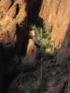
Saguaro Climbers
Saguaro Climbers – three saguaros slowly make their way to the summit.

I photographed this scene along the Palm Canyon Trail. Unlike the palms, this side canyon was better suited for the lens I was carrying, so it was easier to compose. Instead of the palms that I was after, it’s just three common (to the Sonoran Desert) saguaros in a steep ravine. It’s the light of sundown that makes the image work. It emphasizes the canyon’s depth without being so harsh that it blacks out details.

I usually title my photos with descriptive titles, so I don’t have to be imaginative, but in this case, I didn’t. While I processed it—with the aid of my Medicare supplied drugs—I visualized the saguaros as mountain climbers trudging their way to a summit. I called it Saguaro Climbers. That’s crazy because we all know that saguaros can’t climb—don’t we?

As usual, you can see a larger version of Saguaro Climbers on its Web Page by clicking here. I hope you enjoy viewing this week’s post and next week when we’ll show another featured image from the KofA Wildlife Refuge.

Until next time — jw

Winter Castle Picture of the Week

The KofA Wildlife Refuge takes up a good chunk of land. It covers a megabyte—or 1040 square miles if you’re not a computer nerd and don’t get the joke—nearly the size of Rhode Island. The topography is Basin and Range, which is standard for western Arizona, Nevada, and California’s Mohave Desert. Finally—one last bit of trivia before I move on from statistics—the wildlife range spans three mountain ranges (that’s three more than in Rhode Island).

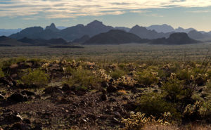
Winter Castle
Winter Castle – The Castle Dome Range, south of King Valley, is back-lit by a low winter sun.

The reason for so much space is to support herds of desert bighorn and antelope. Fifty years ago, both of these large animals were almost gone. Like bison, the sheep were plentiful in western Arizona, but a century of overhunting took its toll. It’s actually the sheep’s fault. They walk to the edge of a precipice then strike a magnificent pose saying, “Go on and shoot. I won’t move, and I’ll bet you’ll miss.” It was a living shooting gallery. By the time Arizona was a state, they were effectively wiped out.

Things started to change in 1933 when the Boy Scouts worked to get a game range established. Although the idea seems convoluted, you can’t hunt big horn without having sheep—the very logic that started the conservation movement. The game management people augmented the herds with transplants from other areas—including Mexico, but there was too much inbreeding. To successfully reintroduce them, they needed a broader gene base with multiple herds. Wildlife scientists established a crowd in the KofA and a southern pack in the Castle Domes and another in the New Water range to the north. To make this system work young males need to migrate across the open desert between ranges and breed with a different stock. Sheep can’t move freely across an Interstate Highway. Now you know why the KofA management area is so large. We like sheep, however rattlesnakes are a different thing.

When I set up to photograph this week’s featured image, none of what I told you was in my head. I thought it was pretty. That’s all I need to take a picture. I made it late in the day while driving away from Palm Canyon looking south. On the far side of King Valley, the Castle Dome Mountains are back-lit from the low winter sun. The atmospherics show off the range’s depth, as the peaks progressively get lighter in the distance, with Castle Dome Peak rising to 3788 feet. As I processed this image, I began to understand its story. I called it Winter Castle, and I hope you like it.

As usual, you can see a larger version of Winter Castle on its Web Page by clicking here. I hope you enjoy viewing this week’s post and return next week when we’ll show another featured image from the KofA Wildlife Refuge.

Until next time — jw

KofA Moonrise Picture of the Week

For the last couple of years, on the drive to see the dentist, we drive past a place that I wanted to photograph. That sounds like it’s down the street, but our dentist is three hours away in Mexico. When we pass by in the morning, we’re on our way to an appointment, and I’m too tired to stop on the way home. I decided that I can’t do it justice with a drive-by shooting. I need to make it a destination.

The place I’m talking about is the Kofa Wildlife Refuge in the far west part of Arizona and near the western edge of the Sonoran Desert, which is the Colorado River thirty miles away. It’s along US 95, a half hour south of Quartzsite. The refuge spans three mountain ranges: the Castle Dome, the Kofa, and the New Water ranges. It supports a herd of desert bighorn sheep large enough to allow limited hunting. The refuge also has a couple of indigenous plants that only grow within its boundaries.

KofA Moonrise
KofA Moonrise – A partial moon rises over the KofA Range in western Arizona.

Of the three ranges, I think the Kofa Range is the most photogenic; at least along its western face. There’s a central mountain—Signal Peak—that is surrounded by shorter—but impressive—needles and jagged peaks. It reminds me of the Superstitions a bit as they’re both volcanic in origin and have a similar geographical setting. Early prospectors called them the Shit House Mountains because they thought the spires looked like outhouses. Mapmakers didn’t care for that name, so they changed the name to Stone House and finally Kofa after the King of Arizona Mine—an operation that pulled millions of dollars of gold from the mountains in the twenty years that it operated.

Besides the rugged terrain and the bighorn, the Kofa has Palm Canyon. The canyon requires a short but steep half-mile hike to see a dozen and a half California Fan Palms growing in a vertical gash in the mountain. I know that you can see palms anywhere in Arizona, but these are the only native ones in the state. They’re a holdover from one of the Ice Ages. I failed to get a good shot on this trip because to get close you would need to be a mountain goat, and the sun shines on them for a limited time. When I go back, I’ll take a different lens.

This week’s featured image was an afterthought. I was driving down from Palm Canyon and stopped to capture an image in the west. When I got out of the truck, I saw a three-quarter moon rising above Signal Peak, so I instinctively fired a couple of shots, but quickly dismissed them as insignificant because of the wide lens I used. Wide lenses make a small moon even smaller. When I saw this shot with those streaky clouds and golden light on my monitor, I thought this would be perfect for an introduction to this month’s topic. I call it KofA Moonrise (I think it’s the way we should spell the range’s name). Incidentally, Palm Canyon is in the dark area beneath Signal Peak.

You can see a larger version of KofA Moonrise on its Web Page by clicking here. I hope you enjoy viewing this week’s post and come back next week when we’ll show another featured image from the KofA Wildlife Refuge.

Until next time — jw