It’s Too Beautiful; Run For Your Lives Warning: Summer is comming to the desert.

Blooming Palo Verde
Blooming Palo Verde – When the Palo Verde Trees bloom in the desert it means that spring is at a crescendo and summer will be soon.

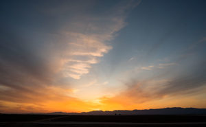
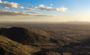
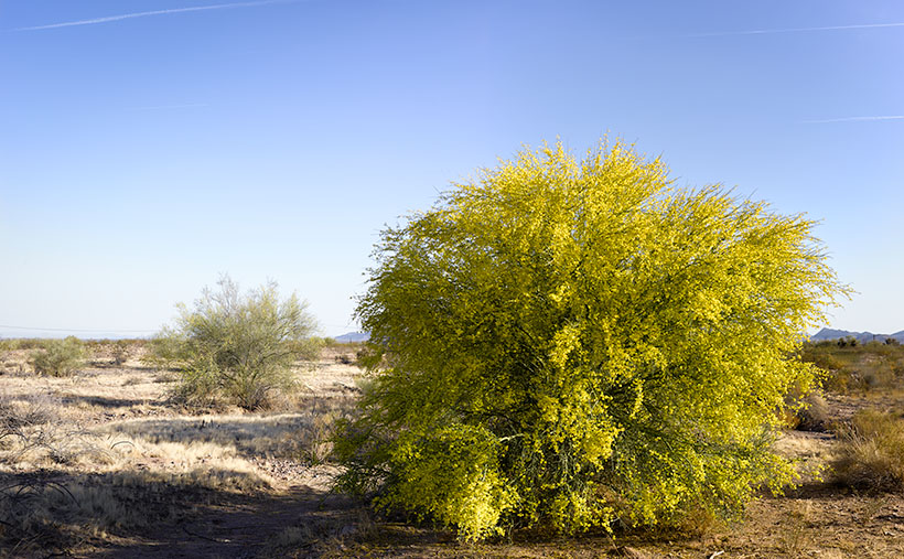
The Palo Verde are in bloom. Spring in the Sonoran Desert is at its pinnacle. It’s sort of like the finale at a fireworks show and when the desert is the best. In wet years—like last year—the wildflowers carpet the floor with cacti sprouting surreal and almost garish flowers soon after. Then, starting in the lowlands, the native Palo Verde turn yellow in a succession that works its way to higher elevations, like a Technicolor wave. Finally, the giant saguaro put out dinner-plate sized white flowers at their arm tops.

There are, of course, other signs of spring around us. Male doves try to attract a mate by cooing from perches then furiously flapping into the sky as high possible before they stall and glide back to their starting place. I suppose it’s their equivalent of doing push-ups to impress the girls. Queen Anne and I spot more quail while on our morning bike ride. Soon the adults will be shepherding multi dozen covey of chicks from one shrub to the next. Other birds like the Cardinals, Cooper Hawks, and Turkey Buzzards have returned from their winter retreats. Sex is in the air and I might as well break out my copy of Stravinsky’s Rite of Spring as a soundtrack.

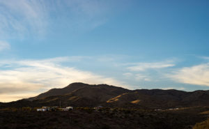
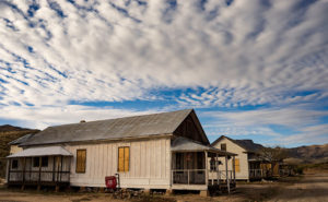
Here at Uncle Ernie’s Holiday Camp another spring ritual has begun. Each day, another fifth-wheel or motorhome pulls out of the park and begins a journey north. Our friends and neighbors are leaving for their seasonal excursions or summer homes which are beginning to emerge from snow banks. Pretty soon our neighborhood will be empty again with only a few of us hearty souls standing guard.

Although Anne and I don’t have a Montana home, even we’ve put pennies aside to escape the heat that comes after all of this desert beauty dries and shrivels up. This is a travel photography blog after all and—like last year—I want to report of some exotic far-off land. This year, our Shangri-La is … Utah (I know, I know. You don’t have to rub it in).

We’re going to make camp in a valley somewhere between the high plateaus that flank U.S. Highway 89. It’s been a while since I’ve photographed Utah and with several National Parks located within a day’s drive, I’ll be building on my projects. Equally important is that I will be able to blog about our adventures just like we did on past trips. We haven’t settled on where, when or exactly how long we will be on the road, but we have a couple of months to work that all out. Until then, we need to scrape the dust off the Ritz, buy fresh linens, and maybe even fix the microwave.

Since it’s travel season again, and we will only be on the road part-time, I’m going to open the blog for guest posts as I did last year. We had a positive response from those articles and they provided interesting content. So, if you’re out on the road, here’s your chance to share your stories and photos with our readers. Let me know if you’re interested and I’ll send off some guidance.

Until next time — jw

Harcuvar Sunset Picture of the Week

There are good days and there are bad days. I have been out on photo shoots where nothing went right, and then there have been days when everything was perfect. This week’s photo is from one of my better days. Last week, I went on an expedition to Alamo Lake—a place I hadn’t visited before—because I saw a place in a student’s assignment that I wanted to photograph. I spent several hours driving to La Paz County and an hour searching for the right place. I spent another hour or two walking and shooting before I felt like I had what I wanted and packed up for the long drive home. As I got closer to home, the sun was setting and when I turned onto State Route 71, this was the view out of my door window so I pulled over to capture it.

Harcuvar Sunset
Harcuvar Sunset – After a day of shooting in the desert, I stopped on the drive home to take one last photograph.

I’m pretty ambivalent about sunset photos. They’re beautiful and all, but they’re everywhere. When I was younger I shot a lot of them, then I went through a period where I ignored them. Maybe I’ve mellowed in my old age because I feel like I’ve passed up some spectacular shots because I was too lazy to drive to an open field and I promised myself to rectify that.

This shot—called Harcuvar Sunset—is interesting to me because of the cloud layers. The sun’s last rays color the low clouds while the higher upper streaks are still white. The contrail—usually something that meddles in a photo—seems to be caught in the space between them. I captured this scene at the edge of an alfalfa field in Aguila and the mountains are the Harcuvar Range—I was shooting on the north side of them for most of the day.

You can see a larger version of Harcuvar Sunset on its Web page here. I hope you enjoy my new work and that you’ll tell me what you think. Do you think sunsets are beautiful or are they trite and overdone?

Until next time — jw

The Legends of Elephant Curve Under Yavapai Skies

Elephant Rock

While testing new photo equipment last weekend, I stopped at a spot on the road that I’ve meant to stop at since we moved to Congress over two years ago. Before this weekend, I was either in a hurry, or there was too much traffic, and there was no room to get off the road. This spot is part of the famous Yarnell grade, a stretch of Arizona State Route 89 that winds through the scenic landscape. The Yarnell grade is known for its steep descent and tight curves, making it a challenging drive for many motorists. However, it also has a unique and intriguing landmark—the legendary Elephant Curve.

Elephant Curve
Elephant Curve – As shown on the USGS Topo map, Elephant Curve has earned its spot on the map, but what happened there?

It’s a real place, and the USGS Topographic map shows its name, and at that curve, there is always an elephant painted on the rocks. Once or twice a year, the Arizona Department of Transportation, or a disgruntled Democrat, will cover over the pachyderm. Someone else takes it upon themselves to draw a new version within a week. This is the fourth iteration that I’ve witnessed since we moved here.

Elephant Rock – This is the latest version of our elephant-on-the-rock. The rock art gets painted over annually but quickly reappears within a week. The version before this was in pink paint and traces of the pink area on the pachyderm’s back.Why is this elephant so important? My favorite legend is about a circus caravan traveling to Phoenix in the late 1930s. As the group descended the newly paved but steep grade, one of the trucks lost its brakes and crashed into the rock, killing Scooby—their prized elephant—and as is the tradition in Arizona, the circus troop memorialized Scooby with a painting at the crash site.

Isn’t that sad? That would explain why the elephant painting should remain a lasting memorial marker. Unfortunately, when I researched the story online and visited the Congress Library, I discovered it’s all a myth. When I asked a long-time resident, she gave me a wry smile and muttered, “That’s just a made-up story. It never happened.”

A second local legend involves a miner returning home from a night on Prescott’s Whisky Row. Reportedly, he had to swerve at that spot to avoid a giant pink elephant in the road and crashed his car head-on into the boulder. This story explains why new versions are sometimes pink instead of white.

Elephant Curve
Elephant Curve – As you descend Yarnell Hill, Elephant Curve is the tightest and slowest you’ll meet. Five days after I took this shot, another accident ripped apart this section of the Armco barrier.

Neither story is true—so I’ve been told. The true story is that some unknown local with a strong sense of humor likes to perpetuate the elephant myths. I think there must be more than one artist because each version I’ve seen has distinctive brush strokes. Now that I’m in on the joke, I can picture myself out at night painting my take on Scooby.

Until next time — jw

Yarnell Overlook Picture of the Week

For each picture of the week in this series, I normally select the best shots from the locations that I’ve written about. This week is a little different. I had to push back the scheduled image that I was going to use so I could insert a shot that I took yesterday. I intended to just shoot some test shots, but because this image fits into the current theme and because it came out better than expected, I decided to insert it into this week’s rotation. It’s called Yarnell Overlook named so because that’s where I shot it.

Yarnell Overlook  – The vista from the Yarnell Overlook takes in Fools Gulch in the foreground to Harquahala Mountain—fifty miles to the west.


I ordered a tripod part from Amazon that arrived Friday and I was anxious to put it to work, so I decided that I would ‘run up the hill’ at sunset and test it at the overlook. It was an easy place to get to and there’s little traffic there. During the day, I was concerned because of a boring cloudless sky and the winds kicked up a layer of dust making the atmosphere hazy. I resigned myself that the results would technically be OK,  so I didn’t expect more than that. As sunset approached, however, a few puffy clouds began forming near the Weavers which picked up my spirits. After dinner, I packed my gear into the car and set off for the pull-out located half-way up Yarnell Hill to conduct my test. The view from the overlook is most often hazy and the back-light from a setting sun is even worse for shooting a high detail photo.

After I processing the test, however, I think the results exceeded my expectations. Although the dust obscures the fine detail and acts, well … like fog adding some drama. I like it because of the afternoon clouds above the layer of dust. The viewpoint overlooks Fools Gulch with its working gold mine. The Stanton road that I wrote about for the last couple of weeks is just beyond the very large Parker Diary Farm that you can see in the middle-right. The last thing that is pleasing to my eye is the repeating round shapes of the boulder-covered foreground hill and Harquahala Mountain—some fifty miles away on the horizon. In case you’re curious, our house is located in a lighter patch of homes near photo’s center.

You can see a larger version of Yarnell Overlook on its Web page here. In last week’s post, I mentioned using a Like button. Fred correctly pointed out that when you follow the post links, there isn’t such a button. There are Like and Share buttons, but they are only on the blog’s homepage. To access that version, you need to first open my Webpage and click on the Blog link in the menu. That sounds like too much trouble, so I won’t bother mentioning them again. No matter which version you see, I hope you enjoy viewing my newest work.

Until next time — jw

Stanton Dusk Picture of the Week

On my last outing, I spent an afternoon exploring the Stanton Road searching for suitable photography subjects. The dirt road runs along the base of the Weaver range between Arizona Highway 89 and the Stanton ghost town. There, you can either continue up the hill on the back road to Yarnell—something that I’ll do in the future—or take the Octave road to the old Octave Mine site. I drove down the road until it became too rough for my wimpy truck and I turned around. The light was failing anyway, so I decided to call it a day. I was almost back to Stanton, and as I rounded a corner, I saw this scene and stopped the truck so I could take a photo. I call this shot Stanton Dusk and it’s my new photo of the week.

Stanton Dusk
Stanton Dusk – The sun at the western horizon lights the ridges along the Weaver Range behind the ghost town of Stanton.

The low sun lighting the mountain ridges is what first caught my attention. The ridgelines highlighted like that keeps Weaver Mountain from being a flat silhouette and adds texture and perspective to the large dark shape. I think the sky and clouds contribute to a sense of open space. Finally, the light-colored structures atop the lower ridge anchor the frame. This shot has many of the elements that Ansel Adams captured in his masterpiece: Moonrise over Hernandez (I must mention that the image in this link is a poor representation of one of his original prints). I’m not saying that my shot has the stature of his, but Moonrise has long been a personal inspiration and I can see some of the influences in my shot. Of course, my shot doesn’t have a moon and—as some photographers do—I could add one in post-processing, but I won’t.

You can see a larger version of Stanton Dusk on my Website here. Examine both pieces and see if you agree with me. Can you see the similarity in the dark sky, the light structures, background mountain, and clouds, or am I fantasizing? Please feel free to share your thoughts in the comment section below and don’t be bashful about clicking on the Like button if you enjoyed this post.

Until next time — jw

Eggs Benedict Done Right Nichols West Restaurant A Congress Brightspot

My favorite thing for breakfast is Eggs Benedict. It’s an indulgence that I refuse to give up even though I know that plate full of calories and cholesterol is trying to kill me. By no means am I a traditionalist. I like all the varietals. I’ve tried the Californian with turkey and avocado, the Florentine with spinach, a crab cake version, and one made with salmon. The most exotic and memorable Benedict I’ve ever had was when Jeff and I stopped in Santa Cruz on the homeward bound leg of our infamous San Francisco trip. I believe it was in the Walnut Avenue Café that I ordered Blackened Ahi Tuna Benedict. I don’t know why I’ve never been back. The peppery tuna and lemon creaminess of the sauce was one of the best things I have ever eaten.

I have a version that I make when I’m in the mood to struggle with egg poaching. I substitute a nice thick ham slice instead of the usual Canadian bacon and I replace the Hollandaise with Béarnaise because I enjoy the tarragon and vinegar sauce even more. I call my version Eggs Better-dict.

Eggs Benedict at Nichols West
Craft paper replaces white tablecloths at Nichols West and they make the best Eggs Benedict.

One of the best things about living in Congress is that we have a local restaurant that really doesn’t belong here. A couple blocks west of US 89 on State Route 71 is a small café named Nichols West. It would be in the heart of downtown if Congress had a downtown. The cream-colored building with its star jasmine-covered façade houses a bar and restaurant that seats—at best—fifty people. Simon ­­­Smith—a British transplant—is the proprietor of this American Restaurant and over the last decade, he has built up a large and very loyal clientage here by having a varied menu, serving fresh ingredients, and being open year round. That’s an important part of being able to keep good staff.

As expected from a diner like this, the prices—although reasonable—prevent us—as retieries—from having dinner there every night. However, they’re open for breakfast every morning at eight, and one of the best deals on the breakfast menu is the Eggs Benedict, starting at under $10.00. I say starting because they have a half-dozen versions including a Country Benedict (biscuits and gravy in place of the good stuff). The sauce is the key to making this meal great. Anyone can slap egg yolks and lemons together, but here it’s bright without being too lemony. I don’t recall having a better Hollandaise, and so I’ll put it up against the best in Arizona.

Nichols West In Congress Arizona
Nichols West is a small restaurant that has unexpectedly good food for such a small town.

Out here in Podunk-Ville, we live without a lot of amenities, like sidewalks, stop lights, bike lanes, and indoor toilets. But a great restaurant isn’t one of the missing. That’s why on trash days when Queen Anne and I are heading home from the dump, we’ll most likely be stopping off at Nichols West for breakfast.

Until next time – jw

Stanton Street Picture of the Week

This week’s new image shouldn’t be a surprise. I sort of previewed it in the last post. It is the row of houses that I took while visiting the ghost town of Stanton last week. If you missed the post you can scroll down to learn more about the gold and the shady characters that lived there. Maybe not as exciting as it was, Stanton, is now an RV Park where baby boomers like me can spend their vacations panning for gold.

Stanton Homes
Stanton Homes – Only three houses have survived the years of abandonment. They line a street surrounded by campers.

It was late in the day when I finally got to Stanton and the light was low with long shadows. I had watched the sky during the day thinking I may not go because it was gray and uninteresting, but in the afternoon, the clouds broke up into puffy finger-like shapes with a good light underneath. I started shooting the front buildings first, frankly because of the old signs on them, and when I satisfied myself that I had got what I wanted, I walked up the dirt street where this row of homes is. I loved the soft light falling on the white-washed buildings. The light wasn’t too harsh that it blocked up the shadows, yet it still showed off the building’s dimensions. Because the sky was so striking, I backed off from the homes to include the clouds. I think this shot came off as more than a house picture. I see it as a specific instant of time when the light was weird and the clouds were right. I’m very happy with it.

I named this shot Stanton Street and now you can see a larger version of it on my Website by clicking here. Please feel free to share your thoughts in the comment section below and don’t be bashful about clicking on the Like button if you enjoy what we’re doing.

Until next time — jw