Eagletail Mountains Picture of the Week


Eagletail Mountains - The Eagletail Mountain Wilderness Area is an hour west of Phoenix, and south of Interstate 10. Since you have to hike to see the good stuff, it's challenging for me to photograph properly.
Eagletail Mountains – The Eagletail Mountain Wilderness Area is west of Phoenix and south of Interstate 10. Since you have to hike to see the good stuff, it’s challenging to photograph correctly.

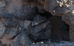
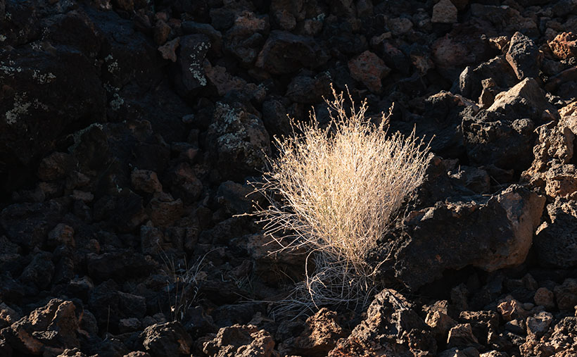
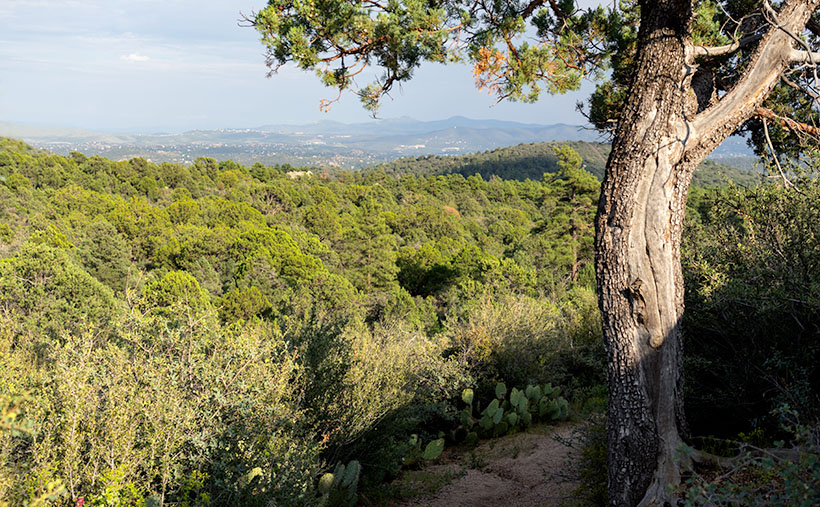
I find some places where it is difficult to photograph properly. Most of those are wilderness areas. Because they’re not accessible by road, you have to hike to get to the good stuff; that’s exciting visually. You know by now how I feel about hiking—I’m vehemently against it. However, sometimes you have to do things that make you uncomfortable.

The Eagletail Mountains are one of those places. Plenty of old jeep trails are running through the area, but since it was declared a wilderness and set aside in 1990, you can’t drive on them. Instead, you have to hike anywhere within its boundaries.

I last visited the Eagletails in 2003—when I first created my Website. Since I routinely update the site with newer and better photos, I discarded those shots long ago. I needed a new project, so I decided to revisit the Eagletail Wilderness and try my luck again.

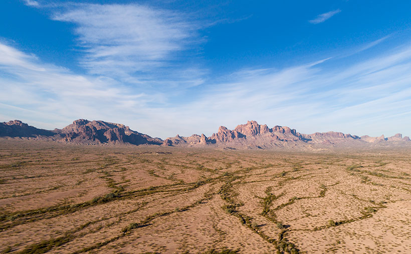
There are two mountain ranges in the Eagletail Wilderness. Foremost is the Eagletail Range that runs north-south. If it were a hand on a clock, they would be in the 11:00 position. The other range is Cemetery Ridge (hmm, there’s got to be a story behind that name), a line of mountains that run northwest-southeast, or 9:30-10:00. Most of this wilderness fits within this triangle between the two ranges. That’s the justification that Congress used to preserve it. It is a complete example of two mountain ranges separated by a flat Sonoran Desert basin.

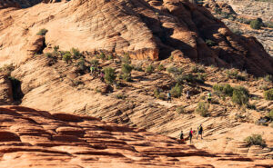
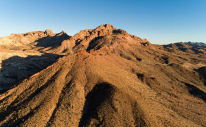
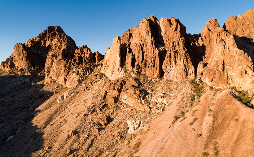
This week’s picture is of the western slope of the Eagletails. It’s an aerial shot taken with my drone. Since I can’t fly into a wilderness, it’s as close as I could get from the east side. It shows the jagged ridgeline with Eagletail Peak—the high point—at center-right. If you got closer, you’d see its top has several granite spires resembling feathers—so its name is descriptive.

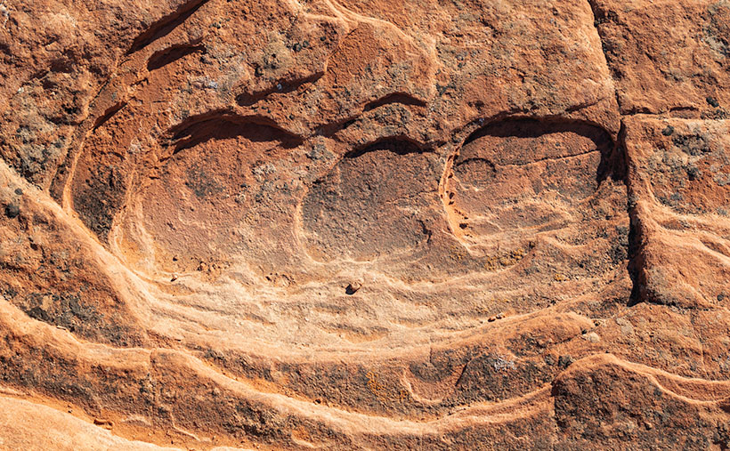
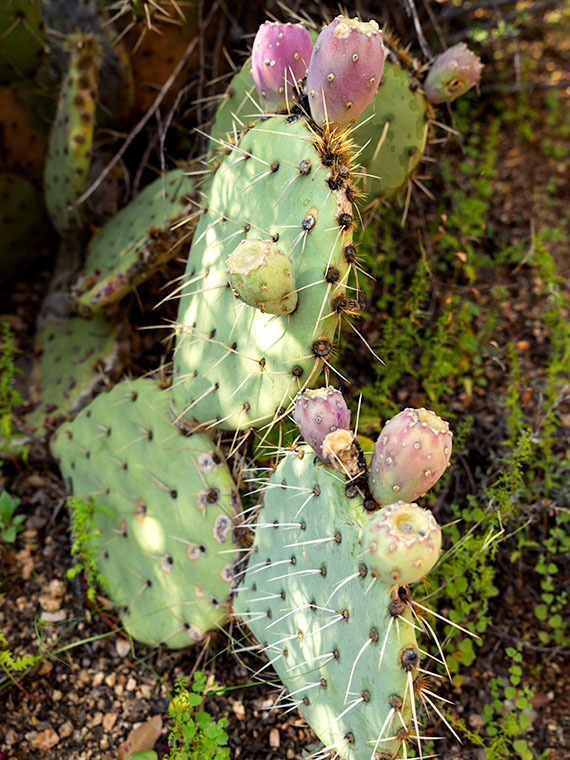
The trouble is that the interesting geologic formations and petroglyphs are on the other side. For February, my challenge is to see how far I can walk in and show you what’s there. It’s been several years since I last twisted my ankle, so I’m about due.

You can see a larger version of Eagletail Mountains on its Web Page by clicking here. Next week, we move south and get a shot, including Cemetery Ridge. I promise to see how it got that name. Come back then and see what we found.

Until next time — jw

Lava Grass  Picture of the Week

Christmas, along with the rest of the solstice holidays, is almost over. I hope that Santa brought you something better than the lump of coal I got. Queen Anne is on the couch in her bathrobe and tiara with a box of Kleenex. She’ll be useless until Amazon Prime stops showing Christmas movies. Since we won’t be back before then, we’d like to wish you the best New Year in 2022. Things have got to turn around eventually, so let’s give it a go one more time.

Today, I will finish up the year, and our visit to Snow Canyon State Park by talking about the other rock found there—basalt from recent lava flows. If wind, water, and ice sculpt sandstone, the cooled magma is geology’s Etch-a-Sketch reset button. The black rock covers the softer sandstone and forces water to change course. The runoff carves different canyons, like in the park.

As you explore the park’s north side, you’ll see basalt-covered cliffs. They used to be the canyon floor, but 27,000 years ago, the lava forced the drainage west and carved a new floor—now a couple of hundred feet lower. Snow Canyon has a couple of trails that wander through the jagged black rocks; the Lava Tube and the Cinder Cone trails. The latter is interesting because you can hike to the cone’s rim and look into the extinct caldera. However, the track is uphill, and on the east side of State Route 18, so we skipped it.

Lava Tube - When the magma skin cools and then ruptures, the flowing magma escapes leaving behind a cave.
Lava Tube – When the magma skin cools and then ruptures, the flowing magma escapes leaving behind a cave.

The Lava Tube Trail is shorter,  level, and leads to two lava tubes—which are places where the hardened surface fractures releasing the still molten magma inside to flow away. The remaining caves are sometimes big enough that you can crawl into and see where the bats and spiders live—I’ll pass. The above photo is the smaller tube, and visitors— braver than I—crawl into it.

Lava Grass - A small tuft of grass ekes out a living in barren basalt.
Lava Grass – A small tuft of grass ekes a living in barren basalt.

I find basalt a challenging subject to photograph. It’s like taking a picture of a black cat in a coal mine. To get any detail, you need to over-expose, which washes out the rich depth. Fortunately, and is the case with this week’s picture that I call Lava Grass, there’s enough green lichen growing on the rock to prevent the shadows from completely blocking up.

I feel lucky to have spotted the tuft of dried grass surviving in the barren rock. I concentrated hard on staying upright as I hiked the trail in the early morning. The jagged basalt is not skin-friendly and will likely draw blood if you fall on it. And—silly me—I left my bicycle helmet at home.

You can see a larger version of Lava Grass on its Web Page by clicking here. Next week we start a new year, with a new project in a new location. Be sure to come back and see where the road takes us.

Until next time — jw

Cup Holders Picture of the Week

I’m going to pause our Snow Canyon State Park tour for a couple of paragraphs so that we can run over to the coast. Don’t worry; we won’t have to put up with any of those weird Californians. Where we’re going, they don’t exist yet. We’re not traveling far—maybe a foot or two. However, we are breaking every law in physics to travel back in time one-hundred eighty million years ago—to the Jurassic era. You can turn around now and take in the Sundance Sea, right here in southern Utah (how old is Robert Redford anyway). Don’t go in the water. There are big things in there that will eat you like you’re a gummy bear.

Turn back this way and look down the shoreline. Massive dunes—hundreds of feet high—go on for hundreds of miles. Until now, it’s been hot and dry here along the Equator, but the climate is changing. It’s becoming muggier and swamp-like. The oceans are rising, and soon (in geological time), the water will cover the sand and pile more sediment on top. The pressure on the dunes will bind them into stone—never to be seen again.

Things would have stayed that way except our stupid captain rammed the North American plate into the Pacific Plate, and there goes the neighborhood. The crash spun us around, raised the Rockies, the Sierra Nevada, and all the other little wrinkles in between. The resulting damage cracked the mantle so bad that volcanoes could form and eventually raise the Colorado Plateau. Then the Californians move in—can it get any worse?

The crash shoved our peaceful little seaside village up a hillside. We no longer live in a basin where sediments collect. Now our water flows to a place far away. It peels back layers of rock—like an onion when it does. After erosion uncovers parts of the great dunes, we’ll see them again here in St. George, Zion, and north of Escalante. Now they’re as hard as a rock.

Dune Walkers - About the only way you can stay on the Petrified Dune Trail is to go on a guided hike, like these people.
Dune Walkers – About the only way you can stay on the Petrified Dune Trail is to go on a guided hike, like these eight people.

Ok, you can snap out of it now and come back to reality, where we’re standing on the Petrified Dunes Trail. Because it’s all rock, the only clue you have to follow is the path worn smooth from countless boots. It’s easy to leave it, but that’s fine because you’re not going to damage anything. The rock grips like—well—sandpaper, which makes it easy to scramble up and down the slopes. As you wander across the uniformly fractured rock, you begin to examine the exceptions.

Cup Holders - Freezing water bores into the sand stone and will over time reduce the rock to sand grains.
Cup Holders – Freezing water bores into the sandstone and reducing the rock to sand grains over time.

That’s how I found this week’s picture. The round wells in the picture are places where water collected and had a chance to freeze. As the ice expanded, it fractured the sandstone and chipped it. These spots get deeper; they’ll hold more water and bore into the stone faster. Eventually, they’ll be so deep that they’ll split the block until it reverts to sand grains again. I think the shapes of the cups are cool, but I really like the rich and varied colors in the stone. When you get a close look like this, sandstone has a lot of depth and texture.

You can see a larger version of Cup Holders on its Web Page by clicking here. Come back next week when I’ll tell you about the times the stupid captain left the kettle on too long and spilled hot lava all over the park.

Until next time — jw

Sunset Wall Picture of the Week

Alright, class, settle down. Get out a sheet of paper and a pen, then put away your backpacks. Today we’re starting with a pop quiz. There is only one question, and you have 15 minutes to answer with 10,000 words—or more. You must cite your sources. Spelling and punctuation will be graded. Are you ready? Your question is, “What do Memphis, Tennessee, and Kingman, Arizona have in common?”

I have talked before about old trading trails morphing into the well-laid-out highway system that we have today. Most of us don’t care how it happened, and we just drive on them. They think that Eisenhower signed a paper in 1956, and the freeways just popped into existence. I think that’s because people younger than me—and that’s pretty much everybody—didn’t experience the change first hand. Our forebearers built most roads over existing paths, and there are reasons someone blazed those original paths. Mark Knopfler describes this phenomenon well in his 1982 song Telegraph Road from the Dire Straits album Love Over Gold.

There have been trading trails across Northern Arizona since the first Pueblo inhabitants. European settlers didn’t use them much because the New Mexico territory was Spanish. Their roads came up from Mexico to towns like Santa Fe and the Old Pueblo at Tucson. Those roads followed the Rio Grande and Santa Cruz Rivers because there was always reliable water. The rest of the desert was a wasteland. What changed that? It was gold.

In 1848, James Marshall discovered gold at Sutter’s Mill in California. In less than two years, California became a state—that’s instantaneous in government time. They needed to move goods and people to the Golden State—and get the gold back to Washington. But, there were no east-west roads, so they put Captain Lorenzo Sitgreaves in charge of a surveying expedition, and he laid out a railroad route around the 35th Parallel.

Then in 1857, the Fed’s paid Edward (Fitzgerald) Beale to build a wagon road from Ft. Smith, Arkansas, to Los Angeles—again along the 35th Parallel (remember, Tucson was still in Mexico). He built his road in a year using camels because they needed less water and food than oxen and horses. By all accounts, it wasn’t much of a road, but Beale bragged that it was the shortest route by 300 miles and “It is the most level: our wagons only double-teaming once in the entire distance, and that at a short hill . . .” His road became the Santa Fe line in 1880, then Route 66 in 1926, and finally Interstate 40 in 1978.

SR 68 through Union Pass - Arizona State Route 68 (on the right) as it enters Union Pass through the Black Mountain Range.
SR 68 through Union Pass – Arizona State Route 68 (on the right) as it enters Union Pass through the Black Mountain Range.

His wagon road wandered a bit from the 35th as it meandered across the desert, but wagon tracks are visible in places on Google Earth. As vehicles became more efficient, each of the subsequent roads shortened its length. Some silly people hike the old road just for giggles. I’m not that ambitious. However, I do know of a place where you’ll be in Ed’s footsteps. Yep, you guessed it. It’s our Union Pass on SR 68. While Sitgreaves went through Oatman, Beale found a more accessible way to Fort Mohave and his river crossing.

Sunset Wall - Layers of volcanic rock upended vertically in the Black Mountain Range.
Sunset Wall – Layers of volcanic rock upended vertically in the Black Mountain Range.

I took this week’s picture on the west side of Union Pass, and it shows layers of lava and ash (tuff) that have been turned horizontal by geological forces. As Don Sprinkle commented in another post; “. . . just like the Grand Tetons.” It was sundown as I took this photo, and that’s why the ordinarily dark rock has a beautiful red glow, and that’s why I called it Sunset Wall.

So, back to your quiz; I’m going to let you grade your papers. What did you answer to: What do Memphis, Tennessee, and Kingman have in common? If you said that they are both along Interstate 40, you get 50%, and if you said that they both have a Beale Street, you get another 50%. I must add that there is a difference too. While Kingman knows who they named their street after, according to the Wikipedia entry for Memphis’ Beale Street, nobody remembers who Edward Beale was, which I find amusing. Maybe it’s forgotten because he was a Union Naval officer.

You can see a larger version of Sunset Wall on its Web Page by clicking here. Please come back next when we begin December’s project and new pictures.

Until next time — jw

Five Cairns Picture of the Week

If you’ve ever hiked a backcountry trail, you know about cairns. They’re the road signs hikers use to stay on track. They’re simply piles of rocks high enough to be seen and reassure travelers that they’re following the right path. According to Wikipedia, cairns have been around throughout time all around the world.

I don’t know who has the time to build and maintain these stone piles, so I’ve concluded that it must be the Pixies. If you think about it, who else has the skills to precariously balance rocks on top of one another that magically survive wind and rainstorms? You never see humans stopping to build them. Yeah, it’s definitely the Pixies.

The markers confirm the obvious on some trails—like this month’s hike up the Little Granite Peak trail. The steep climb from the parking area to the first flat was like tromping through a rain gutter. Runoff and traffic have carved a trough that’s easy to follow. On the other hand, where trails traverse slick rock areas, cairns will reliably mark the easiest path. When I hiked to Coyote Gulch in Utah, there were long sections of trail where I had to stop at one of the cairns and look for the next one before I went any further. Later I found that the markers kept me from having to scramble down treacherous cliffs.

Another time that I remember cairns saving my butt was on the outing to Cedar Mesa. While Queen Anne waited in the truck, I hiked down into Cigarette Canyon to get this shot of Fallen Roof Ruin. She insisted that I leave the keys with her. After reaching the canyon bottom, I only had to trudge a mile before I spotted the ruin nesting high in the cliffs. Paying no attention to my route, I scrambled up the smooth sandstone wall with my camera and tripod.

Fallen Roof Ruin - Built high above a canyon floor, these ruins were a strenuous hike to get to, but a treacherous path down.
Fallen Roof Ruin – Built high above a canyon floor, these ruins were a strenuous hike to get to but a treacherous path down.

After getting my shot, I started my descent, but what I saw scared me. It was one of those steep hills where you could only see the first few feet before the ground plunged out of sight—like the first hill of a roller coaster. I had visions of rescuers finding my skeletal remains among the ruins because I became trapped there. Anne would surely get bored and drive off, leaving me to rot alone. But as I searched for a way down, I spotted a pile of rocks to one side, so I headed toward them. From there, I saw more cairns that made a zigzag pattern down to the bottom. Thank God I didn’t have to make Anne put down her book and get out of the truck to find me.

Five Cairns - This little cairn didn't like the way you looked at her, this little cairn didn't like the way you spoke to her, this little cairn hated the way you bumped into her, this little cairn thought you smelled, and this little cairn went "wee, wee, wee," all the way to the police station.
Five Cairns – This little cairn didn’t like the way you looked at her, this little cairn didn’t like the way you spoke to her, this little cairn hated the way you bumped into her, this little cairn thought you smelled, and this little cairn went “wee, wee, wee,” all the way to the police station.

So, imagine my smile when I reached the first intersection on the Little Granite Mountain trail and saw five miniature cairns lined up on top of a boulder the size of a small Toyota. This spot must be where the fairies had a picnic. It was off the path behind some bushes, so these weren’t actual trail markers. They were left by the little people having some mischievous fun.

You can see a larger version of Five Cairns on its Web Page by clicking here. Next week, we start a new project, so come back and see where the road leads us.

Until next time — jw

Prescott Basin Picture of the Week

There’s a growing trend in the comedy routines that Queen Anne and I watch on YouTube’s Dry Bar channel. The bits poke fun at young people for not knowing about obsolete things my generation regularly used. I’m not sure if the joke is at the youth’s expense or if it’s simply us old farts complaining about change again.

To give you an example, one performer asked a teen in the audience to explain the relationship between a pencil and a cassette tape (the kid didn’t know what the tape was). Another was about the phone books we used to get each year. The fact that we had to look numbers up on our own was mind-boggling enough, but they couldn’t comprehend that the books were primarily used at grandma’s house as a booster seat. Finally, hold up a 10’ curly phone cord and ask a young person why it existed.

I uncovered another lost phone tradition this week after talking to a particularly annoying salesman. It’s known as the old 40mph-hangup. I learned it from my dad back in the age of unenlightenment. It has Zen-like qualities and resembles a marshal-arts move, but it more closely mimics the grace of a baseball pitch. I’ll try my best to describe it. After you’ve had your fill with the person at the other end of the line, you scream a final taunt—after all, you must have the last word—then as you lift your left leg, you begin to swing your right arm in a full roundhouse motion and slam the handset onto the cradle. It should bounce at least once. I saw my father shatter an old black Bakelite phone we were renting from Ma Bell. Although this hang-up never accomplished anything productive, it always put a satisfying exclamation point on your lunacy.

With remote handsets these days, they took away that small joy of life. No matter how hard you mash the End button, it’s silent. Your adversary doesn’t know if you hung up or the phone dropped the connection. I don’t own a smartphone, but vigorously swiping at the screen can’t be any better. Maybe someone could write an app that plays a recording of a loud car crash before disconnecting. That would come close. Kids don’t know what they’re missing.

Now we have to find another channel to drain all that excess adrenalin. I could have run up and down the Little Granite Mountain Trail a couple of times with that pent-up anger. I wouldn’t have even broken into a sweat by the time I reached upper flats. Instead, I had to stop constantly until the pounding in my ears subsided.

Prescott Basin - You can see miles in any direction from the flats on the Little Granite Mountain Trail, like this view of Prescott to the east.
Prescott Basin – You can see miles in any direction from the flats on the Little Granite Mountain Trail, like this view of Prescott to the east.

It was at one of those rest stops that I got this week’s featured image. Close to the trail’s top, it begins to flatten, and you can finally see above the trees. After I passed this Alligator Juniper, I stopped for a rest. Here, I could see Prescott in the distance below, so I couldn’t resist snapping a photo. The view was hazy from the humidity, so I’m sure it would be spectacular on a clear winter afternoon. I call this photo Prescott Basin. I hope you enjoy seeing it.

You can see a larger version of Prescott Basin on its Web Page by clicking here. Next week, we’ll walk around and take in more views from the top of the trail, so I hope to see you then.

Until next time — jw

Prickly Pear Fruit Picture of the Week

For September, I’m going to bring you something out of the ordinary. We’re going to put the clouds behind us, pull off the road, and get out of the truck. We’re going to go for a short walk down a path—well, it’s more like a hike up a steep trail. I survived, so you’ll be fine. I promise you’ll be fine.

The subject that I originally had in mind for this month was the Sierra Prieta Range. The name is Spanish and means Cold Mountains. They are an offshoot of the Bradshaws. If we went to the top of Prescott’s tallest building and faced west, you’d be looking at the Sierra Prieta. Then if we turned south, the mountains that we stared at would be the Bradshaws. The best-known icons of the Sierra Prieta are Granite Mountain, Little Granite Mountain, and Thumb Butte.

So, when the rains finally broke late this week, I hopped in Archie and drove up to the Little Granite Mountain trailhead. All I intended to do was get above the treetops and photograph some of the mountain peaks. However, the surrounding chaparral was so dense that I wound up where my trail intersects with the Clark Spring Trail—a mile and a half further and four hundred feet higher than I intended. The good news is that I frequently had to stop and rest, and when I did, I was able to shoot some pretty things around me. When I returned to my computer that evening, I changed my month-long project from an entire mountain range to a single trail—well, the first third of it.

Prickly Pear Fruit - A prickly pear growing in the shade of an alligator juniper in the Sierra Prieta Mountains.
Prickly Pear Fruit – A prickly pear growing in the shade of an alligator juniper in the Sierra Prieta Mountains.

The underbrush along the trail is a transitional zone. It’s where Sonoran Desert plants intermingle with those found in our mountains. This week’s contribution is an example. In the photo that I call Prickly Pear Fruit, a common cactus is growing in the shade of an Alligator Juniper. Y’all should know by now that I’m fond of subjects in dappled light, and that’s what drove me to my knees to get this shot.

I like the soft pastel colors of this plant and the complementary color of its ripening fruit against a background of deeper green ground ferns (or whatever they are). I guess the purple is the prickly pear’s way of saying, “Here, eat this part,” to javelina. They eat it like candy. But, the piggies disperse the seeds in their scat, so both parties benefit from the exchange.

As an aside, the fruit makes a great jam that is getting harder to find. It’s sweet and spicy, and I like that taste combination. Because it’s not widely sold, only local kitchens produce it. Our health inspectors have been shutting down the mom-and-pop shops because they don’t have extensive stainless steel production lines like big food producers. So—like moonshine these days—you have to know someone who knows someone—or roll your own.

You can see a larger version of Prickly Pear Fruit on its Web Page by clicking here. Next week, we’ll take a few more steps up the trail until I’m out of breath again, and you’ll see what I found while I rested.

Until next time — jw